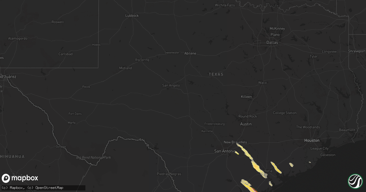
Hail Map in Texas on November 1, 2025
Get this storm
November 1 map
$229
one time, instant access
Download today. No call, no setup
Keep the $229
Bought the map and want the full workflow? Apply the entire $229 to a subscription within 7 days. None of it is wasted.
Every map, not just this one
This buys you this map. Subscription and you get every map we run, in the markets you choose from a few cities to whole states to nationwide. Plus real-time alerts the moment a storm fires.
Contact data
Name, contact info, occupancy, even credit band for addresses in the footprint. You go from where it hit to who to call.
Become the source they trust
Unlimited branding weather history reports on demand. You already have the documented answer ready for the property owner, and you are the one who showed up with it.
Property data and RoofTrace estimates
Pull up any address you have got, its value and the exact code rules for that jurisdiction, straight from One Click Code. Then RoofTrace estimates the squares, pitch, and roof value, priced the way you price.
Storm reports in Texas
Texas
| Date | Description |
|---|---|
| 11/01/20256:09 PM CDT | Report from storm spotter near skidmore. |
| 11/01/20255:26 PM CDT | Social media pictures show numerous hailstones in seguin. Location estimate based on doppler radar. |
| 10/31/202511:00 PM CDT | Public reported quarter sized hail 5 miles east of brownsville... Tx. |
| 10/31/202510:58 PM CDT | Nws brownsville observed and measured hail of 1.25 inches at the weather forecast office just northeast of the brownsville south padre |
| 10/31/202510:58 PM CDT | Corrects previous hail report from 2 e brownsville to 4 e. Nws brownsville observed and measured hail of 1.25 inches at the weather forecast office just northeast of th |
| 10/31/202510:58 PM CDT | Nws brownsville observed and measured hail of 1.25 inches at the weather forecast office just northeast of the brownsville south padre international airport. |
| 10/31/202510:45 PM CDT | Public reported estimated hail size of 1.25 inches in arroyo city... Tx. |
| 10/31/202510:36 PM CDT | Public reported hail of 1.00 inch 1 mile east of los fresnos... Tx. |
| 10/31/20259:32 PM CDT | Estimated hail size from mustang island state park em. |
| 10/31/20259:21 PM CDT | Significant damage to windshields and car hoods. |
| 10/31/20258:58 PM CDT | Hail size estimated. |
| 10/31/20258:57 PM CDT | Received video from public. Location |
| 10/31/20258:57 PM CDT | Received video from public. Location and size estimated. |
| 10/31/20258:49 PM CDT | Hail size estimated from picture. |
| 10/31/20258:31 PM CDT | Picture received of hail along with reports of broken windshields. |
| 10/31/20258:30 PM CDT | Border patrol reports golfball sized hail at a checkpoint 14 miles south of sarita... Tx... 6.5 miles north of armstrong... Tx. |
| 10/31/20258:28 PM CDT | Significant damage to several cars in the area. |
| 10/31/20258:26 PM CDT | Door ripped off hinges. |
| 10/31/20258:10 PM CDT | Most hail below 1 inch in diameter but a few of the biggest stones reached around golf ball size. Time estimated via radar. |
| 10/31/20258:10 PM CDT | Multiple reports of wind damage around the town of meyersville and the west-southwestward portions of dewitt county; power out across the area as well. Time estimated v |
| 10/31/20258:08 PM CDT | Lots of hail reported. No size estimate. |
| 10/31/20258:06 PM CDT | Report from mping: quarter |
| 10/31/20258:04 PM CDT | Law enforcement reports golfball sized hail in sarita... Tx. Time estimated from radar. |
| 10/31/20258:00 PM CDT | County staff reported hail near weser. |
| 10/31/20257:44 PM CDT | Received photos of damage to fence after being hit by an airborne trampoline. |
| 10/31/20257:44 PM CDT | Received photos of d |
| 10/31/20257:30 PM CDT | Automated station. |
| 10/31/20257:30 PM CDT | Location is estimated. |
| 10/31/20257:24 PM CDT | Report from mping: quarter |
| 10/31/20257:24 PM CDT | Report from mping: qua |
| 10/31/20257:10 PM CDT | Corrects previous hail report from meyersville. Most hail below 1 inch in diameter but a few of the biggest stones reached around golf ball size. Time estimated via rad |
| 10/31/20257:10 PM CDT | Corrects previous tstm wnd dmg report from meyersville. Multiple reports of wind damage around the town of meyersville and the west-southwestward portions of dewitt cou |
| 10/31/20257:09 PM CDT | Report from mping: half dollar |
| 10/31/20257:06 PM CDT | Automated station. |
All States Impacted by Hail Map on November 1, 2025
Cities Impacted by Hail Map on November 1, 2025
- Seguin, TX
- New Braunfels, TX
- McQueeney, TX
- Beeville, TX
- San Diego, TX
- Nixon, TX
- Leesville, TX
- Cost, TX
- Skidmore, TX
- Orange Grove, TX
- Sinton, TX
- Woodsboro, TX
- Markham, TX
- Smiley, TX
- Alice, TX
- Taft, TX
- Bishop, TX
- La Vernia, TX
- Bay City, TX
- Lake Jackson, TX
- Angleton, TX
- Clute, TX
- Stockdale, TX
- Kingsville, TX
- Westhoff, TX
- Portland, TX
- Gregory, TX
- Aransas Pass, TX
- Yorktown, TX
- Cuero, TX
- Edna, TX
- Ingleside, TX
- Port Aransas, TX
- Matagorda, TX
- Corpus Christi, TX
- Robstown, TX
- Riviera, TX
- Meyersville, TX
- Goliad, TX
- Victoria, TX
- Vanderbilt, TX
- Sarita, TX
- Lolita, TX
- Armstrong, TX
- Tivoli, TX
- Austwell, TX
- Rockport, TX
- San Perlita, TX
- Port Mansfield, TX
- Raymondville, TX
- Lyford, TX
- Sebastian, TX
- Rio Hondo, TX
- Harlingen, TX
- San Benito, TX
- Los Fresnos, TX
- Olmito, TX
- Brownsville, TX
- Port Isabel, TX
- Hebbronville, TX
- Sutherland Springs, TX
- Angier, NC
- Benson, NC


