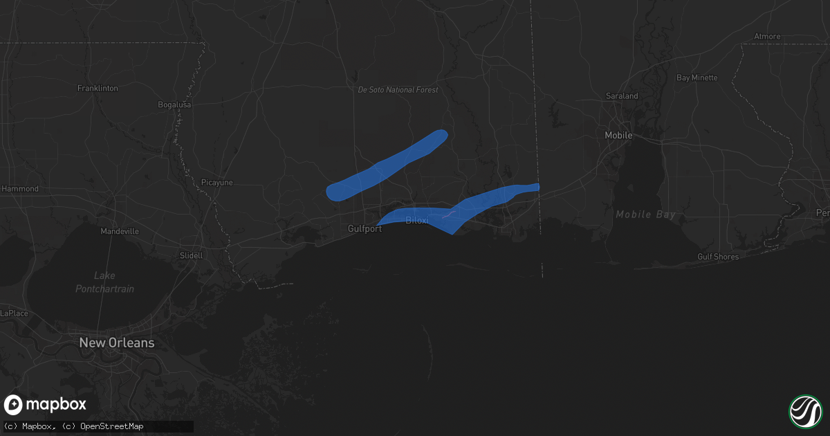
Hail Map in Biloxi, MS on October 31, 2018
Get this storm
October 31 map
$229
one time, instant access
Download today. No call, no setup
Keep the $229
Bought the map and want the full workflow? Apply the entire $229 to a subscription within 7 days. None of it is wasted.
Every map, not just this one
This buys you this map. Subscription and you get every map we run, in the markets you choose from a few cities to whole states to nationwide. Plus real-time alerts the moment a storm fires.
Contact data
Name, contact info, occupancy, even credit band for addresses in the footprint. You go from where it hit to who to call.
Become the source they trust
Unlimited branding weather history reports on demand. You already have the documented answer ready for the property owner, and you are the one who showed up with it.
Property data and RoofTrace estimates
Pull up any address you have got, its value and the exact code rules for that jurisdiction, straight from One Click Code. Then RoofTrace estimates the squares, pitch, and roof value, priced the way you price.
Storm reports in Biloxi, MS
Biloxi, MS
| Date | Description |
|---|---|
| 10/31/20185:53 AM CDT | An ef-1 tornado touched down just south of ms highway 67 and 605 interchange... Snapping trees and blowing down road signs. Additional snapped trees observed along the |
| 10/31/20185:52 AM CDT | A harrison county employee reports trees down on feller drive and garcia drive... Which is about a mile south of the intersection of ms-605 and ms-67... Near lyman... M |
| 10/31/20185:13 AM CDT | Reports of 10-12lounge chairs from ocean city condos... Which is north of hwy 90... Also have been blown over to sand beach in biloxi. |
All States Impacted by Hail Map on October 31, 2018
All Cities Impacted by Hail Map on October 31, 2018
- Van Horn, TX
- Singer, LA
- De Queen, AR
- New Braunfels, TX
- San Antonio, TX
- Bulverde, TX
- Call, TX
- Deweyville, TX
- Merryville, LA
- Starks, LA
- Gillett, TX
- Smiley, TX
- Rockdale, TX
- Thorndale, TX
- La Grange, TX
- Longville, LA
- Friendswood, TX
- Sierra Blanca, TX
- Round Top, TX
- Kirby, AR
- Amity, AR
- Deridder, LA
- Helotes, TX
- Lumberton, TX
- Glenwood, AR
- Newhope, AR
- Brenham, TX
- Glenmora, LA
- Elmer, LA
- Buna, TX
- Yorktown, TX
- Silsbee, TX
- Dierks, AR
- Bismarck, AR
- Las Cruces, NM
- Deming, NM
- Natchez, MS
- Port Gibson, MS
- Crystal Springs, MS
- Bolton, MS
- Bentonia, MS
- Ridgeland, MS
- Florence, MS
- Meadville, MS
- Roxie, MS
- McCall Creek, MS
- Morton, MS
- Brandon, MS
- Lena, MS
- Forest, MS
- Louisville, MS
- Ocean Springs, MS
- Moss Point, MS
- Vidalia, LA
- Raymond, MS
- Utica, MS
- Clinton, MS
- Terry, MS
- Hermanville, MS
- Jackson, MS
- Edwards, MS
- Madison, MS
- Tougaloo, MS
- Vicksburg, MS
- Brookhaven, MS
- Union Church, MS
- Crosby, MS
- Wesson, MS
- Pickens, MS
- Satartia, MS
- Benton, MS
- Yazoo City, MS
- Sallis, MS
- Vaughan, MS
- Goodman, MS
- Carthage, MS
- Kosciusko, MS
- Greenwood, MS
- McCarley, MS
- Carrollton, MS
- North Carrollton, MS
- Winona, MS
- Magee, MS
- Newhebron, MS
- Mount Olive, MS
- Collins, MS
- Magnolia, MS
- Kokomo, MS
- Columbia, MS
- Foxworth, MS
- Mccomb, MS
- Tylertown, MS
- Hattiesburg, MS
- Lumberton, MS
- Sumrall, MS
- Pulaski, MS
- Newton, MS
- Decatur, MS
- Raleigh, MS
- Lake, MS
- Lawrence, MS
- Perkinston, MS
- Brooklyn, MS
- Poplarville, MS
- Carriere, MS
- Wiggins, MS
- Saucier, MS
- Picayune, MS
- McHenry, MS
- Kiln, MS
- Louin, MS
- Bay Springs, MS
- Gore Springs, MS
- Grenada, MS
- Indianola, MS
- Calhoun City, MS
- Pittsboro, MS
- Derma, MS
- Vardaman, MS
- Houston, MS
- Shannon, MS
- Okolona, MS
- Pontotoc, MS
- Houlka, MS
- Verona, MS
- Tupelo, MS
- Booneville, MS
- Golden, MS
- Belmont, MS
- Bay Saint Louis, MS
- Biloxi, MS
- Vancleave, MS
- Gulfport, MS
- Diberville, MS
- Gautier, MS
- Grand Bay, AL
- Neely, MS
- Lucedale, MS
- Leakesville, MS
- McLain, MS
- Weir, MS
- French Camp, MS
- Ethel, MS
- McCool, MS
- Ackerman, MS
- Quitman, MS
- Shubuta, MS
- Pachuta, MS
- Meridian, MS
- Vossburg, MS
- Laurel, MS
- Ellisville, MS
- Heidelberg, MS
- Richton, MS
- Petal, MS
- Purvis, MS
- New Augusta, MS
- Buckatunna, MS
- Millry, AL
- Waynesboro, MS
- State Line, MS
- Millport, AL
- Columbus, MS
- Ethelsville, AL
- Steens, MS


