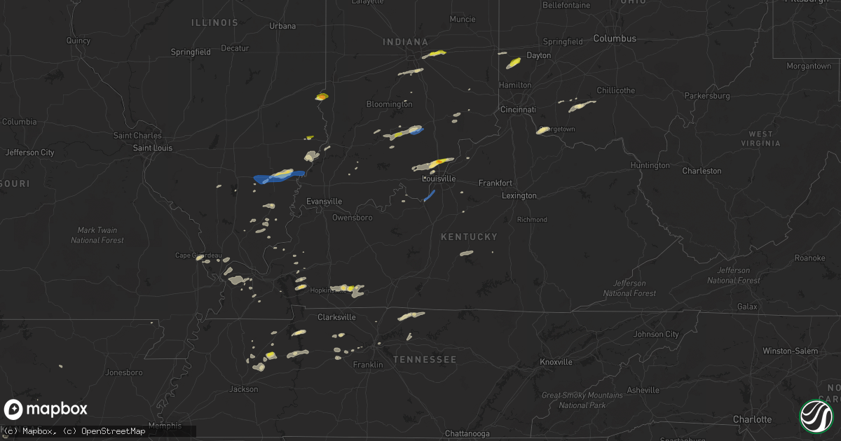
Hail Map in Kentucky on October 23, 2020
Get this storm
October 23 map
$229
one time, instant access
Download today. No call, no setup
Keep the $229
Bought the map and want the full workflow? Apply the entire $229 to a subscription within 7 days. None of it is wasted.
Every map, not just this one
This buys you this map. Subscription and you get every map we run, in the markets you choose from a few cities to whole states to nationwide. Plus real-time alerts the moment a storm fires.
Contact data
Name, contact info, occupancy, even credit band for addresses in the footprint. You go from where it hit to who to call.
Become the source they trust
Unlimited branding weather history reports on demand. You already have the documented answer ready for the property owner, and you are the one who showed up with it.
Property data and RoofTrace estimates
Pull up any address you have got, its value and the exact code rules for that jurisdiction, straight from One Click Code. Then RoofTrace estimates the squares, pitch, and roof value, priced the way you price.
Storm reports in Kentucky
Kentucky
| Date | Description |
|---|---|
| 10/23/20205:50 PM CDT | Some trees down in a couple areas...port royal road and nearby vance road. |
| 10/23/20205:40 PM CDT | Large limb snapped based on pictures relayed to a broadcast media meteorologist. |
| 10/23/20205:40 PM CDT | Tree down in new castle. Time estimated from tsdf. |
| 10/23/20203:50 PM CDT | Tree down on husband road. |
| 10/23/20203:45 PM CDT | Near intersection of highways 178 and 106. |
| 10/23/20203:40 PM CDT | Trees down over roadway. |
| 10/23/20203:22 PM CDT | Tree down on ky121 & ky339. |
| 10/23/20203:22 PM CDT | Trees down along the mccracken/ballard county line near lovelaceville. Time estimated by radar. |
| 10/23/20201:58 AM CDT | At 658 PM EDT, a severe thunderstorm was located near Taylorsville, moving east at 30 mph. HAZARD...60 mph wind gusts and quarter size hail. SOURCE...Radar indicated. IMPACT...Hail damage to vehicles is expected. Expect wind damage to roofs, siding, and trees. Locations impacted include... Taylorsville, Yoder, Southville, Rivals, Wayside, Waddy, Hemp Ridge, Little Mount, Normandy and Junte. |
| 10/23/20201:45 AM CDT | At 645 PM EDT, a severe thunderstorm was located near New Castle, moving northeast at 35 mph. HAZARD...60 mph wind gusts and quarter size hail. SOURCE...Radar indicated. IMPACT...Hail damage to vehicles is expected. Expect wind damage to roofs, siding, and trees. Locations impacted include... New Castle, Campbellsburg, Port Royal, Drennon Springs, Lacie, Delville, Franklinton, Turners Station and Sulphur. |
| 10/23/20201:14 AM CDT | At 614 PM EDT, a severe thunderstorm was located 7 miles northwest of La Grange, moving east at 40 mph. HAZARD...60 mph wind gusts and quarter size hail. SOURCE...Radar indicated. IMPACT...Hail damage to vehicles is expected. Expect wind damage to roofs, siding, and trees. Locations impacted include... Bedford, Pendleton, Owen, Campbellsburg, Bethlehem, Westport, Oldham, Greenhaven, Otto and Russell Corner. |
| 10/22/202011:57 PM CDT | At 457 PM EDT, a severe thunderstorm was located over Felicity, moving northeast at 30 mph. HAZARD...60 mph wind gusts and quarter size hail. SOURCE...Radar indicated. IMPACT...Minor hail damage to vehicles is possible. Expect wind damage to trees and power lines. Locations impacted include... Georgetown, Mount Orab, Bethel, Williamsburg, Augusta, Sardinia, Felicity, New Market, Hamersville, Mowrystown, Moscow, Chilo, Danville in Highland County, Saltair, Point Isabel, Feesburg, Fincastle, Utopia and State Route 32 at US Route 62. |
| 10/22/202010:45 PM CDT | At 345 PM EDT, a severe thunderstorm was located 8 miles south of Lawrenceburg, moving east at 35 mph. HAZARD...60 mph wind gusts and penny size hail. SOURCE...Radar indicated. IMPACT...Expect damage to roofs, siding, and trees. Locations impacted include... Lawrenceburg, Versailles, Ballard, Wilmore, Oregon, Bondville, Dugansville, Jessamine, Terrapin and Dixon Town. |
| 10/22/202010:44 PM CDT | At 343 PM CDT, a severe thunderstorm was located near Elkton, moving east at 20 mph. HAZARD...60 mph wind gusts and half dollar size hail. SOURCE...Radar indicated. IMPACT...Hail damage to vehicles is expected. Expect wind damage to roofs, siding, and trees. Locations impacted include... Russellville, Justice, Gordonsville, Edwards, Epleys, Everett, Crossroad and Whippoorwill. |
| 10/22/202010:38 PM CDT | At 337 PM CDT, a severe thunderstorm was located near Elkton, moving east at 25 mph. HAZARD...60 mph wind gusts and quarter size hail. SOURCE...Radar indicated. IMPACT...Hail damage to vehicles is expected. Expect wind damage to roofs, siding, and trees. Locations impacted include... Elkton, Justice, Everett and Allegre. |
| 10/22/202010:32 PM CDT | At 332 PM CDT, a severe thunderstorm was located near Lone Oak, moving east at 40 mph. HAZARD...60 mph wind gusts and nickel size hail. SOURCE...Radar indicated. IMPACT...Expect damage to roofs, siding, and trees. Locations impacted include... Calvert City, Reidland, Ledbetter and Symsonia. This includes the following highways... Interstate 24 in Kentucky between Mile Markers 11 and 28. Interstate 69 in Kentucky between Mile Markers 46 and 51. |
| 10/22/202010:10 PM CDT | At 310 PM EDT, a severe thunderstorm was located 7 miles east of Bardstown, moving northeast at 30 mph. HAZARD...60 mph wind gusts and quarter size hail. SOURCE...Radar indicated. IMPACT...Hail damage to vehicles is expected. Expect wind damage to roofs, siding, and trees. Locations impacted include... Bloomfield, Willisburg, East Bardstown, Booker, Maud, Botland, Mooresville, Polin, Johnsonville and Croakes. |
All States Impacted by Hail Map on October 23, 2020
Cities Impacted by Hail Map on October 23, 2020
- Brownstown, IN
- Medora, IN
- Vallonia, IN
- Hillsboro, OH
- Campbellsville, KY
- Allendale, IL
- Shoals, IN
- Williams, IN
- Macedonia, IL
- McLeansboro, IL
- Benton, KY
- Marion, KY
- Mount Carmel, IL
- Big Sandy, TN
- Stewart, TN
- Bruceton, TN
- Buena Vista, TN
- Huntingdon, TN
- Cadiz, KY
- Allensville, KY
- Lewisburg, KY
- Sharon Grove, KY
- Pembroke, KY
- Elkton, KY
- Russellville, KY
- Olmstead, KY
- Hopkinsville, KY
- Ellery, IL
- Fairfield, IL
- Golden Gate, IL
- Creal Springs, IL
- Greenfield, IN
- Port Austin, MI
- Kinde, MI
- Lena, MS
- Jasper, IN
- Otwell, IN
- La Center, KY
- Barlow, KY
- Wickliffe, KY
- Paducah, KY
- Kevil, KY
- Mayfield, KY
- Nashville, TN
- Dudley, MO
- Fisk, MO
- Bernie, MO
- Milan, OH
- Norwalk, OH
- Monroeville, OH
- Whiteland, IN
- Franklin, IN
- Greenwood, IN
- Cleveland, OH
- Cleburne, TX
- Granbury, TX
- Rainbow, TX
- Glen Rose, TX
- Britton, MI
- Taylorsville, KY
- Princeton, KY
- Eaton, OH
- West Alexandria, OH
- Camden, OH
- Ida, MI
- Monroe, MI
- Orange, TX
- Dickson, TN
- Westmoreland, TN
- Bethpage, TN
- Cedar Grove, TN
- Broaddus, TX
- New Palestine, IN
- Indianapolis, IN
- Junction, IL
- Kosciusko, MS
- Borden, IN
- Floyds Knobs, IN
- Bedford, IN
- Ohio City, OH
- Van Wert, OH
- Nettleton, MS
- Roland, AR
- Aberdeen, MS
- Cunningham, KY
- Charlestown, IN
- Marysville, IN
- Sellersburg, IN
- Memphis, IN
- Laurel, MS
- Stringer, MS
- Taylorsville, MS
- Soso, MS
- Amory, MS
- Liberty, KY
- Weston, OH
- Burns, TN
- White Bluff, TN
- Felicity, OH
- Bethel, OH
- Moscow, OH
- New Johnsonville, TN
- Eva, TN
- Waverly, TN
- Camden, TN
- Paron, AR
- Little Rock, AR
- Sumner, IL
- Saint Francisville, LA
- Elkton, MI
- Port Hope, MI
- Filion, MI
- Caseville, MI
- Albion, IL
- Grayville, IL
- Barnhill, IL
- Burnt Prairie, IL
- Gleason, TN
- Dresden, TN
- Fredonia, KY
- Pigeon, MI
- Bay Port, MI
- West Union, IL
- Farmersburg, IN
- Dahlgren, IL
- Orleans, IN
- Paoli, IN
- Erath, LA
- Abbeville, LA
- Elk Horn, KY
- Rogersville, AL
- Athens, AL
- Puxico, MO
- Pendleton, KY
- Bedford, KY
- Sulphur, KY
- Oran, MO
- Chaffee, MO
- Charlotte, TN
- Cumberland Furnace, TN
- Bronson, TX
- Otisville, MI
- Davison, MI
- Flint, MI
- Lavinia, TN
- Snover, MI
- Hamtramck, MI
- Detroit, MI
- Highland Park, MI
- Huron, OH
- Bellevue, OH
- New Albany, IN
- Mount Washington, KY
- Norris City, IL
- Eldorado, IL
- Omaha, IL
- Broughton, IL
- Scott City, MO
- Cape Girardeau, MO
- McClure, IL
- Lafayette, TN
- Webster, KY
- Guston, KY
- Payneville, KY
- Brandenburg, KY
- Wappapello, MO
- Ramsey, IN
- Palmyra, IN
- Greenville, IN
- Depauw, IN
- New Salisbury, IN
- Pekin, IN
- Pegram, TN
- Batesville, AR
- Milan, TN
- Atwood, TN
- Junction City, AR
- Bryan, TX
- Dundee, MI
- Foster, KY
- Hamersville, OH
- Neville, OH
- Batesville, IN
- Harrisburg, IL
- Carrier Mills, IL
- Fulton, MS
- Plantersville, MS
- Kopperl, TX
- Morgan, TX
- Lanesville, IN
- Piedmont, MO
- Mill Spring, MO
- Olmsted, IL
- Ullin, IL
- Grand Chain, IL
- Owendale, MI
- Sebewaing, MI
- Napoleon, OH
- Liberty Center, OH
- Birch Run, MI
- Clio, MI
- Conway, AR
- Mayflower, AR
- Unionville, MI
- Salem, KY
- Mitchell, IN
- Bridgeport, IL
- Clinton, MI
- Willard, OH
- Nashville, IN
- Brookeland, TX
- Bainbridge, OH
- Winchester, OH
- Hamshire, TX
- Winnie, TX
- Stephens, AR
- North Olmsted, OH
- Westlake, OH
- Frohna, MO
- Weatherford, TX
- Lipan, TX
- Poplar Bluff, MO
- Maybee, MI
- Farmersville, OH
- Kingston Springs, TN
- Fairview, TN
- Bargersville, IN
- Springfield, TN
- Greenbrier, TN
- Rosebud, TX
- Battletown, KY
- Mooresville, IN
- Martinsville, IN
- Butlerville, IN
- Dupont, IN
- North Vernon, IN
- Herod, IL
- New Lothrop, MI
- Tamaroa, IL
- West Point, KY
- Trezevant, TN
- Winslow, IN
- Stendal, IN
- Azle, TX
- Broseley, MO
- Bon Aqua, TN
- Livingston, TX
- Altenburg, MO
- Deckerville, MI
- Campbell, MO
- Eddyville, KY
- Ubly, MI
- Melber, KY
- Piggott, AR
- Pollard, AR
- Versailles, IN
- Terre Haute, IN
- Pulaski, IL
- Lebanon, TN
- Saint Francisville, IL
- Vincennes, IN
- Olmsted Falls, OH
- Carencro, LA
- Montrose, MI
- Lynchburg, OH
- Fayetteville, OH
- Bell City, MO
- Sikeston, MO
- Beaumont, TX
- Paris, TN
- Brookpark, OH
- McKenzie, TN
- Mandeville, LA
- Saint Clair Shores, MI
- Harper Woods, MI
- Grosse Pointe, MI
- Millington, MI
- Shannon, MS
- Stonefort, IL
- Eddyville, IL
- Benton, IL
- Bloomfield, KY
- Bardstown, KY
- Henry, TN
- Mansfield, TN
- Heber Springs, AR
- Nacogdoches, TX
- Tamms, IL
- Thebes, IL
- Madison, TN
- Strawn, TX
- Freetown, IN
- Lawrenceville, IL
- Malden, MO
- Hickory, KY
- Boaz, KY
- East Lansing, MI
- Laingsburg, MI
- Bath, MI
- Bancroft, MI
- Durand, MI
- Morrice, MI
- Lansing, MI
- Perry, MI
- Owosso, MI
- Dewitt, MI
- Williamston, MI
- Haslett, MI
- Okemos, MI
- Dimondale, MI
- Holt, MI
- Henderson, MI
- Corunna, MI
- Elsie, MI
- Ovid, MI
- Fenton, MI
- Linden, MI
- Howell, MI
- Clifford, MI
- Silverwood, MI
- Kingston, MI
- Marlette, MI
- Decker, MI
- Minden City, MI
- Harbor Beach, MI
- Ruth, MI
- Palms, MI
- Deford, MI
- Louisville, KY
- Shepherdsville, KY
- Bloomville, OH
- Green Springs, OH
- Leipsic, OH
- New Riegel, OH
- Rawson, OH
- Mount Cory, OH
- Wakeman, OH
- Clyde, OH
- Sandusky, OH
- McComb, OH
- Attica, OH
- Alvada, OH
- Bettsville, OH
- Fremont, OH
- Pandora, OH
- Burgoon, OH
- Vickery, OH
- Ottawa, OH
- Findlay, OH
- Tiffin, OH
- Republic, OH
- Old Fort, OH
- Castalia, OH
- Bloomdale, OH
- Van Buren, OH
- Bascom, OH
- Fostoria, OH
- Collins, OH
- Kansas, OH
- Arcadia, OH
- Bluffton, OH
- Jenera, OH
- Vanlue, OH
- Port Clinton, OH
- Oak Harbor, OH
- Lakeside Marblehead, OH
- Woodville, OH
- Lacarne, OH
- Elmore, OH
- Lindsey, OH
- Gibsonburg, OH
- Kelleys Island, OH
- Amherst, OH
- Elyria, OH
- Oberlin, OH
- North Ridgeville, OH
- Sheffield Lake, OH
- Lorain, OH
- Lakewood, OH
- Saint Charles, MI
- Brant, MI
- Milan, MI
- Hollow Rock, TN
- Keenes, IL
- Mill Shoals, IL
- Wayne City, IL
- Carmi, IL
- Browns, IL
- Broadview Heights, OH
- Independence, OH
- Tolar, TX
- Nemo, TX
- Blum, TX
- Itasca, TX
- Joshua, TX
- Alvarado, TX
- Grandview, TX
- Graford, TX
- Perrin, TX
- Springtown, TX
- Poolville, TX
- Bridgeport, TX


