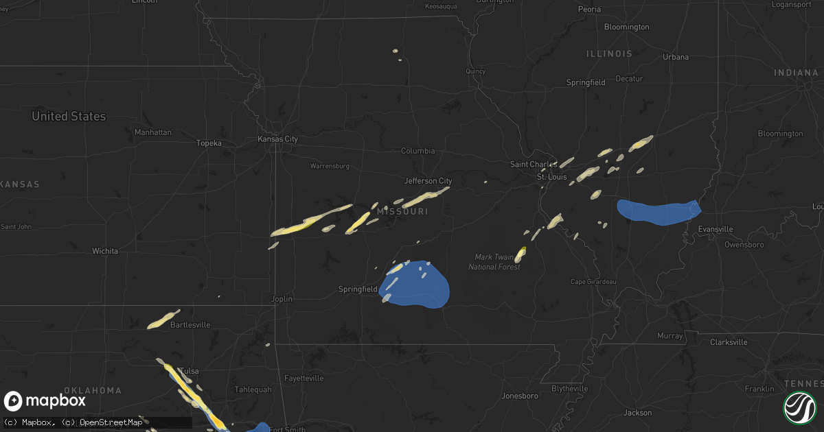
Hail Map in Missouri on October 18, 2025
Get this storm
October 18 map
$229
one time, instant access
Download today. No call, no setup
Keep the $229
Bought the map and want the full workflow? Apply the entire $229 to a subscription within 7 days. None of it is wasted.
Every map, not just this one
This buys you this map. Subscription and you get every map we run, in the markets you choose from a few cities to whole states to nationwide. Plus real-time alerts the moment a storm fires.
Contact data
Name, contact info, occupancy, even credit band for addresses in the footprint. You go from where it hit to who to call.
Become the source they trust
Unlimited branding weather history reports on demand. You already have the documented answer ready for the property owner, and you are the one who showed up with it.
Property data and RoofTrace estimates
Pull up any address you have got, its value and the exact code rules for that jurisdiction, straight from One Click Code. Then RoofTrace estimates the squares, pitch, and roof value, priced the way you price.
Storm reports in Missouri
Missouri
| Date | Description |
|---|---|
| 10/18/20253:46 PM CDT | Tree down across hwy 119 north of montauk state park entrance. Time estimated by radar. |
| 10/18/20252:25 PM CDT | Tree limb blown down across live powerline... Catching fire. |
| 10/18/20251:40 PM CDT | Tree down blocking half the roadway. |
| 10/18/202510:31 AM CDT | Hail to the size of quarters fell southwest of dry knob. |
All States Impacted by Hail Map on October 18, 2025
Cities Impacted by Hail Map on October 18, 2025
- Leavenworth, KS
- Lansing, KS
- Platte City, MO
- Waldron, MO
- Farley, MO
- Kansas City, MO
- Kansas City, KS
- Crane, TX
- McCamey, TX
- Richards, MO
- Hamlin, TX
- Fort Scott, KS
- Hume, MO
- McCaulley, TX
- Walker, MO
- Nevada, MO
- Harwood, MO
- Schell City, MO
- Anson, TX
- Rockville, MO
- Appleton City, MO
- Osceola, MO
- Lowry City, MO
- Jay, OK
- Deepwater, MO
- Gravois Mills, MO
- Ryan, OK
- Terral, OK
- Rocky Mount, MO
- Ringling, OK
- Climax Springs, MO
- Macks Creek, MO
- Warsaw, MO
- Grove, OK
- Nocona, TX
- Lake Ozark, MO
- Wilson, OK
- Healdton, OK
- Bowie, TX
- Eldon, MO
- Burbank, OK
- Shidler, OK
- Tuscumbia, MO
- Sulphur, OK
- Ardmore, OK
- Mill Creek, OK
- Westphalia, MO
- Burneyville, OK
- Leon, OK
- Pawhuska, OK
- Saint Jo, TX
- Loose Creek, MO
- Eugene, MO
- Henley, MO
- Saint Elizabeth, MO
- Jefferson City, MO
- Saint Thomas, MO
- Meta, MO
- Springer, OK
- Newcastle, OK
- Blanchard, OK
- Washington, OK
- Norman, OK
- Oklahoma City, OK
- Tishomingo, OK
- Linn, MO
- Gainesville, TX
- Freeburg, MO
- Stonewall, OK
- Mullinville, KS
- Roff, OK
- Barnett, MO
- Conway, MO
- Elkland, MO
- New Haven, MO
- Marshfield, MO
- Niangua, MO
- Lebanon, MO
- Grovespring, MO
- Coalgate, OK
- Hermitage, MO
- Wheatland, MO
- Tupelo, OK
- Centrahoma, OK
- Cross Timbers, MO
- Quincy, MO
- Weaubleau, MO
- Edwards, MO
- Bellevue, TX
- Seymour, MO
- Saint Louis, MO
- Coffeyville, KS
- Granite City, IL
- Stuart, OK
- Hartville, MO
- Liberty, KS
- Bronaugh, MO
- Garland, KS
- Stover, MO
- Wardville, OK
- Pittsburg, OK
- Edwardsville, IL
- Glen Carbon, IL
- Blanco, OK
- Hartford, IL
- Deerfield, MO
- Pocahontas, IL
- Greenville, IL
- Trenton, IL
- Quinton, OK
- Summerfield, IL
- Highland, IL
- Lebanon, IL
- Belleville, IL
- Scott Air Force Base, IL
- Stigler, OK
- Smithboro, IL
- Aviston, IL
- Breese, IL
- Carlyle, IL
- Keyesport, IL
- Mulberry Grove, IL
- El Dorado Springs, MO
- Collins, MO
- Saint Elmo, IL
- Altamont, IL
- Brownstown, IL
- Vandalia, IL
- Shobonier, IL
- Patoka, IL
- Mason, IL
- Effingham, IL
- Addieville, IL
- Nashville, IL
- Okawville, IL
- Whitefield, OK
- Mccurtain, OK
- Kinta, OK
- Keota, OK
- Celeste, TX
- Sallisaw, OK
- Spiro, OK
- Gans, OK
- Muldrow, OK
- Red Oak, OK
- Wilburton, OK
- Hartshorne, OK
- Greenville, TX
- Salem, IL
- Kinmundy, IL
- Iuka, IL
- Godley, TX
- Cleburne, TX
- Joshua, TX
- Burleson, TX
- Rusk, TX
- Fordland, MO
- Chester, IL
- Perryville, MO
- Mansfield, MO
- Falcon, MO
- Mountain Grove, MO
- Norwood, MO
- Lynchburg, MO
- Plato, MO
- Macomb, MO
- Ironton, MO
- Ava, IL
- Pinckneyville, IL
- Vergennes, IL
- Middle Brook, MO
- Belleview, MO
- Prescott, AR
- Okolona, AR
- Gurdon, AR
- Huggins, MO
- Garland City, AR
- Fouke, AR
- Texarkana, AR
- Du Quoin, IL
- Arkadelphia, AR
- Bismarck, MO
- Graff, MO
- Bucyrus, MO
- Success, MO
- Licking, MO
- Roby, MO
- Cabool, MO
- Houston, MO
- Raymondville, MO
- Mount Enterprise, TX
- Lewisville, AR
- Hope, AR
- Vanzant, MO
- Drury, MO
- Solo, MO
- Ava, MO
- Donaldson, AR
- Bismarck, AR
- Farmington, MO
- Bonne Terre, MO
- Timpson, TX
- Garrison, TX
- Wanatah, IN
- Union Mills, IN
- Hanna, IN
- Park Hills, MO
- Elk Creek, MO
- Eunice, MO
- Yukon, MO
- Willow Springs, MO
- Charlotte, AR
- Moro, AR
- Newark, AR
- Cotton Plant, AR
- Pottersville, MO
- Moody, MO
- Sulphur Rock, AR
- Evening Shade, AR
- Poplar Grove, AR
- Helena, AR
- Marianna, AR
- McCrory, AR
- Sidney, AR
- Oil Trough, AR
- Palestine, AR
- Sturkie, AR
- Lexa, AR
- Batesville, AR
- Cave City, AR
- Viola, AR
- Caulfield, MO
- Dora, MO
- Augusta, AR
- Clarksdale, MS
- Horseshoe Bend, AR
- West Plains, MO
- West Helena, AR
- Bradford, AR
- Salem, AR
- Goodwin, AR
- Franklin, AR
- Newport, AR
- Sainte Genevieve, MO
- Bloomsdale, MO
- Prairie Du Rocher, IL
- French Village, MO
- Chidester, AR
- Bluff City, AR
- Rosston, AR
- Carthage, TX
- Tenaha, TX
- Poyen, AR
- Malvern, AR
- Mansfield, LA
- Camden, AR
- Logansport, LA
- Bearden, AR
- Sparkman, AR
- Prattsville, AR
- Red Bud, IL
- Choudrant, LA
- Fordyce, AR
- Coushatta, LA
- Thornton, AR
- Ruston, LA
- Downsville, LA
- Farmerville, LA
- Hampton, AR
- Kingsland, AR
- New Edinburg, AR
- Ozan, AR
- Broken Bow, OK
- Lockesburg, AR
- Blevins, AR
- Nashville, AR
- Eagletown, OK
- Cleveland, OK
- Sterlington, LA
- Prue, OK
- Osage, OK
- Sand Springs, OK
- Mannford, OK
- Rison, AR
- Marion, LA
- Sapulpa, OK
- Monroe, LA
- Tulsa, OK
- Waynesville, MO
- Richland, MO
- Glenpool, OK
- Bullard, TX
- Arp, TX
- Kiefer, OK
- Mounds, OK
- Overton, TX
- Whitehouse, TX
- Troup, TX
- Kilgore, TX
- Jenks, OK
- Bixby, OK
- Broken Arrow, OK
- Okmulgee, OK
- Beggs, OK
- Haskell, OK
- Morris, OK
- Boynton, OK
- Kellyville, OK
- Henderson, TX
- Sparks, OK
- Prague, OK
- Gilmer, TX
- Tatum, TX
- Big Sandy, TX
- Pittsburg, TX
- Council Hill, OK
- Oktaha, OK
- Checotah, OK
- Atlanta, TX
- Seminole, OK
- Ore City, TX
- Beckville, TX
- Paden, OK
- Okemah, OK
- Midway, TX
- Earlsboro, OK
- Tallulah, LA
- Linden, TX
- Wewoka, OK
- Diana, TX
- Gladewater, TX
- De Berry, TX
- Wetumka, OK
- Holdenville, OK
- Gary, TX
- Long Branch, TX
- Nacogdoches, TX
- Porum, OK
- Eufaula, OK
- Novinger, MO
- Doddridge, AR
- Kirksville, MO
- Lufkin, TX
- Joaquin, TX
- Yazoo City, MS
- Kennard, TX
- Center, TX
- Vernon, IL
- Converse, LA
- Groveton, TX
- Pennington, TX
- Crockett, TX
- Warner, OK
- Dubach, LA
- Robeline, LA
- Marthaville, LA
- Pleasant Hill, LA
- Belmont, LA
- Zwolle, LA
- Many, LA
- Evansville, IL
- Cutler, IL
- Macedonia, IL
- Ashley, IL
- Scheller, IL
- Ewing, IL
- Dahlgren, IL
- Ina, IL
- Opdyke, IL
- Mount Vernon, IL
- Woodlawn, IL
- Belle Rive, IL
- Benton, IL
- Whittington, IL
- McLeansboro, IL
- Bonnie, IL
- Waltonville, IL
- Keenes, IL
- Springerton, IL
- Enfield, IL
- Carmi, IL
- Norris City, IL
- Broughton, IL
- Mill Shoals, IL
- Burnt Prairie, IL
- Crossville, IL
- Grayville, IL
- Albion, IL
- New Harmony, IN
- Griffin, IN
- Barnhill, IL
- Fairfield, IL
- Golden Gate, IL
- Poseyville, IN
- Owensville, IN
- Mount Carmel, IL


