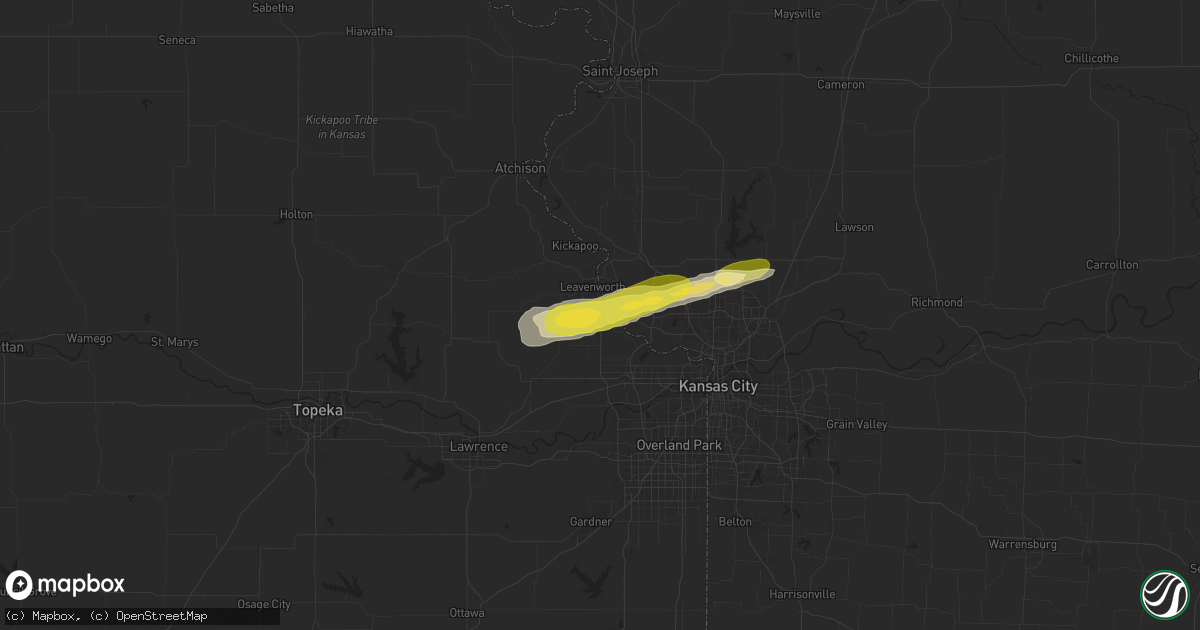
Hail Map in Lansing, KS on October 17, 2025
Get this storm
October 17 map
$229
one time, instant access
Download today. No call, no setup
Keep the $229
Bought the map and want the full workflow? Apply the entire $229 to a subscription within 7 days. None of it is wasted.
Every map, not just this one
This buys you this map. Subscription and you get every map we run, in the markets you choose from a few cities to whole states to nationwide. Plus real-time alerts the moment a storm fires.
Contact data
Name, contact info, occupancy, even credit band for addresses in the footprint. You go from where it hit to who to call.
Become the source they trust
Unlimited branding weather history reports on demand. You already have the documented answer ready for the property owner, and you are the one who showed up with it.
Property data and RoofTrace estimates
Pull up any address you have got, its value and the exact code rules for that jurisdiction, straight from One Click Code. Then RoofTrace estimates the squares, pitch, and roof value, priced the way you price.
Storm reports in Lansing, KS
Lansing, KS
| Date | Description |
|---|---|
| 10/17/20252:30 AM CDT | Civilian reports a large downed tree and wires near wolcott road. Several power outages in the area. Time confirmed from radar. Report via social media. |
| 10/17/20252:29 AM CDT | Several reports of tree limbs and power lines down in lansing. Social media reports also confirm hail covering the ground in several locations with limbs down. Time bas |
| 10/17/20252:29 AM CDT | Social media reports of large trees and limbs down near brookwood street. Time estimated from radar. |
All Cities Impacted by Hail Map on October 17, 2025
- Albany, MO
- New Hampton, MO
- Bethany, MO
- Drakesville, IA
- Unionville, IA
- Eldon, IA
- Ottumwa, IA
- Bloomfield, IA
- Batavia, IA
- Tonganoxie, KS
- Basehor, KS
- McLouth, KS
- Leavenworth, KS
- Seaton, IL
- Kansas City, KS
- Lansing, KS
- Easton, KS
- Kansas City, MO
- Farley, MO
- Platte City, MO
- Waldron, MO
- Smithville, MO
- Liberty, MO
- Kearney, MO
- Odessa, TX
- Crane, TX
- Edina, MO
- Knox City, MO
- La Belle, MO
- McCamey, TX
- Midland, TX
- Chelsea, OK
- Midkiff, TX
- Big Lake, TX
- Garden City, TX
- Erie, KS
- Butler, MO
- Stark, KS
- Savonburg, KS
- Uniontown, KS
- Throckmorton, TX
- Sylvester, TX
- Roby, TX
- McCaulley, TX
- Redfield, KS
- Fort Scott, KS


