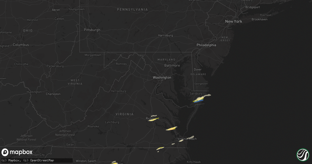
Hail Map in Maryland on October 17, 2022
Get this storm
October 17 map
$229
one time, instant access
Download today. No call, no setup
Keep the $229
Bought the map and want the full workflow? Apply the entire $229 to a subscription within 7 days. None of it is wasted.
Every map, not just this one
This buys you this map. Subscription and you get every map we run, in the markets you choose from a few cities to whole states to nationwide. Plus real-time alerts the moment a storm fires.
Contact data
Name, contact info, occupancy, even credit band for addresses in the footprint. You go from where it hit to who to call.
Become the source they trust
Unlimited branding weather history reports on demand. You already have the documented answer ready for the property owner, and you are the one who showed up with it.
Property data and RoofTrace estimates
Pull up any address you have got, its value and the exact code rules for that jurisdiction, straight from One Click Code. Then RoofTrace estimates the squares, pitch, and roof value, priced the way you price.
Storm reports in Maryland
Maryland
| Date | Description |
|---|---|
| 10/17/20223:04 AM CDT | At 804 PM EDT, severe thunderstorms were located along a line extending from near Parsonsburg to near Snow Hill to 9 miles east of Pocomoke City, moving east northeast at 45 mph. HAZARD...60 mph wind gusts and quarter size hail. SOURCE...Radar indicated. IMPACT...Minor damage to vehicles is possible. Expect wind damage to trees and powerlines. Severe thunderstorms will be near... Newark around 815 PM EDT. Ocean Pines around 820 PM EDT. Berlin around 825 PM EDT. Cape Isle Of Wight around 830 PM EDT. Ocean City around 835 PM EDT.Other locations impacted by these severe thunderstorms include WestOcean City, Boxiron, Ocean City Municipality, Cedartown, PublicLanding, Powellville, Ironshire, Mount Wesley, Showell and Whiton. |
| 10/16/20227:15 PM CDT | Power lines down. Time estimated. |
All States Impacted by Hail Map on October 17, 2022
Cities Impacted by Hail Map on October 17, 2022
- Graham, NC
- Mebane, NC
- Hillsborough, NC
- Durham, NC
- Efland, NC
- Chapel Hill, NC
- Virginia Beach, VA
- Henrico, VA
- Richmond, VA
- Midlothian, VA
- Vero Beach, FL
- Melbourne, FL
- Roma, TX
- Mechanicsville, VA
- Chesapeake, VA
- Pendleton, NC
- Sandston, VA
- Chesterfield, VA
- Port Saint Joe, FL
- Surry, VA
- Yorktown, VA
- Williamsburg, VA
- Gloucester Point, VA
- Hayes, VA
- Newport News, VA
- Fort Eustis, VA
- Spring Grove, VA
- Snow Hill, MD
- Margarettsville, NC
- Como, NC
- Franklin, VA
- Newsoms, VA
- Suffolk, VA
- Kenansville, FL
- Pittsboro, NC
- Apex, NC
- Berlin, MD
- Pocomoke City, MD
- Newark, MD
- Conway, NC
- Huger, SC
- Ocean City, MD
- Princess Anne, MD
- Westover, MD
- Palm Bay, FL
- Malabar, FL
- Melbourne Beach, FL
- Saint Cloud, FL
- Indialantic, FL
- Girdletree, MD
- Quinton, VA
- Boykins, VA
- Haw River, NC
- Concord, MA
- Tewksbury, MA
- Bedford, MA
- Wilmington, MA
- Billerica, MA


