Hail Map in Texas on October 13, 2021
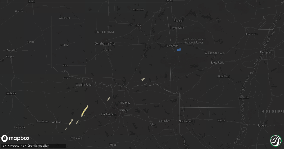
Get this storm
October 13 map
$229
one time, instant access
Download today. No call, no setup
Keep the $229
Bought the map and want the full workflow? Apply the entire $229 to a subscription within 7 days. None of it is wasted.
Every map, not just this one
This buys you this map. Subscription and you get every map we run, in the markets you choose from a few cities to whole states to nationwide. Plus real-time alerts the moment a storm fires.
Contact data
Name, contact info, occupancy, even credit band for addresses in the footprint. You go from where it hit to who to call.
Become the source they trust
Unlimited branding weather history reports on demand. You already have the documented answer ready for the property owner, and you are the one who showed up with it.
Property data and RoofTrace estimates
Pull up any address you have got, its value and the exact code rules for that jurisdiction, straight from One Click Code. Then RoofTrace estimates the squares, pitch, and roof value, priced the way you price.
Storm reports in Texas
Texas
| Date | Description |
|---|---|
| 10/13/202112:37 AM CDT | At 537 PM CDT, severe thunderstorms were located along a line extending from 19 miles north of Tuff to 6 miles south of Kerr Wildlife Management Area to 10 miles northeast of Lost Maples State Natural Area to 6 miles east of Utopia, moving north at 60 mph. HAZARD...60 mph wind gusts. SOURCE...Radar indicated. IMPACT...Expect damage to roofs, siding, and trees. Locations impacted include... Medina, Kerrville, Bandera, Vanderpool, Tarpley, Ingram, Hunt, Cherry Spring, Camp Verde, Tivydale, Kerrville-Schreiner Park, Doss, Kerr Wildlife Management Area, Waltonia, Harper, Mountain Home, Center Point, Hill Country State Natural Area, Lost Maples State Natural Area and I-10 Near The Kimble-Kerr County Line. |
| 10/12/202111:48 PM CDT | At 448 PM CDT, severe thunderstorms were located along a line extending from 6 miles northwest of Reagan Wells to 6 miles southwest of Concan to near Uvalde Estates, moving northeast at 40 mph. HAZARD...60 mph wind gusts. SOURCE...Radar indicated. IMPACT...Expect damage to roofs, siding, and trees. Locations impacted include... Uvalde, Leakey, Vanderpool, Sabinal, Camp Wood, Knippa, Tuff, Rio Frio, Concan, Garner State Park, Reagan Wells, Utopia, Lost Maples State Natural Area and Uvalde Estates. |
| 10/12/202111:21 PM CDT | At 420 AM CDT, a severe thunderstorm was located near Gail, moving northeast at 30 mph. HAZARD...60 mph wind gusts and quarter size hail. SOURCE...Radar indicated. IMPACT...Hail damage to vehicles is expected. Expect wind damage to roofs, siding, and trees. Locations impacted include... Gail and Fluvanna. |
| 10/12/202110:27 PM CDT | Citizen reported to law enforcement that low-hanging clouds or a tornado was sighted just south of aguilares at 10:27 pm cdt. |
Cities Impacted by Hail Map on October 13, 2021
- Strawn, TX
- Laredo, TX
- Graford, TX
- Bandera, TX
- Lockridge, IA
- Fairfield, IA
- Mount Pleasant, IA
- Krum, TX
- Moran, TX
- Cisco, TX
- Wayland, IA
- Sanger, TX
- Decatur, TX
- Bryson, TX
- Jacksboro, TX
- Stockport, IA
- Eastland, TX
- Ranger, TX
- Baird, TX
- Cross Plains, TX
- Caddo, TX
- Graham, TX
- Blanco, TX
- Boerne, TX
- Mirando City, TX
- Cost, TX
- Nixon, TX
- Soper, OK
- Boswell, OK
- Comfort, TX
- Pipe Creek, TX
- Ingram, TX
- Hunt, TX
- Medina, TX
- Rio Frio, TX
- Uvalde, TX
- Leakey, TX
- Mountain Home, TX
- Vanderpool, TX
- Junction, TX
- Shiner, TX
- Gonzales, TX
- Moulton, TX
- Fort Smith, AR
- Booneville, AR
- Charleston, AR


