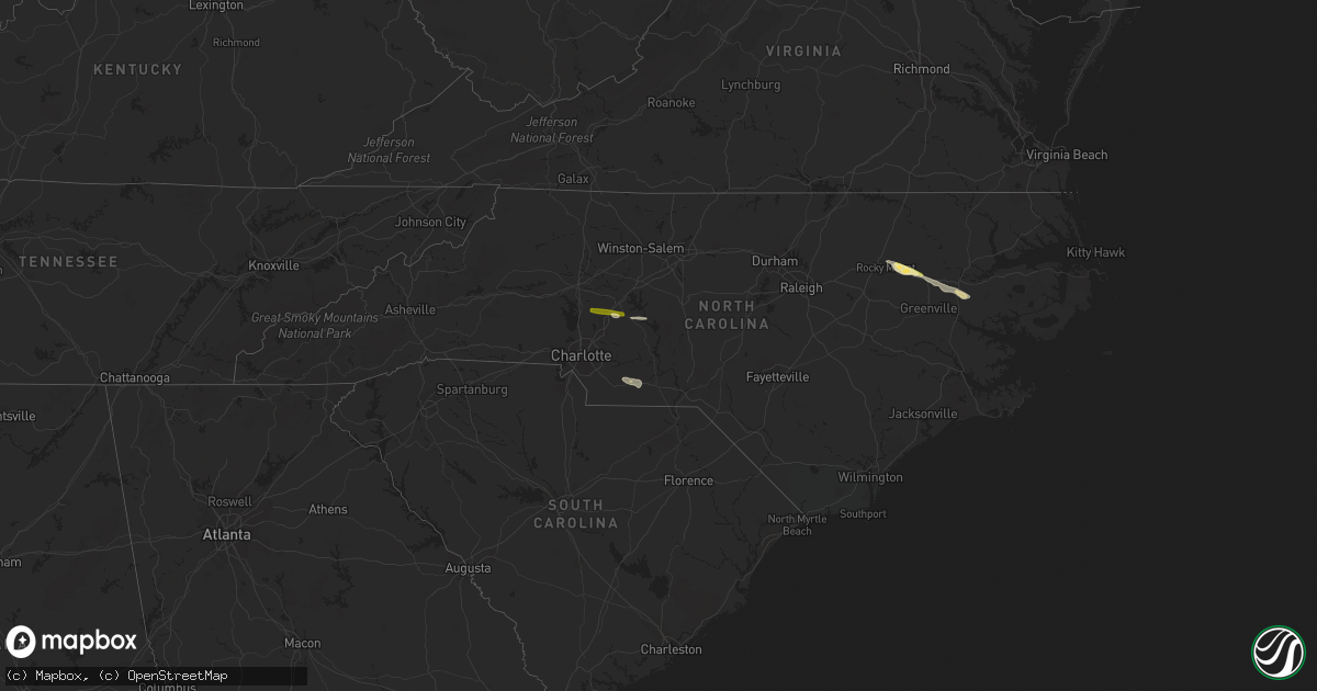
Hail Map in North Carolina on October 11, 2014
Get this storm
October 11 map
$229
one time, instant access
Download today. No call, no setup
Keep the $229
Bought the map and want the full workflow? Apply the entire $229 to a subscription within 7 days. None of it is wasted.
Every map, not just this one
This buys you this map. Subscription and you get every map we run, in the markets you choose from a few cities to whole states to nationwide. Plus real-time alerts the moment a storm fires.
Contact data
Name, contact info, occupancy, even credit band for addresses in the footprint. You go from where it hit to who to call.
Become the source they trust
Unlimited branding weather history reports on demand. You already have the documented answer ready for the property owner, and you are the one who showed up with it.
Property data and RoofTrace estimates
Pull up any address you have got, its value and the exact code rules for that jurisdiction, straight from One Click Code. Then RoofTrace estimates the squares, pitch, and roof value, priced the way you price.
Storm reports in North Carolina
North Carolina
| Date | Description |
|---|---|
| 10/11/20145:15 PM CDT | Tree down on route 742 |
| 10/11/20145:05 PM CDT | Tree down on route 1418 |
| 10/11/20144:44 PM CDT | Several large trees blown down on fowler seacrest rd. |
| 10/11/20144:33 PM CDT | Tarboro fire department observed hail up to quarter size. |
| 10/11/20142:49 PM CDT | Time determined from radar data. |
| 10/11/20142:42 PM CDT | Small storage building destroyed by high winds on west park drive. Time determined from radar. |
| 10/11/20142:20 PM CDT | Trees and powerlines blown down. Time estimated by radar. |
All States Impacted by Hail Map on October 11, 2014
Cities Impacted by Hail Map on October 11, 2014
- Lettsworth, LA
- Monterey, LA
- Angola, LA
- Robersonville, NC
- Williamston, NC
- Aberdeen, MS
- Hamilton, MS
- Jamesville, NC
- Washington, NC
- Tarboro, NC
- Rocky Mount, NC
- Battleboro, NC
- Macclesfield, NC
- Magdalena, NM
- Richfield, NC
- Gold Hill, NC
- Bayfield, CO
- Greenwood Springs, MS
- Woodville, MS
- West Point, MS
- Bethel, NC
- Arley, AL
- Laguna, NM
- China Grove, NC
- Rockwell, NC
- Salisbury, NC
- Woodsboro, TX
- Wingate, NC
- Peachland, NC
- Marshville, NC
- Polkton, NC
- Hillsboro, NM
- Mooresville, NC
- Landis, NC


