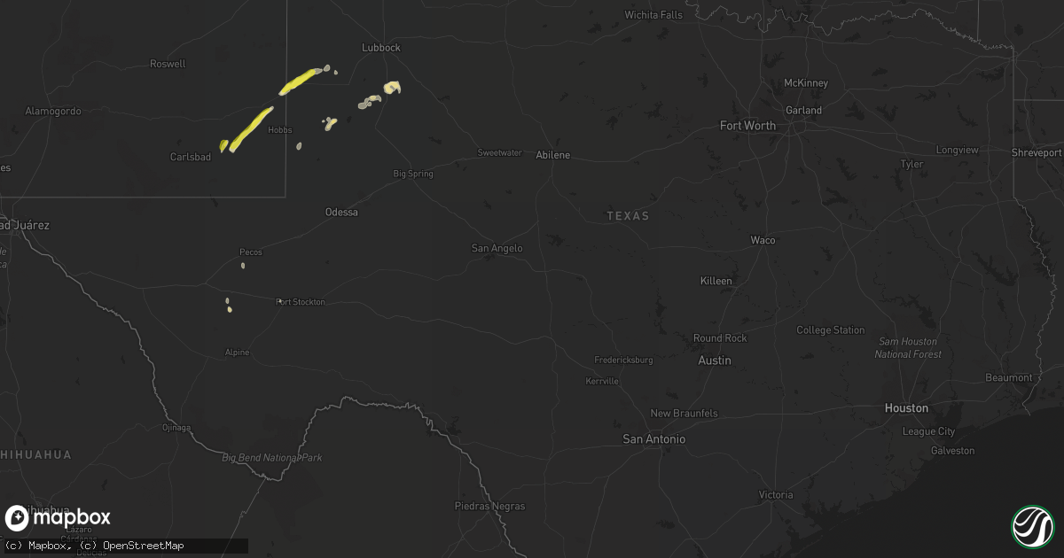
Hail Map in Texas on October 4, 2018
Get this storm
October 4 map
$229
one time, instant access
Download today. No call, no setup
Keep the $229
Bought the map and want the full workflow? Apply the entire $229 to a subscription within 7 days. None of it is wasted.
Every map, not just this one
This buys you this map. Subscription and you get every map we run, in the markets you choose from a few cities to whole states to nationwide. Plus real-time alerts the moment a storm fires.
Contact data
Name, contact info, occupancy, even credit band for addresses in the footprint. You go from where it hit to who to call.
Become the source they trust
Unlimited branding weather history reports on demand. You already have the documented answer ready for the property owner, and you are the one who showed up with it.
Property data and RoofTrace estimates
Pull up any address you have got, its value and the exact code rules for that jurisdiction, straight from One Click Code. Then RoofTrace estimates the squares, pitch, and roof value, priced the way you price.
Storm reports in Texas
Texas
| Date | Description |
|---|---|
| 10/04/20184:05 PM CDT | A local report indicates 71 MPH wind near 3 N PLAINS |
| 10/04/20182:15 AM CDT | At 714 PM MDT, a severe thunderstorm was located 13 miles west of Humble City, or 14 miles southwest of Lovington, moving northeast at 35 mph. HAZARD...60 mph wind gusts and half dollar size hail. SOURCE...Radar indicated. IMPACT...Hail damage to vehicles is expected. Expect wind damage to roofs, siding, and trees. Locations impacted include... Lovington, Humble City and Knowles. |
| 10/03/201811:11 PM CDT | At 411 PM CDT, a severe thunderstorm was located over Plains, moving northeast at 15 mph. HAZARD...60 mph wind gusts and quarter size hail. SOURCE...Radar indicated. IMPACT...Hail damage to vehicles is expected. Expect wind damage to roofs, siding, and trees. Locations impacted include... Plains. |
| 10/03/201810:30 PM CDT | At 330 PM CDT, a severe thunderstorm was located 8 miles south of Balmorhea State Park, or 18 miles northeast of Fort Davis, and is nearly stationary. HAZARD...60 mph wind gusts and half dollar size hail. SOURCE...Radar indicated. IMPACT...Hail damage to vehicles is expected. Expect wind damage to roofs, siding, and trees. Locations impacted include... Balmorhea State Park, Balmorhea Lake, Star Mountain and Toyahvale. |


