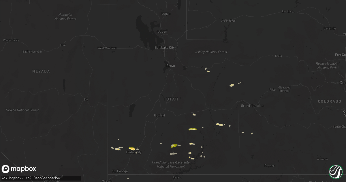
Hail Map in Utah on October 2, 2022
Get this storm
October 2 map
$229
one time, instant access
Download today. No call, no setup
Keep the $229
Bought the map and want the full workflow? Apply the entire $229 to a subscription within 7 days. None of it is wasted.
Every map, not just this one
This buys you this map. Subscription and you get every map we run, in the markets you choose from a few cities to whole states to nationwide. Plus real-time alerts the moment a storm fires.
Contact data
Name, contact info, occupancy, even credit band for addresses in the footprint. You go from where it hit to who to call.
Become the source they trust
Unlimited branding weather history reports on demand. You already have the documented answer ready for the property owner, and you are the one who showed up with it.
Property data and RoofTrace estimates
Pull up any address you have got, its value and the exact code rules for that jurisdiction, straight from One Click Code. Then RoofTrace estimates the squares, pitch, and roof value, priced the way you price.
Storm reports in Utah
Utah
| Date | Description |
|---|---|
| 10/02/20225:55 PM CDT | Many pictures on social media shared by broadcast media of hail and hail damage in the cedar city to enoch area. Largest pictured thus far is ping pong ball sized. Vide |
| 10/02/20225:55 PM CDT | A local report indicates 1.25 inch wind near 1 WNW ENOCH |
| 10/02/20224:24 PM CDT | Damage included hail dents on cars... Shredded leaves on trees. |
| 10/02/20224:13 PM CDT | Report from employee at anasazi state park museum. |
| 10/02/20221:27 AM CDT | At 626 PM MDT, a severe thunderstorm was located 11 miles south of Escalante, moving east at 15 mph. HAZARD...60 mph wind gusts and quarter size hail. SOURCE...Radar indicated. IMPACT...Hail damage to vehicles is expected. Expect wind damage to roofs, siding, and trees. This severe thunderstorm will remain over mainly rural areas of south central Garfield and north central Kane Counties. |
| 10/02/20221:26 AM CDT | At 626 PM MDT, a severe thunderstorm was located 10 miles northwest of Glen Canyon National Recreation Area, or 40 miles east of Escalante, moving east at 20 mph. HAZARD...60 mph wind gusts and half dollar size hail. SOURCE...Radar indicated. IMPACT...Hail damage to vehicles is expected. Expect wind damage to roofs, siding, and trees. Locations impacted include... Bullfrog, Glen Canyon National Recreation Area, Ticaboo and Halls Crossing.This includes Utah Route 276 between mile markers 24 and 34. |
| 10/02/20221:25 AM CDT | At 624 PM MDT, a severe thunderstorm was located 14 miles east of Ticaboo, or 46 miles northwest of Mexican Hat, moving east at 20 mph. HAZARD...60 mph wind gusts and quarter size hail. SOURCE...Radar indicated. IMPACT...Hail damage to vehicles is expected. Expect wind damage to roofs, siding, and trees. This severe thunderstorm will remain over mainly rural areas of southeastern Garfield and central San Juan Counties. |
| 10/02/202212:33 AM CDT | At 532 PM MDT, a severe thunderstorm was located near Parowan, or 15 miles east of Cedar City, moving east at 25 mph. HAZARD...60 mph wind gusts and half dollar size hail. SOURCE...Public. IMPACT...Hail damage to vehicles is expected. Expect wind damage to roofs, siding, and trees. Locations impacted include... Cedar City, Enoch, Parowan, Hatch, Panguitch Lake, Cedar Breaks National Monument, Summit and Brian Head.This includes the following highways... Interstate 15 between mile markers 62 and 79. US Route 89 between mile markers 109 and 117. |
| 10/02/202212:32 AM CDT | At 531 PM MDT, a severe thunderstorm was located 13 miles west of Hite Marina, or 36 miles south of Hanksville, moving east at 25 mph. HAZARD...60 mph wind gusts and quarter size hail. SOURCE...Radar indicated. IMPACT...Hail damage to vehicles is expected. Expect wind damage to roofs, siding, and trees. Locations impacted include... Hite Marina.This includes the following highways... Utah Route 95 between mile markers 20 and 54. Utah Route 276 between mile markers 0 and 24. |
| 10/02/202212:30 AM CDT | At 530 PM MDT, a severe thunderstorm was located 16 miles west of Cedar City, moving east at 20 mph. HAZARD...60 mph wind gusts and quarter size hail. SOURCE...Radar indicated. IMPACT...Hail damage to vehicles is expected. Expect wind damage to roofs, siding, and trees. Locations impacted include... Cedar City and Hamilton Fort. This includes the following highways... Interstate 15 between mile markers 49 and 55. Utah Route 56 between mile markers 36 and 39, and between milemarkers 45 and 59. |
| 10/02/202212:02 AM CDT | At 501 PM MDT, a severe thunderstorm was located over Enoch, or near Cedar City, moving east at 15 mph. HAZARD...60 mph wind gusts and half dollar size hail. SOURCE...Public. IMPACT...Hail damage to vehicles is expected. Expect wind damage to roofs, siding, and trees. Locations impacted include... Cedar City, Enoch, Parowan, Cedar Breaks National Monument, Summit and Brian Head.This includes the following highways... Interstate 15 between mile markers 58 and 73. Utah Route 56 between mile markers 58 and 61. |
| 10/01/202211:59 PM CDT | At 459 PM MDT, a severe thunderstorm was located 22 miles northwest of Ticaboo, or 26 miles southeast of Capitol Reef National Park, moving east at 15 mph. HAZARD...60 mph wind gusts and quarter size hail. SOURCE...Radar indicated. IMPACT...Hail damage to vehicles is expected. Expect wind damage to roofs, siding, and trees. This severe thunderstorm will remain over mainly rural areas of east central Garfield County.This includes Utah Route 276 between mile markers 4 and 23. |
| 10/01/202211:54 PM CDT | At 454 PM MDT, a severe thunderstorm was located 24 miles northwest of New Harmony, or 28 miles west of Cedar City, moving east at 20 mph. HAZARD...60 mph wind gusts and quarter size hail. SOURCE...Radar indicated. IMPACT...Hail damage to vehicles is expected. Expect wind damage to roofs, siding, and trees. Locations impacted include... Newcastle.This includes the following highways... Utah Route 18 between mile markers 47 and 51. Utah Route 56 between mile markers 20 and 45. |
| 10/01/202211:30 PM CDT | At 430 PM MDT, a severe thunderstorm was located 10 miles west of Moab, moving east at 25 mph. HAZARD...60 mph wind gusts and half dollar size hail. SOURCE...Radar indicated. IMPACT...Hail damage to vehicles is expected. Expect wind damage to roofs, siding, and trees. This severe thunderstorm will be near... Moab around 450 PM MDT. This includes the following highways... U.S. Highway 191 in Utah between mile markers 121 and 127. Utah 279 between mile markers 0 and 13. Utah 313 between mile markers 0 and 9. |
| 10/01/202211:28 PM CDT | At 428 PM MDT, a severe thunderstorm was located over Spanish Valley, or 10 miles southeast of Moab, moving northeast at 25 mph. HAZARD...60 mph wind gusts and quarter size hail. SOURCE...Radar indicated. IMPACT...Hail damage to vehicles is expected. Expect wind damage to roofs, siding, and trees. Locations impacted include... Castle Valley. This includes U.S. Highway 191 in Utah between mile markers 112 and119. |
| 10/01/202211:25 PM CDT | At 425 PM MDT, a severe thunderstorm was located over Enoch, or near Cedar City, moving east at 25 mph. HAZARD...60 mph wind gusts and quarter size hail. SOURCE...Radar indicated. IMPACT...Hail damage to vehicles is expected. Expect wind damage to roofs, siding, and trees. Locations impacted include... Cedar City, Enoch, Parowan, Cedar Breaks National Monument, Summit and Brian Head.This includes Interstate 15 between mile markers 60 and 77. |
| 10/01/202211:22 PM CDT | At 422 PM MDT, a severe thunderstorm was located 7 miles north of Escalante, moving east at 15 mph. HAZARD...60 mph wind gusts and quarter size hail. SOURCE...Radar indicated. IMPACT...Hail damage to vehicles is expected. Expect wind damage to roofs, siding, and trees. Locations impacted include... Escalante and Boulder. This includes Utah Route 12 between mile markers 67 and 90. |
| 10/01/202211:14 PM CDT | At 414 PM MDT, a severe thunderstorm was located 22 miles east of Hanksville, moving east at 25 mph. HAZARD...60 mph wind gusts and quarter size hail. SOURCE...Radar indicated. IMPACT...Hail damage to vehicles is expected. Expect wind damage to roofs, siding, and trees. This severe thunderstorm will remain over mainly rural areas of eastern Garfield and southeastern Wayne Counties. |
| 10/01/202211:03 PM CDT | At 403 PM MDT, severe thunderstorms were located along a line extending from 26 miles northeast of Green River to 18 miles northwest of Moab to near Canyonlands National Park, moving east at 25 mph. HAZARD...60 mph wind gusts and quarter size hail. SOURCE...Radar indicated. IMPACT...Hail damage to vehicles is expected. Expect wind damage to roofs, siding, and trees. These severe thunderstorms will remain over mainly rural areas of northern San Juan and central Grand Counties, including the following locations... Arches National Park and Dead Horse Point State Park. This includes the following highways... Interstate 70 in Utah between mile markers 184 and 206. U.S. Highway 191 in Utah between mile markers 124 and 147. Utah 128 between mile markers 0 and 5, and between mile markers 8and 12, and near mile marker 44. Utah 279 between mile markers 0 and 15. Utah 313 between mile markers 0 and 22. |
| 10/01/202210:44 PM CDT | At 344 PM MDT, a severe thunderstorm was located near Green River, moving east at 20 mph. HAZARD...60 mph wind gusts and quarter size hail. SOURCE...Radar indicated. IMPACT...Hail damage to vehicles is expected. Expect wind damage to roofs, siding, and trees. This severe thunderstorm will remain over mainly rural areas of eastern Emery County. |
| 10/01/202210:38 PM CDT | At 337 PM MDT, a severe thunderstorm was located 7 miles southeast of Green River, moving northeast at 30 mph. HAZARD...60 mph wind gusts and quarter size hail. SOURCE...Radar indicated. IMPACT...Hail damage to vehicles is expected. Expect wind damage to roofs, siding, and trees. This severe thunderstorm will remain over mainly rural areas of west central Grand County. This includes the following highways... Interstate 70 in Utah between mile markers 164 and 185. U.S. Highway 191 in Utah between mile markers 153 and 157. |
| 10/01/202210:13 PM CDT | At 313 PM MDT, a severe thunderstorm was located near Hanksville, moving east at 20 mph. HAZARD...60 mph wind gusts and half dollar size hail. SOURCE...Public. IMPACT...Hail damage to vehicles is expected. Expect wind damage to roofs, siding, and trees. Locations impacted include... Hanksville.This includes the following highways... Utah Route 24 between mile markers 111 and 120. Utah Route 95 between mile markers 0 and 11. |
| 10/01/20229:39 PM CDT | At 239 PM MDT, a severe thunderstorm was located 7 miles north of Escalante, moving east at 10 mph. HAZARD...60 mph wind gusts and quarter size hail. SOURCE...Radar indicated. IMPACT...Hail damage to vehicles is expected. Expect wind damage to roofs, siding, and trees. Locations impacted include... Escalante and Boulder. This includes Utah Route 12 between mile markers 57 and 61, betweenmile markers 68 and 69, and between mile markers 71 and 92. |
| 10/01/20229:33 PM CDT | At 232 PM MDT, a severe thunderstorm was located 9 miles north of Red Canyon, or 25 miles south of Junction, moving east at 20 mph. HAZARD...60 mph wind gusts and quarter size hail. SOURCE...Radar indicated. IMPACT...Hail damage to vehicles is expected. Expect wind damage to roofs, siding, and trees. This severe thunderstorm will remain over mainly rural areas of west central Garfield County. |
All States Impacted by Hail Map on October 2, 2022
Cities Impacted by Hail Map on October 2, 2022
- Boulder, UT
- Alzada, MT
- Hammond, MT
- Rhame, ND
- Bowman, ND
- Bedrock, CO
- Duchesne, UT
- Brian Head, UT
- Cedar City, UT
- Hanksville, UT
- Nucla, CO
- Naturita, CO
- Camp Crook, SD
- Buffalo, SD
- Vernal, UT
- Monticello, UT
- Thompson, UT
- Kanab, UT
- Lake Powell, UT
- Wibaux, MT
- Spearfish, SD
- Saint Onge, SD
- Belle Fourche, SD
- Edgemont, SD
- Beryl, UT
- Newcastle, WY
- Miles City, MT
- Escalante, UT
- Capitol, MT
- Lead, SD
- Green River, UT
- Moab, UT
- Kingman, AZ
- Rangely, CO
- Colorado City, AZ
- Antimony, UT
- Summit, UT


