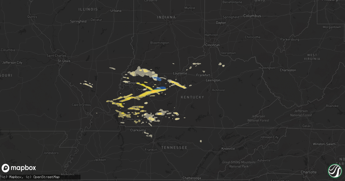
Hail Map in Kentucky on September 27, 2023
Get this storm
September 27 map
$229
one time, instant access
Download today. No call, no setup
Keep the $229
Bought the map and want the full workflow? Apply the entire $229 to a subscription within 7 days. None of it is wasted.
Every map, not just this one
This buys you this map. Subscription and you get every map we run, in the markets you choose from a few cities to whole states to nationwide. Plus real-time alerts the moment a storm fires.
Contact data
Name, contact info, occupancy, even credit band for addresses in the footprint. You go from where it hit to who to call.
Become the source they trust
Unlimited branding weather history reports on demand. You already have the documented answer ready for the property owner, and you are the one who showed up with it.
Property data and RoofTrace estimates
Pull up any address you have got, its value and the exact code rules for that jurisdiction, straight from One Click Code. Then RoofTrace estimates the squares, pitch, and roof value, priced the way you price.
Storm reports in Kentucky
Kentucky
| Date | Description |
|---|---|
| 09/26/202311:44 PM CDT | A local report indicates 1.25 inch wind near Harned |
| 09/26/202311:42 PM CDT | Trees down in hardinsburg... Including one on a mobile home. Windows of a residence broken by large hail. |
| 09/26/202311:35 PM CDT | Kentucky mesonet. |
| 09/26/202311:08 PM CDT | Golfball size or larger hail in southern hancock county. |
| 09/26/202310:58 PM CDT | A local report indicates 1.00 inch wind near Whitesville |
| 09/26/202310:58 PM CDT | Delayed report from last night. A couple of large tree limbs blown down. |
| 09/26/202310:53 PM CDT | Hail stone slightly bigger than a quarter. |
| 09/26/202310:53 PM CDT | A local report indicates 1.25 inch wind near Philpot |
| 09/26/202310:08 PM CDT | Tree down on highway 31w on muldraugh hill. |
| 09/26/20239:57 PM CDT | A local report indicates 1.00 inch wind near 6 ENE Fredonia |
| 09/26/20239:56 PM CDT | A local report indicates 1.00 inch wind near Pellville |
| 09/26/20239:41 PM CDT | Hail covering the ground with the largest stones around a half dollar. |
| 09/26/20239:31 PM CDT | Hail of at least 1 inch in diameter in yelvington. |
| 09/26/20239:26 PM CDT | Late report. A few hailstones larger than quarters. |
| 09/26/20239:25 PM CDT | Corrects previous tstm wnd dmg report from 4 se macio. One tree down at the intersection of highway 1389 and yelvington-knottsville rd. Retransmission. |
Cities Impacted by Hail Map on September 27, 2023
- Eden, TX
- Menard, TX
- Clarkrange, TN
- Rocksprings, TX
- Del Rio, TX
- Junction, TX
- Center Point, TX
- London, TX
- Vidor, TX
- Ozona, TX
- Leakey, TX
- Batesville, TX
- Mertzon, TX
- Kerrville, TX
- Sonora, TX
- Deer Lodge, TN
- Brady, TX
- Camp Wood, TX
- Barksdale, TX
- Poseyville, IN
- Wadesville, IN
- Dryden, TX
- Salem, KY
- Marion, KY
- Newburgh, IN
- Richland, IN
- Rockport, IN
- Dixon, KY
- Clay, KY
- Laconia, IN
- West Point, KY
- Elizabeth, IN
- Muldraugh, KY
- Maceo, KY
- Owensboro, KY
- Lewisport, KY
- Philpot, KY
- Hawesville, KY
- Reynolds Station, KY
- Whitesville, KY
- Providence, KY
- Slaughters, KY
- Calhoun, KY
- Fordsville, KY
- Utica, KY
- Sebree, KY
- Robards, KY
- Brandenburg, KY
- Brackettville, TX
- New Harmony, IN
- Saratoga, TX
- Grandview, IN
- Chrisney, IN
- Louise, TX
- Edna, TX
- Lebanon Junction, KY
- Katy, TX
- Houston, TX
- Uvalde, TX
- Rumsey, KY
- Big Lake, TX
- Burna, KY
- Hampton, KY
- Velpen, IN
- Winslow, IN
- Eagle Pass, TX
- Morganfield, KY
- Mount Vernon, IN
- Dawson Springs, KY
- Vergennes, IL
- Sturgis, KY
- Elizabethtown, IL
- Cave In Rock, IL
- Kountze, TX
- Smithland, KY
- Fredonia, KY
- Rosiclare, IL
- Golconda, IL
- Boonville, IN
- La Center, KY
- Barlow, KY
- Hurst, IL
- Carterville, IL
- Elkville, IL
- Ava, IL
- De Soto, IL
- Huntingburg, IN
- Campbell Hill, IL
- Oakland City, IN
- Petersburg, IN
- Jasper, IN
- Comstock, TX
- Owensville, IN
- Fort Branch, IN
- Royalton, IL
- Evansville, IN
- Quemado, TX
- Battletown, KY
- Leavenworth, IN
- Cannelton, IN
- Mauckport, IN
- Sour Lake, TX
- Hull, TX
- Batson, TX
- Geff, IL
- Fairfield, IL
- Golden Gate, IL
- Princeton, KY
- Livermore, KY
- Hartford, KY
- Hanson, KY
- Cloverport, KY
- Falls Of Rough, KY
- Hardinsburg, KY
- Irvington, KY
- Garfield, KY
- Harned, KY
- Bristow, IN
- Saint Meinrad, IN
- Leopold, IN
- Branchville, IN
- Saint Croix, IN
- Tell City, IN
- Union Star, KY
- Derby, IN
- Evanston, IN
- Bowling Green, KY
- Roundhill, KY
- Holland, IN
- Russellville, KY
- Belton, KY
- Greenville, KY
- Auburn, KY
- Frankfort, KY
- Lewisburg, KY
- Sharon Grove, KY
- La Grange, KY
- Campbellsburg, KY
- Mount Olivet, KY
- Carlisle, KY
- Cynthiana, KY
- Cynthiana, IN
- Princeton, IN
- Haubstadt, IN
- Stendal, IN
- Canyon, TX
- Dundee, KY
- Bardstown, KY
- Boston, KY
- Fort Knox, KY
- Sacramento, KY
- Central City, KY
- Madisonville, KY
- Nortonville, KY
- Saint Charles, KY
- Earlington, KY
- Graham, KY
- White Plains, KY
- Mortons Gap, KY
- Powderly, KY
- Rio Grande City, TX
- Orange Grove, TX
- Shepherdsville, KY
- Berry, KY
- Centertown, KY
- Pekin, IN
- Salem, IN
- Bloomfield, KY
- Turners Station, KY
- Bedford, KY
- Pendleton, KY
- Sulphur, KY
- Ferdinand, IN
- Birdseye, IN
- Perry Park, KY
- Owenton, KY
- Elberfeld, IN
- Dale, IN
- Saint Anthony, IN
- English, IN
- Lynnville, IN
- Tennyson, IN
- Spurgeon, IN
- Francisco, IN
- Dunmor, KY
- Browder, KY
- Beech Creek, KY
- Drakesboro, KY
- Hopkinsville, KY
- Crofton, KY
- Elkton, KY
- Smithfield, KY
- Crestwood, KY
- Buckner, KY
- Coxs Creek, KY
- Oakland, KY
- Franklin, KY
- Woodburn, KY
- Olaton, KY
- Westview, KY
- Island, KY
- Custer, KY
- Nebo, KY
- Eddyville, KY
- Glasgow, KY
- Etoile, KY
- Cadiz, KY
- Summer Shade, KY
- Pembroke, KY
- Trenton, KY
- Whites Creek, TN
- Goodlettsville, TN
- Joelton, TN
- Ashland City, TN
- Du Quoin, IL
- Guston, KY
- Ekron, KY
- Edmonton, KY
- Burkesville, KY
- Kuttawa, KY
- Cave City, KY
- Gracey, KY
- Cerulean, KY
- Rockport, KY
- Lucas, KY
- Morgantown, KY
- Rockfield, KY
- Smiths Grove, KY
- Scottsville, KY
- Vine Grove, KY
- Park City, KY
- Mulkeytown, IL
- Grand Rivers, KY
- Springfield, TN
- Chapmansboro, TN
- Cedar Hill, TN
- Pleasant View, TN
- Clay City, KY
- Adairville, KY
- Brooksville, KY
- Austin, KY
- Clarksville, TN
- Tiline, KY
- Pinckneyville, IL
- Santa Claus, IN
- Gentryville, IN
- Leitchfield, KY
- McDaniels, KY
- Horse Cave, KY
- Rome, IN
- Herndon, KY
- Oak Grove, KY
- Hudson, KY
- New Castle, KY
- Olmstead, KY
- Louisville, KY
- Guthrie, KY
- Webster, KY


