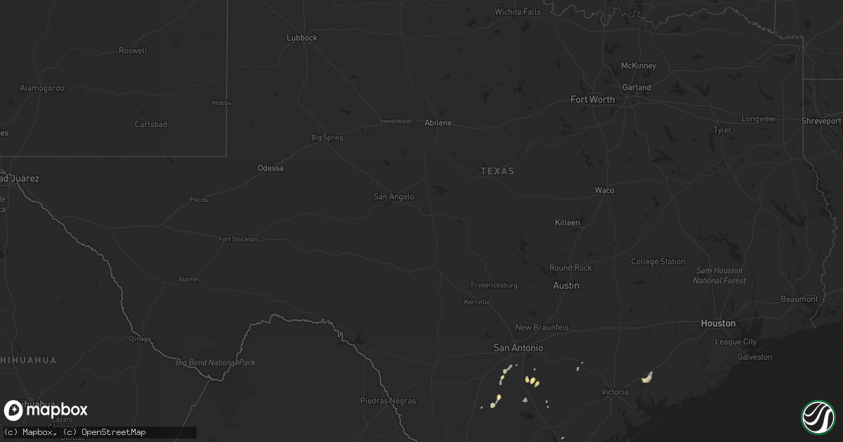
Hail Map in Texas on September 25, 2015
Get this storm
September 25 map
$229
one time, instant access
Download today. No call, no setup
Keep the $229
Bought the map and want the full workflow? Apply the entire $229 to a subscription within 7 days. None of it is wasted.
Every map, not just this one
This buys you this map. Subscription and you get every map we run, in the markets you choose from a few cities to whole states to nationwide. Plus real-time alerts the moment a storm fires.
Contact data
Name, contact info, occupancy, even credit band for addresses in the footprint. You go from where it hit to who to call.
Become the source they trust
Unlimited branding weather history reports on demand. You already have the documented answer ready for the property owner, and you are the one who showed up with it.
Property data and RoofTrace estimates
Pull up any address you have got, its value and the exact code rules for that jurisdiction, straight from One Click Code. Then RoofTrace estimates the squares, pitch, and roof value, priced the way you price.
Storm reports in Texas
Texas
| Date | Description |
|---|---|
| 09/25/20153:50 PM CDT | Microburst with estimated 50 mph winds causing damage to apartment complex near 34th and waco dr. |
| 09/25/20152:28 PM CDT | San antonio international airport asos ksat recorded a 50 knot wind gust. |
| 09/25/20152:11 PM CDT | Microburst with estimated 50 to 60 mph winds caused damage to an apartment complex near 34th and waco dr. No injuries reporte |
| 09/25/20152:00 PM CDT | Microburst with estimated 50 mph winds causing damage to apartment complex near 34th and waco dr. |
| 09/24/201511:10 PM CDT | A local report indicates 60 MPH wind near 1 ESE SAN LEON |


