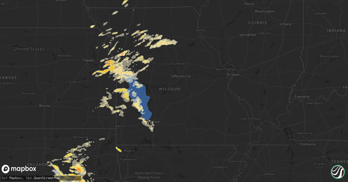
Hail Map in Missouri on September 23, 2023
Get this storm
September 23 map
$229
one time, instant access
Download today. No call, no setup
Keep the $229
Bought the map and want the full workflow? Apply the entire $229 to a subscription within 7 days. None of it is wasted.
Every map, not just this one
This buys you this map. Subscription and you get every map we run, in the markets you choose from a few cities to whole states to nationwide. Plus real-time alerts the moment a storm fires.
Contact data
Name, contact info, occupancy, even credit band for addresses in the footprint. You go from where it hit to who to call.
Become the source they trust
Unlimited branding weather history reports on demand. You already have the documented answer ready for the property owner, and you are the one who showed up with it.
Property data and RoofTrace estimates
Pull up any address you have got, its value and the exact code rules for that jurisdiction, straight from One Click Code. Then RoofTrace estimates the squares, pitch, and roof value, priced the way you price.
Storm reports in Missouri
Missouri
| Date | Description |
|---|---|
| 09/23/20236:49 PM CDT | A local report indicates 58 MPH wind near 2.2 SSW Appleton City |
| 09/23/20236:45 PM CDT | Delayed report. Large tree limbs down throughout town and smaller trees uprooted. Time estimated from radar. |
| 09/23/20236:38 PM CDT | Public reported estimated wind gust of 60 mph between deepwater and clinton. |
| 09/23/20236:33 PM CDT | A local report indicates 1.00 inch wind near 3 NNE Deepwater |
| 09/23/20236:28 PM CDT | Corrects previous tstm wnd gst report from 3 n deepwater. Public reported estimated wind gust of 60 mph between deepwater and clinton. |
| 09/23/20235:23 PM CDT | A local report indicates 60 MPH wind near 1 ESE Gunn City |
| 09/23/20235:15 PM CDT | Trained spotter reported. |
| 09/23/20235:14 PM CDT | Report from mping: half dollar |
| 09/23/20235:10 PM CDT | Report from mping: quarter |
| 09/23/20234:51 PM CDT | A local report indicates 1.00 inch wind near Chillicothe |
| 09/23/20234:50 PM CDT | Report from mping: half dollar |
| 09/23/20234:46 PM CDT | Report from mping: quarter |
| 09/23/20234:45 PM CDT | A local report indicates 1.00 inch wind near 1 S Raymore |
| 09/23/20234:41 PM CDT | A local report indicates 1.50 inch wind near 2 NNE Cleveland |
| 09/23/20234:40 PM CDT | A local report indicates 1.00 inch wind near Belton |
| 09/23/20234:40 PM CDT | (ea |
| 09/23/20234:40 PM CDT | Trained spotter reported mostly dime size hail with quarter size hail southwest of raymore. |
| 09/23/20234:40 PM CDT | Received a cocorahs report of 1.75 inch hail. |
| 09/23/20234:36 PM CDT | Public reported varying size hail from dime to quarter size hail. Located near lowes in raymore. |
| 09/23/20234:36 PM CDT | Report from mping: half dollar |
| 09/23/20234:35 PM CDT | Report via social media. |
| 09/23/20234:25 PM CDT | A local report indicates 1.00 inch wind near 5 SSW Belton |
| 09/23/20233:31 PM CDT | Report from mping: quarter |
| 09/23/20233:08 PM CDT | Quarter size hail reported at the ta travel center. |
| 09/23/20231:31 PM CDT | Report from mping: quarter |
| 09/23/20231:25 PM CDT | Mainly quarter to half dollar size hail but a few golf ball size hail reported. |
| 09/23/20231:15 PM CDT | A local report indicates 1.75 inch wind near 2 E Gunn City |
| 09/23/20231:07 PM CDT | A local report indicates 1.50 inch wind near 2 WNW Gunn City |
| 09/23/20231:04 PM CDT | Report from mping: golf ball |
| 09/23/202312:50 PM CDT | A local report indicates 1.50 inch wind near 1 NW Missouri City |
| 09/23/202312:47 PM CDT | A local report indicates 1.00 inch wind near 1 WSW Harrisonville |
| 09/23/202312:40 PM CDT | Several trees and fences damaged from microburst. |
| 09/23/202312:40 PM CDT | A local report indicates 1.25 inch wind near Buckner |
| 09/23/202312:40 PM CDT | Report from mping: ping pong ball |
| 09/23/202312:38 PM CDT | Mature trees snapped from microburst. Time estimated from radar. |
| 09/23/202312:35 PM CDT | A local report indicates 2.50 inch wind near Liberty |
| 09/23/202312:24 PM CDT | A local report indicates 1.00 inch wind near 1 SW Lee's Summit |
| 09/23/202312:15 PM CDT | Report via social media. |
| 09/23/202312:05 PM CDT | Report via social media. |
| 09/23/202310:05 AM CDT | Wind gusts to 40 mph as well. |
| 09/23/202310:04 AM CDT | A local report indicates 1.00 inch wind near 1 SE Platte City |
| 09/22/20239:34 PM CDT | Report from mping: 1-inch tree limbs broken; shingles blown off. |
| 09/22/20239:30 PM CDT | Trees down from 380 to 295. |
| 09/22/20239:17 PM CDT | Delayed report. A barn collapsed and several trees were down in the farm road 65 area near highway 266. |
| 09/22/20239:16 PM CDT | Report from mping: 3-inch tree limbs broken. |
| 09/22/20239:15 PM CDT | Report from mping: 3-inch tree limbs broken. Time estimated from radar. |
| 09/22/20239:00 PM CDT | Gusts estimated to near 60 mph caused sporadic tree damage including an uprooted tree. Time estimated. |
| 09/22/20238:56 PM CDT | A local report indicates 60 MPH wind near 1 WSW Ebenezer |
| 09/22/20238:36 PM CDT | Report from mping and social media: tree branches snapped... Roof blown off. |
| 09/22/20238:35 PM CDT | 4 to 5 inch tree limbs down. |
| 09/22/20238:35 PM CDT | Estimated winds 50-60. |
| 09/22/20238:31 PM CDT | Large tree down on truck. |
| 09/22/20238:27 PM CDT | Report from mping: quarter |
| 09/22/20238:15 PM CDT | Tree down near dadeville. |
| 09/22/20238:05 PM CDT | Reported through skywarn. |
| 09/22/20237:57 PM CDT | Delayed report. Trees down on county road 143 south of county road 270. |
| 09/22/20237:57 PM CDT | Delayed report. Trees down across county road 270 west of highway 83. |
| 09/22/20237:45 PM CDT | Minor roof damage to an older mobile home one mile south of weaubleau on highway 123. |
| 09/22/20237:38 PM CDT | Delayed report of downed powerline on car on sw highway y through schell osage conservation area. |
| 09/22/20237:30 PM CDT | Delayed report of large tree down on state highway v north of highway 54. Time estimated by radar. |
| 09/22/20237:28 PM CDT | A local report indicates 67 MPH wind near 2.5 NE El Dorado Spring |
| 09/22/20237:25 PM CDT | Delayed report of large tree down on sw 101 and 82 near roscoe. Time estimated from radar. |
| 09/22/20237:20 PM CDT | Delayed report. Tree down on lost valley road in warsaw. Also a report of limbs down in warsaw. |
All States Impacted by Hail Map on September 23, 2023
Cities Impacted by Hail Map on September 23, 2023
- Julesburg, CO
- Venango, NE
- Spalding, NE
- Wolbach, NE
- Greeley, NE
- Belgrade, NE
- Cedar Rapids, NE
- Primrose, NE
- Ottawa, KS
- Baldwin City, KS
- Wellsville, KS
- Fullerton, NE
- Saint Edward, NE
- Genoa, NE
- Platte Center, NE
- Columbus, NE
- Monroe, NE
- Edgerton, KS
- Spring Hill, KS
- Gardner, KS
- Norfolk, NE
- Battle Creek, NE
- Lawrence, KS
- Linwood, KS
- Tonganoxie, KS
- Eudora, KS
- De Soto, KS
- Atchison, KS
- Easton, KS
- Leavenworth, KS
- Weston, MO
- Platte City, MO
- Camden Point, MO
- Bellwood, NE
- Olathe, KS
- Falls City, NE
- Rulo, NE
- Wisner, NE
- Beemer, NE
- Tekamah, NE
- Little Sioux, IA
- Blencoe, IA
- Lenexa, KS
- Shawnee, KS
- Overland Park, KS
- Kansas City, KS
- Pisgah, IA
- Onawa, IA
- Moorhead, IA
- Mission, KS
- Cosby, MO
- Clarksdale, MO
- Soldier, IA
- Ute, IA
- Kansas City, MO
- Lees Summit, MO
- Bucyrus, KS
- Paola, KS
- Louisburg, KS
- Stilwell, KS
- Belton, MO
- Cleveland, MO
- Grandview, MO
- Drexel, MO
- Freeman, MO
- Benton, IA
- Blockton, IA
- Redding, IA
- Mount Ayr, IA
- Diagonal, IA
- Liberty, MO
- Buckner, MO
- Grain Valley, MO
- Sibley, MO
- Oak Grove, MO
- Excelsior Springs, MO
- Missouri City, MO
- Harrisonville, MO
- Pleasant Hill, MO
- Independence, MO
- Orrick, MO
- Peculiar, MO
- Sioux City, IA
- Sergeant Bluff, IA
- Manning, IA
- Arcadia, IA
- Osceola, IA
- Kingsville, MO
- Garden City, MO
- East Lynne, MO
- Holden, MO
- Albion, NE
- Easton, MO
- Nortonville, KS
- Cummings, KS
- Austin, MN
- Arthur, IA
- Odebolt, IA
- Schaller, IA
- Troy, KS
- Parnell, MO
- Ravenwood, MO
- Basehor, KS
- Bonner Springs, KS
- Pilger, NE
- Amazonia, MO
- Savannah, MO
- Lyle, MN
- Rose Creek, MN
- Saint Joseph, MO
- Leigh, NE
- Pomona, KS
- Dearborn, MO
- De Kalb, MO
- Faucett, MO
- Glenville, MN
- Northwood, IA
- Dow City, IA
- Tilden, NE
- Oakdale, NE
- Fillmore, MO
- Maitland, MO
- Graham, MO
- Barnard, MO
- Bolckow, MO
- Oregon, MO
- Oakland, NE
- Lyons, NE
- Creston, NE
- Riverside, MO
- Stanton, NE
- Agency, MO
- Leawood, KS
- Elgin, NE
- Craig, NE
- Scribner, NE
- Hooper, NE
- Robinson, KS
- Highland, KS
- Wathena, KS
- Bancroft, NE
- Schleswig, IA
- Charter Oak, IA
- Manilla, IA
- Vail, IA
- Denison, IA
- Lansing, KS
- Farley, MO
- Trimble, MO
- Edgerton, MO
- Gower, MO
- Clarkson, NE
- Hoskins, NE
- Howells, NE
- Madison, NE
- Winside, NE
- Schuyler, NE
- Decatur, NE
- Dunlap, IA
- Loup City, NE
- Humphrey, NE
- Herman, NE
- Mondamin, IA
- Castana, IA
- Woodbine, IA
- Winslow, NE
- Mapleton, IA
- Rosalie, NE
- Newman Grove, NE
- Pierce, NE
- Wayne, NE
- Randolph, NE
- Lindsay, NE
- West Point, NE
- Prairie Village, KS
- Wall Lake, IA
- Breda, IA
- Arion, IA
- Neligh, NE
- Clearwater, NE
- Raymore, MO
- Rushville, MO
- Osborn, MO
- Sheridan, MO
- Scotia, NE
- Meadow Grove, NE
- Cameron, MO
- Stewartsville, MO
- Silver Creek, NE
- Palmer, NE
- Saint Paul, NE
- Carroll, NE
- Ericson, NE
- Bartlett, NE
- Dodge, NE
- Early, IA
- Sac City, IA
- Lake View, IA
- Maryville, MO
- Williamsburg, KS
- Denton, KS
- Everest, KS
- Salix, IA
- Petersburg, NE
- Elba, NE
- Laurel, NE
- Blue Springs, MO
- Creighton, MO
- Rayville, MO
- New Virginia, IA
- Watertown, SD
- Knob Noster, MO
- La Monte, MO
- Mayview, MO
- Higginsville, MO
- Lexington, MO
- Corder, MO
- Castle, OK
- Okemah, OK
- Okmulgee, OK
- Dover, MO
- Waverly, MO
- Concordia, MO
- Sweet Springs, MO
- Blackburn, MO
- Henryetta, OK
- Weleetka, OK
- Marshall, MO
- Houstonia, MO
- Eufaula, OK
- Madison, MN
- Bogard, MO
- Hale, MO
- Tina, MO
- Bosworth, MO
- Ludlow, MO
- Dawn, MO
- Utica, MO
- Mooresville, MO
- Hamilton, MO
- Gallatin, MO
- Hanna, OK
- Lock Springs, MO
- Jamesport, MO
- Chillicothe, MO
- Sumner, MO
- Brookfield, MO
- Rothville, MO
- Marceline, MO
- Blairstown, MO
- Butler, MO
- Urich, MO
- Archie, MO
- Mcalester, OK
- Canadian, OK
- Indianola, OK
- Bucklin, MO
- De Witt, MO
- Triplett, MO
- Brunswick, MO
- Pleasanton, KS
- Foster, MO
- Hume, MO
- Montrose, MO
- Clinton, MO
- Crowder, OK
- Lohrville, IA
- Chula, MO
- Maysville, MO
- Weatherby, MO
- Odessa, MO
- Alma, MO
- Kearney, MO
- Carroll, IA
- Auburn, IA
- Convent, LA
- Gramercy, LA
- Paulina, LA
- Saint James, LA
- Maurepas, LA
- Vacherie, LA
- Saint Amant, LA
- Richmond, MO
- Westside, IA
- Halbur, IA
- Glidden, IA
- Braymer, MO
- Breckenridge, MO
- Ponchatoula, LA
- Folsom, LA
- Robert, LA
- Loranger, LA
- Gowrie, IA
- Malta Bend, MO
- Hinton, IA
- Whittemore, IA
- Rolfe, IA
- West Bend, IA
- Algona, IA
- Ottosen, IA
- Hardin, MO
- Churdan, IA
- Lehigh, IA
- Duncombe, IA
- Bristow, OK
- Carrollton, MO
- Murray, IA
- New Century, KS
- Ogden, IA
- Dayton, IA
- Paton, IA
- Burnside, IA
- Stratford, IA
- Fort Dodge, IA
- Harcourt, IA
- Boxholm, IA
- Ellston, IA
- Palmer, IA
- Warrensburg, MO
- Stanhope, IA
- Kamrar, IA
- Webster City, IA
- Norborne, MO
- Lake City, IA
- Grand River, IA
- Covington, LA
- Smithville, MO
- Gilman City, MO
- Trenton, MO
- Springfield, LA
- Henrietta, MO
- Camden, MO
- Wellington, MO
- Winston, MO
- Boley, OK
- Chilhowee, MO
- Centerview, MO
- Cowgill, MO
- Napoleon, MO
- Lone Jack, MO
- Bates City, MO
- La Cygne, KS
- Greenwood, MO
- Terlton, OK
- Cleveland, OK
- Mannford, OK
- Osage, OK
- Beggs, OK
- Kellyville, OK
- Skiatook, OK
- Hominy, OK
- Quinton, OK
- Asher, OK
- Macomb, OK
- Tecumseh, OK
- Maud, OK
- Konawa, OK
- Mounds, OK
- Glenpool, OK
- Osceola, MO
- Deepwater, MO
- Appleton City, MO
- Lowry City, MO
- Rockville, MO
- Salisbury, MO
- Clifton Hill, MO
- Huntsville, MO
- Rich Hill, MO
- Schell City, MO
- Warsaw, MO
- El Dorado Springs, MO
- Wetumka, OK
- Harwood, MO
- Cairo, MO
- Stockton, MO
- Collins, MO
- Quincy, MO
- Weaubleau, MO
- Humansville, MO
- Jacksonville, MO
- Dunnegan, MO
- Fair Play, MO
- Dadeville, MO
- Drumright, OK
- Wewoka, OK
- Sasakwa, OK
- Allen, OK
- Flemington, MO
- Wheatland, MO
- Dustin, OK
- Morris, OK
- Aldrich, MO
- Jenks, OK
- Bixby, OK
- Broken Arrow, OK
- Tulsa, OK
- Bolivar, MO
- Walnut Grove, MO
- Hermitage, MO
- Everton, MO
- Morrisville, MO
- Holdenville, OK
- Calvin, OK
- Atwood, OK
- Mindenmines, MO
- Liberal, MO
- Ash Grove, MO
- Willard, MO
- Brighton, MO
- Pleasant Hope, MO
- Springfield, MO
- Bois D Arc, MO
- Tryon, OK
- Carney, OK
- Agra, OK
- Chandler, OK
- Coalgate, OK
- Centrahoma, OK
- Stuart, OK
- Wardville, OK
- Cushing, OK
- Stroud, OK
- Checotah, OK
- Sparks, OK
- Meeker, OK
- Davenport, OK
- Prague, OK
- Fort Scott, KS
- Farlington, KS
- Hepler, KS
- Shawnee, OK
- Earlsboro, OK
- Seminole, OK
- Sperry, OK
- Coyle, OK
- Meadville, MO
- Republic, MO
- Appleton, MN
- Jennings, OK
- Sand Springs, OK
- Prue, OK
- Ozark, MO
- Perkins, OK
- Laclede, MO
- Nevada, MO
- Walker, MO
- Jasper, MO
- Keytesville, MO
- Mendon, MO
- Wheeling, MO
- Moran, KS
- Bronson, KS
- Prescott, KS
- Blue Mound, KS
- New Cambria, MO
- Parkersburg, IA
- Shell Rock, IA
- White, SD
- Franklin, KS
- Pittsburg, KS
- Mulberry, KS
- Lamar, MO
- Frontenac, KS
- Stillwater, OK
- Ripley, OK
- Catoosa, OK
- Oologah, OK
- Talala, OK
- Ramona, OK
- Afton, OK
- Vinita, OK
- Brookings, SD
- Toronto, SD
- Bronaugh, MO
- Collinsville, OK
- Centerville, KS
- Sheldon, MO
- Dalton, MO
- Excello, MO
- Callao, MO
- Paden, OK
- Richards, MO
- Greenfield, MO
- Jerico Springs, MO
- Clarence, MO
- Madison, MO
- Macon, MO
- Sapulpa, OK
- Kiefer, OK
- Milo, MO
- Oronogo, MO
- Girard, KS
- Boynton, OK
- Adrian, MO
- Bruce, SD
- Astoria, SD
- Bevier, MO
- Meridian, OK
- Wellston, OK
- Amsterdam, MO
- Strasburg, MO
- Hartshorne, OK
- Krebs, OK
- Wilburton, OK
- Haileyville, OK
- Tuskahoma, OK
- Bowlegs, OK
- Maysville, AR
- Gentry, AR
- Decatur, AR
- Gravette, AR
- Kiowa, OK
- Eagleville, MO
- Manly, IA
- Nixa, MO
- Council Hill, OK
- Clear Lake, IA
- Mason City, IA
- Chelsea, OK
- Adams, MN
- Clayton, OK
- Rogersville, MO
- Pearl River, LA
- Grafton, IA
- Plymouth, IA
- Uniontown, KS
- Redfield, KS
- Big Cabin, OK
- Mapleton, KS
- Mound City, KS
- Fulton, KS
- Lawson, MO
- Holt, MO
- Nashoba, OK
- Napoleonville, LA
- Thayer, KS
- Chanute, KS
- Owasso, OK
- Arcadia, KS
- Claremore, OK
- Amoret, MO
- Waldron, MO
- Jay, OK
- Savonburg, KS
- Walnut, KS
- Arma, KS
- Stark, KS
- Erie, KS
- Elsmore, KS
- McCune, KS
- Nowata, OK
- Vera, OK
- Barnsdall, OK
- Union Star, MO
- Lamar, OK
- Pittsburg, OK
- Daisy, OK
- Stringtown, OK
- Yale, OK
- Talihina, OK
- Brookline, MO
- Clever, MO
- Billings, MO
- Highlandville, MO
- Savanna, OK
- Haskell, OK
- Whiteman Air Force Base, MO
- Levasy, MO
- Hooks, TX
- New Boston, TX
- Maud, TX
- Texarkana, TX
- Douglassville, TX
- Atlanta, TX
- Queen City, TX
- Linden, TX
- Bivins, TX
- Jefferson, TX
- Karnack, TX
- Mooringsport, LA
- Vivian, LA
- Shreveport, LA
- Rattan, OK
- Bellingham, MN
- Wakefield, NE
- Oktaha, OK
- Marionville, MO
- Halltown, MO
- Snow, OK
- Ringold, OK
- Valliant, OK
- Broken Bow, OK


