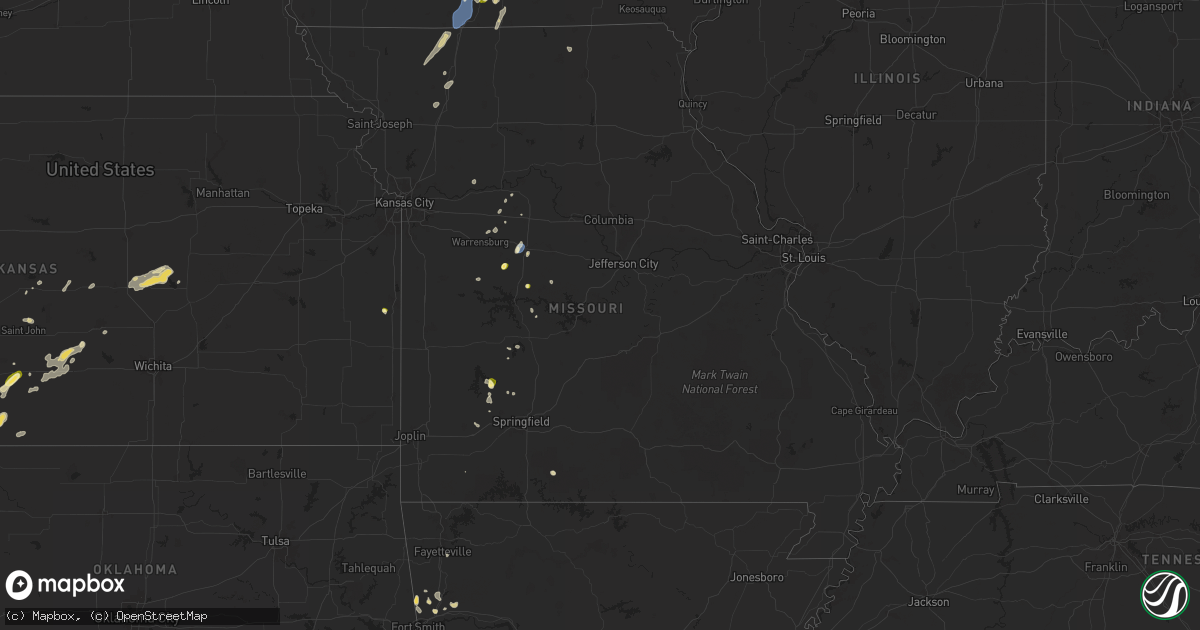
Hail Map in Missouri on September 17, 2025
Get this storm
September 17 map
$229
one time, instant access
Download today. No call, no setup
Keep the $229
Bought the map and want the full workflow? Apply the entire $229 to a subscription within 7 days. None of it is wasted.
Every map, not just this one
This buys you this map. Subscription and you get every map we run, in the markets you choose from a few cities to whole states to nationwide. Plus real-time alerts the moment a storm fires.
Contact data
Name, contact info, occupancy, even credit band for addresses in the footprint. You go from where it hit to who to call.
Become the source they trust
Unlimited branding weather history reports on demand. You already have the documented answer ready for the property owner, and you are the one who showed up with it.
Property data and RoofTrace estimates
Pull up any address you have got, its value and the exact code rules for that jurisdiction, straight from One Click Code. Then RoofTrace estimates the squares, pitch, and roof value, priced the way you price.
Storm reports in Missouri
Missouri
| Date | Description |
|---|---|
| 09/17/20256:15 PM CDT | Corrects previous tstm wnd dmg report from 4 ssw bradleyville. Several trees were reported town... A few on local roads. A barn also suffered minor roof damage. |
| 09/17/20256:00 PM CDT | Delayed report. Downed tree limbs reported in the lineville area along with small hail. Time estimated from radar. |
| 09/17/20255:48 PM CDT | Hail up to the size of quarters was reported. |
| 09/17/20254:45 PM CDT | Personal weather station measurement. |
| 09/17/20254:30 PM CDT | Personal weather station. |
| 09/17/20254:25 PM CDT | Delayed report. Social media report of downed tree limbs southwest of sedalia. Time based on social media reports and confirmed from radar. |
| 09/17/20254:25 PM CDT | Delayed report. Social media video of quarter size hail on clover drive. Time based on video footage and confirmed from radar. |
| 09/17/20254:02 PM CDT | Tree down near mckissock and lincoln ave. |
| 09/17/20254:02 PM CDT | Tree knocked down. Time estimated from radar. |
| 09/17/20254:00 PM CDT | A local report indicates 1.00 inch wind near 3 NE Windsor |
| 09/17/20254:00 PM CDT | A local report indicates 1.00 inch wind near 3 NE Windsor |
| 09/17/20254:00 PM CDT | Report from mping... Quarter size hail. |
| 09/16/20257:16 PM CDT | Several trees were reported town... A few on local roads. A barn also suffered minor roof damage. |
| 09/16/20257:16 PM CDT | Several trees were reported town... A few on local roads. A barn a |
All States Impacted by Hail Map on September 17, 2025
Cities Impacted by Hail Map on September 17, 2025
- Fort Dodge, IA
- Otho, IA
- Lehigh, IA
- Burnside, IA
- Dayton, IA
- Duncombe, IA
- Porter, MN
- Canby, MN
- Punta Gorda, FL
- Darwin, MN
- Saint Charles, IA
- Skandia, MI
- Miami, TX
- Winterset, IA
- Norwalk, IA
- Prole, IA
- Canadian, TX
- Oakdale, LA
- Ville Platte, LA
- Gwinn, MI
- Ozark, AR
- Mulberry, AR
- Rock, MI
- Rudy, AR
- Alma, AR
- Heflin, LA
- Pitkin, LA
- Glen, MS
- Van Buren, AR
- Oberlin, LA
- Blue Mountain, MS
- Chester, AR
- Sibley, LA
- Annandale, MN
- South Haven, MN
- Arnegard, ND
- Elton, LA
- Watford City, ND
- Mound City, KS
- Prescott, KS
- Walker, LA
- Little Lake, MI
- Pleasanton, KS
- Haynesville, LA
- Sugartown, LA
- Cedarville, AR
- Natural Dam, AR
- Clearwater, MN
- Maple Lake, MN
- Borger, TX
- Mountainburg, AR
- Uniontown, AR
- Denham Springs, LA
- Kinder, LA
- Lincoln, MO
- Cole Camp, MO
- Clinton, LA
- Sallisaw, OK
- Lafayette, LA
- Carencro, LA
- Becker, MN
- Albany, MO
- Big Lake, MN
- Edwards, MO
- Sedalia, MO
- Clear Lake, MN
- Foster City, MI
- Trinchera, CO
- Baton Rouge, LA
- Prairieville, LA
- Leesville, LA
- Fayetteville, AR
- Pampa, TX
- Isanti, MN
- Hatfield, MO
- Madison, AL
- Huntsville, AL
- Greensburg, LA
- Kentwood, LA
- Reeves, LA
- Welsh, LA
- Pheba, MS
- Stover, MO
- Princeton, MN
- Zimmerman, MN
- Trinidad, CO
- Martinsville, MO
- Muldrow, OK
- Denver, MO
- Branson, CO
- Mount Vernon, MO
- Windsor, MO
- Green Ridge, MO
- Provencal, LA
- Las Vegas, NM
- Felch, MI
- Weatherby, MO
- Cambridge, MN
- Pittsburg, MO
- Iron Mountain, MI
- Versailles, MO
- Florien, LA
- Eagleville, MO
- Langley, AR
- Murray, IA
- Minden, LA
- Smithdale, MS
- Iowa, LA
- Perryton, TX
- Chase, KS
- Waldron, AR
- Grand River, IA
- Ellston, IA
- Saint Gabriel, LA
- Stanchfield, MN
- Harris, MN
- Miller, MO
- Lamoni, IA
- Davis City, IA
- Kellerton, IA
- Decatur, IA
- Osceola, IA
- Weldon, IA
- Van Wert, IA
- Leon, IA
- Vulcan, MI
- Lake Arthur, LA
- La Monte, MO
- Bevington, IA
- Van Meter, IA
- Knob Noster, MO
- Pattonsburg, MO
- Lyons, KS
- Umpire, AR
- Cassville, MO
- Grandy, MN
- Ruston, LA
- Choudrant, LA
- Raton, NM
- Mercer, MO
- McFall, MO
- Liberty, MS
- Follett, TX
- Garden Grove, IA
- Humeston, IA
- Weston, CO
- Warrensburg, MO
- Coffey, MO
- Hazlehurst, MS
- Clinton, MO
- Summit, MS
- Bell City, LA
- Woodburn, IA
- New Virginia, IA
- Concordia, MO
- Allerton, IA
- Lineville, IA
- Fyffe, AL
- Flemington, MO
- Laverne, OK
- May, OK
- Lacassine, LA
- Sturgis, MS
- Fargo, OK
- Shattuck, OK
- Ash Grove, MO
- Fence, WI
- Guffey, CO
- Florissant, CO
- Bethany, MO
- Indianola, IA
- Lucas, IA
- Folsom, NM
- Milo, IA
- Ackworth, IA
- Aldrich, MO
- Blackburn, MO
- Morrisville, MO
- Hazelhurst, WI
- Walnut Grove, MO
- Everton, MO
- Florence, WI
- Collinsville, AL
- Fort Payne, AL
- Buffalo, OK
- Lake Charles, LA
- Bremen, GA
- Brookhaven, MS
- Saint Martinville, LA
- Attalla, AL
- Gloster, MS
- Liberty Center, IA
- Pleasantville, IA
- Novinger, MO
- Unionville, MO
- Bradleyville, MO
- Malta Bend, MO
- Sulphur, LA
- St John, KS
- Carlisle, IA
- Hudson, KS
- Hackberry, LA
- Grenville, NM
- Fair Play, MO
- Lac Du Flambeau, WI
- Divide, CO
- Freedom, OK
- Willard, MO
- Dadeville, MO
- Brighton, MO
- Vinton, LA
- Protection, KS
- Coldwater, KS
- Minocqua, WI
- Clio, IA
- Union Church, MS
- Ellinwood, KS
- Claflin, KS
- Hardin, MO
- Colorado Springs, CO
- Corydon, IA
- Orange, TX
- Yoder, CO
- Lumberton, TX
- Beaumont, TX
- Sour Lake, TX
- Rush, CO
- Wilmore, KS
- Clayton, NM
- Walsenburg, CO
- Avondale, CO
- Great Bend, KS
- Lake City, KS
- Sun City, KS
- Texline, TX
- Hutchinson, KS
- Dalhart, TX
- Larned, KS
- Hardtner, KS
- Sawyer, KS
- Coats, KS
- Haviland, KS
- Westcliffe, CO
- Dumas, TX
- Haven, KS
- Felt, OK
- Boone, CO
- Model, CO
- Ordway, CO
- Medicine Lodge, KS
- Cripple Creek, CO
- Pratt, KS
- Isabel, KS
- Cunningham, KS
- Florence, CO
- Penrose, CO
- Olney Springs, CO
- Turon, KS
- Aguilar, CO
- Victor, CO
- La Junta, CO
- Arlington, KS
- Manzanola, CO
- Crowley, CO
- Partridge, KS
- Stafford, KS
- Rocky Ford, CO
- Sugar City, CO
- Kingman, KS
- Lamar, CO
- Swink, CO
- Canon City, CO
- Little River, KS
- Rolla, KS
- Granada, CO
- Holly, CO
- Jetmore, KS
- Galva, KS
- Mcpherson, KS
- Canton, KS
- Hugoton, KS
- Ulysses, KS
- Durham, KS
- Roxbury, KS
- Lehigh, KS
- Hillsboro, KS
- Tampa, KS
- Curtis, NE
- Maywood, NE
- McCook, NE
- Wright, KS
- Salida, CO
- Marion, KS
- Cotopaxi, CO
- Howard, CO
- Stockville, NE
- Hanston, KS
- Ness City, KS
- Worthington, MO
- Bazine, KS
- Alexander, KS
- McCracken, KS
- La Crosse, KS
- Harshaw, WI
- Sweet Springs, MO


