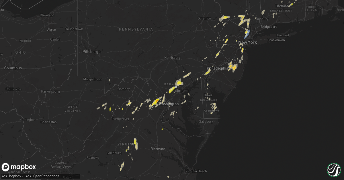
Hail Map on September 8, 2023
Get this storm
September 8 map
$229
one time, instant access
Download today. No call, no setup
Keep the $229
Bought the map and want the full workflow? Apply the entire $229 to a subscription within 7 days. None of it is wasted.
Every map, not just this one
This buys you this map. Subscription and you get every map we run, in the markets you choose from a few cities to whole states to nationwide. Plus real-time alerts the moment a storm fires.
Contact data
Name, contact info, occupancy, even credit band for addresses in the footprint. You go from where it hit to who to call.
Become the source they trust
Unlimited branding weather history reports on demand. You already have the documented answer ready for the property owner, and you are the one who showed up with it.
Property data and RoofTrace estimates
Pull up any address you have got, its value and the exact code rules for that jurisdiction, straight from One Click Code. Then RoofTrace estimates the squares, pitch, and roof value, priced the way you price.
States Impacted by Hail Map on September 8, 2023
Storm reports
Maryland
| Date | Description |
|---|---|
| 09/08/20236:57 PM CDT | Numerous trees blew down blocking md-140 reisterstown road near woodholme avenue. |
| 09/08/20236:57 PM CDT | Numerous trees blew down blocking md-140 reisterstown road near woodholme avenu |
| 09/08/20236:54 PM CDT | A wind gust of 59 knots |
| 09/08/20236:42 PM CDT | Multiple reports of large hail around quarter sized in west friendship. |
| 09/08/20236:35 PM CDT | Trees blew down on eastbound i-70 baltimore national pike between mile markers 82.0 and 83.0. |
| 09/08/20236:33 PM CDT | Multiple trees down on frederick road and fairground road. |
| 09/08/20236:29 PM CDT | Multiple reports of trees down northwest of cockeysville toward butler. |
| 09/07/20238:49 PM CDT | 911 center reported several roads north of elkton had trees down. Time estimated from radar. |
| 09/07/20237:49 PM CDT | Tree down on the 4000 block of mellow road |
| 09/07/20237:45 PM CDT | Tree down near the intersection of ridge road and whiteford road |
| 09/07/20237:30 PM CDT | Trees and wires blew down near the intersection of md-624 graceton road and md-136 whiteford road. |
| 09/07/20237:26 PM CDT | Tree down near the intersection of madonna road and mt. Horeb road |
| 09/07/20237:09 PM CDT | A local report indicates 1.00 inch wind near 1 N Cockeysville |
| 09/07/20237:00 PM CDT | Numerous trees down in the randallstown... Windsor mill... Woodlawn area. A roof caved in on the north side of woodlawn. |
Vermont
| Date | Description |
|---|---|
| 09/08/20233:54 PM CDT | Trees down in guilford. Time estimated by radar. |
| 09/08/20232:51 PM CDT | Report of hail damage to a car |
New Hampshire
| Date | Description |
|---|---|
| 09/08/20235:45 PM CDT | Trees and wires down. |
| 09/08/20235:41 PM CDT | Trees and wires down. |
| 09/08/20235:36 PM CDT | Trees and wires down on main street in dublin. |
| 09/08/20235:35 PM CDT | Trees down on route 137. |
| 09/08/20235:25 PM CDT | Trees and wires down w lake road. |
| 09/08/20235:13 PM CDT | Trees and wires down. |
| 09/08/20235:10 PM CDT | Trees and wires down. |
| 09/08/20235:07 PM CDT | Trees and wires down. |
| 09/08/20233:57 PM CDT | Numerous reports of trees and wires down reported to claremont dispatch. Time estimated by radar. |
| 09/08/20233:25 PM CDT | A local report indicates 1.00 inch wind near 3 NW Alton |
| 09/08/20233:25 PM CDT | A local report indicates 1.00 inch wind near Troy |
| 09/08/20233:02 PM CDT | A local report indicates 1.50 inch wind near 4 WSW Westmoreland |
| 09/08/20233:00 PM CDT | A local report indicates 1.00 inch wind near 3 WNW Chesterfield |
| 09/08/20232:53 PM CDT | Power poles broken and branches down. Time estimated by radar. |
| 09/08/20232:47 PM CDT | Trained spotter sent pictures via social media of widespread tree damage... Including large branches greater than 6 inches covering roads and a car. Also a large tree g |
| 09/08/20232:35 PM CDT | Trees and power lines down. |
| 09/08/20231:56 PM CDT | Reports of trees and branches down in the city of nahua. Time estimated by radar. |
Georgia
| Date | Description |
|---|---|
| 09/08/20235:20 PM CDT | Power poles down at the intersection of camp ground road and highway 76 in morvin georgia. |
| 09/08/20235:20 PM CDT | Tree over powerlines on adel highway and old coffee road. |
| 09/08/20234:10 PM CDT | Tree down at the intersection of highway 135 south and ganas road in lanier county georgia. |
New Jersey
| Date | Description |
|---|---|
| 09/08/20234:48 PM CDT | Reports of trees and power lines down in belvidere. Time estimated from radar. |
| 09/08/20234:20 PM CDT | Reports of trees and power lines down in byram twp. Time estimated from radar. |
| 09/08/20234:20 PM CDT | Reports of trees and power lines down in green twp. Time estimated from radar. |
| 09/08/20234:07 PM CDT | Report from mping: quarter |
| 09/08/20234:06 PM CDT | Downed tree on us 46 westbound east of cr 604/nj 182/willow grove st |
| 09/08/20234:05 PM CDT | Photos from trained spotter showed hail as large as half dollar size in long valley. Hail fell for 5 minutes. |
| 09/08/20233:47 PM CDT | Reports of trees and power lines down in franklin twp. Time estimated from radar. |
| 09/08/20233:38 PM CDT | Social media photo of ping pong ball sized hail in browns mills. Time estimated from radar. |
| 09/08/20233:30 PM CDT | Two reports of trees down on power lines in allentown. Time estimated from radar. |
| 09/08/20233:08 PM CDT | Social media photo of ping pong ball sized hail in browns mills. Time estimated from radar. |
| 09/08/20233:01 PM CDT | Social media video showing quarter sized hail falling in pemberton township. Time estimated from radar. |
| 09/08/20232:47 PM CDT | Report from mping: 3-inch tree limbs broken; power poles broken. |
| 09/08/20232:38 PM CDT | Report of extensive tree damage and downed trees across east hanover on social media. Time estimated with radar. |
| 09/08/20232:36 PM CDT | Large tree down near hanover park high school. Power is out in the area as well. Time estimated from radar. |
| 09/08/20232:30 PM CDT | A large white pine uprooted and completely blocking the road. |
| 09/08/20232:30 PM CDT | Report of trees down in east hanover on social media. |
| 09/08/20232:25 PM CDT | Large tree uprooted and down on corner of street blocking part of the road. |
| 09/08/20232:24 PM CDT | Dime to quarter sized hail. Shredded maple leaves. Wind gusts of 15-20 mph. |
| 09/08/20232:20 PM CDT | Tree limbs broken and on ground with time estimated by radar. |
| 09/08/20232:19 PM CDT | A 66 mph thunderstorm wind gust was reported by the teb asos. |
| 09/08/20232:17 PM CDT | Tree branches down on the road. |
| 09/08/20232:10 PM CDT | Large tree limbs fallen on car in ironbound section of newark. |
| 09/08/20232:06 PM CDT | Large tree down on powerline at 203 3rd avenue. |
| 09/08/20232:05 PM CDT | Social media photo of a large... Healthy tree with half of its truck snapped off. Time estimated from radar. |
| 09/08/20232:05 PM CDT | A local report indicates 1.00 inch wind near Upper Saddle River |
| 09/08/20231:59 PM CDT | Tree down blocking the road on harrison ave. |
| 09/08/20231:59 PM CDT | Tree down on roadway at bryant st and elm ave. |
| 09/08/20231:45 PM CDT | 1 inch hail reported at 255 us highway 46 in saddle brook. |
| 09/08/20231:30 PM CDT | High winds observed at mmu airport at approximately 2:30 pm. Peak gusts reported at 51 kts. Several aircraft were lifted and damaged. |
| 09/08/20231:30 PM CDT | Reports of trees down on wires in freehold borough. Time estimated from radar. |
| 09/08/20231:23 PM CDT | Several reports of trees down on wires across freehold twp. Time estimated from radar. |
| 09/08/202312:55 PM CDT | Reports of trees down on wires in colts neck twp. Time estimated from radar. |
| 09/08/202312:51 PM CDT | Trees down in the eastern portion of pemberton twp. Time estimated from radar. |
| 09/08/202312:50 PM CDT | Report via social media of trees and wires down in howell nj. |
Maine
| Date | Description |
|---|---|
| 09/08/20233:47 PM CDT | Tree blocking burnham rd. |
| 09/08/20233:45 PM CDT | Trees on wires and trees on fire. |
| 09/08/20233:29 PM CDT | Trees and wires down on lillian ave. |
| 09/08/20233:25 PM CDT | Trained spotted relayed that there are numerous trees down on houses in goodwins mills. Time estimated by radar. |
| 09/08/20233:13 PM CDT | Trees... Pole... Wires down at depot and summer street. Summer st. Closed. Time estimated by radar. |
| 09/08/20233:04 PM CDT | Police report numerous trees and wires down all over town. Time estimated from radar. |
Delaware
| Date | Description |
|---|---|
| 09/08/20231:25 PM CDT | Trained spotter reports quarter-sized hail in milton de. |
| 09/07/20239:25 PM CDT | Report from mping: quarter |
| 09/07/20239:23 PM CDT | Quarter size hail reported at marsh road and philadelphia pike. Time estimated from radar. |
Arkansas
| Date | Description |
|---|---|
| 09/08/20238:50 AM CDT | Tree downed on highway 32 near the hempstead county line. |
| 09/08/20238:45 AM CDT | Tree downed along highway 73 west on the east side of hope. |
| 09/08/20238:40 AM CDT | Tree downed on highway 371 in prescott. |
| 09/08/20237:57 AM CDT | Numerous trees and power lines reported throughout the county. |
| 09/08/20237:55 AM CDT | A tree was blown down in this area. |
| 09/08/20237:52 AM CDT | Numerous trees and power lines blown down along highway 8 between caddo gap and glenwood. |
Oklahoma
| Date | Description |
|---|---|
| 09/08/20236:09 PM CDT | A local report indicates 70 MPH wind near 4 E Walters |
Pennsylvania
| Date | Description |
|---|---|
| 09/08/20235:57 PM CDT | Trees and wires down. |
| 09/08/20235:35 PM CDT | Reports of tree limbs down on wires. Time estimated by radar. |
| 09/08/20235:35 PM CDT | Trees and wires reported down near east delp road and landis valley road. Time estimated by radar. |
| 09/08/20235:24 PM CDT | Emergency management reports trees and wires down across plumstead twp. Time estimated by radar. |
| 09/08/20235:20 PM CDT | Trees and wires down. |
| 09/08/20235:10 PM CDT | Reports of multiple trees down. Time estimated by radar. |
| 09/08/20235:06 PM CDT | Reports of multiple trees down. Time estimated by radar. |
| 09/08/20235:02 PM CDT | Emergency management reports trees and wires down across buckingham twp. Time estimated by radar. |
| 09/08/20234:51 PM CDT | Emergency management reports trees and wires down across doylestown. Time estimated by radar. |
| 09/08/20234:34 PM CDT | Downed tree on wires. Time estimated from radar. |
| 09/08/20234:20 PM CDT | Several reports of trees down on wires in central bucks county. Impacted roads include park av... Ferry rd... New galena rd... Railroad av... Barry rd... Sunset av... P |
| 09/08/20234:05 PM CDT | Report on social media of quarter-sized hail. |
| 09/08/20233:57 PM CDT | Quarter sized hail fell in danboro around 4:30 pm and again 4:57 pm. |
| 09/08/20233:30 PM CDT | A local report indicates 1.00 inch wind near 1 ENE Fountainville |
| 09/08/20233:29 PM CDT | Numerous large trees down... Some into homes... Across north coventry twp. Time estimated from radar. |
| 09/08/20233:24 PM CDT | Corrects previous tstm wnd dmg report from plumstead twp. Emergency management reports trees and wires down across plumstead twp. Time estimated by radar. |
| 09/08/20232:15 PM CDT | Trees and powerlines downed. |
| 09/07/202310:20 PM CDT | Down tree and limbs near shawmount school in northwest philadelphia. Peco reported 400 customers without power. Time estimated from radar. |
| 09/07/20239:53 PM CDT | Down trees or limbs in the rosemary circle area of upper providence township resulting in several power outages. Time estimated from radar. |
| 09/07/20238:52 PM CDT | Downed tree in wires on pa route 926. Time estimated from radar. |
| 09/07/20238:10 PM CDT | Trees and wires down. Time estimated by radar. |
| 09/07/20237:50 PM CDT | Tree and wires down. Time estimated by radar. |
| 09/07/20237:35 PM CDT | Multiple reports of trees and wires down. Time estimated by radar. |
| 09/07/20237:15 PM CDT | Report of a major tree down along with trees and wires down. Time estimated by radar. |
West Virginia
| Date | Description |
|---|---|
| 09/08/20236:45 PM CDT | Public relayed image of half dollar size hail at upper tract. Time estimated from radar. |
Massachusetts
| Date | Description |
|---|---|
| 09/08/20236:21 PM CDT | A local report indicates 1.00 inch wind near Sterling |
| 09/08/20236:06 PM CDT | Tree downed blocking intervale road by rte 68. Time estimated from radar. |
| 09/08/20235:50 PM CDT | Large branch blocking lyon road. |
| 09/08/20235:50 PM CDT | Numerous trees and wires down on old greenwich plains road and fisk road. |
| 09/08/20235:45 PM CDT | Tree and wires down. Report relayed by amateur radio. |
| 09/08/20235:25 PM CDT | Tree down on warren road. Relayed by amateur radio. |
| 09/08/20235:20 PM CDT | Tree uprooted and wires down on dwight street. Relayed by amateur radio. |
| 09/08/20235:15 PM CDT | Tree down on wires blocking easthampton road. |
| 09/08/20235:15 PM CDT | Report from mping: 1-inch tree limbs broken; shingles blown off. |
| 09/08/20235:10 PM CDT | Tree down on a car on sylvester road. Person was trapped... But not injured. Relayed by amateur radio. |
| 09/08/20235:00 PM CDT | Tree down on north silver lane. Relayed by amateur radio. |
| 09/08/20234:45 PM CDT | Tree and wires down on granby road. Relayed by amateur radio. |
| 09/08/20234:32 PM CDT | Tree down on wires on mountain road. Relayed by amateur radio. |
| 09/08/20234:30 PM CDT | Wires down on elm street. Relayed by amateur radio. |
| 09/08/20234:30 PM CDT | Wires down on jackson street. Relayed by amateur radio. |
| 09/08/20233:48 PM CDT | Tree down on east hoosac street |
| 09/08/20232:40 PM CDT | Tree and power lines down on brattleboro road. Relayed by amateur radio. |
| 09/08/20232:15 PM CDT | Trees down on several streets. |
| 09/08/20232:12 PM CDT | Reported by trained spotter. |
| 09/08/20232:11 PM CDT | Numerous reports of trees and wires down on various streets with one tree down on roof of fire station. Relayed by amateur radio. |
| 09/08/20232:07 PM CDT | Numerous trees and wires down on numerous streets. |
| 09/08/20232:02 PM CDT | Tree and wires down on hamilton road and tree down on vehicle on lexington avenue. |
| 09/08/20232:00 PM CDT | A local report indicates 1.00 inch wind near Andover |
| 09/08/20232:00 PM CDT | In lowell... There were wires down on monadnock ave. |
| 09/08/20232:00 PM CDT | Multiple reports of trees and wires down across town. Tree down with limbs on the roof of a home with 2 broken windows on beacon hill boulevard. |
| 09/08/20232:00 PM CDT | Corrects previous hail report from andover. |
| 09/08/20231:53 PM CDT | In lowell wires were down on rodgers st. |
| 09/08/20231:45 PM CDT | Tree down on wires on porter road. Trees down on house and through the window of a home on frederick street. |
| 09/08/20231:45 PM CDT | Tree down on longmeadow road. |
| 09/08/20231:40 PM CDT | Tree down on park road. Trees down on wires on mill road... Boston road and concord road. |
| 09/08/20231:40 PM CDT | Numerous trees down and snapped. Straight line sw to ne after the heavy rainfall. |
| 09/08/20231:40 PM CDT | 2 trees down on newtown road. |
| 09/08/20231:37 PM CDT | Numerous reports of trees downed across town. Time estimated from radar. |
| 09/08/20231:35 PM CDT | Tree blocking rutland street. |
| 09/08/20231:30 PM CDT | 5-6 trees snapped in a stright line along route 117/main st. |
| 09/08/20231:25 PM CDT | Multiple trees down with 12+ inch diameter at tuttle drive and lothrop road. |
| 09/08/20231:25 PM CDT | Multiple trees down along central st. Windsor ave... Prospect street and main street. |
| 09/08/20231:17 PM CDT | Tree down on a house on west main street. Trees down on wires on west main street. |
| 09/08/20231:15 PM CDT | Tree down across blackstone street and tree down across wheelock road. Relayed by amateur radio. |
| 09/08/20231:13 PM CDT | Trees down on riverlin street. Relayed by amateur radio. |
| 09/08/20231:00 PM CDT | Laarge tree down on blackmere road. Relayed by amateur radio. |
| 09/08/202312:57 PM CDT | Quarter size hail. |
| 09/08/202312:19 PM CDT | Trees and wires down on several streets. Relayed by amateur radio. |
Texas
| Date | Description |
|---|---|
| 09/08/20236:11 PM CDT | Nickel size hail... Tree limbs and fences down were also reported. Report shared via social media. |
| 09/08/20233:09 PM CDT | Broadcast media reports weathernet gust to 60 mph. |
| 09/08/20232:20 PM CDT | Severe thunderstorm wind gusts knocked over some trees in powerlines in beaumont. There is also a social media picture of a tree down on a car in beaumont on 5th street |
| 09/08/20232:20 PM CDT | Severe thunderstorm wind gusts downed a large tree on the northwest side of silsbee. |
| 09/08/20231:35 PM CDT | Report estimating 50 mph winds and trees down northwest of kirbyville. |
| 09/08/20234:00 AM CDT | Thunderstorm wind gust was measured at a mesonet site. |
| 09/07/202311:58 PM CDT | A local report indicates 72 MPH wind near 2 SW Venus |
| 09/07/202311:05 PM CDT | Kcpt measured 59 kts. |
| 09/07/202310:44 PM CDT | Kftw measured 51 kts. |
| 09/07/202310:29 PM CDT | Knfw measured 52 kts. |
| 09/07/202310:22 PM CDT | Delayed report. Insurance adjuster/storm spotter reports 18 inch diameter branches down; numerous trees up to 2 feet in diameter either blown down or snapped time estim |
| 09/07/202310:13 PM CDT | Delayed report. Ham reports damage to cars and powerlines. Houses damaged due to falling tree limbs. Sent pictures of large trees damaged and large limbs blocking road. |
| 09/07/20237:53 PM CDT | A local report indicates 1.50 inch wind near 1 SSE Clarksville |
| 09/07/20237:39 PM CDT | Report from mping: quarter |
| 09/07/20237:08 PM CDT | Corrects previous hail report from 1 sse clarksville. |
Florida
| Date | Description |
|---|---|
| 09/08/202311:50 AM CDT | Several large trees down along the area of walnut ave and bayberry street west of bunnell... Fl in western flagler county. Time estimated from radar. |
| 09/08/202310:50 AM CDT | Sheriff deputy in crescent city reported hail to near 1 inch in size. |
South Dakota
| Date | Description |
|---|---|
| 09/07/202310:45 PM CDT | A local report indicates 60 MPH wind near 1 S White River |
| 09/07/20237:48 PM CDT | A local report indicates 1.50 inch wind near 5 W Owanka |
North Carolina
| Date | Description |
|---|---|
| 09/08/20235:34 PM CDT | Tree knocked on a powerline resulting in power outages. Time estimated from radar. |
| 09/08/20234:56 PM CDT | Trees down along old halifax rd near rosemary. Time estimated by radar. |
| 09/08/20234:53 PM CDT | Trees down on concord church rd. |
| 09/08/20234:45 PM CDT | Trees reported down east of highway 301 along green acres rd. |
| 09/08/20234:38 PM CDT | Utility company reports fallen trees damaged power equipment and led to power outages near the intersection of allensville rd and old allensville rd in roxboro. |
| 09/08/20234:37 PM CDT | Trees down on whitt town rd. |
| 09/08/20233:53 PM CDT | Trees down at oakland and englewood. |
| 09/08/20233:46 PM CDT | Utility company reports power outages due to fallen trees on power equipment near the intersection of dwight rowland rd and kennebec rd in willow springs. |
| 09/08/20233:45 PM CDT | Utility company reports power outages due to fallen trees near the intersection of holly rd and topez ln west of spring hope. Time estimated by radar. |
| 09/08/20233:42 PM CDT | A tree was reported down near the intersection of pearson st and gold st in wilson. Time estimated by radar. |
| 09/08/20233:40 PM CDT | 1 tree down on burgess rd between cone rd and bryantown rd. |
| 09/08/20233:38 PM CDT | Trees down on corbett ave. |
| 09/08/20233:34 PM CDT | A tree was reported down near the intersection of jackson st and green st in wilson. Time estimated by radar. |
| 09/08/20233:33 PM CDT | A tree was reported down near the intersection of martin luther king jr parkway and tuskeegee st. Time estimated by radar. |
| 09/08/20233:33 PM CDT | A tree was reported down near the intersection of nash st and reid st in wilson. Time estimated by radar. |
| 09/08/20233:33 PM CDT | A tree was reported down near the intersection of us highway 301 and new bern st. Time estimated by radar. |
| 09/08/20233:28 PM CDT | Utility company reports power outages due to fallen trees on powerlines near the intersection of holloman rd and page rd in bethesda. Time estimated by radar. |
| 09/08/20233:21 PM CDT | A local report indicates 76 MPH wind near 2 N Rdu International |
| 09/08/20233:21 PM CDT | Greene county 911 call center reports tree down on power lines near intersection of hwy13 s and rodell barrow rd. Time estimated by radar. |
| 09/08/20233:20 PM CDT | Media reports a large tree down near the intersection of slabtown rd and morningside rd near lucama. Time estimated by radar. |
| 09/08/20233:08 PM CDT | A tree was blown down across both lanes of traffic of airport rd near big daddys rd. |
| 09/08/20233:05 PM CDT | A tree was blown down and blocking one lane of traffic near 750 forehand rd. Time estimated by radar. |
| 09/08/20232:53 PM CDT | Report from mping: trees uprooted or snapped; roof blown off. Time updated based on radar. |
| 09/08/20232:52 PM CDT | Report from mping: 1-inch tree limbs broken; shingles blown off. Time estimated by radar. |
| 09/08/20232:46 PM CDT | Corrects previous tstm wnd dmg report from 4 e fuquay-varina. Utility company reports power outages due to fallen trees on power equipment near the intersection of dwig |
| 09/08/20232:45 PM CDT | Quarter sized hail reported. |
| 09/08/20232:32 PM CDT | One tree blown down near the intersection of kelly springs rd and nc 55 hwy east near mount olive. |
| 09/08/20232:32 PM CDT | One tree blown down on a power pole near the 400 block of n southerland street in mount olive. |
| 09/08/20232:07 PM CDT | A large tree was blown down near the intersection of e hill st and n lee st in benson. The tree took out some power lines and blocked the intersection. |
| 09/08/20232:05 PM CDT | *** 1 inj *** tree on car on e. Main and n. Lee. 1 passenger in the car was injured. |
| 09/08/20231:18 PM CDT | Emergency manager reported multiple trees down... With both lanes blocked in the area of 14900 garland highway. |
Louisiana
| Date | Description |
|---|---|
| 09/08/20232:57 PM CDT | Large section of tree blown down onto house. Time estimated by radar. |
| 09/08/20232:50 PM CDT | Small tree down on hwy 70. |
| 09/08/20232:35 PM CDT | Severe thunderstorm wind gusts downed numerous trees and powerlines parish wide. |
| 09/08/20232:34 PM CDT | Thunderstorm caused a tree to fall down on clarence road near the powell road intersection. |
| 09/08/20232:23 PM CDT | Report from mping: 1-inch tree limbs broken; shingles blown off. |
| 09/08/20232:22 PM CDT | Power lines down in white castle. |
| 09/08/20232:12 PM CDT | Report tree down in cade. |
| 09/08/20232:04 PM CDT | Asos station klch lake charles. Station reported gusts of 50 mph. |
| 09/08/20232:01 PM CDT | Power line down on sunset dr. |
| 09/08/20232:00 PM CDT | Cesna plane was flipped and destroyed. |
| 09/08/20231:56 PM CDT | Large commercial sign in crowley blown down on top of car. One person is trapped inside of vehicle per em report. No injuries reported at this time. Time estimated by r |
| 09/08/20231:56 PM CDT | *** 1 inj *** corrects previous tstm wnd dmg report from 2 nnw crowley. Large commercial sign in crowley blown down on top of car. One person was injured and trapped in |
| 09/08/20231:55 PM CDT | Report from mping: 1-inch tree limbs broken; shingles blown off. |
| 09/08/20231:53 PM CDT | Broadcast media reports roof damage at the healthworks gym in crowley. |
| 09/08/20231:53 PM CDT | Corrects previous tstm wnd dmg report from 1 nnw crowley. Broadcast media reports roof damage near the healthworks gym in crowley. |
| 09/08/20231:53 PM CDT | Trees down between grosse tete and maringouin. |
| 09/08/20231:53 PM CDT | Measured wind from the lsu mesonet. |
| 09/08/20231:30 PM CDT | Severe thunderstorm wind gusts caused a large tree to fall on a house in port barre. |
| 09/08/20231:25 PM CDT | Severe thunderstorm wind gusts downed numerous trees and powerlines in the ragley area. The eastern part of the parish also experienced widespread tree and powerline da |
| 09/08/20231:15 PM CDT | Significant tree and powerline damage parish wide. Will get a full report of details from the emd later this evening. |
| 09/08/20231:04 PM CDT | Thunderstorm caused a large tree branch to fall across 10 mile road. |
| 09/08/20231:00 PM CDT | Tree damage in the plainview fd district. |
| 09/08/202312:55 PM CDT | Severe thunderstorm wind gusts down numerous trees throughout the parish from near the communities of mansura... Cottonport... And bunkie. |
| 09/08/202312:35 PM CDT | Report from mping: 1-inch tree limbs broken; shingles blown off. |
| 09/08/202312:35 PM CDT | Rapides 911 reports numerous trees down along and near hwy113. |
| 09/08/202312:15 PM CDT | Rapides 911 reports sporadic trees down east of pineville. Time estimated by radar. |
| 09/08/202312:10 PM CDT | Rapides 911 reports trees down in the tioga area. |
| 09/08/202312:05 PM CDT | Social media report of portion of fence blown down from thunderstorm winds. Time estimated by radar. |
| 09/08/202312:00 PM CDT | Trees down along hwy 8 in the slagle area. Time estimated by radar. |
| 09/08/202311:57 AM CDT | Pictures received of trees down south of boyce. Time estimated by radar. |
Virginia
| Date | Description |
|---|---|
| 09/08/20236:59 PM CDT | Quarter sized hail observed near the intersection of state road 646 and route 24. |
| 09/08/20236:42 PM CDT | Tree downed by thunderstorm winds near on old evergreen road. |
| 09/08/20236:39 PM CDT | Tree downed by thunderstorm winds near the intersection of bowler creek road and rocks church road. |
| 09/08/20236:37 PM CDT | Tree downed by thunderstorm winds on forest chapel road. |
| 09/08/20236:12 PM CDT | Multiple trees down along a line from just east of brookneal to hat creek community. |
| 09/08/20236:09 PM CDT | Trees down on dog creek road. |
| 09/08/20236:08 PM CDT | Tree and powerlines down on cook ave. |
| 09/08/20236:08 PM CDT | Tree down on a powerline on mattox street. |
| 09/08/20236:05 PM CDT | Trees blew down near the intersection of va-601 shelter lane and greenville drive. |
| 09/08/20236:00 PM CDT | Tree knocked down and powerlines down. Time estimated from radar. |
| 09/08/20236:00 PM CDT | Numerous trees and powerlines down near the intersection of mill creek road and waterfall road |
| 09/08/20235:53 PM CDT | Two trees down on aspen road. |
| 09/08/20235:44 PM CDT | Two trees down on coles ferry loop road. |
| 09/08/20235:43 PM CDT | One tree down across ridgeway road. |
| 09/08/20235:35 PM CDT | A tree was blown down by thunderstorm winds near the intersection of cove road and neals corner road. |
| 09/08/20235:35 PM CDT | Another round of quarter size hail was observed at the nws sterling office. |
| 09/08/20235:35 PM CDT | Another round of quarter to ping pong ball size hail was observed at the nws sterling office between 6:35 and 6:40 pm. |
| 09/08/20235:35 PM CDT | Another round of quarter to ping pong ball size hail was observed at the nws sterling office between 6:35 and 6:45 pm. |
| 09/08/20235:15 PM CDT | Wind gusts of up to 62 knots |
| 09/08/20235:10 PM CDT | A local report indicates 1.25 inch wind near 3 WSW Sterling Park |
| 09/08/20235:00 PM CDT | Hail of up to half dollar size was observed for about 15 minutes from 6:00 to 6:15 pm at the nws office in sterling. Hail covered the ground. |
| 09/08/20234:42 PM CDT | A local report indicates 1.00 inch wind near Arcola |
| 09/08/20234:38 PM CDT | Quarter size hail was reported south of arcola. |
| 09/08/20234:36 PM CDT | Multiple reports of quarter-sized hail in the chantilly and south riding areas |
| 09/08/20234:24 PM CDT | A local report indicates 1.00 inch wind near Basye |
| 09/08/20234:15 PM CDT | A wind gust of 50 knots |
| 09/08/20233:35 PM CDT | A local report indicates 1.00 inch wind near 2 S Alonzaville |
| 09/07/20238:27 PM CDT | 911 call center reported a tree down on i-64 near mile marker 131.5. |
| 09/07/20238:26 PM CDT | Calls for a couple individual trees down in/near keswick. |
| 09/07/20238:26 PM CDT | Calls for a couple individual trees down in/near keswick. |
| 09/07/20238:15 PM CDT | Numerous trees and powerlines down countywide. |
| 09/07/20238:15 PM CDT | Report from mping: 1-inch tree limbs broken; shingles blown off. |
| 09/07/20238:12 PM CDT | 911 call center reported tons of trees and tons of power lines down across fluvanna county. |
| 09/07/20238:02 PM CDT | Calls for several trees down in and around woodridge. |
| 09/07/20237:54 PM CDT | A couple calls for trees down in and around scottsville. |
| 09/07/20237:29 PM CDT | Tree downed by thunderstorm winds near the intersection of patterson road and howardsville road. |
| 09/07/20237:15 PM CDT | Tree downed by thunderstorm winds near the intersection of woods road and texas school road. |
| 09/07/20237:14 PM CDT | Two trees down on possum island road. |
| 09/07/20237:12 PM CDT | Tree downed by thunderstorm winds near the intersection of candlers mountain road and sunnymeade road. |
| 09/07/20237:03 PM CDT | Two trees downed by thunderstorm winds near the intersection of mount rush highway and toga road. |
New York
| Date | Description |
|---|---|
| 09/08/20235:56 PM CDT | Tree down at 401 north greenbush road |
| 09/08/20235:54 PM CDT | Wires down on teliska avenue |
| 09/08/20235:48 PM CDT | Downed tree and powerline at the intersection of route 4 and sunset boulevard. |
| 09/08/20234:45 PM CDT | Large tree on wires over road on cauterskill avenue |
| 09/08/20233:58 PM CDT | Telephone poll on fire on route 26 |
| 09/08/20233:58 PM CDT | Tree down and blocking part of pine road at washington street |
| 09/08/20233:45 PM CDT | Trees and wires down in cornwall. |
| 09/08/20233:15 PM CDT | Tree down on road on honey hallow road |
| 09/08/20233:14 PM CDT | Powerline down on tree. |
| 09/08/20233:12 PM CDT | Trees on wires on borden ave... Time estimated by radar. |
| 09/08/20233:06 PM CDT | Downed trees resulting in power outages along dosen road with time estimated by radar. |
| 09/08/20233:01 PM CDT | Multiple trees downn on rapp rd. Time estimated on radar. |
| 09/08/20232:55 PM CDT | A tree and large branches fell on a school bus on agor lane in mahopac with power company and highway dept arriving on scene shortly after. |
| 09/08/20232:50 PM CDT | Power out with a tree that fell on saddle river road in spring valley... Time estimated by radar. |
| 09/08/20232:50 PM CDT | Tree blocking road on nelson road with crew responding. |
| 09/08/20232:36 PM CDT | Report from mping: quarter |
| 09/08/20232:32 PM CDT | Multiple reports of downed tree limbs and power lines. |
| 09/08/20232:10 PM CDT | Multiple tree limbs downed at a campground. |
| 09/08/20232:02 PM CDT | Trees and powerlines down near roeblings bridge. |
| 09/08/20231:40 PM CDT | Half dollar hail reported in annadale on staten island. |
| 09/07/20237:20 PM CDT | A local report indicates 1.00 inch wind near Malta Gardens Trailer P |
Connecticut
| Date | Description |
|---|---|
| 09/08/20235:10 PM CDT | Tree down on house on brookside lane and a tree downed on a vehicle on high street. Time estimated from radar. |
| 09/08/20235:10 PM CDT | Trees and wires down on school street and nonotuck street. Relayed by amateur radio. |
| 09/08/20234:17 PM CDT | Limbs and wires down. |
| 09/08/20234:06 PM CDT | A couple of wires down on tirus road |
| 09/08/20233:52 PM CDT | A few trees down on sabbaday road. |
| 09/08/20233:42 PM CDT | Limbs and wires down. |
| 09/08/20233:38 PM CDT | Limbs and wires down. |
| 09/08/20233:10 PM CDT | Trees and wires down throughout the town of new milford. Time estimated by radar. |
| 09/08/202312:55 PM CDT | Several trees down. Relayed by amateur radio. |
| 09/08/202312:55 PM CDT | Corrects previous tstm wnd dmg report from woodstock. Several trees down. Area of dugg hill road. Relayed by amateur radio. |
| 09/08/202312:13 PM CDT | Reported by spotter at university of connecticut. |
| 09/08/202312:00 PM CDT | Corrects previous non-tstm wnd dmg report from andover. Corrects previous non-tstm wnd dmg report from andover. Tree and wires down on shoddy mill road. Relayed by amat |
| 09/07/20238:30 PM CDT | Several limbs down on stone st between new britain avenue and i-84. |
Cities Impacted by Hail Map on September 8, 2023
- Howard, KS
- Amity, AR
- Kirby, AR
- Murfreesboro, AR
- Delight, AR
- Prescott, AR
- Blevins, AR
- Crescent City, FL
- Bunnell, FL
- Coventry, CT
- Storrs Mansfield, CT
- West Brookfield, MA
- Brookfield, MA
- Provencal, LA
- Mayo, FL
- Eustis, FL
- Umatilla, FL
- Woodville, MS
- Marksville, LA
- Alexandria, LA
- Hessmer, LA
- Lecompte, LA
- Ocala, FL
- Orlando, FL
- Aynor, SC
- Monroe, LA
- Mount Ida, AR
- Norman, AR
- Effie, LA
- Slagle, LA
- Leesville, LA
- Caddo Gap, AR
- Tabor City, NC
- Emmet, AR
- Plain Dealing, LA
- Palm Coast, FL
- Christmas, FL
- Gilbert, LA
- Evergreen, NC
- Bladenboro, NC
- Rosston, AR
- Chadbourn, NC
- Perry, FL
- Daytona Beach, FL
- Port Orange, FL
- White Oak, NC
- Tar Heel, NC
- Oden, AR
- Mena, AR
- Winnsboro, LA
- Wisner, LA
- Okolona, AR
- Glenwood, AR
- Antoine, AR
- Langley, AR
- Bolton, CT
- Hebron, CT
- Andover, CT
- Saint Cloud, FL
- Florien, LA
- Hampton, AR
- Seville, FL
- Winter Garden, FL
- Ocoee, FL
- Punta Gorda, FL
- Green Sea, SC
- Loris, SC
- Cocoa, FL
- Deville, LA
- Titusville, FL
- Seneca, MO
- North Brookfield, MA
- Barryville, NY
- Pond Eddy, NY
- Shohola, PA
- Glen Spey, NY
- Sparrow Bush, NY
- Millrift, PA
- East Rutherford, NJ
- Rutherford, NJ
- Lyndhurst, NJ
- Wallington, NJ
- Carlstadt, NJ
- Lodi, NJ
- Rochelle Park, NJ
- Hasbrouck Heights, NJ
- Garfield, NJ
- Wood Ridge, NJ
- South Hackensack, NJ
- Moonachie, NJ
- Maywood, NJ
- Bogota, NJ
- Hackensack, NJ
- Little Ferry, NJ
- Teterboro, NJ
- Ridgefield Park, NJ
- River Edge, NJ
- Emerson, NJ
- Westwood, NJ
- New Milford, NJ
- Oradell, NJ
- Teaneck, NJ
- Paramus, NJ
- Orangeburg, NY
- Tappan, NY
- Dumont, NJ
- Demarest, NJ
- Palisades, NY
- Northvale, NJ
- Cresskill, NJ
- Tenafly, NJ
- Bergenfield, NJ
- Norwood, NJ
- Closter, NJ
- Harrington Park, NJ
- Haworth, NJ
- Lake Charles, LA
- Hackberry, LA
- Sulphur, LA
- Sparkill, NY
- Blauvelt, NY
- Nyack, NY
- Piermont, NY
- Blooming Grove, NY
- Washingtonville, NY
- Salisbury Mills, NY
- Rock Tavern, NY
- Brattleboro, VT
- West Chesterfield, NH
- Hinsdale, NH
- Winchester, NH
- Troy, NH
- Swanzey, NH
- Westmoreland, NH
- Putney, VT
- Morrisville, NC
- Raleigh, NC
- Hampton Falls, NH
- Stratham, NH
- Portsmouth, NH
- Newmarket, NH
- Greenland, NH
- Seabrook, NH
- Rye, NH
- Kittery, ME
- Amesbury, MA
- Rye Beach, NH
- North Hampton, NH
- Durham, NH
- New Castle, NH
- Hampton, NH
- East Kingston, NH
- Salisbury, MA
- Exeter, NH
- York, ME
- Cape Neddick, ME
- Eliot, ME
- Madbury, NH
- Dover, NH
- Kittery Point, ME
- Ogunquit, ME
- South Berwick, ME
- Wells, ME
- Kennebunkport, ME
- Kennebunk, ME
- North Berwick, ME
- Rollinsford, NH
- Old Orchard Beach, ME
- Saco, ME
- Biddeford Pool, ME
- South Portland, ME
- Ocean Park, ME
- Biddeford, ME
- Berwick, ME
- Scarborough, ME
- Sanford, ME
- Alfred, ME
- Buxton, ME
- Newfields, NH
- Newburyport, MA
- Ipswich, MA
- Byfield, MA
- Rowley, MA
- Newbury, MA
- Merrimac, MA
- Andover, MA
- Haverhill, MA
- Groveland, MA
- West Newbury, MA
- Boxford, MA
- Lowell, MA
- Georgetown, MA
- North Andover, MA
- Tewksbury, MA
- Topsfield, MA
- Lawrence, MA
- South Hamilton, MA
- Wilmington, MA
- Billerica, MA
- Middleton, MA
- North Billerica, MA
- North Reading, MA
- Methuen, MA
- Woodstock, VA
- Aldie, VA
- Chantilly, VA
- Sterling, VA
- Ashburn, VA
- Plymouth, NH
- Holderness, NH
- Centreville, VA
- Catharpin, VA
- Mount Jackson, VA
- Broadway, VA
- Timberville, VA
- Walters, OK
- Fuquay Varina, NC
- Willow Spring, NC
- Haymarket, VA
- Frederick, OK
- Hollister, OK
- Loveland, OK
- Temple, OK
- Perkinsville, VT
- Springfield, VT
- Rowe, MA
- Maringouin, LA
- Livonia, LA
- Shawmut, MT
- Alton Bay, NH
- Columbus, NJ
- Carmel, NY
- Milton, NY
- Highland, NY
- Wallkill, NY
- Highland Falls, NY
- Bear Mountain, NY
- Fort Montgomery, NY
- Garrison, NY
- Kissimmee, FL
- Spring Hope, NC
- Franklin, LA
- Ryegate, MT
- Shirley, MA
- Groton, MA
- Stow, MA
- Vincentown, NJ
- Cary, NC
- Apex, NC
- Brimfield, MA
- Warren, MA
- East Brookfield, MA
- Quinton, OK
- Rose Hill, NC
- Oakdale, LA
- Fulks Run, VA
- Bergton, VA
- Greenfield, MA
- Bernardston, MA
- Colrain, MA
- New Milford, CT
- Bridgewater, CT
- Washington Depot, CT
- New Fairfield, CT
- Sherman, CT
- Frederica, DE
- Magnolia, DE
- Moore Haven, FL
- Cranford, NJ
- Roselle, NJ
- Roselle Park, NJ
- Clark, NJ
- Linden, NJ
- Hanna, OK
- Eufaula, OK
- Weleetka, OK
- Henryetta, OK
- Kenilworth, NJ
- Rahway, NJ
- White Sulphur Springs, MT
- Madison, NJ
- Chatham, NJ
- Green Village, NJ
- Florham Park, NJ
- Milford, DE
- Milton, DE
- Lincoln, DE
- Ellendale, DE
- Crowley, LA
- Morse, LA
- Patterson, LA
- Broad Run, VA
- Rocky Mount, NC
- Centreville, MS
- Gloster, MS
- Crosby, MS
- Pinetops, NC
- Macclesfield, NC
- Elm City, NC
- Dudley, MA
- Georgetown, DE
- Jasper, TX
- Ballston Lake, NY
- Garland, NC
- Clinton, NC
- Port Arthur, TX
- Beaumont, TX
- Stephentown, NY
- Pittsfield, MA
- New Lebanon, NY
- Pineville, LA
- Devers, TX
- New Egypt, NJ
- Browns Mills, NJ
- Pemberton, NJ
- Wrightstown, NJ
- Jobstown, NJ
- Mount Holly, NJ
- Manchester Township, NJ
- Trenton, NJ
- Allentown, NJ
- Chesterfield, NJ
- Joint Base Mdl, NJ
- Jackson, NJ
- Lakehurst, NJ
- Cookstown, NJ
- Monroe, NY
- Warwick, NY
- Greenwood Lake, NY
- Maurertown, VA
- Edinburg, VA
- Schenectady, NY
- Amsterdam, NY
- Ballston Spa, NY
- Florence, MA
- Easthampton, MA
- Gainesville, VA
- Gilmanton Iron Works, NH
- Alton, NH
- Markham, VA
- Linden, VA
- Bolton, MA
- Conway, SC
- Staten Island, NY
- Elizabeth, NJ
- Elizabethport, NJ
- Hillside, NJ
- Harbeson, DE
- Tomkins Cove, NY
- Garnerville, NY
- West Haverstraw, NY
- Stony Point, NY
- Buchanan, NY
- Haverstraw, NY
- Verplanck, NY
- Montrose, NY
- Hazlet, NJ
- Keyport, NJ
- Cliffwood, NJ
- Morganville, NJ
- Matawan, NJ
- Holmdel, NJ
- Fayetteville, NC
- Adams, MA
- Stockton, NJ
- Ringoes, NJ
- Flemington, NJ
- Lake Placid, FL
- Worcester, MA
- Auburn, MA
- Millbury, MA
- Brownfield, ME
- Wewoka, OK
- Okemah, OK
- Wetumka, OK
- Mamou, LA
- Ville Platte, LA
- Castle, OK
- Paden, OK
- Holdenville, OK
- Fellsmere, FL
- Palm Bay, FL
- Donaldsonville, LA
- Belle Rose, LA
- Goldsboro, NC
- White Castle, LA
- Plaquemine, LA
- Sudbury, MA
- Framingham, MA
- Pittstown, NJ
- Annandale, NJ
- Clinton, NJ
- Frenchtown, NJ
- Camden Wyoming, DE
- Jackson, LA
- Saint Francisville, LA
- Woodcliff Lake, NJ
- Township Of Washington, NJ
- Ridgewood, NJ
- Saddle River, NJ
- Park Ridge, NJ
- Ho Ho Kus, NJ
- Hillsdale, NJ
- Oakham, MA
- Rutland, MA
- Orange, TX
- Vinton, LA
- Sebring, FL
- Lancaster, MA
- Lunenburg, MA
- Leominster, MA
- Campbell Hall, NY
- Ivanhoe, NC
- Harrells, NC
- Coats, NC
- Benson, NC
- Vernon, VT
- Northfield, MA
- Canal Point, FL
- Union, NJ
- Pitkin, LA
- Saddle Brook, NJ
- Durham, NC
- Natick, MA
- Sherborn, MA
- Boxborough, MA
- Littleton, MA
- Clinton, MA
- Harvard, MA
- Berlin, MA
- Hudson, MA
- Luray, VA
- Dulac, LA
- Two Dot, MT
- Chichester, NH
- Hartshorne, OK
- Mcalester, OK
- Farmingdale, NJ
- Freehold, NJ
- Marlboro, NJ
- Colts Neck, NJ
- Vero Beach, FL
- Okeechobee, FL
- Stuyvesant, NY
- Valatie, NY
- Schodack Landing, NY
- Niverville, NY
- Middletown, NY
- Jeanerette, LA
- East Nassau, NY
- Nassau, NY
- Sperryville, VA
- Bentonville, VA
- Washington, VA
- Holland, MA
- Fiskdale, MA
- Sturbridge, MA
- Marshall, VA
- Middleburg, VA
- Upperville, VA
- Lewes, DE
- Salem, NJ
- Maybrook, NY
- Goshen, NY
- Chester, NY
- Montgomery, NY
- Tuxedo Park, NY
- Wilson, NC
- Hannacroix, NY
- Kinderhook, NY
- West Coxsackie, NY
- New Baltimore, NY
- Coeymans, NY
- Selkirk, NY
- Ravena, NY
- Dover, DE
- Mittie, LA
- Oberlin, LA
- Thiells, NY
- Naylor, GA
- Monterey, LA
- Winnie, TX
- Melbourne, FL
- Batson, TX
- New Windsor, NY
- Harriman, NY
- Central Valley, NY
- Highland Mills, NY
- Otisville, NY
- Boley, OK
- Bristow, OK
- Depew, OK
- Stroud, OK
- Lebanon, NJ
- Califon, NJ
- Norwood, LA
- Ashford, CT
- Sloatsburg, NY
- Hillburn, NY
- Pottstown, PA
- Savoy, MA
- The Plains, VA
- Porter, ME
- Denmark, ME
- La Grange, NC
- Cheneyville, LA
- Chapel Hill, NC
- Mount Olive, NC
- Faison, NC
- Warsaw, NC
- Loxahatchee, FL
- Clinton, LA
- Fremont, NC
- Perkasie, PA
- Chalfont, PA
- Fountainville, PA
- Pipersville, PA
- Doylestown, PA
- Lansdale, PA
- New Hope, PA
- Elverson, PA
- Climax, NY
- Greenville, NY
- Castleton On Hudson, NY
- South Bethlehem, NY
- Earlton, NY
- Surprise, NY
- Freehold, NY
- Coeymans Hollow, NY
- Smyrna, DE
- Kingwood, TX
- Splendora, TX
- New Caney, TX
- Porter, TX
- Marlborough, MA
- Southborough, MA
- Middlesex, NC
- Monsey, NY
- Nashville, NC
- Castalia, NC
- Harman, WV
- Whitmer, WV
- Seneca Rocks, WV
- Jefferson, NY
- Summit, NY
- Delaplane, VA
- Ethel, LA
- Long Valley, NJ
- Kenansville, FL
- Gilmanton, NH
- Lakewood, NJ
- Howell, NJ
- New Iberia, LA
- Lottie, LA
- Fordoche, LA
- Glen Gardner, NJ
- Magnolia, NC
- Whitehall, MT
- Grosse Tete, LA
- Lanesborough, MA
- Eastford, CT
- Felton, DE
- Stedman, NC
- Indianola, OK
- Center Barnstead, NH
- Toms Brook, VA
- Loudon, NH
- Rockledge, FL
- Townsend, DE
- Sewaren, NJ
- Port Reading, NJ
- Perth Amboy, NJ
- Keasbey, NJ
- Woodbridge, NJ
- Avenel, NJ
- Great Falls, VA
- Chester, VT
- Saint Martinville, LA
- Plymouth, NC
- Roper, NC
- Huguenot, NY
- Matamoras, PA
- Hawley, PA
- Greeley, PA
- Milford, PA
- Lucama, NC
- Breaux Bridge, LA
- Laurel, DE
- Boylston, MA
- Acton, MA
- Shrewsbury, MA
- West Boylston, MA
- Northborough, MA
- Seven Springs, NC
- Dudley, NC
- Wade, NC
- Leesburg, VA
- Englishtown, NJ
- Millstone Township, NJ
- Angier, NC
- Dunn, NC
- Millsboro, DE
- Abbeville, LA
- Youngsville, LA
- Erath, LA
- Delcambre, LA
- Canadian, OK
- Southfields, NY
- Montvale, NJ
- Spring Valley, NY
- Peekskill, NY
- West Nyack, NY
- Nanuet, NY
- Suffern, NY
- West Point, NY
- New City, NY
- Cortlandt Manor, NY
- Pearl River, NY
- Zebulon, NC
- Woodstock, CT
- Woodstock Valley, CT
- Glady, WV
- Hopewell Junction, NY
- Stantonsburg, NC
- Black Creek, NC
- Pikeville, NC
- Bedford, MA
- Burlington, MA
- Dayton, MD
- Ellicott City, MD
- Clarksville, MD
- West Friendship, MD
- Magnolia, TX
- Pinehurst, TX
- Rapid City, SD
- Ellsworth Afb, SD
- Box Elder, SD
- Davidson, OK
- Marriottsville, MD
- Windsor Mill, MD
- Randallstown, MD
- Woodstock, MD
- Sparks Glencoe, MD
- Cockeysville, MD
- Hunt Valley, MD
- Stevenson, MD
- Owings Mills, MD
- Pikesville, MD
- Phoenix, MD
- Gladstone, VA
- Buckingham, VA
- Dillwyn, VA
- Monkton, MD
- Baldwin, MD
- New Underwood, SD
- Owanka, SD
- Gainesville, TX
- Clarksville, TX
- Detroit, TX
- Bagwell, TX
- Bogata, TX
- Mount Pleasant, TX
- Talco, TX
- Cookville, TX
- Wasta, SD
- New Canton, VA
- Bremo Bluff, VA
- Palmyra, VA
- Fork Union, VA
- Arvonia, VA
- Diana, TX
- Longview, TX
- Hallsville, TX
- Sterling, MA
- Wilmington, DE
- Marcus Hook, PA
- Garnet Valley, PA
- Chadds Ford, PA
- Montchanin, DE
- Rockland, DE
- Round Lake, NY
- Mechanicville, NY
- Fort Worth, TX
- Newark, TX
- Haslet, TX
- Rhome, TX
- Azle, TX
- Boyd, TX
- Aledo, TX
- Naval Air Station Jrb, TX
- Franklin, WV
- Upper Tract, WV
- Crowley, TX
- Spencerville, OK
- Rattan, OK
- Fort Towson, OK
- Sawyer, OK
- Joshua, TX
- Burleson, TX
- Cleburne, TX
- Antlers, OK
- Soper, OK
- Hugo, OK
- Godley, TX
- Keene, TX
- Alvarado, TX
- Lillian, TX
- Mansfield, TX
- Granbury, TX
- Honey Grove, TX
- Petty, TX
- Sumner, TX
- Rio Vista, TX
- Grandview, TX
- Venus, TX
- Midlothian, TX
- Blum, TX
- Hermosa, SD
- Grandfield, OK
- Tolland, CT
- Port Murray, NJ
- Washington, NJ
- Belvidere, NJ
- Windsor, CT
- Bloomfield, CT
- Daingerfield, TX
- Hackettstown, NJ
- Phenix, VA
- Garryowen, MT
- McHenry, MD
- Accident, MD
- Shepherd, MT
- Amherst, MA
- Leverett, MA
- Canadensis, PA
- Campton, NH
- Thornton, NH
- Williamsburg, MA
- Haydenville, MA
- Leeds, MA
- Hume, VA
- Huntly, VA
- Manchester, NH
- Hooksett, NH
- Princeton, NJ
- Daisy, OK
- Charlemont, MA
- Tatum, TX
- Hubbardston, MA
- Muenster, TX
- Gaithersburg, MD
- Shelburne Falls, MA
- Windsor, VT
- Feura Bush, NY
- Glenmont, NY
- Delmar, NY
- Glenelg, MD
- Sykesville, MD
- Chatsworth, NJ
- Bordentown, NJ
- Candia, NH
- Deerfield, NH
- Cumberland, VA
- Nashoba, OK
- Elkton, MD
- North East, MD
- Ahoskie, NC
- Como, NC
- Murfreesboro, NC
- Boling, TX
- Pledger, TX
- Bath, PA
- Tenaha, TX
- Purcellville, VA
- Kilgore, TX
- Ashland, MA
- Franklin, VA
- Newsoms, VA
- Courtland, VA
- Easton, PA
- Bangor, PA
- Gary, TX
- Northampton, MA
- Pylesville, MD
- Fawn Grove, PA
- Peach Bottom, PA
- Drumore, PA
- Delta, PA
- Whiteford, MD
- Ardmore, OK
- Springer, OK
- Malta, MT
- Columbia, MD
- Valliant, OK
- Ringold, OK
- High Bridge, NJ
- Princeton, MA
- Fitchburg, MA
- Columbia, VA
- Haworth, OK
- Waldorf, MD
- Lutherville Timonium, MD
- Poolesville, MD
- Potomac, MD
- Germantown, MD
- Ashuelot, NH
- Stafford Springs, CT
- Brookneal, VA
- Carthage, TX
- Charlotte Court House, VA
- Halifax, VA
- Crystal Hill, VA
- Randolph, VA
- Nathalie, VA
- Electra, TX
- Harrold, TX
- Piedmont, SD
- Jefferson, MA
- Brownsville, VT
- Oxford, MA
- Cresco, PA
- De Kalb, TX
- Royalston, MA
- Granville, MA
- Southampton, MA
- Hadley, MA
- Hatfield, MA
- Finley, OK
- Robbinsville, NJ
- Oxford, CT
- Waterbury, CT
- Prospect, CT
- Naugatuck, CT
- Farmville, VA
- Dingmans Ferry, PA
- Clayton, OK
- Pittsburg, OK
- Snow, OK
- Arthur City, TX
- Ashfield, MA
- West Halifax, VT
- Conway, MA
- Chadron, NE
- Rileyville, VA
- Blandford, MA
- Russell, MA
- Gilbertsville, PA
- Van Vleck, TX
- Sweeny, TX
- Port Royal, VA
- Criders, VA
- Clewiston, FL
- Broken Bow, OK
- Wright City, OK
- Red House, VA
- Wilburton, OK
- Paxton, MA
- Holden, MA
- Brainard, NY
- White Plains, MD
- Wall, SD
- Dodson, MT
- Windsor, MA
- Ware, MA
- Scottsville, VA
- Geronimo, OK
- Bethany, CT
- Beacon Falls, CT
- Pasadena, MD
- Idabel, OK
- Bryantown, MD
- Foreman, AR
- Avery, TX
- Annona, TX
- West Lebanon, NH
- Lebanon, NH
- Plantsville, CT
- Cheshire, CT
- Southington, CT
- Huntington, MA
- Rockville, MD
- Prospect, VA
- Reisterstown, MD
- Glen Arm, MD
- Newburgh, NY
- Wappingers Falls, NY
- Ore City, TX
- Harleton, TX
- Jefferson, TX
- Henderson, TX
- Parkton, MD
- Hydes, MD
- White Hall, MD
- Cooksville, MD
- Glenwood, MD
- Jarrettsville, MD
- Quarryville, PA
- Street, MD
- Hancock, NH
- Bennington, NH
- Antrim, NH
- Brogue, PA
- Airville, PA
- Ochopee, FL
- Covington, TX
- Roxton, TX
- Mabank, TX
- Trinidad, TX
- Dike, TX
- Sulphur Springs, TX
- Olney, MD
- Weatherford, TX
- Cresson, TX
- Webster, MA
- Malakoff, TX
- Bennington, OK
- Boswell, OK
- Lufkin, TX
- Reklaw, TX
- Laneville, TX
- Cushing, TX
- Charlotte Hall, MD
- Bokchito, OK
- Caddo, OK
- Caney, OK
- Atoka, OK
- Hurst, TX
- Nacogdoches, TX
- Grapeland, TX
- Alto, TX
- Wells, TX
- Arlington, TX
- Brookston, TX
- Gibson Island, MD
- Rock Hall, MD
- Banco, VA
- Madison, VA
- Washington, DC
- La Plata, MD
- Brandywine, MD
- Pomona Park, FL
- Nokesville, VA
- Catlett, VA
- Woodville, VA
- Euless, TX
- Bedford, TX
- Tupelo, OK
- Wapanucka, OK
- Chester, TX
- Athens, TX
- Kemp, TX
- Kerens, TX
- Aston, PA
- Media, PA
- Chester Heights, PA
- Glen Mills, PA
- Kennedale, TX
- Huntington, TX
- Riverton, WV
- Pittsburg, TX
- Newtown Square, PA
- Yorklyn, DE
- Hockessin, DE
- Sour Lake, TX
- Stonewall, OK
- Crozet, VA
- Free Union, VA
- Woodville, TX
- Paris, TX
- Tishomingo, OK
- Milburn, OK
- Roff, OK
- Chester Gap, VA
- Montalba, TX
- Gilmer, TX
- Edgewater, MD
- Annapolis, MD
- Broaddus, TX
- Brookeville, MD
- Bethesda, MD
- Vienna, VA
- McLean, VA
- Manassas, VA
- Warrenton, VA
- Fort McCoy, FL
- Clinton, MD
- Springtown, TX
- Jordan, MT
- Larue, TX
- Leesburg, TX
- Moyers, OK
- Kennard, TX
- Denton, MD
- Easton, MD
- Preston, MD
- Haverford, PA
- Bryn Mawr, PA
- Frankston, TX
- Lindsay, TX
- Oakton, VA
- Reston, VA
- Herndon, VA
- Fairfax, VA
- Palestine, TX
- Upper Black Eddy, PA
- Gibbstown, NJ
- Houston, TX
- Humble, TX
- Spring, TX
- Oxon Hill, MD
- Montgomery Village, MD
- Washington Grove, MD
- Derwood, MD
- Fallston, MD
- Fork, MD
- Falls Church, VA
- Naval Anacost Annex, DC
- Newark, DE
- Andover, SD
- Groton, SD