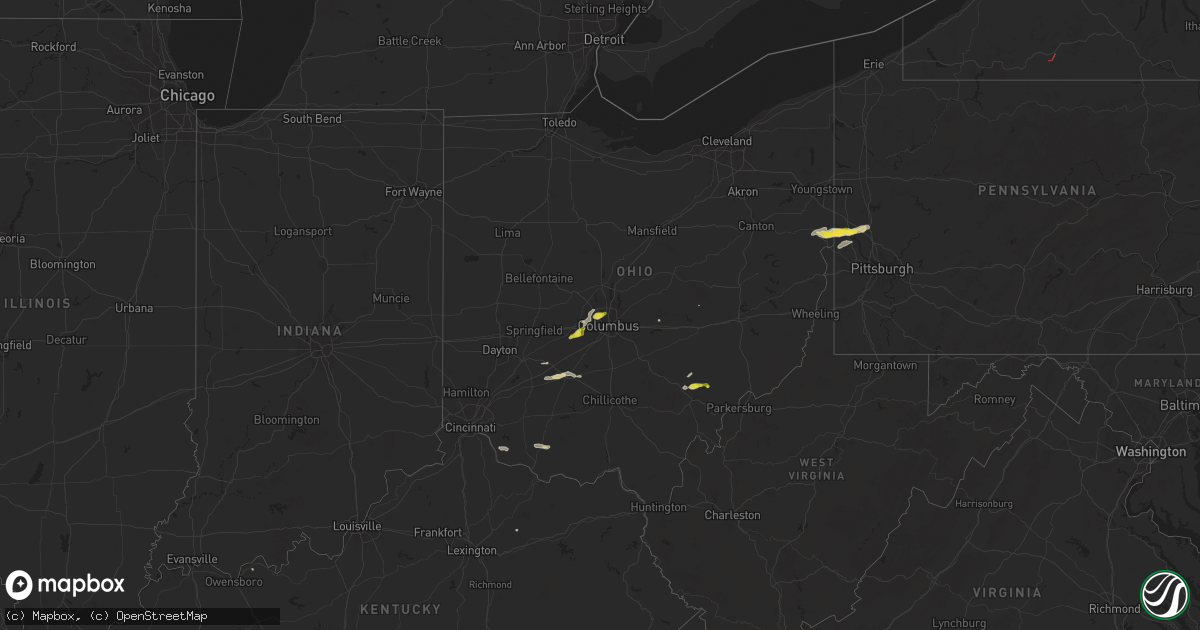
Hail Map on September 6, 2024
Get this storm
September 6 map
$229
one time, instant access
Download today. No call, no setup
Keep the $229
Bought the map and want the full workflow? Apply the entire $229 to a subscription within 7 days. None of it is wasted.
Every map, not just this one
This buys you this map. Subscription and you get every map we run, in the markets you choose from a few cities to whole states to nationwide. Plus real-time alerts the moment a storm fires.
Contact data
Name, contact info, occupancy, even credit band for addresses in the footprint. You go from where it hit to who to call.
Become the source they trust
Unlimited branding weather history reports on demand. You already have the documented answer ready for the property owner, and you are the one who showed up with it.
Property data and RoofTrace estimates
Pull up any address you have got, its value and the exact code rules for that jurisdiction, straight from One Click Code. Then RoofTrace estimates the squares, pitch, and roof value, priced the way you price.
States Impacted by Hail Map on September 6, 2024
Storm reports
Pennsylvania
| Date | Description |
|---|---|
| 09/06/20245:42 PM CDT | Power lines reported down. Time based on radar. |
| 09/06/20245:42 PM CDT | A few trees reported down. |
| 09/06/20245:30 PM CDT | Report of trees down along silver spring road. Time estimated based on radar. |
| 09/06/20245:30 PM CDT | Report of numerous trees down causing power outages. Time estimated based on radar. |
| 09/06/20245:30 PM CDT | Report of trees down along dogwood drive. Time estimated based on radar. |
| 09/06/20245:29 PM CDT | Report of trees down along goehring road. Time estimated basedar on radar. |
| 09/06/20245:28 PM CDT | Public estimated nickel to quarter size hail. Time estimated based on radar. |
| 09/06/20245:28 PM CDT | A local report indicates 1.00 inch wind near New Brighton |
| 09/06/20245:26 PM CDT | Report of power poles broken. Time estimated based on radar. |
| 09/06/20245:25 PM CDT | Report of trees and wires down along route 18. Time estimated based on radar. |
| 09/06/20245:24 PM CDT | Report of multiple trees down along route 51 near bradys run park. Tim estimated based on radar. |
| 09/06/20245:23 PM CDT | Report of trees down along allegheny street. Time estimated based on radar. |
| 09/06/20245:23 PM CDT | Report and photos of large tree uprooted and into a home. Injuries unknown at this time. Time estimated based on radar. |
| 09/06/20245:20 PM CDT | Numerous trees down |
| 09/06/20245:20 PM CDT | A local report indicates 1.25 inch wind near Blackhawk |
| 09/06/20245:19 PM CDT | Report of power poles broken. Time estimated based on radar. |
| 09/06/20245:18 PM CDT | Report of lots of trees down on road outside home. Time estimated based on radar. |
| 09/06/20245:13 PM CDT | Report of large tree limbs and a tree down along with dime sized hail. Time estimated based on radar. |
| 09/06/20245:12 PM CDT | Public report of trees down along blackhawk road. Time estimated based on radar. |
| 09/06/20245:11 PM CDT | Report of tree damage and wires down along with nickel size hail near the blackhawk golf course. Time estimated based on radar. |
| 09/06/20245:10 PM CDT | Report of trees and power lines down. Time esitmaed based on radar. |
| 09/06/20245:07 PM CDT | Report of trees down along lisbon road. Time estimated based on radar. |
Oregon
| Date | Description |
|---|---|
| 09/05/20249:30 PM CDT | Tree fell down onto power lines in the evening. Gusts up to 30+ mph... Approximated using peak winds from nearby iraws. |
| 09/05/20248:25 PM CDT | Pacific power and county 911 report that the roof blew off the pacific power building and onto the road. There are also a number of powerlines and tree limbs down with |
Indiana
| Date | Description |
|---|---|
| 09/06/20245:16 PM CDT | Tree down on hamby road near the intersection of cooks mill road. |
New York
| Date | Description |
|---|---|
| 09/05/20248:50 PM CDT | Multiple trees down in allegany county. |
Kentucky
| Date | Description |
|---|---|
| 09/06/20246:40 PM CDT | Corrects previous tstm wnd dmg report from 1 nne kendall springs. Trees were blown down on kendall springs road approximately 1 mile south from the owingsville city lim |
| 09/06/20245:40 PM CDT | Trees were blown down on kendall springs road approximately 1 mile south from the owingsville city limits and interstate 64. The event time is estimated from radar. |
| 09/06/20244:40 PM CDT | Small microburst with 55mph winds peeled some of a barn roof off and snapped a large tree limb on iron bridge road. |
| 09/06/20243:53 PM CDT | Four trees down. |
Ohio
| Date | Description |
|---|---|
| 09/06/20245:56 PM CDT | Report of tree down along township road. Time estimated based on radar. |
| 09/06/20245:52 PM CDT | Large tree reported down blocking east kasler creek road. |
| 09/06/20245:47 PM CDT | Tree down on power lines. |
| 09/06/20245:42 PM CDT | Several trees down near the intersection of monserat ridge road and millfield road. Time estimated by radar. |
| 09/06/20245:39 PM CDT | Tree reported down. Time is estimated by radar. |
| 09/06/20245:38 PM CDT | Tree reported down. Time is estimated by radar. |
| 09/06/20245:30 PM CDT | Several trees reported down near us-32 and graces run road. Time estimated from radar data. |
| 09/06/20245:19 PM CDT | Numerous trees downed at a property on john woods road. Time estimated from radar. |
| 09/06/20244:55 PM CDT | Multiple healthy tree limbs downed in the wahlsburg area. Time estimated from radar. |
| 09/06/20244:55 PM CDT | Report of multiple trees down across st. Clair township in columbiana county. Time estimated based on radar. |
| 09/06/20244:49 PM CDT | Trees down in the area. Time estimated from radar data. |
| 09/06/20244:48 PM CDT | Report of multiple trees down across madison township. Time estimated based on radar. |
| 09/06/20244:48 PM CDT | 911 center reporting multiple trees down including one on roadway with burning power line. Time estimated based on radar. |
| 09/06/20243:08 PM CDT | A local report indicates 1.00 inch wind near 3 NE Hilliard |
| 09/06/20242:42 PM CDT | Roof damage to a structure at the intersection of east court street and south north street. Time estimated from radar data. |
Cities Impacted by Hail Map on September 6, 2024
- Sabina, OH
- Washington Court House, OH
- West Jefferson, OH
- Hilliard, OH
- New Holland, OH
- Columbus, OH
- Dublin, OH
- Amlin, OH
- Jamestown, OH
- Lewisport, KY
- Heath, OH
- London, OH
- Moscow, OH
- Bethel, OH
- New Richmond, OH
- Galloway, OH
- Lisbon, OH
- East Liverpool, OH
- Negley, OH
- Rogers, OH
- Wellsville, OH
- Midland, PA
- Darlington, PA
- Beaver Falls, PA
- Industry, PA
- Georgetown, OH
- Beaver, PA
- New Brighton, PA
- Winchester, OH
- Sardinia, OH
- Millfield, OH
- Glouster, OH
- Amesville, OH
- Harmony, PA
- Fombell, PA
- Rochester, PA
- Shippingport, PA
- Monaca, PA
- Chesterhill, OH
- Zelienople, PA
- Aliquippa, PA
- Polk, PA
- Hookstown, PA
- Sharpsburg, KY
- Carlisle, KY
- Friendship, NY
- Georgetown, PA