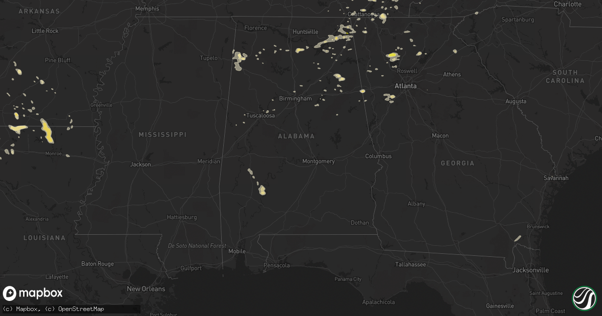
Hail Map in Alabama on September 5, 2017
Get this storm
September 5 map
$229
one time, instant access
Download today. No call, no setup
Keep the $229
Bought the map and want the full workflow? Apply the entire $229 to a subscription within 7 days. None of it is wasted.
Every map, not just this one
This buys you this map. Subscription and you get every map we run, in the markets you choose from a few cities to whole states to nationwide. Plus real-time alerts the moment a storm fires.
Contact data
Name, contact info, occupancy, even credit band for addresses in the footprint. You go from where it hit to who to call.
Become the source they trust
Unlimited branding weather history reports on demand. You already have the documented answer ready for the property owner, and you are the one who showed up with it.
Property data and RoofTrace estimates
Pull up any address you have got, its value and the exact code rules for that jurisdiction, straight from One Click Code. Then RoofTrace estimates the squares, pitch, and roof value, priced the way you price.
Storm reports in Alabama
Alabama
| Date | Description |
|---|---|
| 09/05/20175:50 PM CDT | Tree and power lines down near the intersection of 8th ave and 2nd st. Winds estimated 30-40 mph based on radar. Time estimated. |
| 09/05/20174:28 PM CDT | Quarter sized hail was reported in ider. |
All States Impacted by Hail Map on September 5, 2017
Cities Impacted by Hail Map on September 5, 2017
- Waco, GA
- Heflin, AL
- Muscadine, AL
- Bowdon, GA
- Higdon, AL
- Flat Rock, AL
- Rydal, GA
- White, GA
- Waleska, GA
- Marion, LA
- Strong, AR
- Huttig, AR
- Sterlington, LA
- Farmerville, LA
- Wildwood, GA
- Jacksonville, AL
- Piedmont, AL
- North Wilkesboro, NC
- Millers Creek, NC
- Okolona, MS
- Shannon, MS
- Clear Spring, MD
- Hagerstown, MD
- Mercersburg, PA
- Big Pool, MD
- Hancock, MD
- Greencastle, PA
- Washington Boro, PA
- Willow Street, PA
- Millersville, PA
- Lancaster, PA
- Mountville, PA
- Columbia, PA
- Mount Joy, PA
- South China, ME
- Albion, ME
- Haynesville, LA
- Ethel, MS
- McCool, MS
- Reading, PA
- Leesport, PA
- Wernersville, PA
- Bernville, PA
- Bluemont, VA
- Crofton, KY
- Cerulean, KY
- Mooringsport, LA
- Karnack, TX
- Ivan, AR
- Fordyce, AR
- Cleveland, TN
- Ozan, AR
- Nashville, AR
- Ashland, AL
- Stevens, PA
- Newmanstown, PA
- Lititz, PA
- Ephrata, PA
- Reinholds, PA
- Denver, PA
- Robesonia, PA
- Delight, AR
- Arcadia, LA
- Gibsland, LA
- Wellington, AL
- Gadsden, AL
- Monmouth, ME
- Anniston, AL
- Carthage, TX
- Cheraw, SC
- Patrick, SC
- Society Hill, SC
- Center, TX
- Wrightsville, PA
- Bird In Hand, PA
- Smoketown, PA
- Ronks, PA
- York, PA
- Bow, NH
- Contoocook, NH
- Concord, NH
- Chichester, NH
- Suncook, NH
- Petersburg, NY
- West Point, MS
- Cedarbluff, MS
- Hartselle, AL
- Falkville, AL
- Raeford, NC
- Aberdeen, NC
- Fort Bragg, NC
- Birchwood, TN
- Harrison, TN
- Soddy Daisy, TN
- Mount Enterprise, TX
- Carnesville, GA
- Marietta, PA
- Elizabethtown, PA
- McCaskill, AR
- Cross Junction, VA
- Junction City, AR
- Summerfield, LA
- Lillie, LA
- Carmel, NY
- Mahopac, NY
- Putnam Valley, NY
- Hackleburg, AL
- Hamilton, AL
- Princeton, KY
- Florence, VT
- Castleton, VT
- Mentone, AL
- Fort Payne, AL
- Spring Lake, NC
- Conway, SC
- Palermo, ME
- Smackover, AR
- Palmetto, GA
- Fairburn, GA
- Gordo, AL
- Madisonville, TN
- Minden, LA
- Hartsville, SC
- Altoona, AL
- Lower Peach Tree, AL
- Jasper, GA
- Timpson, TX
- Garrison, TX
- Bennington, VT
- Front Royal, VA
- Golden, MS
- Red Bay, AL
- El Dorado, AR
- Canton, GA
- Plantersville, MS
- Rosman, NC
- Sunset, SC
- Brevard, NC
- Grapeland, TX
- Brattleboro, VT
- Warren, AR
- Maben, MS
- Bellefontaine, MS
- Eupora, MS
- Stewart, MS
- Fort Mcdowell, AZ
- Huntington, TX
- Shreveport, LA
- Cottondale, AL
- Tuscaloosa, AL
- Brookwood, AL
- Raleigh, NC
- Morrisville, NC
- Cary, NC
- Apex, NC
- Detroit, AL
- Beaverton, AL
- Diboll, TX
- Lufkin, TX
- Pollok, TX
- Ringgold, GA
- Garrison, NY
- Patterson, NY
- Brewster, NY
- Jones, LA
- Bryant, AL
- Newville, PA
- Aspers, PA
- Gardners, PA
- Magnolia, AR
- Eva, AL
- Somerville, AL
- Elm Grove, LA
- Haughton, LA
- Doyline, LA
- Logansport, LA
- Colmesneil, TX
- Fulton, AR
- Crockett, TX
- Kennard, TX
- Puryear, TN
- Cottage Grove, TN
- Ellijay, GA
- Cherokee, NC
- Shongaloo, LA
- Inwood, WV
- Berkeley Springs, WV
- Gerrardstown, WV
- Martinsburg, WV
- Hedgesville, WV
- Dutton, AL
- Section, AL
- Texarkana, AR
- Nacogdoches, TX
- Tremont, MS
- Zavalla, TX
- Jasper, TX
- Saratoga, AR
- Columbus, AR
- Washington, AR
- Mineral Springs, AR
- Ogden, AR
- Lake Lure, NC
- Black Mountain, NC
- Hampden, ME
- Old Town, ME
- Carmel, ME
- Orono, ME
- Bangor, ME
- Biglerville, PA
- Henagar, AL
- Pheba, MS
- Etoile, TX
- Dawsonville, GA
- Valley Head, AL
- Sarepta, LA
- Coila, MS
- Carrollton, MS
- Greenwood, MS
- Sidon, MS
- Louisburg, NC
- Pottstown, PA
- Bechtelsville, PA
- Barto, PA
- Gilbertsville, PA
- Boyertown, PA
- Hallowell, ME
- Manchester, ME
- Augusta, ME
- Paris, VA
- Delaplane, VA
- Harpers Ferry, WV
- Boyce, VA
- Charles Town, WV
- Upperville, VA
- Round Hill, VA
- Purcellville, VA
- Berryville, VA
- Macungie, PA
- Alburtis, PA
- Benton, MS
- Marston, NC
- Rockingham, NC
- Long Barn, CA
- Pinecrest, CA
- Pittsford, VT
- Ringgold, LA
- Crossville, AL
- Morven, NC
- Lilesville, NC
- Heflin, LA
- Jamestown, LA
- Stevenson, AL
- Red Springs, NC
- Wagram, NC
- Laurinburg, NC
- Laurel Hill, NC
- La Fayette, GA
- Sierraville, CA
- Calpine, CA
- Grand Cane, LA
- Waterville, ME
- Bernice, LA
- Spearsville, LA
- Emerson, AR
- Aragon, GA
- Rockmart, GA
- Mcminnville, TN
- Winchester, VA
- Burlington, ME
- Greenbush, ME
- Milford, ME
- Dover, PA
- Mount Wolf, PA
- Emigsville, PA
- Manchester, PA
- Kearneysville, WV
- Pinson, AL
- Spring Grove, PA
- Thomasville, PA
- Lincoln, AL
- Ragland, AL
- Belvidere, TN
- Scottsboro, AL
- Fayetteville, PA
- Waynesboro, PA
- Chambersburg, PA
- Oakwood, TX
- Hiram, ME
- Tupelo, MS
- Pontotoc, MS
- Houlka, MS
- Houston, MS
- Magnolia, AL
- Dixons Mills, AL
- Linden, AL
- Coy, AL
- Newnan, GA
- Douglasville, GA
- Whitesburg, GA
- Winston, GA
- Benton, TN
- Reliance, TN
- Danville, AL
- West Baldwin, ME
- Charles City, VA
- Albertville, AL
- Guntersville, AL
- Vina, AL
- Bendersville, PA
- Athens, LA
- Homer, LA
- Rock Spring, GA
- Texarkana, TX
- Ackerman, MS
- Weir, MS
- Haleyville, AL
- Lexington, MS
- Phil Campbell, AL
- Camden, SC
- Lupton City, TN
- Signal Mountain, TN
- Chattanooga, TN
- Hixson, TN
- Carthage, MS
- Kosciusko, MS
- Manheim, PA
- Mansfield, LA
- Cedartown, GA
- Troy, ME
- Dixmont, ME
- Levant, ME
- Kenduskeag, ME
- Windsor, ME
- Etna, ME
- Thorndike, ME
- Unity, ME
- Freedom, ME
- Vassalboro, ME
- Horton, AL
- Fairfield, TX
- Langston, AL
- Pisgah, AL
- Grant, AL
- Woodville, AL
- Tenaha, TX
- Oil City, LA
- Cornwall Bridge, CT
- Litchfield, CT
- Goshen, CT
- Centerville, TX
- Ashdown, AR
- Stephens City, VA
- Hilliard, FL
- Greeleyville, SC
- Markleeville, CA
- Pine Hill, AL
- Thomasville, AL
- San Augustine, TX
- Henderson, TX
- Clifton Forge, VA
- Alto, TX
- Rusk, TX
- Dallas, GA
- Carlisle, PA
- Cohutta, GA
- Sells, AZ
- Hodges, AL
- Romney, WV
- Quarryville, PA
- New Hill, NC
- Horseshoe Bay, TX
- Folkston, GA
- White Oak, GA
- Keithville, LA
- Sparkman, AR
- Gary, TX
- Hamburg, AR
- Capon Bridge, WV
- Paw Paw, WV
- Bloomery, WV
- East Greenville, PA
- Palm, PA
- Morrison, TN
- Stephenson, VA
- Litchfield, ME
- Benton, LA
- Cotton Valley, LA
- Jacksonville, TX
- East Berlin, PA
- Landisville, PA
- Gainesville, GA
- Moulton, AL
- Vivian, LA
- Eutaw, AL
- Alstead, NH
- Charlestown, NH
- Westminster, VT
- Bellows Falls, VT
- North Walpole, NH
- Putney, VT
- Gordonville, PA
- Shoemakersville, PA
- Birdsboro, PA
- Oley, PA
- Maytown, PA
- York Haven, PA
- Mertztown, PA
- Green Lane, PA
- Bally, PA
- Frederick, PA
- Fleetwood, PA
- Dillsburg, PA
- Zionsville, PA
- Strasburg, PA
- Little Orleans, MD
- Douglassville, PA
- Mohnton, PA
- Bainbridge, PA
- Mont Alto, PA
- Temple, PA
- Middletown, PA
- East Petersburg, PA
- Wellsville, PA
- Hereford, PA
- Warfordsburg, PA
- Needmore, PA
- York Springs, PA
- Lewisberry, PA
- Leola, PA
- Perkiomenville, PA
- Pennsburg, PA
- Orrtanna, PA
- Big Cove Tannery, PA
- Great Cacapon, WV
- Marion, PA
- Erwin, NC
- Coats, NC
- Lillington, NC
- Frierson, LA
- Ooltewah, TN
- Kilmichael, MS
- Vaiden, MS
- French Camp, MS
- Menlo, GA
- Rising Fawn, GA
- Ider, AL
- Tiline, KY
- Grand Rivers, KY
- Smithland, KY
- Marion, KY
- Salem, KY
- Kuttawa, KY
- Fredonia, KY
- Eddyville, KY
- Boaz, AL
- McBee, SC
- Burlington, WV
- Keyser, WV
- Purlear, NC
- McGrady, NC
- Keene, NH
- Woodland, MS
- Amory, MS
- Smithville, MS
- Middleburg, VA
- Lisbon, LA
- Franklinton, NC
- Pickens, SC
- Old Fort, TN
- Bumpus Mills, TN
- Collinsville, AL
- Strasburg, VA
- Maggie Valley, NC
- Bastrop, LA
- Groveoak, AL
- Fairmount, GA
- Farmington, KY
- Murray, KY
- Kirksey, KY
- Weaver, AL
- Alexandria, AL
- Fyffe, AL
- Teague, TX
- Kingsland, AR
- Stephens, AR
- Youngsville, NC
- Wake Forest, NC
- Carthage, AR
- Oxford, GA
- Woodville, TX
- Ellerbe, NC
- Southern Pines, NC
- Palestine, TX
- Frankston, TX
- Mount Holly, AR
- Woodland, AL
- Graham, AL
- Gurdon, AR
- Banks, AR
- Crossville, TN
- Camden, AR
- Delano, TN
- Riceville, TN
- Athens, TN
- Etowah, TN
- Beach Haven, NJ
- Lookout Mountain, GA
- Trenton, GA
- Rayville, LA
- Marshall, TX
- Vass, NC
- Cameron, NC
- Angier, NC
- Sewanee, TN
- Summerton, SC
- Alpine, AL
- Maxton, NC
- Augusta, WV
- Porter, ME
- Sebago, ME
- Parsonsfield, ME
- Elkhart, TX
- Pittsboro, MS
- Calhoun City, MS
- Russellville, AL
- New Concord, KY
- Fouke, AR
- Brookport, IL
- Tyaskin, MD
- Quantico, MD
- Greene, ME
- Lewiston, ME
- Sabattus, ME
- Leeds, ME
- Woodstock, GA
- Acworth, GA
- Hebron, MD
- West Chesterfield, NH
- Chesterfield, NH
- Quakertown, PA
- Trumbauersville, PA
- Sullivan, NH
- Westmoreland, NH
- Gilsum, NH
- Spofford, NH
- Sparta, TN
- Sweetwater, TN
- Middletown, VA
- Joaquin, TX
- Brandon, VT
- Chittenden, VT
- Fair Haven, VT
- Bomoseen, VT
- Springfield, WV
- Fort Ashby, WV
- Arkadelphia, AR
- Cordell, OK
- Sentinel, OK
- Hamlet, NC
- Troup, TX
- Jefferson, TX
- Pell City, AL
- Union Grove, AL
- Sequatchie, TN
- Somers, NY
- Katonah, NY
- Cartersville, GA
- Laneville, TX
- Sharpsburg, GA
- Midway, TX
- Summit Point, WV
- Cumming, GA
- Sanford, NC
- Airville, PA
- Brogue, PA
- Hoosick Falls, NY
- North Pownal, VT
- Gilbertsville, KY
- Mathiston, MS
- Starkville, MS
- Mantee, MS
- Georgetown, TN
- Charleston, TN
- Bossier City, LA
- Pontotoc, TX
- Valley Spring, TX
- Gore Springs, MS
- Duck Hill, MS
- Gardendale, AL
- Converse, LA
- Glens Fork, KY
- Calvert City, KY
- Benton, KY
- Fulton, MS
- Nettleton, MS
- Apison, TN
- Crandall, GA
- Dalton, GA
- Mount Hope, AL
- Manning, SC
- Whitwell, TN
- Shenandoah Junction, WV
- Mayfield, KY
- Chidester, AR
- Ranburne, AL
- Tallapoosa, GA
- Adger, AL
- Savannah, GA
- Turner, ME
- Coushatta, LA
- Hampton, AR
- Calion, AR
- Talladega, AL
- Palmersville, TN
- Double Springs, AL
- De Berry, TX
- Manchester, TN
- Dunlap, TN
- Murphy, NC
- Donaldson, AR
- Lanexa, VA
- Points, WV
- Levels, WV
- Slanesville, WV
- Ashville, AL
- South Pittsburg, TN
- Dawson, AL
- Wallace, SC
- Cordova, NC
- Silver Creek, GA
- Green Spring, WV
- Ridgeley, WV
- Guild, TN
- Jasper, TN
- Sale Creek, TN
- Graysville, TN
- Pittsfield, VT
- Rutland, VT
- Calhoun, TN
- Murfreesboro, AR
- Barlow, KY
- La Center, KY
- Tamms, IL
- Villa Ridge, IL
- Mounds, IL
- Olmsted, IL
- Paducah, KY
- West Paducah, KY
- Kevil, KY
- Zieglerville, PA
- Torrington, CT


