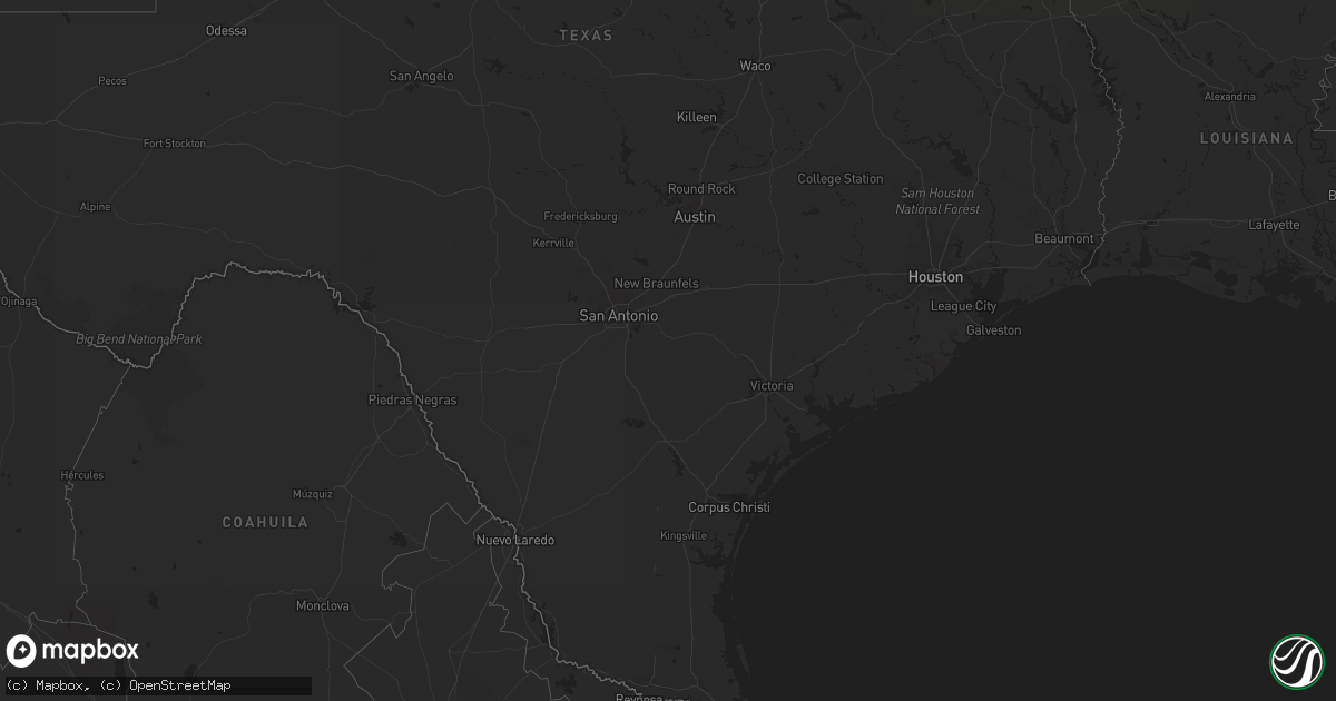
Hail Map on September 5, 2011
Get this storm
September 5 map
$229
one time, instant access
Download today. No call, no setup
Keep the $229
Bought the map and want the full workflow? Apply the entire $229 to a subscription within 7 days. None of it is wasted.
Every map, not just this one
This buys you this map. Subscription and you get every map we run, in the markets you choose from a few cities to whole states to nationwide. Plus real-time alerts the moment a storm fires.
Contact data
Name, contact info, occupancy, even credit band for addresses in the footprint. You go from where it hit to who to call.
Become the source they trust
Unlimited branding weather history reports on demand. You already have the documented answer ready for the property owner, and you are the one who showed up with it.
Property data and RoofTrace estimates
Pull up any address you have got, its value and the exact code rules for that jurisdiction, straight from One Click Code. Then RoofTrace estimates the squares, pitch, and roof value, priced the way you price.
States Impacted by Hail Map on September 5, 2011
Storm reports
Alabama
| Date | Description |
|---|---|
| 09/05/20116:03 PM CDT | Trees down around hodgesville. |
| 09/05/20114:03 PM CDT | Trees down around the area from another storm. |
| 09/05/20113:14 PM CDT | 2 trees down near abbeville. |
| 09/05/20112:53 PM CDT | Tree down on a house with injuries on ross clark circle se. |
| 09/05/20112:50 PM CDT | Estimated winds at least 60 mph near highway 134 |
| 09/05/20112:47 PM CDT | Trees down on county road 15 near skipperville |
| 09/05/20112:35 PM CDT | Tree down on south union avenue in ozark. |
| 09/05/20112:24 PM CDT | Trees and power lines down in the logan road area around ozark. |
| 09/05/20112:05 PM CDT | Few trees down around the county |
| 09/05/201111:05 AM CDT | Possible tornado reported near intersection of highway 25 and county road 85. Trees reported down and roof was off a barn. |
| 09/05/20117:47 AM CDT | Several large tree limbs down on zirlott road. |
Virginia
| Date | Description |
|---|---|
| 09/05/20116:34 PM CDT | One large tree fell and took down two power lines on grove street |
| 09/05/20116:25 PM CDT | Tree down on woods gap road. |
| 09/05/20116:05 PM CDT | Tree down on a power line and also fell on a house on harris hollow road. |
| 09/05/20115:05 PM CDT | Efo tornado w/ 60-70 mph winds confirmed by nws storm survey. |
| 09/05/201111:40 AM CDT | Tree down on emmanuel road near conner grove road. |
| 09/04/201110:15 PM CDT | Tree down on union school road. |
| 09/04/20119:11 PM CDT | Thunderstorm winds blew trees downa across route 52 between hillsville and cana. |
| 09/04/20119:10 PM CDT | Damage from possible tornado. Gas station pumps blown away with significant damage to station. Many trees and power lines down. Other structures damaged. |
| 09/04/20119:03 PM CDT | *** 2 inj *** roof blown off gas station |
| 09/04/20117:57 PM CDT | One tree down on route 43 just south of bedford |
Arizona
| Date | Description |
|---|---|
| 09/05/20116:25 PM CDT | Roof partially blown off shed |
South Carolina
| Date | Description |
|---|---|
| 09/05/20116:19 PM CDT | One tree down near salem crossroads near sr 34 and sr 215. |
| 09/05/20116:00 PM CDT | Enforcement highway patrol reports trees down on sc215 at wallaceville road. |
| 09/05/20115:50 PM CDT | Trees down at intersection of 1700 block of fairlamb avenue and percival road |
| 09/05/20115:45 PM CDT | Trees down near the intersection of beards creek circle and island trail |
| 09/05/20115:22 PM CDT | Trees down near the intersection of clay hill rd and younce rd just east of pelion. |
| 09/05/20115:14 PM CDT | Trees down on dean swamp church road about 2 miles north of sc highway 4 |
| 09/05/20115:00 PM CDT | Highway patrol reports debris in roadway near intersection of sc 37 and 39. Time based on radar. |
| 09/05/20114:36 PM CDT | Tree down at tillman rd and tarboro rd. |
| 09/05/20114:36 PM CDT | Trees down on highway 278 just outside of the town of kline. |
| 09/05/20114:36 PM CDT | Highway patrol reports powerlines in roadway on us278 in kline. |
| 09/05/20114:34 PM CDT | Tree down at us hwy 321 and sc 336. |
| 09/05/20114:25 PM CDT | Trees and powerlines down on bostick road. |
| 09/05/20114:22 PM CDT | Tree down on becks ferry rd near hwy 321. |
| 09/05/20114:20 PM CDT | Trees and powerlines down on bluff road. |
| 09/05/20114:19 PM CDT | Trees down on interstate 26 east of newberry. |
| 09/05/20114:16 PM CDT | Nws storm survey concluded a brief ef0 tornado touched down near the intersection of epps and spur roads. The track length was 100 yards and width 50 yards. Estimated w |
| 09/04/20117:14 PM CDT | Tree down in rock hill. |
| 09/04/20117:14 PM CDT | Tree down |
| 09/04/20117:14 PM CDT | Tree down |
| 09/04/20117:14 PM CDT | Tree down kelly road and hwy 49. |
New Hampshire
| Date | Description |
|---|---|
| 09/05/20116:00 PM CDT | Six rvs destroyed and six damaged. Wind gust estimated at 60 mph |
Florida
| Date | Description |
|---|---|
| 09/05/20116:50 PM CDT | Tree reported down near thurgood marshall middle school. Time estimated from radar...report delayed. |
| 09/05/20115:20 PM CDT | Trees down near high springs. Time estimated based on radar. |
| 09/05/20115:10 PM CDT | Tree down |
| 09/05/20114:55 PM CDT | Tree down |
| 09/05/20114:53 PM CDT | Tree down |
| 09/05/20114:24 PM CDT | Powerlines down along barnes road |
| 09/05/20114:13 PM CDT | Trees down around capps |
| 09/05/20114:09 PM CDT | Few trees down in the last hour around the county. |
| 09/05/20114:08 PM CDT | Trees down in the southern part of the county. |
| 09/05/20114:03 PM CDT | Power lines down around the county. |
| 09/05/20113:46 PM CDT | Trees and power lines down in the eastern part of the county. |
| 09/05/20113:30 PM CDT | Trees down from a new round of storms. |
| 09/05/20113:24 PM CDT | Duke field /egi/ asos recorded a gust of 63 mph. |
| 09/05/20113:06 PM CDT | Trees and power lines down |
| 09/05/20113:01 PM CDT | Trees down and traffic lights out. |
| 09/05/20113:01 PM CDT | Trees down around bull run and kerry forest pkwy. |
| 09/05/20112:55 PM CDT | Few trees down around madison including marion street...horry avenue...and washington street. Also large palm tree broken 15 feet off. |
| 09/05/20112:28 PM CDT | Trees down county wide. |
| 09/05/20111:58 PM CDT | 52 knot wind gust at kecp airport |
| 09/05/20111:53 PM CDT | Spotter estimated winds of 60 to 70 mph with power lines down |
| 09/05/20111:52 PM CDT | 2 trees down on highway 81 north of ponce de leon |
| 09/05/20111:52 PM CDT | 2 trees down along interstate 10. |
| 09/05/20111:41 PM CDT | Trees down around 7140 us highway 331. |
| 09/05/20111:35 PM CDT | Tree down on power line near 288 county highway 83a |
| 09/05/20111:34 PM CDT | Trees down around 2644 bob sikes road. |
| 09/05/20111:33 PM CDT | Several trees down around 6120 bob sikes road. |
| 09/05/20111:33 PM CDT | Tree on power line near 5687 s us 331. |
| 09/05/20111:33 PM CDT | Widespread tree damage |
| 09/05/20111:30 PM CDT | Trees down near the intersection of bond drive and cosson road. |
| 09/05/20111:30 PM CDT | Power lines down near highway 20 between business 331 and the 331 bypass. |
| 09/05/201112:58 PM CDT | Likely brief tornado touchdown near 3164 highway 69 ne. Public reported seeing condensation funnel with trees uprooted and a farm tractor moved. Relayed by state watch |
| 09/05/201112:45 PM CDT | Large oak tree blown over by strong wind gusts doing significant damage to a home. |
| 09/05/201112:45 PM CDT | Several large tree limbs down across escambia county. |
| 09/05/201111:47 AM CDT | Pensacola regional airport recorded a gust of 59 mph. |
| 09/05/201111:45 AM CDT | Pine tree reported blown down onto a house on wadsworth blvd. |
| 09/05/201111:31 AM CDT | Numerous small with a few large tree limbs down on elgin air force base near the burger king. |
| 09/05/201111:31 AM CDT | Hurlbert field /fmq-19/ sensor on runway 36...recorded a gust of 65 mph. |
| 09/05/201111:30 AM CDT | The public reported a funnel cloud on okaloosa island near the islander apartments. Report relayed by the flordia state warning point. |
| 09/04/20117:00 PM CDT | Power line down near henderson farm |
Georgia
| Date | Description |
|---|---|
| 09/05/20115:50 PM CDT | Whitfield county emergency management relayed a report of a tree downed onto a house causing structural damage. |
| 09/05/20115:01 PM CDT | One tree fell on a mobile home. |
| 09/05/20114:55 PM CDT | Trees down countywide |
| 09/05/20114:50 PM CDT | Trees reported down on douglas highway. Time estimated by radar. |
| 09/05/20114:26 PM CDT | Tree down |
| 09/05/20114:25 PM CDT | Madison county 911 relayed reports of 2 downed trees in comer along hwy 72. |
| 09/05/20114:10 PM CDT | Emergency manager reported a few trees and power lines down in the homerville vicinity. Time is estimated and based on radar imagery. |
| 09/05/20114:08 PM CDT | Garden city fire reports trees and powerlines down. |
| 09/05/20114:03 PM CDT | Awning on a store blown off |
| 09/05/20113:51 PM CDT | Few power lines down along highway 62 west. |
| 09/05/20113:46 PM CDT | Bartow county 911 relayed reports of over a dozen downed trees in the county so far through the event. |
| 09/05/20113:46 PM CDT | Pine tree down in richmond hill. Time estimated based on radar. |
| 09/05/20113:45 PM CDT | Emergency manager reported a few trees and power lines down to the northeast of statenville. Time is estimated and based on radar imagery. |
| 09/05/20113:41 PM CDT | Trees down around the county. |
| 09/05/20113:40 PM CDT | Lumpkin county 911 relayed reports of 1-2 downed trees. |
| 09/05/20113:40 PM CDT | Few trees down in the western part of the county. |
| 09/05/20113:36 PM CDT | Tree down at highway 17 north and sand dollar drive. Time estimated by radar. |
| 09/05/20113:35 PM CDT | Tree fell on house on third street. Time estimated by radar. |
| 09/05/20113:35 PM CDT | Tree fell on vehicle on west general stewart way. Time estimated by radar. |
| 09/05/20113:33 PM CDT | Fire department reports trees down across roadways in midway. Time estimated basd on radar. |
| 09/05/20113:33 PM CDT | Large oak tree down on ashmore street. Time estimated by radar. |
| 09/05/20113:33 PM CDT | Tree down on south main street. Time estimated by radar. |
| 09/05/20113:33 PM CDT | Tree down on ola-b lane. Time estimated by radar. |
| 09/05/20113:30 PM CDT | Tree down near 2500 east double gate. |
| 09/05/20113:30 PM CDT | Tree down near the intersection of harvest ln and phillips dr. |
| 09/05/20113:28 PM CDT | Paulding county emergency management relayed reports of several downed trees. |
| 09/05/20113:24 PM CDT | 3 trees down along 8 mile road. |
| 09/05/20113:24 PM CDT | Fire department reports trees down across several roadways in riceboro. Time estimated based on radar. |
| 09/05/20113:24 PM CDT | Power lines down in thomasville. |
| 09/05/20113:20 PM CDT | Pickens county emergency management relayed reports of 3 closed roads due to numerous downed trees and powerlines. Possible tornado damage. |
| 09/05/20113:20 PM CDT | Muscogee county 911 relayed reports of several downed trees and lines. |
| 09/05/20113:19 PM CDT | Trees down in the eastern part of the county. |
| 09/05/20113:18 PM CDT | Trees down around the county and including downtown pelham. |
| 09/05/20113:18 PM CDT | Trees down around the county. |
| 09/05/20113:10 PM CDT | One tree blown on burnt mountain road...one tree down on clear creek road and one tree down on big creek road. |
| 09/05/20113:05 PM CDT | Union county 911 relayed a report of a downed tree. |
| 09/05/20113:02 PM CDT | Jones county 911 relayed reports of 5 downed trees and 4-5 downed powerlines in the time from 400 pm to 600 pm. |
| 09/05/20113:00 PM CDT | Public reports numerous trees and power lines down. A house had a tree downed onto it along mcray drive. |
| 09/05/20112:55 PM CDT | Tree down on spring hill road. |
| 09/05/20112:51 PM CDT | Amateur radio relayed reports of multiple trees down along hwy 53. |
| 09/05/20112:50 PM CDT | Numerous trees down on the east side of the county. 2 houses damaged along marble hill church road south of tate. |
| 09/05/20112:48 PM CDT | Public reported 20 trees downed...canapy and awning off house...roof off barn and shed...and crushed vehicles and fences. |
| 09/05/20112:47 PM CDT | Carroll county emergency management relayed reports of 3-4 downed trees in the county. |
| 09/05/20112:38 PM CDT | Cobb county 911 relayed reports of 3-4 downed trees. |
| 09/05/20112:35 PM CDT | Public reported several trees down on wedgewood falls drive. Power lines were also downed. |
| 09/05/20112:31 PM CDT | Cherokee county emergency management relayed reports of major damage in ne canton as tornado crossed hwy 20. |
| 09/05/20112:30 PM CDT | Public reports several trees downed along river estates pkwy. |
| 09/05/20112:21 PM CDT | Cherokee county emergency management relayed a report of damage along sixes road near holly springs. |
| 09/05/20112:19 PM CDT | Amateur radio relayed reports of multiple downed trees in the area of bascom and carmel roads west of interstate 575 in cherokee county. |
| 09/05/20112:15 PM CDT | Public reports tornado touchdown in woodstock. Trees were downed onto 2 houses...shingles taken off roofs...and townlake parkway was blocked by numerous trees. |
| 09/05/20112:13 PM CDT | Cherokee county emergency management relayed a law enforcement report of a tornado 1 mile west of woodstock. |
| 09/05/20112:13 PM CDT | Cherokee county emergency management relayed a report of hwy 92 blocked by downed trees and debris. |
| 09/05/20112:11 PM CDT | *** 1 inj *** max wind speed 90 mph...path length 24 miles semi-continuous...max path width 1/4 mile. Initial touch down just south of dixie speedway near woodstock in |
| 09/05/20112:05 PM CDT | *** 1 inj *** trees and power lines down county wide. Update...woman struck by falling limb in hunt camp. |
| 09/05/20112:04 PM CDT | Several trees down along west bluffton road |
| 09/05/20111:45 PM CDT | Amateur radio relayed trained spotter report of tornado in the macklin woods area of powder springs. |
| 09/05/20111:38 PM CDT | Harris county relayed reports of 3 downed trees in mulberry grove. |
| 09/05/20111:35 PM CDT | Amateur radio relayed a report from a trained spotter of a tornado near powder springs. |
| 09/05/20111:35 PM CDT | Amateur radio relayed a report from a trained spotter of a tornado near winston. |
| 09/05/201111:30 AM CDT | Haralson county 911 relayed a report of at least half a dozen downed trees. |
| 09/04/20117:57 PM CDT | Trees and power lines down along highway 112 near camilla. |
| 09/04/20117:15 PM CDT | Tree limbs down over western parts of echols county. Power still out to a number of residents due to tree limbs falling on power lines. Time estimated based on radar. |
North Carolina
| Date | Description |
|---|---|
| 09/05/20116:54 PM CDT | In addition to the previously reported damage to barns and tin roofs on ridge road near c.j. Thomas road...there were also trees down in the area. |
| 09/05/20116:54 PM CDT | State patrol reported damage to barns and tin roofs on ridge road near c.j. Thomas road. |
| 09/05/20116:10 PM CDT | A few trees and limbs down at tuckaseegee park. Time is based on when strongest storm passed over this location. Nobody was around on labor day to see this occur. |
| 09/05/20114:25 PM CDT | 911 center relyed citizen report of possible tornado in the 10200 block of longbottom road. |
| 09/05/20114:20 PM CDT | Minor damage to 3 homes. 14 outbuildings destroyed. Large oak tree uprooted. Tree damage in stone mountain sp |
| 09/05/20113:24 PM CDT | One tree down on glade valley road along route 21 |
| 09/05/20113:19 PM CDT | One tree down on pine swamp road |
| 09/05/20113:01 PM CDT | One tree down on route 88 near laurel springs |
| 09/05/20116:07 AM CDT | Tree down on a power line on n saylor street |
| 09/05/20115:40 AM CDT | Long leaf pine trees blown down and snapped. Some blown into a lake. No damage to residences. All damage currently known to be confined to a golf course. |
| 09/05/20115:25 AM CDT | Tree down on highway 18. Also power went out at about this time in part of the area. |
| 09/04/20119:06 PM CDT | One tree down on flippin road |
| 09/04/20119:06 PM CDT | One tree down on moore road |
| 09/04/20118:15 PM CDT | Tree down on elk creek darby road |
| 09/04/20117:52 PM CDT | Media reported barns destroyed on miller road near pauls crossing |
| 09/04/20117:51 PM CDT | Numerous trees and power lines were reported down in the pauls crossing area... Along pauls crossing road. |
| 09/04/20117:47 PM CDT | Tree down on snuggs park road |
| 09/04/20117:45 PM CDT | Numerous trees and power lines were reported down in the millingport area... Near hwy 73 and millingport rd. |
| 09/04/20117:35 PM CDT | Powerlines blown down 1200 marble road. |