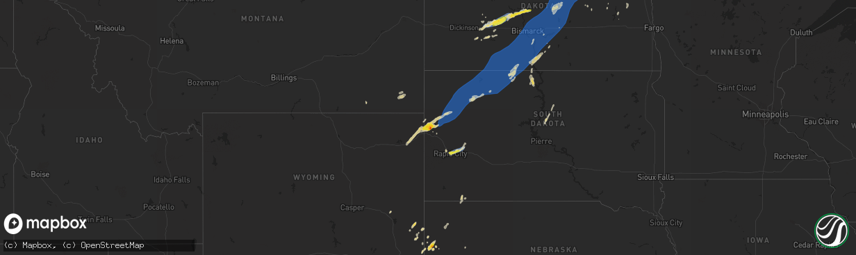
Hail Map on September 4, 2023
The weather event on September 4, 2023 includes Hail and Wind maps. 13 states and 309 cities were impacted and suffered possible damage. The total estimated number of properties impacted is 11,313.
Want more than just the map?
Turn this storm into a full workflow.
- Owner + property data so you know who to knock
- OnDemand branded weather history reports to win the "did we even have hail?" argument
- RoofTrace estimate so reps stop guessing numbers at the door
Bought this map? Upgrade within 7 days and we'll credit the $230. (10-15 min setup call)
Hail
Wind
11,313
Estimated number of impacted properties by a 1.00" hail or larger1,521
Estimated number of impacted properties by a 1.75" hail or larger0
Estimated number of impacted properties by a 2.50" hail or largerStates Impacted by Hail Map on September 4, 2023
Storm reports
Montana
| Date | Description |
|---|---|
| 09/04/20236:25 PM CDT | A local report indicates 1.00 inch wind near 14 SSE Broadus |
| 09/03/20237:38 PM CDT | A local report indicates 60 MPH wind near 1 E Ridgeway |
South Dakota
| Date | Description |
|---|---|
| 09/04/20236:45 PM CDT | Trees downed... Lost power and resident remains without power an hour after the storm has passed. |
| 09/04/20236:43 PM CDT | A local report indicates 60 MPH wind near 3 W Lemmon |
| 09/04/20236:40 PM CDT | Personal weather station. |
| 09/04/20236:20 PM CDT | Time estimated via radar |
| 09/04/20235:59 PM CDT | A local report indicates 72 MPH wind near 7 SSE Meadow |
| 09/04/20235:55 PM CDT | A local report indicates 69 MPH wind near Bison |
| 09/04/20235:30 PM CDT | A local report indicates 60 MPH wind near 7 SSE Bison |
| 09/04/20235:27 PM CDT | A local report indicates 71 MPH wind near 1 N Buffalo |
| 09/04/20235:08 PM CDT | A local report indicates 63 MPH wind near 1 ENE Mud Butte |
| 09/04/20234:46 PM CDT | A local report indicates 70 MPH wind near 13 NE Newell |
| 09/04/20234:36 PM CDT | A local report indicates 66 MPH wind near 7 WSW Hoover |
| 09/04/20234:32 PM CDT | A local report indicates 70 MPH wind near 14 SSE Hereford |
| 09/04/20234:15 PM CDT | Photo shows several stones of quarter to half dollar size |
| 09/04/20234:15 PM CDT | Winds estimated 60 or higher |
| 09/04/20234:15 PM CDT | Winds estimated 60 or higher |
| 09/04/20234:12 PM CDT | Mping report |
| 09/04/20234:12 PM CDT | Lasted about 10 minutes |
| 09/04/20234:07 PM CDT | A local report indicates 69 MPH wind near Ellsworth AFB |
| 09/04/20233:59 PM CDT | Mping report |
| 09/04/20233:54 PM CDT | Mping report |
| 09/04/20233:52 PM CDT | Time estimated from radar |
| 09/04/20233:52 PM CDT | A local report indicates 1.25 inch wind near Belle Fourche |
| 09/04/20232:54 PM CDT | A local report indicates 59 MPH wind near 8 W Jewel Cave |
| 09/04/20232:44 PM CDT | A local report indicates 63 MPH wind near 8 W Jewel Cave |
| 09/03/20239:28 PM CDT | Several tree branches down. Siding removed from house just over the border in north dakota. |
| 09/03/20239:06 PM CDT | A local report indicates 58 MPH wind near 4 SSE Witten |
| 09/03/20238:55 PM CDT | Mesonet station 13 vivian |
| 09/03/20238:41 PM CDT | A local report indicates 60 MPH wind near 2 E Okreek |
| 09/03/20238:25 PM CDT | A local report indicates 58 MPH wind near 7 ESE Rosebud |
| 09/03/20237:36 PM CDT | A local report indicates 58 MPH wind near 7 E Wanblee |
North Dakota
| Date | Description |
|---|---|
| 09/04/20236:55 PM CDT | A local report indicates 70 MPH wind near 10 N North Lemmon |
| 09/04/20236:40 PM CDT | Pea size hail. |
| 09/04/202312:24 AM CDT | Asos station kgfk grand forks ap nd. |
| 09/04/202312:14 AM CDT | Via ndawn. |
| 09/04/202312:14 AM CDT | Corrects previous tstm wnd dmg report from emerado to thunderstorm wind gust. Via ndawn. |
| 09/03/202310:09 PM CDT | Private weather station report. Winds lasted from 1009-1014 pm cdt. |
| 09/03/20239:56 PM CDT | Davis weather observation report. |
| 09/03/20239:40 PM CDT | Strongest winds lasted around 10 minutes. |
| 09/03/20239:15 PM CDT | Mature tree and several tree branches were knocked down from strong thunderstorm winds |
| 09/03/20239:15 PM CDT | Asos station kbis bismarck airport. Winds gusted between 58 and 64 mph from 915-923 pm cdt. |
| 09/03/20239:00 PM CDT | Reported by ndawn station steele 5nw. |
| 09/03/20238:40 PM CDT | At least quarter size hail. Ongoing at the time of call. |
| 09/03/20238:28 PM CDT | Private weather station observation near lincoln. |
| 09/03/20238:07 PM CDT | Davis site observation... Private weather site. |
| 09/03/20238:00 PM CDT | Power line downed around 8pm cdt... Rain moving sideways estimated to be a minimum of 50 mph. Relayed through social media. |
| 09/03/20238:00 PM CDT | Ndawn station carson 9ene. |
| 09/03/20237:50 PM CDT | Tatanka prairie raws observation. Timing based on radar. |
| 09/03/20237:34 PM CDT | Private weather station observation. |
| 09/03/20237:17 PM CDT | Wind gusts estimated at 60 mph. |
| 09/03/20237:06 PM CDT | 2.00 inches of rain and very small soft hail. |
| 09/03/20237:00 PM CDT | Also estimated 60-70 mph winds with the hail. |
| 09/03/20237:00 PM CDT | Also had quarter size hail. Event ongoing at time of call. |
Missouri
| Date | Description |
|---|---|
| 09/04/20236:15 PM CDT | Power poles blown down along the i-70 service drive near the montgomery/warren county line. |
| 09/04/20235:45 PM CDT | Estimated 60 mph winds from multiple sources in the farmington area. Time estimated. Only minor tree limb damage noted. |
| 09/04/20235:45 PM CDT | A local report indicates 60 MPH wind near Farmington |
| 09/04/20235:25 PM CDT | Downed trees and powerlines reported by three rivers electric in the vienna area. |
| 09/04/20235:15 PM CDT | Kvih asos reported peak gust to 51 kts or |
| 09/04/20235:15 PM CDT | Kvih asos reported peak gust to 51 kts or 59 mph. Time estimated from radar. |
| 09/04/20235:00 PM CDT | Delayed report from davis weather station. Mesonet station fw7335 3 ne rolla. |
| 09/04/20234:54 PM CDT | Doolittle fire reported hundreds of trees down in the doolittle and newburg areas. Trees fell to the north. Time estimated from radar. |
| 09/04/20234:10 PM CDT | Delayed report of trees down in houston. |
| 09/04/20234:05 PM CDT | Delayed report of trees down. |
| 09/04/20233:40 PM CDT | Delayed report. Tree snapped off in mountain grove. Raws site also measured a peak gust of 50 mph. |
| 09/04/20233:30 PM CDT | Branch blown down on powerline. |
| 09/04/20232:50 PM CDT | Four broken utility poles and areas with power lines down in the northeast part of springfield per city utilities. Tree limbs down at golf course in northeast springfie |
| 09/04/20232:50 PM CDT | Tree down on a house in miller. |
| 09/04/20232:45 PM CDT | Tree blown over. Time estimated by radar. |
| 09/04/20232:27 PM CDT | Delayed report. A few reports of large tree branches down in aurora. |
Nebraska
| Date | Description |
|---|---|
| 09/04/20234:47 PM CDT | Ping pong ball sized hail reported. |
| 09/04/20234:43 PM CDT | A local report indicates 1.00 inch wind near 2 NE Mitchell |
| 09/03/20239:02 PM CDT | A local report indicates 76 MPH wind near 5 E North Platte |
| 09/03/20238:30 PM CDT | A local report indicates 62 MPH wind near Valentine |
Wyoming
| Date | Description |
|---|---|
| 09/04/20233:35 PM CDT | Time estimated from radar |
Minnesota
| Date | Description |
|---|---|
| 09/04/20231:50 AM CDT | Mesonet station mn169 t.h.11 - karlstad - mp 37.7. |
| 09/04/20231:20 AM CDT | Estimated. |
| 09/04/20231:20 AM CDT | Corrects previous tstm wnd gst report from 3 s florian. Estimated. |
| 09/04/20231:05 AM CDT | Mesonet station mn168 t.h.1 - warren - mp 11.5. |
| 09/04/20231:00 AM CDT | Large tree uprooted. |
| 09/04/202312:50 AM CDT | Awos station kckn crookston ap mn. |
| 09/04/202312:45 AM CDT | 2 large trees uprooted. |
| 09/04/202312:40 AM CDT | Mesonet station mn060 e grand forks mn dot. |
Cities Impacted by Hail Map on September 4, 2023
- Bluffton, AR
- Clarksville, AR
- Lamar, AR
- Belleville, AR
- Dardanelle, AR
- Havana, AR
- Hagarville, AR
- Delaware, AR
- New Blaine, AR
- Scranton, AR
- London, AR
- Belle Fourche, SD
- Aladdin, WY
- Beulah, WY
- Saint Onge, SD
- Rapid City, SD
- Box Elder, SD
- Ellsworth Afb, SD
- Mitchell, NE
- Newell, SD
- Nisland, SD
- Mud Butte, SD
- Reva, SD
- Buffalo, SD
- Prairie City, SD
- Bison, SD
- New Underwood, SD
- Dover, AR
- Calico Rock, AR
- Morrill, NE
- Whitewood, SD
- Doniphan, MO
- Paris, AR
- Knobel, AR
- Fort Laramie, WY
- Hazen, AR
- Willow Springs, MO
- West Plains, MO
- Verona, MO
- Cassville, MO
- Purdy, MO
- Corning, AR
- Success, AR
- Lesterville, MO
- Quitman, AR
- Livingston, TX
- Quitman, LA
- Stuttgart, AR
- Annapolis, MO
- Ironton, MO
- Lingle, WY
- Torrington, WY
- Shirley, AR
- Ruston, LA
- Fox, AR
- Clinton, AR
- Mountain Home, AR
- Ozone, AR
- Mount Judea, AR
- Pelsor, AR
- Jay Em, WY
- Eminence, MO
- Sundance, WY
- Coushatta, LA
- Ringgold, LA
- McGee, MO
- Black Hawk, SD
- Humphrey, AR
- Gainesville, MO
- Clarkridge, AR
- Batesville, AR
- Douglas, WY
- Elizabeth, AR
- Viola, AR
- Chadron, NE
- Pine Ridge, SD
- Russellville, AR
- Grandin, MO
- Ellsinore, MO
- Campbell, MO
- Qulin, MO
- Moorcroft, WY
- Imboden, AR
- Cherokee Village, AR
- Mammoth Spring, AR
- Hardy, AR
- Aurora, MO
- Van Buren, MO
- Williamsville, MO
- Branson, MO
- Fairfield Bay, AR
- Atkins, AR
- Magazine, AR
- Ellington, MO
- Gassville, AR
- Bixby, MO
- Yoder, WY
- Cave City, AR
- Lyman, NE
- Hawk Springs, WY
- Elk Creek, MO
- Cabool, MO
- Solo, MO
- Houston, MO
- Yellville, AR
- Marvell, AR
- Shawnee, WY
- Flippin, AR
- Broseley, MO
- Meadow, SD
- Jerusalem, AR
- Scotland, AR
- Livermore, CO
- Peach Orchard, AR
- Cloutierville, LA
- Cotter, AR
- Upton, WY
- Salem, AR
- Leslie, AR
- Lodgepole, SD
- Lemmon, SD
- Dupree, SD
- Keldron, SD
- Hettinger, ND
- McIntosh, SD
- Selfridge, ND
- Morristown, SD
- Watauga, SD
- New Leipzig, ND
- McLaughlin, SD
- Hebron, ND
- Richardton, ND
- Glen Ullin, ND
- Beulah, ND
- New Salem, ND
- Hazen, ND
- Stanton, ND
- Elgin, ND
- Carson, ND
- Shields, ND
- Raleigh, ND
- Flasher, ND
- Walker, SD
- Solen, ND
- Fort Yates, ND
- Center, ND
- Saint Anthony, ND
- Mandan, ND
- Bismarck, ND
- Cannon Ball, ND
- Baldwin, ND
- Hazelton, ND
- Linton, ND
- Sterling, ND
- Braddock, ND
- Dawson, ND
- Steele, ND
- Menoken, ND
- Driscoll, ND
- Moffit, ND
- Wilton, ND
- Washburn, ND
- Tappen, ND
- Regan, ND
- Tuttle, ND
- Robinson, ND
- Wing, ND
- Pettibone, ND
- Hurdsfield, ND
- Goodrich, ND
- Chaseley, ND
- Bowdon, ND
- Harvey, ND
- Woodworth, ND
- Fessenden, ND
- Sykeston, ND
- Cathay, ND
- Carrington, ND
- New Rockford, ND
- Oberon, ND
- Sheyenne, ND
- Warwick, ND
- Mchenry, ND
- Leachville, AR
- Arbyrd, MO
- Chappell, NE
- Big Springs, NE
- Bridgeport, NE
- Searcy, AR
- Griffithville, AR
- Etowah, AR
- Osceola, AR
- Hammond, MT
- Boyes, MT
- Lefor, ND
- Lemoyne, NE
- Arthur, NE
- Scottsbluff, NE
- Gering, NE
- Marsland, NE
- Hemingford, NE
- Harrison, NE
- Delhi, LA
- Rockaway Beach, MO
- Broadus, MT
- Carlisle, AR
- Alzada, MT
- Cleveland, AR
- Augusta, AR
- Mott, ND
- Paragould, AR
- Faith, SD
- Dell, AR
- Manila, AR
- Rolla, MO
- Vichy, MO
- Mount Vernon, AR
- Idaho Falls, ID
- Weiner, AR
- Fisher, AR
- Glenwood, AR
- Gipsy, MO
- Zalma, MO
- McCrory, AR
- Camp Crook, SD
- Ward, AR
- Saint Michael, ND
- Fort Totten, ND
- Devils Lake, ND
- Tolna, ND
- Crary, ND
- Lakota, ND
- Pekin, ND
- Lawton, ND
- Webster, ND
- Sharon, ND
- Aneta, ND
- Northwood, ND
- Reynolds, ND
- East Grand Forks, MN
- Grand Forks, ND
- Thompson, ND
- Hatton, ND
- Emerado, ND
- Fisher, MN
- Larimore, ND
- Arvilla, ND
- Grand Forks Afb, ND
- Crookston, MN
- Euclid, MN
- Warren, MN
- Petersburg, ND
- Michigan, ND
- Fordville, ND
- Brocket, ND
- Lankin, ND
- Edinburg, ND
- Park River, ND
- Edmore, ND
- Crystal, ND
- Mountain, ND
- Osnabrock, ND
- Adams, ND
- Fairdale, ND
- Cavalier, ND
- Hensel, ND
- Milton, ND
- Glasston, ND
- Hoople, ND
- Pisek, ND
- Hamilton, ND
- Saint Thomas, ND
- Bathgate, ND
- Pembina, ND
- Drayton, ND
- Mekinock, ND
- Manvel, ND
- Alvarado, MN
- Argyle, MN
- Viking, MN
- Stephen, MN
- Newfolden, MN
- Strandquist, MN
- Karlstad, MN
- Greenbush, MN
- Strathcona, MN
- Middle River, MN
- Roseau, MN
- Agar, SD
- Onida, SD
- Gettysburg, SD
- Badger, MN
- Mcville, ND
- Kensal, ND
- Atwood, KS
- Wakpala, SD
- Salol, MN
- Wannaska, MN
- Ovid, CO
- Julesburg, CO
- Hannaford, ND
- McCook, NE
- Luverne, ND
- Warroad, MN
- Roosevelt, MN
- Hanover, KS
- Valley City, ND
- Hope, ND
- Clifford, ND