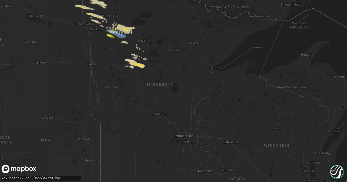
Hail Map in Minnesota on September 4, 2019
Get this storm
September 4 map
$229
one time, instant access
Download today. No call, no setup
Keep the $229
Bought the map and want the full workflow? Apply the entire $229 to a subscription within 7 days. None of it is wasted.
Every map, not just this one
This buys you this map. Subscription and you get every map we run, in the markets you choose from a few cities to whole states to nationwide. Plus real-time alerts the moment a storm fires.
Contact data
Name, contact info, occupancy, even credit band for addresses in the footprint. You go from where it hit to who to call.
Become the source they trust
Unlimited branding weather history reports on demand. You already have the documented answer ready for the property owner, and you are the one who showed up with it.
Property data and RoofTrace estimates
Pull up any address you have got, its value and the exact code rules for that jurisdiction, straight from One Click Code. Then RoofTrace estimates the squares, pitch, and roof value, priced the way you price.
Storm reports in Minnesota
Minnesota
| Date | Description |
|---|---|
| 09/04/20196:55 AM CDT | Via social media |
| 09/04/20196:50 AM CDT | Video of hail on socialmedia |
| 09/04/20196:45 AM CDT | A local report indicates 1.50 inch wind near 1 N HUBBARD |
| 09/04/20196:30 AM CDT | A local report indicates 1.25 inch wind near 3 E OSAGE |
| 09/04/20194:18 AM CDT | Reports of downed trees and power lines. |
| 09/04/20194:12 AM CDT | Multiple reports of trees and power lines down. Roof damage to a building... Also reports of a grain cart toppled onto the train tracks. |
| 09/04/20194:02 AM CDT | A local report indicates 62 MPH wind near FOSSTON |
| 09/04/20193:48 AM CDT | Reports of downed trees and power lines. |
| 09/04/20193:40 AM CDT | Multiple reports of trees and power lines down. Roof damage to buildings and trees down on a structure. Also reports of a grain cart toppled onto the train tracks. |
| 09/04/20193:34 AM CDT | A local report indicates 62 MPH wind near 4 S BROOKS |
| 09/04/20193:00 AM CDT | Few quarter size hail... Mostly pea size via social media. |
All States Impacted by Hail Map on September 4, 2019
Cities Impacted by Hail Map on September 4, 2019
- Red Lake Falls, MN
- Erskine, MN
- Fertile, MN
- Mentor, MN
- Clearbrook, MN
- Fosston, MN
- Bagley, MN
- Mcintosh, MN
- Wellton, AZ
- Trail, MN
- Leonard, MN
- Plummer, MN
- Shevlin, MN
- Gonvick, MN
- Oklee, MN
- Gully, MN
- Park Rapids, MN
- Osage, MN
- Rochert, MN
- Frazee, MN
- Nevis, MN
- Ponsford, MN
- Detroit Lakes, MN
- Menahga, MN
- Newfolden, MN
- Winterhaven, CA
- Lengby, MN
- Roll, AZ
- Warren, MN
- Alvarado, MN
- Thief River Falls, MN
- Saint Hilaire, MN
- Amenia, NY
- Sharon, CT
- Langdon, ND
- Cavalier, ND
- Walhalla, ND
- Grafton, ND
- Solway, MN
- Maida, ND
- Glasston, ND
- Donaldson, MN
- Saint Thomas, ND
- Middle River, MN
- Karlstad, MN
- Mountain, ND
- Kennedy, MN
- Stephen, MN
- Drayton, ND
- Strandquist, MN
- Hamilton, ND
- Hensel, ND
- Chilcoot, CA
- Oneonta, NY
- Hammonton, NJ
- Brooklyn, NY
- Pine Valley, CA
- Southwick, MA
- Broad Brook, CT
- Suffield, CT
- Enfield, CT
- South Windsor, CT
- Coventry, CT
- Somers, CT
- Ellington, CT
- Storrs Mansfield, CT
- Willington, CT
- West Suffield, CT
- Vernon Rockville, CT
- Tolland, CT
- East Windsor, CT
- Argyle, MN
- Minto, ND
- Wales, ND
- Crystal, ND
- Brooks, MN
- Williamstown, NJ
- Sicklerville, NJ
- Badger, MN
- Euclid, MN
- Rockaway Park, NY
- Far Rockaway, NY
- Laporte, MN
- Lancaster, MN
- Elizabeth, CO
- West Oneonta, NY
- Otego, NY
- Arverne, NY
- Atlantic Beach, NY
- Breezy Point, NY
- Greenbush, MN
- Long Beach, NY
- Staten Island, NY
- Warner Springs, CA
- Crookston, MN
- Mahnomen, MN
- Elbert, CO
- Backus, MN
- Akeley, MN
- Windsor Locks, CT
- Chaplin, CT
- Hampton, CT
- Mansfield Center, CT
- Great Barrington, MA
- Hillsdale, NY
- Mount Holly, VT
- Belmont, VT
- East Wallingford, VT
- Reading, VT
- Ludlow, VT
- Weston, VT
- Proctorsville, VT
- Bayville, NJ
- Beachwood, NJ
- Berlin, NJ
- North Myrtle Beach, SC
- Longs, SC
- Little River, SC
- Ash, NC
- Sunset Beach, NC
- Calabash, NC
- Wilmington, NC
- Delco, NC
- Hampstead, NC
- Rocky Point, NC
- Kelly, NC
- Burgaw, NC
- Arapahoe, NC
- Isle Of Palms, SC
- Ladson, SC
- Beaufort, NC
- Nassawadox, VA
- Folly Beach, SC
- Lowland, NC
- Oak Island, NC
- Scranton, NC
- Gresham, SC
- Ridgeville, SC
- Maple Hill, NC
- Washington, NC
- Roper, NC
- Aydlett, NC
- Saint Helena Island, SC
- Winnabow, NC
- Clarendon, NC
- North Charleston, SC
- Goose Creek, SC
- Nesmith, SC
- Vanceboro, NC
- Charleston, SC
- Salvo, NC
- Johns Island, SC
- Morehead City, NC
- Okatie, SC
- Currie, NC
- South Mills, NC
- Norfolk, VA
- Engelhard, NC
- Merritt, NC
- Coinjock, NC
- Myrtle Beach, SC
- Ocracoke, NC
- Jamesville, NC
- Moyock, NC
- Tabor City, NC
- Sunbury, NC
- Wanchese, NC
- Havelock, NC
- Georgetown, SC
- Harkers Island, NC
- Frisco, NC
- Blounts Creek, NC
- Pawleys Island, SC
- Sneads Ferry, NC
- Bonneau, SC
- Williamston, NC
- Jacksonboro, SC
- Camp Lejeune, NC
- Ernul, NC
- Plymouth, NC
- Powells Point, NC
- Midway Park, NC
- Hatteras, NC
- Currituck, NC
- Birdsnest, VA
- Hobucken, NC
- Conway, SC
- Hemingway, SC
- Ivanhoe, NC
- Virginia Beach, VA
- Chesapeake, VA
- Columbia, NC
- Hollywood, SC
- Merry Hill, NC
- Camden, NC
- New Bern, NC
- Davis, NC
- Sealevel, NC
- Moncks Corner, SC
- Portsmouth, VA
- Oriental, NC
- Swansboro, NC
- Ravenel, SC
- Midway, GA
- Savannah, GA
- Richlands, NC
- Adams Run, SC
- Rodanthe, NC
- Shawboro, NC
- Port Royal, SC
- Council, NC
- Gloucester, NC
- Castle Hayne, NC
- Sullivans Island, SC
- Point Harbor, NC
- Maysville, NC
- Holly Ridge, NC
- Charleston Afb, SC
- Jacksonville, NC
- Fairfield, NC
- Shallotte, NC
- Pantego, NC
- Aurora, NC
- Cordesville, SC
- Riegelwood, NC
- Stumpy Point, NC
- Edisto Island, SC
- Longwood, NC
- Ocean Isle Beach, NC
- Manns Harbor, NC
- Hertford, NC
- Nags Head, NC
- Bayboro, NC
- Lake Waccamaw, NC
- Jamestown, SC
- Vandemere, NC
- Aynor, SC
- Trenton, NC
- Harbinger, NC
- Exmore, VA
- Pollocksville, NC
- Bluffton, SC
- Summerville, SC
- Andrews, SC
- Belhaven, NC
- Newport, NC
- Dover, NC
- Hardeeville, SC
- Waves, NC
- Southport, NC
- Belvidere, NC
- Stella, NC
- Ayden, NC
- Grimesland, NC
- Jarvisburg, NC
- Windsor, NC
- Chocowinity, NC
- Green Pond, SC
- Edward, NC
- Kinston, NC
- Tybee Island, GA
- Wadmalaw Island, SC
- McClellanville, SC
- Smyrna, NC
- Beulaville, NC
- Bolton, NC
- Murrells Inlet, SC
- Chinquapin, NC
- Kure Beach, NC
- Grantsboro, NC
- Hilton Head Island, SC
- Bolivia, NC
- Edenton, NC
- Swanquarter, NC
- Salter Path, NC
- Pinetown, NC
- Willard, NC
- Elizabeth City, NC
- Manteo, NC
- Marshallberg, NC
- Machipongo, VA
- Grandy, NC
- Nakina, NC
- Daufuskie Island, SC
- Grifton, NC
- Buxton, NC
- Saint Stephen, SC
- Wrightsville Beach, NC
- Barco, NC
- Cedar Island, NC
- Creswell, NC
- Kill Devil Hills, NC
- Townsend, GA
- Stacy, NC
- Wallace, NC
- Beaufort, SC
- Hanahan, SC
- Loris, SC
- Tarawa Terrace, NC
- Hallsboro, NC
- Tyner, NC
- Poplar Branch, NC
- Knotts Island, NC
- Cape Charles, VA
- Franktown, VA
- Whiteville, NC
- Hubert, NC
- Corolla, NC
- Sapelo Island, GA
- Shiloh, NC
- Supply, NC
- Maple, NC
- Awendaw, SC
- Kitty Hawk, NC
- Avon, NC
- Cove City, NC
- Atlantic Beach, NC
- Atlantic, NC
- Emerald Isle, NC
- Seabrook, SC
- Bath, NC
- Huger, SC
- Mount Pleasant, SC
- Leland, NC
- Atkinson, NC
- Carolina Beach, NC
- Albany, NY
- Tonopah, AZ
- Lake Havasu City, AZ
- Winger, MN
- Stafford Springs, CT


