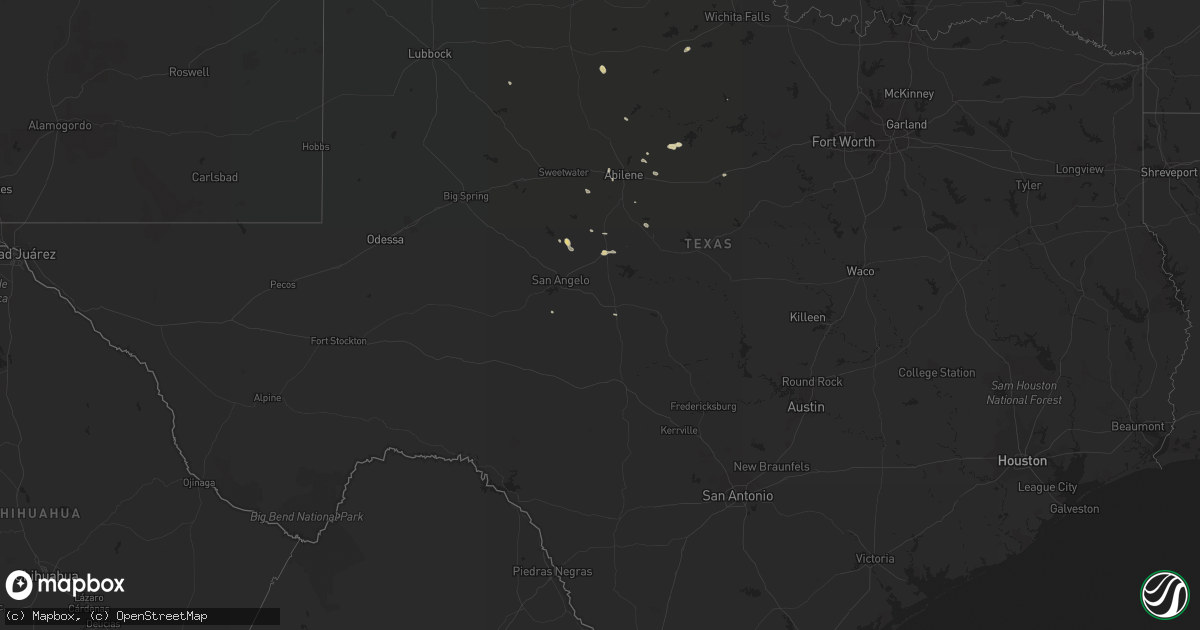
Hail Map in Texas on September 2, 2017
Get this storm
September 2 map
$229
one time, instant access
Download today. No call, no setup
Keep the $229
Bought the map and want the full workflow? Apply the entire $229 to a subscription within 7 days. None of it is wasted.
Every map, not just this one
This buys you this map. Subscription and you get every map we run, in the markets you choose from a few cities to whole states to nationwide. Plus real-time alerts the moment a storm fires.
Contact data
Name, contact info, occupancy, even credit band for addresses in the footprint. You go from where it hit to who to call.
Become the source they trust
Unlimited branding weather history reports on demand. You already have the documented answer ready for the property owner, and you are the one who showed up with it.
Property data and RoofTrace estimates
Pull up any address you have got, its value and the exact code rules for that jurisdiction, straight from One Click Code. Then RoofTrace estimates the squares, pitch, and roof value, priced the way you price.
Storm reports in Texas
Texas
| Date | Description |
|---|---|
| 09/01/20177:49 PM CDT | Restaurant sign blown onto vehicle in southwestern abilene near the intersection of southwest drive and clack street |
| 09/01/20177:44 PM CDT | The police dept at tye reported a small 10 ft by 10 ft metal building destroyed... And a couple of small 4 ft by 8 ft signs blown over by winds... Estimated at 60 mph. |
| 09/01/20177:43 PM CDT | A local report indicates 63 MPH wind near DYESS AFB |
Cities Impacted by Hail Map on September 2, 2017
- Knox City, TX
- O'Brien, TX
- Baird, TX
- Merkel, TX
- Bronte, TX
- Ranger, TX
- Rice Lake, WI
- Mondovi, WI
- Colfax, WI
- Elk Mound, WI
- Menomonie, WI
- Spooner, WI
- Nolan, TX
- Cadott, WI
- Jim Falls, WI
- Chippewa Falls, WI
- Winters, TX
- Albany, TX
- Ballinger, TX
- Fall Creek, WI
- Finlayson, MN
- Sandstone, MN
- Eden, TX
- Seymour, TX
- Wheeler, WI
- Boyceville, WI
- Avoca, TX
- Christoval, TX
- Graham, TX
- Robert Lee, TX
- Snyder, TX
- Danbury, WI
- Clyde, TX
- Coleman, TX
- Shell Lake, WI
- Abilene, TX


