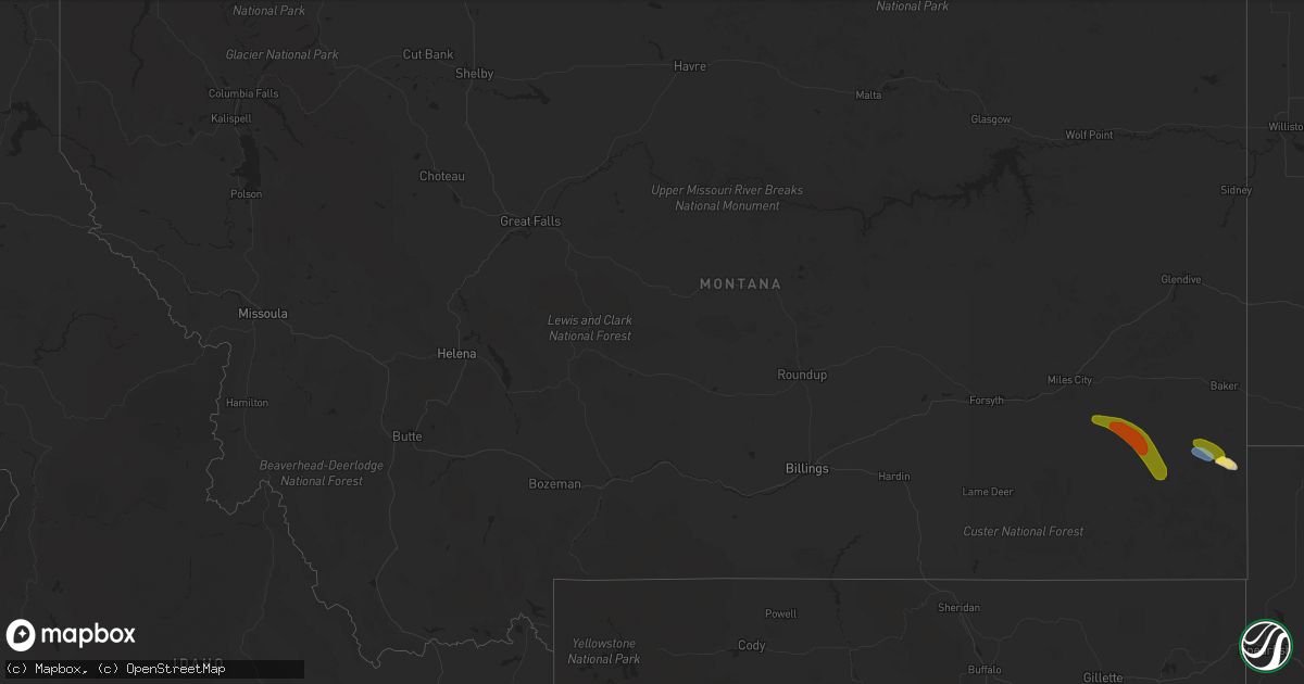
Hail Map in Montana on September 1, 2019
Get this storm
September 1 map
$229
one time, instant access
Download today. No call, no setup
Keep the $229
Bought the map and want the full workflow? Apply the entire $229 to a subscription within 7 days. None of it is wasted.
Every map, not just this one
This buys you this map. Subscription and you get every map we run, in the markets you choose from a few cities to whole states to nationwide. Plus real-time alerts the moment a storm fires.
Contact data
Name, contact info, occupancy, even credit band for addresses in the footprint. You go from where it hit to who to call.
Become the source they trust
Unlimited branding weather history reports on demand. You already have the documented answer ready for the property owner, and you are the one who showed up with it.
Property data and RoofTrace estimates
Pull up any address you have got, its value and the exact code rules for that jurisdiction, straight from One Click Code. Then RoofTrace estimates the squares, pitch, and roof value, priced the way you price.
Storm reports in Montana
Montana
| Date | Description |
|---|---|
| 09/01/20195:25 PM CDT | Tree branches ripped off. |
| 09/01/20194:45 PM CDT | A local report indicates 1.50 inch wind near 18 SSW MIZPAH |
| 08/31/201910:25 PM CDT | At 325 PM MDT, a severe thunderstorm was located 19 miles northeast of Volborg, or 30 miles southeast of Miles City, moving southeast at 20 mph. HAZARD...60 mph wind gusts and half dollar size hail. SOURCE...Radar indicated. IMPACT...Hail damage to vehicles is expected. Expect wind damage to roofs, siding, and trees. This severe thunderstorm will remain over mainly rural areas of southeastern Custer County. |
All States Impacted by Hail Map on September 1, 2019
Cities Impacted by Hail Map on September 1, 2019
- Wingate, TX
- Marana, AZ
- Burwell, NE
- Saint Francis, SD
- Marysville, OH
- Ostrander, OH
- Belvidere, SD
- White River, SD
- Okaton, SD
- Midland, SD
- Valentine, NE
- Mission, SD
- Norris, SD
- Parmelee, SD
- Oregonia, OH
- Waynesville, OH
- Clarksville, OH
- Buckeye, AZ
- Bassett, NE
- Long Pine, NE
- Cottonwood, AZ
- Sidney, OH
- Comstock, NE
- Payson, AZ
- Tonto Basin, AZ
- Sabina, OH
- Salome, AZ
- Oxford, OH
- Mechanicstown, OH
- Carrollton, OH
- Salineville, OH
- Kensington, OH
- Milesville, SD
- Columbus, OH
- Groveport, OH
- Pickerington, OH
- Canal Winchester, OH
- Reynoldsburg, OH
- Camp Verde, AZ
- Ainsworth, NE
- Ashville, OH
- Lockbourne, OH
- Congress, AZ
- Ekalaka, MT
- Clearwater, NE
- Chambers, NE
- Ewing, NE
- New Cumberland, WV
- Kingman, AZ
- Powell, OH
- Dublin, OH
- Plain City, OH
- Johnstown, OH
- Lisbon, OH
- Summitville, OH
- Sells, AZ
- Young, AZ
- Circleville, OH
- Verdigre, NE
- Bouse, AZ
- Hookstown, PA
- Georgetown, PA
- Wellsville, OH
- Tucson, AZ
- Galloway, OH
- Mercer, PA
- Jackson Center, PA
- Delaware, OH
- Woodstock, OH
- Milford Center, OH
- Mechanicsburg, OH
- Irwin, OH
- Parker Dam, CA
- Parker, AZ
- Johnstown, NE
- Amelia, NE
- Wood Lake, NE
- Crown King, AZ
- Ajo, AZ
- Pataskala, OH
- Blacklick, OH
- New Albany, OH
- Brockton, MT
- Sundance, WY
- Oneill, NE
- Coraopolis, PA
- Roosevelt, AZ
- Pleasant Plain, OH
- Goshen, OH
- Lebanon, OH
- North Lewisburg, OH
- Williamsport, OH
- Wilmington, OH
- Orchard, NE
- Stoneboro, PA
- Orient, OH
- Smithfield, PA
- Inman, NE
- Elizabethtown, IN
- Columbus, IN
- Hartsville, IN
- Westerville, OH
- Skull Valley, AZ
- Kirkland, AZ
- Sahuarita, AZ
- Seligman, AZ
- Cornville, AZ
- Sedona, AZ
- Clarkdale, AZ
- Urbana, OH
- Abilene, TX
- Whiteriver, AZ
- Westport, IN
- Fluvanna, TX
- West Liberty, OH
- Lucasville, OH
- Piketon, OH
- Bulger, PA
- Burgettstown, PA
- Gold Canyon, AZ
- Clinton, PA
- Aliquippa, PA
- Imperial, PA
- Dryden, TX
- Grove City, OH
- Woodville, MS
- Mount Sterling, OH
- Cable, OH
- Zanesfield, OH
- Albion, NE
- Prescott, AZ
- Dewey, AZ
- Philip, SD
- Ord, NE
- Arcadia, NE
- Hanoverton, OH
- Washington Court House, OH
- Norwich, OH
- New Concord, OH
- Cambridge, OH
- Page, NE
- Hamilton, OH
- Superior, AZ
- Golden Valley, AZ
- Irondale, OH
- Hammondsville, OH
- Apache Junction, AZ
- Paradise Valley, AZ
- Scottsdale, AZ
- Phoenix, AZ
- Gila Bend, AZ
- Blythe, CA
- Earp, CA
- Lake Havasu City, AZ
- Biddle, MT
- Boyes, MT
- Volborg, MT
- Ismay, MT


