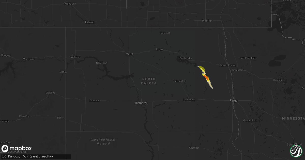
Hail Map in North Dakota on September 1, 2017
Get this storm
September 1 map
$229
one time, instant access
Download today. No call, no setup
Keep the $229
Bought the map and want the full workflow? Apply the entire $229 to a subscription within 7 days. None of it is wasted.
Every map, not just this one
This buys you this map. Subscription and you get every map we run, in the markets you choose from a few cities to whole states to nationwide. Plus real-time alerts the moment a storm fires.
Contact data
Name, contact info, occupancy, even credit band for addresses in the footprint. You go from where it hit to who to call.
Become the source they trust
Unlimited branding weather history reports on demand. You already have the documented answer ready for the property owner, and you are the one who showed up with it.
Property data and RoofTrace estimates
Pull up any address you have got, its value and the exact code rules for that jurisdiction, straight from One Click Code. Then RoofTrace estimates the squares, pitch, and roof value, priced the way you price.
Storm reports in North Dakota
North Dakota
| Date | Description |
|---|---|
| 09/01/20176:56 PM CDT | Ocassional nickel to ping pong ball sized hail in very heavy rain across southeast lenora township. |
| 09/01/20176:56 PM CDT | Ocassional nickel to ping pong ball sized hail in very heavy rain across southeast lenora township. |
| 09/01/20176:25 PM CDT | A few hail up to half dollar sized just north of highway 15...in northwest lee township. |
| 09/01/20175:59 PM CDT | Heavy rain with a few dime to quarter sized hail. |
| 09/01/20175:38 PM CDT | This tornado touched down just east stump lake and west of highway 1. It tracked eastward over mainly opened fields for nearly 5 miles and ended around 8.5 s of mapes a |
| 09/01/20175:38 PM CDT | A tornado tracked to the eastward over mainly opened fields from northeast wamduska township into northeast central township. Multiple reports and photos showed a persi |
| 09/01/20175:30 PM CDT | A brief touchdown with dust swirl was noted northeast of stump lake. |
| 09/01/20175:30 PM CDT | A brief touchdown with water swirl was noted over the north end of stump lake. Touchdown was a minute or less with an estimated track length of around a quarter mile. T |
| 08/31/20178:15 PM CDT | A few large branches broken down in shelter belts. Corn and bean fields flattened in spots across northwest rochester and northeast ellsbury townships. Time estimated b |
| 08/31/20177:55 PM CDT | Large branches broken down around the town of hope. One poplar tree snapped at the golf course. |
| 08/31/20177:50 PM CDT | Strong winds gusts in rear flank shelf cloud. Some dime to nickel sized hail as well. |
| 08/31/20177:30 PM CDT | Several large 4 to 8 inch diameter tree branches snapped in a farmstead shelter belt near cr25 north of highway 200... In west central greenview township. |
| 08/31/20177:25 PM CDT | Very heavy rain with ocassional large hail... A few up to golf ball sized. |
| 08/31/20177:25 PM CDT | Very heavy rain with ocassional large hail... A few up to golf ball sized. |
| 08/31/20177:16 PM CDT | This tornado tracked intermittently for about 2 miles across a portion of the sheyenne river valley and along the steele county line to around 7 wsw of finley by 722 pm |
All States Impacted by Hail Map on September 1, 2017
Cities Impacted by Hail Map on September 1, 2017
- Graham, NC
- Snow Camp, NC
- Pittsboro, NC
- Siler City, NC
- Staley, NC
- Mooresville, NC
- Huntersville, NC
- Davidson, NC
- Concord, NC
- Cornelius, NC
- Kannapolis, NC
- Asheboro, NC
- Finley, ND
- Mount Olive, NC
- Snow Hill, NC
- La Grange, NC
- Garden City, KS
- Pierceville, KS
- Ingalls, KS
- Mcville, ND
- Hope, ND
- Aneta, ND
- Sharon, ND
- Laurinburg, NC
- Hamer, SC
- Little Rock, SC
- Dillon, SC
- Rowland, NC
- Rockingham, NC
- Cimarron, NM
- Morehead City, NC
- Beaufort, NC
- Liberty Hill, SC
- Ridgeway, SC
- Camden, SC
- Broadway, NC
- Sanford, NC
- Punta Gorda, FL
- Raton, NM
- Flagler Beach, FL
- Ormond Beach, FL
- Arcadia, FL
- Claxton, GA
- Willow Spring, NC
- Garner, NC
- Holly Springs, NC
- Raleigh, NC
- Fuquay Varina, NC
- Angier, NC
- Saint Augustine, FL
- Raeford, NC
- Wagram, NC
- Geneva, FL
- Hardeeville, SC
- Okatie, SC
- Ridgeland, SC
- Landis, NC
- Fayetteville, NC
- Cary, NC
- Jacksonville, FL
- Chiefland, FL
- Trinidad, CO
- Model, CO
- Troutman, NC
- Statesville, NC
- Sherrills Ford, NC
- Terrell, NC
- Catawba, NC
- Denver, NC
- Ocate, NM
- Macclenny, FL
- Newton Grove, NC
- Johnson, KS
- Denton, NC
- Troy, NC
- West End, NC
- Jackson Springs, NC
- Carthage, NC
- Blythewood, SC
- Quitman, GA
- Pavo, GA
- Morven, GA
- Barney, GA
- New Hill, NC
- Benson, NC
- Four Oaks, NC
- Clayton, NC
- Boise City, OK
- Vanceboro, NC
- Cheraw, SC
- McBee, SC
- Bethune, SC
- Patrick, SC
- Hartsville, SC
- Lillington, NC
- Trenton, FL
- Ulysses, KS
- Lilesville, NC
- Shannon, NC
- Red Springs, NC
- Maxton, NC
- Lumber Bridge, NC
- Parkton, NC
- Labelle, FL
- Great Bend, KS
- Pawnee Rock, KS
- Albert, KS
- Otis, KS
- Rush Center, KS
- Newport, NC
- Cooperstown, ND
- North, SC
- Faison, NC
- Princeton, NC
- Springfield, GA
- Havelock, NC
- Inverness, FL
- Aberdeen, NC
- Cameron, NC
- Ocklawaha, FL
- Vass, NC
- Southern Pines, NC
- Pekin, ND
- China Grove, NC
- Coats, NC
- Grifton, NC
- Dover, NC
- Rockwell, NC
- McColl, SC
- Gibson, NC
- Hope Mills, NC
- Bennettsville, SC
- Stedman, NC
- Wallace, SC
- Laurel Hill, NC
- Wade, NC
- Florence, SC
- Dudley, NC
- Seven Springs, NC
- Goldsboro, NC
- Page, ND
- Luverne, ND
- Ramseur, NC
- Silver Springs, FL
- Guyton, GA
- Fair Bluff, NC
- Nichols, SC
- Candor, NC
- Chapel Hill, NC
- Hoffman, NC
- Marston, NC
- Cove City, NC
- Kinston, NC
- Edgemoor, SC
- Richburg, SC
- Bison, KS
- Ness City, KS
- Richlands, NC
- Jacksonville, NC
- Maple Hill, NC
- Inglis, FL
- Salisbury, NC
- New London, NC
- Harrisburg, NC
- Midland, NC
- Charlotte, NC
- Heath Springs, SC
- Pikeville, NC
- Waycross, GA
- Ellerbe, NC
- Brooklet, GA
- Webster, FL
- Bluffton, SC
- Lyons, GA
- Orlando, FL
- Tarpon Springs, FL
- Palm Harbor, FL
- Supply, NC
- Palm Coast, FL
- Ocala, FL
- Thonotosassa, FL
- Seffner, FL
- Lake Butler, FL
- Moncure, NC
- Okeechobee, FL
- Tampa, FL
- Bear Creek, NC
- Walterboro, SC
- Brooksville, FL
- Elkton, FL
- Atlantic Beach, NC
- Stantonsburg, NC
- Fremont, NC
- Eagle Springs, NC
- Biscoe, NC
- St John, KS
- Clinton, NC
- Seagrove, NC
- Wesley Chapel, FL
- Zephyrhills, FL
- Dunn, NC
- San Antonio, FL
- Dade City, FL
- Cottageville, SC
- Round O, SC
- Key West, FL
- Tavernier, FL
- Key Largo, FL
- Marathon, FL
- Summerland Key, FL
- Islamorada, FL
- Long Key, FL
- Big Pine Key, FL
- Key Colony Beach, FL
- Homestead, FL
- Michigan, ND
- Lakota, ND


