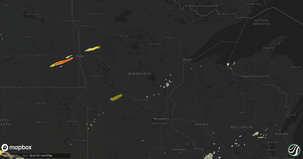
Hail Map in Minnesota on August 27, 2018
Get this storm
August 27 map
$229
one time, instant access
Download today. No call, no setup
Keep the $229
Bought the map and want the full workflow? Apply the entire $229 to a subscription within 7 days. None of it is wasted.
Every map, not just this one
This buys you this map. Subscription and you get every map we run, in the markets you choose from a few cities to whole states to nationwide. Plus real-time alerts the moment a storm fires.
Contact data
Name, contact info, occupancy, even credit band for addresses in the footprint. You go from where it hit to who to call.
Become the source they trust
Unlimited branding weather history reports on demand. You already have the documented answer ready for the property owner, and you are the one who showed up with it.
Property data and RoofTrace estimates
Pull up any address you have got, its value and the exact code rules for that jurisdiction, straight from One Click Code. Then RoofTrace estimates the squares, pitch, and roof value, priced the way you price.
Storm reports in Minnesota
Minnesota
| Date | Description |
|---|---|
| 08/27/20185:56 PM CDT | A couple of large trees were downed on the south end of lake de montreville. |
| 08/27/20185:50 PM CDT | Tree trunk snapped near base. Other large limbs down. Time estimated from radar. |
| 08/27/20185:50 PM CDT | Large tree limb snapped. Time estimated from radar. |
| 08/27/20185:49 PM CDT | Tree branches down. Tree uprooted. Time estimated from radar. |
| 08/27/20185:47 PM CDT | Tractor trailers tipped over. Report relayed via dispatch. Time estimated from radar. |
| 08/27/20185:45 PM CDT | Tree knocked down. Time estimated by radar. |
| 08/27/20185:45 PM CDT | Large tree snapped about 10 feet off the ground. Time estimated from radar. |
| 08/27/20185:40 PM CDT | Social media picture of tree branches down. Time estimated from radar. |
| 08/27/20185:40 PM CDT | Storm survey rated tornado ef-0. |
| 08/27/20185:40 PM CDT | Farm sheds destroyed. |
| 08/27/20185:40 PM CDT | Numerous tree branches down. Time estimated from radar. |
| 08/27/20185:37 PM CDT | Tree uprooted. Time estimated from radar. |
| 08/27/20185:35 PM CDT | Trees damaged |
| 08/27/20185:27 PM CDT | Pine tree snapped near base. Damage to a gazebo. Time estimated from radar. |
| 08/27/20185:27 PM CDT | Large tree limb down. Estimated winds gusts greater than 50 mph. |
| 08/27/20185:23 PM CDT | Windmill fell on shed. Report relayed via dispatch. Time estimated from radar. |
| 08/27/20185:19 PM CDT | Trees branches down and corn down. Report relayed via dispatch. Time estimated from radar. |
| 08/27/20185:18 PM CDT | Branches snapped and metal pole bent. Report relayed via dispatch. Time estimated from radar. |
| 08/27/20185:17 PM CDT | Storm survey rated tornado ef-0. |
| 08/27/20185:10 PM CDT | Powerline down. Report relayed via dispatch. Time estimated from radar. |
| 08/27/20185:05 PM CDT | 1 tree down in faribault. Report relayed via dispatch. Time estimated from radar. |
| 08/27/20184:50 PM CDT | Trees down. Report relayed via dispatch. Time estimated from radar. |
| 08/27/20184:48 PM CDT | Trees down in le sueur. Report relayed via dispatch. Time estimated from radar. |
| 08/27/20184:42 PM CDT | Trees down. Report relayed via dispatch. Time estimated from radar. |
| 08/27/20184:33 PM CDT | Multiple trees down. |
| 08/27/20184:32 PM CDT | Telephone pole down. Report relayed via dispatch. Time estimated from radar. |
| 08/27/20184:30 PM CDT | Multiple trees down in the kasota area. |
| 08/27/20184:05 PM CDT | Trained spotter reported quarter to half dollar sized hail. |
| 08/27/20183:57 PM CDT | Large branches and a tree down. Estimated wind gusts of 70 mph. |
| 08/27/20183:45 PM CDT | Reports of quarter sized hail and wind gusts estimated greater than 60 mph. |
| 08/27/20183:40 PM CDT | Social media photo of tree and power lines down in northrop. Time estimated from radar. |
| 08/27/20183:29 PM CDT | Tree down on trailer. Report relayed via dispatch. Time estimated from radar. |
| 08/27/20187:53 AM CDT | At 1253 AM CDT, severe thunderstorms were located along a line extending from near Weme to near Ogema, moving east at 35 mph. HAZARD...60 mph wind gusts and quarter size hail. SOURCE...Radar indicated. IMPACT...Hail damage to vehicles is expected. Expect wind damage to roofs, siding, and trees. Severe thunderstorms will be near... Lengby and Ebro around 1255 AM CDT. Weme around 100 AM CDT. Bagley around 110 AM CDT. Leonard and Shevlin around 120 AM CDT. Tulaby Lake around 125 AM CDT.Other locations impacted by these severe thunderstorms include ManyPoint Scout Camp. |
| 08/27/20184:47 AM CDT | At 946 PM CDT, a severe thunderstorm was located near Flom, or 24 miles northwest of Detroit Lakes, moving east at 55 mph. HAZARD...60 mph wind gusts and quarter size hail. SOURCE...Radar indicated. IMPACT...Hail damage to vehicles is expected. Expect wind damage to roofs, siding, and trees. This severe thunderstorm will be near... Waubun and Ogema around 955 PM CDT. White Earth around 1000 PM CDT. Naytahwaush and Tulaby Lake around 1010 PM CDT. Roy Lake and Mahkonce around 1015 PM CDT. Lower Rice Lake and Long Lost Lake around 1020 PM CDT.Other locations impacted by this severe thunderstorm include northernMany Point Scout Camp. |
| 08/27/20181:34 AM CDT | At 633 PM CDT, a severe thunderstorm was located near Webb Lake Wisconsin, or 22 miles northwest of Spooner, moving east at 45 mph. HAZARD...60 mph wind gusts. SOURCE...Radar indicated. IMPACT...Expect damage to roofs, siding, and trees. This severe thunderstorm will be near, Minong around 655 PM CDT. Wascott and Gordon around 700 PM CDT. Other locations impacted by this severe thunderstorm include SpoonerLake, Cozy Corner, Mckenzie Lake, Minong Flowage, Springbrook, MooseJunction, Amnicon Lake, Oakland, Birch Island Lake, and Lampson. |
| 08/27/20181:07 AM CDT | At 606 PM CDT, severe thunderstorms were located along a line extending from near Elmwood to near Plainview to near Stewartville, moving northeast at 60 mph. HAZARD...60 mph wind gusts. SOURCE...Radar indicated. IMPACT...Expect damage to roofs, siding, and trees. Severe thunderstorms will be near... Buffalo and Buffalo City around 625 PM CDT. Arcadia and Lewiston around 640 PM CDT. Stockton and Rollingstone around 645 PM CDT. Winona, Independence, Goodview and Fountain City around 650 PM CDT. Other locations impacted by these severe thunderstorms include Dodge,Franklin, New Hartford, York and Eleva. |
| 08/27/201812:58 AM CDT | At 558 PM CDT, severe thunderstorms were located along a line extending from near Bruno, to 9 miles southeast of Sandstone, to near Rock Creek, moving northeast at 40 mph. HAZARD...60 mph wind gusts and torrential rainfall. SOURCE...Radar indicated. IMPACT...Expect damage to roofs, siding, and trees. Locations impacted include... Pine City, Hinckley, Sandstone, Rock Creek, Grantsburg, Siren, Webster, Willow River, Askov, Webb Lake Wisconsin, Rutledge, Dairyland, Holyoke, Bruno, Cloverton, Danbury, Hertel, Nemadji, South Range, and Duxbury. |
| 08/27/201812:34 AM CDT | At 534 PM CDT, a severe thunderstorm was located over Hinckley, moving northeast at 50 mph. HAZARD...60 mph wind gusts and torrential rainfall. SOURCE...Radar indicated. IMPACT...Expect damage to roofs, siding, and trees. Locations impacted include... Pine City, Hinckley, Sandstone, Rock Creek, Willow River, Askov, Rutledge, Brook Park, Bruno, Henriette, Cloverton, Duxbury, Sturgeon Lake, Finlayson, Kerrick, Denham, Duquette, Banning State Park, Kingsdale, and West Rock.This also includes Interstate 35 between Rush City and Willow River. |
| 08/27/201812:32 AM CDT | At 532 PM CDT, severe thunderstorms were located along a line extending from Spencer Brook to near Elk River to near Hanover, moving east at 40 mph. HAZARD...60 mph wind gusts. SOURCE...Radar indicated. IMPACT...Expect damage to roofs, siding, and trees. Severe thunderstorms will be near... Ramsey around 535 PM CDT. Andover and Champlin around 540 PM CDT. Maple Grove and Anoka around 545 PM CDT. Cambridge, Coon Rapids, Ham Lake and Isanti around 550 PM CDT. Brooklyn Park, Plymouth and East Bethel around 555 PM CDT. Blaine, Brooklyn Center and Lino Lakes around 600 PM CDT. Fridley, Columbia Heights, Mounds View and Spring Lake Park around 605 PM CDT. Shoreview and New Brighton around 610 PM CDT. |
| 08/27/201812:14 AM CDT | At 513 PM CDT, a severe thunderstorm was located near Lake Mills, or 7 miles north of Forest City, moving northeast at 50 mph. HAZARD...60 mph wind gusts. SOURCE...Radar indicated. IMPACT...Expect damage to roofs, siding, and trees. Locations impacted include... Forest City, Northwood, Lake Mills, Emmons, Rice Lake, Fertile, Leland, Joice, Scarville, Lake Mills Municipal Airport, Hogsback Wildlife Area, Rice Lake State Park and Pilot Knob State Park.This includes Interstate 35 between mile markers 209 and 218. |
| 08/26/201811:57 PM CDT | At 456 PM CDT, severe thunderstorms were located along a line extending from near Medford to Clarks Grove to Rice Lake, moving east at 35 mph. HAZARD...60 mph wind gusts and penny size hail. SOURCE...Radar indicated. IMPACT...Expect damage to roofs, siding, and trees. Locations impacted include... Rochester, Austin, Dodge Center, Mantorville, Kasson, Stewartville, Byron, Hayfield, Oronoco, West Concord, Brownsdale, Lyle, Claremont, Rose Creek, High Forest, Lansing, Wasioja, Douglas, Rock Dell and Concord. |
| 08/26/201811:42 PM CDT | At 442 PM CDT, severe thunderstorms were located along a line extending from near Otisco to Matawan to Walters, moving northeast at 50 mph. HAZARD...60 mph wind gusts. SOURCE...Radar indicated. IMPACT...Expect damage to roofs, siding, and trees. Severe thunderstorms will be near... Freeborn around 445 PM CDT. Waseca, New Richland and Hartland around 450 PM CDT. Albert Lea and Ellendale around 500 PM CDT. Owatonna, Medford, Clarks Grove and Hayward around 510 PM CDT. Geneva and Hollandale around 515 PM CDT. Blooming Prairie around 530 PM CDT. |
| 08/26/201811:30 PM CDT | At 429 PM CDT, a severe thunderstorm was located 7 miles east of Union Slogh, or 17 miles west of Forest City, moving northeast at 55 mph. HAZARD...60 mph wind gusts and quarter size hail. SOURCE...Radar indicated. IMPACT...Hail damage to vehicles is expected. Expect wind damage to roofs, siding, and trees. Locations impacted include... Lake Mills, Rice Lake, Buffalo Center, Thompson, Titonka, Leland, Woden, Scarville, Lake Mills Municipal Airport, Hogsback Wildlife Area and Rice Lake State Park. |
| 08/26/201811:14 PM CDT | At 413 PM CDT, severe thunderstorms were located along a line extending from near Judson to St. Clair, moving northeast at 55 mph. HAZARD...70 mph wind gusts and nickel size hail. SOURCE...Radar indicated. IMPACT...Expect considerable tree damage. Damage is likely to mobile homes, roofs, and outbuildings. Severe thunderstorms will be near... St. Peter, Kasota and Elysian around 430 PM CDT. Waterville and Cleveland around 435 PM CDT. Le Sueur, Morristown and Warsaw around 440 PM CDT. Faribault and Henderson around 445 PM CDT. Lonsdale around 450 PM CDT. New Prague and Belle Plaine around 455 PM CDT. Northfield, Webster and Dundas around 500 PM CDT. |
| 08/26/201810:52 PM CDT | At 352 PM CDT, severe thunderstorms were located along a line extending from Madelia to near Winnebago, moving northeast at 55 mph. HAZARD...60 mph wind gusts. SOURCE...Radar indicated. IMPACT...Expect damage to roofs, siding, and trees. Severe thunderstorms will be near... Lake Crystal, Mapleton and Good Thunder around 405 PM CDT. Nicollet and Pemberton around 415 PM CDT. Eagle Lake and St. Clair around 420 PM CDT. Janesville and Madison Lake around 425 PM CDT. Elysian around 430 PM CDT. |
| 08/26/201810:38 PM CDT | At 338 PM CDT, a severe thunderstorm was located near Sedan, or 25 miles south of Alexandria, moving northeast at 45 mph. HAZARD...60 mph wind gusts and quarter size hail. SOURCE...Radar indicated. IMPACT...Hail damage to vehicles is expected. Expect wind damage to roofs, siding, and trees. This severe thunderstorm will be near... Sauk Centre around 410 PM CDT. Melrose around 415 PM CDT. St. Anthony and Grey Eagle around 425 PM CDT. Swanville around 435 PM CDT.This includes the following highways... Interstate 94 in Minnesota between mile markers 118 and 147. U.S. Highway 71 between mile markers 147 and 182. |
| 08/26/201810:17 PM CDT | At 316 PM CDT, severe thunderstorms were located along a line extending from near Bergen to near Estherville Municipal Airport, moving northeast at 40 mph. HAZARD...60 mph wind gusts and quarter size hail. SOURCE...Radar indicated. IMPACT...Hail damage to vehicles is expected. Expect wind damage to roofs, siding, and trees. Severe thunderstorms will be near... Trimont and Ceylon around 330 PM CDT. Fairmont around 340 PM CDT. St. James around 350 PM CDT. Lewisville around 400 PM CDT. Blue Earth, Madelia and Winnebago around 410 PM CDT.Other locations impacted by these severe thunderstorms includeFairmont Airport, Huntley, Dunnell, Northrop, Ormsby, St JamesAirport, Granada, Echols, East Chain and Grogan.This includes the following highways... Interstate 90 between mile markers 82 and 119. U.S. Highway 169 between mile markers 1 and 9. |
| 08/26/20189:47 PM CDT | Large amount of hail estimated up to quarter sized covered ground... Filled ditches... And produced some crop damage to soybeans... Sunflowers... And corn. |
| 08/26/20189:35 PM CDT | A local report indicates 1.00 inch wind near ULEN |
| 08/26/20189:30 PM CDT | At 229 PM CDT, a severe thunderstorm was located over just east of Mora, or 8 miles west of Pine City, moving east at 40 mph. HAZARD...60 mph wind gusts and penny size hail and torrential rainfall. SOURCE...Radar indicated. IMPACT...Expect damage to roofs, siding, and trees. Locations impacted include... Pine City, Hinckley, Sandstone, Rock Creek, Grantsburg, Trade Lake, Askov, Brook Park, Henriette, Duxbury, Branstad, Danbury, Randall, Finlayson, Falun, Banning State Park, Four Corners, West Rock, Trade River, and Friesland.This also includes Interstate 35 between Rush City and Sandstone. |
| 08/26/20189:30 PM CDT | At 230 AM CDT, severe thunderstorms were located along a line extending from 25 miles east of Voyageurs National Park, to 6 miles west of Crane Lake, to near Togo, moving east at 30 mph. HAZARD...60 mph wind gusts and quarter size hail. SOURCE...Radar indicated. IMPACT...Hail damage to vehicles is expected. Expect wind damage to roofs, siding, and trees. Severe thunderstorms will be near, Buyck around 240 AM CDT. Crane Lake around 245 AM CDT. Gheen around 310 AM CDT. Boundary Waters Canoe Area Wilderness Near Trout Lake around 315 AM CDT. Lake Vermilion around 330 AM CDT. Other locations impacted by these severe thunderstorms include Lac laCroix, Greaney, Echo Lake, Black Duck Lake, Trout Lake, Lake Agnes,Crooked Lake, Sand Point Lake, Loon Lake, and Bois Forte Reservation. |
| 08/26/20189:03 PM CDT | At 202 PM CDT, a severe thunderstorm was located over Pease, or 23 miles northwest of Cambridge, moving northeast at 45 mph. HAZARD...60 mph wind gusts and quarter size hail. SOURCE...Radar indicated. IMPACT...Hail damage to vehicles is expected. Expect wind damage to roofs, siding, and trees. Locations impacted include... Princeton, Mora, Milaca, Brunswick, Foreston, Ogilvie, Grasston, Bock, Dalbo, Pease, Oak Park and Mora Airport.This includes U.S. Highway 169 between mile markers 179 and 193. |
| 08/26/20188:52 PM CDT | At 151 AM CDT, a severe thunderstorm was located 8 miles southeast of Turtle River, or 13 miles east of Bemidji, moving east at 40 mph. HAZARD...60 mph wind gusts and quarter size hail. SOURCE...Radar indicated. IMPACT...Hail damage to vehicles is expected. Expect wind damage to roofs, siding, and trees. This severe thunderstorm will be near, Lake Winnibigoshish around 225 AM CDT. Inger and Oslund around 230 AM CDT. Other locations impacted by this severe thunderstorm include SandLake, Spring Lake, Whitefish Lake, Rosy, Max, Bowstring Lake, CutFoot Sioux Lake, Decker Lake, Wirt, and Dixon Lake. |
| 08/26/20188:49 PM CDT | At 148 AM CDT, severe thunderstorms were located along a line extending from 7 miles northeast of Rainy Lake, to near Kabetogama, to 9 miles west of Nett Lake, moving east at 40 mph. HAZARD...60 mph wind gusts and quarter size hail. SOURCE...Radar indicated. IMPACT...Hail damage to vehicles is expected. Expect wind damage to roofs, siding, and trees. Severe thunderstorms will be near, Kabetogama Lake around 155 AM CDT. Ash Lake around 215 AM CDT. Other locations impacted by these severe thunderstorms include Black Duck Lake, Sand Point Lake, and Bois Forte Reservation. This line of severe thunderstorms will also move through Voyageurs National Park. |
| 08/26/20188:25 PM CDT | At 124 AM CDT, severe thunderstorms were located along a line extending from near Puposky to Itasca State Park, moving east at 40 mph. HAZARD...60 mph wind gusts and quarter size hail. SOURCE...Radar indicated. IMPACT...Hail damage to vehicles is expected. Expect wind damage to roofs, siding, and trees. Locations impacted include... Bemidji, Plantagenet Lake, Lake George, Wilton, Tenstrike, Lavinia and Turtle River. |
All States Impacted by Hail Map on August 27, 2018
Cities Impacted by Hail Map on August 27, 2018
- Stanton, TX
- Emmetsburg, IA
- Mallard, IA
- Curlew, IA
- Tripp, SD
- Wilson, TX
- Stapleton, NE
- Washington Island, WI
- Viroqua, WI
- Soldiers Grove, WI
- Hillsboro, WI
- La Farge, WI
- Readstown, WI
- Viola, WI
- Cresco, IA
- Post, TX
- Hartley, IA
- Brandon, SD
- Sioux Falls, SD
- Corsica, SD
- Dimock, SD
- Armour, SD
- Hartford, SD
- Ethan, SD
- Olivet, SD
- Freeman, SD
- Alexandria, SD
- Humboldt, SD
- Bridgewater, SD
- Chancellor, SD
- Parker, SD
- Marion, SD
- Parkston, SD
- Emery, SD
- Monroe, SD
- Ferryville, WI
- De Soto, WI
- Jackson, MN
- Wheatland, ND
- Fingal, ND
- Leonard, ND
- Mapleton, ND
- Ogdensburg, WI
- Iola, WI
- Havelock, IA
- Viborg, SD
- Lennox, SD
- Scotland, SD
- Irene, SD
- Worthing, SD
- Davis, SD
- Menno, SD
- Centerville, SD
- Lesterville, SD
- Beresford, SD
- Hurley, SD
- Midland, SD
- Plainview, MN
- Webb, IA
- Sutherland, IA
- Peterson, IA
- Larrabee, IA
- Cylinder, IA
- Everly, IA
- Alta, IA
- Dickens, IA
- Royal, IA
- Ruthven, IA
- Ayrshire, IA
- West Bend, IA
- Paullina, IA
- Spencer, IA
- Calumet, IA
- Primghar, IA
- Gillett Grove, IA
- Granville, IA
- Aurelia, IA
- Meriden, IA
- Rolfe, IA
- Sioux Rapids, IA
- Cleghorn, IA
- Marcus, IA
- Laurens, IA
- Marathon, IA
- Greenville, IA
- Rembrandt, IA
- Linn Grove, IA
- Remsen, IA
- Cherokee, IA
- Rock Valley, IA
- Inwood, IA
- Clintonville, WI
- Wall, SD
- Philip, SD
- Milesville, SD
- Doon, IA
- Odessa, TX
- Clearwater, NE
- Anselmo, NE
- Arnold, NE
- Richland Center, WI
- Seminole, TX
- Alton, IA
- Hospers, IA
- Orange City, IA
- Enderlin, ND
- Delmont, SD
- Wagner, SD
- Kennebec, SD
- Presho, SD
- Canby, MN
- Maurice, IA
- Alpha, MN
- Pickstown, SD
- Naper, NE
- Fairfax, SD
- Lake Andes, SD
- Avon, SD
- Tea, SD
- Valley Springs, SD
- Bonesteel, SD
- Milaca, MN
- Spencer, SD
- Mitchell, SD
- Mount Vernon, SD
- Nome, ND
- Fort Ransom, ND
- Litchville, ND
- Kathryn, ND
- Neligh, NE
- Elgin, NE
- Oakdale, NE
- Pecos, TX
- Ramona, SD
- South Range, WI
- Lyndon Station, WI
- Reedsburg, WI
- Portales, NM
- Cashton, WI
- Norwalk, WI
- Lime Springs, IA
- Ontario, WI
- Cazenovia, WI
- New London, WI
- Waupaca, WI
- Weyauwega, WI
- Tallahassee, FL
- Buffalo Center, IA
- Saint Peter, MN
- Vivian, SD
- Draper, SD
- Westby, WI
- Brule, WI
- Iron River, WI
- Saint Ansgar, IA
- Lyle, MN
- Canton, SD
- Decorah, IA
- Dorchester, IA
- Spring Grove, MN
- Caledonia, MN
- Kimball, SD
- Ord, NE
- Northwood, IA
- Kensett, IA
- Fort Pierre, SD
- Midland, TX
- Nunda, SD
- Chester, IA
- Lubbock, TX
- Chamberlain, SD
- Pukwana, SD
- Finlayson, MN
- Sandstone, MN
- Gregory, SD
- Platte, SD
- Reliance, SD
- Oacoma, SD
- Wells, MN
- Wasta, SD
- Utica, SD
- Elk Point, SD
- Ponca, NE
- Le Mars, IA
- Madison, MN
- Bancroft, WI
- Hancock, WI
- Akron, IA
- Necedah, WI
- Nekoosa, WI
- La Crosse, WI
- Manawa, WI
- Scarville, IA
- Leland, IA
- Joice, IA
- Andrews, TX
- Westfield, IA
- Harrisburg, SD
- Lake Mills, IA
- Newcastle, NE
- Ulen, MN
- Rushford, MN
- Houston, MN
- Mabel, MN
- Riceville, IA
- McIntire, IA
- Hull, IA
- Alvord, IA
- Sheldon, IA
- Stickney, SD
- Forest City, IA
- Monahans, TX
- Sioux Center, IA
- Murdo, SD
- Endeavor, WI
- Portage, WI
- Ironwood, MI
- Scandinavia, WI
- Amherst, WI
- Hinckley, MN
- Brook Park, MN
- Manly, IA
- Arlington, SD
- Preston, MN
- Harmony, MN
- Alma Center, WI
- Fairchild, WI
- Elma, IA
- Alta Vista, IA
- Sanborn, IA
- Lake Linden, MI
- Arkdale, WI
- Charles City, IA
- Colwell, IA
- Meadow Grove, NE
- Gary, SD
- La Pointe, WI
- Harrison, SD
- Crane, TX
- Royal, NE
- Brunswick, NE
- Felton, MN
- Garner, IA
- Woden, IA
- Titonka, IA
- Beaver Dam, WI
- Ostrander, MN
- Elkton, MN
- Grand Meadow, MN
- Ireton, IA
- Halsey, NE
- Hurley, WI
- Braham, MN
- Burbank, SD
- Milan, MN
- Danvers, MN
- Black River Falls, WI
- Melrose, WI
- New Albin, IA
- Lanesboro, MN
- Rockford, IA
- Slaton, TX
- Ogema, MN
- Estherville, IA
- Terril, IA
- Blooming Prairie, MN
- Adams, MN
- Rose Creek, MN
- Tilden, NE
- Chaseburg, WI
- La Crescent, MN
- Coon Valley, WI
- Hokah, MN
- West Salem, WI
- Onalaska, WI
- Brownsville, MN
- Eitzen, MN
- Stoddard, WI
- Genoa, WI
- Bangor, WI
- Osage, IA
- Sparta, WI
- Wonewoc, WI
- La Valle, WI
- Little Cedar, IA
- Wisconsin Rapids, WI
- Goldsmith, TX
- Casselton, ND
- Archer, IA
- Shallowater, TX
- Krakow, WI
- Foley, MN
- Blue Earth, MN
- Owanka, SD
- Boyden, IA
- Fairview, SD
- George, IA
- Milford, IA
- Albert City, IA
- Truesdale, IA
- Storm Lake, IA
- Mora, MN
- Shawano, WI
- Dante, SD
- Fostoria, IA
- Rudolph, WI
- Levelland, TX
- Willow River, MN
- Green Bay, WI
- Cochrane, WI
- Spencer, NE
- Butte, NE
- Canton, MN
- Hanlontown, IA
- Clear Lake, IA
- Starbuck, MN
- Glenwood, MN
- Bradenton, FL
- Rochester, MN
- Tyndall, SD
- Le Roy, MN
- Hayes, SD
- Belvidere, SD
- Okaton, SD
- Quinn, SD
- Thompson, IA
- Villard, MN
- Sauk Centre, MN
- Brooten, MN
- Waubun, MN
- Allen, NE
- Dixon, NE
- Jefferson, SD
- Laurel, NE
- Dunning, NE
- Thedford, NE
- Kaylor, SD


