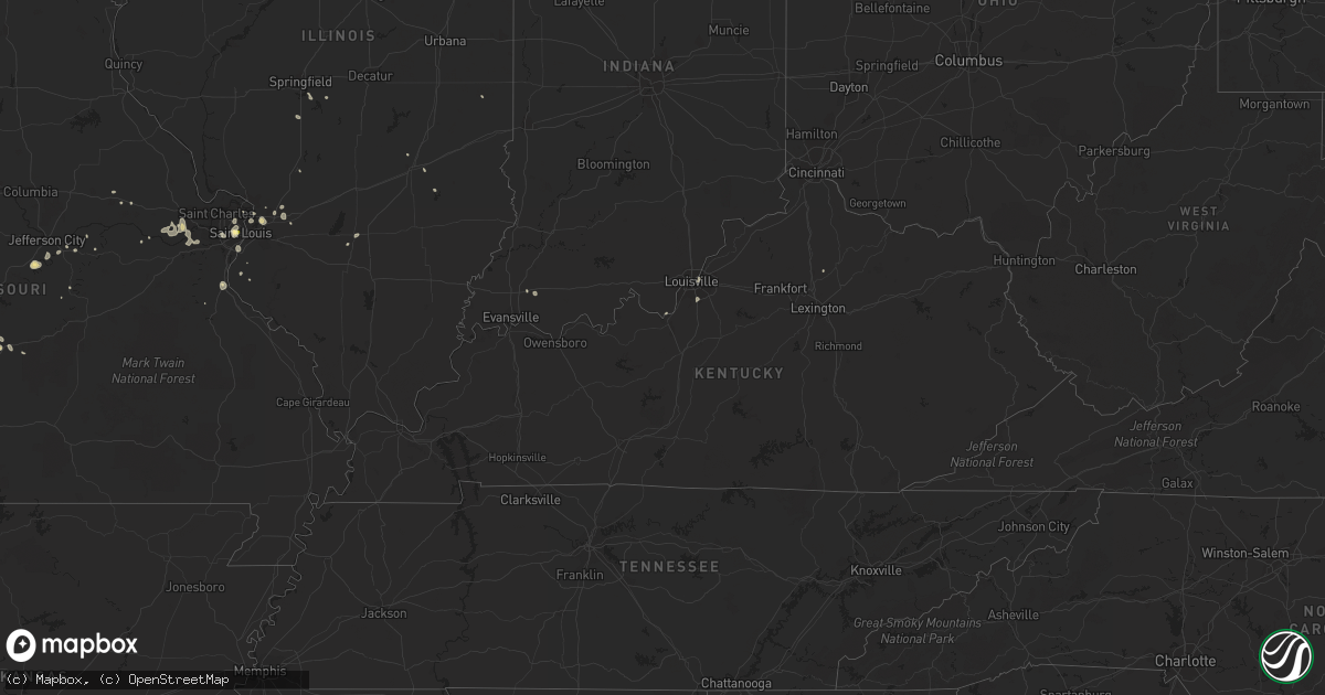
Hail Map in Kentucky on August 27, 2014
Get this storm
August 27 map
$229
one time, instant access
Download today. No call, no setup
Keep the $229
Bought the map and want the full workflow? Apply the entire $229 to a subscription within 7 days. None of it is wasted.
Every map, not just this one
This buys you this map. Subscription and you get every map we run, in the markets you choose from a few cities to whole states to nationwide. Plus real-time alerts the moment a storm fires.
Contact data
Name, contact info, occupancy, even credit band for addresses in the footprint. You go from where it hit to who to call.
Become the source they trust
Unlimited branding weather history reports on demand. You already have the documented answer ready for the property owner, and you are the one who showed up with it.
Property data and RoofTrace estimates
Pull up any address you have got, its value and the exact code rules for that jurisdiction, straight from One Click Code. Then RoofTrace estimates the squares, pitch, and roof value, priced the way you price.
Storm reports in Kentucky
Kentucky
| Date | Description |
|---|---|
| 08/27/20146:10 PM CDT | Tree blown on to house. |
| 08/27/20145:49 PM CDT | Trees down. Cor to location and time. |
| 08/27/20145:40 PM CDT | Trees down in scott county around long lick and in newtown. |
| 08/27/20145:05 PM CDT | Trees down at long lick. |
| 08/27/20143:58 PM CDT | Two trees snapped. |
| 08/27/20143:50 PM CDT | Three large trees down. |
| 08/27/20143:40 PM CDT | Two trees down. |
| 08/27/20143:10 PM CDT | 1 tree down |
| 08/27/20142:58 PM CDT | A local report indicates 58 MPH wind near LOUISVILLE |
All States Impacted by Hail Map on August 27, 2014
Cities Impacted by Hail Map on August 27, 2014
- Satanta, KS
- Genoa, CO
- Limon, CO
- Defiance, MO
- Julesburg, CO
- Yuma, CO
- Brush, CO
- Fort Morgan, CO
- Akron, CO
- Saint Louis, MO
- Keenesburg, CO
- Roggen, CO
- Penokee, KS
- Morland, KS
- Ellis, KS
- Ransom, KS
- Wakeeney, KS
- Ogallah, KS
- Utica, KS
- Dighton, KS
- Geneva, NE
- Shickley, NE
- Shamrock, TX
- Kim, CO
- Moscow, KS
- Hudson, CO
- Log Lane Village, CO
- Carthage, MO
- Kiowa, CO
- Elbert, CO
- Wiggins, CO
- Fort Lupton, CO
- Hawk Springs, WY
- Healy, KS
- Maryville, IL
- Granite City, IL
- Glen Carbon, IL
- Collinsville, IL
- Balko, OK
- Cope, CO
- Flagler, CO
- Hill City, KS
- Festus, MO
- De Soto, MO
- Torrington, WY
- Jasper, MO
- Ramah, CO
- Calhan, CO
- Agate, CO
- Wheeler, IL
- Newton, IL
- Big Springs, NE
- Grafton, NE
- Davenport, NE
- Ong, NE
- Sutton, NE
- New Haven, MO
- Joes, CO
- Haxtun, CO
- Arthur, NE
- Washington, MO
- Perryton, TX
- Osborne, KS
- Marthasville, MO
- Augusta, MO
- Wentzville, MO
- Foristell, MO
- Lebanon, MO
- Mankato, KS
- Westphalia, MO
- Jefferson City, MO
- Denton, NE
- Lincoln, NE
- Bennett, CO
- Elizabeth, CO
- Edwardsville, IL
- Burr Oak, KS
- Arriba, CO
- Henley, MO
- Lagrange, WY
- Miami, TX
- Platteville, CO
- Beaver, OK
- Alhambra, IL
- Otis, CO
- East Carondelet, IL
- Columbia, IL
- Wray, CO
- Sadieville, KY
- Cynthiana, KY
- Jonesburg, MO
- Garden City, KS
- Sarahsville, OH
- Saint Jacob, IL
- Kanab, UT
- Saint Thomas, MO
- Kittredge, CO
- Evergreen, CO
- Sigel, IL
- Elizabeth, IN
- West Point, KY
- Muldraugh, KY
- Chesterfield, MO
- Labadie, MO
- Pacific, MO
- Wildwood, MO
- Eureka, MO
- Saint Albans, MO
- Conifer, CO
- Morrison, CO
- Oakley, KS
- Edinburg, IL
- Deer Trail, CO
- Marietta, OH
- Rochester, IL
- Pawnee, IL
- Marine, IL
- Simla, CO
- Holyoke, CO
- Paris, IL
- Castle Rock, CO
- Richland, MO
- Herculaneum, MO
- Crystal City, MO
- Las Animas, CO
- Teutopolis, IL
- Bonnots Mill, MO
- Virden, IL
- Divernon, IL
- Linn, MO
- Courtland, KS
- Webber, KS
- Scott City, KS
- Chamois, MO
- Louisville, KY
- Waterloo, IL
- Amherst, CO
- Weldona, CO
- Hardesty, OK
- Sandoval, IL
- Odin, IL
- Lemoyne, NE
- Lockwood, MO
- Litchfield, IL
- Elberfeld, IN
- New Florence, MO
- Montgomery City, MO
- Vienna, MO
- Orchard, CO
- Boonville, IN
- Lynnville, IN
- Arcola, MO
- Yoder, CO
- Bogue, KS
- Centralia, IL
- Stockton, KS
- Glade, KS
- Eldridge, MO
- Bolivar, MO
- Esbon, KS
- Sharon, CT
- Amenia, NY
- La Junta, CO
- Portis, KS
- Booker, TX
- Woodrow, CO
- Brighton, CO
- Thornton, CO


