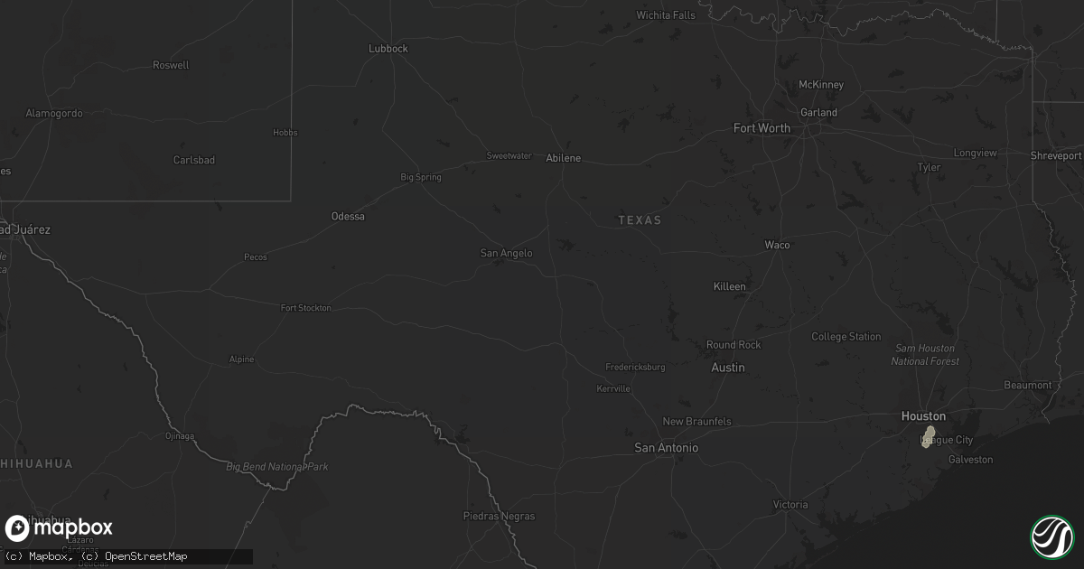
Hail Map in Texas on August 26, 2017
Get this storm
August 26 map
$229
one time, instant access
Download today. No call, no setup
Keep the $229
Bought the map and want the full workflow? Apply the entire $229 to a subscription within 7 days. None of it is wasted.
Every map, not just this one
This buys you this map. Subscription and you get every map we run, in the markets you choose from a few cities to whole states to nationwide. Plus real-time alerts the moment a storm fires.
Contact data
Name, contact info, occupancy, even credit band for addresses in the footprint. You go from where it hit to who to call.
Become the source they trust
Unlimited branding weather history reports on demand. You already have the documented answer ready for the property owner, and you are the one who showed up with it.
Property data and RoofTrace estimates
Pull up any address you have got, its value and the exact code rules for that jurisdiction, straight from One Click Code. Then RoofTrace estimates the squares, pitch, and roof value, priced the way you price.
Storm reports in Texas
Texas
| Date | Description |
|---|---|
| 08/26/20175:32 PM CDT | The tornado began as a weak ef-0 in downtown east bernard and then traveled northwest across alt hwy 90 where it strengthened to an ef-1 snapping several large mature o |
| 08/26/20175:30 PM CDT | Trees down se-nw path... Damaged home and horse trailer overturned |
| 08/26/20175:23 PM CDT | Trees down se-nw path...damaged home and horse trailer overturned. |
| 08/26/20174:30 PM CDT | Public reports trees down and debris in the moffitt community via ktre facebook page. |
| 08/26/20174:27 PM CDT | Another tornado confirmed on the ground in the vicinity of highway 290 and barker cypress |
| 08/26/20174:23 PM CDT | Tornado confirmed via social media |
| 08/26/20174:10 PM CDT | Another tornado confirmed on the ground in the vicinity of highway 290 and barker cypress. |
| 08/26/20174:08 PM CDT | Trees blown over and minor roof damage reported near barker cypress and tuckerton |
| 08/26/20173:52 PM CDT | Trees blown over and minor roof damage reported near barker cypress and tuckerton. |
| 08/26/20172:55 PM CDT | Fire station employee reported seeing a possible tornado near honey island... Tx |
| 08/26/20178:05 AM CDT | Tree damage reported near olympia buddy road. Possible brief spin up. |
| 08/26/20177:44 AM CDT | Broadcast media reporting tornado touchdown resulting in roof... Tree... And fence damage in lakeshore subdivision |
| 08/26/20174:15 AM CDT | Tornado sighting near spencer highway and underwood road in la porte heading north. |
| 08/26/20174:05 AM CDT | Short damage path. Trees down...minor damage to roof. |
| 08/26/20172:22 AM CDT | Dual eyewitness reports of a tornado at the windsor estates apartments off of the emmett lowry freeway. |
| 08/26/20171:42 AM CDT | Four apartments damaged in east bernard |
| 08/26/20171:42 AM CDT | The tornado began as a weak ef-0 in downtown east bernard and then traveled northwest across alt hwy 90 where it strengthened to an ef-1 snapping several large mature o |
| 08/26/201712:03 AM CDT | Nws employee reports the awning on a gas station ripped and flipped over at the dude mart on el camino real just north of nasa 1 |
| 08/26/201712:00 AM CDT | Nws employee reports the awning on a gas station ripped and flipped over. Funnel cloud sighted. |
| 08/25/20179:54 PM CDT | Sheriffs dept reports tree down. |
| 08/25/20178:23 PM CDT | Damage to 28 homes reported in the woodland west subdivision |
| 08/25/20178:23 PM CDT | Tornado sighted at the 800 block of robins way. |
| 08/25/20178:15 PM CDT | Damage to 28 homes reported in the woodland west subdivision. Damage path extends into missouri city. High end ef1 damage in spots. Tornado on ground for estimated 15 m |
All States Impacted by Hail Map on August 26, 2017
Cities Impacted by Hail Map on August 26, 2017
- Midland, SD
- Hastings, NE
- Doniphan, NE
- Karval, CO
- White River, SD
- Long Valley, SD
- Norris, SD
- Belvidere, SD
- Philip, SD
- Kadoka, SD
- Mankato, KS
- Piedmont, SD
- Brewster, NE
- Ainsworth, NE
- Ruthven, IA
- Ayrshire, IA
- Dickens, IA
- Webb, IA
- Trumbull, NE
- Hyannis, NE
- Thedford, NE
- Elgin, ND
- New Leipzig, ND
- Trenton, NE
- Atwood, KS
- Whitman, NE
- Pocahontas, IA
- Rapid City, SD
- Gordon, NE
- Merriman, NE
- Arnold, NE
- Superior, NE
- Benkelman, NE
- Wauneta, NE
- Valentine, NE
- Enning, SD
- Johnstown, NE
- Sturgis, SD
- Deadwood, SD
- Whitewood, SD
- Spearfish, SD
- Saint Onge, SD
- Belle Fourche, SD
- Alliance, NE
- Mott, ND
- Milesville, SD
- Callaway, NE
- Elm Creek, NE
- Howes, SD
- Wall, SD
- Okreek, SD
- Mission, SD
- Wood, SD
- Murdo, SD
- Hayes, SD
- Fort Pierre, SD
- Okaton, SD
- Anselmo, NE
- Broken Bow, NE
- Cherry Creek, SD
- Union Center, SD
- Mud Butte, SD
- White Owl, SD
- Newell, SD
- Chadron, NE
- Palmer, IA
- North Loup, NE
- Ord, NE
- Fairburn, SD
- Oral, SD
- Buffalo Gap, SD
- Hermosa, SD
- Pine Ridge, SD
- Keystone, SD
- Burwell, NE
- Taylor, NE
- Grand Island, NE
- Alda, NE
- Ludell, KS
- Stratton, NE
- Palisade, NE
- Farwell, NE
- Oconto, NE
- Max, NE
- Bird City, KS
- Ashton, NE
- Litchfield, NE
- Ansley, NE
- Arcadia, NE
- Elyria, NE
- Loup City, NE
- Burr Oak, KS
- Parmelee, SD
- Lexington, NE
- Burlington, CO
- Merna, NE
- Cozad, NE
- Gothenburg, NE
- Hemingford, NE
- Lawrence, NE
- Deweese, NE
- Nelson, NE
- Guide Rock, NE
- Smithfield, NE
- Bertrand, NE
- Eddyville, NE
- Elba, NE
- Inland, NE
- Juniata, NE
- Harvard, NE
- Orleans, NE
- Faith, SD
- Cody, NE
- Black Hawk, SD
- Nemo, SD
- Boelus, NE
- Dannebrog, NE
- Glenvil, NE
- Milligan, NE
- Columbus, NE
- Hay Springs, NE
- Ellsworth, NE
- Goodland, KS
- Batesland, SD
- Comstock, NE
- Shelby, NE
- Genoa, NE
- Osceola, NE
- Silver Creek, NE
- Saint Paul, NE
- Stapleton, NE
- Dunning, NE
- Halsey, NE
- Beloit, KS
- Holdrege, NE
- Sumner, NE
- Amherst, NE
- Miller, NE
- Mason City, NE
- Purdum, NE
- Overton, NE
- Seneca, NE
- Mullen, NE
- Bowman, ND
- Tobias, NE
- Western, NE
- Weston, NE
- Swanton, NE
- Wilber, NE
- Riverdale, NE
- De Witt, NE
- Red Cloud, NE
- Fullerton, NE
- Sidney, IA
- Washta, IA
- Correctionville, IA
- Norton, KS
- Chapman, NE
- Phillips, NE
- Giltner, NE
- Kilgore, NE
- Wood Lake, NE
- Edgar, NE
- Wood River, NE
- Aurora, NE
- Fairfield, NE
- Clay Center, NE
- Kearney, NE
- Paullina, IA
- Sutherland, IA
- Larrabee, IA
- Rolfe, IA
- Mallard, IA
- Sargent, NE
- Sparks, NE
- Madrid, NE
- Havelock, IA
- Winner, SD
- Manvel, TX
- Alvin, TX
- Houston, TX
- Pearland, TX
- Westerville, NE
- Rising City, NE
- Ravenna, NE
- Shelton, NE
- Gilmore City, IA
- Springview, NE
- Atlanta, NE
- Alma, NE
- Hunter, KS
- Sylvan Grove, KS
- Arapahoe, CO
- Sutton, NE
- Almena, KS
- Cairo, NE
- Rockville, NE
- Kingsley, IA
- Pierson, IA
- Moville, IA
- Oelrichs, SD
- Greenville, IA
- Indianola, NE
- Ceresco, NE
- Barnard, KS
- Bassett, NE
- Long Pine, NE
- Logan, KS
- Milford, IA
- Saint Libory, NE
- David City, NE
- Gillett Grove, IA
- Spencer, IA
- Herndon, KS
- Culbertson, NE


