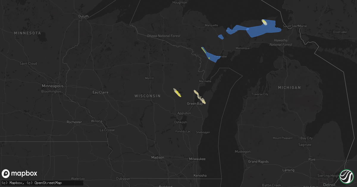
Hail Map on August 25, 2023
Get this storm
August 25 map
$229
one time, instant access
Download today. No call, no setup
Keep the $229
Bought the map and want the full workflow? Apply the entire $229 to a subscription within 7 days. None of it is wasted.
Every map, not just this one
This buys you this map. Subscription and you get every map we run, in the markets you choose from a few cities to whole states to nationwide. Plus real-time alerts the moment a storm fires.
Contact data
Name, contact info, occupancy, even credit band for addresses in the footprint. You go from where it hit to who to call.
Become the source they trust
Unlimited branding weather history reports on demand. You already have the documented answer ready for the property owner, and you are the one who showed up with it.
Property data and RoofTrace estimates
Pull up any address you have got, its value and the exact code rules for that jurisdiction, straight from One Click Code. Then RoofTrace estimates the squares, pitch, and roof value, priced the way you price.
States Impacted by Hail Map on August 25, 2023
Storm reports
Louisiana
| Date | Description |
|---|---|
| 08/25/20234:55 PM CDT | Tree down on bellwood street near hwy. 117 in provencal. Damaging winds also removed shingles from that area as well. |
| 08/25/20234:15 PM CDT | Several trees downed along with powerlines from near many... South and southwest across the parish to west of florien to east of the clare community. |
District of Columbia
| Date | Description |
|---|---|
| 08/25/20234:55 PM CDT | There were reports of tree damage in the kingman park neighborhood of washington dc... Including a tree that blew down blocking an alley in the 1600 block of f street n |
New Mexico
| Date | Description |
|---|---|
| 08/24/20237:10 PM CDT | Delayed report... Mesonet station nm008 lordsburg playa i10 mp7 |
Michigan
| Date | Description |
|---|---|
| 08/25/20233:20 PM CDT | Image from social media of damage to tree in hardwood... Mi. Time estimated via radar. |
| 08/25/20232:27 PM CDT | Corrects previous tstm wnd dmg report from 4 nnw sands. Portion of a maple tree broke off about 10 feet up and was over the road in the feather ridge subdivision. |
| 08/25/20232:27 PM CDT | Tree down over the road in the feather ridge subdivision. |
Mississippi
| Date | Description |
|---|---|
| 08/25/20234:00 PM CDT | Report of trees downed on hwy 25 northbound. |
Florida
| Date | Description |
|---|---|
| 08/25/20236:50 PM CDT | Local law enforcement reported trees blocking the road across us 90. |
| 08/25/20236:45 PM CDT | Local law enforcement reported trees blocking n. Hwy 53. |
| 08/25/20236:45 PM CDT | Local law enforcement reported a few trees blocking hwy 150. |
| 08/24/202311:18 PM CDT | Jefferson county dispatch reported a downed large tree fully blocking 227 wb on i-10. |
| 08/24/202311:05 PM CDT | Jefferson county dispatch reported a downed tree blocking 1 lane on big joe rd & east washington hwy. |
| 08/24/20237:14 PM CDT | A tree blew down into the westbound lanes of i-10 at mm 241... Striking a truck. |
Maryland
| Date | Description |
|---|---|
| 08/25/20235:15 PM CDT | Multiple trees snapped east of shaffer mill rd. Near manchester. |
Minnesota
| Date | Description |
|---|---|
| 08/25/202312:30 PM CDT | Report of debris over a ramp at exit 242 along interstate 35. Also a report of two large trees about 12 inches in diameter down in esko. |
| 08/25/202312:30 PM CDT | Report of debri |
| 08/25/202312:09 PM CDT | Corrects time of previous tstm wnd dmg report from esko. Report of debris over a ramp at exit 242 along interstate 35. Also a report of two large trees about 12 inches |
Idaho
| Date | Description |
|---|---|
| 08/24/20238:00 PM CDT | Mesonet station pc371 medicine lodge. |
Kansas
| Date | Description |
|---|---|
| 08/25/20236:56 PM CDT | A local report indicates 58 MPH wind near Phillipsburg Airport |
| 08/25/20236:51 PM CDT | Kansas state mesonet site. |
| 08/25/20236:49 PM CDT | A local report indicates 64 MPH wind near 3 WSW Woodruff |
| 08/25/20236:49 PM CDT | Corrects previous non-tstm wnd gst report from 1 nnw norton. Awos station knrn norton. Dialed in. |
| 08/25/20236:30 PM CDT | Corrects previous hail report from 4 n plainville. On highway 183 between plainville and stockton. |
| 08/25/20236:30 PM CDT | Mesonet station lcrk1 la crosse. |
| 08/25/20236:30 PM CDT | Asos station khlc hill city. |
| 08/25/20236:30 PM CDT | Corrects previous hail report from 4 n plainville. On highway 183 between plainv |
| 08/25/20236:30 PM CDT | On highway 183 between plainville and stockton. |
| 08/25/20236:25 PM CDT | Delayed report of 10 inch tree limb down from friday storm. Time estimated via radar. |
| 08/25/20236:18 PM CDT | Awos station knrn norton sustained winds at 42 knots. |
| 08/25/20236:02 PM CDT | Ksu mesonet site southwest of norton... Ks. |
| 08/25/20235:57 PM CDT | Delayed report of estimated 50-60 mph wind gusts. |
| 08/25/20235:32 PM CDT | Delayed report of hail up to golf ball size from yesterdays storm. |
| 08/25/20235:10 PM CDT | Delayed report of 50-60 mph winds. Time estimated via radar. |
| 08/25/20235:04 PM CDT | Golf ball sized hail reported 8 wnw of oberlin that lasted for 3 minutes. 1.5 inches of rain has been recorded on a pws. |
| 08/24/20238:10 PM CDT | A local report indicates 61 MPH wind near Russell Airport |
| 08/24/20237:18 PM CDT | A local report indicates 60 MPH wind near 5 W Agra |
| 08/24/20237:01 PM CDT | Heavy rain... Measured 59 mph with anemometer... Zero visibility. Dime size hail. |
Nebraska
| Date | Description |
|---|---|
| 08/25/20235:14 PM CDT | A local report indicates 1.00 inch wind near 6 S Nelson |
| 08/25/20234:35 PM CDT | Public report of quarter sized hail. |
| 08/25/20234:00 PM CDT | Mesonet station knestock2. |
| 08/25/20233:52 PM CDT | A local report indicates 1.00 inch wind near 3 NW Stockville |
| 08/25/20233:22 PM CDT | Estimated 55 to 60 mph winds... Heavy rain and sporadic pea size hail. |
| 08/25/202312:40 AM CDT | Several tree limbs down. |
| 08/25/202312:28 AM CDT | Personal weather stationed measured a peak wind gust of 69 mph. |
| 08/24/202311:20 PM CDT | Numerous power outages and 2 to 3 inch diameter branches down. |
| 08/24/202311:15 PM CDT | Emergency management reported a peak wind gust of 68 mph. |
| 08/24/202311:00 PM CDT | Via davis weatherlink. |
| 08/24/202310:56 PM CDT | Via davis weatherlink. |
| 08/24/202310:55 PM CDT | Em reports significant damage to the roof on pioneer inn in gilead. Time estimated from radar. |
| 08/24/202310:55 PM CDT | Via davis weatherlink. |
| 08/24/202310:40 PM CDT | Em reports widespread crop damage south of gilead extending to hubbell. Over 5 inches of rain from storms. Time estimated from radar. |
Indiana
| Date | Description |
|---|---|
| 08/25/20234:38 PM CDT | Tree down on state rd 67 between bicknell and edwardsport. Time estimated from radar. |
| 08/25/20234:18 PM CDT | Tree down on old 41 at taylor rd... South of oaktown. |
| 08/25/20232:15 AM CDT | Reports of a few trees and wires down in evansville. |
| 08/25/20232:13 AM CDT | Tree down on a house in newburgh. Powerlines down at oak grove rd and 261 in newburgh. |
| 08/25/20231:28 AM CDT | House roof off... Barn damaged... Trees down. |
| 08/25/20231:25 AM CDT | Trees down across the county. |
| 08/24/202311:45 PM CDT | Tree damage reported in bloomington. Time estimated from radar. |
| 08/24/202311:30 PM CDT | Multiple 4-ft diameter trees down in and around hazelwood. |
| 08/24/202311:17 PM CDT | Sr 340 and us 40 at brazil....55 to 60 mph wind gust. |
| 08/24/20237:28 PM CDT | Delayed report of trees down on perrin lane in jeffersonville. |
Alabama
| Date | Description |
|---|---|
| 08/25/20233:31 PM CDT | Several trees blown down on red oak rd near hwy 13 from an apparent microburst. |
Georgia
| Date | Description |
|---|---|
| 08/25/20235:50 PM CDT | Roof blown off pawn shop... Trees down in yard. |
| 08/25/20235:50 PM CDT | Trees and power lines down with a roof blown off of a building. |
Kentucky
| Date | Description |
|---|---|
| 08/25/20236:49 PM CDT | Delayed report of large tree down on brashears creek rd. |
| 08/25/20236:45 PM CDT | Delayed report. 2 large trees heavily damaged near taylorsville rd. |
| 08/25/20236:13 PM CDT | Delayed report of tree down on ashby rd. |
| 08/25/20236:10 PM CDT | Delayed report of tree down on johnson rd. |
| 08/25/20236:06 PM CDT | Delayed report of tree down on pisgah pike. |
| 08/25/20235:40 PM CDT | Ky mesonet site wadd measured 83 mph wind gust. |
| 08/25/20235:25 PM CDT | Multiple reports of power lines down in lexington. |
| 08/25/20235:25 PM CDT | Delayed report of trees down on midway rd. |
| 08/25/20235:25 PM CDT | Large tree down on crawley lane. |
| 08/25/20235:05 PM CDT | Multiple reports of trees down across georgetown and scott county. Power outages also reported across the county. Time estimated from radar. |
| 08/25/20234:55 PM CDT | Delayed report of tree down on johnson rd. |
| 08/25/20234:44 PM CDT | Delayed report. Report from mping of 1-inch tree limbs broken; shingles blown off. |
| 08/25/20234:30 PM CDT | Tree down on fork lick road. Time estimated from radar. |
| 08/25/20234:02 PM CDT | Delayed report of tree down on concord rd. |
| 08/25/20233:58 PM CDT | Trees down on claxton ridge road. Time estimated from radar. |
| 08/25/20233:58 PM CDT | Tree down on clarks creek road. Time estimated from radar. |
| 08/25/20233:54 PM CDT | Corrects previous tstm wnd dmg report from 5 wsw union. Tree down on big bone church road. Time estimated from radar. |
| 08/25/20233:43 PM CDT | Tree down on camp ernst road. Time estimated from radar. |
| 08/25/20233:26 PM CDT | Numerous trees down reported south of falmouth. Time estimated from radar. |
| 08/25/20233:26 PM CDT | Corrects previous tstm wnd dmg report from 4 s falmouth. Numerous trees down reported south of falmouth. Time estimated from radar. |
| 08/25/20233:26 PM CDT | Corrects previous tstm wnd dmg report from 5 sse falmouth. Corrects previous tstm wnd dmg report from 4 s falmouth. Numerous trees down reported south of falmouth. Time |
| 08/25/20233:09 PM CDT | Tree down on 165 off of 19. Time estimated from radar. |
| 08/25/20233:00 PM CDT | Tree reported down along route 650 about 2 miles from route 172. |
| 08/25/20231:06 PM CDT | Menifee county dispatch reported a tree down near the 90 block of indian creek rd. Time estimated from radar. |
| 08/25/202312:55 PM CDT | Menifee county dispatch reported a tree down near the 1400 block of tom stamper rd. Time estimated from radar. |
| 08/25/20232:25 AM CDT | Several trees and powerlines down in e |
| 08/25/20232:25 AM CDT | Several trees and powerlines down in eastern henderson county. |
| 08/25/20232:25 AM CDT | Several trees and powe |
| 08/24/20238:02 PM CDT | Delayed report of power lines down near north preston highway. |
| 08/24/20237:53 PM CDT | Delayed report... Two trees down on cooper chapel rd at beulah church rd. Time estimated from radar. |
| 08/24/20237:19 PM CDT | Reported at klou. |
| 08/24/20237:19 PM CDT | About 30 trees lost at oxmoor country club. Winds estimated around 65 mph. |
| 08/24/20237:12 PM CDT | Multiple trees and power lines down in the county. |
| 08/24/20237:00 PM CDT | Multiple large trees down on arlington court. Reported by private sector meteorologist. |
Illinois
| Date | Description |
|---|---|
| 08/25/20236:52 PM CDT | 30 inch tree limb down near us 136 and curless rd... Just west of havana. |
| 08/25/20236:31 PM CDT | 8 to 12 inch tree limb down. |
| 08/25/20236:20 PM CDT | Trees and power lines downed on garfield st. |
| 08/25/20234:35 PM CDT | Tree limbs and power lines down. |
| 08/25/20233:05 PM CDT | Multiple trees reported down near coffeen. Location and time estimated. |
| 08/24/202310:18 PM CDT | Large tree branches down. Time estimated from radar. |
| 08/24/20239:56 PM CDT | Large tree branches down. |
| 08/24/20239:04 PM CDT | A local report indicates 60 MPH wind near 2 SE Forsyth |
| 08/24/20238:58 PM CDT | On 1900 east rd...12 to 18 inch tree limbs downed. Delayed report via social media. Time estimated from radar. |
| 08/24/20238:55 PM CDT | 6 inch tree limbs down. |
| 08/24/20238:52 PM CDT | Multiple tree limbs down. |
| 08/24/20238:40 PM CDT | Multiple large trees down... Roads blocked in funks grove. |
| 08/24/20238:36 PM CDT | Trees down. Time estimated from radar. |
| 08/24/20238:28 PM CDT | Roof damage at high school. Time estimated from radar. |
| 08/24/20238:25 PM CDT | A local report indicates 62 MPH wind near 2 N Delavan |
| 08/24/20238:21 PM CDT | Trees down. Time estimated from radar. |
| 08/24/20238:21 PM CDT | Multiple trees down. |
| 08/24/20238:21 PM CDT | Multiple large branches snapped off of trees across the street from the cocorahs observer site. |
| 08/24/20238:16 PM CDT | Trees down. Time estimated from radar. |
| 08/24/20238:13 PM CDT | Large garage or outbuilding collapsed. |
| 08/24/20238:10 PM CDT | 6 in tree branch down near toboggan ave and hackney ln. |
| 08/24/20237:44 PM CDT | Several broken limbs and a few whole trees snapped in mason city. Town currently without power. |
Virginia
| Date | Description |
|---|---|
| 08/25/20236:35 PM CDT | There were several reports of trees and wires down around mclean. A tree blew down blocking va-309 old dominion drive near holmes place. A tree blew down onto wires on |
| 08/25/20236:33 PM CDT | A large tree branch was reported blocking part of the roadway near reston parkway and fox mill rd. |
| 08/25/20236:33 PM CDT | A larg |
| 08/25/20235:50 PM CDT | A lamp pole was reported down at the intersection of tavern drive and jersey mills place in ashburn. |
| 08/25/20235:10 PM CDT | A few trees and branches blew down near lovettsville and waterford... Including a tree that blew down into the roadway on va-692 rickford road near va-287 berlin turnpi |
Ohio
| Date | Description |
|---|---|
| 08/25/20233:16 PM CDT | 3-inch tree limbs broken. |
| 08/25/202312:05 PM CDT | A couple of downed trees. One tree uprooted and fallen on a structure. |
Missouri
| Date | Description |
|---|---|
| 08/25/20232:04 PM CDT | Report of shingles being blown off roof of house and some tree limbs down. |
| 08/25/20232:02 PM CDT | Tree limbs down. |
| 08/25/20232:00 PM CDT | Pictures sent in nwschat of tree down and roof damage. |
| 08/25/20232:53 AM CDT | A local report indicates 63 MPH wind near 1 NE Saint Joseph Airpo |
| 08/24/20237:06 PM CDT | Several reports of tree damage in the newberry subdivision. Time estimated from radar. |
Oklahoma
| Date | Description |
|---|---|
| 08/25/20233:35 PM CDT | Several tree limbs down on e 86th street north... Just east of bird creek. Time estimated from radar. |
Cities Impacted by Hail Map on August 25, 2023
- Moriarty, NM
- Encino, NM
- Frenchburg, KY
- Wellington, KY
- Denniston, KY
- Ezel, KY
- Morehead, KY
- Branchland, WV
- Hurricane, WV
- Winfield, WV
- Scott Depot, WV
- Hamlin, WV
- West Hamlin, WV
- Red House, WV
- Ranger, WV
- Midkiff, WV
- Spurlockville, WV
- Alkol, WV
- Means, KY
- Drift, KY
- Printer, KY
- Culloden, WV
- Griffithsville, WV
- Yawkey, WV
- Sumerco, WV
- Sod, WV
- Barboursville, WV
- Huntington, WV
- Salt Rock, WV
- Blue River, KY
- Prestonsburg, KY
- Martin, KY
- Langley, KY
- Clearfield, KY
- Olive Hill, KY
- Sandy Hook, KY
- Birch Tree, MO
- Alton, MO
- West Liberty, KY
- Goodman, MS
- Sallis, MS
- Pickens, MS
- Owingsville, KY
- Hillsboro, IL
- Irving, IL
- Fillmore, IL
- Coffeen, IL
- South Webster, OH
- Minford, OH
- Portsmouth, OH
- Palisade, NE
- Stratton, NE
- Falmouth, KY
- Foster, KY
- Brooksville, KY
- Mount Olivet, KY
- Germantown, KY
- Ewing, KY
- Mayslick, KY
- Skandia, MI
- Trenary, MI
- Shingleton, MI
- Munising, MI
- Au Train, MI
- Wetmore, MI
- Iron Mountain, MI
- Foster City, MI
- Rapid River, MI
- Hermansville, MI
- Perronville, MI
- Newberry, MI
- Manistique, MI
- Paradise, MI
- Eckerman, MI
- Seney, MI
- McMillan, MI
- Grand Marais, MI
- Bark River, MI
- Spalding, MI
- Wilson, MI
- Powers, MI
- Escanaba, MI
- Kinross, MI
- Hulbert, MI
- Germfask, MI
- Walton, KY
- Morning View, KY
- Independence, KY
- Hillsboro, KY
- De Mossville, KY
- Butler, KY
- Dry Ridge, KY
- Crittenden, KY
- Jonesville, KY
- Williamstown, KY
- Berry, KY
- Verona, KY
- Jeffersonville, KY
- Mount Sterling, KY
- Hope, KY
- Salt Lick, KY
- Olympia, KY
- Stockville, NE
- Curtis, NE
- Moorefield, NE
- Corinth, KY
- Brimley, MI
- Carney, MI
- Eustis, NE
- Mountainburg, AR
- Alma, AR
- Sadieville, KY
- Owenton, KY
- Georgetown, KY
- Stamping Ground, KY
- Cynthiana, KY
- Rudy, AR
- Mason, IL
- Edgewood, IL
- Louisville, IL
- Clay City, IL
- Ingraham, IL
- Herndon, KS
- Oberlin, KS
- Norton, KS
- Norcatur, KS
- Superior, NE
- Nelson, NE
- Phillipsburg, KS
- Prairie View, KS
- Almena, KS
- Clayton, KS
- Jennings, KS
- Wilsonville, NE
- Shelbyville, KY
- Waddy, KY
- Mount Eden, KY
- Plainville, KS
- Stockton, KS
- Hendley, NE
- Beaver City, NE
- Lenora, KS
- Maysville, KY
- Flemingsburg, KY
- Vanceburg, KY
- Saint Elmo, IL
- Brownstown, IL
- Scotia, NE
- Bagdad, KY
- Carlisle, KY
- Carthage, MS
- Manchester, OH
- Red Bud, IL
- Elnora, IN
- Myra, WV
- Billingsley, AL
- Paris, KY
- McCook, NE
- Stanton, KY
- Enterprise, LA
- Columbia, LA
- Harrisonburg, LA
- Jackson, OH
- Lawrence, NE
- Florien, LA
- Robeline, LA
- Provencal, LA
- Trenton, NE
- Stockton, MO
- Denton, GA
- Hazlehurst, GA
- Bedford, KY
- Hanover, IN
- Milton, KY
- Versailles, KY
- Frankfort, KY
- Wallingford, KY
- Danbury, NE
- Atwood, KS
- Ludell, KS
- Lebanon, MO
- Oxford, NE
- Orleans, NE
- Many, LA
- McDonald, KS
- Hemphill, TX
- Brandon, MS
- Lena, MS
- Morton, MS
- Smithfield, KY
- La Grange, KY
- Pendleton, KY
- Fort Necessity, LA
- Winnsboro, LA
- Culbertson, NE
- Eminence, KY
- Searcy, AR
- Judsonia, AR
- Pleasureville, KY
- Waynesville, MO
- Laquey, MO
- Oaktown, IN
- Clay City, KY
- Brookeland, TX
- Delhi, LA
- Chester, AR
- Oak Hill, OH
- Sharpsburg, KY
- Zwolle, LA
- Tullos, LA
- Commiskey, IN
- Deputy, IN
- Marion, AL
- Long Island, KS
- Walsenburg, CO
- Wilber, NE
- Tollesboro, KY
- Jesup, GA
- Hayes Center, NE
- Lexington, KY
- Ashland, LA
- Tallulah, LA
- North Vernon, IN
- Seymour, IN
- Duncanville, AL
- Tuscaloosa, AL
- Broxton, GA
- Edwards, MO
- Willow Springs, MO
- Madison, IN
- Beecher City, IL
- Moorefield, KY
- Sondheimer, LA
- Winchester, KY
- Lumber City, GA
- Fisher, LA
- Baxley, GA
- North Loup, NE
- Hermitage, MO
- Pomona, MO
- West Plains, MO
- Ambrose, GA
- Finchville, KY
- Louise, MS
- Marion Junction, AL
- La Crosse, KS
- Rush Center, KS
- Shawano, WI
- Stamford, NE
- Kensington, KS
- Republican City, NE
- Smith Center, KS
- Alma, NE
- Agra, KS
- Athol, KS
- Delavan, IL
- Hartsburg, IL
- Green Valley, IL
- Emden, IL
- San Jose, IL
- Hopedale, IL
- McLean, IL
- Atlanta, IL
- Stanford, IL
- Tremont, IL
- Shirley, IL
- Armington, IL
- Minier, IL
- Bloomington, IL
- Heyworth, IL
- Downs, IL
- Elkhart, IL
- Mount Pulaski, IL
- Lincoln, IL
- Williamsville, IL
- Kenney, IL
- Buffalo, IL
- Latham, IL
- Maroa, IL
- Warrensburg, IL
- Chestnut, IL
- Oreana, IL
- Argenta, IL
- Cisco, IL
- Niantic, IL
- Decatur, IL
- Macon, IL
- Harristown, IL
- Mt Zion, IL
- Forsyth, IL
- Boody, IL
- Mount Auburn, IL
- Illiopolis, IL
- Moweaqua, IL
- Blue Mound, IL
- Gorham, KS
- Russell, KS
- Monticello, IL
- Dalton City, IL
- Cerro Gordo, IL
- Bement, IL
- La Place, IL
- Ivesdale, IL
- Milmine, IL
- Lovington, IL
- Hammond, IL
- Villa Grove, IL
- Atwood, IL
- Sadorus, IL
- Pesotum, IL
- Tuscola, IL
- Arthur, IL
- Mattoon, IL
- Findlay, IL
- Charleston, IL
- Arcola, IL
- Gays, IL
- Trilla, IL
- Sullivan, IL
- Hindsboro, IL
- Bethany, IL
- Humboldt, IL
- Camargo, IL
- Windsor, IL
- Lerna, IL
- Redmon, IL
- Longview, IL
- Oakland, IL
- Kansas, IL
- Metcalf, IL
- Newman, IL
- Ashmore, IL
- Paris, IL
- Brocton, IL
- Clinton, IN
- Westfield, IL
- Chrisman, IL
- Murdock, IL
- Hume, IL
- Greenup, IL
- Marshall, IL
- Vermilion, IL
- Dennison, IL
- Martinsville, IL
- West Terre Haute, IN
- Casey, IL
- Washington, IN
- Morland, KS
- Lawrenceburg, KY
- Leavenworth, IN
- Wakeeney, KS
- Kyles Ford, TN
- Sneedville, TN
- Greencastle, IN
- Tylertown, MS
- Kokomo, MS
- Foxworth, MS
- Spearville, KS
- McCracken, KS
- Hays, KS
- Bardstown, KY
- Woodville, MS
- Orrville, AL
- Masonic Home, KY
- Louisville, KY
- Fillmore, IN
- Coatesville, IN
- Bainbridge, IN
- Oconto, WI
- Little Suamico, WI
- Abrams, WI
- New Franken, WI
- Mechanicsburg, IL
- Hillsdale, IN
- Rockville, IN
- Mecca, IN
- Montezuma, IN
- Hill City, KS
- Hanover, KS
- Gresham, WI
- Brazil, IN
- Carbon, IN
- Hermanville, MS
- Hazlehurst, MS
- Taylorsville, KY
- Utica, MS
- Pattison, MS
- Jackson, AL
- Athens, IL
- Rolling Fork, MS
- Hueysville, KY
- Luxemburg, WI
- Bicknell, IN
- Sylvan Grove, KS
- Dorrance, KS
- Easton, IL
- Valdosta, GA
- Quitman, GA
- Greenview, IL
- Clinton, LA
- Syracuse, KS
- Rosedale, IN
- Lucas, KS
- Casco, WI
- Kewaunee, WI
- Republic, KS
- Belleville, KS
- Garrison, KY
- Springfield, CO
- Uniontown, AL
- Newbern, AL
- Keokuk, IA
- Stilesville, IN
- New Holland, IL
- Catharine, KS
- Astoria, IL
- Collyer, KS
- Simpsonville, KY
- Mason City, IL
- Dawson, IL
- Middletown, IL
- Crestwood, KY
- Florence, MS
- Bison, KS
- Pritchett, CO
- Forest City, IL
- Topeka, IL
- Manito, IL
- Coxs Creek, KY
- Mount Washington, KY
- Willacoochee, GA
- Bloomfield, KY
- Garrett, KY
- Shepherdsville, KY
- Mayersville, MS
- Ipava, IL
- Lewistown, IL
- Salem, IN
- Scottsburg, IN
- Decatur, MS
- Conehatta, MS
- Mahomet, IL
- Champaign, IL
- Bridgeton, IN
- Dana, IN
- Utica, KS
- Fairdale, KY
- Concordia, KS
- Flat Rock, IL
- Urbana, IL
- Le Roy, IL
- Arrowsmith, IL
- Midway, KY
- Walnut Grove, MS
- Forest, MS
- Lake, MS
- Campton, KY
- Pearl, MS
- Richland, MS
- Green Bay, WI
- Washington, KS
- Browning, IL
- Wiggins, MS
- Trinidad, CO
- Bude, MS
- Meadville, MS
- Hamilton, IL
- Alexandria, MO
- Warsaw, IL
- Springfield, IL
- Clarksville, IN
- Jeffersonville, IN
- Glenview, KY
- Brooks, KY
- Borden, IN
- Floyds Knobs, IN
- Greenville, IN
- Georgetown, IN
- New Albany, IN
- Hebron, NE
- Chester, NE
- Hubbell, NE
- Gilead, NE
- Fairbury, NE
- Diller, NE
- Beatrice, NE
- Reynolds, NE
- Jansen, NE
- Wymore, NE
- Steele City, NE
- Endicott, NE
- Odell, NE
- Blue Springs, NE
- Bremen, KS
- Marysville, KS
- Hollenberg, KS
- Morrowville, KS
- Mahaska, KS
- Narka, KS
- Haddam, KS
- Knightsville, IN
- Staunton, IN
- New Goshen, IN
- Terre Haute, IN
- Universal, IN
- Wathena, KS
- Saint Joseph, MO
- Elwood, KS
- Sullivan, IN
- Pana, IL
- Plymouth, IL
- Homer, IL
- Litchfield, IL
- Robinson, IL
- Monroe City, MO
- Linton, IN
- West Point, IL
- Loraine, IL
- Mendon, IL
- Sutter, IL
- Assumption, IL
- Reelsville, IN
- Poland, IN
- Centerpoint, IN
- Carrollton, IL
- White Hall, IL
- Harvel, IL
- Morrisonville, IL
- Hidalgo, IL
- Willow Hill, IL
- Yale, IL
- Stoy, IL
- Annapolis, IL
- Palestine, IL
- Oblong, IL
- Sherman, IL
- Dahlgren, IL
- Belle Rive, IL
- Toledo, IL
- Teutopolis, IL
- Neoga, IL
- Sigel, IL
- Montrose, IL
- Jewett, IL
- Enfield, IL
- McLeansboro, IL
- Lakewood, IL
- Tower Hill, IL
- Taylorville, IL
- Wheatland, IN
- New Harmony, IN
- Mount Vernon, IN
- Spencer, IN
- Velpen, IN
- Esko, MN
- Cloquet, MN
- Boonville, IN
- West Baden Springs, IN
- Springerton, IL
- Switz City, IN
- Lyons, IN
- Oconee, IL
- Cowden, IL
- Cloverdale, IN
- Broughton, IL
- Stendal, IN
- Winslow, IN
- Petersburg, IN
- Otwell, IN
- Newburgh, IN
- Lynnville, IN
- Tennyson, IN
- Oakland City, IN
- Huntingburg, IN
- Wayne City, IL
- Hutsonville, IL
- Shelbyville, IL
- Hunnewell, MO
- Milltown, IN
- Owensboro, KY
- Reed, KY
- Gentryville, IN
- Dale, IN
- Farmer City, IL
- Clayton, IN
- Martinsville, IN
- Monrovia, IN
- Mooresville, IN
- Bowling Green, IN
- Cory, IN
- Clay City, IN
- Coal City, IN
- Freedom, IN
- New London, MO
- Frankford, MO
- Humboldt, NE
- Gosport, IN
- Paragon, IN
- Quincy, IN
- Riverton, IL
- Holly, CO
- Evansville, IN
- Spurgeon, IN
- Henderson, KY
- Spottsville, KY
- Chandler, IN
- Richland, IN
- Elberfeld, IN
- Baylis, IL
- Griggsville, IL
- Vincennes, IN
- Stewardson, IL
- Effingham, IL
- Dieterich, IL
- Ellettsville, IN
- Odon, IN
- Cantrall, IL
- Easton, MO
- Henley, MO
- Curryville, MO
- Shelbyville, MO
- Barry, IL
- New Canton, IL
- Butler, IL
- Hannibal, MO
- New Salem, IL
- Pittsfield, IL
- Nokomis, IL
- Center, MO
- Rosamond, IL
- Vandalia, MO
- Montgomery, IN
- Farina, IL
- Jasper, IN
- Santa Fe, MO