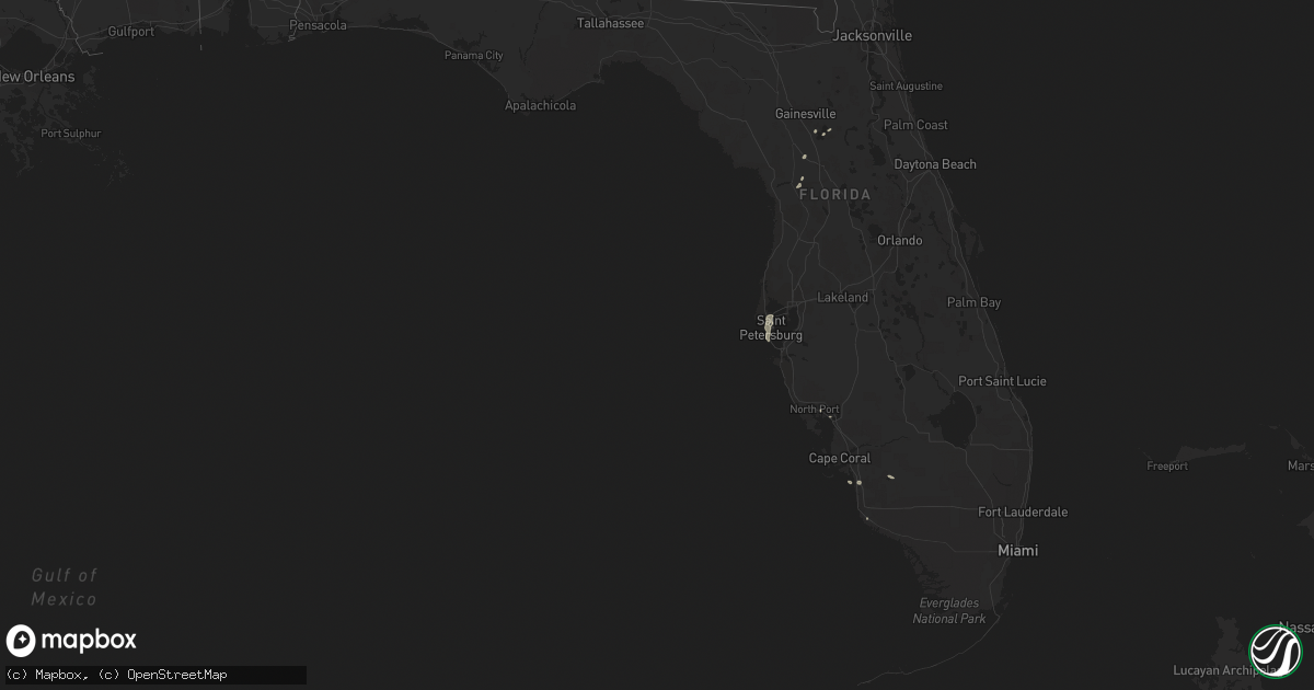
Hail Map in Florida on August 25, 2018
Get this storm
August 25 map
$229
one time, instant access
Download today. No call, no setup
Keep the $229
Bought the map and want the full workflow? Apply the entire $229 to a subscription within 7 days. None of it is wasted.
Every map, not just this one
This buys you this map. Subscription and you get every map we run, in the markets you choose from a few cities to whole states to nationwide. Plus real-time alerts the moment a storm fires.
Contact data
Name, contact info, occupancy, even credit band for addresses in the footprint. You go from where it hit to who to call.
Become the source they trust
Unlimited branding weather history reports on demand. You already have the documented answer ready for the property owner, and you are the one who showed up with it.
Property data and RoofTrace estimates
Pull up any address you have got, its value and the exact code rules for that jurisdiction, straight from One Click Code. Then RoofTrace estimates the squares, pitch, and roof value, priced the way you price.
Storm reports in Florida
Florida
| Date | Description |
|---|---|
| 08/25/20186:55 PM CDT | Marion county 911/dispatch reports a power pole downed across southeast 69th avenue in ocala. Time of damage based on radar data. |
| 08/25/20186:25 PM CDT | Marion county 911/dispatch reports a tree downed across the southbound lanes of southeast 36th avenue. Time of damage based on radar data. |
| 08/25/20184:30 PM CDT | Multiple trees and branches down. |
| 08/25/20184:20 PM CDT | Marion county 911/dispatch reports a tree down across tropical park road near the intersection of woodridge drive. Time of damage based on radar data. |
| 08/25/20184:20 PM CDT | Marion county 911/dispatch reports trees downed across the northbound lane of southwest 140th avenue near the intersection with state road 40. Time of damage based on r |
| 08/25/20184:05 PM CDT | Marion county 911/dispatch reports a tree downed across west highway 316 near the intersection of u.s. Highway 441 in the vicinity of citra. Time of damage based on rad |
| 08/25/201812:24 AM CDT | At 524 PM EDT, a severe thunderstorm was located over Pinellas Park, and is nearly stationary. HAZARD...60 mph wind gusts and quarter size hail. SOURCE...Radar indicated. IMPACT...Hail damage to vehicles is expected. Expect wind damage to roofs, siding, and trees. Locations impacted include... Clearwater, Largo, Pinellas Park, Seminole, Downtown Saint Petersburg, Saint Petersburg, St. Petersburg, Bay Pines, South Highpoint, Gandy, Feather Sound, West And East Lealman, Gulfport, Treasure Island, Kenneth City, South Pasadena, Madeira Beach, Tropicana Field, Sawgrass Lake Park and Vinoy Park. |
| 08/25/201812:12 AM CDT | At 512 PM EDT, a severe thunderstorm was located near Rainbow Lakes Estates, moving west at 10 mph. HAZARD...60 mph wind gusts and penny size hail. SOURCE...Radar indicated. IMPACT...Expect damage to roofs, siding, and trees. Locations impacted include... Rainbow Lakes Estates and Dunnellon. |
All States Impacted by Hail Map on August 25, 2018
Cities Impacted by Hail Map on August 25, 2018
- International Falls, MN
- Kindred, ND
- Davenport, ND
- Leonard, ND
- Tower City, ND
- Oriska, ND
- Buffalo, ND
- Clear Lake, MN
- Foley, MN
- Princeton, MN
- Eagle Butte, SD
- Hannaford, ND
- Wray, CO
- Vernon, CO
- Eckley, CO
- Fairborn, OH
- Dayton, OH
- Colby, KS
- Holly, CO
- Syracuse, KS
- Oak Park, MN
- Greenfield, IN
- Mccordsville, IN
- Ypsilanti, ND
- Littlefork, MN
- Greensburg, IN
- Fargo, ND
- Melrose, MN
- Bridgeport, NE
- Saint Petersburg, FL
- Dieterich, IL
- Indianapolis, IN
- Tappen, ND
- Panhandle, TX
- Kabetogama, MN
- Chisago City, MN
- Anoka, MN
- Wyoming, MN
- Zimmerman, MN
- Lindstrom, MN
- Stacy, MN
- Saint Francis, MN
- Scandia, MN
- Marine On Saint Croix, MN
- Forest Lake, MN
- Shafer, MN
- Elk River, MN
- Bethel, MN
- New Richmond, WI
- Osceola, WI
- Cedar, MN
- Isanti, MN
- Star Prairie, WI
- Buffalo Gap, SD
- Hot Springs, SD
- Freeport, MN
- Albany, MN
- Harrold, SD
- Ogilvie, MN
- Crane Lake, MN
- Orr, MN
- Big Falls, MN
- Loman, MN
- Fortville, IN
- Oral, SD
- Dupree, SD
- Richmond, IN
- Dalbo, MN
- Braham, MN
- Shelbyville, IN
- New Palestine, IN
- Sunman, IN
- Manilla, IN
- Milroy, IN
- Napoleon, IN
- Oldenburg, IN
- Arlington, IN
- Fountaintown, IN
- Metamora, IN
- Laurel, IN
- Morristown, IN
- Moores Hill, IN
- Milan, IN
- Homer, IN
- Waldron, IN
- Osgood, IN
- Rushville, IN
- Fairland, IN
- Batesville, IN
- Courtenay, ND
- Wimbledon, ND
- Cooperstown, ND
- Skellytown, TX
- Horace, ND
- Steele, ND
- Amenia, ND
- Harwood, ND
- Absaraka, ND
- Pingree, ND
- Barnesville, MN
- Mapleton, ND
- Ayr, ND
- Comstock, MN
- Moorhead, MN
- Woodworth, ND
- Valley City, ND
- Fingal, ND
- Casselton, ND
- West Fargo, ND
- Sanborn, ND
- Sabin, MN
- Dawson, ND
- Wolverton, MN
- Wheatland, ND
- Litchville, ND
- Christine, ND
- Jamestown, ND
- Spiritwood, ND
- Medina, ND
- Kathryn, ND
- Pettibone, ND
- Cleveland, ND
- Buchanan, ND
- Marion, ND
- Ocala, FL
- Morriston, FL
- Meadow, SD
- Timber Lake, SD
- Glencross, SD
- Isabel, SD
- Trail City, SD
- Coolidge, KS
- Sheridan Lake, CO
- Saint Francis, KS
- Evansville, MN
- Richwood, OH
- Prospect, OH
- Dumont, MN
- Stanchfield, MN
- Maxwell, IN
- Ingalls, IN
- Glenwood, IN
- Brownsburg, IN
- Dillsboro, IN
- Carthage, IN
- Wilkinson, IN
- Pendleton, IN
- Fishers, IN
- Warroad, MN
- Peever, SD
- Bison, SD
- Yuma, CO
- Fritch, TX
- Spiceland, IN
- Knightstown, IN
- Saint Cloud, MN
- Upper Sandusky, OH
- Carey, OH
- Huntington, IN
- Stinnett, TX
- Bonita Springs, FL
- Sauk Rapids, MN
- Rice, MN
- Carrington, ND
- Holdingford, MN
- Robinson, ND
- Dimmitt, TX
- Carlos, MN
- Alexandria, MN
- Immokalee, FL
- Sartell, MN
- Pease, MN
- Milaca, MN
- Pine City, MN
- Rush City, MN
- Avon, MN
- Mora, MN
- Saint Stephen, MN
- Grantsburg, WI
- Saint Joseph, MN
- Foreston, MN
- Hawthorne, FL
- Beardsley, MN
- Verona, OH
- Englewood, OH
- Lewisburg, OH
- West Manchester, OH
- Arcanum, OH
- Brookville, OH
- Clayton, OH
- Hancock, MN
- Columbia City, IN
- Akron, CO
- Fort Wayne, IN
- Roanoke, IN
- Cathay, ND
- Salol, MN
- Micanopy, FL
- Aurora, IN
- Starbuck, MN
- Glenwood, MN
- Becker, MN
- Monticello, MN
- Big Lake, MN
- Punta Gorda, FL
- Port Charlotte, FL
- Pampa, TX
- Parks, NE
- Cambridge, MN
- Hitchcock, SD
- Joes, CO
- Cope, CO
- Murdo, SD
- Mount Victory, OH
- Lebanon, IN
- Kirklin, IN
- Donnelly, MN
- Morris, MN
- Sauk Centre, MN
- Grey Eagle, MN
- Churubusco, IN
- Saint Croix Falls, WI
- North Branch, MN
- Harris, MN
- Cushing, WI
- Custer, SD
- Finley, ND
- Borger, TX
- Vivian, SD
- Graceville, MN
- Browns Valley, MN
- Sisseton, SD
- Buffalo, SD
- Lower Brule, SD
- Thorntown, IN
- Holyoke, CO
- Glenham, SD
- New Madison, OH
- Driscoll, ND
- Herman, MN
- Chokio, MN
- Sheridan, IN
- Westfield, IN
- Zionsville, IN
- Whitestown, IN
- Anderson, IN
- Long Valley, SD
- Delphi, IN
- Elbow Lake, MN
- Barrett, MN
- Trail, MN
- Gully, MN
- Plummer, MN
- Laotto, IN
- Presho, SD
- Las Animas, CO
- Frankfort, IN
- Luck, WI
- Raymond, OH
- Fort Myers Beach, FL
- Rising Sun, IN
- La Rue, OH
- New Bloomington, OH
- Marion, OH
- Arcola, IN
- Dunnellon, FL
- Center City, MN
- Centuria, WI
- Mason, IL
- Booker, TX
- South Whitley, IN
- Carmel, IN
- Noblesville, IN
- Saint Paul, IN
- Charlottesville, IN
- Gwynneville, IN
- Lapel, IN
- Hoffman, MN
- Rogers, ND
- Selby, SD
- Tribune, KS
- Taylors Falls, MN
- Wheaton, MN
- Wallace, KS
- Williams, MN
- Perryton, TX
- Wessington, SD
- Erwin, SD
- Lake Norden, SD
- Lowry, MN
- Fountain City, IN
- Anton, CO
- Findlay, OH
- Xenia, OH
- Weskan, KS
- Cyrus, MN
- Kensington, MN
- Farwell, MN
- Comstock, WI
- Arapahoe, CO
- Draper, SD
- Cicero, IN
- Arcadia, IN
- Clearwater, FL
- Pinellas Park, FL
- Otis, CO
- North Port, FL
- McLaughlin, SD
- Hawley, MN
- Naples, FL
- Hereford, TX
- Sutton, ND


