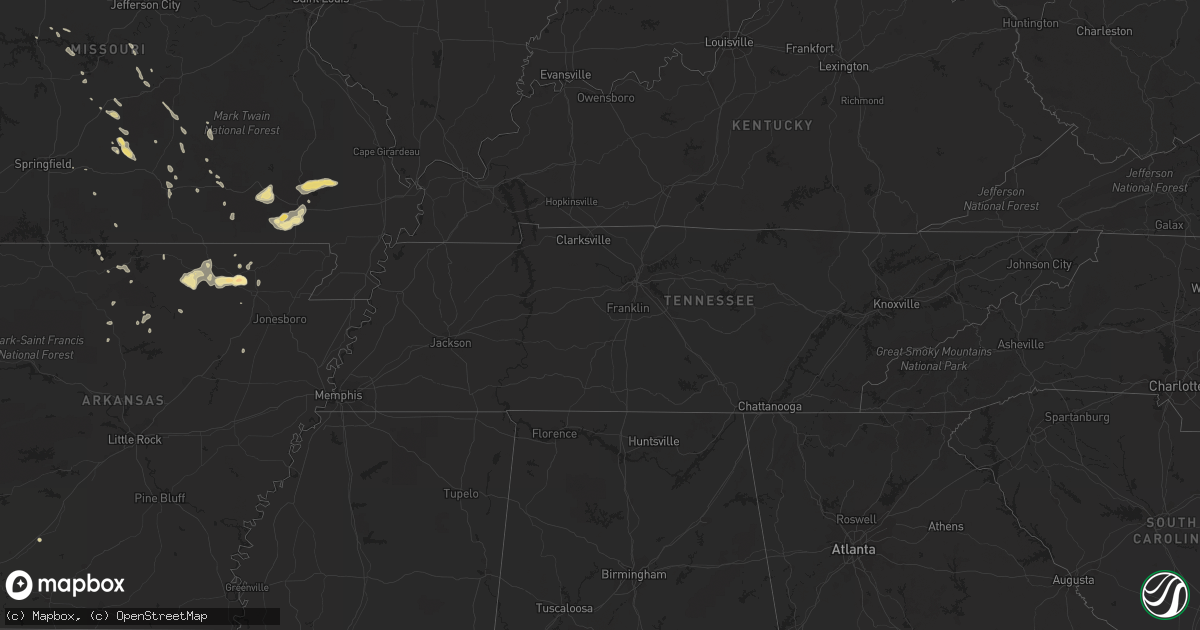
Hail Map in Wisconsin on August 23, 2011
Get this storm
August 23 map
$229
one time, instant access
Download today. No call, no setup
Keep the $229
Bought the map and want the full workflow? Apply the entire $229 to a subscription within 7 days. None of it is wasted.
Every map, not just this one
This buys you this map. Subscription and you get every map we run, in the markets you choose from a few cities to whole states to nationwide. Plus real-time alerts the moment a storm fires.
Contact data
Name, contact info, occupancy, even credit band for addresses in the footprint. You go from where it hit to who to call.
Become the source they trust
Unlimited branding weather history reports on demand. You already have the documented answer ready for the property owner, and you are the one who showed up with it.
Property data and RoofTrace estimates
Pull up any address you have got, its value and the exact code rules for that jurisdiction, straight from One Click Code. Then RoofTrace estimates the squares, pitch, and roof value, priced the way you price.
Storm reports in Wisconsin
Wisconsin
| Date | Description |
|---|---|
| 08/23/20116:56 PM CDT | Brief ef0 tornado touched down in field shortly before 7 pm north of shady rd between herman creek rd and elm rd. Tall grass/hay in field was flattened in cyclonic patt |
| 08/23/20116:12 PM CDT | Trees down along highway h |
| 08/23/20116:00 PM CDT | Trees down in the red springs township |
| 08/23/20115:58 PM CDT | Power lines down. Possible tornado damage. |
| 08/23/20115:44 PM CDT | A local report indicates 1.25 inch wind near NEILLSVILLE |
| 08/23/20115:30 PM CDT | House off foundation...power lines down...roofs off houses...and barns destroyed |
| 08/23/20115:20 PM CDT | Power lines down on pine creek road and county y |
| 08/23/20115:15 PM CDT | A local report indicates a tornado near 5 NW CHILI |
| 08/23/20115:05 PM CDT | Tornado rated an ef2 with estimated winds in the 120 to 130 mph range. Average width was around 200 yards. Tornado touched down around 505 pm 7 miles northwest of chili |
| 08/23/20115:05 PM CDT | Sporadic power outages and house fire reported in tomahawk. |
| 08/23/20115:01 PM CDT | A local report indicates 1.00 inch wind near LOYAL |
| 08/23/20114:44 PM CDT | A local report indicates 1.00 inch wind near 3 S THORP |
| 08/23/20114:38 PM CDT | Power out in corning township |
| 08/23/20114:24 PM CDT | A local report indicates 1.75 inch wind near THORP |
| 08/23/20114:00 PM CDT | A local report indicates 1.00 inch wind near 8 N STANLEY |
| 08/23/20113:59 PM CDT | A local report indicates 1.00 inch wind near 8 NNW STANLEY |
| 08/22/20119:10 PM CDT | A local report indicates 1.00 inch wind near FOREST JUNCTION |
| 08/22/20119:05 PM CDT | Ef0 tornado struck less than a mile northeast of sherwood. Several structures were impacted including two barns that were heavily damaged. Several pine trees were snapp |
| 08/22/20119:05 PM CDT | Trees down |
All States Impacted by Hail Map on August 23, 2011
Cities Impacted by Hail Map on August 23, 2011
- Sicily Island, LA
- Ferriday, LA
- Raymond, MS
- Clarksville, TX
- Lake Wales, FL
- Climax, MI
- Lakeview, OH
- Roundhead, OH
- Belle Center, OH
- Walnut, MS
- Falkner, MS
- Shiocton, WI
- Kendallville, IN
- Albion, IN
- Randalia, IA
- Hawkeye, IA
- Sumner, IA
- Ravenden Springs, AR
- Imboden, AR
- McNeal, AZ
- El Paso, IL
- Chiefland, FL
- Hilbert, WI
- Chilton, WI
- Donaldsonville, LA
- Belle Rose, LA
- Lebanon, MO
- Richland, MO
- Lulu, FL
- Lake Butler, FL
- Olive Branch, MS
- Memphis, TN
- Congerville, IL
- Secor, IL
- Goodfield, IL
- Eureka, IL
- Carlock, IL
- Washington, IL
- Hudson, IL
- Bowler, WI
- Middlebury, IN
- Clermont, FL
- Marcellus, MI
- Decatur, MI
- Brillion, WI
- Dodge, NE
- Wisner, NE
- West Point, NE
- Crystal River, FL
- Dunnellon, FL
- Apopka, FL
- Poplar Bluff, MO
- Covert, MI
- Thorp, WI
- Hartville, MO
- Junction City, WI
- Pocahontas, AR
- Black Rock, AR
- Alton, MO
- Salem, MO
- Jadwin, MO
- Millersburg, IN
- Syracuse, IN
- Goshen, IN
- Mayo, FL
- East Leroy, MI
- Mountain Grove, MO
- Metamora, IL
- East Peoria, IL
- Ash Flat, AR
- Cherokee Village, AR
- Evening Shade, AR
- Hardy, AR
- Horseshoe Bend, AR
- Franklin, AR
- Clintonville, WI
- Dixon, MO
- Saint Robert, MO
- Crocker, MO
- Dowagiac, MI
- Old Town, FL
- New Auburn, WI
- Tiplersville, MS
- Leesville, LA
- Deridder, LA
- Howe, IN
- Burr Oak, MI
- Sturgis, MI
- Keithville, LA
- Vail, AZ
- Green Valley, AZ
- Mountain Home, AR
- Gassville, AR
- Trenton, FL
- Lexington, IL
- Colfax, IL
- Fairbury, IL
- Cropsey, IL
- Bennett, IA
- Wilton, IA
- New Liberty, IA
- Stockton, IA
- Durant, IA
- Walcott, IA
- Naples, FL
- Ravenden, AR
- Smithville, AR
- Poughkeepsie, AR
- Clifton, AZ
- Hoxie, KS
- Ligonier, IN
- New Paris, IN
- Medford, WI
- Neillsville, WI
- Williford, AR
- Batesville, AR
- Plant City, FL
- Gainesville, FL
- Stanley, WI
- Lagrange, IN
- Holcombe, WI
- Cornell, WI
- West Branch, IA
- Tipton, IA
- Farmer City, IL
- Hereford, AZ
- Inglis, FL
- Walker, LA
- Douglas, AZ
- Lake City, FL
- Alachua, FL
- High Springs, FL
- Avilla, IN
- Climax Springs, MO
- Gravois Mills, MO
- Stover, MO
- Edwards, MO
- Bronson, MI
- Danvers, IL
- Branford, FL
- Steinhatchee, FL
- Salem, FL
- Kiel, WI
- Valders, WI
- Bloomer, WI
- Saint Cloud, FL
- Paw Paw, MI
- Gobles, MI
- Bangor, MI
- Grand Junction, MI
- Bloomingdale, MI
- Sherwood, MI
- Coldwater, MI
- Saint Elizabeth, MO
- Tuscumbia, MO
- Summerfield, FL
- Rockbridge, OH
- Grinnell, KS
- Gonzales, LA
- Saint Amant, LA
- Willard, WI
- Augusta, WI
- Fall Creek, WI
- Fairchild, WI
- Jim Falls, WI
- Galesburg, IL
- Wataga, IL
- Punta Gorda, FL
- Fort McCoy, FL
- Williston, FL
- Seymour, WI
- Pulaski, WI
- Green Bay, WI
- Grainfield, KS
- Wapakoneta, OH
- Fayette, IA
- Westgate, IA
- Stanley, IA
- Maynard, IA
- Oelwein, IA
- Bonita Springs, FL
- Lawton, MI
- Cassopolis, MI
- Three Rivers, MI
- Schoolcraft, MI
- Fort Myers, FL
- Eminence, MO
- Doniphan, MO
- Grandin, MO
- Naylor, MO
- Harviell, MO
- Fairdealing, MO
- Colfax, LA
- Altoona, FL
- Withee, WI
- Greenwood, WI
- Owen, WI
- Van Buren, MO
- Ellsinore, MO
- Jefferson, TX
- Marshfield, WI
- Shipshewana, IN
- Weyerhaeuser, WI
- Bruce, WI
- Woodville, MS
- Iberia, MO
- Suamico, WI
- Robins, IA
- Cedar Rapids, IA
- Springville, IA
- Palo, IA
- Marion, IA
- Toddville, IA
- Kaukauna, WI
- Appleton, WI
- Black Creek, WI
- Lynch, NE
- Verdigre, NE
- Oneill, NE
- Carthage, TX
- Falcon, MO
- Sadorus, IL
- Chetek, WI
- Saucier, MS
- Wappapello, MO
- Greenville, MO
- Williamsville, MO
- McGee, MO
- Zolfo Springs, FL
- Portage, MI
- Kalamazoo, MI
- Saint James, LA
- Okeechobee, FL
- Merryville, LA
- Milford, IN
- Nappanee, IN
- Topeka, IN
- Blue Grass, IA
- Camdenton, MO
- Ocala, FL
- Franklinton, LA
- Texarkana, AR
- Puxico, MO
- Marysville, OH
- Lincolnshire, IL
- Buffalo Grove, IL
- Wauchula, FL
- Greenwell Springs, LA
- Bronson, FL
- Perry, FL
- Mount Vernon, IA
- Elk Creek, MO
- Willow Springs, MO
- Frostproof, FL
- Paulding, OH
- Payne, OH
- Prescott, AR
- Pierre Part, LA
- Mendon, OH
- Ohio City, OH
- Venedocia, OH
- Rockford, OH
- Spencerville, OH
- Lancaster, OH
- Winona, MO
- Quincy, MI
- Reading, MI
- Clearwater, NE
- Neligh, NE
- Fouke, AR
- Gilman, WI
- Conrath, WI
- Loyal, WI
- Lublin, WI
- Boyd, WI
- Mikana, WI
- Sheldon, WI
- Rice Lake, WI
- Ladysmith, WI
- Birchwood, WI
- Hartshorn, MO
- Raymondville, MO
- Liberty, MS
- Palmetto, LA
- Cross City, FL
- Gainesville, MO
- New Windsor, IL
- Live Oak, FL
- Lee, FL
- Patagonia, AZ
- Shawano, WI
- Gresham, WI
- Yellville, AR
- Mattawan, MI
- Lawrence, MI
- Oscar, LA
- Hawthorne, FL
- Micanopy, FL
- Chillicothe, IL
- Vicksburg, MI
- Cloutierville, LA
- Lena, LA
- White Springs, FL
- Jasper, FL
- Wittenberg, WI
- Birnamwood, WI
- Jena, LA
- Grovespring, MO
- Birch Tree, MO
- Denham Springs, LA
- Mountain View, MO
- Bristol, IN
- Umatilla, FL
- Bear Creek, WI
- New London, WI
- Amagon, AR
- Pittsville, WI
- Granton, WI
- Fordland, MO
- Huntsville, OH
- South Haven, MI
- Mendon, MI
- Berrien Springs, MI
- Niles, MI
- De Kalb, TX
- Colon, MI
- Eland, WI
- Hatley, WI
- Elgin, AZ
- Titusville, FL
- Mims, FL
- Marshall, AR
- Constantine, MI
- White Pigeon, MI
- Jones, MI
- Ashland, MS
- Center Point, IA
- Alburnett, IA
- Shellsburg, IA
- Hiawatha, IA
- New Knoxville, OH
- Saint Marys, OH
- Augusta, MI
- Dixon, IA
- Davenport, IA
- South Whitley, IN
- Lindsay, NE
- Edwardsburg, MI
- Mechanicsville, IA
- Eau Claire, MI
- Melrose, FL
- Earleton, FL
- Sherwood, WI
- Cleveland, WI
- Menasha, WI
- Tigerton, WI
- Marion, WI
- Embarrass, WI
- Bonduel, WI
- Caroline, WI
- Nichols, WI
- Potter, WI
- Leopolis, WI
- Newton, WI
- Oneida, WI
- Combined Locks, WI
- Tilleda, WI
- Hortonville, WI
- Schofield, WI
- Ringle, WI
- Sobieski, WI
- Little Chute, WI
- Kimberly, WI
- Wolcottville, IN
- Hudson, IN
- Rome City, IN
- Clinton, AR
- Waynesfield, OH
- Kenton, OH
- Georgetown, FL
- Crescent City, FL
- Jonesville, LA
- Moscow, IA
- West Liberty, IA
- Atalissa, IA
- Flippin, AR
- Cadott, WI
- Haines City, FL
- Reedsville, WI
- North Manchester, IN
- Bradford, IL
- Sheffield, IL
- Kewanee, IL
- Neponset, IL
- Toulon, IL
- Abita Springs, LA
- Ashley, OH
- Delaware, OH
- Wabash, IN
- Saint Joseph, MI
- Stevensville, MI
- Baroda, MI
- Sodus, MI
- Spencer, WI
- Tony, WI
- Ava, MO
- Franklin Park, IL
- River Forest, IL
- Melrose Park, IL
- Oak Park, IL
- River Grove, IL
- Elmwood Park, IL
- Unity, WI
- Stratford, WI
- Beulah, MO
- Edgar Springs, MO
- Licking, MO
- Lynchburg, MO
- Sunbury, OH
- Allegan, MI
- Groveland, FL
- Haviland, OH
- Norfork, AR
- Leesburg, FL
- Okahumpka, FL
- Satsuma, FL
- Palatka, FL
- Benson, AZ
- Auburndale, WI
- Middleton, TN
- Neelyville, MO
- Oxly, MO
- Chenoa, IL
- Gove, KS
- Columbia City, IN
- Cedar Key, FL
- Pomona, MO
- Brooksville, FL
- Scribner, NE
- White Castle, LA
- Clayton, LA
- Park, KS
- Woodstock, MN
- Tripoli, IA
- Floral City, FL
- Holland, MN
- Viola, AR
- Lamont, FL
- Pelican, LA
- Walnut Ridge, AR
- Knoxville, IL
- Dahinda, IL
- Logansport, LA
- Raymond, OH
- Dry Creek, LA
- Gridley, IL
- Mountain View, AR
- Cole Camp, MO
- Sells, AZ
- Baton Rouge, LA
- Sahuarita, AZ
- Towanda, IL
- Deer Creek, IL
- Morton, IL
- Peoria, IL
- Roanoke, IL
- Humphrey, NE
- Seymour, MO
- Lowpoint, IL
- Washburn, IL
- Eastpoint, FL
- Denver, IA
- Dunkerton, IA
- Waterloo, IA
- Milan, IL
- Rock Island, IL
- Luverne, ND
- Fort Lauderdale, FL
- Pilger, NE
- Lincoln, MO
- Union City, MI
- Andalusia, IL
- Donahue, IA
- Taylor Ridge, IL
- Muscatine, IA
- Calamus, IA
- Illinois City, IL
- Reynolds, IL
- Buffalo, IA
- Wheatland, IA
- Macks Creek, MO
- Roach, MO
- Valliant, OK
- Warsaw, MO
- Rio, IL
- North Fort Myers, FL
- Elkhart, IN
- Wausau, WI
- Inverness, FL
- Chili, WI
- Alicia, AR
- Scotts, MI
- Galesburg, MI
- Apalachicola, FL
- Viola, IL
- Aledo, IL
- Leslie, AR
- Sherrard, IL
- Morenci, AZ
- Opelousas, LA
- Edgemont, AR
- O'Brien, FL
- Oakland, IL
- Sugartown, LA
- Sierra Vista, AZ
- Montverde, FL
- Rosepine, LA
- Laotto, IN
- Bucyrus, MO
- Success, MO
- Eldridge, MO


