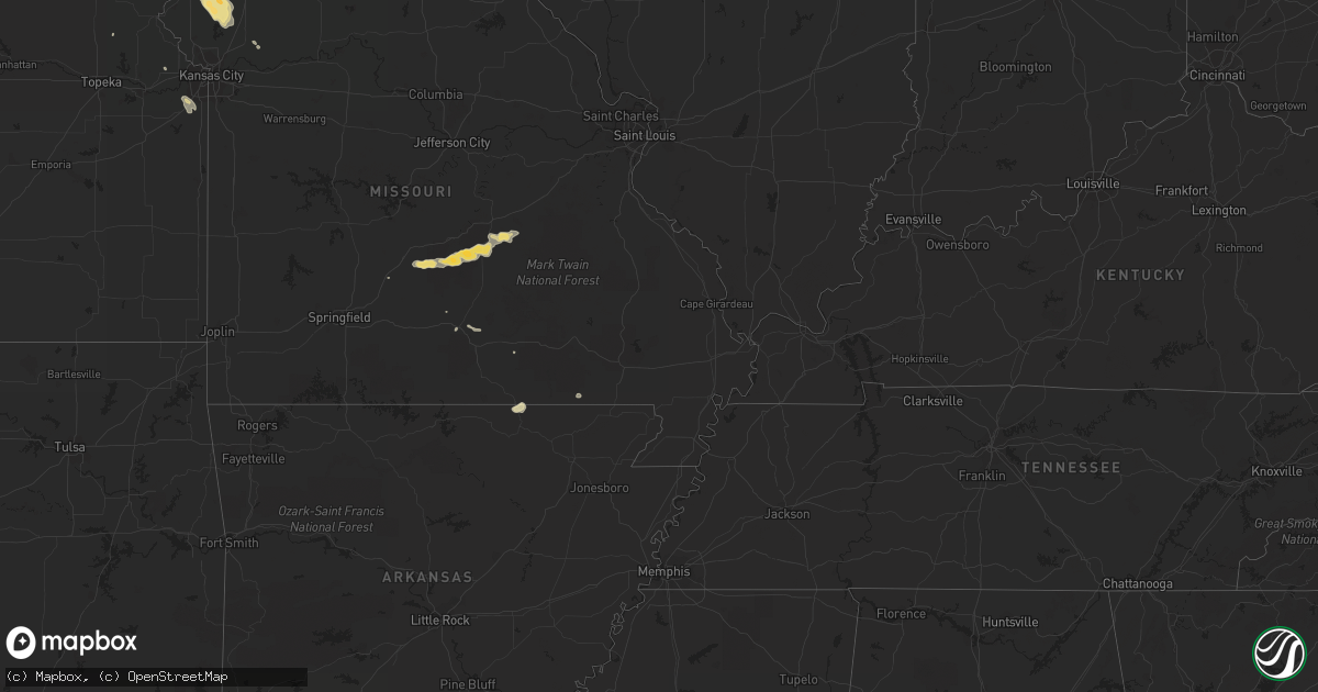
Hail Map in Iowa on August 22, 2011
Get this storm
August 22 map
$229
one time, instant access
Download today. No call, no setup
Keep the $229
Bought the map and want the full workflow? Apply the entire $229 to a subscription within 7 days. None of it is wasted.
Every map, not just this one
This buys you this map. Subscription and you get every map we run, in the markets you choose from a few cities to whole states to nationwide. Plus real-time alerts the moment a storm fires.
Contact data
Name, contact info, occupancy, even credit band for addresses in the footprint. You go from where it hit to who to call.
Become the source they trust
Unlimited branding weather history reports on demand. You already have the documented answer ready for the property owner, and you are the one who showed up with it.
Property data and RoofTrace estimates
Pull up any address you have got, its value and the exact code rules for that jurisdiction, straight from One Click Code. Then RoofTrace estimates the squares, pitch, and roof value, priced the way you price.
Storm reports in Iowa
Iowa
| Date | Description |
|---|---|
| 08/22/20116:58 AM CDT | A few 4 to 6 diameter limbs down. Extensive corn and bean crop damage. |
| 08/22/20116:52 AM CDT | Tree down partially blocking road near the intersection of willow and main street. |
| 08/22/20115:57 AM CDT | A local report indicates 1.00 inch wind near 3 SE WEBSTER CITY |
| 08/22/20115:52 AM CDT | A local report indicates 1.00 inch wind near 2 ESE WEBSTER CITY AIRP |
| 08/22/20114:35 AM CDT | Large tree blown down |
| 08/22/20114:30 AM CDT | A couple of powerlines blown down |
| 08/22/20113:36 AM CDT | Extensive tree damage throughout the town of webster city. Multiple tree limbs down about a foot in diameter. Time estimated by radar. |
| 08/22/20113:20 AM CDT | A local report indicates 1.00 inch wind near 2 N FORT DODGE AIRPORT |
| 08/22/20112:40 AM CDT | A local report indicates 68 MPH wind near ALGONA AIRPORT |
| 08/22/20112:40 AM CDT | Considerable tree damage in town. Many roads impassable. Time estimated from radar. |
| 08/22/20112:37 AM CDT | Power lines down in town. Time estimated from radar. |
| 08/22/20112:35 AM CDT | A local report indicates 75 MPH wind near 2 NE WHITTEMORE |
| 08/22/20112:14 AM CDT | Numerous trees uprooted in town. Minor flooding also noted. |
| 08/22/20112:14 AM CDT | Patio furniture blown around and branches down in yard. Time estimated from radar. |
| 08/22/20111:30 AM CDT | Two grain bins destroyed. |
| 08/22/20111:06 AM CDT | Trees and power lines down in town. |
| 08/22/201112:58 AM CDT | Also estimated 60 mph winds with 3 inch branches down. |
| 08/22/201112:35 AM CDT | A local report indicates 1.75 inch wind near SHELDON |
| 08/22/201112:10 AM CDT | A local report indicates 1.00 inch wind near ROCK RAPIDS |
| 08/22/201112:10 AM CDT | Tree damage with numerous branches down. A few branches down on homes. |
All States Impacted by Hail Map on August 22, 2011
Cities Impacted by Hail Map on August 22, 2011
- Barnwell, SC
- Blackville, SC
- Williston, SC
- Springfield, SC
- McIntire, IA
- Stacyville, IA
- Mason City, IA
- Rockford, IA
- Rockwell, IA
- Lake Wilson, MN
- New Ulm, MN
- Courtland, MN
- Nicollet, MN
- Springfield, MN
- Hanska, MN
- Sleepy Eye, MN
- Saint James, MN
- Thornton, IA
- Meservey, IA
- Klemme, IA
- Goodell, IA
- Stewartsville, MO
- Lathrop, MO
- Gower, MO
- Plattsburg, MO
- Saint Joseph, MO
- Agency, MO
- Easton, MO
- Clarksdale, MO
- Cosby, MO
- Ochlocknee, GA
- Morton, MN
- Danube, MN
- Olivia, MN
- Renville, MN
- Redwood Falls, MN
- Morgan, MN
- Monroeville, AL
- Raymond, MN
- Emmetsburg, IA
- Curlew, IA
- Cylinder, IA
- West Bend, IA
- Rolfe, IA
- Mallard, IA
- Tifton, GA
- Lenox, GA
- Turney, MO
- Trimble, MO
- Holt, MO
- Osage, IA
- Orchard, IA
- Hawkeye, IA
- Willmar, MN
- Lake Lillian, MN
- Blomkest, MN
- Starbuck, MN
- Campbellton, FL
- Charleston, SC
- Summerville, SC
- North Charleston, SC
- Ladson, SC
- Goose Creek, SC
- Glennville, GA
- Reidsville, GA
- Sterling, ND
- Stirum, ND
- Metter, GA
- Twin City, GA
- Garfield, GA
- Savannah, GA
- Doniphan, MO
- Round Lake, MN
- Worthington, MN
- Brewster, MN
- Eldora, IA
- Wellsburg, IA
- Steamboat Rock, IA
- Grundy Center, IA
- Conrad, IA
- Falcon, MO
- Laquey, MO
- Lebanon, MO
- Morris, MN
- Hancock, MN
- Danvers, MN
- Salem, MO
- Duke, MO
- Edgar Springs, MO
- Fort Leonard Wood, MO
- Waynesville, MO
- Plato, MO
- Cook Sta, MO
- Rolla, MO
- Saint James, MO
- Newburg, MO
- Ludowici, GA
- Boston, GA
- Dixie, GA
- Andrews, SC
- Georgetown, SC
- Melbourne, AR
- Franklin, AR
- Brockwell, AR
- Thomasville, AL
- Saint Peter, MN
- Cedar Rapids, IA
- Ely, IA
- Mount Pleasant, SC
- Blairsburg, IA
- Williams, IA
- Alden, IA
- Brinson, GA
- Ravenden, AR
- Daytona Beach, FL
- New Smyrna Beach, FL
- Benson, MN
- Clontarf, MN
- La Porte City, IA
- Traer, IA
- Dysart, IA
- Garrison, IA
- Cotton Valley, LA
- Dawson, GA
- Fort Dodge, IA
- Clare, IA
- Holdingford, MN
- Montevideo, MN
- Foley, MN
- Swainsboro, GA
- Coolidge, GA
- Ellabell, GA
- Greenville, FL
- Monticello, FL
- Chester, SD
- Jasper, MN
- Dell Rapids, SD
- Madison, SD
- Baltic, SD
- Canova, SD
- Colton, SD
- Howard, SD
- Winfred, SD
- Garretson, SD
- Luverne, MN
- Albert Lea, MN
- Lime Springs, IA
- Cresco, IA
- Blakely, GA
- Lisbon, LA
- Dubach, LA
- Bernice, LA
- Homer, LA
- Cascade, IA
- Waterloo, IA
- Milton, FL
- Ellendale, ND
- Forbes, ND
- Poughkeepsie, AR
- Williford, AR
- Hardy, AR
- Cave City, AR
- Strawberry, AR
- Sulphur Rock, AR
- Tappen, ND
- Soperton, GA
- Adrian, GA
- Frisco City, AL
- Uriah, AL
- Barnum, IA
- Manson, IA
- Rocky Ford, GA
- Buckingham, IA
- Becker, MN
- Princeton, MN
- Zimmerman, MN
- Big Lake, MN
- Murdock, MN
- Tyler, AL
- Hayneville, AL
- Sheldon, IA
- Mechanicsville, IA
- Lisbon, IA
- Hector, MN
- Gladbrook, IA
- Beaman, IA
- Marshalltown, IA
- Pocahontas, IA
- Rock Rapids, IA
- Hartley, IA
- Primghar, IA
- Smoaks, SC
- Sibley, IA
- George, IA
- Little Rock, IA
- Rice, MN
- Sauk Rapids, MN
- Whatley, AL
- Grove Hill, AL
- Ashton, IA
- Thomasville, GA
- Glenwood, MN
- Boyden, IA
- Hull, IA
- Melvin, IA
- Sanborn, IA
- Sunburg, MN
- Pennock, MN
- Kerkhoven, MN
- Arlington, GA
- Holland, IA
- Parkersburg, IA
- Gackle, ND
- Streeter, ND
- Coffee Springs, AL
- Brunson, SC
- Fairfax, SC
- Midway, GA
- Ravenden Springs, AR
- Garvin, MN
- Napoleon, ND
- Shell Rock, IA
- New Hartford, IA
- Hudson, IA
- Lyons, GA
- Cabool, MO
- Edgerton, MN
- Baxley, GA
- Humboldt, IA
- Bradgate, IA
- Havelock, IA
- Gilmore City, IA
- Fredericksburg, IA
- Sumner, IA
- Round O, SC
- Wentworth, SD
- Soldiers Grove, WI
- Alberta, MN
- Holloway, MN
- Spicer, MN
- Belgrade, MN
- Cyrus, MN
- Farwell, MN
- Hoffman, MN
- Appleton, MN
- Kensington, MN
- Brooten, MN
- Donnelly, MN
- New London, MN
- Clara City, MN
- Maynard, MN
- Claremont, SD
- Sutherland, IA
- Peterson, IA
- Royal, IA
- Hanahan, SC
- Moncks Corner, SC
- Hampstead, NC
- Salley, SC
- Wagener, SC
- Sylvester, GA
- Seabrook, SC
- Beaufort, SC
- Graettinger, IA
- Wallingford, IA
- Fenton, IA
- Lone Rock, IA
- Ruthven, IA
- Whittemore, IA
- Moultrie, GA
- Pavo, GA
- Oak Park, MN
- Ponce De Leon, FL
- Defuniak Springs, FL
- Bonifay, FL
- Vernon, FL
- Caryville, FL
- Westville, FL
- Cold Spring, MN
- Avon, MN
- Saint Joseph, MN
- Newton, GA
- Albany, GA
- Camilla, GA
- Lowden, IA
- Bennett, IA
- Ashby, MN
- Vining, MN
- Battle Lake, MN
- Elbow Lake, MN
- Evansville, MN
- Barrett, MN
- Clitherall, MN
- Clear Lake, IA
- Willow Springs, MO
- Brooklet, GA
- Huger, SC
- Violet Hill, AR
- Chauncey, GA
- Eastman, GA
- Parkers Prairie, MN
- Le Sueur, MN
- Laurens, IA
- Rutland, IA
- Moorland, IA
- Badger, IA
- Dakota City, IA
- Thor, IA
- Palmer, IA
- Hardy, IA
- Newellton, LA
- Cairo, GA
- Oxford Junction, IA
- Clarence, IA
- Statesboro, GA
- Kissimmee, FL
- Davenport, FL
- Jesup, GA
- Allendale, SC
- Bricelyn, MN
- Blue Earth, MN
- Thompson, IA
- Alden, MN
- Easton, MN
- Winnebago, MN
- Kiester, MN
- Frost, MN
- Lake Mills, IA
- Emmons, MN
- Delavan, MN
- Scarville, IA
- Wells, MN
- Pinola, MS
- Harrisville, MS
- Hills, MN
- New Augusta, MS
- Ruthton, MN
- Jud, ND
- Berlin, ND
- Dickey, ND
- Edgeley, ND
- Lamoure, ND
- Bolivia, NC
- Beaumont, MS
- Balaton, MN
- Pattison, MS
- Robertsdale, AL
- Alburnett, IA
- Central City, IA
- Northwood, IA
- Cologne, MN
- Chaska, MN
- Carver, MN
- Tuttle, ND
- Spencer, IA
- Wolverton, MN
- Eastman, WI
- Steuben, WI
- Britton, SD
- Hecla, SD
- Bamberg, SC
- Tracy, MN
- Frederick, SD
- Wray, GA
- Townsend, GA
- McRae Helena, GA
- Alamo, GA
- Dawson, ND
- Ashley, ND
- Black Rock, AR
- Smithville, AR
- Webster City, IA
- Kamrar, IA
- Duncombe, IA
- Harmony, MN
- Lanesboro, MN
- New Prague, MN
- Belle Plaine, MN
- Bismarck, ND
- Amboy, MN
- Bloomingdale, GA
- Jordan, MN
- Elma, IA
- Terril, IA
- Estherville, IA
- Spirit Lake, IA
- Ravenel, SC
- Estill, SC
- Early Branch, SC
- Varnville, SC
- Backus, MN
- Poplarville, MS
- Perkinston, MS
- Brainerd, MN
- Kulm, ND
- Aurelia, IA
- Alta, IA
- Mammoth Spring, AR
- Milan, GA
- Fredonia, ND
- Lehr, ND
- Riceville, IA
- Chester, IA
- Fort Ransom, ND
- Brandon, MN
- Peterson, MN
- Ocheyedan, IA
- Harris, IA
- Lake Park, IA
- Steele, ND
- Regan, ND
- Driscoll, ND
- Robinson, ND
- Baldwin, ND
- Wing, ND
- Medina, ND
- Bluffton, SC
- Daufuskie Island, SC
- Sisseton, SD
- Peever, SD
- Ottosen, IA
- Bode, IA
- Woolstock, IA
- Headland, AL
- Iowa Falls, IA
- Hattiesburg, MS
- Dalton, MN
- Richmond, MN
- Castleberry, AL
- Lenox, AL
- Repton, AL
- Chaseley, ND
- Hilton Head Island, SC
- Litchville, ND
- Verona, ND
- Talihina, OK
- Palo, IA
- Shellsburg, IA
- Vinton, IA
- Le Center, MN
- Ossian, IA
- Castalia, IA
- Ruston, LA
- Grambling, LA
- Pierpont, SD
- Roslyn, SD
- Langford, SD
- Jacksonville, FL
- Livermore, IA
- Hortense, GA
- New Hampton, IA
- Alta Vista, IA
- Dike, IA
- Vidalia, GA
- Hardwick, MN
- Joice, IA
- Kensett, IA
- Leola, SD
- Eagle Bend, MN
- Clarissa, MN
- Bertha, MN
- Austin, MN
- Ellendale, MN
- Blooming Prairie, MN
- Hayfield, MN
- Keystone, IA
- Ellenton, GA
- Norman Park, GA
- Hollandale, MN
- Waltham, MN
- Geneva, MN
- Leary, GA
- Dows, IA
- Cathay, ND
- Sykeston, ND
- Bowdon, ND
- Arlington, IA
- Lamont, IA
- Bird Island, MN
- Motley, MN
- Pillager, MN
- Olathe, KS
- Overland Park, KS
- Marathon, IA
- Woodstock, MN
- Shakopee, MN
- Pine River, MN
- Currie, MN
- Meridian, MS
- Douglas, GA
- Broxton, GA
- Ambrose, GA
- Crestview, FL
- Wishek, ND
- Long Lake, SD
- Garner, IA
- Cottonwood, AL
- Everly, IA
- Colquitt, GA
- Pipestone, MN
- Luray, SC
- Little Cedar, IA
- Mount Auburn, IA
- Screven, GA
- Steen, MN
- Dothan, AL
- Vincent, IA
- Prior Lake, MN
- Henderson, MN
- Elko New Market, MN
- Lakeville, MN
- Webster, MN
- Millen, GA
- Portal, GA
- Sylvania, GA
- Cosmos, MN
- Holland, MN
- Sherwood, AR
- Quitman, GA
- Tallahassee, FL
- Ehrhardt, SC
- Morgan, GA
- Colfax, WI
- Newton, AL
- Martelle, IA
- Mount Vernon, IA
- Springville, IA
- Marion, IA
- Slocomb, AL
- Radcliffe, IA
- Branchville, SC
- Buffalo Center, IA
- Marion, ND
- Vivian, LA
- Ida, LA
- Clutier, IA
- Elberon, IA
- Toledo, IA
- Chelsea, IA
- Fairmont, MN
- Sacred Heart, MN
- Kintyre, ND
- Montpelier, ND
- Menoken, ND
- Pettibone, ND
- Jamestown, ND
- Cleveland, ND
- Woodworth, ND
- Menomonie, WI
- Hartshorne, OK
- Wilburton, OK
- Rutland, SD
- Samson, AL
- Wykoff, MN
- Chatfield, MN
- Clermont, FL
- Denton, GA
- Saint Ansgar, IA
- Lyle, MN
- Damascus, GA
- Northfield, MN
- Lumberton, MS
- Sartell, MN
- Batesville, AR
- Desha, AR
- Cokato, MN
- Brooklyn, MS
- Renwick, IA
- Waverly, GA
- Maumelle, AR
- Little Rock, AR
- North Little Rock, AR
- Fayette, IA
- Maynard, IA
- Randalia, IA
- Ulmer, SC
- Hampton, IA
- Waseca, MN
- Midland City, AL
- Lumber City, GA
- Plaquemine, LA
- White Castle, LA
- Browerville, MN
- Slayton, MN
- Rochester, MN
- Clarion, IA
- Glenville, MN
- Atmore, AL
- McDavid, FL
- Century, FL
- Eagle Grove, IA
- Rebecca, GA
- Linn Grove, IA
- Jesup, IA
- Shongaloo, LA
- Odum, GA
- Surrency, GA
- Bristol, GA
- Center Junction, IA
- Wyoming, IA
- Onslow, IA
- Ionia, IA
- Waverly, IA
- Plainfield, IA
- Tripoli, IA
- Richton, MS
- Madelia, MN
- Andalusia, AL
- Lawler, IA
- Colman, SD
- Fitzgerald, GA
- Saucier, MS
- McHenry, MS
- Flandreau, SD
- Waynesville, GA
- Britt, IA
- Braddock, ND
- Sparks, GA
- Walnut Grove, MN
- Frederika, IA
- Fort Atkinson, IA
- Calmar, IA
- Waucoma, IA
- Jacksonville, AR
- Excelsior Springs, MO
- Rayville, MO
- Belmond, IA
- Lakefield, MN
- Gainestown, AL
- Vredenburgh, AL
- Jackson, AL
- Barnesville, MN
- Pelican Rapids, MN
- Goldfield, IA
- Vilonia, AR
- Youngstown, FL
- Chandler, MN
- Spiritwood, ND
- Center Point, IA
- Toddville, IA
- Miltona, MN
- Alexandria, MN
- Ellsworth, IA
- Jewell, IA
- Nahunta, GA
- Sanderson, FL
- Glen Saint Mary, FL
- Mountain View, AR
- Hampton, SC
- Nunda, SD
- Wilmington, NC
- Dickens, IA
- Hayward, MN
- Reinbeck, IA
- Madison, FL
- Pineland, SC
- Henning, MN
- Ridgeway, IA
- Spillville, IA
- Rochelle, GA
- Fullerton, ND
- Thayer, MO
- Eglin Afb, FL
- Magnolia, MN
- Eden, SD
- Tonganoxie, KS
- Oakfield, GA
- Houghton, SD
- Sycamore, GA
- Chula, GA
- Toomsuba, MS
- Lauderdale, MS
- Pelion, SC
- Columbia, SD
- Robins, IA
- Kathryn, ND
- Richmond Hill, GA
- Shorterville, AL
- Abbeville, AL
- Newville, AL
- Columbia, AL
- Laurel Hill, FL
- Graceville, MN
- Allenhurst, GA
- Janesville, IA
- Cedar Falls, IA
- Mountain Grove, MO
- Prinsburg, MN
- Cope, SC
- Lodge, SC
- Islandton, SC
- Cordesville, SC
- Bonneau, SC
- Alexander, IA
- Latimer, IA
- Ayrshire, IA
- Union, IA
- Liscomb, IA
- Milford, IA
- West Union, IA
- Green Pond, SC
- Edisto Island, SC
- Olar, SC
- Kanawha, IA
- Ridgeland, SC
- Yemassee, SC
- Garfield, MN
- Brandon, IA
- Lake City, SD
- Houston, MN
- Loxahatchee, FL
- Minter, AL
- Lowndesboro, AL
- Morrison, IA
- Cadwell, GA
- Rentz, GA
- Dublin, GA
- Selma, AL
- Oronoco, MN
- Claxton, GA
- Doon, IA
- Conway, MO
- Pembroke, GA
- Valley Springs, SD
- Sioux Rapids, IA
- Archer, IA
- Alvord, IA
- Greenville, IA
- Larrabee, IA
- Matlock, IA
- Larchwood, IA
- Webb, IA
- Ringsted, IA
- Rembrandt, IA
- Ellsworth, MN
- Algona, IA
- Beaver Creek, MN
- Kanaranzi, MN
- Adrian, MN
- Trent, SD
- Inwood, IA
- Albert City, IA
- Rock Valley, IA
- Paullina, IA
- Valley Falls, KS
- Orlando, FL
- Pearson, GA
- Rodessa, LA
- Morven, GA
- Morley, IA
- Olin, IA
- Anamosa, IA
- Sumner, GA
- Independence, IA
- Orrick, MO
- Cobbtown, GA
- Southport, NC
- Birch Tree, MO
- Willacoochee, GA
- Scales Mound, IL
- Galena, IL
- Evening Shade, AR
- Pocahontas, AR
- Rushmore, MN
- Bigelow, MN
- West Green, GA
- Lake Benton, MN
- Winnabow, NC
- Oakes, ND
- Estero, FL
- Alma Center, WI
- Egan, SD
- Deer Creek, MN
- Okatie, SC
- Port Royal, SC
- Beardsley, MN
- Solon, IA
- Tipton, IA
- Delmar, IA
- Maquoketa, IA
- Christmas, FL
- Saint Marys, GA


