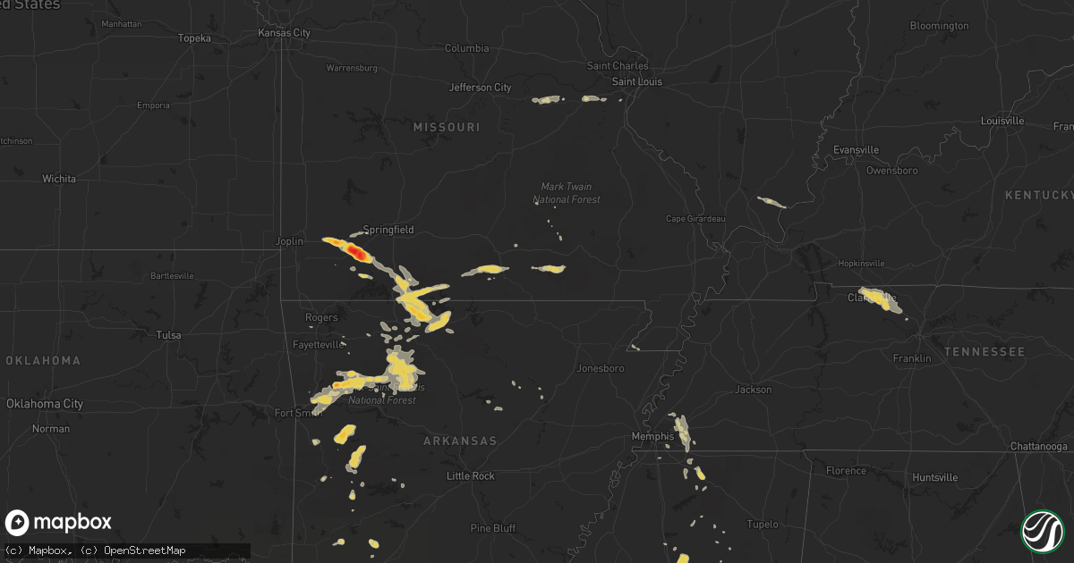
Hail Map on August 20, 2011
Get this storm
August 20 map
$229
one time, instant access
Download today. No call, no setup
Keep the $229
Bought the map and want the full workflow? Apply the entire $229 to a subscription within 7 days. None of it is wasted.
Every map, not just this one
This buys you this map. Subscription and you get every map we run, in the markets you choose from a few cities to whole states to nationwide. Plus real-time alerts the moment a storm fires.
Contact data
Name, contact info, occupancy, even credit band for addresses in the footprint. You go from where it hit to who to call.
Become the source they trust
Unlimited branding weather history reports on demand. You already have the documented answer ready for the property owner, and you are the one who showed up with it.
Property data and RoofTrace estimates
Pull up any address you have got, its value and the exact code rules for that jurisdiction, straight from One Click Code. Then RoofTrace estimates the squares, pitch, and roof value, priced the way you price.
States Impacted by Hail Map on August 20, 2011
Storm reports
Wisconsin
| Date | Description |
|---|---|
| 08/20/20118:10 AM CDT | Quarter to half dollar sized hail. The wind driven hail shredded leaves off of the trees. |
| 08/20/20118:10 AM CDT | Pea to quarter size hail. Accumulated up to 6 inches. Time estimated. |
Alabama
| Date | Description |
|---|---|
| 08/20/20113:43 PM CDT | Storm spotter reports top of one tree down on hilltop road. The spotter estimated winds at 50 mph. |
Maine
| Date | Description |
|---|---|
| 08/20/20111:00 PM CDT | Large tree branch fell on a power line causing a fire. |
| 08/20/201112:55 PM CDT | Quater sized hail along western avenue. |
South Dakota
| Date | Description |
|---|---|
| 08/20/20114:55 AM CDT | A local report indicates 1.75 inch wind near 6 NE KILGORE |
Colorado
| Date | Description |
|---|---|
| 08/19/201110:31 PM CDT | Heavy rain plus lots of pea to marble hail accumulation. |
Missouri
| Date | Description |
|---|---|
| 08/20/20116:23 PM CDT | Fire chief reported tennis ball size hail |
| 08/20/20116:22 PM CDT | Baseball size hail knocked out sky lights at the walmart |
| 08/20/20116:15 PM CDT | Media relayed report of golfball size hail |
| 08/20/20116:06 PM CDT | A local report indicates 1.00 inch wind near AURORA |
| 08/20/20115:46 PM CDT | Media relayed public report of golfball size hail. Had another public call of golfball size hail on i-44 in the same area. |
| 08/20/20115:40 PM CDT | Public reported half dollar size hail at the massie super stop gas station. |
| 08/20/20117:00 AM CDT | Trees blown onto power lines. |
| 08/19/20117:25 PM CDT | Power pole down |
| 08/19/20117:25 PM CDT | A local report indicates 70 MPH wind near KISSEE MILLS |
| 08/19/20117:10 PM CDT | Trees down just east of forsyth |
Arkansas
| Date | Description |
|---|---|
| 08/20/20116:55 PM CDT | A local report indicates 1.00 inch wind near PARTHENON |
| 08/20/20116:16 PM CDT | Large trees down between ozark and pleasant view...south of highway 64. |
| 08/20/20115:50 PM CDT | Tree down |
| 08/20/20115:50 PM CDT | Many large trees down. Travel trailers blown over at river ridge park. |
| 08/20/20115:45 PM CDT | Roofs off houses. Large trees down. |
| 08/20/20115:33 PM CDT | Wind blew steeple off a church. Tree limbs broken also. |
| 08/20/20115:30 PM CDT | Trees and powerlines down |
| 08/20/20115:13 PM CDT | Measured by asos at kfsm. |
| 08/20/20115:13 PM CDT | Window at mcdonalds restaurant on highway 71 on south side of fort smith blown out. Trees reported down on south side of fort smith too. |
| 08/20/20114:55 PM CDT | Trees down on hwy 167 near junction city. |
| 08/20/20113:40 PM CDT | Trees down in norphlet and along hwy 7 near 7 brothers road. |
| 08/19/20117:50 PM CDT | Trees reported down along hwy 27 just before the hwy 16 junction. |
| 08/19/20117:20 PM CDT | Trees reported down in deer. |
| 08/19/20117:03 PM CDT | Hail reported south of jasper along hwy 7. |
| 08/19/20117:03 PM CDT | Numerous trees reported down along hwy 21 just north of the newton and johnson county line. |
Texas
| Date | Description |
|---|---|
| 08/20/20116:20 PM CDT | Trees snapped and uprooted in mcleod. Metal signs were twisted and blown down. |
| 08/20/20116:20 PM CDT | Trees and powerlines down. |
| 08/20/20116:15 PM CDT | A metal roof was blown off of a building in the carthage downtown square. A window also blown out of a building downtown. Tree down on a home on north st. Mary street. |
| 08/20/20115:35 PM CDT | Trees and powerlines down in the mc leod community |
| 08/20/20113:30 PM CDT | Trees and powerlines down on gatlin road and fm 2879 near lake deerwood. |
Pennsylvania
| Date | Description |
|---|---|
| 08/20/20111:35 AM CDT | A local report indicates 1.00 inch wind near 6 S ERIE |
Georgia
| Date | Description |
|---|---|
| 08/20/20113:24 PM CDT | Trees and power lines down on clyo shawnee road and springfield road. Time estimated by radar. |
| 08/20/20113:15 PM CDT | Tree down on ardmore oaky road. Time estimated by radar. |
| 08/20/20113:05 PM CDT | Large tree limbs were blown down and were blocking route 119 near effingham county high school. |
| 08/20/20112:55 PM CDT | Barrow county 911 reported a few trees down on power lines in the area around mulberry and rockwell church roads. |
| 08/20/20112:23 PM CDT | Large tree down over johnson street near west jones avenue. Time estimated by radar. |
| 08/20/20111:35 PM CDT | Wet microburst downed 10 trees...some very large...as well as numerous limbs near jason ct. Patio furniture was blown approx a dozen feet. Damaged area isolated to arou |
| 08/20/201112:50 PM CDT | Local news reported about 10 trees down along buford highway in buford. |
| 08/20/201112:50 PM CDT | Fayette county emergency management reported around a dozen trees blown down in the area of tyrone road... Adams road and dogwood trail. Falling trees brought down powe |
| 08/20/201112:30 PM CDT | Fayette county emergency management reported around a dozen trees blown down in the area of tyrone road... Adams road and dogwood trail. Falling trees brought down powe |
Mississippi
| Date | Description |
|---|---|
| 08/20/20115:22 PM CDT | A couple trees and a power line down |
| 08/20/20115:00 PM CDT | A couple trees and a power line were down |
| 08/20/20111:55 PM CDT | 4 inch limbs down at the intersection of cr 148 and cr 102 just north of the oxford airport. |
| 08/20/20111:30 PM CDT | Quarter to half dollar size hail in the town of holly springs. |
| 08/20/20111:30 PM CDT | Power is also out...spotter was not sure if power lines were down. |
Michigan
| Date | Description |
|---|---|
| 08/20/20114:15 PM CDT | A local report indicates 65 MPH wind near ROSEVILLE |
| 08/20/20113:58 PM CDT | 5 inch diameter tree limbs down |
| 08/20/20113:54 PM CDT | Wires reported down |
| 08/20/20113:52 PM CDT | 3 to 4 inch diameter trees on house |
| 08/20/20113:50 PM CDT | Minor structural damage to greenhouses |
| 08/20/20113:50 PM CDT | A local report indicates 60 MPH wind near 4 NNW SOUTHFIELD |
| 08/20/20113:50 PM CDT | Dozens of large branches and trees down |
| 08/20/20113:25 PM CDT | Wires down in green oak township |
| 08/20/20113:18 PM CDT | Trees and wires down |
| 08/20/20113:13 PM CDT | Central dispatch reported trees down |
| 08/20/20112:44 PM CDT | 2 inch diameter tree limbs down |
| 08/20/20112:28 PM CDT | Power line snapped in half |
| 08/20/20112:03 PM CDT | 3 inch diameter tree branches down |
| 08/20/20111:55 PM CDT | A local report indicates 60 MPH wind near 1 N FREELAND |
| 08/20/20111:45 PM CDT | Emergency manager reports a couple pine trees have been blown down along with some power lines. Branches are down as well. |
| 08/20/20111:40 PM CDT | Numerous trees down...e ave and poorman rds...lynch and pine lake rds... And smith and w drive. |
| 08/20/20111:26 PM CDT | Central dispatch reports numerous trees down across forest township |
| 08/20/20111:03 PM CDT | Tree down on power and cable lines on sweet street ne. |
| 08/20/20111:01 PM CDT | Spotter estimated wind gusts in the 50 to 60 mph range. Some small branches have come down. |
| 08/20/20111:00 PM CDT | 35 foot...2 inch diameter healthy branch down. |
| 08/20/201112:59 PM CDT | Wires down in burton heights due to wind. |
| 08/20/201112:48 PM CDT | A two inch diameter and healthy 35 foot long 2 inch diameter branch is blown down. Time is approximate. |
| 08/20/201112:40 PM CDT | Unhealthy 3 foot diameter tree is down and blocking the byrne rd between 5 mile and 6 mile. Time is estimated. |
| 08/20/201112:15 PM CDT | Tree and limb damage in riverside park between coit avenue and knapp street. Two foot diameter limbs down. Time estimated by radar. |
Illinois
| Date | Description |
|---|---|
| 08/20/201110:40 AM CDT | Delayed report. Power lines downed...igniting a gas fire. |
| 08/20/201110:08 AM CDT | Numerous six to twelve inch tree branches downed in the area. |
| 08/20/201110:04 AM CDT | Delayed report.several trees and tree limbs down. |
| 08/20/20119:40 AM CDT | Delayed report. Burst of wind between 940 am and 942 am resulting in multiple large tree limbs down. |
| 08/20/20118:35 AM CDT | Cocorahs observer. |
| 08/20/20118:26 AM CDT | Trees down. Size unknown at this time. |
| 08/19/20118:10 PM CDT | Barn blown apart with debris in trees and power lines. 1 mile east of rt. 40 near camp grove road. Time estimated. |
Tennessee
| Date | Description |
|---|---|
| 08/20/201112:36 PM CDT | Quarter size hail near raleigh lagrange and collierville arlington road. |
| 08/20/201112:15 PM CDT | A few trees were knocked down in the town of lakeland. 4 or 5 power poles were down along evergreen street near city hall. |
| 08/20/20115:15 AM CDT | Emergency mngr reported multiple trees down and several hundred without power county-wide due to high winds. |
| 08/20/20113:10 AM CDT | Wsmv-tv reported a gas station awning was damaged at i-24 exit 19. Time estimated. |
| 08/20/20112:35 AM CDT | Numerous reports of trees blown down in the clarksville area. |
Louisiana
| Date | Description |
|---|---|
| 08/20/20116:00 PM CDT | Trees and powerlines down |
| 08/20/20114:25 PM CDT | Roof blown off a building in homer and numerous trees down throughout the area. |
| 08/20/20113:25 PM CDT | Tree down across hwy 520 near wade correctional center. |
| 08/19/20118:00 PM CDT | Trees and powerlines down on philpot road. |
South Carolina
| Date | Description |
|---|---|
| 08/20/20116:09 PM CDT | Highway patrol reported a tree down along highway 66 two miles west of the elementary school. |
| 08/20/20115:01 PM CDT | Sc highway patrol reports a tree down near the intersection of i-26 and old gilliard road. |
| 08/20/20114:16 PM CDT | Tri-county electric reported outages due to downed power lines. |
| 08/20/20113:05 PM CDT | Several limbs down on cedar creek rd near yogi bear campground |
| 08/20/20113:00 PM CDT | Volunteer fire fighter reports several trees down and damage to an old tobacco barn and metal shed near mcgee and azalea rd near coward. Also tree down on a house along |
North Carolina
| Date | Description |
|---|---|
| 08/20/20116:15 PM CDT | Trees down near roaring river. |
| 08/20/20116:05 PM CDT | Trees down along river street. |
| 08/20/20115:45 PM CDT | Tree down on highway 268 east |
| 08/20/20115:41 PM CDT | Sheriff reports multiple trees down or snapped along the 6000 block of kingtown road. Several houses with minor roof damage as well. |
| 08/20/20114:45 PM CDT | Limbs and powerlines down on island ford road. |
| 08/19/20119:15 PM CDT | One tree limb down on powerlines as reported by fire station 2. |
| 08/19/20119:05 PM CDT | Carport blown off by wind and light pole blown over. |
| 08/19/20119:01 PM CDT | Quarter sized hail reported by public. |
Cities Impacted by Hail Map on August 20, 2011
- Lake Providence, LA
- Peck, MI
- Melvin, MI
- Croswell, MI
- Yale, MI
- Gladwin, MI
- Muskegon, MI
- Lead Hill, AR
- Harrison, AR
- Yellville, AR
- Kissee Mills, MO
- Powersite, MO
- Rockaway Beach, MO
- Kirbyville, MO
- Cedarcreek, MO
- Forsyth, MO
- Branson, MO
- Cape Fair, MO
- Aurora, MO
- Rudy, AR
- Texarkana, AR
- Valentine, NE
- Wood Lake, NE
- Rossville, TN
- Story, AR
- Sims, AR
- Register, GA
- Statesboro, GA
- Brooklet, GA
- Sheldon, IL
- Saint Anne, IL
- Watseka, IL
- Chebanse, IL
- Earl Park, IN
- Ashkum, IL
- Kankakee, IL
- Clifton, IL
- Kentland, IN
- Martinton, IL
- Buckingham, IL
- Reddick, IL
- Northbrook, IL
- Winnetka, IL
- Atoka, TN
- Millington, TN
- Oak Grove, LA
- Orchard, CO
- Weldona, CO
- Deer, AR
- Clinton, SC
- Kinards, SC
- Morocco, IN
- Donovan, IL
- Brook, IN
- Saint Matthews, SC
- Manhattan, IL
- Isabella, MO
- Protem, MO
- Taneyville, MO
- Hollister, MO
- Rueter, MO
- Theodosia, MO
- Omaha, AR
- Peel, AR
- Thornfield, MO
- Walnut Shade, MO
- Glennie, MI
- Mikado, MI
- Cruger, MS
- Tchula, MS
- Spring Grove, IL
- Twin Lakes, WI
- Richmond, IL
- Genoa City, WI
- Howard City, MI
- Newaygo, MI
- Columbiaville, MI
- Clio, MI
- Otisville, MI
- Otter Lake, MI
- Mount Morris, MI
- Flushing, MI
- Crookston, NE
- Kilgore, NE
- Saint Francis, SD
- West Monroe, LA
- Mount Vernon, MO
- Verona, MO
- Crane, MO
- Marionville, MO
- Smackover, AR
- El Dorado, AR
- Galva, IL
- Kewanee, IL
- Altona, IL
- Simpson, IL
- Eddyville, IL
- Spearsville, LA
- Ainsworth, NE
- Johnstown, NE
- Grover, CO
- Carpenter, WY
- Pine Bluffs, WY
- Fort Morgan, CO
- Whitman, NE
- Merriman, NE
- Juda, WI
- Brodhead, WI
- Cotter, AR
- Flippin, AR
- Lakeview, AR
- Bull Shoals, AR
- Summit, AR
- West Plains, MO
- Pomona, MO
- Oark, AR
- Jasper, AR
- Parthenon, AR
- Dover, AR
- Saint Paul, AR
- Mount Judea, AR
- Ozone, AR
- Hector, AR
- Ozark, AR
- Vendor, AR
- Clarksville, AR
- Hagarville, AR
- Combs, AR
- Pelsor, AR
- Dora, MO
- Stoneham, CO
- Holly Springs, MS
- Bonfield, IL
- Birch Tree, MO
- Alton, MO
- Fremont, MO
- Harvey, AR
- Gravelly, AR
- Millington, MI
- Erie, PA
- Fleming, CO
- Mendota, IL
- Beaufort, MO
- Burns, WY
- Walworth, WI
- Sharon, WI
- South Beloit, IL
- Poplar Grove, IL
- Janesville, WI
- Beloit, WI
- Clinton, WI
- Darien, WI
- Capron, IL
- Harvard, IL
- Orfordville, WI
- Caledonia, IL
- Rockton, IL
- Roscoe, IL
- Machesney Park, IL
- Durand, IL
- Davis, IL
- Rockford, IL
- Transylvania, LA
- Tuthill, SD
- Farwell, MI
- Lake, MI
- Collierville, TN
- Wiggins, CO
- Martin, SC
- Clarksville, TN
- West Olive, MI
- Libertyville, IL
- Gurnee, IL
- Waukegan, IL
- Dyer, AR
- Mulberry, AR
- Alma, AR
- Booneville, AR
- Magazine, AR
- Ash, NC
- Eads, TN
- Wadsworth, IL
- Big Rapids, MI
- White Cloud, MI
- Parmelee, SD
- McKean, PA
- Waterford, PA
- Edinboro, PA
- Evart, MI
- Barryton, MI
- Hersey, MI
- Rodney, MI
- Chippewa Lake, MI
- Paris, MI
- Sears, MI
- Cheyenne, WY
- Golconda, IL
- Smithland, KY
- Isola, MS
- Inverness, MS
- Hollandale, MS
- Salley, SC
- North, SC
- Lupton, MI
- South Branch, MI
- Vaiden, MS
- West, MS
- Forsyth, GA
- Blackfoot, ID
- Easton, IL
- San Jose, IL
- Mason City, IL
- Norman, AR
- Mount Ida, AR
- Shirland, IL
- Pettigrew, AR
- Elkins, AR
- Mountainburg, AR
- Witts Springs, AR
- Lavaca, AR
- Charleston, AR
- Winslow, AR
- Hasty, AR
- Western Grove, AR
- Rose City, MI
- Floral, AR
- Grover, NC
- Kings Mountain, NC
- Salt Lake City, UT
- West Jordan, UT
- Morris, IL
- Coal City, IL
- Mazon, IL
- Canton, IL
- Ellisville, IL
- Smithfield, IL
- Cuba, IL
- Grand Haven, MI
- Rayville, LA
- Gordon, NE
- Harleyville, SC
- Bowman, SC
- Saint George, SC
- Spring Hill, FL
- Brooksville, FL
- Belmont, MI
- Rockford, MI
- Hale, MI
- Ashland City, TN
- Chapmansboro, TN
- Mantee, MS
- Mathiston, MS
- Twin Lake, MI
- Holton, MI
- Fremont, MI
- Ravenna, MI
- Grant, MI
- Toulon, IL
- Wataga, IL
- Oneida, IL
- Windsor, IL
- Campbell, OH
- Canfield, OH
- Youngstown, OH
- Hillsdale, WY
- Applegate, MI
- Lexington, MI
- Sumner, MI
- Island Lake, IL
- Mchenry, IL
- Crystal Lake, IL
- Homer, LA
- Randolph, MS
- Villa Grove, IL
- Wayan, ID
- Grenada, MS
- Purdy, MO
- Garrett, WY
- Lake Zurich, IL
- Delavan, WI
- Lake Geneva, WI
- Hebron, IL
- Wauconda, IL
- Cary, IL
- Barrington, IL
- Round Lake, IL
- Woodstock, IL
- Monroe, WI
- Wonder Lake, IL
- Fox River Grove, IL
- Mundelein, IL
- Palatine, IL
- Bolton, MS
- Flora, MS
- Canton, MS
- Bentonia, MS
- Whitmire, SC
- Pierce City, MO
- Stotts City, MO
- North Branch, MI
- Harleton, TX
- Spring Lake, MI
- Coleman, MI
- Solano, NM
- Conchas Dam, NM
- Mosquero, NM
- Cardwell, MO
- Cabery, IL
- Dwight, IL
- Herscher, IL
- Malta, ID
- McCarley, MS
- Winona, MS
- Glencoe, NM
- Alto, NM
- Atlanta, TX
- Sarcoxie, MO
- Wentworth, MO
- Thomaston, GA
- Molena, GA
- Meansville, GA
- Zebulon, GA
- Concord, GA
- Comstock Park, MI
- Delight, AR
- Antoine, AR
- Alma, MI
- Mission, SD
- Martin, SD
- Aiken, SC
- Windsor, SC
- Williston, SC
- Mona, UT
- Prescott, AR
- Blevins, AR
- Genesee, MI
- Fostoria, MI
- Flint, MI
- Merino, CO
- Arlington, TN
- Lecanto, FL
- Edwards, MS
- Norris, SD
- Lincolnwood, IL
- Skokie, IL
- Chicago, IL
- Evanston, IL
- South Wilmington, IL
- Essex, IL
- Gardner, IL
- Fithian, IL
- Convoy, OH
- Douglassville, TX
- Morley, MI
- Bartlett, IL
- Elgin, IL
- Streamwood, IL
- Schaumburg, IL
- Hoffman Estates, IL
- Lincoln, MI
- Harrisville, MI
- Pioneer, LA
- Brown City, MI
- Marlette, MI
- Platteville, CO
- La Fontaine, IN
- Vestaburg, MI
- Edmore, MI
- Galena, MO
- Freistatt, MO
- Everton, AR
- Reeds Spring, MO
- Monett, MO
- Gassville, AR
- Spokane, MO
- Billings, MO
- Mountain View, MO
- Wesley, AR
- Hindsville, AR
- Huntsville, AR
- Braidwood, IL
- Wilmington, IL
- Plum Branch, SC
- Edgefield, SC
- McCormick, SC
- Ridgeway, OH
- Magnolia, AR
- Springfield, GA
- Clyo, GA
- Gerald, MO
- Coffeeville, MS
- Springdale, AR
- Akron, CO
- Atwood, CO
- Sterling, CO
- Berryville, AR
- Stanton, MI
- Pacific, MO
- Villa Ridge, MO
- Gray Summit, MO
- Homosassa, FL
- Nashville, AR
- Inkom, ID
- Camargo, IL
- Tuscola, IL
- Pelion, SC
- Swansea, SC
- Republic, MO
- West Branch, MI
- Paris, AR
- East Tawas, MI
- Oakley, ID
- Lillie, LA
- Junction City, AR
- Bernice, LA
- Fairview, PA
- Rock Creek, OH
- Springer, NM
- Gladstone, NM
- Raymond, MS
- Bivins, TX
- Dundee, IL
- Algonquin, IL
- Union, IL
- Lake In The Hills, IL
- Huntley, IL
- Salters, SC
- Andrews, SC
- Branchville, SC
- Holcomb, MS
- Monee, IL
- Alamo, GA
- Girard, PA
- North East, PA
- Ripley, NY
- Bessemer, AL
- Middle River, MD
- White Marsh, MD
- Perry Hall, MD
- Duck Hill, MS
- Vardaman, MS
- Chiefland, FL
- Marshall, TX
- Newport, MI
- Lincolnton, GA
- Elwell, MI
- Crystal, MI
- Riverdale, MI
- Chesaning, MI
- Elsie, MI
- Saint Charles, MI
- Henderson, MI
- Oakley, MI
- Alpena, AR
- Green Forest, AR
- Marble Falls, AR
- Compton, AR
- Green Valley, IL
- Ridgeville, SC
- Midvale, UT
- Ruidoso, NM
- Sidon, MS
- Willow Springs, MO
- Heber Springs, AR
- Eastover, SC
- Oxford, MS
- Haynesville, LA
- Boles, AR
- Willoughby, OH
- Vernon Hills, IL
- Russell, PA
- Sugar Grove, PA
- Warren, PA
- Grand Rapids, MI
- Sparta, MI
- Gainesville, MO
- Brixey, MO
- Zanoni, MO
- Birch Run, MI
- Eureka, MO
- Iroquois, IL
- Papineau, IL
- Goodland, IN
- Beaverville, IL
- Steinhatchee, FL
- Bailey, MI
- Cordova, TN
- Coopersville, MI
- Conklin, MI
- Guyton, GA
- Wattsburg, PA
- Hampshire, IL
- Marengo, IL
- Gilberts, IL
- Rosebud, MO
- Niles, OH
- South Paris, ME
- Streator, IL
- Grand Ridge, IL
- Barnwell, SC
- Allendale, SC
- Oakland, MS
- Burt, MI
- Montrose, MI
- Nakina, NC
- Calhoun City, MS
- Eupora, MS
- Epps, LA
- Jessieville, AR
- Clare, MI
- Hope, MI
- Sanford, MI
- Arnold, MO
- Fenton, MO
- Bluffton, AR
- Danville, AR
- Waldron, AR
- Delhi, LA
- Winnsboro, LA
- Eudora, AR
- Larkspur, CO
- La Rue, OH
- Mount Victory, OH
- Richwood, OH
- Columbus, MS
- Utica, MS
- Arlington, IL
- Manning, SC
- Columbus, PA
- Panama, NY
- Bear Lake, PA
- Shepherd, MI
- Belle Center, OH
- Rushsylvania, OH
- Morriston, FL
- Hesperia, MI
- Hampden, ME
- Avoca, MI
- Jeddo, MI
- Byhalia, MS
- West Mansfield, OH
- Warren, OH
- Sheffield, IL
- Annawan, IL
- Barton City, MI
- Peotone, IL
- Lewisville, AR
- Houlka, MS
- Bruce, MS
- Minooka, IL
- Newark, IL
- Owensville, MO
- New Haven, MO
- Saint Helen, MI
- Locust Grove, AR
- Belzoni, MS
- Twin City, GA
- Oil Trough, AR
- Dahinda, IL
- Williamsfield, IL
- Land O'Lakes, FL
- New Raymer, CO
- Monroe, LA
- Pottersville, MO
- Ithaca, MI
- Ashley, MI
- Snover, MI
- Ubly, MI
- Carrollton, MS
- Adams, TN
- Nunica, MI
- Memphis, TN
- Chardon, OH
- Mentor, OH
- Stanwood, MI
- Oakland, IL
- Brocton, IL
- Waterford, MS
- West Chicago, IL
- Mansfield, AR
- Galesburg, IL
- Bois D Arc, MO
- Ash Grove, MO
- Kennesaw, GA
- Avon, IL
- Water Valley, MS
- Prudenville, MI
- Okolona, AR
- Kalamazoo, MI
- Portage, MI
- Arbyrd, MO
- Tampa, FL
- Odessa, FL
- Salem, MO
- Jadwin, MO
- Oakland, AR
- Pontiac, MO
- Bronson, FL
- Arlington Heights, IL
- Mount Prospect, IL
- Marion, OH
- McNabb, IL
- Magnolia, IL
- Gastonia, NC
- Bessemer City, NC
- Victoria, IL
- La Fayette, IL
- Idaville, IN
- Monticello, IN
- Davison, MI
- Imlay City, MI
- Rosedale, MD
- Nottingham, MD
- Essex, MD
- Pleasant View, TN
- Cedar Hill, TN
- Coloma, MI
- Joanna, SC
- Ringwood, IL
- Leslie, MO
- Bellefontaine, MS
- Southaven, MS
- Marne, MI
- Cameron, IL
- Columbus, GA
- Red Banks, MS
- Malden, IL
- Merrill, MI
- Hemlock, MI
- Stamps, AR
- Buckner, AR
- Lamar, AR
- Joelton, TN
- Lena, IL
- Gore Springs, MS
- Bradford, ME
- Hudson, ME