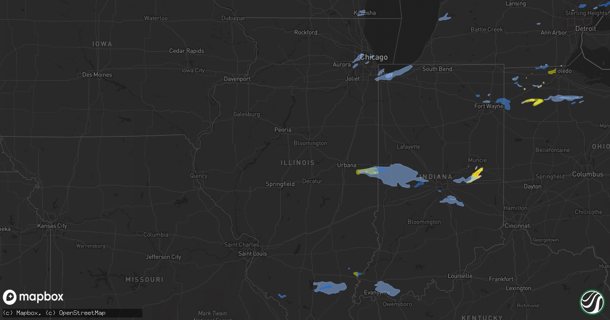
Hail Map in Illinois on August 18, 2019
Get this storm
August 18 map
$229
one time, instant access
Download today. No call, no setup
Keep the $229
Bought the map and want the full workflow? Apply the entire $229 to a subscription within 7 days. None of it is wasted.
Every map, not just this one
This buys you this map. Subscription and you get every map we run, in the markets you choose from a few cities to whole states to nationwide. Plus real-time alerts the moment a storm fires.
Contact data
Name, contact info, occupancy, even credit band for addresses in the footprint. You go from where it hit to who to call.
Become the source they trust
Unlimited branding weather history reports on demand. You already have the documented answer ready for the property owner, and you are the one who showed up with it.
Property data and RoofTrace estimates
Pull up any address you have got, its value and the exact code rules for that jurisdiction, straight from One Click Code. Then RoofTrace estimates the squares, pitch, and roof value, priced the way you price.
Storm reports in Illinois
Illinois
| Date | Description |
|---|---|
| 08/18/20195:40 PM CDT | Delayed report. Business sign blown over. Time estimated. |
| 08/18/20194:30 PM CDT | A local report indicates 1.00 inch wind near WESTVILLE |
| 08/18/20194:25 PM CDT | 1 inch diamter hail from tilton to georgetown |
| 08/18/20194:25 PM CDT | Measured 1 inch diameter hail from tilton to georgetown |
| 08/18/20194:21 PM CDT | Wind gusts of 60 mph and higher measured in georgetown |
| 08/18/20194:20 PM CDT | Tree blown down causing a propane tank leak |
| 08/18/20194:15 PM CDT | Tree damage and debris from tilton to westville. Powerlines down by westville sanitary plant blocking roads. |
| 08/18/20193:51 PM CDT | Large trees fell on two different mobile homes in town. |
| 08/18/20193:40 PM CDT | Trees down in grayville. |
| 08/18/20193:30 PM CDT | 2 to 3 foot diameter tree down at the corner of 400e and 725n just southwest of albion. Lots of smaller tree limbs down in the area. |
| 08/18/20193:30 PM CDT | Multiple small trees down a half mile south of 400e and 400n. |
| 08/18/20192:35 PM CDT | Several large tree limbs down. Relayed through news media. |
| 08/18/20192:05 PM CDT | Several large tree limbs down. Relayed through news media. Corrected for time. |
| 08/18/20198:50 AM CDT | Delayed report: photo shared on twitter of a large tree branch down near lincoln park. Time estimated based on radar. |
| 08/18/20198:30 AM CDT | Niles pd reports via social media numerous instances of tree damage. Time estimated by radar. |
| 08/18/20197:55 AM CDT | Update to previous report from spotter. 8-10 inch diameter branch downed on powerlines near ojibwa and curran west of mchenry. Also 17 inch diameter branch snapped in s |
| 08/18/20197:25 AM CDT | Numerous large branches downed at residence in oak brook along adams road. Report relayed by media. Time estimated by radar. |
| 08/18/20197:15 AM CDT | Delayed report: facebook photo of large branch down near elgin. Time and location estimated based on radar. |
| 08/18/20197:08 AM CDT | Delayed report: facebook photo of large tree downed near downers grove. Time estimated based on radar. |
| 08/18/20197:05 AM CDT | Delayed report... Numerous branches downed along lemont road between 87th street and 75th street in darien. |
| 08/18/20197:05 AM CDT | Photo shared via social media of minor tree damage in darien. Numerous twigs and at least one small branch downed. |
| 08/18/20197:05 AM CDT | Delayed report... Large section of tree snapped at mccollum park in downers grove. Branch over 2ft in diameter and over 20ft long. Time estimated by radar. |
| 08/18/20197:00 AM CDT | Damage to numerous trees and powerlines along briarcliff road in the vicinity of ashbury... Oxford... And queenswood. Reported by dispatch center. |
| 08/18/20193:41 AM CDT | At 841 AM CDT, a severe thunderstorm was located over Midway Airport, moving northeast at 40 mph. HAZARD...60 mph wind gusts. SOURCE...Radar indicated. IMPACT...Expect damage to roofs, siding, and trees. Locations impacted include... Chicago, Cicero, Bolingbrook, Orland Park, Oak Lawn, Berwyn, Oak Park, Downers Grove, Westmont, Brookfield, Hinsdale, Lemont, La Grange, Forest Park, Justice, Summit, Worth, Lyons, Burr Ridge and Riverside.Including the following interstates... I-55 between mile markers 270 and 294. I-94 between mile markers 49 and 59. I-290 between mile markers 23 and 29. I-294 between mile markers 49 and 59. I-355 between mile markers 8 and 10, and mile marker 12 and nearmile marker 14.This includes... Argonne National Laboratory, Brookfield Zoo,Lincoln Park Zoo, Toyota Park, Hawthorne Park, Moraine ValleyCommunity College, Soldier Field, University of Illinois Chicago, USCellular Field...IL Institute of Technology, The Loop, Museum Campus,and Northerly Island. |
| 08/18/20193:20 AM CDT | At 820 AM CDT, a severe thunderstorm was located over Lombard, moving northeast at 35 mph. HAZARD...60 mph wind gusts. SOURCE...Radar indicated. IMPACT...Expect damage to roofs, siding, and trees. Locations impacted include... Chicago, Aurora, Naperville, Cicero, Arlington Heights, Evanston, Bolingbrook, Skokie, Des Plaines, Berwyn, Mount Prospect, Wheaton, Oak Park, Downers Grove, Glenview, Elmhurst, Lombard, Carol Stream, Park Ridge and Addison.Including the following interstates... I-88 between mile markers 123 and 140. I-94 between mile markers 29 and 48. I-290 between mile markers 3 and 24. I-294 between mile markers 29 and 48. I-355 between mile markers 15 and 30.This includes... Brookfield Zoo, Loyola University, Oakton CommunityCollege, Triton College, Benedictine University, College of DuPage,DuPage County Fairgrounds, Morton Arboretum, Northeastern IllinoisUniversity, Northwestern University, Wheaton College, Wrigley Field,and North Central College. |
| 08/18/20193:13 AM CDT | At 813 AM CDT, a severe thunderstorm was located near Kenosha, moving east at 50 mph. HAZARD...60 mph wind gusts. SOURCE...Radar indicated. IMPACT...Expect damage to roofs, siding, and trees. Locations impacted include... Kenosha, Racine, Pleasant Prairie and Elmwood Park. |
| 08/18/20192:13 AM CDT | At 713 AM CDT, severe thunderstorms were located along a line extending from Bartlett to Woodridge, moving east at 40 mph. HAZARD...60 mph wind gusts and penny size hail. SOURCE...Radar indicated. IMPACT...Expect damage to roofs, siding, and trees. Locations impacted include... Elgin, Arlington Heights, Evanston, Schaumburg, Palatine, Skokie, Des Plaines, Mount Prospect, Wheaton, Hoffman Estates, Glenview, Elmhurst, Lombard, Buffalo Grove, Carol Stream, Wheeling, Park Ridge, Addison, Northbrook and Highland Park.Including the following interstates... I-88 between mile markers 128 and 129. I-94 between mile markers 20 and 39. I-290 between mile markers 1 and 13. I-294 between mile markers 20 and 39. I-355 between mile markers 24 and 30.This includes... Oakton Community College, Schaumburg BoomersBaseball, College of DuPage, DuPage County Fairgrounds, HarperCollege, Lake Forest College, Ravinia Music Festival, and WheatonCollege. |
| 08/18/20191:59 AM CDT | At 659 AM CDT, a severe thunderstorm was located over Bolingbrook, moving northeast at 35 mph. HAZARD...60 mph wind gusts and quarter size hail. SOURCE...Radar indicated. IMPACT...Hail damage to vehicles is expected. Expect wind damage to roofs, siding, and trees. Locations impacted include... Chicago, Joliet, Naperville, Cicero, Evanston, Bolingbrook, Skokie, Orland Park, Oak Lawn, Berwyn, Oak Park, Downers Grove, Elmhurst, Lombard, Romeoville, Plainfield, Wilmette, Lockport, Westmont and Homer Glen.Including the following interstates... I-55 between mile markers 260 and 294. I-57 between mile markers 355 and 358. I-88 between mile markers 129 and 140. I-94 between mile markers 39 and 65. I-290 between mile markers 13 and 29. I-294 between mile markers 39 and 65. I-355 between mile markers 4 and 23.This includes... Argonne National Laboratory, Brookfield Zoo,Lincoln Park Zoo, Loyola University, Toyota Park, Triton College,University of Chicago, Benedictine University, Hawthorne Park, LewisUniversity, Moraine Valley Community College, Morton Arboretum,Northeastern Illinois University, Northwestern University, SoldierField, University of Illinois Chicago, US Cellular Field...ILInstitute of Technology, Wrigley Field, The Loop, Museum of Scienceand Industry, Museum Campus, Northerly Island, and North CentralCollege. |
| 08/18/201912:08 AM CDT | At 508 PM CDT, severe thunderstorms were located along a line extending from 6 miles west of Newport to near Newman, moving east at 25 mph. HAZARD...60 mph wind gusts and half dollar size hail. SOURCE...Radar indicated. IMPACT...Hail damage to vehicles is expected. Expect wind damage to roofs, siding, and trees. Locations impacted include... Chrisman, Hume, Brocton, Edgar, Metcalf, Palermo, Scottland and Edgar County Airport. |
| 08/17/201910:47 PM CDT | At 347 PM CDT, severe thunderstorms were located along a line extending from near St. Joseph to near Broadlands, moving east at 30 mph. HAZARD...60 mph wind gusts and half dollar size hail. SOURCE...Radar indicated. IMPACT...Hail damage to vehicles is expected. Expect wind damage to roofs, siding, and trees. Locations impacted include... Danville, St. Joseph, Georgetown, Westville, Tilton, Catlin, Oakwood, Homer, Ridge Farm, Ogden, Fairmount, Sidell, Fithian, Belgium, Broadlands, Allerton, Muncie, Bismarck, Indianola and Jamaica.This includes Interstate 74 between mile markers 192 and 220. |
| 08/17/201910:44 PM CDT | At 344 PM CDT, a severe thunderstorm was located over Grayville, or 8 miles southeast of Albion, moving east at 15 mph. HAZARD...60 mph wind gusts and quarter size hail. SOURCE...Radar indicated. IMPACT...Hail damage to vehicles is expected. Expect wind damage to roofs, siding, and trees. Locations impacted include... Princeton, Mount Carmel, Fort Branch, Albion, Grayville, Lancaster, Haubstadt, Owensville, Poseyville, West Salem, Patoka, Cynthiana, Allendale, Bellmont, Hazleton, Decker, Bone Gap, Keensburg, Griffin and Browns.This includes Interstate 64 in Indiana between Mile Markers 1 and 15. |
| 08/17/201910:41 PM CDT | At 341 PM CDT, a severe thunderstorm was located near Mcleansboro, moving east at 40 mph. HAZARD...60 mph wind gusts and quarter size hail. SOURCE...Radar indicated. IMPACT...Hail damage to vehicles is expected. Expect wind damage to roofs, siding, and trees. Locations impacted include... Carmi, Eldorado, Mcleansboro, Grayville, Norris City, Galatia, Ridgway, Crossville, Enfield, New Haven, Raleigh, Omaha, Mill Shoals, Broughton, Maunie, Springerton, Belle Prairie City, Burnt Prairie and Phillipstown.This includes Interstate 64 in Illinois between Mile Markers 117 and130. |
| 08/17/201910:21 PM CDT | At 321 PM CDT, a severe thunderstorm was located 9 miles north of Thompsonville, or 10 miles east of Benton, moving east at 30 mph. HAZARD...60 mph wind gusts and quarter size hail. SOURCE...Radar indicated. IMPACT...Hail damage to vehicles is expected. Expect wind damage to roofs, siding, and trees. Locations impacted include... Mcleansboro, Thompsonville, Dahlgren, Belle Rive, Hanaford, Ewing, Broughton, Macedonia and Belle Prairie City. |
| 08/17/20198:40 PM CDT | At 140 PM CDT, a severe thunderstorm was located 7 miles northwest of Bluford, or 9 miles northeast of Mount Vernon, moving east at 25 mph. HAZARD...60 mph wind gusts and quarter size hail. SOURCE...Radar indicated. IMPACT...Hail damage to vehicles is expected. Expect wind damage to roofs, siding, and trees. Locations impacted include... Bluford and Johnsonville. |
All States Impacted by Hail Map on August 18, 2019
Cities Impacted by Hail Map on August 18, 2019
- Jasper, MI
- Millport, NY
- Pine Valley, NY
- Beaver Dams, NY
- Horseheads, NY
- New Bethlehem, PA
- Ravenna, OH
- Windham, OH
- Stow, OH
- Deshler, OH
- Leipsic, OH
- Hamler, OH
- Continental, OH
- Emporium, PA
- Myerstown, PA
- Sigel, PA
- Denver, PA
- Reinholds, PA
- Wernersville, PA
- Stevens, PA
- Reading, PA
- Painted Post, NY
- Campbell, NY
- Kent, OH
- Tallmadge, OH
- Mogadore, OH
- Alpine, NY
- Cayuta, NY
- Van Etten, NY
- Erin, NY
- Boyertown, PA
- Mayfield, NY
- Allentown, PA
- Bath, PA
- Northampton, PA
- Bethlehem, PA
- Coplay, PA
- Catasauqua, PA
- Whitehall, PA
- Middletown, MD
- Jefferson, MD
- Frenchtown, NJ
- Pittstown, NJ
- Hardy, AR
- Williford, AR
- Junction City, OH
- Wellington, TX
- Peninsula, OH
- Secaucus, NJ
- North Bergen, NJ
- West New York, NJ
- Carlstadt, NJ
- East Rutherford, NJ
- Chrisman, IL
- Akron, OH
- Galway, NY
- Hamburg, PA
- New Bavaria, OH
- Atwater, OH
- New Castle, IN
- Charlottesville, IN
- Springport, IN
- Knightstown, IN
- Spiceland, IN
- Kennard, IN
- Shirley, IN
- Mooreland, IN
- Lakemore, OH
- Palmerton, PA
- Lehighton, PA
- Jonestown, PA
- Lebanon, PA
- Cold Spring, NY
- Hopewell Junction, NY
- Carmel, NY
- Homer, IL
- Ottawa, OH
- Miller City, OH
- Williamsfield, OH
- Gloversville, NY
- Pennsburg, PA
- East Greenville, PA
- Woodbine, MD
- Defiance, OH
- Mohnton, PA
- Birdsboro, PA
- Buskirk, NY
- Brookville, PA
- Johnstown, NY
- Caroga Lake, NY
- Clarington, PA
- Middletown, IN
- Daleville, IN
- Dolgeville, NY
- Stratford, NY
- Saint Johnsville, NY
- Salisbury Center, NY
- Pleasant Valley, NY
- Mount Airy, MD
- Orrville, OH
- Dalton, OH
- Jamestown, PA
- Andover, OH
- Liberty Center, OH
- Georgetown, IL
- Uniontown, OH
- Coopersburg, PA
- Center Valley, PA
- Hudson, OH
- Streetsboro, OH
- Wauseon, OH
- Quakertown, PA
- North Canton, OH
- Candor, NY
- Willseyville, NY
- North Baltimore, OH
- Custar, OH
- Rome, NY
- Holland Patent, NY
- Barneveld, NY
- Marcy, NY
- Utica, NY
- Stittville, NY
- Ballston Lake, NY
- Cambridge Springs, PA
- Edinboro, PA
- Taylors, SC
- Oakwood, OH
- Holgate, OH
- Paulding, OH
- Mechanicville, NY
- Ballston Spa, NY
- Cuyahoga Falls, OH
- Oley, PA
- Aurora, OH
- Bernville, PA
- Mohrsville, PA
- Fayette City, PA
- Allenport, PA
- Stockdale, PA
- Medina, OH
- Templeton, PA
- Muncie, IN
- Fairmount, IL
- Indianola, IL
- Breinigsville, PA
- Mertztown, PA
- Alburtis, PA
- Metcalf, IL
- Slatington, PA
- Walnutport, PA
- Blacksburg, SC
- Monkton, MD
- Fallston, MD
- Wadsworth, OH
- Hartville, OH
- Stewartsville, NJ
- Asbury, NJ
- Washington, NJ
- Phillipsburg, NJ
- Cherryville, PA
- Laurys Station, PA
- Danielsville, PA
- Ephrata, PA
- Point Of Rocks, MD
- Perkasie, PA
- Hollis, OK
- Poughkeepsie, NY
- Kinsman, OH
- Mantua, OH
- Hiram, OH
- Douglassville, PA
- Newark Valley, NY
- Macungie, PA
- Trexlertown, PA
- Ottsville, PA
- Canal Fulton, OH
- North Lawrence, OH
- Orwell, OH
- Masontown, PA
- Smithfield, PA
- Schaghticoke, NY
- Home, PA
- Creekside, PA
- Brandywine, WV
- Franklin, WV
- Newmanstown, PA
- Archbold, OH
- Barberton, OH
- Lebanon, NJ
- Sherwood, OH
- Napoleon, OH
- Mammoth Spring, AR
- Sinnamahoning, PA
- Frederick, MD
- Harrisonburg, VA
- Brunswick, MD
- Lovettsville, VA
- Knoxville, MD
- Saylorsburg, PA
- Kunkletown, PA
- Westminster, MD
- Middlebourne, WV
- Malone, WI
- Schuylkill Haven, PA
- Austin, PA
- Blissfield, MI
- Weedville, PA
- Toledo, OH
- Temperance, MI
- Dayton, PA
- Daisytown, PA
- Richeyville, PA
- Fredericktown, PA
- Brownsville, PA
- Mohegan Lake, NY
- Newton Falls, OH
- Greenville, PA
- Roscoe, PA
- Grindstone, PA
- East Brady, PA
- Tremont, PA
- Berkshire, NY
- Adamstown, MD
- Rootstown, OH
- Pitman, PA
- Adrian, PA
- Bryan, OH
- Brodheadsville, PA
- Gilbert, PA
- Fleetwood, PA
- Lucinda, PA
- Strattanville, PA
- Perryopolis, PA
- Elco, PA
- Driftwood, PA
- Benezett, PA
- Rockton, PA
- Du Bois, PA
- Penfield, PA
- Byrnedale, PA
- Spencer, NY
- Poland, NY
- Newport, NY
- Little Falls, NY
- Amsterdam, NY
- Burnt Hills, NY
- Montpelier, OH
- West Unity, OH
- Berkey, OH
- Metamora, OH
- Lyons, OH
- Ney, OH
- Tiffin, OH
- Fostoria, OH
- Risingsun, OH
- Bloomdale, OH
- Kansas, OH
- Wayne, OH
- Jerry City, OH
- Cygnet, OH
- West Millgrove, OH
- Van Buren, OH
- Green Springs, OH
- Hoytville, OH
- McComb, OH
- Bascom, OH
- Munroe Falls, OH
- Leavittsburg, OH
- Warren, OH
- McDonald, OH
- Niles, OH
- Hubbard, OH
- Girard, OH
- North Jackson, OH
- Diamond, OH
- Mineral Ridge, OH
- Youngstown, OH
- Holland, OH
- Monclova, OH
- Swanton, OH
- Bluffton, AR
- Strasburg, VA
- Greer, SC
- Greenville, SC
- Pleasant Prairie, WI
- Kenosha, WI
- Fairview, NJ
- Cliffside Park, NJ
- Edgewater, NJ
- New York, NY
- Grayville, IL
- Danville, IL
- Catlin, IL
- Cayuga, IN
- Westville, IL
- South Haven, MI
- Allegan, MI
- Fennville, MI
- Pullman, MI
- Grand Junction, MI
- West Olive, MI
- Grand Haven, MI
- Croswell, MI
- Imlay City, MI
- North Branch, MI
- Marlette, MI
- Melvin, MI
- Peck, MI
- Brown City, MI
- Lexington, MI
- East China, MI
- Marine City, MI
- Fair Haven, MI
- New Baltimore, MI
- Stockbridge, MI
- Gregory, MI
- Chelsea, MI
- Keego Harbor, MI
- Pontiac, MI
- Waterford, MI
- Bloomfield Hills, MI
- Utica, MI
- Rochester, MI
- Washington, MI
- Macomb, MI
- Windsor, NY
- Walton, NY
- Fremont Center, NY
- North Branch, NY
- Roscoe, NY
- Livingston Manor, NY
- Callicoon, NY
- Hankins, NY
- Schoharie, NY
- Clifton Park, NY
- Rexford, NY
- Schenectady, NY
- Auburn, NY
- Union Springs, NY
- Cayuga, NY
- Chandler, IN
- Chrisney, IN
- Elberfeld, IN
- Evansville, IN
- Boonville, IN
- Richland, IN
- Haubstadt, IN
- Newburgh, IN
- Rockport, IN
- Coatesville, IN
- North Salem, IN
- Bainbridge, IN
- Danville, IN
- Carmel, IN
- Indianapolis, IN
- Mccordsville, IN
- Wilkinson, IN
- Fortville, IN
- Greenfield, IN
- Maxwell, IN
- Franklin, IN
- Needham, IN
- Fairland, IN
- Greenwood, IN
- Whiteland, IN
- Shelbyville, IN
- Boggstown, IN
- Edinburgh, IN
- Waldron, IN
- Bargersville, IN
- Hammond, IN
- Lansing, IL
- East Chicago, IN
- Calumet City, IL
- Gary, IN
- Michigan City, IN
- Chesterton, IN
- Lake Station, IN
- Beverly Shores, IN
- Chicago Heights, IL
- Griffith, IN
- Valparaiso, IN
- Dyer, IN
- Merrillville, IN
- Hobart, IN
- Munster, IN
- Highland, IN
- Schererville, IN
- Portage, IN
- Churubusco, IN
- Columbia City, IN
- Fort Wayne, IN
- Huntertown, IN
- Garrett, IN
- Auburn, IN
- New Haven, IN
- Woodburn, IN
- Antwerp, OH
- Payne, OH
- Grabill, IN
- Harlan, IN
- Haviland, OH
- Burkittsville, MD
- Rohrersville, MD
- Tuscarora, MD
- Leesburg, VA
- Ewing, IL
- Ina, IL
- Whittington, IL
- Macedonia, IL
- Dale, IL
- Dahlgren, IL
- Belle Rive, IL
- Norris City, IL
- Broughton, IL
- Enfield, IL
- Carmi, IL
- McLeansboro, IL
- Benton, IL
- Thompsonville, IL
- Golden Gate, IL
- Ellery, IL
- Mount Carmel, IL
- Campbell Hill, IL
- Ava, IL
- Chester, IL
- Steeleville, IL
- Ridge Farm, IL
- Lizton, IN
- Bloomingdale, IN
- Rockville, IN
- Perrysville, IN
- Veedersburg, IN
- Ladoga, IN
- Marshall, IN
- Dana, IN
- Hillsboro, IN
- Kingman, IN
- Russellville, IN
- Montezuma, IN
- Greencastle, IN
- New Ross, IN
- Alamo, IN
- Waveland, IN
- Pittsboro, IN
- Crawfordsville, IN
- New Market, IN
- Jamestown, IN
- Roachdale, IN
- Hillsdale, IN
- Waynetown, IN
- Covington, IN
- Downers Grove, IL
- Westmont, IL
- Bolingbrook, IL
- Darien, IL
- Woodridge, IL
- Lisle, IL
- Westchester, IL
- Melrose Park, IL
- Oak Brook, IL
- Hillside, IL
- Franklin Park, IL
- Stone Park, IL
- Maywood, IL
- Elmhurst, IL
- Villa Park, IL
- Lombard, IL
- River Grove, IL
- Bellwood, IL
- Berkeley, IL
- Chicago, IL
- Clarion, PA
- Saint Marys, PA
- Kersey, PA
- Lewistown, PA
- Reedsville, PA
- Yeagertown, PA
- Belleville, PA
- Huntingdon, PA
- Mifflintown, PA
- Burnham, PA
- Port Royal, PA
- Mifflin, PA
- Gillett, PA
- Millerton, PA
- Childress, TX
- Lakeview, TX


