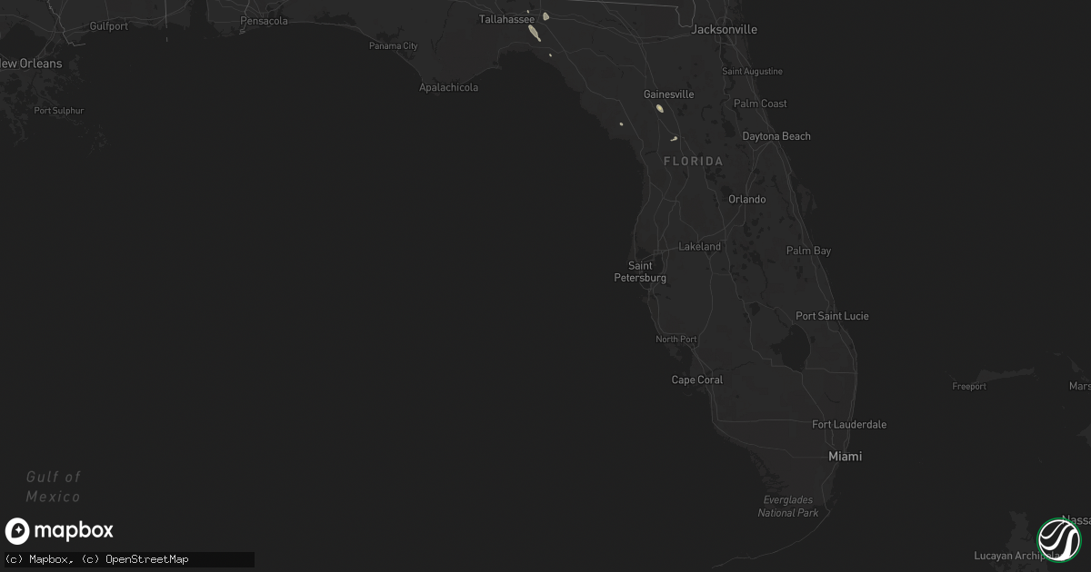
Hail Map in Florida on August 14, 2016
Get this storm
August 14 map
$229
one time, instant access
Download today. No call, no setup
Keep the $229
Bought the map and want the full workflow? Apply the entire $229 to a subscription within 7 days. None of it is wasted.
Every map, not just this one
This buys you this map. Subscription and you get every map we run, in the markets you choose from a few cities to whole states to nationwide. Plus real-time alerts the moment a storm fires.
Contact data
Name, contact info, occupancy, even credit band for addresses in the footprint. You go from where it hit to who to call.
Become the source they trust
Unlimited branding weather history reports on demand. You already have the documented answer ready for the property owner, and you are the one who showed up with it.
Property data and RoofTrace estimates
Pull up any address you have got, its value and the exact code rules for that jurisdiction, straight from One Click Code. Then RoofTrace estimates the squares, pitch, and roof value, priced the way you price.
Storm reports in Florida
Florida
| Date | Description |
|---|---|
| 08/14/20165:55 PM CDT | County roads department reported two trees down near florida camp site road. |
| 08/14/20165:20 PM CDT | Tree down |
| 08/14/20164:20 PM CDT | Numerous trees down and several landed on homes in area of south country club road. Columbia county emergency management surveyed and photographed the damage. Their rep |
| 08/14/20162:55 PM CDT | Tree down in eastbound lane of us 90. |
| 08/14/20162:42 PM CDT | Tree down in the road. |
| 08/14/20162:28 PM CDT | Lake county ems reports structural damage to a community pool house at the shangri-la by the lake mobile home park. Roof torn off building and damage to wiring. Time es |
| 08/14/20162:10 PM CDT | Lake county sheriff reports lakeshore dr between bay rd and sunset dr is closed due to a large tree down. Time estimated by radar |
All States Impacted by Hail Map on August 14, 2016
Cities Impacted by Hail Map on August 14, 2016
- Laurel, MD
- Beltsville, MD
- Presho, SD
- Fort Pierre, SD
- Faith, SD
- Otter, MT
- Gann Valley, SD
- Eagle Butte, SD
- Beallsville, MD
- Poolesville, MD
- Dickerson, MD
- Cairo, GA
- Meadow, SD
- Richardton, ND
- Lefor, ND
- Murdo, SD
- Draper, SD
- Washington Court House, OH
- Bloomingburg, OH
- New Holland, OH
- Gate City, VA
- Church Hill, TN
- Mott, ND
- Charlotte, NC
- Nemo, SD
- Unicoi, TN
- Chiefland, FL
- Keldron, SD
- McIntosh, SD
- Prairie City, SD
- Bison, SD
- Dupree, SD
- Roundup, MT
- Terry, MT
- Afton, TN
- Greeneville, TN
- Kinsey, MT
- Quinn, SD
- Philip, SD
- Kadoka, SD
- Wall, SD
- Albuquerque, NM
- Perry, FL
- Belle Fourche, SD
- Pierre, SD
- Monticello, FL
- Owanka, SD
- Wasta, SD
- Frankfort, OH
- Appling, GA
- Lead, SD
- Agar, SD
- Angela, MT
- Ocala, FL
- Malta, MT
- Golconda, IL
- Metropolis, IL
- Williston, FL
- Micanopy, FL
- Archer, FL
- Browning, MT
- Cut Bank, MT
- Fallon, MT
- Ripley, WV
- New Market, VA
- Cohagen, MT
- Donalsonville, GA
- Thomasville, GA
- Saltville, VA
- Union, WV
- Gap Mills, WV
- Jordan, MT
- Circle, MT
- Brockway, MT
- Rogersville, TN
- Miller, SD
- Tallahassee, FL
- Alzada, MT
- West Liberty, KY
- Clarksburg, MD
- Boyds, MD
- Naylor, GA
- Lake Park, GA
- Onida, SD
- Robbins, NC
- Carthage, NC
- Big Island, VA
- Daleville, AL
- Bynum, MT
- Okaton, SD
- Lamont, FL
- Deadwood, SD
- Earleville, MD
- Dayton, MD
- Clarksville, MD
- Vivian, SD
- Belvidere, SD
- Buffalo Gap, SD
- Jeffersonville, OH
- New Leipzig, ND
- Mount Sterling, OH
- Lindside, WV
- Greenville, WV
- Moncure, NC
- Hettinger, ND
- Decker, MT
- Vesuvius, VA
- Fort Mill, SC
- Ballard, WV
- Wilmington, OH
- Creston, NC
- Zionville, NC
- Mountain City, TN
- Kershaw, SC
- Highmore, SD
- Taylorsville, KY
- South Solon, OH
- Ray City, GA
- Valdosta, GA
- Moody Afb, GA
- Lakeland, GA
- Ellicott City, MD
- Winnett, MT
- Jefferson, NC
- Harrold, SD
- Marshall, NC
- Kennebec, SD
- Lancaster, SC
- Pageland, SC
- Charlottesville, VA
- Hulett, WY
- Glenelg, MD
- Hays, NC
- Hartford, AL
- Taylor, ND
- Isabel, SD
- Galax, VA
- Lemmon, SD
- Leesburg, VA
- Boston, KY
- Indian Trail, NC
- Bastian, VA
- Abingdon, VA
- Bristol, TN
- Ohkay Owingeh, NM
- Espanola, NM
- Reva, SD
- Shelbyville, KY


