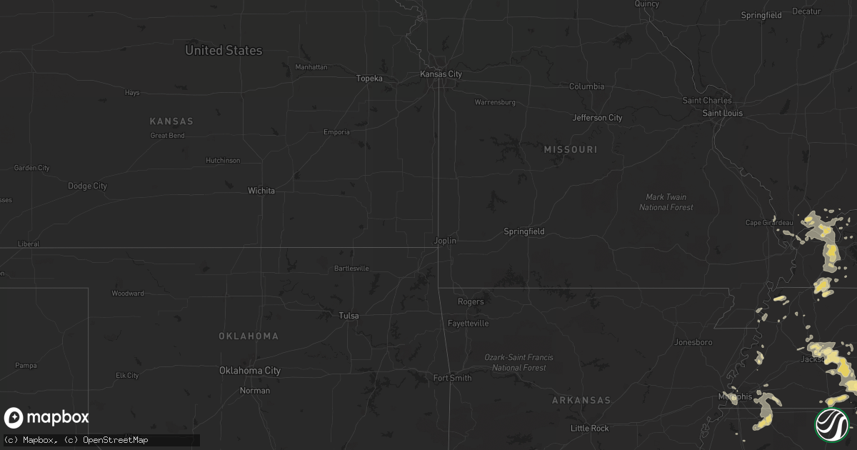
Hail Map in Tennessee on August 13, 2012
Get this storm
August 13 map
$229
one time, instant access
Download today. No call, no setup
Keep the $229
Bought the map and want the full workflow? Apply the entire $229 to a subscription within 7 days. None of it is wasted.
Every map, not just this one
This buys you this map. Subscription and you get every map we run, in the markets you choose from a few cities to whole states to nationwide. Plus real-time alerts the moment a storm fires.
Contact data
Name, contact info, occupancy, even credit band for addresses in the footprint. You go from where it hit to who to call.
Become the source they trust
Unlimited branding weather history reports on demand. You already have the documented answer ready for the property owner, and you are the one who showed up with it.
Property data and RoofTrace estimates
Pull up any address you have got, its value and the exact code rules for that jurisdiction, straight from One Click Code. Then RoofTrace estimates the squares, pitch, and roof value, priced the way you price.
Storm reports in Tennessee
Tennessee
| Date | Description |
|---|---|
| 08/13/20126:13 PM CDT | Several trees down and telephone poles broken in several locations around south parkway and i-240. |
| 08/13/201212:10 PM CDT | Tree blown down on puryear road |
| 08/13/201211:10 AM CDT | Public report via twitter of numerous trees down on division st in mount juliet |
| 08/13/201211:00 AM CDT | Tree blown down on topeka drive in hermitage |
| 08/13/201210:55 AM CDT | Tree blown down at lebanon road and stewarts ferry pike in hermitage |
| 08/13/201210:48 AM CDT | Two trees were downed near the fedex world service center at 127 athens way in nashville. |
| 08/13/20127:15 AM CDT | A local report indicates 1.00 inch wind near SAMBURG |
| 08/13/20127:00 AM CDT | A local report indicates 60 MPH wind near TIPTONVILLE |
All States Impacted by Hail Map on August 13, 2012
Cities Impacted by Hail Map on August 13, 2012
- Snow Lake, AR
- Daytona Beach, FL
- Port Orange, FL
- Pittsboro, MS
- Houston, MS
- Vardaman, MS
- Houlka, MS
- Sulligent, AL
- Detroit, AL
- Hamilton, AL
- Cohagen, MT
- Jordan, MT
- Corinth, MS
- Clarksdale, MS
- Nashville, TN
- Greenwood, MS
- Sidon, MS
- Tamms, IL
- Villa Ridge, IL
- Pulaski, IL
- Mounds, IL
- Banning, CA
- Indian Mound, TN
- Tennessee Ridge, TN
- Cumberland City, TN
- Centreville, AL
- West Blocton, AL
- Raton, NM
- Rio Frio, TX
- Leakey, TX
- Metropolis, IL
- Goodman, MS
- Sallis, MS
- Tichnor, AR
- Oakland, MS
- Enid, MS
- Coffeeville, MS
- Pope, MS
- Courtland, MS
- Water Valley, MS
- Batesville, MS
- Charleston, MS
- Chinook, MT
- Lloyd, MT
- Rogersville, AL
- Town Creek, AL
- Millport, AL
- Vernon, AL
- Hornbeak, TN
- Tiptonville, TN
- Belknap, IL
- Jemison, AL
- Clanton, AL
- Morton, MS
- Rosedale, MS
- Gunnison, MS
- Watson, AR
- Beech Bluff, TN
- Huron, TN
- Luray, TN
- Coldwater, MS
- Gore Springs, MS
- Grenada, MS
- Paducah, KY
- Brookport, IL
- Golconda, IL
- Randolph, MS
- Arkansas City, AR
- McGehee, AR
- Rohwer, AR
- Camden, MS
- Carthage, MS
- Kosciusko, MS
- Minter City, MS
- Vienna, IL
- Karnak, IL
- Brewton, AL
- Holly Springs, MS
- Red Banks, MS
- Winona, MS
- Kilmichael, MS
- Jackson, TN
- Oakfield, TN
- Farmington, KY
- Murray, KY
- De Witt, AR
- Selma, AL
- Plantersville, AL
- Malta, MT
- Miles City, MT
- Sylacauga, AL
- West Monroe, LA
- Farmerville, LA
- Monroe, LA
- Ethel, AR
- Shiloh, TN
- Michie, TN
- Selmer, TN
- Counce, TN
- Stantonville, TN
- Guys, TN
- Ramer, TN
- Mayfield, KY
- Wingo, KY
- Water Valley, KY
- Sedalia, KY
- Dukedom, TN
- Martin, TN
- Fulton, KY
- South Fulton, TN
- Pelahatchie, MS
- Brandon, MS
- Byhalia, MS
- Lexington, TN
- Shaw, MS
- Inverness, MS
- Ruleville, MS
- Cleveland, MS
- Sunflower, MS
- Mound Bayou, MS
- Merigold, MS
- Boyle, MS
- Drew, MS
- Belzoni, MS
- Doddsville, MS
- Itta Bena, MS
- Moorhead, MS
- Schlater, MS
- Indianola, MS
- Dresden, TN
- Palmersville, TN
- Marks, MS
- Wildersville, TN
- Yuma, TN
- La Loma, NM
- Las Vegas, NM
- Loxahatchee, FL
- Lawrenceburg, TN
- Westpoint, TN
- Centerville, TN
- Lobelville, TN
- Johnson City, TX
- El Centro, CA
- Kenton, TN
- Canton, MS
- Paris, MS
- Oxford, MS
- Banner, MS
- Talladega, AL
- Stewart, MS
- Duck Hill, MS
- Vaiden, MS
- Carrollton, MS
- McCarley, MS
- Holcomb, MS
- Spicewood, TX
- Florence, AL
- Cypress Inn, TN
- Iron City, TN
- Thebes, IL
- Memphis, TN
- Henderson, TN
- Killen, AL
- Lutts, TN
- Waterloo, AL
- Sardis, MS
- Rayville, LA
- Alma, WI
- Nunnelly, TN
- Senatobia, MS
- Bruce, MS
- Beaumont, CA
- Ashland, AL
- Portland, AR
- Brockway, MT
- Dumas, AR
- Dongola, IL
- Henning, TN
- Covington, TN
- Vinegar Bend, AL
- Leakesville, MS
- Beaverton, AL
- Pontotoc, MS
- Lambert, MS
- Muscle Shoals, AL
- Lexington, AL
- Big Rock, TN
- Waverly, TN
- Erin, TN
- La Fayette, KY
- Fort Campbell, KY
- Palmyra, TN
- Dover, TN
- Woodlawn, TN
- Herndon, KY
- Stewart, TN
- Clarksville, TN
- Scobey, MS
- Tillatoba, MS
- Vicksburg, MS
- Cottage Grove, TN
- Hickory, KY
- West Paducah, KY
- Smithland, KY
- Boaz, KY
- Ullin, IL
- Calvert City, KY
- Benton, KY
- Kirksey, KY
- La Center, KY
- Cypress, IL
- Kevil, KY
- Symsonia, KY
- Grand Chain, IL
- Hampton, KY
- Grantsburg, IL
- Ledbetter, KY
- West Memphis, AR
- Collinwood, TN
- Round Mountain, TX
- Vaughan, MS
- Pickens, MS
- Newellton, LA
- Ismay, MT
- Athens, AL
- Buchanan, TN
- Stanton, AL
- Boncarbo, CO
- Oakland, TN
- Arlington, TN
- Liberty Hill, TX
- Tillar, AR
- Gillett, AR
- West, MS
- Coila, MS
- Sardis, TN
- Humboldt, TN
- Reagan, TN
- Enville, TN
- Medina, TN
- Milledgeville, TN
- Sells, AZ
- Linden, TN
- Gould, AR
- McIntosh, AL
- Jackson, AL
- Cadiz, KY
- Tuscaloosa, AL
- Del Rio, TX
- Bentonia, MS
- Benoit, MS
- Morris Chapel, TN
- Adamsville, TN
- Savannah, TN
- Olivehill, TN
- Waynesboro, TN
- Clifton, TN
- Ripley, TN
- Williston, TN
- Moscow, TN
- Rossville, TN
- Lyon, MS
- Coahoma, MS
- Terry, MT
- Circle, MT
- Parsons, TN
- Okolona, MS
- Eddyville, IL
- Alligator, MS
- Duncan, MS
- Holladay, TN
- Sugar Tree, TN
- Troy, TN
- Pocahontas, TN
- Caruthersville, MO
- Hayti, MO
- Summertown, TN
- Kaycee, WY
- Madison, TN
- McCool, MS
- Weir, MS
- French Camp, MS
- Ackerman, MS
- Brierfield, AL
- Leander, TX
- Trenton, TN
- Saltillo, MS
- Obion, TN
- Bells, TN
- Gadsden, TN
- Forest, MS
- Fallon, MT
- Kennedy, AL
- Santa Fe, NM
- Nettleton, MS
- Raleigh, MS
- Lake, MS
- Pulaski, MS
- Barksdale, TX
- Fort Davis, TX
- Lena, MS
- Aberdeen, MS
- Durant, MS
- Fayette, AL
- Hardin, KY
- Almo, KY
- Starkville, MS
- Tallulah, LA
- Louin, MS
- Madison, MS
- Barlow, KY
- Silver City, MS
- Crump, TN
- Eads, TN
- Cordova, TN
- Collierville, TN
- Madisonville, KY
- Edwards, MS
- Amory, MS
- Dripping Springs, TX
- Blanco, TX
- Vance, MS
- Georgetown, TX
- Brighton, TN
- Grand Rivers, KY
- Shelby, MS
- Leland, MS
- Isola, MS
- Tutwiler, MS
- Hollandale, MS
- Tchula, MS
- Cascilla, MS
- Philipp, MS
- Sumner, MS
- Glendora, MS
- Greenville, MS
- Cruger, MS
- Edinburg, TX
- Casa Blanca, NM
- Greenwood Springs, MS
- Weogufka, AL
- Dyersburg, TN
- Finley, TN
- McEwen, TN
- Uvalde, TX
- Cape Girardeau, MO
- McClure, IL
- Saltillo, TN
- Fort Peck, MT
- Uriah, AL
- Benton, MS
- Anton Chico, NM
- Northport, AL
- Elkmont, AL
- Scotts Hill, TN
- Lavinia, TN
- Milan, TN
- Camp Wood, TX
- New Smyrna Beach, FL
- Lamy, NM
- Trenton, KY
- Marion, AR
- Sledge, MS
- Loretto, TN
- Sturgis, MS
- Eldridge, AL
- Winfield, AL
- Leoma, TN
- Bankston, AL
- Nauvoo, AL
- Flora, MS
- Bolton, MS
- Goodwater, AL
- Crenshaw, MS
- Hurricane Mills, TN
- Jacks Creek, TN
- Cedar Grove, TN
- Buffalo, WY
- Iuka, MS
- Mount Vernon, AL
- Simpson, IL
- Kuttawa, KY
- Eddyville, KY
- Eudora, AR
- Darden, TN
- Berry, AL
- Woodland, MS
- Rosebud, MT
- Shelby, AL
- Yazoo City, MS
- Germantown, TN
- Bastrop, LA
- Burna, KY
- Salem, KY
- Marion, KY
- Citronelle, AL
- Ethel, MS
- Rutherford, TN
- Newbern, TN


