Hail Map in Georgia on August 13, 2011
Get this storm
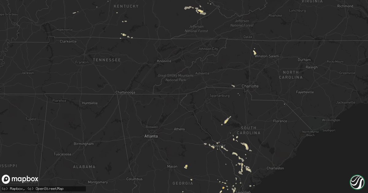
August 13 map
$229
one time, instant access
Download today. No call, no setup
Keep the $229
Bought the map and want the full workflow? Apply the entire $229 to a subscription within 7 days. None of it is wasted.
Every map, not just this one
This buys you this map. Subscription and you get every map we run, in the markets you choose from a few cities to whole states to nationwide. Plus real-time alerts the moment a storm fires.
Contact data
Name, contact info, occupancy, even credit band for addresses in the footprint. You go from where it hit to who to call.
Become the source they trust
Unlimited branding weather history reports on demand. You already have the documented answer ready for the property owner, and you are the one who showed up with it.
Property data and RoofTrace estimates
Pull up any address you have got, its value and the exact code rules for that jurisdiction, straight from One Click Code. Then RoofTrace estimates the squares, pitch, and roof value, priced the way you price.
Storm reports in Georgia
Georgia
| Date | Description |
|---|---|
| 08/13/20116:40 PM CDT | Public reported trees down on powerlines near highway 252 and 3r fish camp road. Time is approximate. |
| 08/13/20115:20 PM CDT | 911 center reported a power line down on ralph rahn rd. |
| 08/13/20114:55 PM CDT | Several large tree limbs down near the intersection of fawn and ash street. |
| 08/13/20114:29 PM CDT | Public reported several trees down. One tree uprooted and on a barn and water pump house. Another tree down on a car. |
| 08/13/20114:29 PM CDT | Law enforcement reported 1 tree down near the intersection of steel bridge road and highway 57. |
| 08/13/20114:10 PM CDT | The roof was blown off a carport along georgia highway 57 near buckeye road. |
| 08/13/20113:55 PM CDT | The public reported quarter to golf ball size hail lasting 1 to 2 minutes on sunbury road. A swing on a porch was also blown into front yard. |
| 08/13/20112:25 PM CDT | Trees down on tobacco road. |
| 08/13/20112:25 PM CDT | Quarter size hail reported south of augusta on tobacco rd. |
| 08/13/20112:23 PM CDT | 911 center reported a tree down on a power line on 6th street in hilltonia. |
| 08/13/20112:16 PM CDT | Emergency management reported 25 to 30 trees down at and near an apartment complex along highway 196. Approximately 12 cars were damaged from fallen trees at the comple |
| 08/13/20112:06 PM CDT | The asos at augusta regional bush field reported a wind gust of 63 mph. |
All States Impacted by Hail Map on August 13, 2011
Cities Impacted by Hail Map on August 13, 2011
- Knox, IN
- La Crosse, IN
- Hanna, IN
- Lafayette, IN
- Dayton, IN
- Rochester, IN
- Kewanna, IN
- Boonville, NC
- Yadkinville, NC
- Grant, CO
- Yermo, CA
- Clayhole, KY
- Jackson, KY
- Gunlock, KY
- Vest, KY
- Valparaiso, IN
- Spencer, IN
- Freedom, IN
- Genoa, IL
- Raton, NM
- Gilman, IL
- Ellery, IL
- Golden Gate, IL
- Palatine, IL
- Arlington Heights, IL
- Buffalo Grove, IL
- Lake Zurich, IL
- Walker, WV
- Augusta, GA
- Leesville, SC
- Wagener, SC
- Pelion, SC
- Inwood, WV
- Martinsburg, WV
- Hedgesville, WV
- Gerrardstown, WV
- Eckerty, IN
- Birdseye, IN
- Elizabeth, PA
- Mckeesport, PA
- Clairton, PA
- Canton, IL
- Glasford, IL
- Greencastle, IN
- Cloverdale, IN
- Onarga, IL
- Crescent City, IL
- Odell, IL
- Mount Pulaski, IL
- Lincoln, IL
- Elkhart, IL
- New Holland, IL
- Middletown, IL
- Hilton Head Island, SC
- Bluffton, SC
- Solsberry, IN
- Bloomington, IN
- Marathon, TX
- Mount Olive, IL
- Litchfield, IL
- Walshville, IL
- Lombard, IL
- Glen Ellyn, IL
- Hoopeston, IL
- Milford, IL
- Wellington, IL
- Jackson, SC
- Aiken, SC
- West Lafayette, IN
- Fort Stockton, TX
- Barrington, IL
- Beloit, WI
- Janesville, WI
- Orfordville, WI
- Lebanon Junction, KY
- Boston, KY
- Claxton, GA
- Fowler, IN
- Ambia, IN
- Oxford, IN
- Pine Village, IN
- Boswell, IN
- Templeton, IN
- Cynthiana, KY
- Berry, KY
- Rockford, IL
- Jeffersonville, IN
- Clarksville, IN
- Sellersburg, IN
- Onondaga, MI
- Parma, MI
- Rives Junction, MI
- Clifton, IL
- Ashkum, IL
- Woodridge, IL
- Virgie, KY
- Beaver, KY
- Teaberry, KY
- Robinson Creek, KY
- McDowell, KY
- Pikeville, KY
- Betsy Layne, KY
- Harold, KY
- Ocala, FL
- Waverly, IL
- Jacksonville, IL
- Franklin, IL
- Pontiac, IL
- Flanagan, IL
- Graymont, IL
- Mountain Top, PA
- Nescopeck, PA
- Berwick, PA
- Wapwallopen, PA
- Mifflinville, PA
- Drums, PA
- Bloomsburg, PA
- Sugarloaf, PA
- Buchanan, MI
- Niles, MI
- Galien, MI
- Sparta, MI
- Conklin, MI
- De Land, IL
- Clinton, IL
- Weldon, IL
- Early Branch, SC
- Yemassee, SC
- Pembroke, GA
- Portage, IN
- Merrillville, IN
- Gary, IN
- Hobart, IN
- Bloomington, IL
- Forreston, IL
- Polo, IL
- Lowell, IN
- Crown Point, IN
- Wilmington, IL
- Elwood, IL
- Manhattan, IL
- Anderson, IN
- Middletown, IN
- Markleville, IN
- Pendleton, IN
- Model, CO
- Leland, IL
- Berne, IN
- Bluffton, IN
- Geneva, IN
- Monroe, IN
- Trinidad, CO
- Weston, CO
- Deputy, IN
- Madison, IN
- Chebanse, IL
- Herscher, IL
- Buckingham, IL
- Cabery, IL
- Burkesville, KY
- Cullom, IL
- Lawton, MI
- Mcconnelsville, OH
- Cumberland, OH
- Blue Rock, OH
- Kimbolton, OH
- Newcomerstown, OH
- Waverly, WV
- Rincon, GA
- Hidalgo, IL
- Newton, IL
- Latham, IL
- Warrensburg, IL
- Metamora, IL
- Grovetown, GA
- Aurora, IL
- Naperville, IL
- Hartsburg, IL
- Atlanta, IL
- Emden, IL
- Centertown, KY
- Central City, KY
- Woodstock, IL
- Schnellville, IN
- Dubois, IN
- Saint Anthony, IN
- Jasper, IN
- Celestine, IN
- Ivesdale, IL
- Yorkville, IL
- Bolingbrook, IL
- Plainfield, IL
- Oswego, IL
- La Porte, IN
- Huntingburg, IN
- Loami, IL
- Winchester, IL
- Weirsdale, FL
- Lady Lake, FL
- Ocklawaha, FL
- Summerfield, FL
- Mumford, NY
- Caledonia, NY
- Scottsville, NY
- Oconto, NE
- Callaway, NE
- Byron Center, MI
- Hudsonville, MI
- Decatur, IN
- Lanark, IL
- San Jose, IL
- Mason City, IL
- Moweaqua, IL
- Bethany, IL
- Smithfield, KY
- Eminence, KY
- Paris Crossing, IN
- Lexington, IN
- Commiskey, IN
- Hanover, IN
- Cisco, IL
- Charlotte, MI
- Vermontville, MI
- Mulliken, MI
- Shannon, IL
- Ashland, IL
- Virginia, IL
- Arenzville, IL
- Grandfalls, TX
- Dryden, TX
- McLean, IL
- Mount Morris, IL
- Pearl City, IL
- Rochelle, IL
- Oregon, IL
- Chana, IL
- Mount Carroll, IL
- Easton, IL
- Kilbourne, IL
- Havana, IL
- Fruitland Park, FL
- Rossville, IN
- Dunkirk, IN
- Michigan City, IN
- Chesterton, IN
- Decker, IN
- Mount Carmel, IL
- Mapleton, IL
- Pekin, IL
- Peoria, IL
- Farmer City, IL
- Dwight, IL
- Grand Rapids, MI
- Grandville, MI
- Jenison, MI
- Alapaha, GA
- Nashville, GA
- Rockbridge, IL
- Monon, IN
- Winamac, IN
- Monticello, IN
- Buffalo, IN
- Star City, IN
- Francesville, IN
- Monticello, IL
- Sheridan, IL
- Sandwich, IL
- Newark, IL
- Shepherdsville, KY
- Ashton, IL
- Steward, IL
- Elfrida, AZ
- Marseilles, IL
- Wabash, IN
- Urbana, IN
- Otterbein, IN
- Isonville, KY
- Ellabell, GA
- Carbon, IN
- Rosedale, IN
- Ontario, NY
- Macedon, NY
- Walworth, NY
- Chesterfield, IL
- Carlinville, IL
- Waterman, IL
- Folkston, GA
- Shipman, IL
- Gillespie, IL
- Saint Meinrad, IN
- Saint Croix, IN
- Tell City, IN
- Bristow, IN
- Branchville, IN
- Ferdinand, IN
- New Castle, IN
- Chicago, IL
- Park Ridge, IL
- Harwood Heights, IL
- Schiller Park, IL
- Bensenville, IL
- Des Plaines, IL
- Minonk, IL
- Hebron, IN
- Vandalia, IL
- Pleasant Plains, IL
- Springfield, IL
- Sylvania, GA
- Scotts, MI
- Yale, IL
- Eddyville, NE
- Sumner, NE
- Columbia, KY
- Irwinton, GA
- Toomsboro, GA
- McIntyre, GA
- East Leroy, MI
- Vicksburg, MI
- Climax, MI
- Fulton, MI
- Petersburg, WV
- Durand, IL
- Fisherville, KY
- Louisville, KY
- Simpsonville, KY
- Lisle, IL
- Downers Grove, IL
- Washburn, IL
- Toluca, IL
- Farmington, MI
- Novi, MI
- Sierra Blanca, TX
- Broken Bow, NE
- Switz City, IN
- Linton, IN
- Rockford, MI
- Sugar Grove, IL
- Big Rock, IL
- Hawthorne, FL
- Fort McCoy, FL
- Citra, FL
- Interlachen, FL
- McNabb, IL
- Lostant, IL
- Leaf River, IL
- Jewett, IL
- Burlington, WI
- Genoa City, WI
- Newaygo, MI
- Grant, MI
- Uhrichsville, OH
- Battle Creek, MI
- Marshall, MI
- Ceresco, MI
- Burlington, MI
- Farmersville, IL
- Divernon, IL
- Virden, IL
- Algonquin, IL
- Fox River Grove, IL
- Palatka, FL
- Satsuma, FL
- Jefferson, CO
- Bailey, CO
- Le Roy, IL
- Mount Olivet, KY
- Silex, MO
- Lake Station, IN
- Schererville, IN
- Greenview, IL
- Athens, IL
- White Oak, GA
- Polk City, FL
- Gregory, MI
- Chelsea, MI
- Dexter, MI
- Summit Argo, IL
- La Grange, IL
- Clarendon Hills, IL
- Justice, IL
- Bridgeview, IL
- Hinsdale, IL
- Willowbrook, IL
- Western Springs, IL
- Westmont, IL
- Darien, IL
- Demotte, IN
- Shelby, IN
- Saluda, SC
- Silverstreet, SC
- Newberry, SC
- Walsenburg, CO
- Maroa, IL
- Rush, NY
- Brooklet, GA
- Tremont, IL
- Mackinaw, IL
- Roanoke, IN
- South Lyon, MI
- Whitmore Lake, MI
- Pinckney, MI
- Brighton, MI
- Hamburg, MI
- Dekalb, IL
- Malta, IL
- Paris, IL
- Redmon, IL
- Brocton, IL
- Rankin, IL
- Cissna Park, IL
- Armington, IL
- Hardy, KY
- Stone, KY
- Morris, IL
- Davis Junction, IL
- Corning, OH
- Crooksville, OH
- Minooka, IL
- Cary, IL
- Findlay, IL
- Sullivan, IL
- Windsor, IL
- Peotone, IL
- Putnam, IL
- Fremont, MI
- Georgetown, KY
- Stamping Ground, KY
- Ada, MI
- Lowell, MI
- Belmont, MI
- Casnovia, MI
- Woodbine, GA
- Waverly, GA
- Milledgeville, IL
- Brazil, IN
- Reelsville, IN
- Waynesville, IL
- Beason, IL
- Wapella, IL
- Kenney, IL
- Long Point, IL
- Cornell, IL
- Pecatonica, IL
- Rochester, NY
- Mulberry Grove, IL
- Saunemin, IL
- Springfield, GA
- Clyo, GA
- Hamlet, IN
- Albion, IL
- McColl, SC
- English, IN
- Grantsburg, IN
- Marengo, IN
- Taswell, IN
- North Augusta, SC
- Somonauk, IL
- Bardstown, KY
- Cordova, SC
- Cope, SC
- Orangeburg, SC
- Browns, IL
- Evansville, IN
- Owensville, IN
- Haubstadt, IN
- Grayville, IL
- Poseyville, IN
- Griffin, IN
- Wadesville, IN
- New Harmony, IN
- Cynthiana, IN
- Shortsville, NY
- Farmington, NY
- Canandaigua, NY
- Victor, NY
- Bloomfield, NY
- Beech Island, SC
- Salley, SC
- Colfax, IL
- Howard City, MI
- Lake In The Hills, IL
- Carpentersville, IL
- Register, GA
- Metter, GA
- Augusta, MO
- Defiance, MO
- Marthasville, MO
- Grant Park, IL
- South Haven, MI
- Covert, MI
- Ransom, IL
- Roanoke, IL
- Lowpoint, IL
- Jupiter, FL
- Loxahatchee, FL
- West Palm Beach, FL
- Groveland, IL
- Manito, IL
- Skokie, IL
- Evanston, IL
- Sheldon, IL
- Martinton, IL
- Emington, IL
- Watseka, IL
- Kempton, IL
- Webster, NY
- Doerun, GA
- Trinchera, CO
- Tampa, FL
- Jamestown, TN
- Georgetown, IN
- Floyds Knobs, IN
- Fort Lauderdale, FL
- Shabbona, IL
- Hinckley, IL
- Streator, IL
- Rutland, IL
- Dana, IL
- Cedar Lake, IN
- Three Rivers, MI
- Paris, KY
- Varnville, SC
- Estill, SC
- Pineland, SC
- Ulmer, SC
- Donnellson, IL
- Fairport, NY
- Chestnut, IL
- Hephzibah, GA
- Bloomingdale, GA
- Winfield, IL
- West Chicago, IL
- Rentz, GA
- Dublin, GA
- Frankfort, KY
- Elkton, FL
- Dowagiac, MI
- Delphi, IN
- Battle Ground, IN
- Burton, WV
- Holbrook, PA
- Spraggs, PA
- Wana, WV
- New Freeport, PA
- Portland, IN
- Hennepin, IL
- Pawnee, IL
- Spencerville, OH
- Venedocia, OH
- Rockford, OH
- Mendon, OH
- Immokalee, FL
- Fithian, IL
- Marion, NY
- Palmyra, NY
- West Henrietta, NY
- Lizton, IN
- Waterford, WI
- Celina, TN
- Seneca, IL
- Mendon, MI
- Alma, IL
- Salem, IL
- Brunson, SC
- Fairfax, SC
- Leslie, MI
- Westcliffe, CO
- Stanford, IL
- Mchenry, IL
- Cannelton, IN
- Derby, IN
- Union Star, KY
- Sigel, IL
- Norman Park, GA
- Comstock Park, MI
- Kent City, MI
- Twelve Mile, IN
- Lucerne, IN
- Fairfield, IL
- Cisne, IL
- Decatur, IL
- McArthur, OH
- Frankfort, IN
- Cutler, IN
- Barnwell, SC
- Harlem, GA
- Appling, GA
- Varna, IL
- Richmond, IL
- Hebron, IL
- Hesperia, MI
- Deltona, FL
- Lake Helen, FL
- Muncie, IN
- Winslow, IN
- Dansville, NY
- Eaton Rapids, MI
- Olivet, MI
- Albion, MI
- Springport, MI
- Coopersville, MI
- Cedar Springs, MI
- Marne, MI
- Leitchfield, KY
- Wauconda, IL
- Bloomfield, IN
- West Lafayette, OH
- Plainfield, OH
- Fresno, OH
- Port Washington, OH
- Coshocton, OH
- Marcellus, MI
- Jones, MI
- Eighty Four, PA
- Finleyville, PA
- Bentleyville, PA
- Plano, IL
- Crestwood, KY
- Wyoming, MI
- Kingsland, GA
- Royal Center, IN
- Daleville, IN
- East Troy, WI
- Elkhorn, WI
- The Villages, FL
- Wildwood, FL
- Neeses, SC
- Hoffman Estates, IL
- Elgin, IL
- Williamson, NY
- Penfield, NY
- Honeoye, NY
- Preston, MD
- Trappe, MD
- Ridott, IL
- Rome, IN
- Daggett, CA
- Olar, SC
- Ehrhardt, SC
- Alexandria, IN
- Frankton, IN
- Chrisman, IL
- Ridge Farm, IL
- Union Grove, WI
- Sturtevant, WI
- Kennard, IN
- Shirley, IN
- Owaneco, IL
- Taylorville, IL
- Gibson City, IL
- New Matamoras, OH
- Graysville, OH
- Brunswick, GA
- Townsend, GA
- Darien, GA
- Joliet, IL
- Channahon, IL
- Kingston Mines, IL
- Morton, IL
- Danvers, IL
- Georgetown, IL
- Indianola, IL
- Catlin, IL
- Stephensport, KY
- Hardinsburg, KY
- Lebanon, IN
- Summersville, KY
- York, SC
- Garnett, SC
- Hampton, SC
- Jeromesville, OH
- Springwater, NY
- New Concord, OH
- Jackson, MI
- Howell, MI
- Glendale Heights, IL
- Bloomingdale, IL
- Heltonville, IN
- Bedford, IN
- Kings Mountain, NC
- Fairbury, IL
- Forrest, IL
- Piper City, IL
- Chatsworth, IL
- Bunnell, FL
- East Palatka, FL
- Hastings, FL
- Edinburg, IL
- Rochester, IL
- Thomson, GA
- White Cloud, MI
- Manchester, MD
- Hampstead, MD
- Geff, IL
- Beardstown, IL
- Chatham, IL
- Clayton, IN
- Eastman, GA
- Rhine, GA
- Neoga, IL
- Mattoon, IL
- Deland, FL
- New Berlin, IL
- Albany, KY
- Kalamazoo, MI
- Paw Paw, MI
- Portage, MI
- Mattawan, MI
- Serena, IL
- Downs, IL
- Normal, IL
- Pleasureville, KY
- Montezuma, IN
- Hillsdale, IN
- West Finley, PA
- Malta, OH
- River Grove, IL
- Franklin Park, IL
- Maywood, IL
- Melrose Park, IL
- Elmwood Park, IL
- River Forest, IL
- Sterling, IL
- Woosung, IL
- Dixon, IL
- Franklin Grove, IL
- Itasca, IL
- Wood Dale, IL
- Mundelein, IL
- Island Lake, IL
- Grayslake, IL
- Plymouth, MI
- Branchville, SC
- North Judson, IN
- Grovertown, IN
- Wanatah, IN
- Allons, TN
- North Manchester, IN
- Lakeland, FL
- Auburndale, FL
- Grover, NC
- Shelby, NC
- Sarahsville, OH
- Summerfield, OH
- Senecaville, OH
- Quaker City, OH
- Grand Ledge, MI
- Sorrento, FL
- Bloomingdale, IN
- Clinton, IN
- Bryant, IN
- Springville, IN
- Owensburg, IN
- Cutler, IL
- Pittsford, NY
- Henrietta, NY
- Reddick, IL
- Kenosha, WI
- Edwardsburg, MI
- Cassopolis, MI
- Ypsilanti, MI
- Kouts, IN
- Pecos, TX
- Argenta, IL
- Vandalia, MI
- Apopka, FL
- Fitzgerald, GA
- Constantine, MI
- Guyton, GA
- Lake George, CO
- Saint Augustine, FL
- Dana, IN
- Cayuga, IN
- Nashville, MI
- Belfry, KY
- Canada, KY
- Sidney, KY
- Coldwater, OH
- Fort Recovery, OH
- Celina, OH
- Bagdad, KY
- Pall Mall, TN
- Galesburg, MI
- Coal City, IL
- Verona, IL
- Pana, IL
- Dobson, NC
- Green Cove Springs, FL
- Osteen, FL
- Montgomery, IL
- Bristol, IL
- Millington, IL
- Danville, IL
- Cherry Valley, IL
- Belvidere, IL
- Land O'Lakes, FL
- Gays, IL
- Statesboro, GA
- Batesburg, SC
- Bellevue, MI
- Garrett, KY
- Grethel, KY
- Weeksbury, KY
- Dema, KY
- Minnie, KY
- Bypro, KY
- Langley, KY
- Drift, KY
- Melvin, KY
- Topmost, KY
- Lackey, KY
- Bevinsville, KY
- Hi Hat, KY
- Wheelwright, KY
- Sandy Hook, KY
- Lodge, SC
- Medora, IL
- Petersburg, IN
- Hazleton, IN
- Glennville, GA
- Mineral Point, WI
- White Sands Missile Range, NM
- Milltown, IN
- Depauw, IN
- Bushnell, FL
- Michigantown, IN
- Shelbiana, KY
- Elkhorn City, KY
- Hellier, KY
- Jenkins, KY
- Paoli, IN
- Hardinsburg, IN
- Masonic Home, KY
- Fort Pierce, FL
- Hueysville, KY
- Chiefland, FL
- Marengo, IL
- Earlville, IL
- Stillman Valley, IL
- Byron, IL
- Byrdstown, TN
- Wesley Chapel, FL
- Welaka, FL
- Grand Junction, MI
- West Liberty, KY
- Danforth, IL
- Bainbridge, IN
- Thawville, IL
- Dyer, IN
- Crete, IL
- Beecher, IL
- Bamberg, SC
- Lapel, IN
- Earl Park, IN
- Minier, IL
- Hopedale, IL
- Kincaid, IL
- Rebecca, GA
- Chappells, SC
- Kirkland, IL
- Monroe Center, IL
- Canton, MI
- Shelbyville, KY
- Oreana, IL
- Schaumburg, IL
- Rolling Meadows, IL
- Winnebago, IL
- Bangor, MI
- Midway, KY
- Lexington, KY
- Oakland, IL
- Churchville, NY
- Brookston, IN
- Norway, SC
- Ottawa, IL
- Moorefield, WV
- Payneville, KY
- Fennville, MI
- Pullman, MI
- Alexander, IL
- Livonia, NY
- Lima, NY
- Hemlock, NY
- Nicholls, GA
- Southfield, MI
- Franklin, MI
- Cecilia, KY
- Kentland, IN
- Munith, MI
- Northville, MI
- Livonia, MI
- Hamburg, AR
- Odin, IL
- Patoka, IL
- Huntsville, AL


