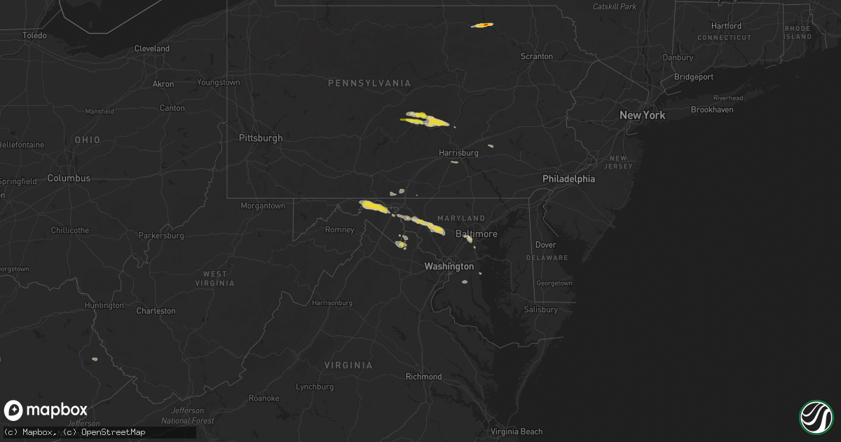
Hail Map on August 12, 2017
Get this storm
August 12 map
$229
one time, instant access
Download today. No call, no setup
Keep the $229
Bought the map and want the full workflow? Apply the entire $229 to a subscription within 7 days. None of it is wasted.
Every map, not just this one
This buys you this map. Subscription and you get every map we run, in the markets you choose from a few cities to whole states to nationwide. Plus real-time alerts the moment a storm fires.
Contact data
Name, contact info, occupancy, even credit band for addresses in the footprint. You go from where it hit to who to call.
Become the source they trust
Unlimited branding weather history reports on demand. You already have the documented answer ready for the property owner, and you are the one who showed up with it.
Property data and RoofTrace estimates
Pull up any address you have got, its value and the exact code rules for that jurisdiction, straight from One Click Code. Then RoofTrace estimates the squares, pitch, and roof value, priced the way you price.
States Impacted by Hail Map on August 12, 2017
Storm reports
Colorado
| Date | Description |
|---|---|
| 08/12/20176:45 PM CDT | A local report indicates a tornado near 7 SE ANTON |
| 08/12/20176:42 PM CDT | A local report indicates 1.50 inch wind near 3 S ARICKAREE SCHOOL |
| 08/12/20176:40 PM CDT | A local report indicates 1.00 inch wind near 1 SSE ARICKAREE SCHOOL |
| 08/12/20176:30 PM CDT | A local report indicates a tornado near SE ANTON |
| 08/12/20176:30 PM CDT | A local report indicates a tornado near 5 SE ANTON |
| 08/12/20176:27 PM CDT | A local report indicates a tornado near 1 NW ARICKAREE SCHOOL |
| 08/12/20176:10 PM CDT | Brief land spot |
| 08/12/20175:50 PM CDT | A local report indicates 1.00 inch wind near 6 SSW CALHAN |
| 08/12/20175:42 PM CDT | A local report indicates 2.00 inch wind near PLATNER |
Maryland
| Date | Description |
|---|---|
| 08/12/20176:57 PM CDT | Wires down in the 500 block of crescent road. |
| 08/12/20176:56 PM CDT | Wires down in the 4900 block of branchville road. |
| 08/12/20176:26 PM CDT | Tree down in roadway near the intersection of southwestern boulevard and francis avenue. |
| 08/12/20176:25 PM CDT | Tree down on clara barton parkway near the capital beltway. |
| 08/12/20176:06 PM CDT | Tree down on light pole near intersection of old court road and woodholme avenue. |
| 08/12/20175:26 PM CDT | Tree down in roadway near the intersection of southwestern boulevard and francis avenue. |
| 08/12/20175:11 PM CDT | Tree down near the intersection of long corner road and gue road. |
| 08/12/20175:10 PM CDT | A local report indicates 1.00 inch wind near 2 N FRIENDSHIP |
| 08/12/20175:08 PM CDT | Two trees down near the intersection of long corner road and new cut road. |
| 08/12/20175:04 PM CDT | 8 inch in diameter tree down in the 13000 block of penn shop road. |
| 08/12/20174:32 PM CDT | Tree down blocking exit ramp at interstate 70 and highway 40 |
| 08/12/20174:31 PM CDT | Quarter size hail |
| 08/12/20174:27 PM CDT | Poles and wires down on rosemont avenue. |
| 08/12/20174:20 PM CDT | Tree down blocking both directions of baltimore national pike at gambrill park road. |
| 08/12/20172:28 PM CDT | Tree down on oldtown orleans road southeast near apple road. |
| 08/12/20172:27 PM CDT | Two trees down along turkey farm road northeast. |
| 08/11/20177:49 PM CDT | Several large six inch in diameter tree limbs down along nottingham road and molly berry road. |
| 08/11/20177:24 PM CDT | A local report indicates 62 MPH wind near 1 N BELVEDERE HEIGHTS |
| 08/11/20177:15 PM CDT | Tree down blocking two right lanes of governor ritchie highway at cypress creek road. |
| 08/11/20177:05 PM CDT | Wires down in the 6700 block of parkwood street. |
North Dakota
| Date | Description |
|---|---|
| 08/12/20176:08 PM CDT | Baseball sized hail bouncing 5 feet off the around. Dents in his vehicle. |
| 08/12/20176:00 PM CDT | Est. 40 mph winds. |
| 08/12/20172:30 PM CDT | Little damage to the soy beans. |
| 08/11/20177:35 PM CDT | A local report indicates 1.75 inch wind near 7.1NNE WHITE BUTTE |
| 08/11/20177:00 PM CDT | A local report indicates 1.00 inch wind near 10.4S REGENT |
| 08/11/20177:00 PM CDT | A local report indicates 1.00 inch wind near 11 SSW REGENT |
South Dakota
| Date | Description |
|---|---|
| 08/12/20175:45 PM CDT | A local report indicates 1.75 inch wind near 8 SSE COLOME |
| 08/12/20175:30 PM CDT | A local report indicates 60 MPH wind near 3 SSE SORUM |
| 08/12/20175:26 PM CDT | A local report indicates 58 MPH wind near 9 SSE SORUM |
| 08/12/20175:20 PM CDT | A local report indicates 1.00 inch wind near 3 W COLOME |
| 08/12/20175:15 PM CDT | A local report indicates 60 MPH wind near 8 SE REVA |
| 08/12/20174:50 PM CDT | Window broken |
| 08/12/20174:50 PM CDT | Window broken |
| 08/12/20174:40 PM CDT | A local report indicates 1.00 inch wind near 11 ESE BUFFALO |
| 08/12/20174:40 PM CDT | A local report indicates 70 MPH wind near 4 SSE WITTEN |
| 08/12/20174:30 PM CDT | A local report indicates 60 MPH wind near 4 SSE WITTEN |
| 08/12/20174:30 PM CDT | A local report indicates 1.00 inch wind near 4 E WITTEN |
| 08/12/20174:20 PM CDT | A local report indicates 58 MPH wind near 4 SSE WITTEN |
| 08/12/20174:15 PM CDT | A local report indicates 1.00 inch wind near 4 NNE WITTEN |
| 08/12/20174:15 PM CDT | A local report indicates 60 MPH wind near 4 NNE WITTEN |
| 08/12/20173:50 PM CDT | A local report indicates 1.75 inch wind near 8 NW WITTEN |
| 08/12/20173:36 PM CDT | A local report indicates 1.75 inch wind near 6 NW WITTEN |
| 08/12/20173:29 PM CDT | Large swath of 100 percent destroyed crops from 2 miles west of reliance on a nw path for 8 to 10 miles... With a three mile width. |
| 08/12/20173:28 PM CDT | Radar estimated time. |
| 08/12/20173:21 PM CDT | Radar estimated time. |
| 08/12/20172:45 PM CDT | A local report indicates 1.00 inch wind near 11 NNE WOOD |
| 08/11/20178:33 PM CDT | A local report indicates 60 MPH wind near 1 NE RIDGEVIEW |
| 08/11/20178:00 PM CDT | A local report indicates 1.00 inch wind near 4 S WHITE BUTTE |
| 08/11/20177:56 PM CDT | Radar estimated time. |
Nebraska
| Date | Description |
|---|---|
| 08/12/20176:53 PM CDT | A local report indicates 1.00 inch wind near 2 SE ANSELMO |
| 08/12/20176:40 PM CDT | A local report indicates 1.00 inch wind near 4 ENE BROWNLEE |
| 08/12/20176:00 PM CDT | A local report indicates 1.75 inch wind near 7 SE DUNNING |
| 08/12/20175:35 PM CDT | A local report indicates 1.00 inch wind near 8 SW DUNNING |
| 08/12/20175:28 PM CDT | A local report indicates 1.00 inch wind near 12 NE BRIDGEPORT |
| 08/12/20175:07 PM CDT | A local report indicates 1.50 inch wind near 10 N BRIDGEPORT |
| 08/12/20174:49 PM CDT | A local report indicates 1.00 inch wind near BUSHNELL |
| 08/12/20174:49 PM CDT | A local report indicates 1.00 inch wind near 3 S BUSHNELL |
| 08/12/20174:34 PM CDT | Several cars along the side of hwy 385 with broken windshields. |
| 08/12/20174:33 PM CDT | Golf ball hail along highway 385. Several cars on side of road with broken windows. |
| 08/12/20174:30 PM CDT | Covers hwy 385 south of alliance. |
| 08/12/20174:14 PM CDT | A local report indicates 1.75 inch wind near 10 NW ALLIANCE |
| 08/12/20173:57 PM CDT | Brief hail with heavy rain. |
| 08/12/20173:56 PM CDT | A local report indicates 1.25 inch wind near 2 N HALSEY |
| 08/11/20179:05 PM CDT | Irrigation pivot systems flipped. Systems belived to be full -- est. Winds near 100 mph. Time estimated from radar. |
| 08/11/20178:40 PM CDT | A local report indicates 2.00 inch wind near 8 NNW STRATTON NE |
| 08/11/20178:21 PM CDT | Major damage to multiple trees |
| 08/11/20178:21 PM CDT | A local report indicates 80 MPH wind near BROKEN BOW |
| 08/11/20178:21 PM CDT | A local report indicates 1.50 inch wind near BROKEN BOW |
| 08/11/20177:56 PM CDT | A local report indicates 1.00 inch wind near 13 ESE ELSMERE |
| 08/11/20177:18 PM CDT | A local report indicates 1.00 inch wind near 9 ENE ELSMERE |
Arizona
| Date | Description |
|---|---|
| 08/12/201712:30 AM CDT | Two large trees down. One falling on a house. Time is estimated. |
Pennsylvania
| Date | Description |
|---|---|
| 08/12/20174:05 PM CDT | Trees and wires down |
| 08/12/20173:18 PM CDT | A local report indicates 1.75 inch wind near TOWANDA |
| 08/12/20172:30 PM CDT | Trees down |
| 08/12/20172:12 PM CDT | Ef1 tornado confirmed from nws survey |
| 08/12/20172:09 PM CDT | Reports of trees across roads in thompsontown |
| 08/12/20172:05 PM CDT | Reports of trees down and trees on wires in northern juniata county. |
| 08/12/20172:00 PM CDT | Trees down. Numerous other trees down over the northern part of the county |
| 08/12/20171:56 PM CDT | Trees down near intersection of route 35 and jericho road. |
| 08/12/20171:30 PM CDT | Wires down along north main street near thrid street in derry township. |
| 08/12/20171:17 PM CDT | Tree down across salem road between blue hollow road and jacks lane in armagh township. |
Texas
| Date | Description |
|---|---|
| 08/12/20176:48 PM CDT | A local report indicates 1.00 inch wind near COLORADO CITY |
| 08/12/20175:00 PM CDT | Delayed report. Metal roof off a detached wood framed garage/workshop |
| 08/12/20173:45 PM CDT | 1-inch tree limbs broken. Shingles blown off. |
| 08/12/201712:25 PM CDT | Sweetwater pd has relayed reports of winds taking down a few trees near the 1000 block of pines st in sweetwater. |
| 08/11/20179:06 PM CDT | 6 to 12 inch diameter trees downed |
| 08/11/20177:40 PM CDT | A few large trees downed in the cr2319 area. |
California
| Date | Description |
|---|---|
| 08/11/20177:30 PM CDT | Property damage reported in canebrake to carports and roofs. Time estimated. |
Virginia
| Date | Description |
|---|---|
| 08/12/20176:45 PM CDT | Tree down near the intersection of columbia pike and south quincy street. |
| 08/12/20176:37 PM CDT | Large tree limb down blocking sleepy hollow road near dearborn drive. |
| 08/12/20176:24 PM CDT | Large white pine tree snapped at the base on deerberry court. |
| 08/12/20175:36 PM CDT | Tree down on telegraph springs road near fraklins ford place. |
| 08/12/20175:32 PM CDT | Quarter size hail |
| 08/11/20177:34 PM CDT | Large tree limb down blocking sleepy hollow road near dearborn drive. |
New York
| Date | Description |
|---|---|
| 08/12/20176:05 PM CDT | 3 trees down and wires down. |
| 08/12/20176:01 PM CDT | A local report indicates 1.00 inch wind near EAST GREENBUSH |
| 08/12/20175:45 PM CDT | Trees down |
| 08/12/20175:25 PM CDT | Tree downed |
| 08/12/20174:42 PM CDT | House caught fire due to downed power lines. |
| 08/12/20174:41 PM CDT | A local report indicates 1.00 inch wind near 1 W RICHMONDVILLE |
| 08/12/20174:40 PM CDT | Multiple trees and wires down. |
| 08/12/20174:30 PM CDT | Trees and lines down. Radar based time. |
| 08/12/20174:30 PM CDT | Numerous trees and lines down. Took brunt of storm. Radar based time. |
| 08/12/20174:25 PM CDT | Trees and lines down. Radar based time. |
| 08/12/20174:12 PM CDT | Trees and lines down. Radar based time. |
| 08/12/20174:06 PM CDT | Numerous trees and lines down. Took brunt of storm. Radar based time. |
| 08/12/20173:49 PM CDT | Two trees down at the intersection of route 50 and hutchins road. |
| 08/12/20173:48 PM CDT | Tree down. |
| 08/12/20173:43 PM CDT | A local report indicates 1.00 inch wind near FACTORY VILLAGE |
| 08/12/20173:42 PM CDT | Trees and lines down |
| 08/12/20173:26 PM CDT | A local report indicates 1.50 inch wind near MUNNSVILLE |
| 08/12/20173:25 PM CDT | Tree down on junction road/blocking road |
| 08/12/20173:20 PM CDT | A local report indicates 1.25 inch wind near PETERBORO |
| 08/12/20173:15 PM CDT | Several trees down in area. Photos sent by emergency mgmt. Radar based time. |
| 08/12/20173:05 PM CDT | Multiple trees down |
| 08/12/20173:05 PM CDT | Tree down on state route 7 blocking the road |
| 08/12/20173:00 PM CDT | Tree down on mudlake road |
| 08/12/20173:00 PM CDT | Multiple trees down blocking road including at state park. Via dispatch feed. |
| 08/12/20172:49 PM CDT | Dime to quarter size hail |
| 08/12/20172:18 PM CDT | Trees and lines down. Radar based time. |
| 08/12/20172:10 PM CDT | Multiple trees uprooted. Lines down. Camps and boats damaged at sto-ne-nols campground. Radar based time. Media story online. |
| 08/12/20172:05 PM CDT | Nickel to quarter size hail 3 to 4 inches deep covering the ground |
| 08/12/20171:56 PM CDT | Trees and wires down - time estimated by radar |
| 08/12/20171:36 PM CDT | Trees and wires down - time estimated by radar |
| 08/12/20171:13 PM CDT | Trees and wires down |
| 08/12/20171:13 PM CDT | Trees down |
| 08/12/20171:00 PM CDT | Two reports of trees and wires down |
Montana
| Date | Description |
|---|---|
| 08/12/20173:45 PM CDT | Dime to quarter sized hail. |
Massachusetts
| Date | Description |
|---|---|
| 08/11/20179:58 PM CDT | Large tree and wires down on residence |
District of Columbia
| Date | Description |
|---|---|
| 08/12/20176:55 PM CDT | Tree down in the 1900 block of 4th street northwest. |
| 08/11/20177:02 PM CDT | Tree down in the 1500 block of independence avenue southeast. |
West Virginia
| Date | Description |
|---|---|
| 08/12/20175:13 PM CDT | Tree fell into house on stone ridge road. |
| 08/12/20173:05 PM CDT | Dime to quarter size hail |
| 08/12/20172:56 PM CDT | Tree down on victory lane. |
| 08/12/20172:49 PM CDT | Several large trees... As many as 20 or more... Down along spohrs rd between the intersections of new hope rd and eckerd ln |
| 08/12/20172:46 PM CDT | Quarter size hail and nine locust trees approximately 12 to 14 inches in diameter snapped halfway up. |
| 08/12/20172:46 PM CDT | Quarter size hail and nine locust trees approximately 12 to 14 inches in diameter snapped halfway up. |
| 08/12/20172:44 PM CDT | Power lines down near the intersection of new hope road and guitar lane. |
| 08/12/20172:44 PM CDT | Multiple trees down across rt 9 near the intersection of quaint acres lane |
| 08/12/20172:43 PM CDT | Large tree down onto power lines along wild turkey lane |
| 08/12/20172:43 PM CDT | Tree onto a car near panorama at the peak. No injuries. |
| 08/12/20172:40 PM CDT | Large tree down onto power lines along wild turkey lane |
| 08/12/20172:40 PM CDT | Tree down on power lines on wild turkey road. |
Vermont
| Date | Description |
|---|---|
| 08/12/20176:50 PM CDT | Trees downed |
| 08/12/20176:45 PM CDT | Trees downed on powerlines in brighton |
| 08/12/20176:42 PM CDT | Trees downed on powerlines |
| 08/12/20176:42 PM CDT | Trees downed on powerlines |
| 08/12/20176:42 PM CDT | Tree branches down |
| 08/12/20176:36 PM CDT | Tree downed at lake parker |
| 08/12/20176:06 PM CDT | Trees down on powerlines |
| 08/12/20175:30 PM CDT | Trees down on lee river rd |
| 08/12/20175:20 PM CDT | Trees down on power lines on north williston road |
| 08/12/20175:18 PM CDT | Trees down on power lines. |
| 08/12/20175:12 PM CDT | Trees down on power lines. |
| 08/12/20175:00 PM CDT | Trees down on power lines. |
Cities Impacted by Hail Map on August 12, 2017
- Dallas, SD
- Genoa, CO
- Camden, NY
- Central Square, NY
- Williamstown, NY
- Taberg, NY
- Westdale, NY
- Bernhards Bay, NY
- West Monroe, NY
- Parish, NY
- Constantia, NY
- Mallory, NY
- Julian, CA
- Hedgesville, WV
- New England, ND
- South Heart, ND
- Hettinger, ND
- Eagle Butte, SD
- Nunn, CO
- New Salem, ND
- Colome, SD
- Winner, SD
- Henrietta, TX
- Wood, SD
- Draper, SD
- Towanda, PA
- Boonsboro, MD
- Keedysville, MD
- Brewster, NE
- Little Orleans, MD
- Berkeley Springs, WV
- Hancock, MD
- Great Cacapon, WV
- Caliente, NV
- Limon, CO
- Agate, CO
- Dickinson, ND
- Akron, CO
- Otis, CO
- Reva, SD
- Ludlow, SD
- Buffalo, SD
- Midland, SD
- Ashley, ND
- Hemingford, NE
- Bridgeport, NE
- Alliance, NE
- Angora, NE
- Sterling City, TX
- Sadler, TX
- Whitesboro, TX
- Gainesville, TX
- Schoharie, NY
- Seligman, AZ
- Dolan Springs, AZ
- Rush, CO
- Cooperstown, NY
- Cherry Valley, NY
- Roseboom, NY
- Monrovia, MD
- Damascus, MD
- Mount Airy, MD
- Ijamsville, MD
- Mud Butte, SD
- Bison, SD
- Prairie City, SD
- Pritchett, CO
- Stratton, NE
- Palisade, NE
- Wauneta, NE
- Killdeer, ND
- Blue Ridge, TX
- Roscoe, TX
- East Worcester, NY
- Worcester, NY
- Richmondville, NY
- Colorado City, TX
- Tatum, TX
- Ovid, CO
- Cincinnatus, NY
- Marathon, NY
- Reedsville, PA
- Emory, TX
- Belvidere, SD
- Mansfield, LA
- Elkridge, MD
- Halethorpe, MD
- Baltimore, MD
- Ellicott City, MD
- Hanover, MD
- Linthicum Heights, MD
- Catonsville, MD
- Platte, SD
- Chamberlain, SD
- Kimball, SD
- Pukwana, SD
- Las Vegas, NM
- Pennellville, NY
- Haxtun, CO
- Lemmon, SD
- Show Low, AZ
- Broken Bow, NE
- Anselmo, NE
- Benkelman, NE
- North Platte, NE
- Venango, NE
- Berne, NY
- Grant, NE
- Whitehorse, SD
- Ridgeview, SD
- Timber Lake, SD
- Witten, SD
- Valentine, NE
- Point, TX
- Cumby, TX
- Brashear, TX
- Carson, ND
- Shields, ND
- Raleigh, ND
- Flasher, ND
- Yeagertown, PA
- Lewistown, PA
- Belleville, PA
- Burnham, PA
- Mifflintown, PA
- Ideal, SD
- Milroy, PA
- Amsterdam, NY
- Hagaman, NY
- Zap, ND
- Beulah, ND
- Brandywine, MD
- Upper Marlboro, MD
- Forbes, ND
- Leola, SD
- Davenport, NY
- Jefferson, NY
- East Meredith, NY
- Charlotteville, NY
- Schenevus, NY
- Atwood, KS
- Breaux Bridge, LA
- Kennebec, SD
- Howe, TX
- Van Alstyne, TX
- Shepherdstown, WV
- New Market, MD
- Brookeville, MD
- Rohrersville, MD
- Woodbine, MD
- Frederick, MD
- Sharpsburg, MD
- Myersville, MD
- Martinsburg, WV
- Middletown, MD
- Braddock Heights, MD
- Clarksburg, MD
- Fredonia, ND
- Pollock, SD
- Herreid, SD
- Selfridge, ND
- McLaughlin, SD
- Dunning, NE
- Pleasanton, NE
- Arnold, NE
- Amherst, NE
- Miller, NE
- Ansley, NE
- Oconto, NE
- Merna, NE
- Sumner, NE
- Mason City, NE
- Fort Pierre, SD
- Oneida, NY
- Oriskany Falls, NY
- Jamesville, NY
- Cazenovia, NY
- Morrisville, NY
- Munnsville, NY
- Vernon Center, NY
- Chittenango, NY
- Manlius, NY
- Canastota, NY
- Dalton, NE
- Broadwater, NE
- Lodgepole, NE
- West River, MD
- Churchton, MD
- Deale, MD
- Payson, AZ
- Kanab, UT
- Belfield, ND
- Sweetwater, TX
- Roby, TX
- Lafayette, LA
- Odessa, NE
- Axtell, NE
- Minden, NE
- Elm Creek, NE
- Kearney, NE
- Bassett, NE
- Newport, NE
- Loraine, TX
- Ainsworth, NE
- Purdum, NE
- Bayard, NE
- Lehr, ND
- Hague, ND
- Ortley, SD
- Summit, SD
- Kit Carson, CO
- Graham, TX
- Loving, TX
- Champion, NE
- McDonough, NY
- Bushnell, NE
- Waubay, SD
- Selby, SD
- Java, SD
- Anton, CO
- Cope, CO
- Mott, ND
- Wills Point, TX
- Thompsontown, PA
- McAlisterville, PA
- Oakland Mills, PA
- Richfield, PA
- Reliance, SD
- Cocolamus, PA
- McClure, PA
- Liverpool, PA
- Mount Pleasant Mills, PA
- Millerstown, PA
- Round Hill, VA
- Purcellville, VA
- Petersburg, NY
- Stephentown, NY
- Berlin, NY
- Trail City, SD
- Wysox, PA
- Gurley, NE
- Hannibal, NY
- Sterling, NY
- Cato, NY
- Red Creek, NY
- Martville, NY
- Wood Lake, NE
- De Berry, TX
- Medora, ND
- Marsland, NE
- Wishek, ND
- Saline, LA
- Vernon, NY
- Westmoreland, NY
- Rome, NY
- Haslet, TX
- Fort Worth, TX
- Cody, NE
- Thedford, NE
- Feura Bush, NY
- Selkirk, NY
- Glenmont, NY
- Delmar, NY
- Ore City, TX
- Johnstown, NE
- Chandler, AZ
- Summit, NY
- Maryland, NY
- Bedford, TX
- Athens, TX
- Grover, CO
- Zeeland, ND
- Millersburg, PA
- Grace, ID
- Amidon, ND
- Regent, ND
- Warnerville, NY
- Cobleskill, NY
- Calhan, CO
- White River, SD
- Presho, SD
- Willcox, AZ
- Norwich, NY
- Oxford, NY
- Julesburg, CO
- Troy, PA
- Weatherford, TX
- Halsey, NE
- Coushatta, LA
- Gregory, SD
- Herrick, SD
- Mills, NE
- Kingman, AZ
- Byers, CO
- Deming, NM
- Caddo Mills, TX
- Greenville, TX
- Whiterocks, UT
- Scott, LA
- Model, CO
- Canton, TX
- Middleburgh, NY
- Cottonwood, AZ
- Ballston Spa, NY
- Elsmere, NE
- Ogallala, NE
- Walker, SD
- Almont, ND
- Golden Valley, ND
- Clarkdale, AZ
- Chino Valley, AZ
- Maryneal, TX
- Taylor, NE
- Averill Park, NY
- Castleton On Hudson, NY
- Rensselaer, NY
- East Greenbush, NY
- West Sand Lake, NY
- Nassau, NY
- East Schodack, NY
- Manning, ND
- Fulton, NY
- Washington, DC
- Waynesboro, PA
- Hallsville, TX
- Marshall, TX
- Crawford, NE
- Springview, NE
- Brownsboro, TX
- Murchison, TX
- Odessa, TX
- Mayer, AZ
- Trenton, TX
- Leonard, TX
- Anna, TX
- Whitewright, TX
- Imperial, NE
- Madrid, NE
- Azle, TX
- Holabird, SD
- Kirk, CO
- Idalia, CO
- Franktown, CO
- Flagler, CO
- Gettysburg, SD
- Lower Brule, SD
- Harrisburg, NE
- Lindon, CO
- Williamstown, MA
- Sand Lake, NY
- Fleming, CO
- Smithville Flats, NY
- Willet, NY
- Oxford, NC
- Rougemont, NC
- Flintstone, MD
- Lewisville, TX
- Flower Mound, TX
- Arriba, CO
- Leupp, AZ
- Lovettsville, VA
- Ben Wheeler, TX
- Pilgrim, KY
- Debord, KY
- Westerville, NE
- Crane, TX
- McCamey, TX
- Midland, TX
- De Ruyter, NY
- Pitcher, NY
- Hurricane, UT
- Anton Chico, NM
- Santa Rosa, NM
- Agar, SD
- Diana, TX
- Bennett, CO
- Shreveport, LA
- Chappell, NE
- Camp Verde, AZ
- Pierre, SD
- Animas, NM
- Howes Cave, NY
- East Berne, NY
- Altamont, NY
- Alba, TX
- Washington, UT
- Saint George, UT
- Peyton, CO
- Riverton, WY
- Riverdale, NE
- Harleton, TX
- Conde, SD
- Bellevue, TX
- Farmersville, TX
- Winston, NM
- Caballo, NM
- Enders, NE
- Stanton, ND
- Highmore, SD
- Flagstaff, AZ
- Collinsville, TX
- Sedgwick, CO
- Harpers Ferry, WV
- Charles Town, WV
- Bluemont, VA
- Denver, CO
- Voorheesville, NY
- Albany, NY
- Clarksville, NY
- Elm City, NC
- Wilson, NC
- Elsie, NE
- Millersville, MD
- Glen Burnie, MD
- Mercersburg, PA
- Murdo, SD
- Mission, SD
- Hazard, NE
- Montpelier, VT
- Napoleon, ND
- Hastings, NY
- Strasburg, CO
- Mechanicsburg, PA
- Dillsburg, PA
- Grantham, PA
- Lewisberry, PA
- Burlington, CO
- Vivian, SD
- Golden, CO
- Esperance, NY
- Sloansville, NY
- Central Bridge, NY
- Galway, NY
- Terrell, TX
- Lone Oak, TX
- Gunter, TX
- Lebanon, PA
- Logansport, LA
- Richford, NY
- Candor, NY
- Greencastle, PA
- Clinton, NY
- Deansboro, NY
- De Queen, AR
- Yoder, CO
- Huntingdon, PA
- Litchfield, NE
- Kimball, NE
- Long Pine, NE
- Trenton, NE
- Sargent, NE
- Wibaux, MT