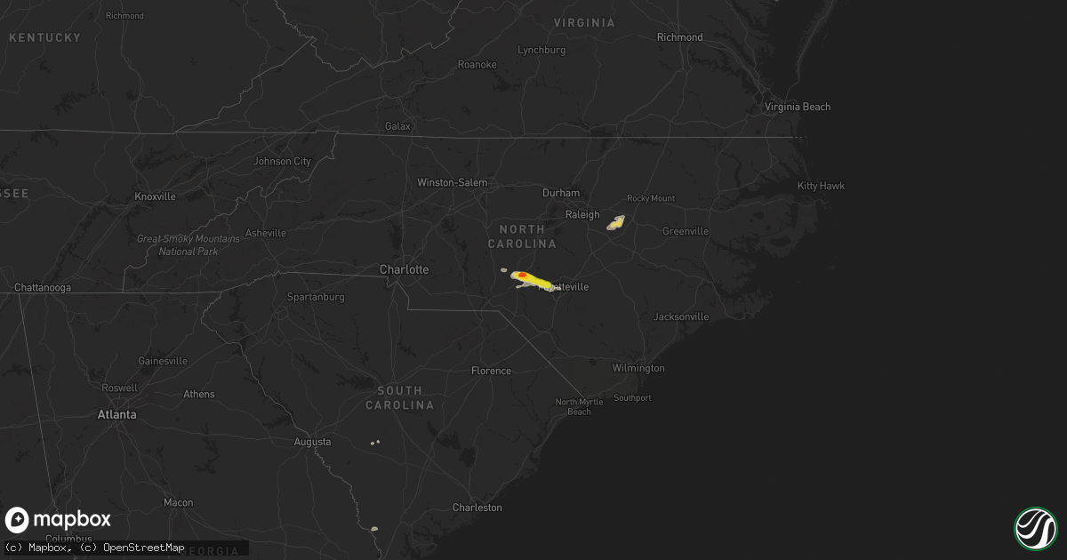
Hail Map on August 11, 2024
Get this storm
August 11 map
$229
one time, instant access
Download today. No call, no setup
Keep the $229
Bought the map and want the full workflow? Apply the entire $229 to a subscription within 7 days. None of it is wasted.
Every map, not just this one
This buys you this map. Subscription and you get every map we run, in the markets you choose from a few cities to whole states to nationwide. Plus real-time alerts the moment a storm fires.
Contact data
Name, contact info, occupancy, even credit band for addresses in the footprint. You go from where it hit to who to call.
Become the source they trust
Unlimited branding weather history reports on demand. You already have the documented answer ready for the property owner, and you are the one who showed up with it.
Property data and RoofTrace estimates
Pull up any address you have got, its value and the exact code rules for that jurisdiction, straight from One Click Code. Then RoofTrace estimates the squares, pitch, and roof value, priced the way you price.
States Impacted by Hail Map on August 11, 2024
Storm reports
South Carolina
| Date | Description |
|---|---|
| 08/11/20243:42 PM CDT | Emergency manager reports tree down along augusta hwy before peirce rd due to thunderstorm outflow. |
| 08/11/20241:52 PM CDT | Sc department of public safety reported a tree down on arcadia lakes drive. |
| 08/11/20241:40 PM CDT | Multiple trees reported down by sc department of public safety and public. Tree down on oak drive and trees down on snow lane near cromer road. |
New York
| Date | Description |
|---|---|
| 08/11/20245:33 PM CDT | Tree and wires downed on irondale road |
| 08/11/20245:33 PM CDT | A tree and wire down in salisbury near irondale road. |
| 08/11/20245:31 PM CDT | Tree downed blocking mang road near curtiss road |
| 08/11/20245:29 PM CDT | Tree downed blocking mang road near curtiss road. Corrected for time based on radar imagery. |
| 08/11/20245:22 PM CDT | Tree downed and blocking a portion of new york state route 28 |
| 08/11/20244:18 PM CDT | Trees and wires down on humaston road. |
| 08/11/20244:18 PM CDT | Trees and wires down on clock road. |
| 08/11/20244:00 PM CDT | Trees and wires down. |
| 08/11/20243:48 PM CDT | Trees down on kibbie lake road. Time estimated by radar. |
| 08/11/20243:22 PM CDT | Trees and wires down in red creek. Time estimated by radar. |
| 08/11/20243:20 PM CDT | Trees and wires down. |
| 08/11/20243:13 PM CDT | Trees and wires down in wolcott. Time estimated by radar. |
| 08/11/20243:08 PM CDT | Trees and wires down in the town of huron. Time estimated by radar. |
| 08/11/20242:58 PM CDT | Trees and wires down in sodus. Time estimated by radar. |
| 08/11/20242:56 PM CDT | Trees and wires down on james road in hannibal. Time estimated by radar. |
| 08/11/20242:43 PM CDT | Several trees and limbs down. Public report on social media. |
| 08/11/20242:10 PM CDT | Large tree down on powerlines and a backyard shed on lakeshire rd. Time estimated by radar. |
| 08/11/20241:40 PM CDT | Quarter size hail in murray. |
| 08/11/20241:15 PM CDT | Trees and wires down in lyndonville. Time estimated by radar. |
| 08/11/20241:13 PM CDT | Trees and wires down in ridgeway. Time estimated by radar. |
Kansas
| Date | Description |
|---|---|
| 08/11/20246:47 PM CDT | Phone report of hail ranging from pea to quarter size in hail. No longer hailing as of call. |
| 08/11/20246:25 PM CDT | Person also reported power being out. |
| 08/10/20247:32 PM CDT | Phone call report of wind driven hail with winds estimated around 65 to 70 mph. Wind drive |
| 08/10/20247:32 PM CDT | Phone call report of wind driven hail with winds estimated around 65 to 70 mph. Wind driven hail broke windows. |
| 08/10/20247:32 PM CDT | Delayed report of a tree uprooted and multiple other branches torn off tree. |
| 08/10/20247:23 PM CDT | Phone call reporting hail between pea and golf ball with a few 2 inch stones. Multiple broken windows due to wind driven hail. |
| 08/10/20247:22 PM CDT | Relayed report of hail around half dollar in size. |
| 08/10/20247:22 PM CDT | Delayed report of medium sized tree damage in southwestern goodland. |
| 08/10/20247:22 PM CDT | Relayed report with picture of a tree with a long branch split and hanging from the main tree. Estimated diameter is 3 to 6 inches from picture. |
| 08/10/20247:19 PM CDT | Report from mping: ping pong ball |
| 08/10/20247:19 PM CDT | Multiple reports from employees... Spotters... And the public of hail between half an inch to an inch in size. Multiple reports of hail covering the ground. |
| 08/10/20247:15 PM CDT | Report from mping: quarter |
| 08/10/20247:14 PM CDT | Delayed report of an irrigation pivot overturned south of i-70 between cr 20 and ks 27. |
North Carolina
| Date | Description |
|---|---|
| 08/11/20246:28 AM CDT | Tree down on dobbin holmes rd. |
| 08/11/20246:25 AM CDT | Power pole and lines down on forest lake dr. |
| 08/11/20246:25 AM CDT | Tree down on murphy rd. |
| 08/11/20245:29 AM CDT | Half dollar size hail reported in the highland trails area of southern pines. Time estimated by radar. |
| 08/11/20245:28 AM CDT | A local report indicates 1.75 inch wind near 1 NE Southern Pines |
| 08/10/20247:15 PM CDT | Several tree branches down on power lines along winters rd. |
Nebraska
| Date | Description |
|---|---|
| 08/11/20245:40 PM CDT | Hail ranging from pea to ping pong ball size. |
| 08/11/20245:30 PM CDT | Limbs and small branches downed. Pea size hail also. |
| 08/11/20245:15 PM CDT | Estimated 60 to 70 mph wind gusts and pea size hail. |
| 08/10/20247:00 PM CDT | Public report via social media of half inch to inch hail. Time estimated from radar. |
Oklahoma
| Date | Description |
|---|---|
| 08/11/20241:55 AM CDT | A local report indicates 59 MPH wind near 4 SSE Blackwell |
Arizona
| Date | Description |
|---|---|
| 08/11/202412:45 AM CDT | Personal weather station from trained spotter. |
Colorado
| Date | Description |
|---|---|
| 08/11/20246:10 PM CDT | Was found hours after the storm had moved through. Estimated time of report from radar. |
| 08/11/20246:10 PM CDT | Occurred with 70 mph wind gusts. Hail is an inch deep. |
| 08/11/20246:10 PM CDT | Occurred with 3 inch hail. Two windows broken. |
| 08/11/20245:51 PM CDT | A local report indicates 2.50 inch wind near 2 ESE Vernon |
| 08/11/20245:43 PM CDT | Report of quarter sized hail relayed over social media. |
| 08/11/20245:40 PM CDT | A local report indicates 1.00 inch wind near 5 NE Vernon |
| 08/11/20245:40 PM CDT | A local report indicates 1.00 inch wind near 3 NNE Vernon |
| 08/11/20245:39 PM CDT | Just north of cr 30 and ee intersection. |
| 08/11/20245:36 PM CDT | Social media report with picture of shed folded up against electric pole. Possible tornado damage. Time estimated from radar. |
| 08/11/20245:23 PM CDT | Reported near cr t and 41. |
| 08/11/20245:00 PM CDT | Estimated 50-60 mph gusts at this location as storm moved through. |
| 08/11/20244:30 PM CDT | Near hwy 59 and cr 54 intersection. |
| 08/11/20243:58 PM CDT | Mesonet station co035 i-76 sterling. |
| 08/11/20242:57 PM CDT | Awos station k1ow 2 nw pawnee buttes. |
South Dakota
| Date | Description |
|---|---|
| 08/11/20245:31 PM CDT | A local report indicates 58 MPH wind near 6 W Cottonwood |
| 08/11/20244:33 PM CDT | A local report indicates 1.00 inch wind near 1 SSE Sharps Corner |
| 08/11/20244:21 PM CDT | A local report indicates 71 MPH wind near 3 NNW Scenic |
| 08/11/20244:16 PM CDT | A local report indicates 58 MPH wind near 3 NNW Scenic |
| 08/11/20243:43 PM CDT | A local report indicates 67 MPH wind near 8 SSW Folsom |
| 08/11/20243:40 PM CDT | A local report indicates 64 MPH wind near 7 SSW Folsom |
| 08/11/20243:11 PM CDT | A local report indicates 1.00 inch wind near Hermosa |
| 08/11/20243:03 PM CDT | Social media post relayed by knbn. Portable restroom blown 700 yards and camper was flipped over. |
| 08/11/20242:48 PM CDT | A local report indicates 1.75 inch wind near Rockerville |
| 08/11/20241:26 PM CDT | A local report indicates 71 MPH wind near 27 WNW Castle Rock |
Utah
| Date | Description |
|---|---|
| 08/10/20247:20 PM CDT | Mesonet station pc349 nephi west. |
Montana
| Date | Description |
|---|---|
| 08/11/20241:45 PM CDT | Mesonet station mtm33 8.2 sw capitol |
Cities Impacted by Hail Map on August 11, 2024
- Vici, OK
- Atwood, KS
- Rexford, KS
- Colby, KS
- Lead, SD
- Barker, NY
- Gasport, NY
- Appleton, NY
- Sidney, MT
- Lyndonville, NY
- Middleport, NY
- Medina, NY
- Albion, NY
- Newfane, NY
- Waterport, NY
- Kent, NY
- Holley, NY
- Kendall, NY
- Brockport, NY
- Hamlin, NY
- Norway, SC
- Blackville, SC
- Neeses, SC
- Rapid City, SD
- Warner Springs, CA
- Webster, NY
- Ontario, NY
- Colorado City, AZ
- Sodus, NY
- Williamson, NY
- Hermosa, SD
- Keystone, SD
- Mims, FL
- Ferron, UT
- Fulton, NY
- Phoenix, NY
- Hardeeville, SC
- Quincy, FL
- Caputa, SD
- Fairburn, SD
- Pine Ridge, SD
- West Monroe, NY
- Central Square, NY
- Sterling, CO
- Scenic, SD
- New Underwood, SD
- Winslow, AZ
- Constantia, NY
- Bernhards Bay, NY
- Cleveland, NY
- Camden, NY
- Crawford, NE
- Garnett, SC
- Merino, CO
- Fleming, CO
- Hemingford, NE
- Marsland, NE
- Littlefield, AZ
- Pineland, SC
- Kyle, SD
- Panguitch, UT
- Williams, AZ
- Yuma, CO
- Otis, CO
- Grand Canyon, AZ
- Porcupine, SD
- Alliance, NE
- Hay Springs, NE
- Haxtun, CO
- Allen, SD
- Dammeron Valley, UT
- Merriman, NE
- Martin, SD
- Batesland, SD
- Ellsworth, NE
- Eckley, CO
- Wray, CO
- Huntington, UT
- Manderson, SD
- Lakeside, NE
- Chino Valley, AZ
- Cody, NE
- Ashby, NE
- Bingham, NE
- Vernon, CO
- Ivins, UT
- Seligman, AZ
- Oshkosh, NE
- Idalia, CO
- Saint Francis, KS
- Hinckley, UT
- Valentine, NE
- Ash Fork, AZ
- Waynesville, GA
- Kanorado, KS
- Goodland, KS
- Whitman, NE
- Middlesex, NC
- Kenly, NC
- Selma, NC
- Zebulon, NC
- Burlington, CO
- Arthur, NE
- Sims, NC
- Bailey, NC
- Thedford, NE
- Edson, KS
- Peach Springs, AZ
- Fillmore, UT
- Herndon, KS
- Helper, UT
- Pioche, NV
- Lamont, OK
- Medford, OK
- Hunter, OK
- Pawhuska, OK
- Wynona, OK
- Tonkawa, OK
- Red Rock, OK
- Barnsdall, OK
- Blackwell, OK
- Nardin, OK
- Deer Creek, OK
- Cleveland, OK
- Jennings, OK
- Pawnee, OK
- Maramec, OK
- Mannford, OK
- Terlton, OK
- Ponca City, OK
- Ralston, OK
- Braman, OK
- Morrison, OK
- Drumright, OK
- Glencoe, OK
- Yale, OK
- Lamar, CO
- Marland, OK
- Holly, CO
- Granada, CO
- Fairfax, OK
- Oxford, KS
- Depew, OK
- Bristow, OK
- Kellyville, OK
- Winfield, KS
- Sapulpa, OK
- Beggs, OK
- Hominy, OK
- Pinehurst, NC
- Aberdeen, NC
- Southern Pines, NC
- Raeford, NC
- Fort Bragg, NC
- Vass, NC
- Fayetteville, NC
- Hope Mills, NC
- West End, NC
- Jackson Springs, NC