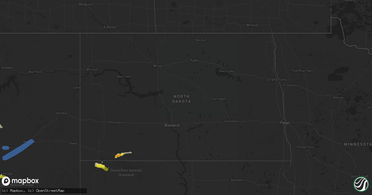
Hail Map in North Dakota on August 11, 2019
Get this storm
August 11 map
$229
one time, instant access
Download today. No call, no setup
Keep the $229
Bought the map and want the full workflow? Apply the entire $229 to a subscription within 7 days. None of it is wasted.
Every map, not just this one
This buys you this map. Subscription and you get every map we run, in the markets you choose from a few cities to whole states to nationwide. Plus real-time alerts the moment a storm fires.
Contact data
Name, contact info, occupancy, even credit band for addresses in the footprint. You go from where it hit to who to call.
Become the source they trust
Unlimited branding weather history reports on demand. You already have the documented answer ready for the property owner, and you are the one who showed up with it.
Property data and RoofTrace estimates
Pull up any address you have got, its value and the exact code rules for that jurisdiction, straight from One Click Code. Then RoofTrace estimates the squares, pitch, and roof value, priced the way you price.
Storm reports in North Dakota
North Dakota
| Date | Description |
|---|---|
| 08/11/20194:40 PM CDT | Reported crop damage as well. |
| 08/10/201910:33 PM CDT | At 332 PM MDT, a severe thunderstorm was located 5 miles north of Hettinger, moving northeast at 15 mph. HAZARD...60 mph wind gusts and half dollar size hail. SOURCE...Radar indicated. IMPACT...Hail damage to vehicles is expected. Expect wind damage to roofs, siding, and trees. This severe thunderstorm will remain over mainly rural areas of central Adams County, including the following locations... Bucyrus. |
All States Impacted by Hail Map on August 11, 2019
Cities Impacted by Hail Map on August 11, 2019
- Saint Francis, KS
- Akron, CO
- Otis, CO
- Shawnee, WY
- Manhattan, MT
- Faith, SD
- Oral, SD
- Eckley, CO
- Yuma, CO
- Billings, MT
- Masterson, TX
- Big Timber, MT
- Grover, CO
- Bighorn, MT
- Deer Trail, CO
- Bennett, CO
- Dillon, MT
- Wray, CO
- Rapelje, MT
- Acton, MT
- Molt, MT
- Vernon, CO
- Kirk, CO
- Sterling, CO
- Winnett, MT
- Aurora, CO
- Strasburg, CO
- Sheridan, MT
- Bozeman, MT
- Grass Range, MT
- Worden, MT
- Arriba, CO
- Iliff, CO
- Crook, CO
- Parker, CO
- Castle Rock, CO
- Franktown, CO
- Byers, CO
- Elizabeth, CO
- Kiowa, CO
- Padroni, CO
- Norton, KS
- Cardwell, MT
- Flagler, CO
- Woodrow, CO
- Fort Morgan, CO
- Ludlow, SD
- Shepherd, MT
- Hettinger, ND
- Ballantine, MT
- Huntley, MT
- Melville, MT
- Broadview, MT
- Bird City, KS
- Forsyth, MT
- Porcupine, SD
- Cheyenne, WY
- Hillsdale, WY
- Burns, WY
- Garryowen, MT
- Busby, MT
- Hulett, WY
- Ryegate, MT
- Judith Gap, MT
- Shawmut, MT
- McDonald, KS
- Helena, MT
- Reed Point, MT
- Lance Creek, WY
- Douglas, WY
- Reva, SD
- Glendo, WY
- Alzada, MT
- Kanorado, KS
- Bridger, MT
- Virginia City, MT
- Logan, KS
- Belle Fourche, SD
- Merino, CO
- Belgrade, MT
- Littleton, CO
- Wilsall, MT
- Hardin, MT
- Two Dot, MT
- Livingston, MT
- Pompeys Pillar, MT
- Pine Bluffs, WY
- Watkins, CO
- Englewood, CO
- Lone Tree, CO
- Meadow, SD
- Haigler, NE
- Buffalo Gap, SD
- Twin Bridges, MT
- Holyoke, CO
- Peetz, CO
- Atwood, KS
- Selden, KS
- Idalia, CO
- Gillette, WY
- Lame Deer, MT
- East Helena, MT
- Pine Ridge, SD
- Kyle, SD
- Manderson, SD
- Kermit, TX
- Norcatur, KS
- Carpenter, WY
- Roundup, MT
- Mosby, MT
- Sidney, NE
- Stanberry, MO
- Guilford, MO
- King City, MO
- Hillrose, CO
- Herndon, KS
- Oberlin, KS
- Larkspur, CO
- Elbert, CO
- Sheridan, WY
- Buffalo, SD
- Clancy, MT
- Crow Agency, MT
- Prairie View, KS
- New Raymer, CO
- Prairie City, SD
- Lodgepole, SD
- Ralph, SD
- Lenora, KS
- Three Forks, MT
- Allen, SD
- Stanford, MT
- Fleming, CO
- Hot Springs, SD
- Sanders, MT
- Rogers, NM
- Bowman, ND
- Coffee Creek, MT
- Frannie, WY
- Powell, WY
- Goodland, KS
- Gallatin Gateway, MT
- Hartville, WY
- Chappell, NE
- Oshkosh, NE
- Wheatland, WY
- Garrett, WY
- Nunn, CO
- Colby, KS
- Carmen, ID
- Broadwater, NE
- Bridgeport, NE
- Burlington, CO
- Colorado Springs, CO
- Edgemont, SD
- Corning, IA
- Midwest, WY
- Redstone, MT
- Parks, NE
- Custer, SD
- Newcastle, WY
- Smithwick, SD
- Oelrichs, SD
- Oglala, SD
- Martin, SD
- Batesland, SD
- Wall, SD
- Quinn, SD
- Clayton, KS
- Benkelman, NE
- Jennings, KS
- Ludell, KS
- Long Island, KS
- Almena, KS
- Dresden, KS
- Phillipsburg, KS
- Edson, KS
- Penokee, KS
- Levant, KS
- Stockton, KS
- Hoxie, KS
- Plainville, KS
- Gem, KS
- Rexford, KS
- Brewster, KS
- Morland, KS
- Hill City, KS
- Bogue, KS
- Damar, KS
- Ingomar, MT
- Greycliff, MT
- Rosebud, MT
- Volborg, MT
- Miles City, MT
- Hathaway, MT
- Missoula, MT
- Lolo, MT
- Pony, MT


