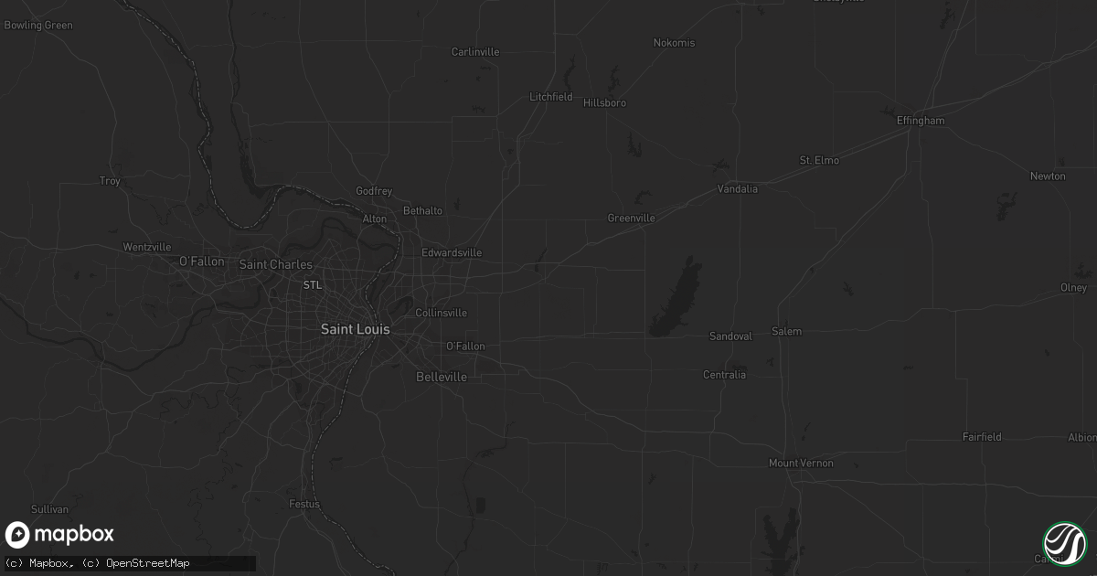
Hail Map in Lincoln, NE on August 6, 2011
Get this storm
August 6 map
$229
one time, instant access
Download today. No call, no setup
Keep the $229
Bought the map and want the full workflow? Apply the entire $229 to a subscription within 7 days. None of it is wasted.
Every map, not just this one
This buys you this map. Subscription and you get every map we run, in the markets you choose from a few cities to whole states to nationwide. Plus real-time alerts the moment a storm fires.
Contact data
Name, contact info, occupancy, even credit band for addresses in the footprint. You go from where it hit to who to call.
Become the source they trust
Unlimited branding weather history reports on demand. You already have the documented answer ready for the property owner, and you are the one who showed up with it.
Property data and RoofTrace estimates
Pull up any address you have got, its value and the exact code rules for that jurisdiction, straight from One Click Code. Then RoofTrace estimates the squares, pitch, and roof value, priced the way you price.
Storm reports in Lincoln, NE
Lincoln, NE
| Date | Description |
|---|---|
| 08/06/201112:42 AM CDT | One inch hail lasted for 2 minutes near 58th and r |
| 08/05/20118:36 PM CDT | Large limbs blocking road near 56th and south st. |
| 08/05/20118:28 PM CDT | Tree down at 25th and e |
| 08/05/20118:28 PM CDT | Also nickel size hail. 54th and princeton. |
| 08/05/20118:22 PM CDT | At the lancaster county event center. |
| 08/05/20118:20 PM CDT | One foot diameter tree blocking street near 24th and washington st. |
| 08/05/20118:18 PM CDT | Sw corner of city |
| 08/05/20118:16 PM CDT | Large limbs blocking road near 56th and south st. |
| 08/05/20118:15 PM CDT | Tree across a car on s 10th and lake st. |
| 08/05/20118:15 PM CDT | Near 24th and a st. Numerous small branches and one large 12+ inch branch down. |
| 08/05/20118:03 PM CDT | 56th and w denton rd. |
All States Impacted by Hail Map on August 6, 2011
All Cities Impacted by Hail Map on August 6, 2011
- Kit Carson, CO
- Wild Horse, CO
- Prosperity, SC
- Clarinda, IA
- Tillman, SC
- Antigo, WI
- Aniwa, WI
- Birnamwood, WI
- Grayville, IL
- Richmond, MN
- Cold Spring, MN
- Paynesville, MN
- Watkins, MN
- Ceresco, NE
- Mora, MN
- Braham, MN
- Ogilvie, MN
- Owatonna, MN
- Creston, IA
- Afton, IA
- Orient, IA
- Lorimor, IA
- Greenfield, IA
- Macksburg, IA
- Massena, IA
- Claremore, OK
- Catoosa, OK
- Springfield, GA
- Albion, NE
- Newman Grove, NE
- Saint Edward, NE
- Mannford, OK
- Waynesville, GA
- Brunswick, GA
- Waverly, GA
- Gorham, IL
- Murphysboro, IL
- Grand Tower, IL
- Dixon, NE
- Laurel, NE
- Homosassa, FL
- Rayville, MO
- Hardin, MO
- Richmond, MO
- Fremont, OH
- Helena, OH
- Burgoon, OH
- Arlington, KY
- Fancy Farm, KY
- Wickliffe, KY
- Charleston, MO
- Cunningham, KY
- Bardwell, KY
- Oak Park, MN
- Foley, MN
- Foreston, MN
- Lacona, IA
- Haxtun, CO
- Earling, IA
- Defiance, IA
- Irwin, IA
- Kirkman, IA
- Auburn, NE
- Danville, GA
- California, MO
- Sparta, GA
- Tulsa, OK
- Sand Springs, OK
- Elgin, NE
- Petersburg, NE
- Ewing, NE
- Melrose, IA
- Wappapello, MO
- Zalma, MO
- McGee, MO
- Gipsy, MO
- Greenville, MO
- Williamsville, MO
- Hickman, KY
- Randolph, NE
- Pierce, NE
- Alta, IA
- Linn Grove, IA
- Rembrandt, IA
- Saint Paul, MN
- Hugo, MN
- Ottumwa, IA
- Hedrick, IA
- Goodland, KS
- Brooksville, FL
- Louisville, NE
- Plattsmouth, NE
- Papillion, NE
- Shenandoah, IA
- Farragut, IA
- Imogene, IA
- Essex, IA
- Clearwater, NE
- Savannah, GA
- Fortuna, MO
- Russellville, MO
- Latham, MO
- Clarksburg, MO
- Tipton, MO
- Meta, MO
- Saint Elizabeth, MO
- Saint Thomas, MO
- Magnolia, NC
- Warsaw, NC
- Colby, KS
- Moorhead, IA
- Dow City, IA
- Manilla, IA
- Dunlap, IA
- Soldier, IA
- Woodbine, IA
- Castana, IA
- Ute, IA
- Onawa, IA
- Pisgah, IA
- Marquette, NE
- Central City, NE
- Chapman, NE
- Peterson, IA
- Sturdivant, MO
- Woodrow, CO
- Akron, CO
- Brush, CO
- Eldon, MO
- Reeds Spring, MO
- Mitchell, GA
- Kanorado, KS
- Coin, IA
- Whittemore, IA
- Algona, IA
- Hutchinson, MN
- Winsted, MN
- Silver Lake, MN
- Oakdale, NE
- Tilden, NE
- Omaha, AR
- Grand Rapids, OH
- McClure, OH
- Ellendale, MN
- Page, NE
- Inman, NE
- Palmyra, NE
- Bennet, NE
- New Raymer, CO
- Stoneham, CO
- Lindsay, NE
- Humphrey, NE
- Monroe, NE
- Agra, OK
- Cushing, OK
- Ripley, OK
- Broken Arrow, OK
- Raymond, NE
- Huntingdon, TN
- Unadilla, NE
- Jonesboro, IL
- Winnebago, NE
- Sterling, NE
- Huntsville, AR
- Hindsville, AR
- Berryville, AR
- Cook, NE
- Browerville, MN
- Palmer, NE
- Fullerton, NE
- Spicer, MN
- New London, MN
- Rock Port, MO
- Forest City, MO
- Rulo, NE
- Falls City, NE
- White Cloud, KS
- Craig, MO
- Ashby, NE
- Cincinnati, IA
- Centerville, IA
- Carter Lake, IA
- Council Bluffs, IA
- Omaha, NE
- Gretna, NE
- Yutan, NE
- Waverly, NE
- Wahoo, NE
- Greenwood, NE
- Waterloo, NE
- Ashland, NE
- Lincoln, NE
- Ithaca, NE
- Memphis, NE
- Springfield, NE
- Albany, MN
- Freeport, MN
- Lead Hill, AR
- Harrison, AR
- Kimball, MN
- Osmond, NE
- Mclean, NE
- Neligh, NE
- Belden, NE
- Birch Tree, MO
- Talmage, NE
- Brock, NE
- Lake Butler, FL
- Red Oak, IA
- Mallard, IA
- Emmetsburg, IA
- Cylinder, IA
- West Bend, IA
- Eugene, MO
- Vienna, MO
- Argyle, MO
- Koeltztown, MO
- Henley, MO
- Westphalia, MO
- Jefferson City, MO
- Olean, MO
- Cobden, IL
- Richmond Hill, GA
- Hickman, NE
- Puxico, MO
- Dudley, MO
- Dexter, MO
- Primrose, NE
- Ellsinore, MO
- Cashion, OK
- Hennessey, OK
- Pacific Junction, IA
- Otoe, NE
- Syracuse, NE
- Burr, NE
- Eagle, NE
- Atwater, MN
- Grove City, MN
- Essex, MO
- Sikeston, MO
- Bertrand, MO
- Bell City, MO
- Saint Martin, MN
- Stapleton, GA
- Louisville, GA
- Nemaha, NE
- Johnson, NE
- Humboldt, NE
- Stella, NE
- Brownville, NE
- Celestine, IN
- Jasper, IN
- East Prairie, MO
- Wolf Lake, IL
- Hurricane Mills, TN
- McEwen, TN
- Platte Center, NE
- Columbus, NE
- Stillwater, MN
- Salem, AR
- Alexandria, MN
- Beaver Crossing, NE
- Waco, NE
- Utica, NE
- David City, NE
- Oakley, ID
- Burley, ID
- Paducah, KY
- Kevil, KY
- Whiting, IA
- Mapleton, IA
- Hornick, IA
- Sloan, IA
- Plainview, NE
- Cedar Rapids, NE
- Hoskins, NE
- Meadow Grove, NE
- Bartlett, NE
- Bearcreek, MT
- Belfry, MT
- Adams, NE
- Firth, NE
- Mead, NE
- Fort Calhoun, NE
- Malmo, NE
- Cedar Bluffs, NE
- Bennington, NE
- Kennard, NE
- Arlington, NE
- Washington, NE
- Elkhorn, NE
- Valley, NE
- Colon, NE
- Crescent, IA
- Fremont, NE
- Boys Town, NE
- Morse Bluff, NE
- Blair, NE
- Percival, IA
- Nehawka, NE
- Avoca, NE
- Nebraska City, NE
- Weeping Water, NE
- Union, NE
- Perryville, MO
- Patton, MO
- Fredericktown, MO
- Manchester, GA
- Tabor, IA
- Sidney, IA
- Thurman, IA
- McCool Junction, NE
- Bradshaw, NE
- York, NE
- Hampton, NE
- Cincinnati, OH
- North Bend, OH
- Dubois, IN
- Pleasant Dale, NE
- Denton, NE
- Olar, SC
- Barnwell, SC
- Oran, MO
- Grand Chain, IL
- Curlew, IA
- Almo, KY
- Kirksey, KY
- Murray, KY
- Randolph, IA
- West Paducah, KY
- Mystic, IA
- Albia, IA
- Moravia, IA
- Brunson, SC
- Estill, SC
- Islandton, SC
- Fairfax, SC
- Varnville, SC
- Hampton, SC
- Callahan, CA
- Murray, NE
- Bellevue, NE
- Marble Hill, MO
- Sperry, OK
- Minneapolis, MN
- Andover, MN
- Circle Pines, MN
- Warrensburg, MO
- Dalbo, MN
- Russell, IA
- Chariton, IA
- McClelland, IA
- Fairfield, IL
- Golden Gate, IL
- Ellery, IL
- Winona, MO
- Fremont, MO
- Van Buren, MO
- Casey, IA
- Fontanelle, IA
- Menlo, IA
- Darwin, MN
- Napoleon, OH
- Malinta, OH
- Sedalia, MO
- Keystone, NE
- Rockford, AL
- Blackshear, GA
- Waycross, GA
- Saint Joseph, MO
- Agency, MO
- Woodville, WI
- Wilson, WI
- Yale, OK
- Drumright, OK
- Jennings, OK
- Benton, MO
- Grovetown, GA
- McClure, IL
- Altenburg, MO
- Frohna, MO
- Uniontown, MO
- Oak Ridge, MO
- Winterset, IA
- Van Meter, IA
- New Richmond, WI
- Dunbar, NE
- Hammond, WI
- Baldwin, WI
- Brainard, NE
- White Oak, GA
- Hortense, GA
- Nahunta, GA
- Walton, NE
- Rose Hill, NC
- Wingo, KY
- Fortuna, ND
- Bode, IA
- New Germany, MN
- Young America, MN
- Lester Prairie, MN
- Plato, MN
- Rising City, NE
- East Dublin, GA
- Jacob, IL
- Old Appleton, MO
- Alto Pass, IL
- Pomona, IL
- Jackson, MO
- Dows, IA
- Rowan, IA
- Hardeeville, SC
- Ridgeland, SC
- Manley, NE
- Elmo, MO
- Polk, NE
- College Springs, IA
- Roca, NE
- Elmwood, NE
- Murdock, NE
- Goehner, NE
- Braddyville, IA
- Blanchard, IA
- Milford, NE
- Westboro, MO
- Alvo, NE
- Riverton, IA
- Shubert, NE
- Peru, NE
- Northboro, IA
- Davey, NE
- Malcolm, NE
- Grand Island, NE
- Douglas, NE
- Highland, KS
- Aurora, NE
- Lorton, NE
- Verdon, NE
- Hamburg, IA
- Tecumseh, NE
- Seward, NE
- Hay Springs, NE
- Chadron, NE
- Lakeville, MN
- Elko New Market, MN
- Webster, MN
- Branson, MO
- Kimberling City, MO
- Anita, IA
- Exira, IA
- Holt, MO
- Lathrop, MO
- Wagoner, OK
- Vichy, MO
- Freeburg, MO
- Tuscumbia, MO
- Pittsfield, IL
- Franklin, AR
- Horseshoe Bend, AR
- Ash Flat, AR
- Dexter, IA
- Muscoda, WI
- Highland, WI
- Owasso, OK
- Clarion, IA
- Karnak, IL
- La Center, KY
- Metropolis, IL
- Butler, AL
- Van Horn, TX
- Otis, CO
- Risingsun, OH
- Fostoria, OH
- Howard Lake, MN
- Cokato, MN
- Belmond, IA
- Billings, MO
- Prior Lake, MN
- Jordan, MN
- Millersville, MO
- Adair, IA
- Kimballton, IA
- Audubon, IA
- Hamlin, IA
- Elk Horn, IA
- Mershon, GA
- Ringgold, VA
- Danville, VA
- Williston, SC
- Blackville, SC
- Bedford, IA
- New Market, IA
- Coleman, GA
- Plattsburg, MO
- Norwood Young America, MN
- Mayer, MN
- Cologne, MN
- Jewell, GA
- Staplehurst, NE
- Albert City, IA
- Storm Lake, IA
- Lake City, FL
- Dodge, NE
- North Bend, NE
- Linwood, NE
- Rogers, NE
- Levant, KS
- Harlan, IA
- Forest Lake, MN
- Walthill, NE
- Burfordville, MO
- Holladay, TN
- Camden, TN
- Indianola, IA
- Olive Branch, IL
- Scott City, MO
- Thebes, IL
- Miller City, IL
- Cairo, IL
- Villa Ridge, IL
- Tamms, IL
- Mounds, IL
- Advance, MO
- Holden, MO
- Kingsville, MO
- Sapulpa, OK
- Evansville, MN
- Butler, GA
- Ullin, IL
- Dongola, IL
- Cape Girardeau, MO
- Denison, IA
- Charter Oak, IA
- Manning, IA
- Stuart, IA
- Reydon, OK
- Clinton, KY
- Crawford, NE
- Naples, FL
- Hollister, MO
- Kirbyville, MO
- Alpena, AR
- Ridgedale, MO
- Green Forest, AR
- Alexander, IA
- Meservey, IA
- Kershaw, SC
- Glenwood City, WI
- Lampe, MO
- Sutherlin, VA
- Milton, NC
- Silver City, IA
- Martin, SC
- Charles City, IA
- Warrenton, GA
- Chapin, SC
- Guthrie, OK
- Purdy, MO
- Bee, NE
- Grasston, MN
- Bloomfield, MO
- Rosholt, WI
- Winona, KS
- Hemingford, NE
- Kanawha, IA
- Owensville, IN
- Griffin, IN
- Mount Carmel, IL
- Concord, NE
- Carroll, NE
- Albion, IL
- Prague, NE
- Mobeetie, TX
- Brandon, MN
- Syracuse, KS
- Brewster, KS
- Corydon, IA
- Allerton, IA
- Clio, IA
- Wiota, IA
- Atlantic, IA
- Bristol, GA
- Farmington, MO
- Milo, IA
- Ackworth, IA
- Montgomery, AL
- Ramer, AL
- Union City, TN
- Marne, IA
- Rocky Comfort, MO
- Murrayville, IL
- Roodhouse, IL
- Sheridan, MO
- Glenallen, MO
- Benton, KY
- Webb, IA
- Hazel, KY
- Lulu, FL
- Irwinton, GA
- Martell, NE
- Glenwood, IA
- Malvern, IA
- Evergreen, AL
- Clever, MO
- Ayrshire, IA
- Genoa, NE
- New Virginia, IA
- Osceola, IA
- Oxford, MS
- Midway, GA
- Demopolis, AL
- Oxford, AR
- Wiseman, AR
- Luckey, OH
- Pemberville, OH
- Jackson, AL
- Fulton, KY
- Truro, IA
- Cleves, OH
- Westville, SC
- Camden, SC
- Bellwood, NE
- New London, NC
- Richfield, NC
- Albemarle, NC
- Saint Libory, NE
- Violet Hill, AR
- Wathena, KS
- Elbow Lake, MN
- Ashby, MN
- Burt, IA
- Sioux Rapids, IA
- Weston, OH
- Tontogany, OH
- Bowling Green, OH
- Earlham, IA
- Anoka, MN
- Prescott, IA
- Bunceton, MO
- Coosawhatchie, SC
- Union, SC
- Panama, IA
- Portsmouth, IA
- Nashua, IA
- Gold Hill, NC
- Salisbury, NC
- Princeton, MN
- Scipio, IN
- Jonesville, IN
- Columbus, IN
- Seymour, IN
- Panama, NE
- Troy, KS
- Burlington, CO
- Salix, IA
- Beulaville, NC
- Fairmont, NE
- Melrose, MN
- Grand Bay, AL
- Sims, IL
- Clarks, NE
- Mill Spring, MO
- Brownwood, MO
- Marionville, MO
- Pulaski, IL
- Olmsted, IL
- Fort Lauderdale, FL
- Villisca, IA
- Corning, IA
- Saint Charles, IA
- Rocky Ford, GA
- Ailey, GA
- Coweta, OK
- Bruceton, TN
- Nowata, OK
- Louisville, KY
- Rockledge, GA
- Tarkio, MO
- Benson, MN
- Brewton, AL
- Milaca, MN
- Merrill, WI
- Kearney, MO
- Lawson, MO
- Walnut, IA
- Avoca, IA
- Stanchfield, MN
- Schuyler, NE
- Poseyville, IN
- Etna, CA
- Scotland, SD
- Sedgewickville, MO
- Titonka, IA
- Wesley, IA
- Willow Springs, MO
- Decatur, GA
- Inola, OK
- Geneva, IA
- Hampton, IA
- Bruce, WI
- West Plains, MO
- Bowler, WI
- Gibson, GA
- Warthen, GA
- Glencoe, MN
- Frederic, WI
- Avera, GA
- Marquand, MO
- Watonga, OK
- Belknap, IL
- Cypress, IL
- Buncombe, IL
- Vienna, IL
- Goetzville, MI
- Ogema, WI
- De Kalb, MS
- Alton, MO
- Gresham, NE
- Roscoe, MN
- Dassel, MN
- Watson, MO
- Atwood, TN
- Harrison, NE
- Mount Pleasant, NC
- Poplar Bluff, MO
- Milton, FL
- Townsend, GA
- Gower, MO
- Perkins, OK
- Stillwater, OK
- Little Mountain, SC
- Leesville, SC
- Hickory, KY
- Mayfield, KY
- Winchester, IL
- Cordova, NE
- Exeter, NE
- Dorchester, NE
- Friend, NE
- Stanton, IA
- Valparaiso, NE
- Fort Myers, FL
- Genoa, OH
- Garland, NE
- Unionville, MO
- Seymour, IA
- Crete, NE
- Litchfield, MN
- Hamburg, MN
- Ames, NE


