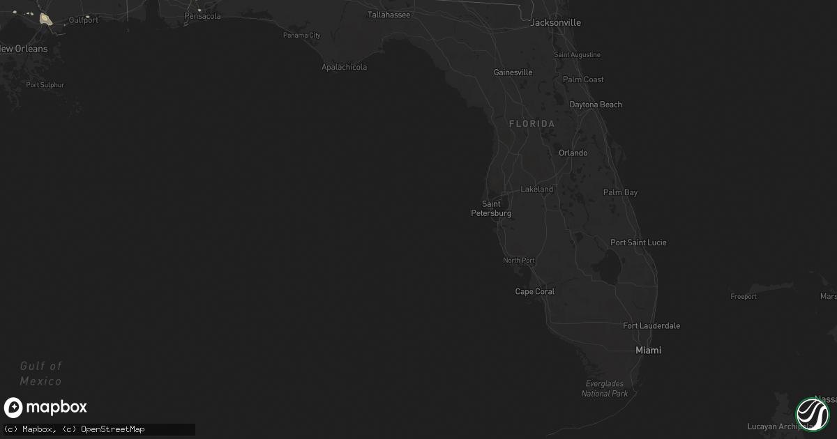
Hail Map in Florida on August 4, 2016
Get this storm
August 4 map
$229
one time, instant access
Download today. No call, no setup
Keep the $229
Bought the map and want the full workflow? Apply the entire $229 to a subscription within 7 days. None of it is wasted.
Every map, not just this one
This buys you this map. Subscription and you get every map we run, in the markets you choose from a few cities to whole states to nationwide. Plus real-time alerts the moment a storm fires.
Contact data
Name, contact info, occupancy, even credit band for addresses in the footprint. You go from where it hit to who to call.
Become the source they trust
Unlimited branding weather history reports on demand. You already have the documented answer ready for the property owner, and you are the one who showed up with it.
Property data and RoofTrace estimates
Pull up any address you have got, its value and the exact code rules for that jurisdiction, straight from One Click Code. Then RoofTrace estimates the squares, pitch, and roof value, priced the way you price.
Storm reports in Florida
Florida
| Date | Description |
|---|---|
| 08/04/20161:05 PM CDT | Nassau county emergency management reports a large tree downed along gene lassere road that is obstructing the roadway in both directions...along with water completely |
| 08/04/20161:00 PM CDT | Nassau county emergency management reports tree downed and a passenger trapped in a vehicle along bobby drive near pages dairy road. |
| 08/04/20161:00 PM CDT | Nassau county emergency management reports a large tree downed over a home along riverwood drive. |
| 08/04/20161:00 PM CDT | Nassau county emergency management reports tornado damage to a residence along meadowood drive. |
| 08/04/20161:00 PM CDT | Nassau county emergency management reports a semi-tractor trailer turned over onto another vehicle along state road 200. |
| 08/04/201612:55 PM CDT | Large trees down |
| 08/04/201612:50 PM CDT | Nassau county emergency management reports tornado damage near the intersection of blackmon road and angie road...with approximately 100 trees downed. Time of damage ba |
| 08/04/201612:40 PM CDT | Preliminary storm survey results found an ef1 tornado with maximum winds of 90 to 100 mph. It started at approximately 140 pm and lifted at approximately 157 pm. Maximu |
All States Impacted by Hail Map on August 4, 2016
Cities Impacted by Hail Map on August 4, 2016
- Lincoln, NE
- Maiden Rock, WI
- Durand, WI
- Arkansaw, WI
- Stockholm, WI
- Pepin, WI
- Plum City, WI
- Calhoun, GA
- Albany, MO
- Pattonsburg, MO
- Darlington, MO
- McFall, MO
- King City, MO
- Holland, IA
- Wellsburg, IA
- Parkersburg, IA
- Altoona, IA
- Waverly, NE
- Princeton, MO
- Montezuma, IA
- Malcom, IA
- Dodgeville, WI
- Mineral Point, WI
- Tama, IA
- Pella, IA
- Quinter, KS
- Park, KS
- Holly, CO
- Dysart, IA
- Keystone, IA
- Vallonia, IN
- Salem, IN
- Bushton, KS
- Chase, KS
- Milligan, NE
- Exeter, NE
- Toledo, IA
- Chelsea, IA
- Wauzeka, WI
- Boscobel, WI
- Little Cedar, IA
- Riceville, IA
- Stacyville, IA
- McIntire, IA
- Monroe, IA
- New Albin, IA
- Lansing, IA
- Waukon, IA
- Decorah, IA
- Dorchester, IA
- Brownsville, MN
- Blakesburg, IA
- Ottumwa, IA
- Drakesville, IA
- Bloomfield, IA
- Preston, MN
- Harmony, MN
- Geneva, NE
- Elkhorn, NE
- Gretna, NE
- Omaha, NE
- Cabot, AR
- Marengo, IA
- Victor, IA
- Ladora, IA
- Ashland, NE
- Greenwood, NE
- Rudd, IA
- Rockford, IA
- Fort Dodge, IA
- Webber, KS
- Saint Paul, MN
- Owatonna, MN
- Claremont, MN
- Thornton, IA
- Council Bluffs, IA
- Gladbrook, IA
- Beaman, IA
- Lakin, KS
- Syracuse, KS
- Garrison, IA
- Mount Auburn, IA
- La Porte City, IA
- Epworth, IA
- Castalia, IA
- Postville, IA
- Ossian, IA
- McClelland, IA
- Treynor, IA
- Prairie City, IA
- Colfax, IA
- Mitchellville, IA
- Hartford, AL
- Bonifay, FL
- Black, AL
- Rueter, MO
- Theodosia, MO
- Ethel, MS
- Forest, MS
- Pulaski, MS
- Grainfield, KS
- Eitzen, MN
- Caledonia, MN
- Mankato, KS
- Superior, NE
- Friend, NE
- Cedar Rapids, IA
- Newton, IA
- Rockwell, IA
- Webster, IA
- North English, IA
- Keswick, IA
- Sigourney, IA
- Cresco, IA
- Fort Atkinson, IA
- Calmar, IA
- Waterville, IA
- Collyer, KS
- Holy Cross, IA
- New Vienna, IA
- Grinnell, IA
- Montour, IA
- Gilman, IA
- Knapp, WI
- Menomonie, WI
- Boyceville, WI
- Minneapolis, MN
- Ostrander, MN
- Dighton, KS
- Independence, WI
- Cochrane, WI
- Jeanerette, LA
- Waveland, MS
- Glade, KS
- Laurel, MS
- Ellisville, MS
- Deerfield, KS
- Holcomb, KS
- Arcadia, WI
- Norwalk, WI
- Wilton, WI
- Shickley, NE
- Madisonville, LA
- Covington, LA
- Stennis Space Center, MS
- Slidell, LA
- Bay Saint Louis, MS
- Picayune, MS
- Pearl River, LA
- Summerville, SC
- Ladson, SC
- Savannah, MO
- Rosendale, MO
- Rea, MO
- Satanta, KS
- Sublette, KS
- Arlington, IA
- Chanhassen, MN
- Excelsior, MN
- Austin, MN
- Walnut Grove, MS
- Fosters, AL
- Green Isle, MN
- Hamburg, MN
- Bernard, IA
- Moulton, IA
- Bristow, IA
- Allison, IA
- Dumont, IA
- Sparta, WI
- Ralph, AL
- Dallas City, IL
- Niota, IL
- Unionville, MO
- Pollock, MO
- Green City, MO
- Livonia, MO
- Cedar, IA
- Fremont, IA
- Abita Springs, LA
- Cedar Falls, IA
- Waterloo, IA
- Evansdale, IA
- Dike, IA
- Hudson, IA
- Shell Rock, IA
- New Hartford, IA
- Dows, IA
- Williams, IA
- Gilman City, MO
- Centerville, IA
- Moravia, IA
- Packwood, IA
- Batavia, IA
- Powersville, MO
- Lucerne, MO
- Marble Rock, IA
- Conway, AR
- Mayflower, AR
- Hot Springs National Park, AR
- Hamlin, IA
- Exira, IA
- State Center, IA
- Plainfield, IA
- Center Point, IA
- Walsh, CO
- Hedrick, IA
- Leoti, KS
- Nevada, IA
- Ames, IA
- Nora Springs, IA
- Barnes City, IA
- Deep River, IA
- Gibson, IA
- Donalsonville, GA
- Memphis, MO
- Gorin, MO
- Rutledge, MO
- Swaledale, IA
- Clear Lake, IA
- Fountain City, WI
- Steuben, WI
- Jackson, AL
- Gainestown, AL
- Clarksville, IA
- Keota, IA
- Ollie, IA
- Columbia, MS
- Oak Vale, MS
- Story City, IA
- Boone, IA
- Gilbert, IA
- Cambridge, IA
- Plainville, KS
- Glen Haven, WI
- Bloomington, WI
- Coon Rapids, IA
- Vossburg, MS
- Paulding, MS
- Dyersville, IA
- Guttenberg, IA
- Edgewood, IA
- Earlville, IA
- Luxemburg, IA
- Colesburg, IA
- Garber, IA
- Greeley, IA
- Sheffield, IA
- Glenwood, MO
- Van Horne, IA
- Newhall, IA
- Clutier, IA
- Elberon, IA
- Lime Springs, IA
- Elma, IA
- Adams, MN
- Rose Creek, MN
- Reasnor, IA
- Sully, IA
- Molena, GA
- Zebulon, GA
- Meansville, GA
- Clemons, IA
- Albion, IA
- Lincoln, IA
- Reinbeck, IA
- Traer, IA
- Grundy Center, IA
- Conrad, IA
- Marshalltown, IA
- Montfort, WI
- Livingston, WI
- Fennimore, WI
- Ogallah, KS
- Kirksville, MO
- Greentop, MO
- Novinger, MO
- Millry, AL
- Alma, WI
- Arbela, MO
- Baring, MO
- Avoca, IA
- Muscatine, IA
- Fruitland, IA
- Hiawatha, IA
- Eastman, WI
- Mount Pleasant, IA
- Salem, IA
- Ridgeway, IA
- Fairmont, NE
- Hampton, IA
- Chapin, IA
- La Fayette, GA
- Rocky Face, GA
- Waverly, IA
- Nelson, WI
- Molino, FL
- Bascom, FL
- Blanchardville, WI
- Heidelberg, MS
- Fredericksburg, IA
- New Hampton, IA
- Ionia, IA
- Garner, IA
- Ventura, IA
- Forest City, IA
- Perryville, AR
- Oskaloosa, IA
- Green Castle, MO
- Coatsville, MO
- Worthington, MO
- Brashear, MO
- Bigelow, AR
- Potosi, WI
- Aredale, IA
- Shellsburg, IA
- Modale, IA
- Missouri Valley, IA
- Mingo, IA
- Plainville, IL
- Unionville, IA
- Davenport, NE
- Ong, NE
- Luana, IA
- Stillwater, MN
- Hugo, MN
- Marine On Saint Croix, MN
- Libertyville, IA
- Fairfield, IA
- Enterprise, AL
- Ozark, AL
- Otley, IA
- Kellogg, IA
- Aplington, IA
- Guymon, OK
- Lynnville, IA
- Doniphan, NE
- Vinton, IA
- Beaumont, MS
- Dorchester, NE
- Crete, NE
- Belle Plaine, IA
- Bethany, MO
- Ridgeway, MO
- Lawler, IA
- Quincy, IL
- Hayneville, AL
- Beloit, KS
- Greene, IA
- Clermont, IA
- Melbourne, IA
- Rhodes, IA
- Danville, IA
- Taopi, MN
- Elkton, MN
- Le Roy, MN
- Hillsboro, WI
- Wonewoc, WI
- Dawson, IA
- Thompson, IA
- Jamesport, MO
- Blooming Prairie, MN
- Eagle Grove, IA
- Lindrith, NM
- Queen City, MO
- Newtown, MO
- McDavid, FL
- Jackson, KY
- Campton, KY
- Flomaton, AL
- Century, FL
- Hollandale, WI
- Mount Olive, MS
- Harpersville, AL
- Dougherty, IA
- Meservey, IA
- Walford, IA
- Fairfax, IA
- Shafer, MN
- Osceola, WI
- Scandia, MN
- Thor, IA
- Humboldt, IA
- Hope, MN
- Ellendale, MN
- Dodge Center, MN
- Lake Mills, IA
- Northwood, IA
- Saint Ansgar, IA
- Delta, IA
- What Cheer, IA
- Stockton, KS
- Cantonment, FL
- Cuba City, WI
- Hazel Green, WI
- Paris, MO
- Springfield, CO
- Stoutsville, MO
- Shelbina, MO
- Toone, TN
- Bolivar, TN
- Henderson, TN
- Edina, MO
- Lacombe, LA
- Downing, MO
- Moundville, AL
- Willard, WI
- Biloxi, MS
- Gulfport, MS
- Milan, MO
- Monmouth, IA
- Maquoketa, IA
- Baldwin, IA
- Inver Grove Heights, MN
- Minnetonka, MN
- Burnsville, MN
- Mendota, MN
- Hopkins, MN
- Wayzata, MN
- Nashua, IA
- Zearing, IA
- West Union, IA
- Durango, IA
- Floris, IA
- Woolstock, IA
- Kendall, KS
- New Providence, IA
- Atlanta, GA
- Red Wing, MN
- Kirwin, KS
- Rockland, WI
- Bangor, WI
- Blairsburg, IA
- Pensacola, FL
- Norway, IA
- Atkins, IA
- Watkins, IA
- Linden, WI
- Rewey, WI
- Cobb, WI
- Stitzer, WI
- Madrid, IA
- Waltham, MN
- Brownsdale, MN
- Lake, MS
- Raleigh, MS
- Neola, IA
- Minden, IA
- White Castle, LA
- Blue Grass, IA
- New Augusta, MS
- Iuka, MS
- Union Star, MO
- Amity, MO
- Cave City, AR
- Batesville, AR
- Chatfield, MN
- Wykoff, MN
- Vancleve, KY
- Essex, CA
- Austin, AR
- Neillsville, WI
- Underwood, IA
- Hanlontown, IA
- Joice, IA
- Collins, IA
- Spring Valley, MN
- Hollandale, MN
- Albert Lea, MN
- Wellman, IA
- Wakeeney, KS
- Richland, IA
- Brandon, MS
- Stout, IA
- Wever, IA
- Elroy, WI
- Charles City, IA
- Castleberry, AL
- Mandeville, LA
- Ackley, IA
- Clarion, IA
- Le Center, MN
- Montgomery, MN
- Shelby, IA
- Mabel, MN
- Canton, MN
- Zachary, LA
- Orchard, IA
- Laurel, IA
- Haverhill, IA
- West Salem, WI
- New London, IA
- Counce, TN
- State Line, MS
- North Buena Vista, IA
- Farley, IA
- Coffey, MO
- Walnut, IA
- Elk Horn, IA
- Denton, NE
- Evergreen, AL
- New Sharon, IA
- Courtland, KS
- Emmons, MN
- Thomaston, GA
- Houston, AR
- Morton, MS
- Orient, ME
- Gowrie, IA
- Farnhamville, IA
- Lohrville, IA
- Spring Grove, MN
- Elko New Market, MN
- Lakeville, MN
- Webster, MN
- Jay, FL
- Morgantown, IN
- Richton, MS
- Waterloo, AL
- Lockridge, IA
- Alvo, NE
- Kendall, WI
- Volga, IA
- Pontotoc, MS
- Spickard, MO
- Trenton, MO
- Bagley, WI
- West Branch, IA
- Atalissa, IA
- Michie, TN
- North Little Rock, AR


