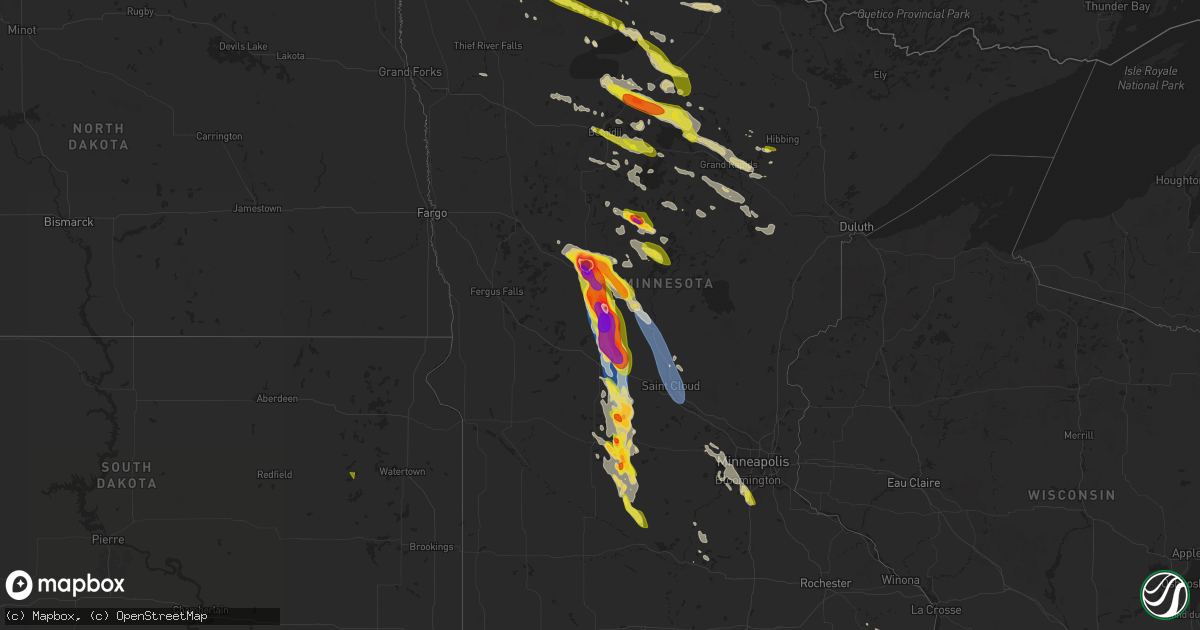
Hail Map on August 3, 2024
Get this storm
August 3 map
$229
one time, instant access
Download today. No call, no setup
Keep the $229
Bought the map and want the full workflow? Apply the entire $229 to a subscription within 7 days. None of it is wasted.
Every map, not just this one
This buys you this map. Subscription and you get every map we run, in the markets you choose from a few cities to whole states to nationwide. Plus real-time alerts the moment a storm fires.
Contact data
Name, contact info, occupancy, even credit band for addresses in the footprint. You go from where it hit to who to call.
Become the source they trust
Unlimited branding weather history reports on demand. You already have the documented answer ready for the property owner, and you are the one who showed up with it.
Property data and RoofTrace estimates
Pull up any address you have got, its value and the exact code rules for that jurisdiction, straight from One Click Code. Then RoofTrace estimates the squares, pitch, and roof value, priced the way you price.
States Impacted by Hail Map on August 3, 2024
Storm reports
Texas
| Date | Description |
|---|---|
| 08/03/20246:50 PM CDT | A local report indicates 58 MPH wind near 3 SW Dalhart |
| 08/03/20246:30 PM CDT | A local report indicates 65 MPH wind near 3 SE Dumas |
| 08/03/20245:53 PM CDT | A local report indicates 58 MPH wind near 7 E Borger |
| 08/03/20245:10 PM CDT | The runnels county sheriff office reported a power line blown down along highway 83... Just southeast of ballinger. |
| 08/03/20245:10 PM CDT | The runnels county sheriff office reported 2 power lines blown down in ballinger. A vacant warehouse had damage to part of the roof... And part of the front of the buil |
| 08/03/20244:21 PM CDT | Severe thunderstorm wind gusts downed trees in two areas of jasper. One area on the southeast side of jasper took out some power lines. |
| 08/02/20249:30 PM CDT | A local report indicates 58 MPH wind near 2 NE Friona |
| 08/02/20249:07 PM CDT | Wind gusts of 58 mph or greater occurred for 3 minutes with the peak being at 909 pm. |
| 08/02/20248:58 PM CDT | A local report indicates 59 MPH wind near 2 WNW Hereford |
| 08/02/20248:20 PM CDT | Severe wind gusts occurred for 3 minutes with the strongest gust at 821 pm. |
| 08/02/20248:11 PM CDT | Strongest wind gust occurred at 817 pm. Multiple gusts of 60 mph or greater occurred for nearly 10 minutes. |
| 08/02/20248:11 PM CDT | Strongest wind gust occurred at 817 pm. |
Nevada
| Date | Description |
|---|---|
| 08/03/20245:44 PM CDT | Asos station klol lovelock. Also reported visibility down to 0.25 mile between 345 and 4 pm. |
| 08/03/20245:44 PM CDT | Mesonet station tornv 9.8 ne trinity junction |
| 08/03/20245:44 PM CDT | Asos station klol lovelock. |
Pennsylvania
| Date | Description |
|---|---|
| 08/03/20244:55 PM CDT | Multiple calls for trees and wires down in caln. Time estimated from radar. |
| 08/03/20244:45 PM CDT | 3 persons rescued by firefighters and river rescue from the middle of octorara lake in colerain twp north of nottingham when their 16 ft green john boat overturned duri |
| 08/03/20244:20 PM CDT | Tree down blocking both lanes of rt 273 several miles south of lancaster near willow street. |
| 08/03/20244:15 PM CDT | Multiple calls for trees and wires down in west brandywine township. Time estimated from radar. |
| 08/03/20244:00 PM CDT | Roof peeled off 1/2 of a 20ft x 20ft outbuilding structure. In the yard a 24 in diameter tree split down the middle. |
| 08/03/20243:45 PM CDT | Tree down - hit the pressure relief valve on a 500 gallon lp propane tank shearing it off... Causing a gas leak in a residential area. No injuries reported. |
| 08/03/20243:45 PM CDT | 7 trees in straight line toppled on property... Two landing on cars in the driveway. |
| 08/03/20243:43 PM CDT | Trees down on wires along five points road in rockland township. Time estimated from radar. |
| 08/03/20243:40 PM CDT | Tree down on a car parked along the roadside |
| 08/03/20243:30 PM CDT | Wires down across the roadway and partially draped across the roof of a mobile home. No injuries reported. |
| 08/03/20243:30 PM CDT | Report from mping: 3-inch tree limbs broken; power poles broken. |
| 08/03/20243:29 PM CDT | Several trees and wires down in richmond township. Time estimated from radar. |
| 08/03/20243:29 PM CDT | Trees down on wires which fell on top of a car along locust street. Time estimated from radar. |
| 08/03/20243:29 PM CDT | Trees and wires down along east vine street and north franklin street. Time estimated from radar. |
| 08/03/20243:27 PM CDT | Several trees and wires down around ruscombmanor township... Pa. Time estimated from radar. |
| 08/03/20243:20 PM CDT | Multiple trees and large diameter limbs down blocking the roadway also bringing power lines down on the roadway.. |
| 08/03/20243:18 PM CDT | Trees down along moselem springs road in richmond township. Time estimated from radar. |
| 08/03/20243:16 PM CDT | Report of a tree down into house along mount laurel road in muhlenberg township. Time estimated from radar. |
| 08/03/20243:15 PM CDT | Multiple trees and large diameter limbs down blocking the roadway. |
| 08/03/20243:15 PM CDT | 3-inch tree limbs broken; power poles broken. |
| 08/03/20243:10 PM CDT | Large diameter tree down onto the roof of a two story condo building. 2 other smaller diameter trees down in the parking area. |
| 08/03/20243:10 PM CDT | Multiple trees down brought down powerlines onto the roadway. |
| 08/03/20243:10 PM CDT | Downed trees brought down electrical wires across the roadway blocking the off ramp. |
| 08/03/20243:10 PM CDT | Multiple trees and large diameter limbs down blocking the roadway. |
| 08/03/20243:10 PM CDT | Roof peeled off one side of a 20ft x 30ft outbuilding structure. |
| 08/03/20243:10 PM CDT | 3-inch tree limbs broken; trees down and power poles broken and down across the roadway. |
| 08/03/20242:57 PM CDT | Several trees and wires down around middle smithfield township... Pa. Time estimated from radar. |
| 08/03/20242:46 PM CDT | Several trees and wires down across barrett township. Time estimated from radar. |
| 08/03/20242:40 PM CDT | Trees and wires down across hamilton township. Time estimated from radar. |
| 08/03/20242:35 PM CDT | Trees down on wires along lakeview drive. Time estimated from radar. |
| 08/03/20241:35 PM CDT | Trees uprooted or snapped; roof blown off an small outbuilding structure. |
| 08/03/20241:30 PM CDT | Wires down on roof of building on willow ave. |
| 08/03/202412:52 PM CDT | 1 inch hail. |
Louisiana
| Date | Description |
|---|---|
| 08/03/20246:21 PM CDT | Severe thunderstorm wind gusts knocked down some trees. Power outages also occurred. |
| 08/03/20245:52 PM CDT | Severe thunderstorm wind gusts damaged trees in far western jeff davis parish. |
| 08/03/20244:21 PM CDT | Delayed report: broadcast relayed photo of uprooted tree at or near perkins road community park in baton rouge from thunderstorm winds. Time estimated from radar. |
| 08/03/20244:21 PM CDT | Delayed report: photo via broadcast media of a downed tree in jefferson highlands off of bluebonnet and jefferson. Time estimated from radar. |
| 08/03/20244:14 PM CDT | Report from mping: quarter |
| 08/03/20244:12 PM CDT | Delayed report: public report of quarter sized hail at the sherwood forest exit on i-12. Time estimated from radar. |
| 08/03/20244:07 PM CDT | Delayed report: photos relayed via broadcast media of tree damage in the sherwood forest subdivision from thunderstorm winds. |
South Carolina
| Date | Description |
|---|---|
| 08/03/20246:16 PM CDT | Tree down in roadway on church st near pamplico hwy |
| 08/03/20246:06 PM CDT | Multiple trees down along farr rd... Including a tree which fell on a home near banning st. |
| 08/03/20246:06 PM CDT | Reports of downed trees and power lines near old hamer road... Pleasant hill road... And gaddys mill road. Time estimated via radar. |
| 08/03/20245:56 PM CDT | Schp reported a tree down on russel st at old elloree rd. |
| 08/03/20245:38 PM CDT | Report of a tree down on higgins road. |
| 08/03/20244:49 PM CDT | Schp reported tree down on old isaac rd near haystack rd. |
| 08/03/20244:40 PM CDT | Report of power outages and uprooted trees near hartsville sc. Time estimated. |
| 08/03/20244:38 PM CDT | Schp reported a tree down along clarkson rd at n line rd. |
| 08/03/20244:33 PM CDT | Schp reported tree down along trenholm dr at wyndham rd. |
| 08/03/20244:08 PM CDT | Large tree uprooted at the columbia country club. Time estimated by radar. |
| 08/03/20244:05 PM CDT | Report of power lines down at sparrow swamp rd. |
| 08/03/20243:49 PM CDT | Schp reported downed power lines along landon place dr. |
| 08/03/20243:21 PM CDT | Lee county sheriff reported a tree down on liberty hill road. |
| 08/03/20243:17 PM CDT | Aiken county dispatch reported that a tree blew down in the roadway near the intersection of new holland rd and wagener rd. Time estimated by radar. |
| 08/03/20242:18 PM CDT | Lancaster county dispatch reported three trees down in the town of kershaw. |
| 08/03/20242:04 PM CDT | Tree down along grover wilson rd near blythewood. |
| 08/03/20241:59 PM CDT | Highway patrol reported a large tree fell and took down power lines at us-21 at i-77. |
| 08/03/20241:50 PM CDT | Edgefield county sheriff reported tree down on garrett road at red oak grove road. |
| 08/03/20241:26 PM CDT | Several trees down in greenwood... Some of which fell on power lines/utility equipment. |
| 08/03/20241:18 PM CDT | Tree down across power lines. |
| 08/02/20249:47 PM CDT | Power lines blown down across the road and power out. Location: 1064 jenkins street intersection of avon drive. |
| 08/02/20248:05 PM CDT | 2 trees down on graham road at california avenue. |
West Virginia
| Date | Description |
|---|---|
| 08/03/20245:10 PM CDT | Several reports of trees down in shepherdstown area. |
| 08/03/20244:58 PM CDT | Tree down on golf course rd |
| 08/03/20244:36 PM CDT | Several trees down in the area of back creek. |
| 08/03/20241:42 PM CDT | Numerous trees reported down along mission road between john brown farm road and charles town road. |
| 08/03/20241:33 PM CDT | Multiple trees reported down along smith road between us 340 and kabletown road. |
| 08/03/202412:54 PM CDT | Two trees were downed on cacapon road near lindsay lane. |
| 08/03/202411:43 AM CDT | A few reports of trees down in hedgesville and martinsburg. |
New Mexico
| Date | Description |
|---|---|
| 08/02/20249:56 PM CDT | Awos station kcvn clovis muni airport. |
North Carolina
| Date | Description |
|---|---|
| 08/03/20246:30 PM CDT | Report of two blown transformers near east white pond rd and baltimore church rd. |
| 08/03/20246:20 PM CDT | Reports of trees down near ward store rd... Gerald rd... And north of nc-904. Time estimated. |
| 08/03/20246:20 PM CDT | Report of large tree down near holly swamp church rd. |
| 08/03/20245:25 PM CDT | Trees down in wake forest. |
| 08/03/20244:47 PM CDT | Tree down at joe lackey ln and hill river rd. |
| 08/03/20244:45 PM CDT | Gas station canopy fell on car. Several trees uproot... Falling in the same direction. |
| 08/03/20244:45 PM CDT | Numerous large tree limbs down near nc96 and willow bend dr. |
| 08/03/20244:40 PM CDT | Numerous trees down around southern moore county... Including southern pines. |
| 08/03/20244:30 PM CDT | Several trees down in fuquay-varina... Including at the intersection of sunset lake and products rd... And judd parkway and stewart st. |
| 08/03/20244:11 PM CDT | Tree down along nc 16 s. |
| 08/03/20244:09 PM CDT | Picture of a tree down along 3 forks church rd. |
| 08/03/20243:56 PM CDT | Tree down at the 400 block of e weatherspoon st. |
| 08/03/20243:54 PM CDT | Multiple trees and power lines down at the 2400 block of nob hill dr. |
| 08/03/20243:50 PM CDT | Trees down at petty rd and creek trail. |
| 08/03/20243:50 PM CDT | Trees and power lines down at wellington dr and cool springs rd. |
| 08/03/20243:47 PM CDT | Large tree limb down on a house at eatons crossing. |
| 08/03/20243:45 PM CDT | Numerous trees down in carthage. |
| 08/03/20243:30 PM CDT | Tree down at parktown rd and leroy cheek rd. |
| 08/03/20243:27 PM CDT | Tree down at shocco springs rd and lucas ln. |
| 08/03/20243:21 PM CDT | Tree down at vicksboro rd and summit rd. |
| 08/03/20243:21 PM CDT | Tree down at dorothy dr and connell rd. |
| 08/03/20243:18 PM CDT | Tree down at snow hill rd and no bottom rd. |
| 08/03/20243:11 PM CDT | Tree down at russell union rd and martin rd. |
| 08/03/20243:06 PM CDT | Tree down at 233 i-85 s. |
| 08/03/20242:56 PM CDT | Thunderstorm winds blew down one tree along pagetown road. |
| 08/03/20242:45 PM CDT | The wilkes county emergency management office reported that there was considerable wind damage in the vicinity of the 1600 block of south center church road in the thur |
| 08/03/20242:39 PM CDT | Tree down at 8th st and raleigh st. |
| 08/03/20242:36 PM CDT | Tree down on tar river rd. |
| 08/03/20242:03 PM CDT | A few trees down in selma. |
| 08/03/20241:50 PM CDT | Tree down near us 421 and kitty fork rd. |
| 08/03/20241:45 PM CDT | Corrects previous tstm wnd dmg report from 2 wnw surl. Trees down in surl. |
| 08/03/20241:45 PM CDT | Tree down just west of newton grove. |
| 08/03/20241:30 PM CDT | A couple trees blown down. |
| 08/03/20241:05 PM CDT | Tree down across road. |
| 08/03/20241:00 PM CDT | Relayed from wfmy. |
| 08/03/202412:49 PM CDT | Thunderstorm winds blew down one tree along the 4000 block of solomon lea road. |
Connecticut
| Date | Description |
|---|---|
| 08/03/20244:10 PM CDT | Trees down on lake avenue. |
| 08/03/20244:10 PM CDT | Corrects previous non-tstm wnd dmg report from 2 ne fairfield. Tree in roadway on i-95 southbound between exits 22 and 21. The right lane is closed. |
| 08/03/20244:10 PM CDT | Numerous locations along route 110 with trees down. Utility pole down on brewster lane. Tree down on a house on birchwood lane. 2 trees down on meadow street. Tree down |
| 08/03/20244:05 PM CDT | Quarter size hail and large tree split in half. |
| 08/03/20244:00 PM CDT | Multiple trees and wires down across the town. |
| 08/03/20244:00 PM CDT | Trees... Wires and utility poles down on main street. Trees down on old oak street. Large tree blocking lantern hill road. |
Delaware
| Date | Description |
|---|---|
| 08/03/20246:50 PM CDT | Report of trees down on wires in bridgeville and a tree down into a house. Time estimated from radar. |
| 08/03/20246:38 PM CDT | Multiple trees down on the south side of milford... Including one tree into a house. Time estimated from radar. |
| 08/03/20245:22 PM CDT | Trees and wires down around claymont. Time estimated from radar. |
| 08/03/20245:09 PM CDT | Trees and wires down around talleyville. Time estimated from radar. |
| 08/03/20245:04 PM CDT | Trees and wires down around hockessin. Time estimated from radar. |
| 08/02/20247:05 PM CDT | Tree blown into a house. Time estimated from radar. |
| 08/02/20247:01 PM CDT | Pictures sent in of large trees down in houston... De. Time estimated from radar. |
New Jersey
| Date | Description |
|---|---|
| 08/03/20246:57 PM CDT | Multiple trees blown down around point pleasant. Additionally had a picture on social media of a roof covering peeled off. Time estimated from radar. |
| 08/03/20246:57 PM CDT | Multiple trees blown down around point pleasant. Time estimated from radar. |
| 08/03/20245:50 PM CDT | Wires down along tomlinson mill road and taunton lake road... Most likely caused by the outflow. Time estimated from radar. |
| 08/03/20245:50 PM CDT | Wires down along 2nd street in moorestown. Time estimated from radar. |
| 08/03/20245:30 PM CDT | Trees down around pilesgrove. Likely due to the outflow. Time estimated from radar. |
| 08/03/20245:22 PM CDT | A few trees down near middletown. Time estimated from radar. |
| 08/03/20241:45 PM CDT | West milford police dispatch reported a few trees down around the town. |
| 08/03/20241:07 PM CDT | Trees and wires down in hampton township. Time estimated from radar. |
| 08/03/20241:01 PM CDT | Downed tree on us 206 northbound south of cr 603/brighton rd in andover twp. Right shoulder closed. Time estimated from radar. |
| 08/03/20241:00 PM CDT | Multiple trees down near green township. Time estimated from radar. |
| 08/03/202412:54 PM CDT | Several trees and wires down around fredon township. Time estimated from radar. |
| 08/03/202412:49 PM CDT | Downed tree on nj 94 in both directions north of cr 661/ramsey rd in fredon twp. Time estimated from radar. |
| 08/03/202412:35 PM CDT | Report of several trees and wires down around hope. Time estimated from radar. |
| 08/03/202412:33 PM CDT | Several trees and wires down around blairstown. Time estimated from radar. |
| 08/02/20247:35 PM CDT | Trees down around woodbine. Time estimated from radar. |
| 08/02/20247:30 PM CDT | Trees down around maurice river township. Time estimated from radar. |
Arizona
| Date | Description |
|---|---|
| 08/03/20245:15 PM CDT | Weather station measured wind gust of 58 mph. |
| 08/02/20248:45 PM CDT | Personal weather station gusted to 64 mph. Time estimated based on radar. |
Alabama
| Date | Description |
|---|---|
| 08/03/20245:05 PM CDT | 50 knot wind gust. |
Florida
| Date | Description |
|---|---|
| 08/03/20245:06 PM CDT | Mesonet station xjup juno beach pier reported a wind gust of 59mph at 6:06pm. |
| 08/02/20248:33 PM CDT | Mesonet station xpeg port everglades measured 73 mph wind gust. |
Maryland
| Date | Description |
|---|---|
| 08/03/20246:57 PM CDT | Over a dozen trees reported down on turkey point in elk neck state park. |
| 08/03/20246:45 PM CDT | Trees dpwn on wires in chestertown. Time estimated from radar. |
| 08/03/20246:35 PM CDT | Several trees and wires down around denton. Time estimated from radar. |
| 08/03/20246:30 PM CDT | Multiple trees down across the county with 2 trees on a house on shelburne way in salisbury. Time estimated via radar. |
| 08/03/20246:30 PM CDT | Multiple trees down in the parkhurst manor neigborhood of salisbury. A few trees also on homes. Time estimated. |
| 08/03/20246:24 PM CDT | Multiple trees and power lines down from fruitland to salisbury... Including some trees on tops of homes. |
| 08/03/20246:22 PM CDT | Trees down south of cordova. Time estimated from radar. |
| 08/03/20246:19 PM CDT | Extensive tree and wire damage in preston due to strong straight-line winds. Time estimated from radar. |
| 08/03/20246:06 PM CDT | Trees down in the trappe area. Time estimated from radar. |
| 08/03/20246:05 PM CDT | Awos station kcge cambridge-dorch gusted to 58 mph. |
| 08/03/20245:58 PM CDT | Trees down on cape st. Claire road. |
| 08/03/20245:54 PM CDT | Wind gusts of up to 52 knots |
| 08/03/20245:24 PM CDT | At least 10 calls for trees down in and around elkton. |
| 08/03/20245:15 PM CDT | A couple trees and numerous branches down on walking paths throughout the area. |
| 08/03/20245:10 PM CDT | Over a dozen reports of trees down in and around north east towards red point along the bay. |
| 08/03/20245:06 PM CDT | Reports of trees down across northern cecil county including farmington... Calvert... And fair hill. |
| 08/03/20244:44 PM CDT | Numerous trees down around the 4000 block of chapel rd in havre de grace. |
| 08/03/20244:27 PM CDT | Numerous reports of trees down in the southeast part of bel air... Including trees down on wires and a tree down on a house. A metal sheet roof on a deck was also blown |
| 08/03/20244:21 PM CDT | Telephone pole snapped and wires down on erdman avenue. |
| 08/03/20244:21 PM CDT | A tree down on wires near the 2600 block of bailey rd. |
| 08/03/20244:19 PM CDT | Multiple trees reported down in the area of 38th street and beach street. |
| 08/03/20244:16 PM CDT | At least 8 trees down on the campus of johns hopkins univerity. |
| 08/03/20244:15 PM CDT | Numerous reports of trees down in central and southern baltimore county... With several in the brooklandville and falls rd corridor of the northern baltimore suburbs. |
| 08/03/20244:10 PM CDT | 184 roads closed due to downed trees in the city of baltimore... According to mayor brandon scott. |
| 08/03/20244:05 PM CDT | Wires down at the 7200 block of rockridge rd in pikesville. |
| 08/03/20243:57 PM CDT | Wires down at the 2300 block of pleasant view rd in adamstown |
| 08/03/20243:31 PM CDT | Large tree down on utility wires blocking both directions of old westminster pike near the intersection of baltimore blvd |
| 08/03/20243:29 PM CDT | Tree down in reisterstown. |
| 08/03/20243:27 PM CDT | Large tree down on utility wires blocking both directions of old westminster pike near the intersection of baltimore blvd. |
| 08/03/20243:07 PM CDT | Two trees down in taylorsville. |
| 08/03/20242:41 PM CDT | Tree down near fire tower rd and doctor perry rd. |
| 08/03/20242:34 PM CDT | Wires down at the 2300 block of pleasant view rd in adamstown |
| 08/03/20242:31 PM CDT | Wires down at the 5800 block of pleasant view rd in adamstown |
| 08/03/20242:25 PM CDT | Report of wires down near pleasant view rd and doubs rd. |
Minnesota
| Date | Description |
|---|---|
| 08/03/20246:55 PM CDT | A local report indicates 1.50 inch wind near Bertha |
| 08/03/20246:50 PM CDT | Trained spotter reported golf ball sized hail and estimated severe winds approximately 15 miles north of cushing. |
| 08/03/20246:50 PM CDT | A local report indicates 2.50 inch wind near Wadena |
| 08/03/20246:45 PM CDT | Still hailing at time of the report. |
| 08/03/20246:45 PM CDT | Hail lasted about 15 minutes. |
| 08/03/20246:40 PM CDT | Mostly ping pong balls... But the largest stones were 3 inches in diameter. |
| 08/03/20246:40 PM CDT | Corrects previous hail report from 1 ese wadena. Mostly ping pong balls... But the largest stones were up to softball in size. |
| 08/03/20246:38 PM CDT | Hail and heavy rainfall... With the largest stones being the size of golf balls. |
| 08/03/20246:38 PM CDT | Largest hailstones only lasted 3 minutes... But smaller hail still ongoing at time of call. |
| 08/03/20246:30 PM CDT | Facebook report of mostly baseball sized stones with a few as large as softballs... No hail stones smaller than golf balls. |
| 08/03/20246:28 PM CDT | A local report indicates 1.00 inch wind near 6 N Wadena |
| 08/03/20246:25 PM CDT | Reported golf ball sized hail ongoing. |
| 08/03/20246:20 PM CDT | Delayed report. Location estimated. |
| 08/03/20246:15 PM CDT | A local report indicates 2.00 inch wind near 1 S Backus |
| 08/03/20246:14 PM CDT | A local report indicates 1.00 inch wind near 3 NE Backus |
| 08/03/20246:11 PM CDT | A local report indicates 1.25 inch wind near Backus |
| 08/03/20246:10 PM CDT | Hailed for 10-15 minutes. |
| 08/03/20246:08 PM CDT | Facebook report. |
| 08/03/20244:40 PM CDT | Em reports hail around town varying from nickel to quarter sized. |
| 08/03/20243:55 PM CDT | Several trees down. Ten inches in diameter. |
| 08/03/20243:35 PM CDT | Time approximated. Facebook message with pictures of hail about quarter size. |
| 08/03/20243:21 PM CDT | Photos from facebook message. Long axis of hail is quite a bit longer on some of the stones. |
| 08/03/202412:50 PM CDT | 6 trees down around portage lake. Largest in diameter was 16 inches. |
| 08/03/202412:10 PM CDT | A local report indicates 1.75 inch wind near Blackduck |
| 08/03/202412:10 PM CDT | Garden damaged. Hail lasted 5 minutes. |
| 08/03/202411:07 AM CDT | Hail was quarter sized or slightly larger. |
| 08/03/202411:00 AM CDT | A few trees down around squaw lake. |
| 08/03/202410:50 AM CDT | A local report indicates 1.25 inch wind near Warroad |
| 08/03/202410:45 AM CDT | A local report indicates 1.00 inch wind near 3 NW Warroad |
| 08/03/20248:30 AM CDT | A local report indicates 1.25 inch wind near Skime |
| 08/02/202411:41 PM CDT | Report received via mping. |
| 08/02/202410:43 PM CDT | A local report indicates 1.00 inch wind near 2 E Credit River |
| 08/02/202410:30 PM CDT | Relayed via county dispatch. |
| 08/02/202410:10 PM CDT | Small maple tree with trunk roughly 4 to 6 inches in diameter snapped near base. Time estimated from radar. |
| 08/02/20249:55 PM CDT | Spotter network report of quarter sized hail with time estimated based on radar. |
| 08/02/20249:33 PM CDT | A local report indicates 1.25 inch wind near Atwater |
| 08/02/20249:30 PM CDT | Relay via emergency manager. Multiple large trees down throughout atwater and just south of atwater. Time estimated from radar. |
| 08/02/20249:30 PM CDT | Picture via x. |
| 08/02/20249:23 PM CDT | 3 to 4 inch branches down in buffalo. |
| 08/02/20249:09 PM CDT | Report from mping: 3-inch tree limbs broken with time estimated by radar. |
| 08/02/20249:08 PM CDT | Delayed report. Golf ball sized hail in nw meeker co. Via dispatch. |
| 08/02/20249:05 PM CDT | Delayed report quarter hail in hawick. |
| 08/02/20248:26 PM CDT | Spotter noted numerous tree branches down... Large tree split in half... And branches on power lines. Time estimated from radar. |
| 08/02/20248:15 PM CDT | Shed and garage down. Roof partially off house. Probable tornado. Time estimated. |
| 08/02/20248:05 PM CDT | Photo sent via twitter... Hailstones appear near golf ball in size. |
| 08/02/20248:00 PM CDT | Photo via twitter. |
| 08/02/20248:00 PM CDT | Photo via x shows large tree uprooted. Time estimated via radar. |
| 08/02/20247:58 PM CDT | Video via x shows multiple full size pine trees snapped in half. Time estimated from radar. |
| 08/02/20247:53 PM CDT | Trees reported down in little falls. Wind gust was measured. |
| 08/02/20247:50 PM CDT | A local report indicates 1.50 inch wind near 1 S Round Prairie |
| 08/02/20247:27 PM CDT | Delayed report via todd co em. |
| 08/02/20247:22 PM CDT | A local report indicates 3.00 inch wind near 1 N Browerville |
| 08/02/20247:20 PM CDT | Picture via x. |
| 08/02/20247:14 PM CDT | Report from mping: golf ball |
| 08/02/20247:10 PM CDT | A local report indicates 1.00 inch wind near Pequot Lakes |
| 08/02/20247:01 PM CDT | Several trees downed on the west side of ball bluff lake. Time estimated from radar. |
| 08/02/20247:00 PM CDT | Public reported tree debris and 3-4 inch diameter branches broken off near southern staples train station via facebook. |
Kansas
| Date | Description |
|---|---|
| 08/03/20244:06 PM CDT | A local report indicates 1.00 inch wind near Rolla |
Utah
| Date | Description |
|---|---|
| 08/03/20243:50 PM CDT | Mesonet station ut144 i-15 at mp 144. |
Maine
| Date | Description |
|---|---|
| 08/02/20247:30 PM CDT | Report from new england 511 of a tree down on route 164 near washburn high school. Time estimated based on radar. |
New York
| Date | Description |
|---|---|
| 08/03/20244:26 PM CDT | Downed tree on bronx river parkway northbound approaching east gun hill road. All lanes blocked. |
| 08/03/20243:10 PM CDT | Large tree down blocking left exit lane on interstate 684 southbound just north of route 22. |
| 08/03/20243:00 PM CDT | Large tree uprooted... Pulling up the sidewalk with power lines down on north broadway. |
| 08/03/20242:54 PM CDT | Downed tree blocking ny 59 westbound at deacon smith hill road in nyack. |
| 08/03/20242:45 PM CDT | Gust to 62 mph at tappan zee light weather flow station. Station elevation 44 ft. |
| 08/03/20242:35 PM CDT | 1 inch hail reported at april court. |
Georgia
| Date | Description |
|---|---|
| 08/03/20245:40 PM CDT | Six power poles downed along hatley road in between arabi williford rd and stokes rd. Just off of east ga hwy 90. |
| 08/03/20245:35 PM CDT | One structure along us hwy 221 north of kite with some shingles off a modular home. |
| 08/03/20245:23 PM CDT | 1 inch hail report at hatley rd and ga 90. |
| 08/03/20245:15 PM CDT | 1 inch hail reported by em at cannon branch rd and cannon rd. |
| 08/03/20245:05 PM CDT | One tree down on hwy 57 just west of downtown wrightsville. |
| 08/03/20242:20 PM CDT | Augusta/richmond dispatch reported a tree down along oakland ave in augusta. |
| 08/03/20241:59 PM CDT | Columbia county dispatch reported a tree fell on a power line at lone oak and gordon hwy. |
| 08/03/20241:58 PM CDT | Columbia county dispatch reported tree fell on a residence along creekview cir in evans. No injuries. |
| 08/03/20241:36 PM CDT | Columbia county dispatch reported tree fell on power line at cottonwood dr and old thompson rd. |
| 08/03/20241:27 PM CDT | Columbia county dispatch reported trees down along appling harlem rd and i-20. |
Virginia
| Date | Description |
|---|---|
| 08/03/20246:40 PM CDT | Very large tree limb across the road. |
| 08/03/20246:22 PM CDT | Tree down along back hamden sydney road. |
| 08/03/20245:48 PM CDT | Tree reported down on buena vista road at chain bridge road. |
| 08/03/20245:45 PM CDT | Thunderstorm winds blew down one tree along the 1800 block of orphanage road. |
| 08/03/20245:35 PM CDT | Tree down across road. |
| 08/03/20245:35 PM CDT | Tree across both lanes. |
| 08/03/20245:34 PM CDT | Tree down across three creeks road... Blocking both lanes. |
| 08/03/20245:31 PM CDT | Large limb laying in the roadway on franklin pike. 4900 block. |
| 08/03/20245:31 PM CDT | Powerlines down on twin springs drive. |
| 08/03/20245:14 PM CDT | Personal weather station measured a wind gust to 61 mph. |
| 08/03/20245:12 PM CDT | Powerlines down along locust grove rd. Time estimated by radar. |
| 08/03/20245:11 PM CDT | Tree down across roadway. |
| 08/03/20245:09 PM CDT | Powerlines were knocked down by thunderstorm winds. Time estimated by radar. |
| 08/03/20245:09 PM CDT | Multiple trees and powerlines down along rappahannock ave. Time estimated by radar. |
| 08/03/20245:06 PM CDT | Trees down along deerchase rd. Time estimated by radar. |
| 08/03/20245:03 PM CDT | Tree down. Time estimated. |
| 08/03/20245:03 PM CDT | Tree down. Time estimated. |
| 08/03/20245:01 PM CDT | A couple calls for trees down in the sotrck and heflin areas. |
| 08/03/20245:01 PM CDT | A tree has fallen and taken down powerlines. Time estimated by radar. |
| 08/03/20245:01 PM CDT | Multiple trees have fallen in west point. Time estimated by radar. |
| 08/03/20244:57 PM CDT | One tree down near chatham elementary school. |
| 08/03/20244:55 PM CDT | A tree fell near riverview rd. Time estimated by radar. |
| 08/03/20244:53 PM CDT | Tree reported down on glade drive near glade bank way. |
| 08/03/20244:53 PM CDT | Tree reported down on n shore drive near wedge drive. |
| 08/03/20244:51 PM CDT | Several trees down blocking tightsqueeze road. |
| 08/03/20244:50 PM CDT | Multiple trees down in great falls. |
| 08/03/20244:48 PM CDT | Multiple reports of trees down in morrisville. |
| 08/03/20244:45 PM CDT | A tree was knocked down powerlines near the intersection of j farm ln and fenton mill dr. Time estimated by radar. |
| 08/03/20244:45 PM CDT | A tree fell along little john rd. Time estimated by radar. |
| 08/03/20244:42 PM CDT | A tree knocked down powerlines on judy dr. Time estimated by radar. |
| 08/03/20244:38 PM CDT | Multiple trees down on new mountain road just south of us-15. |
| 08/03/20244:36 PM CDT | Tree reported down near the intersection of ryan road and evergreen mills road. |
| 08/03/20244:36 PM CDT | Tree reported down on watson road near consolidated lane. |
| 08/03/20244:35 PM CDT | Tree reported down near the intersection with logmill road and ingram drive. |
| 08/03/20244:29 PM CDT | Numerous trees downed in the brambletonn area. |
| 08/03/20244:25 PM CDT | Tree down on a house in aldie va. |
| 08/03/20244:23 PM CDT | Tree reported down near the interesection of oakham road and john mosby highway. |
| 08/03/20244:23 PM CDT | A massive oak tree fell along route 10. Time estimated by radar. |
| 08/03/20244:16 PM CDT | Tree reported near the intersection of washington street and pinckney street. |
| 08/03/20244:15 PM CDT | Tree reporte down near the intersection of tillet way and s street paul street. |
| 08/03/20244:15 PM CDT | Over a dozen reports of trees and wires down countywide. |
| 08/03/20244:15 PM CDT | Tree has fallen down along jackson ln. Time estimated by radar. |
| 08/03/20244:13 PM CDT | A tree has fallen near brittles mill rd. Time estimated by radar. |
| 08/03/20244:10 PM CDT | A tree fell on pleasant shade dr. The tree was blocking the road. Time estimated by radar. |
| 08/03/20244:08 PM CDT | Large tree down and concentration of power outages in the area. Time estimated. |
| 08/03/20244:05 PM CDT | A tree fell near the davis travel center along route 301. Time estimated by radar. |
| 08/03/20243:57 PM CDT | Tree reported down on hebron court. |
| 08/03/20243:55 PM CDT | Trees and limbs down... With one large limb on a house. Time estimated. |
| 08/03/20243:55 PM CDT | Tree reported down on the 700 block of good hope church road. |
| 08/03/20243:54 PM CDT | A tree fell along route 35 at the border of sussex and southampton counties. Time estimated by radar. |
| 08/03/20243:53 PM CDT | Multiple trees reported down on lonnie burke road near n seminole trail. |
| 08/03/20243:52 PM CDT | Tree damage continues north of i-66 and currently 3...000 are without power. |
| 08/03/20243:50 PM CDT | Numerous reports of trees and lines down extending up into the markham area... Including shingle damage to homes and significant damage to old growth trees. |
| 08/03/20243:50 PM CDT | A tree fell along st johns church road. Time estimated by radar. |
| 08/03/20243:49 PM CDT | Tree across both lanes. |
| 08/03/20243:48 PM CDT | A tree fell down along oral oaks road. Time estimated by radar. |
| 08/03/20243:46 PM CDT | Big tree across both lanes. |
| 08/03/20243:45 PM CDT | County emergency manager reported numerous trees down... A roof blown off a house and a shed collapsed in the area of hume rd and leeds manor rd... And northeast toward |
| 08/03/20243:43 PM CDT | Tree down along kings road. Time estimated by radar. |
| 08/03/20243:39 PM CDT | Trees down along lee highway in sperryville |
| 08/03/20243:36 PM CDT | Trees down near mile marker 20 on i-85. |
| 08/03/20243:35 PM CDT | Trees and wires down on mutton hollow road. Road closed. |
| 08/03/20243:35 PM CDT | Trees down near mile marker 30 on i-85. |
| 08/03/20243:33 PM CDT | Trees have fallen down along the north and south bound lanes of i-85. Time estimated by radar. |
| 08/03/20243:20 PM CDT | Corrects previous tstm wnd dmg report from 3 sw bacons fork. A tree fell along st johns church road. Time estimated by radar. |
| 08/03/20243:05 PM CDT | Tree down blocking one lane near apple green ln and mint springs park. |
| 08/03/20242:59 PM CDT | Tree has fallen down at the intersection of hills dr. & wheelers pond rd. Time estimated by radar. |
| 08/03/20242:29 PM CDT | Thunderstorm winds blew down one tree near the intersection of lone jack road and clan alpine way. |
| 08/03/20242:14 PM CDT | Tree reported down on creek lane. |
| 08/03/20242:14 PM CDT | Multiple trees reported down along taylorstown road. |
| 08/03/20242:11 PM CDT | Corrects previous tstm wnd dmg report from 1 s oral oaks. A tree fell down along oral oaks road. Time estimated by radar. |
| 08/03/20242:11 PM CDT | Thunderstorm winds blew down one tree along the 2400 block of old buena vista road. |
| 08/03/20242:09 PM CDT | Multiple tree reported down along ash george road between milltown road and berlin turnpike. |
| 08/03/20242:07 PM CDT | Multiple trees reported down in the area of berlin turnpike outside of purcellville. |
| 08/03/20242:05 PM CDT | Multiple trees reported down along milltown road. |
| 08/03/20242:03 PM CDT | Thunderstorm winds blew down two trees along the 500 block of decatur road. |
| 08/03/20242:03 PM CDT | Corrects previous tstm wnd dmg report from 1 wnw rubermount. Tree down along kings road. Time estimated by radar. |
| 08/03/20241:56 PM CDT | Multiple trees reported down in the area of woodgrove road outside of purcellville. |
| 08/03/20241:50 PM CDT | One tree down on aarons creek road. |
| 08/03/20241:50 PM CDT | Thunderstorm winds blew down one tree near the intersection of turnpike road and south sugar creek road. |
| 08/03/20241:34 PM CDT | Thunderstorm winds blew down one tree along the 1000 block of cassada lane. |
| 08/03/20241:28 PM CDT | Thunderstorm winds blew down one tree along the 2000 block of scottsburg road. |
| 08/03/20241:26 PM CDT | One tree and a few powerlines down in the 5000 block of river road. |
| 08/03/20241:24 PM CDT | Multiple trees reported down near the intersection of us 340 and gaylord lane. |
Rhode Island
| Date | Description |
|---|---|
| 08/03/20246:15 PM CDT | Tree down on a house on indian trail and utility pole down. Report relayed by amateur radio. |
| 08/03/20246:15 PM CDT | Corrects previous tstm wnd dmg report from coventry. Tree down on a house on indian trail and utility pole down. Trees down on wires on camp westwood road blocking the |
Cities Impacted by Hail Map on August 3, 2024
- Lancaster, MN
- Greenbush, MN
- Badger, MN
- Wannaska, MN
- Grygla, MN
- Roseau, MN
- Big Falls, MN
- Littlefork, MN
- Roosevelt, MN
- Warroad, MN
- Salol, MN
- Waskish, MN
- Kelliher, MN
- Mizpah, MN
- Northome, MN
- Wirt, MN
- Baudette, MN
- Williams, MN
- Carlisle, PA
- Max, MN
- Mount Holly Springs, PA
- Trinity, NC
- High Point, NC
- Lena, LA
- Cloutierville, LA
- Blackduck, MN
- Hines, MN
- Redby, MN
- Puposky, MN
- Tenstrike, MN
- Meadville, MS
- Bude, MS
- Gonzales, LA
- Randleman, NC
- Greensboro, NC
- Bangor, PA
- Mount Bethel, PA
- Squaw Lake, MN
- Enola, PA
- Blairstown, NJ
- Columbia, NJ
- Livingston, LA
- Portland, PA
- Calhoun Falls, SC
- Loman, MN
- Bemidji, MN
- Liberty, NC
- Blair, SC
- Julian, NC
- Deer River, MN
- Whitsett, NC
- Burlington, NC
- Springfield, LA
- Summerdale, PA
- Harrisburg, PA
- Marysville, PA
- Smithdale, MS
- Liberty, MS
- Summit, MS
- Edgefield, SC
- Abbeville, SC
- Skipwith, VA
- Marshville, NC
- Newton, NJ
- Pennington, MN
- Andover, NJ
- Spring Lake, MN
- Magnolia, MS
- Clinton, NC
- Rose Hill, NC
- Ramseur, NC
- Seagrove, NC
- Bigfork, MN
- Newberry, SC
- Greenwood, SC
- Olyphant, PA
- Jessup, PA
- Graham, NC
- Chase City, VA
- Warfordsburg, PA
- Needmore, PA
- Big Cove Tannery, PA
- Lafayette, NJ
- Johnston, SC
- Scranton, PA
- Siler City, NC
- Turkey, NC
- Lumberton, MS
- Gibson, GA
- Stapleton, GA
- Laporte, MN
- Cove City, NC
- Dudley, NC
- Mount Olive, NC
- Warrenton, GA
- Sparta, NJ
- Archbald, PA
- Lake Ariel, PA
- Talmoon, MN
- Waymart, PA
- Grand Rapids, MN
- Cohasset, MN
- Seven Springs, NC
- Faison, NC
- Reynolds, GA
- Union Springs, AL
- Banks, AL
- Gatzke, MN
- Middle River, MN
- Roxboro, NC
- Mercersburg, PA
- Weatherly, PA
- La Grange, NC
- Goldsboro, NC
- Seale, AL
- Annville, PA
- Palmyra, PA
- Dozier, AL
- Andalusia, AL
- Bovey, MN
- Oak Ridge, NJ
- Appling, GA
- Haw River, NC
- Pittsboro, NC
- Carlisle, SC
- Charles Town, WV
- Heath Springs, SC
- Hershey, PA
- Hummelstown, PA
- Dearing, GA
- Columbia, SC
- Blythewood, SC
- Berryville, VA
- Thomson, GA
- Newfoundland, NJ
- Coleraine, MN
- Lake Harmony, PA
- Summit Point, WV
- Harpers Ferry, WV
- Bluemont, VA
- Round Hill, VA
- Purcellville, VA
- Hamilton, VA
- Waterford, VA
- Lovettsville, VA
- Belvidere, NJ
- Mount Hermon, LA
- Jim Thorpe, PA
- Albrightsville, PA
- Lebanon, PA
- Jonestown, PA
- Fort Benning, GA
- Kenbridge, VA
- Harlem, GA
- Camden, SC
- Donaldsonville, LA
- Modoc, SC
- Kinston, NC
- Hookerton, NC
- Saluda, SC
- Bristol, FL
- Red Level, AL
- Paeonian Springs, VA
- Leesburg, VA
- Kershaw, SC
- Blakeslee, PA
- Robeline, LA
- Cusseta, GA
- Meherrin, VA
- Victoria, VA
- Beaver, OK
- Durham, NC
- Chapel Hill, NC
- Apex, NC
- Plum Branch, SC
- Long Pond, PA
- Pocono Lake, PA
- Park Ridge, NJ
- Saddle River, NJ
- Monsey, NY
- Woodcliff Lake, NJ
- Pearl River, NY
- Nanuet, NY
- Spring Valley, NY
- Montvale, NJ
- McCormick, SC
- Buena Vista, GA
- Henryville, PA
- Cresco, PA
- Red Lake Falls, MN
- West Nyack, NY
- Lunenburg, VA
- Baskerville, VA
- Valley Cottage, NY
- Morrisville, NC
- Paris, VA
- Boyce, VA
- Hephzibah, GA
- Pocono Summit, PA
- Mount Pocono, PA
- Swiftwater, PA
- Dundas, VA
- New City, NY
- Orangeburg, NY
- Congers, NY
- Ho Ho Kus, NJ
- Allendale, NJ
- Nyack, NY
- Waldwick, NJ
- Mount Gretna, PA
- York, PA
- Folsom, LA
- Alberta, VA
- Blackstone, VA
- Manheim, PA
- Bartonsville, PA
- Tannersville, PA
- Stroudsburg, PA
- East Stroudsburg, PA
- Cary, NC
- Rawlings, VA
- McKenney, VA
- Boydton, VA
- Wake Forest, NC
- Creedmoor, NC
- Oxford, NC
- Covington, LA
- Loranger, LA
- Ossining, NY
- Chappaqua, NY
- Blauvelt, NY
- Township Of Washington, NJ
- Hillsdale, NJ
- Briarcliff Manor, NY
- Ridgewood, NJ
- South Hill, VA
- Bullock, NC
- Mount Gilead, NC
- Candor, NC
- Walker, LA
- Holden, LA
- Troy, NC
- Franklinton, NC
- Sandersville, GA
- Warthen, GA
- Lititz, PA
- Tickfaw, LA
- Upperville, VA
- Hammond, LA
- Raleigh, NC
- Kittrell, NC
- Windsor, PA
- Wrightsville, PA
- Hawthorne, NY
- Pleasantville, NY
- Thornwood, NY
- Tarrytown, NY
- Brodnax, VA
- Stem, NC
- Youngsville, NC
- Blythe, GA
- Armonk, NY
- Valhalla, NY
- Mount Kisco, NY
- Albany, LA
- Independence, LA
- Patagonia, AZ
- Cross River, NY
- Katonah, NY
- Pound Ridge, NY
- Pocono Pines, PA
- Scotrun, PA
- Hemphill, TX
- Pineland, TX
- Elmsford, NY
- Purchase, NY
- Greenwich, CT
- West Harrison, NY
- White Plains, NY
- Port Chester, NY
- Bedford, NY
- Stamford, CT
- Darien, CT
- Old Greenwich, CT
- Cos Cob, CT
- Riverside, CT
- Monroe, CT
- Hartsville, SC
- Liberal, KS
- New Market, MD
- Napoleonville, LA
- Dewitt, VA
- Washington Boro, PA
- Conestoga, PA
- Aiken, SC
- Richmond, VA
- Henderson, NC
- Bear Creek, NC
- Goldston, NC
- Rembert, SC
- Camilla, GA
- Lawrenceville, VA
- Ridgefield, CT
- South Salem, NY
- New Canaan, CT
- Wilton, CT
- Norwalk, CT
- Weston, CT
- Westport, CT
- Fairfield, CT
- Pengilly, MN
- Chester, VA
- Zachary, LA
- Denham Springs, LA
- West End, NC
- Dinwiddie, VA
- Snow Camp, NC
- Baker, LA
- Baton Rouge, LA
- Stewartstown, PA
- Felton, PA
- Pinehurst, GA
- Unadilla, GA
- Gonvick, MN
- Greenwell Springs, LA
- Pride, LA
- Marion, NC
- Matthews, GA
- Trenton, SC
- Bishopville, SC
- Pleasant Garden, NC
- Hibbing, MN
- Westwood, NJ
- Mebane, NC
- Wagener, SC
- Leesville, SC
- Batesburg, SC
- Elgin, SC
- Lugoff, SC
- Courtland, VA
- Sedley, VA
- Waverly, VA
- Wakefield, VA
- Sanford, NC
- Rolla, KS
- Redding, CT
- Easton, CT
- Carthage, NC
- Warfield, VA
- Albany, GA
- Baconton, GA
- Brogue, PA
- Leonard, MN
- Shevlin, MN
- Seymour, CT
- Shelton, CT
- Robbins, NC
- Ramsey, NJ
- Ballinger, TX
- Clearbrook, MN
- Warba, MN
- Trumbull, CT
- Keysville, GA
- Winters, TX
- Carson, VA
- Stony Creek, VA
- Disputanta, VA
- Petersburg, VA
- Front Royal, VA
- Chester Gap, VA
- Huntly, VA
- Linden, VA
- Hume, VA
- Markham, VA
- Delaplane, VA
- Marshall, VA
- The Plains, VA
- Middleburg, VA
- Bridgeport, CT
- Southport, CT
- Millersville, PA
- Wrens, GA
- Des Moines, NM
- Maywood, NJ
- Paramus, NJ
- River Edge, NJ
- Dolphin, VA
- La Crosse, VA
- Aberdeen, NC
- Derby, CT
- Ansonia, CT
- Louisville, GA
- Parkton, MD
- Coleman, TX
- Cliffside Park, NJ
- Fairview, NJ
- Ridgefield, NJ
- North Bergen, NJ
- Edgewater, NJ
- Henrico, VA
- Woodbridge, CT
- Bethany, CT
- White Hall, MD
- New Park, PA
- New Freedom, PA
- Monkton, MD
- Ponchatoula, LA
- Street, MD
- Jarrettsville, MD
- Pylesville, MD
- Port Allen, LA
- Cheshire, CT
- Hamden, CT
- Orange, CT
- New Haven, CT
- Tennille, GA
- Toomsboro, GA
- Goodland, MN
- Fawn Grove, PA
- Delta, PA
- Airville, PA
- Closter, NJ
- Fort Lee, NJ
- Bronx, NY
- New York, NY
- West Columbia, SC
- Cayce, SC
- Toano, VA
- Charles City, VA
- Spring Grove, VA
- Miles, TX
- Americus, GA
- Demarest, NJ
- Norwood, NJ
- Goodwell, OK
- Vienna, GA
- Cass Lake, MN
- Barhamsville, VA
- Lanexa, VA
- San Angelo, TX
- Bronte, TX
- Lamar, SC
- Bel Air, MD
- East Dublin, GA
- Dublin, GA
- Waynesboro, GA
- Jackson Springs, NC
- Wallingford, CT
- Pinehurst, NC
- Hoffman, NC
- Pinebluff, NC
- Forest Hill, MD
- Whiteford, MD
- Windsor Mill, MD
- Woodstock, MD
- Providence Forge, VA
- Dendron, VA
- Surry, VA
- Williamsburg, VA
- Aldie, VA
- Haymarket, VA
- Ashburn, VA
- Vail, AZ
- Greenville, FL
- Rebecca, GA
- Havre De Grace, MD
- Aberdeen Proving Ground, MD
- Wrightsville, GA
- Midland Park, NJ
- Rochelle Park, NJ
- Hackensack, NJ
- New Milford, NJ
- Aberdeen, MD
- Churchville, MD
- Marthaville, LA
- Rochelle, GA
- Palisades Park, NJ
- Fitzgerald, GA
- Gloucester, VA
- West Point, VA
- Mattaponi, VA
- Shacklefords, VA
- Mascot, VA
- Church View, VA
- Saluda, VA
- Urbanna, VA
- Water View, VA
- Lancaster, VA
- Chauncey, GA
- Eastman, GA
- Martinsburg, WV
- Shepherdstown, WV
- Texhoma, OK
- Abbeville, GA
- Perryville, MD
- Saddle Brook, NJ
- Rhine, GA
- Midville, GA
- Ashburn, GA
- Wyckoff, NJ
- Harrison, GA
- Louisburg, NC
- Tucson, AZ
- Baker, FL
- Gladys, VA
- Christoval, TX
- Kite, GA
- North East, MD
- Carlsbad, TX
- Jay, FL
- Bartow, GA
- Arabi, GA
- Cordele, GA
- Pitts, GA
- White Castle, LA
- Keyes, OK
- Wadley, GA
- Swainsboro, GA
- Saint Martinville, LA
- Colora, MD
- South Windham, CT
- North Franklin, CT
- Lebanon, CT
- New York Mills, MN
- Bluffton, MN
- Wadena, MN
- Sebeka, MN
- Nogales, AZ
- Ridgeway, SC
- Tyrone, OK
- Concord, VA
- Brookneal, VA
- Cobb, GA
- Hackensack, MN
- Akeley, MN
- Nevis, MN
- Backus, MN
- Fallston, MD
- Plaquemine, LA
- Nottingham, PA
- Baltic, CT
- Windham, CT
- Hahira, GA
- Jasper, TX
- Verndale, MN
- Wray, GA
- Jacksonville, GA
- Milan, GA
- Simmesport, LA
- Canterbury, CT
- Stratford, TX
- Sunray, TX
- Staples, MN
- Hedgesville, WV
- Plainfield, CT
- Jewett City, CT
- Scotland, CT
- Farwell, TX
- Longville, LA
- Star, NC
- Dillon, SC
- Odum, GA
- Hamer, SC
- Latta, SC
- Pine River, MN
- Linkwood, MD
- East New Market, MD
- Cambridge, MD
- Trappe, MD
- Woolford, MD
- Madison, MD
- Church Creek, MD
- Rhodesdale, MD
- Secretary, MD
- Federalsburg, MD
- Bridgeville, DE
- Greenwood, DE
- Hurlock, MD
- Preston, MD
- Denton, MD
- Motley, MN
- Walker, MN
- Bena, MN
- Remer, MN
- Surrency, GA
- Hewitt, MN
- Aldrich, MN
- Bertha, MN
- Pequot Lakes, MN
- Little Rock, SC
- Smithville, GA
- Leesburg, GA
- Rustburg, VA
- Lake View, SC
- Fairmont, NC
- Perham, MN
- Blairs, VA
- Chatham, VA
- Dequincy, LA
- Ragley, LA
- Alamo, GA
- Outing, MN
- Cushing, MN
- Browerville, MN
- Eagle Bend, MN
- Clarissa, MN
- Nisswa, MN
- Merrifield, MN
- Houston, DE
- Felton, DE
- Harrington, DE
- Milford, DE
- Broxton, GA
- Holmdel, NJ
- Randall, MN
- Jacobson, MN
- Mcgregor, MN
- Menard, TX
- West Haven, CT
- Colts Neck, NJ
- Waycross, GA
- Statesboro, GA
- Hartley, TX
- Long Prairie, MN
- New Rochelle, NY
- Sylvania, GA
- Longville, MN
- Hill City, MN
- Hugoton, KS
- Bamberg, SC
- Swatara, MN
- Moosup, CT
- Wright, MN
- Tamarack, MN
- Kinder, LA
- Reeves, LA
- Brady, TX
- Osakis, MN
- Grey Eagle, MN
- Swanville, MN
- Burtrum, MN
- Melrose, MN
- Sauk Centre, MN
- Freeport, MN
- Lyons, GA
- Little Falls, MN
- Albany, MN
- Lake Charles, LA
- Vega, TX
- Starks, LA
- Central Village, CT
- Sterling, CT
- Channing, TX
- Logan, NM
- Adrian, TX
- Wildorado, TX
- Kaplan, LA
- Gueydan, LA
- Iowa, LA
- Erath, LA
- New Iberia, LA
- Orange, TX
- Abbeville, LA
- Belgrade, MN
- Hereford, TX
- Paynesville, MN
- Royalton, MN
- Rice, MN
- Holdingford, MN
- Saint Joseph, MN
- Saint Stephen, MN
- Sartell, MN
- Bowlus, MN
- Sauk Rapids, MN
- Saint Cloud, MN
- Waite Park, MN
- Clear Lake, MN
- Clearwater, MN
- Parkers Prairie, MN
- Alexandria, MN
- Carlos, MN
- Miltona, MN
- Nelson, MN
- Saint Martin, MN
- Lake Arthur, LA
- Jennings, LA
- Morse, LA
- Livingston, TX
- New London, MN
- Richmond, MN
- Roscoe, MN
- Welsh, LA
- Leslie, GA
- Dalhart, TX
- Grove City, MN
- Eden Valley, MN
- Cameron, LA
- Creole, LA
- Atwater, MN
- Vidalia, GA
- Soperton, GA
- Merryville, LA
- Mcalister, NM
- Spicer, MN
- Friona, TX
- Summerfield, TX
- Sierra Vista, AZ
- Fort Huachuca, AZ
- Broadview, NM
- Bovina, TX
- Dimmitt, TX
- Bronson, TX
- Litchfield, MN
- Provencal, LA
- Grady, NM
- Kandiyohi, MN
- Cosmos, MN
- Port Arthur, TX
- Union Mills, NC
- Tucumcari, NM
- Melrose, NM
- Loretto, MN
- Rockford, MN
- Buffalo, MN
- Patrick, SC
- Willmar, MN
- Maple Plain, MN
- Delano, MN
- Buffalo Lake, MN
- Hutchinson, MN
- Stewart, MN
- Mosquero, NM
- Keysville, VA
- Taylorsville, NC
- Florien, LA
- Wayzata, MN
- Hamel, MN
- Mound, MN
- Long Lake, MN
- Lake Lillian, MN
- Burkeville, VA
- Excelsior, MN
- Victoria, MN
- San Saba, TX
- Eden Prairie, MN
- Chaska, MN
- Chanhassen, MN
- Minnetonka, MN
- Cope, SC
- Cherokee, TX
- Burnsville, MN
- Prior Lake, MN
- Shakopee, MN
- Minneapolis, MN
- Savage, MN
- Hector, MN
- Lakeville, MN
- Elon, NC
- Gibsonville, NC
- Saint Gabriel, LA
- Butner, NC
- Clarksville, VA
- Millen, GA
- McLeansville, NC
- Hopkins, SC
- Sunshine, LA
- Bird Island, MN
- Bracey, VA
- Orangeburg, SC
- Saint Matthews, SC
- Kirbyville, TX
- Conroe, TX
- Woodville, TX
- North, SC
- Elloree, SC
- Henderson, MN
- Le Sueur, MN
- Cordova, SC
- Hillister, TX
- Gibbon, MN
- Olar, SC
- Allendale, SC
- Colmesneil, TX
- Fairfax, MN
- Cleveland, MN
- Fairfax, SC
- Freeman, VA
- Winthrop, MN
- Madison Lake, MN
- Le Center, MN
- Kingman, AZ
- Lafayette, MN
- Hillsborough, NC
- Reidsville, NC
- Efland, NC
- Ruffin, NC
- Carrboro, NC
- Cedar Grove, NC
- Browns Summit, NC
- Grand Chenier, LA
- Roanoke, LA
- Bell City, LA
- Elysian, MN
- Suffern, NY
- Lake George, MN
- Palisade, MN
- Amery, WI
- Foley, MN
- Frederic, WI
- Webster, WI
- Brainerd, MN
- Hamshire, TX
- Beaumont, TX
- Lanesboro, MN
- Canton, MN
- Clark, SD
- Fuquay Varina, NC