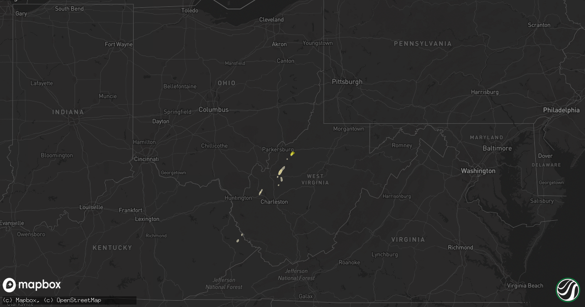
Hail Map on August 3, 2021
Get this storm
August 3 map
$229
one time, instant access
Download today. No call, no setup
Keep the $229
Bought the map and want the full workflow? Apply the entire $229 to a subscription within 7 days. None of it is wasted.
Every map, not just this one
This buys you this map. Subscription and you get every map we run, in the markets you choose from a few cities to whole states to nationwide. Plus real-time alerts the moment a storm fires.
Contact data
Name, contact info, occupancy, even credit band for addresses in the footprint. You go from where it hit to who to call.
Become the source they trust
Unlimited branding weather history reports on demand. You already have the documented answer ready for the property owner, and you are the one who showed up with it.
Property data and RoofTrace estimates
Pull up any address you have got, its value and the exact code rules for that jurisdiction, straight from One Click Code. Then RoofTrace estimates the squares, pitch, and roof value, priced the way you price.
States Impacted by Hail Map on August 3, 2021
Storm reports
West Virginia
| Date | Description |
|---|---|
| 08/03/20216:34 PM CDT | Tree uprooted. |
| 08/03/20216:30 PM CDT | Several downed trees and powerlines down with a tree down on a home on eleanor circle. |
| 08/03/20215:42 PM CDT | Multiple trees down around jones ridge ini jackson county... Wv. |
| 08/03/20214:30 PM CDT | Four trees down on harmony road near jones ridge. |
| 08/03/20214:00 PM CDT | Tree knocked down on rt33 blocking road with power lines. |
| 08/03/20214:00 PM CDT | Tree down on windyville road due to high wind. |
| 08/03/20213:50 PM CDT | Tree reported down across the entirety of stover fork rd. Lines down also. |
| 08/03/20213:50 PM CDT | Tree reported across windyville rd. |
| 08/03/20213:35 PM CDT | Tree and power lines reported down. |
| 08/03/20213:26 PM CDT | Tree reported across vicars ridge rd. |
| 08/03/20211:09 AM CDT | At 609 PM EDT, a severe thunderstorm was located 8 miles southwest of North Bend State Park, or 10 miles west of Harrisville, moving northeast at 25 mph. HAZARD...60 mph wind gusts and quarter size hail. SOURCE...Radar indicated. IMPACT...Hail damage to vehicles is expected. Expect wind damage to roofs, siding, and trees. Locations impacted include... North Bend State Park, Ellenboro, Cairo, Hebron, Pike, Nutter Farm, Maxwell, Petroleum and Highland.This includes Route 50 in West Virginia between mile markers 26 and38. |
| 08/03/202112:15 AM CDT | At 514 PM EDT, a severe thunderstorm was located over Conder, or 7 miles west of Williamson, moving northeast at 25 mph. HAZARD...60 mph wind gusts and penny size hail. SOURCE...Radar indicated. IMPACT...Expect damage to roofs, siding, and trees. This severe thunderstorm will be near... Hatfield Station around 520 PM EDT. Whitepost around 525 PM EDT. |
| 08/03/202112:04 AM CDT | At 503 PM EDT, a severe thunderstorm was located near Spencer, moving north at 20 mph. HAZARD...60 mph wind gusts and quarter size hail. SOURCE...Radar indicated. IMPACT...Hail damage to vehicles is expected. Expect wind damage to roofs, siding, and trees. Locations impacted include... Elizabeth, Reedy, Lucille, Cherry, Peewee, Morristown and Palestine. |
Florida
| Date | Description |
|---|---|
| 08/03/20217:22 AM CDT | At 1222 PM EDT, a severe thunderstorm was located near Weston, or near Pembroke Pines, moving northeast at 20 mph. HAZARD...60 mph wind gusts. SOURCE...Radar indicated. IMPACT...Expect damage to roofs, siding, and trees. Locations impacted include... Fort Lauderdale, Pembroke Pines, Miramar, Davie and Plantation. |
| 08/03/20212:43 AM CDT | At 743 PM EDT, severe thunderstorms were located along a line extending from Coconut Creek to Miami Springs, moving east at 20 mph. HAZARD...60 mph wind gusts. SOURCE...Radar indicated. IMPACT...Expect damage to roofs, siding, and trees. Locations impacted include... Miami, Hialeah, Fort Lauderdale, Pembroke Pines and Hollywood. |
| 08/03/20212:06 AM CDT | At 706 PM EDT, severe thunderstorms were located along a line extending from near Palm Beach Gardens to near Mission Bay, moving northeast at 25 mph. HAZARD...60 mph wind gusts and penny size hail. SOURCE...Radar indicated. IMPACT...Expect damage to roofs, siding, and trees. Locations impacted include... West Palm Beach, Boca Raton, Deerfield Beach, Boynton Beach and Delray Beach. |
| 08/03/20212:05 AM CDT | At 705 PM EDT, severe thunderstorms were located along a line extending from 6 miles north of Intersection I-75 And U.S. 27 to near Miccosukee Resort, moving east at 30 mph. HAZARD...60 mph wind gusts and penny size hail. SOURCE...Radar indicated. IMPACT...Expect damage to roofs, siding, and trees. Locations impacted include... Miami, Hialeah, Fort Lauderdale, Pembroke Pines and Hollywood. |
| 08/02/20217:10 PM CDT | A medium-large tree was uprooted near the intersection of sw 130 avenue and killian parkway in west kendall. Very small branches and leaves were scattered across the ge |
Oregon
| Date | Description |
|---|---|
| 08/03/20211:23 AM CDT | At 622 PM PDT, a severe thunderstorm was located 10 miles west of Union, or 11 miles south of La Grande, moving east at 10 mph. HAZARD...Ping pong ball size hail. SOURCE...Trained weather spotters and doppler radar indicated. IMPACT...People and animals outdoors will be injured. Expect damage to roofs, siding, windows, and vehicles. Locations impacted include... La Grande, Union, Island City and Cove. |
Washington
| Date | Description |
|---|---|
| 08/03/20213:25 AM CDT | Avista utilities reports power outages to approximately 1000 customers near northport and leadpoint... Wa. |
| 08/03/20212:42 AM CDT | Avista utilities reports power outages to approximately 900 customers near inchelium... Wa. |
| 08/03/20212:30 AM CDT | Avista utilities reports power outages to approximately 2300 customers near colville... Wa. |
| 08/03/202112:12 AM CDT | At 511 PM PDT, a severe thunderstorm was located near Snoqualmie Pass, moving north at 25 mph. HAZARD...Half dollar size hail. SOURCE...Radar indicated. IMPACT...Damage to vehicles is expected. This severe thunderstorm will remain over mainly rural areas of southern Snohomish and northeastern King Counties, and will cross US-2 east of Skykomish at 515 to 525 PM. |
| 08/02/202111:49 PM CDT | At 449 PM PDT, a severe thunderstorm was located 8 miles northeast of Snoqualmie Pass, moving north at 25 mph. HAZARD...Golf ball size hail. SOURCE...Radar indicated. IMPACT...People and animals outdoors will be injured. Expect damage to roofs, siding, windows, and vehicles. Locations impacted include... Skykomish and Stevens Pass. |
| 08/02/20219:58 PM CDT | Spotter reports strong winds... With small trees and tree limbs down. Wind took roof off of chicken coop. |
| 08/02/20218:00 PM CDT | Chelan county pud reports power outage to approximately 900 customers near plain... Wa. |
| 08/02/20217:00 PM CDT | Chelan county sheriff dispatch reports tree |
| 08/02/20217:00 PM CDT | Chelan county sheriff dispatch reported a tree down on road near mp 90 on highway 2. |
| 08/02/20217:00 PM CDT | Chelan county sheriff dispatch reported a tree |
| 08/02/20217:00 PM CDT | Chelan county sheriff dispatch reported a tree |
| 08/02/20217:00 PM CDT | Chelan county sheriff dispatch reports of tree |
New Mexico
| Date | Description |
|---|---|
| 08/03/202112:17 AM CDT | At 517 PM MDT, a severe thunderstorm was located 7 miles southwest of Gila Hot Springs, moving south at 10 mph. HAZARD...60 mph wind gusts and quarter size hail. SOURCE...Radar indicated. IMPACT...Hail damage to vehicles is expected. Expect wind damage to roofs, siding, and trees. Locations impacted include... Portions of the Gila Wilderness. |
| 08/02/202110:21 PM CDT | At 321 PM MDT, a severe thunderstorm was located near San Lorenzo, and is nearly stationary. HAZARD...60 mph wind gusts and quarter size hail. SOURCE...Radar indicated. IMPACT...Hail damage to vehicles is expected. Expect wind damage to roofs, siding, and trees. Locations impacted include... San Lorenzo, Sherman and San Juan. |
Cities Impacted by Hail Map on August 3, 2021
- Stehekin, WA
- Naches, WA
- Cove, OR
- Encino, TX
- Ripley, WV
- Gay, WV
- Thorp, WA
- Easton, WA
- Cle Elum, WA
- La Grande, OR
- Houghton Lake, MI
- Newberry, MI
- Union, OR
- Pullman, WA
- Colton, WA
- North Bend, WA
- Skykomish, WA
- Colville, WA
- Sultan, WA
- North Powder, OR
- Addy, WA
- Pikeville, KY
- Varney, KY
- Petroleum, WV
- Selah, WA
- Advent, WV
- Gandeeville, WV
- Darrington, WA
- Palouse, WA
- Cairo, WV
- Reedy, WV
- Le Roy, WV
- Eleanor, WV
- Red House, WV
- Lovely, KY
- Spencer, WV
- Burns, OR
- Ronald, WA
- Eckerman, MI
- Winfield, WV
- Dayton, WA
- Peshastin, WA
- Leavenworth, WA
- Diamond, OR
- Drewsey, OR
- Wagon Mound, NM
- Palestine, WV
- Hurricane, WV
- Viola, ID