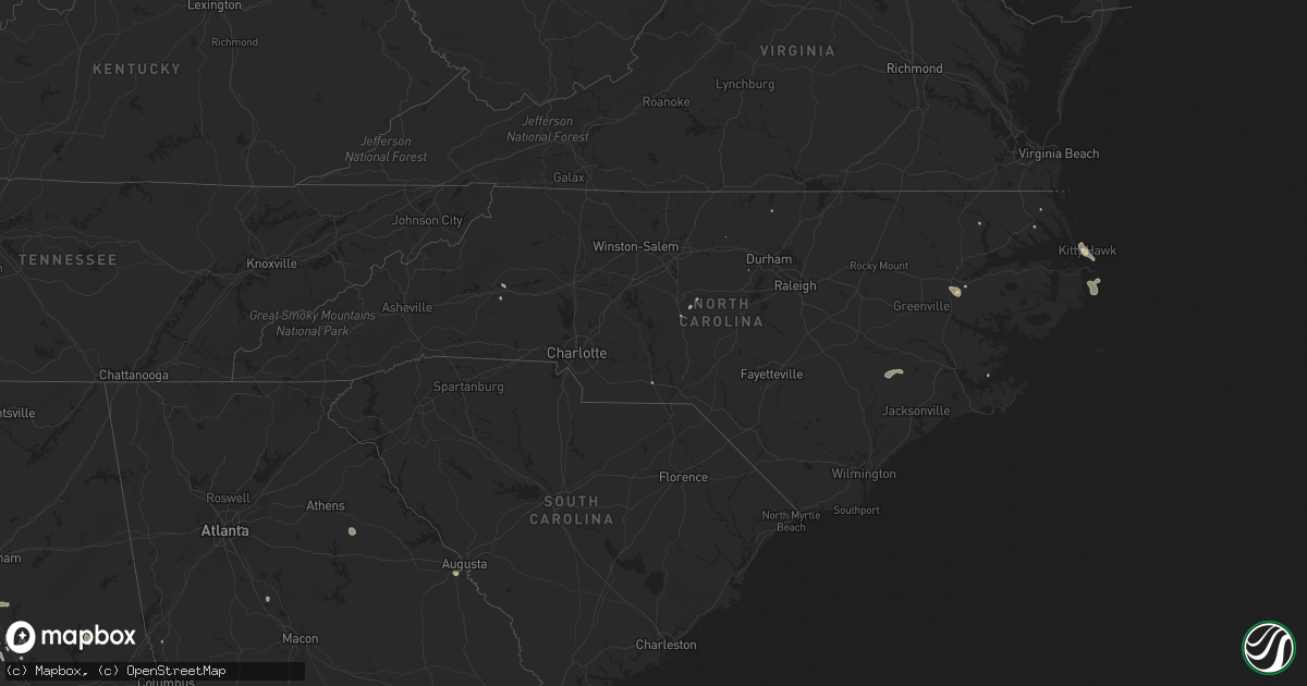
Hail Map in North Carolina on August 2, 2016
Get this storm
August 2 map
$229
one time, instant access
Download today. No call, no setup
Keep the $229
Bought the map and want the full workflow? Apply the entire $229 to a subscription within 7 days. None of it is wasted.
Every map, not just this one
This buys you this map. Subscription and you get every map we run, in the markets you choose from a few cities to whole states to nationwide. Plus real-time alerts the moment a storm fires.
Contact data
Name, contact info, occupancy, even credit band for addresses in the footprint. You go from where it hit to who to call.
Become the source they trust
Unlimited branding weather history reports on demand. You already have the documented answer ready for the property owner, and you are the one who showed up with it.
Property data and RoofTrace estimates
Pull up any address you have got, its value and the exact code rules for that jurisdiction, straight from One Click Code. Then RoofTrace estimates the squares, pitch, and roof value, priced the way you price.
Storm reports in North Carolina
North Carolina
| Date | Description |
|---|---|
| 08/02/20165:29 PM CDT | Large tree limbs down near the intersection of robinson church road and w.t.harris blvd. |
| 08/02/20163:45 PM CDT | Tree blown down at residence along bethlehem rd in knightdale. |
| 08/02/20162:01 PM CDT | A couple of trees down near the intersection of jacumin road and flat gap road. |
| 08/02/20161:25 PM CDT | Tree damage and power lines down along greenlee road...parker padgett road and lytle mountain road. |
| 08/02/20161:02 PM CDT | A tree across the road near intersection of lonnie gentry rd and harold gill rd. . |
| 08/02/20161:00 PM CDT | Tree down on road |
All States Impacted by Hail Map on August 2, 2016
Cities Impacted by Hail Map on August 2, 2016
- Hooker, OK
- Turpin, OK
- Sundance, WY
- Deadwood, SD
- Nemo, SD
- Dighton, KS
- Lebanon, MO
- Linn Creek, MO
- Richland, MO
- Montreal, MO
- Stoutland, MO
- Wadesboro, NC
- Lebanon, SD
- Moorcroft, WY
- Upton, WY
- Fort Pierre, SD
- Leoti, KS
- Byers, CO
- Philadelphia, MS
- Noxapater, MS
- Harrison, NE
- Edgemont, SD
- Phoenix, AZ
- Vale, SD
- Meridian, MS
- Enterprise, MS
- York, AL
- Cuba, AL
- Jones, AL
- Autaugaville, AL
- Billingsley, AL
- Grover, CO
- Detroit, AL
- Sulligent, AL
- New Bloomfield, MO
- Tebbetts, MO
- Deer Trail, CO
- Grinnell, KS
- Roxboro, NC
- Yoder, WY
- Whitlash, MT
- Chester, MT
- Galata, MT
- Nisland, SD
- Saint Onge, SD
- Whitewood, SD
- Belle Fourche, SD
- Van Tassell, WY
- Lusk, WY
- Jefferson City, MO
- Holts Summit, MO
- Sturgis, SD
- Bayard, NE
- Angora, NE
- Hawk Springs, WY
- Iberia, MO
- Hulett, WY
- Camden, NC
- Terry, MT
- Akron, CO
- Tunas, MO
- Windyville, MO
- Buffalo, MO
- Limon, CO
- Merriman, NE
- Tolstoy, SD
- Gettysburg, SD
- Pine Ridge, SD
- Dupree, SD
- Stover, MO
- Cheyenne, WY
- Lagrange, WY
- Platteville, CO
- La Salle, CO
- Alpine, TX
- Healy, KS
- Weston, WY
- California, MO
- Grantsburg, WI
- Ault, CO
- Minter, AL
- Camden, AL
- Ramseur, NC
- Dunnegan, MO
- Fair Play, MO
- New Underwood, SD
- Lead, SD
- Eagle Butte, SD
- Hayes, SD
- Myakka City, FL
- Arcadia, FL
- Heidelberg, MS
- Murdo, SD
- Augusta, GA
- Hephzibah, GA
- Oral, SD
- Buffalo Gap, SD
- Eldridge, MO
- Winslow, AZ
- Hamilton, AL
- Lake Ozark, MO
- Sunrise Beach, MO
- Pink Hill, NC
- Trenton, NC
- Kinston, NC
- Jamesville, NC
- Williamston, NC
- Guernsey, WY
- Louisburg, MO
- Jackson, TN
- Chapel Hill, NC
- Agate, CO
- Oakley, KS
- Stone Mountain, GA
- Wheatland, WY
- Lucedale, MS
- Leakesville, MS
- Trenton, TN
- Humboldt, TN
- Meriden, WY
- Fort Stockton, TX
- Hardesty, OK
- Hammond, MT
- Payson, AZ
- Vega, TX
- Vinegar Bend, AL
- Genoa, CO
- Glendo, WY
- Bradford, TN
- Fort Lawn, SC
- Kitty Hawk, NC
- Nags Head, NC
- Gravois Mills, MO
- Seagrove, NC
- Brumley, MO
- Deatsville, AL
- Valrico, FL
- Dover, FL
- Bonnots Mill, MO
- Scott City, KS
- Asheboro, NC
- Piedmont, SD
- Hartville, WY
- Newell, SD
- Burns, WY
- Rozet, WY
- Burlington, NC
- Demopolis, AL
- Oriental, NC
- Amarillo, TX
- Pine Apple, AL
- Morganton, NC
- Valdese, NC
- Rush City, MN
- Pine City, MN
- Crocker, MO
- Wildorado, TX
- Stephens, GA
- Union Point, GA
- Dadeville, AL
- Jacksons Gap, AL
- Blythewood, SC
- Hot Springs, SD
- Medina, TN
- Andrews, TX
- Versailles, MO
- Scottsdale, AZ
- Clanton, AL
- Verbena, AL
- Fulton, MO
- Richland, GA
- Milan, TN
- Toomsuba, MS
- Devils Tower, WY
- Jackson, AL
- Dixon, MO
- Kill Devil Hills, NC
- Shelby, AL
- Calera, AL
- Columbiana, AL
- Crawford, NE
- Gadsden, TN
- Seneca, SD
- Woodrow, CO
- Centertown, MO
- Shelby, MT
- Whatley, AL
- Forsyth, GA
- Jackson, GA
- Pinehurst, GA
- Unadilla, GA
- Chester, NE
- Texico, NM
- La Place, LA
- Chugwater, WY
- Coolidge, AZ
- Chandler, AZ
- Stratford, TX
- Belle, MO
- Vienna, MO
- Osage Beach, MO
- Pine Mountain, GA
- West Point, GA
- Elizabeth City, NC
- Orrville, AL
- Safford, AL
- Strasburg, CO
- Harrellsville, NC
- Grove Hill, AL
- Beech Island, SC
- Vienna, GA
- Spearfish, SD
- Broadview, NM
- Columbia, MO
- Barnett, MO
- Latham, MO
- Gillette, WY
- Taylorsville, MS
- Quitman, MS
- Williamsburg, MO
- Alliance, NE
- Tibbie, AL
- Weldona, CO
- Seffner, FL
- Plant City, FL
- Columbia, SD
- Barnard, SD
- Frederick, SD
- Webster, SD
- Groton, SD
- Andover, SD
- Bristol, SD
- Ekalaka, MT
- Biddle, MT
- Boyes, MT
- Capitol, MT
- Plevna, MT
- Ismay, MT
- Greeley, CO
- Evans, CO
- Nunn, CO


