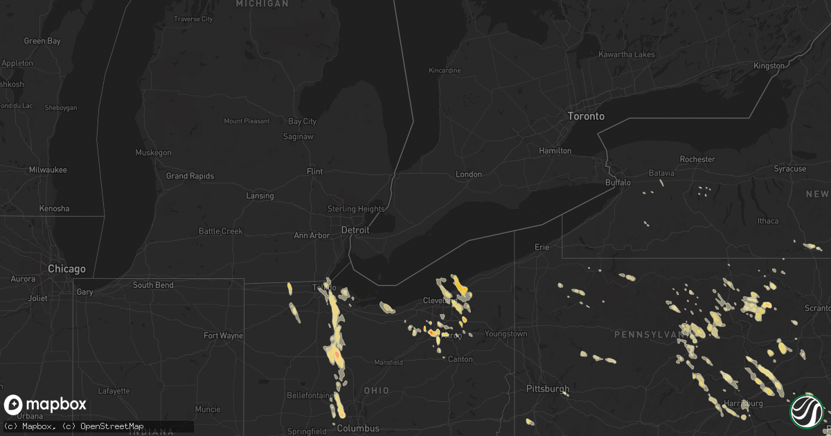
Hail Map in New York on August 1, 2011
Get this storm
August 1 map
$229
one time, instant access
Download today. No call, no setup
Keep the $229
Bought the map and want the full workflow? Apply the entire $229 to a subscription within 7 days. None of it is wasted.
Every map, not just this one
This buys you this map. Subscription and you get every map we run, in the markets you choose from a few cities to whole states to nationwide. Plus real-time alerts the moment a storm fires.
Contact data
Name, contact info, occupancy, even credit band for addresses in the footprint. You go from where it hit to who to call.
Become the source they trust
Unlimited branding weather history reports on demand. You already have the documented answer ready for the property owner, and you are the one who showed up with it.
Property data and RoofTrace estimates
Pull up any address you have got, its value and the exact code rules for that jurisdiction, straight from One Click Code. Then RoofTrace estimates the squares, pitch, and roof value, priced the way you price.
Storm reports in New York
New York
| Date | Description |
|---|---|
| 08/01/20116:57 PM CDT | Scattered branches and limbs and a few trees down across the town. |
| 08/01/20116:21 PM CDT | Bronx coop observer |
| 08/01/20116:00 PM CDT | A local report indicates 1.00 inch wind near CHAPPAQUA |
| 08/01/20115:45 PM CDT | A local report indicates 1.00 inch wind near SCARSDALE |
| 08/01/20115:31 PM CDT | A local report indicates 1.75 inch wind near STORMVILLE |
| 08/01/20115:23 PM CDT | A local report indicates 1.00 inch wind near RYE BROOK |
| 08/01/20115:20 PM CDT | 1 mile south of white plains |
| 08/01/20115:11 PM CDT | Golf ball size hail along i-87 |
| 08/01/20115:05 PM CDT | Multiple branches down near tappan zee bridge |
| 08/01/20115:04 PM CDT | Three inch hail |
| 08/01/20115:00 PM CDT | A local report indicates 1.25 inch wind near WHITE PLAINS |
| 08/01/20114:55 PM CDT | A local report indicates 1.00 inch wind near PHILIPSE MANOR |
| 08/01/20114:53 PM CDT | Tree down between rt 301 and old rt 301 |
| 08/01/20114:31 PM CDT | A local report indicates 1.75 inch wind near STORMVILLE |
| 08/01/20114:29 PM CDT | A local report indicates 1.00 inch wind near SALT POINT |
| 08/01/20114:11 PM CDT | A local report indicates 1.00 inch wind near 5 NNE HOPEWELL JUNCTION |
| 08/01/20114:09 PM CDT | A local report indicates 1.00 inch wind near CROTON-ON-HUDSON |
| 08/01/20113:57 PM CDT | A local report indicates 1.00 inch wind near ROCKVILLE CENTRE |
| 08/01/20113:55 PM CDT | A local report indicates 1.00 inch wind near LAGRANGEVILLE |
| 08/01/20113:54 PM CDT | A local report indicates 1.00 inch wind near HYDE PARK |
| 08/01/20113:53 PM CDT | A local report indicates 1.25 inch wind near TOMKINS COVE |
| 08/01/20113:50 PM CDT | A local report indicates 1.50 inch wind near 5 ENE POUGHKEEPSIE |
| 08/01/20113:45 PM CDT | A local report indicates 1.00 inch wind near S PLEASANT VALLEY |
| 08/01/20113:30 PM CDT | Spotter measured hail at 3.0 inches. Car windshield shattered on durham road. |
| 08/01/20113:28 PM CDT | A local report indicates 1.75 inch wind near GARDEN CITY |
| 08/01/20113:24 PM CDT | Multiple spotters report 2.0 inch hail in new hyde park |
| 08/01/20113:20 PM CDT | A local report indicates 1.00 inch wind near 2 SSE LIVINGSTON |
| 08/01/20113:20 PM CDT | A local report indicates 1.00 inch wind near HEMPSTEAD |
| 08/01/20113:15 PM CDT | A local report indicates 1.00 inch wind near GARDEN CITY |
| 08/01/20113:15 PM CDT | Golf ball size hail |
| 08/01/20113:13 PM CDT | Golf ball size hail |
| 08/01/20113:10 PM CDT | A local report indicates 1.00 inch wind near 2 ENE CLERMONT |
| 08/01/20113:05 PM CDT | A local report indicates 1.00 inch wind near NEW HYDE PARK |
| 08/01/20112:20 PM CDT | A local report indicates 1.75 inch wind near 4 SE HUDSON |
| 08/01/20112:20 PM CDT | A local report indicates 1.25 inch wind near CLAVERACK |
| 08/01/20112:17 PM CDT | A local report indicates 1.00 inch wind near GREENPORT CENTER |
| 08/01/20112:15 PM CDT | A local report indicates 1.50 inch wind near HUDSON |
| 08/01/20112:10 PM CDT | A local report indicates 1.00 inch wind near STUYVESANT |
| 08/01/20111:45 PM CDT | A local report indicates 1.00 inch wind near COXSACKIE |
| 07/31/201110:59 PM CDT | Multiple trees down along route 28. |
| 07/31/201110:36 PM CDT | Trees and wires down at 89 mountain rd. |
| 07/31/201110:21 PM CDT | Tree down at 229 geiger rd. |
| 07/31/20117:35 PM CDT | Branches down across the town. Wires down on county road 31. |
| 07/31/20117:35 PM CDT | Numerous trees down across the town. |
| 07/31/20117:15 PM CDT | Large branches down and power pole damage along route 58 near applebees. |
All States Impacted by Hail Map on August 1, 2011
Cities Impacted by Hail Map on August 1, 2011
- Dover Foxcroft, ME
- Sangerville, ME
- Newell, SD
- Goodwin, SD
- Clear Lake, SD
- Hayti, SD
- Vienna, SD
- Clark, SD
- Henry, SD
- Strandburg, SD
- Hazel, SD
- Watertown, SD
- Castlewood, SD
- Lonsdale, MN
- Webster, MN
- New Prague, MN
- Piedmont, SD
- Greenville, ME
- Greenville Junction, ME
- Muncy Valley, PA
- Williamsport, PA
- Hillsgrove, PA
- West Harrison, NY
- New Rochelle, NY
- Elmsford, NY
- Rye, NY
- Verplanck, NY
- Hastings On Hudson, NY
- Tomkins Cove, NY
- Tuckahoe, NY
- Stony Point, NY
- Hawthorne, NY
- Thornwood, NY
- Congers, NY
- Hartsdale, NY
- Montrose, NY
- Purchase, NY
- Croton On Hudson, NY
- Buchanan, NY
- Scarsdale, NY
- Bear Mountain, NY
- White Plains, NY
- New City, NY
- Cortlandt Manor, NY
- Irvington, NY
- Chappaqua, NY
- Briarcliff Manor, NY
- Mamaroneck, NY
- Pleasantville, NY
- Harrison, NY
- Bronxville, NY
- Armonk, NY
- Valley Cottage, NY
- Peekskill, NY
- Haverstraw, NY
- Yonkers, NY
- Port Chester, NY
- Valhalla, NY
- Nyack, NY
- Ossining, NY
- Tarrytown, NY
- Larchmont, NY
- Eastchester, NY
- Ardsley, NY
- Worton, MD
- Chestertown, MD
- New London, MN
- Spicer, MN
- Milroy, PA
- Shunk, PA
- Canton, PA
- Trout Run, PA
- Forksville, PA
- Hunlock Creek, PA
- Nanticoke, PA
- Dupree, SD
- Euclid, OH
- Cleveland, OH
- Ree Heights, SD
- Highmore, SD
- Unityville, PA
- Hughesville, PA
- Litchfield, MN
- Keene, NH
- Westmoreland, NH
- Darwin, MN
- Eden Valley, MN
- Sunburg, MN
- Pennock, MN
- Dassel, MN
- Paynesville, MN
- Glencoe, MN
- Hutchinson, MN
- Lester Prairie, MN
- Kandiyohi, MN
- Watkins, MN
- Belgrade, MN
- Atwater, MN
- Grove City, MN
- Silver Lake, MN
- Silver Spring, MD
- Sandy Spring, MD
- Ashton, MD
- Brinklow, MD
- Highland, MD
- Brookeville, MD
- Centreville, MD
- Orange, MA
- Wendell, MA
- Cumberland, WI
- Barronett, WI
- Frederic, WI
- Shell Lake, WI
- Danbury, WI
- Solon Springs, WI
- Foxboro, WI
- Gordon, WI
- Haddonfield, NJ
- Lawnside, NJ
- Cherry Hill, NJ
- Ostrander, OH
- Plain City, OH
- Richwood, OH
- Marysville, OH
- Ludlow, MA
- Belchertown, MA
- Granby, MA
- Eastlake, OH
- Mentor, OH
- Willoughby, OH
- Dixfield, ME
- Wilbraham, MA
- Amherst, MA
- Reston, VA
- Hawley, MN
- Speonk, NY
- Eastport, NY
- Jamesport, NY
- Hampton Bays, NY
- Mattituck, NY
- Remsenburg, NY
- Quogue, NY
- Calverton, NY
- Riverhead, NY
- Manorville, NY
- East Quogue, NY
- Westhampton Beach, NY
- Laurel, NY
- South Jamesport, NY
- Westhampton, NY
- Home, PA
- Dayton, PA
- Delmar, DE
- Laurel, DE
- Snow Hill, MD
- Parsonsburg, MD
- Newark, MD
- Salisbury, MD
- Berlin, MD
- Rockland, ME
- Camden, ME
- Rockport, ME
- Prospect, OH
- La Rue, OH
- Marion, OH
- Graceville, MN
- Maple Plain, MN
- Delano, MN
- Montrose, MN
- Webster, WI
- Austin, PA
- Bronx, NY
- Whitestone, NY
- College Point, NY
- Flushing, NY
- Bayside, NY
- Oak Harbor, OH
- Sunbury, PA
- Leesburg, VA
- Hyattsville, MD
- Chagrin Falls, OH
- Solon, OH
- Delmar, MD
- Hebron, MD
- Fruitland, MD
- Eden, MD
- Montague, MA
- Sunderland, MA
- Leverett, MA
- Belle Fourche, SD
- Gibsonburg, OH
- Chardon, OH
- Hedgesville, WV
- Berkeley Springs, WV
- Mifflin, PA
- Rockwood, ME
- Woodbury, NJ
- Sewell, NJ
- National Park, NJ
- Mount Royal, NJ
- Pitman, NJ
- Mantua, NJ
- Mickleton, NJ
- Wenonah, NJ
- Clarksboro, NJ
- Philadelphia, PA
- Thorofare, NJ
- Paulsboro, NJ
- Woodbury Heights, NJ
- Gibbstown, NJ
- Guilford, ME
- Sebec, ME
- Bellefonte, PA
- Howard, PA
- Centre Hall, PA
- Newtown, CT
- Bethel, CT
- Walton, NY
- Green Isle, MN
- Kramer, ND
- Bantry, ND
- Anthony, FL
- Ocala, FL
- Mays Landing, NJ
- Milmay, NJ
- Vineland, NJ
- Richland, NJ
- Buena, NJ
- Mardela Springs, MD
- Glenwood, MN
- Villard, MN
- Brooten, MN
- Carlisle, PA
- Newville, PA
- Landisburg, PA
- Loysville, PA
- Campbell, MN
- Fergus Falls, MN
- Wendell, MN
- Warren, ME
- Rock Hall, MD
- Starbuck, MN
- Tamarack, MN
- Mcgregor, MN
- Rittman, OH
- Draper, SD
- Vivian, SD
- Moorhead, MN
- Fargo, ND
- West Fargo, ND
- Beachwood, OH
- Mullica Hill, NJ
- Essington, PA
- Newbury, OH
- Novelty, OH
- Burton, OH
- Havre De Grace, MD
- Aberdeen, MD
- Aberdeen Proving Ground, MD
- Tower City, PA
- Medina, OH
- Faith, SD
- Wadsworth, OH
- Bernardston, MA
- Northfield, MA
- Wendell Depot, MA
- New Salem, MA
- Gill, MA
- Greenfield, MA
- Erving, MA
- Toledo, OH
- Port Crane, NY
- Binghamton, NY
- Aurora, OH
- Ravenna, OH
- Mantua, OH
- Streetsboro, OH
- Hancock, NY
- Moose Lake, MN
- Troy, AL
- Abbot, ME
- Caratunk, ME
- Bingham, ME
- State College, PA
- University Park, PA
- Malinta, OH
- McClure, OH
- Napoleon, OH
- Grelton, OH
- Mud Butte, SD
- Hopewell Junction, NY
- West Hempstead, NY
- New Hyde Park, NY
- Baldwin, NY
- Williston Park, NY
- Fresh Meadows, NY
- Hempstead, NY
- Franklin Square, NY
- Valley Stream, NY
- Malverne, NY
- Little Neck, NY
- Great Neck, NY
- Oakland Gardens, NY
- Garden City, NY
- Glen Oaks, NY
- Roslyn, NY
- Floral Park, NY
- Mineola, NY
- Rockville Centre, NY
- Bellerose, NY
- Elmont, NY
- Oceanside, NY
- Manhasset, NY
- Naugatuck, CT
- Bethany, CT
- Prospect, CT
- Hamden, CT
- Beacon Falls, CT
- Amity, PA
- Nineveh, PA
- Prosperity, PA
- Sycamore, PA
- Warwick, MA
- Raymond, OH
- Elysburg, PA
- Catawissa, PA
- Garland, ME
- Augusta, ME
- Batesland, SD
- Milford Center, OH
- Nesquehoning, PA
- Wasta, SD
- Coxsackie, NY
- Climax, NY
- West Coxsackie, NY
- Westboro, WI
- Rib Lake, WI
- Upper Sandusky, OH
- Carey, OH
- Nassawadox, VA
- Birdsnest, VA
- Graytown, OH
- Wellington, OH
- Henderson, MN
- Presho, SD
- Brooks, ME
- Port Royal, PA
- Honey Grove, PA
- Lewistown, PA
- Reading, PA
- Oley, PA
- Kent, OH
- East Smithfield, PA
- Columbia Cross Roads, PA
- Milan, PA
- Wright, MN
- Mount Jewett, PA
- Kane, PA
- Lewis Run, PA
- Smethport, PA
- Deer Isle, ME
- Aldie, VA
- Suffield, CT
- Enfield, CT
- Windsor Locks, CT
- Ashburn, VA
- Purcellville, VA
- Hamilton, VA
- Round Hill, VA
- Middleburg, VA
- Voorhees, NJ
- Marlton, NJ
- Berlin, NJ
- Gibbsboro, NJ
- West Berlin, NJ
- Clementon, NJ
- Redding, CT
- Danbury, CT
- Frazee, MN
- Mitchells, VA
- Rapidan, VA
- Okaton, SD
- Belvidere, SD
- White River, SD
- Murdo, SD
- Foxhome, MN
- Bloxom, VA
- Parksley, VA
- Kensington, MN
- Garfield, MN
- Lowry, MN
- Alexandria, MN
- Farwell, MN
- Westport, PA
- Renovo, PA
- Bethel, PA
- Myerstown, PA
- Richland, PA
- Pine Grove, PA
- Gresham, WI
- Bradley, ME
- Eddington, ME
- Clayton, NJ
- Williamstown, NJ
- Franklinville, NJ
- Wittenberg, WI
- Tigerton, WI
- Muncy, PA
- Montoursville, PA
- Stormville, NY
- Putnam Valley, NY
- Bedford Hills, NY
- Katonah, NY
- Harwinton, CT
- Sturgis, SD
- New Underwood, SD
- Milo, ME
- Earlton, NY
- Hannacroix, NY
- Stuyvesant, NY
- Athens, NY
- Richmond, MN
- Pine River, MN
- Murdock, MN
- West Haven, CT
- Milford, CT
- Star Tannery, VA
- Dexter, ME
- Callaway, MN
- Lagrange, OH
- Hope, ME
- Union, ME
- Searsmont, ME
- Lincolnville, ME
- Ardmore, PA
- Wynnewood, PA
- Haverford, PA
- Bryn Mawr, PA
- Gladwyne, PA
- Ludlow, SD
- Albion, ME
- Hinckley, OH
- Akron, OH
- Richfield, OH
- Arco, ID
- Port Deposit, MD
- Le Center, MN
- Montgomery, MN
- Lock Haven, PA
- Cabot, AR
- Vilonia, AR
- Fort Meade, FL
- Arlington, MN
- Gaylord, MN
- Strykersville, NY
- Narberth, PA
- Swedesboro, NJ
- Rio, WV
- Sand Creek, MI
- Clayton, MI
- Midland, SD
- Moore, ID
- Lewisberry, PA
- Dover, PA
- Wellsville, PA
- Cushing, WI
- Middletown, PA
- Etters, PA
- Harrisburg, PA
- New Cumberland, PA
- Lemoyne, PA
- Camp Hill, PA
- College Park, MD
- Ralph, SD
- Ansonia, CT
- Seymour, CT
- Orange, CT
- Derby, CT
- Woodbridge, CT
- Shelton, CT
- Dushore, PA
- Laporte, PA
- Hinckley, MN
- Brook Park, MN
- Fishkill, NY
- Carmel, NY
- Cold Spring, NY
- Beacon, NY
- Nanjemoy, MD
- King George, VA
- Jersey Mills, PA
- Loganton, PA
- Mill Hall, PA
- Jersey Shore, PA
- Waterville, PA
- Linden, PA
- Muir, PA
- Klingerstown, PA
- Tremont, PA
- Hegins, PA
- Valley View, PA
- Addison, ME
- Columbia Falls, ME
- Queens Village, NY
- Sunset, ME
- Marienville, PA
- Goodhue, MN
- Cannon Falls, MN
- Seville, OH
- Holyoke, MN
- Kerrick, MN
- Liberty Center, OH
- Comstock, WI
- Doylestown, OH
- Drums, PA
- Minong, WI
- Jefferson, ME
- Washington, ME
- Pennsylvania Furnace, PA
- Weld, ME
- Birchwood, WI
- Coburn, PA
- McClure, PA
- Spring Mills, PA
- Lower Brule, SD
- Waterbury, CT
- Lebanon, PA
- Jonestown, PA
- Bowling Green, FL
- Powell Butte, OR
- Mascot, VA
- Shacklefords, VA
- Palermo, ME
- Eagle Butte, SD
- Nescopeck, PA
- Zion Grove, PA
- Bloomsburg, PA
- Ringtown, PA
- Hazleton, PA
- Sheppton, PA
- Mifflinville, PA
- Shevlin, MN
- Hyde Park, NY
- Staatsburg, NY
- Boalsburg, PA
- Girdletree, MD
- Pittsville, MD
- Park Rapids, MN
- Kennebec, SD
- Willmar, MN
- Hudson, ME
- Pottstown, PA
- Ortonville, MN
- Saugerties, NY
- Stow, OH
- Cuyahoga Falls, OH
- Redmond, OR
- Terrebonne, OR
- Prineville, OR
- Colrain, MA
- Spencer, OH
- Litchfield, OH
- Capon Bridge, WV
- Augusta, WV
- Annville, PA
- Siren, WI
- Hoffman, MN
- Oakville, CT
- Watertown, CT
- Verndale, MN
- Barrington, NJ
- Morton, PA
- Waterford Works, NJ
- Haddon Heights, NJ
- Maple Shade, NJ
- Swarthmore, PA
- Magnolia, NJ
- Norwood, PA
- Woodlyn, PA
- Wallingford, PA
- Monroeville, NJ
- Blackwood, NJ
- Media, PA
- Prospect Park, PA
- Hammonton, NJ
- Folsom, PA
- Crum Lynne, PA
- Glassboro, NJ
- Ridley Park, PA
- Mount Laurel, NJ
- Newfield, NJ
- Holmes, PA
- Grenloch, NJ
- Atco, NJ
- Chester, PA
- Springfield, PA
- Newtonville, NJ
- Sicklerville, NJ
- Fort Thompson, SD
- Belfast, ME
- Templeton, PA
- Kittanning, PA
- Poughkeepsie, NY
- Poughquag, NY
- Wappingers Falls, NY
- Pleasant Valley, NY
- Lagrangeville, NY
- Highland, NY
- Westbury, NY
- Uniondale, NY
- Lynbrook, NY
- Freeport, NY
- Albertson, NY
- Corona, NY
- Carle Place, NY
- Roosevelt, NY
- Halifax, PA
- Germantown, NY
- Craryville, NY
- Hudson, NY
- Elizaville, NY
- Springfield, VA
- Annandale, VA
- Wilmington, DE
- Garnet Valley, PA
- Marcus Hook, PA
- Catharpin, VA
- Chantilly, VA
- Haymarket, VA
- Kennan, WI
- Catawba, WI
- Middlebury, CT
- Millville, NJ
- Claymont, DE
- Chadds Ford, PA
- Glen Mills, PA
- Mora, MN
- Crosby, MN
- Beech Creek, PA
- Slocomb, AL
- Marion Center, PA
- Creekside, PA
- Smicksburg, PA
- Milesville, SD
- Kirby, OH
- Centerville, PA
- Titusville, PA
- Orland, ME
- Attica, NY
- Varysburg, NY
- Fredericksburg, VA
- London, OH
- Southbury, CT
- Roxbury, CT
- Imnaha, OR
- Sebeka, MN
- Menahga, MN
- Brunswick, OH
- Winchester, VA
- Eckley, CO
- Yuma, CO
- Trafford, PA
- Frankford, DE
- Port Matilda, PA
- Marshallville, OH
- North Lawrence, OH
- Morral, OH
- Helena, OH
- Woodville, OH
- Perrysburg, OH
- Sycamore, OH
- McCutchenville, OH
- Northwood, OH
- Vanlue, OH
- Luckey, OH
- New Riegel, OH
- Tiffin, OH
- Risingsun, OH
- Kansas, OH
- Pemberville, OH
- Wharton, OH
- Millbury, OH
- Genoa, OH
- Forest, OH
- Alvada, OH
- Mount Blanchard, OH
- Fostoria, OH
- Harpster, OH
- Springfield, VT
- Crisfield, MD
- Millerstown, PA
- Thompsontown, PA
- Couderay, WI
- Irwin, PA
- Sawyer, MN
- Cloquet, MN
- Stafford Springs, CT
- Pawling, NY
- Vermilion, OH
- Wakeman, OH
- Huron, OH
- Berlin Heights, OH
- Sandusky, OH
- Leck Kill, PA
- Pitman, PA
- Sacramento, PA
- Dornsife, PA
- Chesterland, OH
- Painesville, OH
- Roaring Branch, PA
- Delancey, NY
- Hamden, NY
- Churchville, MD
- Herndon, PA
- Melfa, VA
- Painter, VA
- Belle Haven, VA
- Morrill, ME
- Palmer, MA
- Monson, MA
- Three Rivers, MA
- Ware, MA
- Hadley, MA
- Shutesbury, MA
- Bondsville, MA
- South Deerfield, MA
- Doland, SD
- Willow Lake, SD
- Scranton, ND
- Gunpowder, MD
- Camden, NJ
- Pennsauken, NJ
- Merchantville, NJ
- Tunnelton, WV
- Wall, SD
- Barberton, OH
- Clarence, PA
- Blanchard, PA
- Orviston, PA
- Karthaus, PA
- Holt, FL
- Eglin Afb, FL
- Milton, FL
- Coaldale, PA
- Tamaqua, PA
- Philip, SD
- Freeport, FL
- Marion Station, MD
- Malaga, NJ
- Elmer, NJ
- Barnum, MN
- Harwood, MD
- Lothian, MD
- Towanda, PA
- Wyalusing, PA
- Monroeton, PA
- New Albany, PA
- Bend, OR
- Cross Fork, PA
- Sturgeon Lake, MN
- Lockesburg, AR
- Tionesta, PA
- Arcadia, FL
- Reinholds, PA
- Denver, PA
- Aitkin, MN
- West Forks, ME
- Lykens, PA
- Finlayson, MN
- North East, MD
- Aston, PA
- Greenbush, ME
- Old Town, ME
- Granville, PA
- Mifflintown, PA
- Belleville, PA
- Ickesburg, PA
- Oregon, OH
- Harbor View, OH
- Erie, MI
- Sidney Center, NY
- Paxinos, PA
- Faribault, MN
- Kilkenny, MN
- Queenstown, MD
- Raymond, MN
- Woodstown, NJ
- Lanham, MD
- Riverdale, MD
- Bascom, OH
- Ashland, PA
- Cherryfield, ME
- Glyndon, MN
- Sabin, MN
- Sheldon, ND
- Adrian, MI
- Irma, WI
- Mechanicsburg, PA
- Mount Holly Springs, PA
- Monroe, CT
- Sanford, VA
- Bucksport, ME
- Stockton Springs, ME
- Lyons, OH
- Delta, OH
- Wauseon, OH
- Machias, ME
- Milford, ME
- McAlisterville, PA
- Machiasport, ME
- Milesburg, PA
- Le Sueur, MN
- Miller, SD
- North Haven, ME
- Thomaston, ME
- Little Deer Isle, ME
- Burlington, CT
- New Hartford, CT
- North Bend, PA
- East Windsor, CT
- West Suffield, CT
- Detroit Lakes, MN
- Columbia, MS
- Avis, PA
- Bagley, MN
- Grand Chenier, LA
- Evergreen, AL
- Springfield, MA
- Hampden, MA
- Hatfield, MA
- Agawam, MA
- Longmeadow, MA
- Thorndike, MA
- East Longmeadow, MA
- Curtice, OH
- Robertsdale, AL
- Blossburg, PA
- Morris Run, PA
- Mansfield, PA
- Covington, PA
- Wellsboro, PA
- Colonial Beach, VA
- Loretto, VA
- Port Royal, VA
- Caret, VA
- Deland, FL
- Elbow Lake, MN
- Dalton, MN
- East Hartland, CT
- West Hartland, CT
- Riverton, CT
- Barkhamsted, CT
- Bemidji, MN
- Laporte, MN
- Orrington, ME
- Union Center, SD
- Lodgepole, NE
- Foxworth, MS
- Windsor, NY
- Gates Mills, OH
- Pleasantville, PA
- De Queen, AR
- Dierks, AR
- Waubun, MN
- Long Eddy, NY
- Fredericksburg, PA
- Dalmatia, PA
- Elizabethville, PA
- Ono, PA
- Wiconisco, PA
- Gratz, PA
- Spring Glen, PA
- Indian Head, MD
- Southington, CT
- Terryville, CT
- Bristol, CT
- Plainville, CT
- Searcy, AR
- Morenci, MI
- Ancram, NY
- Blackduck, MN
- Amityville, NY
- West Babylon, NY
- Copiague, NY
- Lindenhurst, NY
- Farmingdale, NY
- Howes Cave, NY
- Central Bridge, NY
- Sloansville, NY
- Catskill, NY
- Keyser, WV
- Burlington, WV
- Brownton, MN
- New Auburn, MN
- Plato, MN
- Maddock, ND
- York Haven, PA
- Pine Plains, NY
- Red Hook, NY
- Manor, PA
- Harrison City, PA
- Jeannette, PA
- The Plains, VA
- Liverpool, PA
- Newport, PA
- New Bloomington, OH
- Summit, MS
- North Salem, NY
- Brewster, NY
- Croton Falls, NY
- Somers, NY
- Mahopac, NY
- Thomaston, CT
- Plymouth, CT
- Wolcott, CT
- Phillips, WI
- Prentice, WI
- Ogema, WI
- Hawkins, WI
- Buffalo, SD
- Cape Charles, VA
- Blue Hill, ME
- Rochert, MN
- Belle Plaine, MN
- Bonifay, FL
- Weatherly, PA
- Dalton, OH
- Dundas, MN
- Northfield, MN
- Baker, FL
- Crestview, FL
- Cocoa, FL
- Cutler, ME
- King Of Prussia, PA
- Conshohocken, PA
- Endicott, NY
- Maine, NY
- Vienna, VA
- Box Elder, SD
- Pine City, MN
- Harpursville, NY
- Dublin, OH
- Milbridge, ME
- Belgrade, ME
- Manchester, ME
- Tidioute, PA
- East Hickory, PA
- West Hickory, PA
- Fairfield, CT
- Westport, CT
- Southport, CT
- Landers, CA
- Street, MD
- Loretto, MN
- Maple Lake, MN
- Howard Lake, MN
- Rockford, MN
- Buffalo, MN
- Hamel, MN
- Annandale, MN
- Cokato, MN
- Mound, MN
- Watertown, MN
- Waverly, MN
- Long Lake, MN
- Spring City, PA
- Holmes, NY
- Goldens Bridge, NY
- Millbrook, NY
- Purdys, NY
- Patterson, NY
- Ellsworth, ME
- Florence, SD
- Tallmadge, OH
- Liberty, NY
- Ferndale, NY
- Rochester Mills, PA
- Glen Campbell, PA
- New York Mills, MN
- Barnesville, MN
- East Branch, NY
- Roscoe, NY
- Sinnamahoning, PA
- Backus, MN
- Hackensack, MN
- Stonington, ME
- Cromwell, MN
- Kirkwood, NY
- Galeton, PA
- Dillsburg, PA
- Boiling Springs, PA
- Fishs Eddy, NY
- New Bloomfield, PA
- Wayzata, MN
- Minneapolis, MN
- Wilton, ME
- Tappahannock, VA
- Newtown, VA
- Titusville, FL
- Dawson, MN
- Madison, MN
- Eagles Mere, PA
- Cornwall On Hudson, NY
- Cornwall, NY
- Perryville, MD
- Colora, MD
- Conowingo, MD
- Winchester, NH
- Ashuelot, NH
- Middlefield, CT
- Durham, CT
- Middletown, CT
- Duncannon, PA
- Maplecrest, NY
- Franklinville, NY
- Delevan, NY
- Hayward, WI
- Spruce Head, ME
- Mazeppa, MN
- Morris, PA
- New Smyrna Beach, FL
- Unadilla, NY
- Onancock, VA
- Salisbury, PA
- Mount Tremper, NY
- Shokan, NY
- Bearsville, NY
- Boiceville, NY
- Nevis, MN
- Livonia, NY
- Lima, NY
- Ogema, MN
- Wessington, SD
- Wurtsboro, NY
- Clear Lake, MN
- Perham, ME
- Centuria, WI
- Milltown, WI
- Luck, WI
- Mountain Center, CA
- Alexander City, AL
- Beebe, AR
- Austin, AR
- El Paso, AR
- Canandaigua, NY
- Boulevard, CA
- Lake City, MN
- Snow Shoe, PA
- Fort Walton Beach, FL
- Valley City, OH
- Harrington, ME
- Floodwood, MN
- Kettle River, MN
- Taylors Falls, MN
- Saint Croix Falls, WI
- Bloomfield, NY
- Malvern, PA
- Exton, PA
- Immaculata, PA
- Brandon, MN
- Osakis, MN
- Sauk Centre, MN
- Penn, PA
- West Haverstraw, NY
- Garnerville, NY
- Thiells, NY
- Pomona, NY
- Dobbs Ferry, NY
- Mount Vernon, NY
- Alpine, NJ
- Pine Ridge, SD
- Fleischmanns, NY
- Pine Hill, NY
- Port Orange, FL
- Aniwa, WI
- Birnamwood, WI
- Antigo, WI
- Glenwood, AL
- Deshler, OH
- Cold Spring, MN
- Carpenter, SD
- Iroquois, SD
- Yale, SD
- Peninsula, OH
- Sandstone, MN
- Wrenshall, MN
- Bruno, MN
- Superior, WI
- Odessa, MN
- Leonard, MN
- Machipongo, VA
- Warrenton, VA
- Woodstock, NY
- Bay Shore, NY
- Brightwaters, NY
- Palisade, MN
- Unity, ME
- Hines, MN
- Marion, CT
- Wallingford, CT
- Cheshire, CT
- Oxford, CT
- North Haven, CT
- Sandy Hook, CT
- Temple, PA
- Nobleboro, ME
- Aurora, ME
- Loxley, AL
- Stevensville, PA
- Rome, PA
- Petersburg, VA
- Cogan Station, PA
- Broadview Heights, OH
- Brecksville, OH
- Akeley, MN
- Vassalboro, ME
- Bethlehem, NH
- Orrville, OH
- Ralston, PA
- Welcome, MD
- Wahpeton, ND
- McGrath, MN
- Benson, MN
- Yellow Spring, WV
- High View, WV
- Laurel Hill, FL
- Vinegar Bend, AL
- Citronelle, AL
- Lake George, MN
- Oberlin, OH
- Barron, WI
- Cameron, WI
- Kerkhoven, MN
- Castleton, VA
- Pocomoke City, MD
- Fremont, OH
- Defuniak Springs, FL
- Romney, WV
- Corea, ME
- Prospect Harbor, ME
- Long Valley, SD
- Kadoka, SD
- Youngsville, PA
- Hertel, WI
- Magdalena, NM
- Sharon, CT
- Massapequa, NY
- Bellows Falls, VT
- Dennison, MN
- Manitou Beach, MI
- Bar Harbor, ME
- Whitefield, ME
- Royersford, PA
- Wayne, PA
- Norristown, PA
- Bridgeport, PA
- Oaklyn, NJ
- Collegeville, PA
- Villanova, PA
- Mont Clare, PA
- Oaks, PA
- Phoenixville, PA
- Havertown, PA
- Upper Darby, PA
- Collingswood, NJ
- Merion Station, PA
- Canton, CT
- West Granby, CT
- Windsor, CT
- Bloomfield, CT
- West Cornwall, CT
- Kent, CT
- Litchfield, CT
- Cornwall, CT
- Goshen, CT
- Cornwall Bridge, CT
- Wassaic, NY
- Hopkins, MN
- Bridgeport, NJ
- Spotsylvania, VA
- Rootstown, OH
- Atwater, OH
- Ringle, WI
- Irwin, OH
- Monson, ME
- Harmony, ME
- Wernersville, PA
- Naples, NY
- Honeoye, NY
- Bowie, MD
- Glenn Dale, MD
- Enning, SD
- South Acworth, NH
- Acworth, NH
- Ellenville, NY
- Upper Marlboro, MD
- Jayess, MS
- Tylertown, MS
- Merrill, WI
- Walpole, NH
- Willow City, ND
- Belcamp, MD
- Bel Air, MD
- Perryman, MD
- Granville, MA
- Hemlock, NY
- Springwater, NY
- Kyle, SD
- Leeper, PA
- Cass Lake, MN
- Puposky, MN
- Twin Valley, MN
- Baker City, OR
- Richland, OR
- Canby, MN
- Hustle, VA
- Rappahannock Academy, VA
- Stafford, VA
- Temperance, MI
- Newmanstown, PA
- Womelsdorf, PA
- Rebuck, PA
- Shamokin, PA
- Trevorton, PA
- Caribou, ME
- Brownville, ME
- Tioga, PA
- West Chester, PA
- Cheyney, PA
- Thornton, PA
- Newtown Square, PA
- Massapequa Park, NY
- Dale, NY
- East Bethany, NY
- Alexander, NY
- Vernon, FL
- Horace, ND
- Proctorsville, VT
- Ludlow, VT
- Raymond, SD
- Opp, AL
- Elba, AL
- Chokio, MN
- Correll, MN
- Wesley, ME
- Douglassville, PA
- Hitchcock, SD
- Shoup, ID
- Monroe, ME
- Wysox, PA
- Ulster, PA
- Northford, CT
- Warren, PA
- Mogadore, OH
- Rice Lake, WI
- Monticello, NY
- Mongaup Valley, NY
- Ouaquaga, NY
- Port Clinton, OH
- Burgoon, OH
- Stony Ridge, OH
- Arlington, OH
- Rossford, OH
- Walbridge, OH
- South Shore, SD
- Swanzey, NH
- Martin, OH
- Elmore, OH
- Rocky Ridge, OH
- Greenbelt, MD
- Bladensburg, MD
- Livingston Manor, NY


