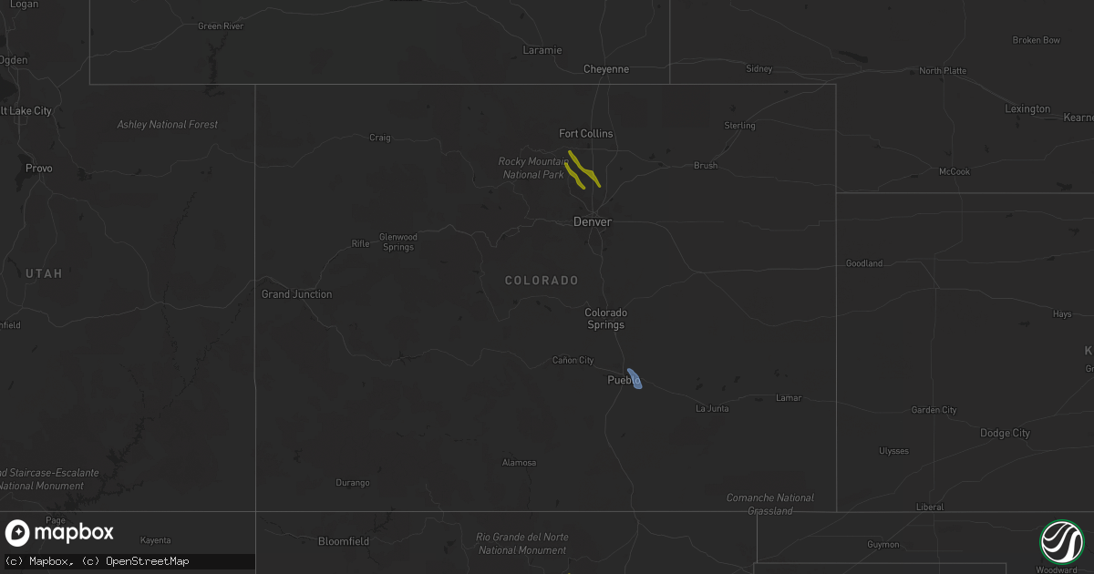
Hail Map in Colorado on July 31, 2020
Get this storm
July 31 map
$229
one time, instant access
Download today. No call, no setup
Keep the $229
Bought the map and want the full workflow? Apply the entire $229 to a subscription within 7 days. None of it is wasted.
Every map, not just this one
This buys you this map. Subscription and you get every map we run, in the markets you choose from a few cities to whole states to nationwide. Plus real-time alerts the moment a storm fires.
Contact data
Name, contact info, occupancy, even credit band for addresses in the footprint. You go from where it hit to who to call.
Become the source they trust
Unlimited branding weather history reports on demand. You already have the documented answer ready for the property owner, and you are the one who showed up with it.
Property data and RoofTrace estimates
Pull up any address you have got, its value and the exact code rules for that jurisdiction, straight from One Click Code. Then RoofTrace estimates the squares, pitch, and roof value, priced the way you price.
Storm reports in Colorado
Colorado
| Date | Description |
|---|---|
| 07/31/20206:32 PM CDT | A local report indicates 1.00 inch wind near 2 S HYGIENE |
| 07/31/20203:49 AM CDT | At 849 PM MDT, a severe thunderstorm was located 4 miles northwest of Firestone, or 22 miles southwest of Greeley, moving southeast at 25 mph. HAZARD...Quarter size hail. SOURCE...Radar indicated. IMPACT...Damage to vehicles is expected. Locations impacted include... Southeastern Longmont, Erie, Firestone, Frederick, Fort Lupton, Dacono and Mead. |
| 07/31/20203:20 AM CDT | At 820 PM MDT, a severe thunderstorm was located 5 miles southwest of Berthoud, or 20 miles south of Fort Collins, moving southeast at 35 mph. HAZARD...Quarter size hail. SOURCE...Radar indicated. IMPACT...Damage to vehicles is expected. Locations impacted include... Longmont, Erie, Firestone, Frederick, Berthoud, Dacono and Mead. |
| 07/31/20202:37 AM CDT | At 736 PM MDT, a severe thunderstorm was located near Blende, or 8 miles east of Pueblo, moving southeast at 25 mph. This storm has a history of producing wind gusts of 60 mph. HAZARD...60 mph wind gusts and quarter size hail. SOURCE...Radar indicated. IMPACT...Hail damage to vehicles is expected. Expect wind damage to roofs, siding, and trees. Locations impacted include... Eastern Pueblo, Boone, Avondale and Pueblo Depot. |
| 07/31/20202:29 AM CDT | At 729 PM MDT, a severe thunderstorm was located near Fort Lupton, or 24 miles south of Greeley, moving southeast at 25 mph. HAZARD...Quarter size hail. SOURCE...Radar indicated. IMPACT...Damage to vehicles is expected. Locations impacted include... Northeastern Commerce City, Brighton, Fort Lupton, Lochbuie, Dacono, Barr Lake and Todd Creek. |
| 07/31/20202:12 AM CDT | At 712 PM MDT, a severe thunderstorm was located over Pueblo West, or 8 miles northwest of Pueblo, moving south at 40 mph. HAZARD...60 mph wind gusts and quarter size hail. SOURCE...Radar indicated. IMPACT...Hail damage to vehicles is expected. Expect wind damage to roofs, siding, and trees. Locations impacted include... Pueblo, Pueblo West, Pueblo Reservoir, Salt Creek, Pinon and Blende. |
| 07/31/202012:34 AM CDT | At 534 PM MDT, a severe thunderstorm was located over Niwot, or 29 miles northwest of Denver, moving southeast at 30 mph. HAZARD...Quarter size hail. SOURCE...Trained weather spotters. IMPACT...Damage to vehicles is expected. Locations impacted include... Thornton, eastern Arvada, eastern Westminster, Boulder, Longmont, Broomfield, northern Commerce City, Northglenn, Brighton, Lafayette, Louisville, Erie, Superior, Federal Heights, Todd Creek and Niwot. |
| 07/30/20208:30 PM CDT | Awos station kpub pueblo airport. |
All States Impacted by Hail Map on July 31, 2020
Cities Impacted by Hail Map on July 31, 2020
- Las Vegas, NM
- San Jose, NM
- Mayhill, NM
- Timberon, NM
- Sacramento, NM
- Cloudcroft, NM
- Ribera, NM
- Moriarty, NM
- Serafina, NM
- Mescalero, NM
- Garita, NM
- Trementina, NM
- Pena Blanca, NM
- Santo Domingo Pueblo, NM
- Cochiti Pueblo, NM
- Algodones, NM
- Bernalillo, NM
- Cimarron, NM
- Mora, NM
- Angel Fire, NM
- Las Cruces, NM
- Albuquerque, NM
- Capitan, NM
- Alto, NM
- Ruidoso Downs, NM
- Glencoe, NM
- Estancia, NM
- Los Lunas, NM
- Alamogordo, NM
- Conchas Dam, NM
- Mosquero, NM
- Logan, NM
- Bard, NM
- Nara Visa, NM
- San Jon, NM
- Glenmora, LA
- Ville Platte, LA
- Oakdale, LA
- Pitkin, LA
- Tribune, KS
- Sugar Grove, NC
- Zionville, NC
- Telford, TN
- Limestone, TN
- Parrottsville, TN
- Banner Elk, NC
- Mosheim, TN
- Hampton, TN
- Erwin, TN
- Jonesborough, TN
- Unicoi, TN
- Elizabethton, TN
- Afton, TN
- Chuckey, TN
- Vilas, NC
- Boone, NC
- Greeneville, TN
- Elk Park, NC
- Butler, TN
- Roan Mountain, TN
- Bakersville, NC
- Johnson City, TN
- McLaughlin, SD
- Mound City, SD
- Wakpala, SD
- Glenham, SD
- Selby, SD
- Mobridge, SD
- Bowdle, SD
- Java, SD
- Akaska, SD
- Hoven, SD
- Gettysburg, SD
- Eagle Butte, SD
- Onaka, SD
- Faulkton, SD
- Tolstoy, SD
- Ipswich, SD
- Roscoe, SD
- Cresbard, SD
- Kirtland Afb, NM
- Kremlin, MT
- Gildford, MT
- Whitlash, MT
- Chester, MT
- Galata, MT
- Ellendale, ND
- Milnor, ND
- McIntosh, SD
- Trail City, SD
- Pueblo, CO
- Avondale, CO
- Newton, NC
- Hildebran, NC
- Conover, NC
- Hickory, NC
- Taylorsville, NC
- Stony Point, NC
- Statesville, NC
- Olin, NC
- Harmony, NC
- Cleveland, NC
- Marion, NC
- Old Fort, NC
- Imperial, NE
- Oak Grove, LA
- Lake Providence, LA
- Niwot, CO
- Boulder, CO
- Longmont, CO
- Lafayette, CO
- Lyons, CO
- Erie, CO
- Berthoud, CO
- Mead, CO
- Loveland, CO
- Dacono, CO
- Firestone, CO
- Fort Lupton, CO
- Frederick, CO
- Sharon Springs, KS
- Weskan, KS
- Greenville, MS
- Glen Allan, MS
- Inverness, MS
- Weir, MS
- West, MS
- Tchula, MS
- Belzoni, MS
- Isola, MS
- Indianola, MS
- Vaiden, MS
- Chatham, MS
- Hollandale, MS
- Cruger, MS
- Ackerman, MS
- McCool, MS
- Itta Bena, MS
- Ethel, MS
- Winona, MS
- French Camp, MS
- Kilmichael, MS
- Coila, MS
- Lexington, MS
- Sidon, MS
- Eudora, AR
- Anguilla, MS
- Silver City, MS
- Rolling Fork, MS
- Kosciusko, MS
- Durant, MS
- Raleigh, MS
- Forest, MS
- Lawrence, MS
- Lake, MS
- Groton, SD
- Stratford, SD
- Highmore, SD
- Prairie City, SD
- Selfridge, ND
- Clifton, AZ
- Nisland, SD
- Belle Fourche, SD
- Elgin, TX
- Coupland, TX
- Del Rio, TX
- Dryden, TX
- Marathon, TX
- Big Wells, TX
- La Junta, CO
- Carrizozo, NM
- Corona, NM
- Junction, TX
- Zortman, MT
- Drake, CO
- Lefor, ND
- Regent, ND
- Hondo, TX
- Fredericksburg, TX
- Brackettville, TX
- Comstock, TX
- Bandera, TX
- Jordan, MT
- Morganton, NC
- Chokio, MN
- Correll, MN
- Ashton, SD
- Austin, TX
- Round Rock, TX
- Colby, KS
- Roy, NM
- Hunt, TX
- Mountain Home, TX
- Newell, SD
- Mott, ND
- Saco, MT
- Hinsdale, MT
- Levant, KS
- Buffalo, SD
- Waller, TX
- Hempstead, TX
- Harper, TX
- Wibaux, MT
- Hankinson, ND
- Medina, TX
- Dumont, MN
- Ingram, TX
- Kerrville, TX
- Socorro, NM
- Circle, MT
- Wolf Point, MT
- Goodland, KS
- Kanorado, KS
- Willcox, AZ
- Dickinson, ND
- Hereford, TX
- Northville, SD
- Conde, SD
- Springer, NM
- Rocky Ford, CO
- Guadalupita, NM
- Rocksprings, TX
- Pearsall, TX
- Two Dot, MT
- Presho, SD
- Mills, NM
- Lenoir, NC
- College Station, TX
- El Paso, TX
- Brenham, TX
- Washington, TX
- Encinal, TX
- Barksdale, TX
- Yale, SD
- Carpenter, SD
- Hockley, TX
- Morris, MN
- Appleton, MN
- Malta, MT
- Warner, SD
- Brentford, SD
- Mellette, SD
- Asherton, TX
- Ocate, NM
- Granite Falls, NC
- Gwinner, ND
- Sisseton, SD
- Nogal, NM
- Somerville, TX
- Caldwell, TX
- Camp Wood, TX
- Mount Ulla, NC
- Hiddenite, NC
- Ruidoso, NM
- Vanderpool, TX
- Utopia, TX
- Leakey, TX
- Hagerman, NM
- Tilden, TX
- Fort Peck, MT
- Fairmount, ND
- Uvalde, TX


