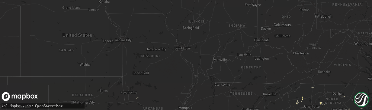
Hail Map in South Carolina on July 31, 2011
The weather event in South Carolina on July 31, 2011 includes Hail map. 21 states and 574 cities were impacted and suffered possible damage. The total estimated number of properties impacted is 0.
Want more than just the map?
Turn this storm into a full workflow.
- Owner + property data so you know who to knock
- OnDemand branded weather history reports to win the "did we even have hail?" argument
- RoofTrace estimate so reps stop guessing numbers at the door
Bought this map? Upgrade within 7 days and we'll credit the $230. (10-15 min setup call)
Hail
0
Estimated number of impacted properties by a 1.00" hail or larger0
Estimated number of impacted properties by a 1.75" hail or larger0
Estimated number of impacted properties by a 2.50" hail or largerStorm reports in South Carolina
South Carolina
| Date | Description |
|---|---|
| 07/31/20116:39 PM CDT | South carolina highway patrol reported one tree down near rice shire road and frontage road. |
| 07/31/20115:55 PM CDT | South carolina highway patrol reported one tree down on crumley road. |
| 07/31/20115:45 PM CDT | South carolina highway patrol reported one tree down near the intersection of saint peters road and highway 64. |
| 07/31/20115:18 PM CDT | South carolina highway patrol reported one tree down near the intersection of jefferies blvd and oakland drive. |
| 07/31/20115:15 PM CDT | Tree down on pineland road near sonoco road. |
| 07/31/20115:15 PM CDT | Power lines down on lockhart dr and north 2nd st.61 |
| 07/31/20115:14 PM CDT | South carolina highway patrol reported one tree down near the intersection of deliverence road and red root road. |
| 07/31/20115:08 PM CDT | South carolina highway patrol reported one tree down near the intersection of jones swamp road and wolfe creek road. |
| 07/31/20114:29 PM CDT | Another tree down along highway 76 going toward kinards. |
| 07/31/20114:28 PM CDT | A tree was down on the whitemire highway just out of joanna. |
| 07/31/20114:15 PM CDT | County comms reports quarter sized hail on ekom beach road. |
| 07/31/20113:49 PM CDT | Trees in roadway on main st also monticell rd reported by highway patrol |
| 07/31/20113:45 PM CDT | Trees down near heyward and pickens sts |
| 07/31/20113:45 PM CDT | Trees down near heyward and pickens sts |
| 07/31/20113:38 PM CDT | Law enforcement reported trees and powerlines down on cooper store road. |
| 07/31/201112:40 PM CDT | Nickel to quarter size hail fell briefly |
| 07/30/20117:57 PM CDT | Large branches broken |
All States Impacted by Hail Map on July 31, 2011
Cities Impacted by Hail Map on July 31, 2011
- Hazelton, ND
- Adams, ND
- Lyndonville, NY
- Wisconsin Rapids, WI
- Lockesburg, AR
- Flasher, ND
- Timmonsville, SC
- Florence, SC
- Lemmon, SD
- Maddock, ND
- Faison, NC
- Pine River, WI
- Waupaca, WI
- Tabor City, NC
- Loris, SC
- Fremont, WI
- Poy Sippi, WI
- Weyauwega, WI
- Wild Rose, WI
- Pineland, SC
- Garnett, SC
- Aneta, ND
- Binford, ND
- Mcclusky, ND
- Cassatt, SC
- Camden, SC
- Woodworth, ND
- Greeleyville, SC
- Salters, SC
- Kingstree, SC
- Wilton, ND
- State Road, NC
- Ellis, KS
- Bowdon, ND
- Hurdsfield, ND
- Chaseley, ND
- Zachary, LA
- Boulevard, CA
- Campo, CA
- Pine Valley, CA
- Bliss, NY
- Arcade, NY
- Lane, SC
- Saint Stephen, SC
- Baldwin, ND
- Regan, ND
- Jesup, GA
- Ludowici, GA
- Warwick, ND
- Blair, SC
- Cooperstown, ND
- Finley, ND
- Hurley, NM
- Wishek, ND
- Sturgis, SD
- Alden, NY
- Saint Anthony, ND
- Mandan, ND
- Ozark, MO
- Butler, GA
- Rupert, GA
- Fountain, FL
- Alford, FL
- Black River Falls, WI
- Merrillan, WI
- Turtle Lake, ND
- Wakeeney, KS
- Hebron, ND
- Sumterville, FL
- Bushnell, FL
- Collyer, KS
- Columbia, SC
- Hopkins, SC
- Sandersville, GA
- Spearfish, SD
- Saint Onge, SD
- Denhoff, ND
- New Salem, ND
- Glen Ullin, ND
- Max, ND
- Amherst, WI
- Redgranite, WI
- Scandinavia, WI
- Berlin, WI
- Carson, ND
- Elgin, ND
- Essexville, MI
- Hettinger, ND
- Grygla, MN
- Kensal, ND
- Carrington, ND
- Erie, KS
- Akron, NY
- Statesboro, GA
- Mud Butte, SD
- Attica, NY
- Cowlesville, NY
- Jessieville, AR
- Mountain Pine, AR
- Plainview, AR
- Munger, MI
- Bay City, MI
- Fairgrove, MI
- Prairie City, SD
- Silver City, NM
- Holland, NY
- Newark Valley, NY
- Berkshire, NY
- Candor, NY
- Groveland, FL
- Okahumpka, FL
- Howey In The Hills, FL
- Leesburg, FL
- Center Hill, FL
- Lake Panasoffkee, FL
- Kathryn, ND
- Litchville, ND
- Jamestown, ND
- Pelham, GA
- Wyndmere, ND
- Jordan Valley, OR
- Islandton, SC
- Waycross, GA
- Rutherfordton, NC
- Spindale, NC
- Forest City, NC
- Aiken, SC
- Saint Michael, ND
- West Valley, NY
- Machias, NY
- Ellicottville, NY
- Linton, ND
- Alexander, AR
- Scranton, SC
- Coward, SC
- Bison, SD
- Ashley, ND
- Rosston, AR
- Round O, SC
- Green Pond, SC
- Cottageville, SC
- Walterboro, SC
- Sumter, SC
- Rembert, SC
- Early Branch, SC
- Varnville, SC
- Reidsville, GA
- Midway, GA
- Fleming, GA
- Dobson, NC
- Elkin, NC
- Freeland, MI
- Fort Stewart, GA
- Ellabell, GA
- Brandon, MN
- Hoffman, MN
- Evansville, MN
- Kensington, MN
- Farwell, MN
- Garfield, MN
- Oberon, ND
- Devils Lake, ND
- Minnewaukan, ND
- Medina, NY
- Middleport, NY
- Benedict, KS
- Dupree, SD
- Clare, MI
- Coleman, MI
- Sanford, MI
- Midland, MI
- Waldo, AR
- Magnolia, AR
- Wing, ND
- Bismarck, ND
- Menoken, ND
- Sterling, ND
- Bluffton, SC
- Hilton Head Island, SC
- Ludington, MI
- Pentwater, MI
- Mears, MI
- Hart, MI
- Fountain Inn, SC
- Belle Fourche, SD
- Almond, WI
- Meadow, SD
- Allenhurst, GA
- Hinesville, GA
- Thorsby, AL
- Maplesville, AL
- Driscoll, ND
- Albemarle, NC
- Troy, NC
- Bancroft, WI
- Moncks Corner, SC
- Byron, NY
- Batavia, NY
- Beulah, ND
- Nashville, AR
- Veguita, NM
- Morgan City, LA
- Alapaha, GA
- Jackson, LA
- Saint Francisville, LA
- Lankin, ND
- Jessie, ND
- Pinopolis, SC
- Tifton, GA
- Marshallville, GA
- Bishopville, SC
- Fergus Falls, MN
- Holyrood, KS
- Bushton, KS
- Lorraine, KS
- Kingsland, GA
- Clarence Center, NY
- Basom, NY
- Gasport, NY
- Lockport, NY
- Corfu, NY
- Trenton, NC
- Connelly Springs, NC
- Whitewood, SD
- Pineville, SC
- Aynor, SC
- Galivants Ferry, SC
- Brocket, ND
- Edgefield, SC
- Oark, AR
- Tolna, ND
- Greenville, MO
- Lakota, ND
- Lawton, ND
- Crary, ND
- Mott, ND
- Eastover, SC
- Saginaw, MI
- Plainfield, WI
- Amherst Junction, WI
- Nelsonville, WI
- Royal, AR
- Hot Springs National Park, AR
- Warsaw, NC
- East Bethany, NY
- Alexander, NY
- Nome, ND
- Enderlin, ND
- Colfax, ND
- Union Center, SD
- Reeder, ND
- Elba, NY
- Albion, NY
- Oakfield, NY
- Reva, SD
- Batesburg, SC
- Ridge Spring, SC
- Regent, ND
- Holden, LA
- Lawley, AL
- Randolph, AL
- De Queen, AR
- Horatio, AR
- Wewahitchka, FL
- Jacksonville, AR
- Sherwood, AR
- Johnston, SC
- Oglethorpe, GA
- Jeanerette, LA
- New Iberia, LA
- Mchenry, ND
- Pooler, GA
- Savannah, GA
- Saint Matthews, SC
- Oldsmar, FL
- Palm Harbor, FL
- Texarkana, AR
- Horace, ND
- Fargo, ND
- Ethel, LA
- Slaughter, LA
- Strasburg, ND
- Hague, ND
- Zeeland, ND
- Amenia, ND
- Isabel, SD
- Hill City, KS
- Lugoff, SC
- Granite Falls, NC
- Valdese, NC
- Selfridge, ND
- New Leipzig, ND
- Sawyer, ND
- Coleharbor, ND
- Harvey, ND
- Alma Center, WI
- Hannaford, ND
- Sutton, ND
- Glenfield, ND
- Sharon, ND
- Sheridan, AR
- Goodrich, ND
- Gordo, AL
- Valdosta, GA
- Lake Park, GA
- Glennville, GA
- Robinson, ND
- Sykeston, ND
- Chanute, KS
- Tuttle, ND
- Steele, ND
- Hope, ND
- Butte, ND
- Lynchburg, SC
- Olanta, SC
- Andersonville, GA
- Americus, GA
- Tillman, SC
- Clyo, GA
- Ridgeland, SC
- Yemassee, SC
- Coosawhatchie, SC
- Estill, SC
- Port Edwards, WI
- Knowlesville, NY
- Barker, NY
- Waterport, NY
- Pierson, FL
- Franklin, LA
- Freedom, NY
- Carrizozo, NM
- Pingree, ND
- Sardinia, NY
- East Concord, NY
- Delevan, NY
- Yorkshire, NY
- Chaffee, NY
- Wagon Mound, NM
- Ogallah, KS
- Clearwater, KS
- Tampa, FL
- Rothsay, MN
- Kent, MN
- Kulm, ND
- Grenville, NM
- Bergen, NY
- Richfield, NC
- New London, NC
- Darien Center, NY
- Brownell, KS
- Brooksville, FL
- Rincon, GA
- Elbow Lake, MN
- Barrett, MN
- Starkweather, ND
- White Springs, FL
- Dalzell, SC
- Stafford, NY
- Leeds, ND
- Cando, ND
- Longwood, FL
- Altamonte Springs, FL
- Bonneau, SC
- Wheatland, ND
- Shelby, MI
- Conchas Dam, NM
- Harrison, GA
- Wrightsville, GA
- Galesburg, ND
- Eastpoint, FL
- Taylors Island, MD
- Hays, KS
- Underwood, ND
- Williston, SC
- Farwell, MI
- Ridgeville, SC
- Greenbush, MN
- Tennille, GA
- Hardeeville, SC
- Webster, FL
- Port Wentworth, GA
- Bloomingdale, GA
- Georgetown, SC
- Hemingway, SC
- Wolverton, MN
- Wendell, NC
- Raleigh, NC
- Knightdale, NC
- Leesville, SC
- Pelion, SC
- Gilbert, SC
- Breckenridge, MN
- Saint George, SC
- Hickory, NC
- Morganton, NC
- Winnsboro, SC
- Zellwood, FL
- Apopka, FL
- Mount Dora, FL
- Mullins, SC
- Barney, ND
- Walcott, ND
- Richlands, NC
- Beulaville, NC
- Chinquapin, NC
- Berwick, LA
- Patterson, LA
- Ward, SC
- Saluda, SC
- New Rockford, ND
- Birch Run, MI
- Hemlock, MI
- Lodgepole, SD
- Columbia, NC
- Marion, SC
- Ypsilanti, ND
- Washburn, ND
- Dazey, ND
- Cathay, ND
- Windsor, SC
- Livingston, LA
- Page, ND
- Jonesville, SC
- Union, SC
- Monetta, SC
- Lehr, ND
- Yates Center, KS
- Toronto, KS
- Selma, AL
- Pamplico, SC
- Badger, MN
- Thayer, KS
- Stanton, ND
- Lexington, NC
- Pinewood, SC
- Gresham, SC
- Lisbon, ND
- Reynolds, GA
- Clinton, LA
- Greenwell Springs, LA
- Claflin, KS
- Hazen, ND
- Medina, ND
- Tijeras, NM
- Dierks, AR
- Holland, MI
- West Olive, MI
- Zeeland, MI
- Hixton, WI
- Mcville, ND
- Blackville, SC
- Milnor, ND
- Mabelvale, AR
- Little Rock, AR
- Jacksonville, FL
- Lake City, SC
- Copemish, MI
- Manning, SC
- Lake City, FL
- New Bern, NC
- Timber Lake, SD
- Colony, KS
- Deer, AR
- Allegany, NY
- Allendale, SC
- Guyton, GA
- Smithville, GA
- Tappen, ND
- Courtenay, ND
- Mauk, GA
- Wagener, SC
- Effingham, SC
- Kinards, SC
- Clinton, SC
- Joanna, SC
- Buena Vista, GA
- Arenas Valley, NM
- Santa Clara, NM
- Omer, MI
- Twining, MI
- Enigma, GA
- Donalds, SC
- Pekin, ND
- Ellaville, GA
- Luverne, ND
- Clifford, ND
- Pillsbury, ND
- Bostic, NC
- Penn, ND
- Whitmire, SC
- Vesper, WI
- Riegelwood, NC
- Zephyrhills, FL
- Ball, LA
- Standish, MI
- Pittsville, WI
- Granton, WI
- Alexandria, MN
- Barnwell, SC
- Nebo, NC
- Union Mills, NC
- Faith, SD
- Mora, NM
- Fredonia, KS
- Murdock, KS
- Chidester, AR
- Cleveland, ND
- Mayesville, SC
- Springfield, LA
- Ponchatoula, LA
- Hammond, LA
- Glenwood, AR
- Caddo Gap, AR
- Solen, ND
- Macclenny, FL
- Summerville, SC
- Webster, ND
- Conway, SC
- Eagle Butte, SD
- Carlisle, SC
- Blackstock, SC
- Ocala, FL
- Melrose, FL
- Wedgefield, SC
- Bryceville, FL
- Richardton, ND
- Hanover, NM
- Amistad, NM
- Laurens, SC
- Foley, AL
- Summerdale, AL
- Denham Springs, LA
- Pine Grove, LA
- Ware Shoals, SC
- Hodges, SC
- Franklinville, NY
- Russell, KS
- Dunnellon, FL
- Lamar, SC
- Sheyenne, ND
- Okatie, SC
- Moorhead, MN
- Comstock, MN
- Linwood, MI
- Kawkawlin, MI
- East Aurora, NY
- Grapevine, AR
- Mount Vernon, GA
- Ailey, GA
- Uvalda, GA
- Casar, NC
- Lawndale, NC
- Harleyville, SC
- Pfeifer, KS
- Bainbridge, GA
- Seymour, WI
- Kaukauna, WI
- Andrews, SC
- Hoisington, KS
- Kingman, AZ
- Dawson, ND
- Gainesville, FL
- Clermont, FL
- White Owl, SD
- Enning, SD
- Christine, ND
- Barnesville, GA
- Falmouth, MA
- Buckner, AR
- Springfield, GA
- Black Creek, WI
- Salley, SC
- Graniteville, SC
- Pettibone, ND


