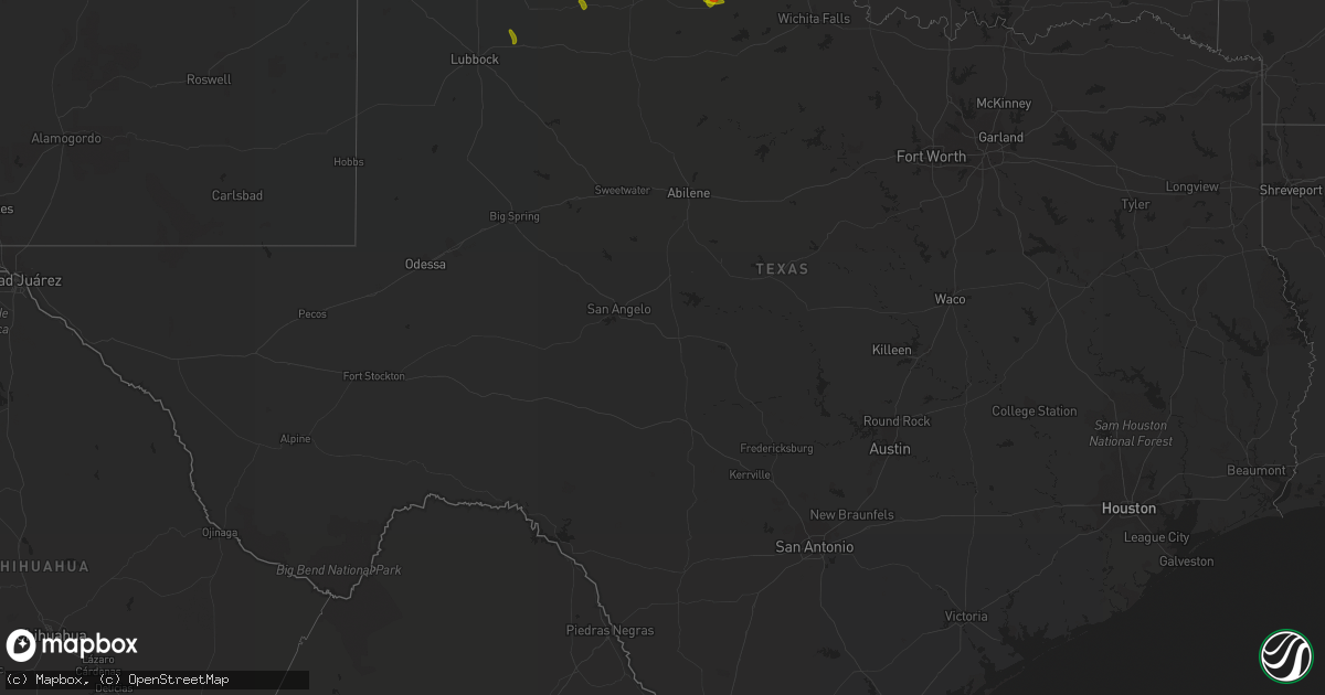
Hail Map in Texas on July 30, 2020
Get this storm
July 30 map
$229
one time, instant access
Download today. No call, no setup
Keep the $229
Bought the map and want the full workflow? Apply the entire $229 to a subscription within 7 days. None of it is wasted.
Every map, not just this one
This buys you this map. Subscription and you get every map we run, in the markets you choose from a few cities to whole states to nationwide. Plus real-time alerts the moment a storm fires.
Contact data
Name, contact info, occupancy, even credit band for addresses in the footprint. You go from where it hit to who to call.
Become the source they trust
Unlimited branding weather history reports on demand. You already have the documented answer ready for the property owner, and you are the one who showed up with it.
Property data and RoofTrace estimates
Pull up any address you have got, its value and the exact code rules for that jurisdiction, straight from One Click Code. Then RoofTrace estimates the squares, pitch, and roof value, priced the way you price.
Storm reports in Texas
Texas
| Date | Description |
|---|---|
| 07/30/20206:50 PM CDT | Haskell sheriffs office reported a sign at the kent kwik convenience store being blown into a power line... Knocking the power out. Haskell mesonet reported a max wind |
| 07/30/20206:38 PM CDT | Spotter estimates 60 mph winds in rochester. |
| 07/30/20205:07 PM CDT | A local report indicates 58 MPH wind near 1 E CROWELL |
| 07/30/20204:35 PM CDT | Near the wilbarger/foard county line. |
| 07/30/20204:32 PM CDT | Semi blown over near the hardeman/wilbarger county line. |
| 07/30/20204:30 PM CDT | Rv trailers flipped. |
| 07/30/20204:04 AM CDT | At 903 PM CDT, severe thunderstorms were located along a line extending from near Tuskahoma to near Oleta to 14 miles northwest of Paris, moving east at 35 mph. HAZARD...60 mph wind gusts and quarter size hail. SOURCE...Radar indicated. IMPACT...Hail damage to vehicles is expected. Expect wind damage to roofs, siding, and trees. Locations impacted include... Idabel, Broken Bow, Manchester, Wright City, Valliant, Millerton, Garvin, Eagletown, Rufe, Smithville, Hochatown, Watson, Battiest, Pickens, Mount Herman, Woodland, Redland, Kanawha, Glover and Kiomatia. |
| 07/30/20203:51 AM CDT | At 850 PM CDT, severe thunderstorms were located along a line extending from near Yanush to 3 miles northeast of Oleta to 5 miles south of Goodland, moving east at 35 mph. HAZARD...60 mph wind gusts and penny size hail. SOURCE...Radar indicated. IMPACT...Expect damage to roofs, siding, and trees. Locations in or near the path include... Hugo... Antlers... Clayton... Fort Towson... Sawyer... Rattan... Soper... Snow... Tuskahoma... Hugo Lake State Park... Stanley... Clayton Lake State Park... Kent... Goodland... Messer... Raymond Gary State Park... Nashoba... Oleta... Cloudy... Grant... |
| 07/30/20203:13 AM CDT | At 812 PM CDT, severe thunderstorms were located along a line extending from 4 miles east of Blanco to 3 miles southwest of Moyers to 4 miles southeast of Bennington, moving east at 35 mph. HAZARD...60 mph wind gusts and penny size hail. SOURCE...Radar indicated. IMPACT...Expect damage to roofs, siding, and trees. Locations in or near the path include... Hugo... Antlers... Clayton... Boswell... Fort Towson... Sawyer... Rattan... Soper... Snow... Tuskahoma... Hugo Lake State Park... Stanley... Kellond... Clayton Lake State Park... Kent... Goodland... Messer... Raymond Gary State Park... Moyers... Nashoba... |
| 07/30/20203:10 AM CDT | First severe gust |
| 07/30/20202:52 AM CDT | At 752 PM CDT, severe thunderstorms were located along a line extending from 2 miles northeast of Ashland to 5 miles southwest of Lane to 3 miles southeast of Armstrong to 4 miles south of Willis, moving southeast at 25 mph. HAZARD...60 mph wind gusts and penny size hail. SOURCE...Radar indicated. IMPACT...Expect damage to roofs, siding, and trees. Locations in or near the path include... Antlers... Kiowa... Boswell... Soper... Ashland... Kent... Moyers... Kosoma... Kellond... Blanco... Pittsburg... Darwin... Unger... |
| 07/30/20202:10 AM CDT | At 710 PM CDT, severe thunderstorms were located along a line extending from 3 miles northeast of Walters to near Grandfield, moving southeast at 40 mph. HAZARD...60 mph wind gusts and quarter size hail. SOURCE...Radar indicated. IMPACT...Hail damage to vehicles is expected. Expect wind damage to roofs, siding, and trees. Locations impacted include... Walters, Geronimo, Grandfield, Temple, Chattanooga, Randlett, Devol, Hastings, Faxon, Addington, Hollister, Loveland, Cookietown, Waurika Lake, Corum, Taylor and Charlie. |
| 07/30/20201:46 AM CDT | At 646 PM CDT, a severe thunderstorm was located near Haskell, moving southeast at 35 mph. HAZARD...60 mph wind gusts and penny size hail. SOURCE...Radar indicated. IMPACT...Expect damage to roofs, siding, and trees. This severe thunderstorm will be near... Haskell around 650 PM CDT. Paint Creek around 705 PM CDT. Lake Stamford Marina around 710 PM CDT. Stamford around 715 PM CDT.Other locations impacted by this severe thunderstorm include Jud, Us-277 Near The Haskell-Knox County Line and Us-380 Near The Haskell-Stonewall County Line. |
| 07/30/20201:27 AM CDT | At 627 PM CDT, severe thunderstorms were located along a line extending from 7 miles northeast of Wynnewood to 4 miles northwest of Loco to 4 miles east of Burkburnett, moving southeast at 35 mph. HAZARD...60 mph wind gusts and quarter size hail. SOURCE...Radar indicated. IMPACT...Hail damage to vehicles is expected. Expect wind damage to roofs, siding, and trees. Locations impacted include... Ardmore, Duncan, Burkburnett, Pauls Valley, Sulphur, Henrietta, Davis, Walters, Waurika, Lone Grove, Healdton, Wynnewood, Wilson, Comanche, Grandfield, Ringling, Temple, Ryan, Roff and Springer. |
| 07/30/20201:14 AM CDT | At 613 PM CDT, severe thunderstorms were located along a line extending from 3 miles west of Waurika Lake to 4 miles southwest of Devol, moving southeast at 40 mph. HAZARD...70 mph wind gusts and ping pong ball size hail. SOURCE...Radar indicated. IMPACT...People and animals outdoors will be injured. Expect hail damage to roofs, siding, windows, and vehicles. Expect considerable tree damage. Wind damage is also likely to mobile homes, roofs, and outbuildings. Locations impacted include... Duncan, Burkburnett, Walters, Comanche, Temple, Randlett, Devol, Hastings, Addington, Cookietown, Waurika Lake, Corum, Empire City, Taylor, Charlie and Cashion.This includes Interstate 44 between mile markers 0 and 24. |
| 07/30/20201:10 AM CDT | At 609 PM CDT, a severe thunderstorm was located near Thalia, moving southeast at 15 mph. HAZARD...Golf ball size hail and 70 mph wind gusts. SOURCE...Radar indicated. IMPACT...People and animals outdoors will be injured. Expect hail damage to roofs, siding, windows, and vehicles. Expect considerable tree damage. Wind damage is also likely to mobile homes, roofs, and outbuildings. Locations impacted include... Margaret, Thalia and Rayland. |
| 07/30/20201:00 AM CDT | At 559 PM CDT, a severe thunderstorm was located 5 miles northeast of Lorenzo, or 14 miles northwest of Crosbyton, moving southeast at 25 mph. HAZARD...60 mph wind gusts and quarter size hail. SOURCE...Radar indicated. IMPACT...Hail damage to vehicles is expected. Expect wind damage to roofs, siding, and trees. Locations impacted include... Crosbyton, Ralls, Lorenzo and Cone. |
| 07/30/202012:45 AM CDT | At 545 PM CDT, a severe thunderstorm was located near Margaret, moving southeast at 30 mph. HAZARD...60 mph wind gusts and quarter size hail. SOURCE...Radar indicated. IMPACT...Hail damage to vehicles is expected. Expect wind damage to roofs, siding, and trees. Locations impacted include... Crowell, Margaret, Thalia and Copper Breaks State Park. |
| 07/30/202012:33 AM CDT | At 533 PM CDT, a severe thunderstorm was located near Thalia, moving southeast at 30 mph. HAZARD...60 mph wind gusts and quarter size hail. SOURCE...Radar indicated. IMPACT...Hail damage to vehicles is expected. Expect wind damage to roofs, siding, and trees. Locations impacted include... Margaret, Thalia and Rayland. |
| 07/30/202012:29 AM CDT | At 529 PM CDT, a severe thunderstorm was located 4 miles south of Hollister, moving east at 30 mph. HAZARD...60 mph wind gusts and quarter size hail. SOURCE...Radar indicated. IMPACT...Hail damage to vehicles is expected. Expect wind damage to roofs, siding, and trees. Locations impacted include... Geronimo, Grandfield, Devol, Hollister, Loveland and Cookietown. |
| 07/30/202012:26 AM CDT | At 526 PM CDT, a severe thunderstorm was located 7 miles northeast of Lake Kemp, moving southeast at 20 mph. HAZARD...70 mph wind gusts and ping pong ball size hail. SOURCE...Radar indicated. IMPACT...People and animals outdoors will be injured. Expect hail damage to roofs, siding, windows, and vehicles. Expect considerable tree damage. Wind damage is also likely to mobile homes, roofs, and outbuildings. Locations impacted include... Dundee, Lake Diversion and northeastern Lake Kemp. |
| 07/29/202011:41 PM CDT | At 441 PM CDT, a severe thunderstorm was located 13 miles west of Crowell, moving southeast at 30 mph. HAZARD...60 mph wind gusts and quarter size hail. SOURCE...Radar indicated. IMPACT...Hail damage to vehicles is expected. Expect wind damage to roofs, siding, and trees. Locations impacted include... Crowell, Truscott, Gilliland and Margaret. |
| 07/29/202011:39 PM CDT | At 439 PM CDT, a severe thunderstorm was located near Vernon, moving southeast at 30 mph. HAZARD...Ping pong ball size hail and 60 mph wind gusts. SOURCE...Radar indicated. IMPACT...People and animals outdoors will be injured. Expect hail damage to roofs, siding, windows, and vehicles. Expect wind damage to roofs, siding, and trees. Locations impacted include... Vernon, Oklaunion, Lockett, Harrold and Grayback. |
| 07/29/202011:25 PM CDT | At 425 PM CDT, a severe thunderstorm was located 13 miles southeast of Swearingen, moving southeast at 25 mph. HAZARD...60 mph wind gusts and quarter size hail. SOURCE...Radar indicated. IMPACT...Hail damage to vehicles is expected. Expect wind damage to roofs, siding, and trees. This severe thunderstorm will remain over mainly rural areas of west central Foard County. |
| 07/29/202011:20 PM CDT | At 420 PM CDT, a severe thunderstorm was located over Matador, moving southeast at 25 mph. HAZARD...70 mph wind gusts and quarter size hail. SOURCE...Radar indicated. IMPACT...Hail damage to vehicles is expected. Expect considerable tree damage. Wind damage is also likely to mobile homes, roofs, and outbuildings. Locations impacted include... Matador, Delwin, Afton, Mcadoo and Roaring Springs. |
| 07/29/202011:14 PM CDT | At 413 PM CDT, a severe thunderstorm was located near Vernon, moving east at 30 mph. HAZARD...60 mph wind gusts and quarter size hail. SOURCE...Radar indicated. IMPACT...Hail damage to vehicles is expected. Expect wind damage to roofs, siding, and trees. Locations impacted include... Vernon, Oklaunion and Lockett. |
| 07/29/202010:10 PM CDT | Large tree down in road. Multiple trees down in west denison. |
| 07/29/20209:55 PM CDT | North texas regional airport reported a 61 mph wind gust. |
| 07/29/20207:25 PM CDT | A local report indicates 69 MPH wind near 5 SSW GRAHAM |
All States Impacted by Hail Map on July 30, 2020
Cities Impacted by Hail Map on July 30, 2020
- La Salle, CO
- Greeley, CO
- Pueblo, CO
- Beulah, CO
- Rye, CO
- Wetmore, CO
- Rockvale, CO
- Coal Creek, CO
- Florence, CO
- Canon City, CO
- Solano, NM
- Wagon Mound, NM
- Trementina, NM
- Conchas Dam, NM
- Ocate, NM
- Matador, TX
- Crowell, TX
- Vernon, TX
- Lorenzo, TX
- Ralls, TX
- Haverstraw, NY
- Garnerville, NY
- Croton On Hudson, NY
- West Haverstraw, NY
- Bedford, NY
- Pound Ridge, NY
- Millwood, NY
- Ossining, NY
- Bedford Hills, NY
- Chappaqua, NY
- Mount Kisco, NY
- Helmetta, NJ
- Sewaren, NJ
- Millstone Township, NJ
- Iselin, NJ
- Rahway, NJ
- Windsor, NJ
- North Brunswick, NJ
- Princeton, NJ
- Spotswood, NJ
- Kendall Park, NJ
- Chesterfield, NJ
- Keansburg, NJ
- Perth Amboy, NJ
- Middlesex, NJ
- Keyport, NJ
- Rocky Hill, NJ
- Cliffwood, NJ
- Sayreville, NJ
- Woodbridge, NJ
- Neshanic Station, NJ
- Allentown, NJ
- Morganville, NJ
- Metuchen, NJ
- Flemington, NJ
- Manville, NJ
- Franklin Park, NJ
- Stockton, NJ
- Port Reading, NJ
- Holmdel, NJ
- Matawan, NJ
- Hopewell, NJ
- Plainsboro, NJ
- Hightstown, NJ
- Keasbey, NJ
- Edison, NJ
- Middletown, NJ
- Hazlet, NJ
- Monmouth Junction, NJ
- East Brunswick, NJ
- Trenton, NJ
- Monroe Township, NJ
- Highland Park, NJ
- Avenel, NJ
- South Amboy, NJ
- Princeton Junction, NJ
- Piscataway, NJ
- Parlin, NJ
- Englishtown, NJ
- New Brunswick, NJ
- Linden, NJ
- Belle Mead, NJ
- Kingston, NJ
- Staten Island, NY
- Ringoes, NJ
- Carteret, NJ
- Hillsborough, NJ
- Milltown, NJ
- South River, NJ
- Cranbury, NJ
- Somerset, NJ
- Port Monmouth, NJ
- Dayton, NJ
- South Bound Brook, NJ
- Fords, NJ
- Robbinsville, NJ
- South Plainfield, NJ
- Colonia, NJ
- Old Bridge, NJ
- Skillman, NJ
- Marlow, OK
- Duncan, OK
- Lawton, OK
- Elgin, OK
- Coalgate, OK
- Stuart, OK
- Wardville, OK
- Kiowa, OK
- Walters, OK
- Hollister, OK
- Loveland, OK
- Paoli, OK
- Maysville, OK
- Pauls Valley, OK
- Wayne, OK
- Pittsburg, OK
- Frederick, OK
- Indiahoma, OK
- Chattanooga, OK
- Faxon, OK
- Cache, OK
- Konawa, OK
- Tupelo, OK
- Stonewall, OK
- Mcalester, OK
- Fort Cobb, OK
- Carnegie, OK
- Indianola, OK
- Gracemont, OK
- Anadarko, OK
- Davis, OK
- Dougherty, OK
- Fittstown, OK
- Roff, OK
- Sulphur, OK
- Mill Creek, OK
- Stratford, OK
- Elmore City, OK
- Fitzhugh, OK
- Allen, OK
- Wynnewood, OK
- Ada, OK
- Tishomingo, OK
- Centrahoma, OK
- Milburn, OK
- Ulster, PA
- Towanda, PA
- Lawton, PA
- Le Raysville, PA
- Friendsville, PA
- Stevensville, PA
- Montrose, PA
- Rome, PA
- Wyalusing, PA
- Wysox, PA
- Boulder, CO
- Jamestown, CO
- Sherman, TX
- Bells, TX
- Hobbs, NM
- Mayhill, NM
- Tinnie, NM
- Picacho, NM
- Malta, MT
- Andrews, TX
- Goldsmith, TX
- Seminole, TX
- Jal, NM
- Bowman, ND
- Valmora, NM
- Las Vegas, NM
- Medicine Park, OK
- Valley View, TX
- Era, TX
- Denton, TX
- Ponder, TX
- Argyle, TX
- Odessa, TX
- Geronimo, OK
- Collinsville, TX
- Tioga, TX
- Gardendale, TX
- Roswell, NM
- Carlsbad, NM


