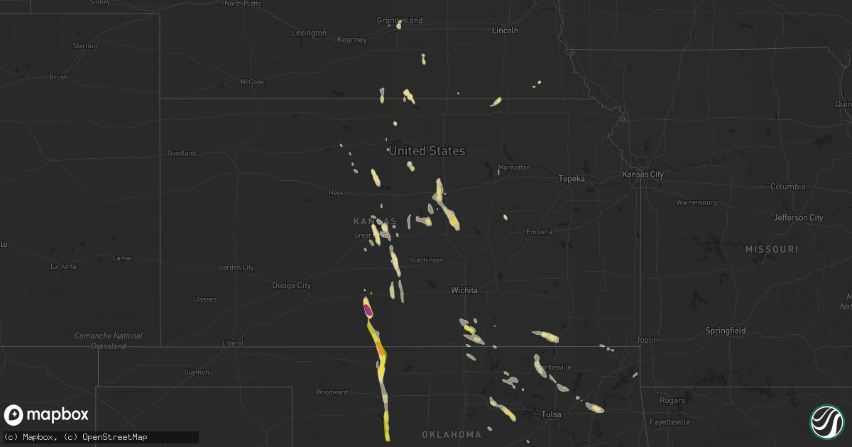
Hail Map in Kansas on July 30, 2018
Get this storm
July 30 map
$229
one time, instant access
Download today. No call, no setup
Keep the $229
Bought the map and want the full workflow? Apply the entire $229 to a subscription within 7 days. None of it is wasted.
Every map, not just this one
This buys you this map. Subscription and you get every map we run, in the markets you choose from a few cities to whole states to nationwide. Plus real-time alerts the moment a storm fires.
Contact data
Name, contact info, occupancy, even credit band for addresses in the footprint. You go from where it hit to who to call.
Become the source they trust
Unlimited branding weather history reports on demand. You already have the documented answer ready for the property owner, and you are the one who showed up with it.
Property data and RoofTrace estimates
Pull up any address you have got, its value and the exact code rules for that jurisdiction, straight from One Click Code. Then RoofTrace estimates the squares, pitch, and roof value, priced the way you price.
Storm reports in Kansas
Kansas
| Date | Description |
|---|---|
| 07/30/20182:05 PM CDT | Tree branches were damaged from thunderstorm winds just south of the state line as noted from a nws wichita storm survey. The time is estimated. |
| 07/30/20182:03 PM CDT | Trained spotter measured 70 mph on his davis weather station. |
| 07/30/20182:02 PM CDT | A local report indicates 70 MPH wind near 1 W ARKANSAS CITY |
| 07/30/20181:56 PM CDT | Power flashes reported on highway 166 |
| 07/30/20181:18 PM CDT | Delayed report from july 30. Video submitted via twitter shows a tree being blown down due to thunderstorm wind gust. Time estimated based on radar. |
| 07/30/20181:16 PM CDT | A local report indicates 62 MPH wind near 2 N WELLINGTON |
| 07/30/20181:16 PM CDT | A local report indicates 60 MPH wind near WELLINGTON AIRPORT |
| 07/30/20181:15 PM CDT | Reports of power poles down near south bright and 4th street. Time based on radar. |
| 07/30/20182:29 AM CDT | At 729 PM CDT, a severe thunderstorm was located very near Coats, moving southeast at 35 mph. HAZARD...60 mph wind gusts and quarter size hail. SOURCE...Radar indicated. IMPACT...Hail damage to vehicles is expected. Expect wind damage to roofs, siding, and trees. Locations impacted include... Medicine Lodge, Kiowa, Hardtner, Sawyer, Hazelton, Coats, Lake City, Sun City and Aetna. |
| 07/30/20181:45 AM CDT | At 645 PM CDT, a severe thunderstorm was located 6 miles northwest of Mcpherson, moving southeast at 25 mph. HAZARD...60 mph wind gusts and penny size hail. SOURCE...Radar indicated. IMPACT...Expect damage to roofs, siding, and trees. Locations impacted include... Mcpherson, Moundridge, Inman, Galva, Windom and Mcpherson Airport. This includes Interstate 135 between Mile Markers 44 and 68. |
| 07/30/20181:26 AM CDT | At 625 PM CDT, a severe thunderstorm was located near Seward. Addtional storms capable of becoming severe were located 6 miles northeast of Larned and also near Hudson. These storms were moving south at 30 mph. HAZARD...Quarter size hail. SOURCE...Radar indicated. IMPACT...Damage to vehicles is expected. Locations impacted include... Pratt, St. John, Stafford, Macksville, Iuka, Preston, Hudson, Seward, Byers, Radium, Hopewell, Zenith, Neola and Dillwyn. |
| 07/30/20181:08 AM CDT | At 608 PM CDT, a severe thunderstorm was located near Smolan, or near Salina, moving south at 25 mph. HAZARD...60 mph wind gusts and penny size hail. SOURCE...Radar indicated. IMPACT...Expect damage to roofs, siding, and trees. Locations impacted include... Salina, Lindsborg, Marquette, Assaria, Brookville, Smolan, Falun, Bridgeport and Salina Airport.This includes the following highways... Interstate 135 between Mile Markers 69 and 95. Interstate 70 between Mile Markers 251 and 253. |
| 07/29/201811:24 PM CDT | At 424 PM CDT, a severe thunderstorm was located 4 miles north of Bremen, moving south at 15 mph. HAZARD...60 mph wind gusts and quarter size hail. SOURCE...Radar indicated. IMPACT...Hail damage to vehicles is expected. Expect wind damage to roofs, siding, and trees. Locations impacted include... Marysville, Hanover and Bremen. |
| 07/29/201810:11 PM CDT | At 311 PM CDT, a severe thunderstorm was located near Webber, or 27 miles west of Belleville, moving southeast at 15 mph. HAZARD...60 mph wind gusts and half dollar size hail. SOURCE...Radar indicated. IMPACT...Hail damage to vehicles is expected. Expect wind damage to roofs, siding, and trees. Locations impacted include... Burr Oak, Webber and Lovewell State Park. |
| 07/29/20189:50 PM CDT | At 250 PM CDT, severe thunderstorms were located along a line extending from 3 miles south of Elgin to 5 miles west of Fairfax, moving southeast at 40 mph. HAZARD...60 mph wind gusts. SOURCE...Radar indicated. IMPACT...Expect damage to roofs, siding, and trees. Locations in or near the path include... Bartlesville... Pawhuska... Hominy... Dewey... Cleveland... Fairfax... Barnsdall... Copan... Ramona... Shidler... Wynona... Ochelata... Jennings... Ralston... Avant... Osage... Burbank... Wann... Hallett... Blackburn... |
| 07/29/20189:21 PM CDT | At 220 PM CDT, severe thunderstorms were located along a line extending from 2 miles south of Hardy to 2 miles northwest of Kaw Lake to 2 miles northwest of Ponca City, moving southeast at 40 mph. HAZARD...60 mph wind gusts and penny size hail. SOURCE...Radar indicated. IMPACT...Expect damage to roofs, siding, and trees. Locations in or near the path include... Fairfax... Shidler... Ralston... Burbank... Grainola... Foraker... Sooner Lake... Southern Kaw Lake... Webb City... Apperson... |
| 07/29/20188:12 PM CDT | At 112 PM CDT, severe thunderstorms were located along a line extending from Belle Plaine to Argonia, moving south at 30 mph. HAZARD...70 mph wind gusts. SOURCE...Radar indicated. IMPACT...Expect considerable tree damage. Damage is likely to mobile homes, roofs, and outbuildings. Locations impacted include... Wellington, Belle Plaine, Conway Springs, Caldwell, Oxford, Argonia, South Haven, Mayfield, Milan, Hunnewell, Perth, Riverdale and Wellington Airport.This includes Interstate 35 between Mile Markers 1 and 32. |
| 07/29/20187:42 PM CDT | A local report indicates 1.75 inch wind near 5 N LAKE CITY |
| 07/29/20187:38 PM CDT | Also with wind gusts estimated 50 mph. |
All States Impacted by Hail Map on July 30, 2018
Cities Impacted by Hail Map on July 30, 2018
- Georgetown, LA
- Winchester, KY
- Crane, TX
- Odessa, TX
- Kirtland Afb, NM
- Albuquerque, NM
- Huntington, TX
- Talala, OK
- Los Lunas, NM
- Bernalillo, NM
- Algodones, NM
- Placitas, NM
- Tijeras, NM
- Isleta, NM
- Leesville, LA
- Robeline, LA
- Coushatta, LA
- Pleasant Hill, LA
- Marthaville, LA
- Pollok, TX
- Nacogdoches, TX
- Diboll, TX
- Corrigan, TX
- Etoile, TX
- Lufkin, TX
- Chireno, TX
- Apple Springs, TX
- San Augustine, TX
- Groveton, TX
- Zavalla, TX
- Truth Or Consequences, NM
- Wellington, KS
- Cunningham, KS
- Turon, KS
- Luray, KS
- Clay Center, NE
- Saronville, NE
- Edgar, NE
- Lamesa, TX
- Tarzan, TX
- Lenorah, TX
- Ackerly, TX
- Andrews, TX
- Pratt, KS
- Golden Valley, AZ
- Kingman, AZ
- Esbon, KS
- Mankato, KS
- Gypsum, KS
- Galva, KS
- Mayer, AZ
- Peridot, AZ
- San Carlos, AZ
- Florence, AZ
- Fond Du Lac, WI
- Mount Calvary, WI
- Tinnie, NM
- Mayhill, NM
- Cloutierville, LA
- Lena, LA
- Lebanon, KS
- Inavale, NE
- Midland, TX
- Danville, WV
- Julian, WV
- Luxemburg, WI
- New Franken, WI
- Waldo, KS
- Lucas, KS
- Steinauer, NE
- Baton Rouge, LA
- Sun City, KS
- Coats, KS
- Hardtner, KS
- Sylvia, KS
- Benson, AZ
- Dacoma, OK
- Alva, OK
- Carmen, OK
- Gillham, AR
- Robert Lee, TX
- Hartford, SD
- Humboldt, SD
- Chancellor, SD
- Parker, SD
- Ramona, OK
- Collinsville, OK
- Oologah, OK
- Longdale, OK
- Windom, KS
- Marquette, KS
- St John, KS
- Oxford, KS
- Artesia, NM
- Miami, AZ
- Provencal, LA
- Yale, OK
- Pawnee, OK
- Maramec, OK
- Glencoe, OK
- Morrison, OK
- Drumright, OK
- Jennings, OK
- Searchlight, NV
- Grand Island, NE
- Mora, LA
- Winfield, KS
- Bristow, OK
- Red Cloud, NE
- Willcox, AZ
- Big Spring, TX
- Plaquemine, LA
- Superior, NE
- Guide Rock, NE
- Little River, KS
- Chouteau, OK
- Locust Grove, OK
- Pryor, OK
- Ellinwood, KS
- Claflin, KS
- Tea, SD
- Corona, NM
- Denmark, WI
- Chilton, WI
- Payson, AZ
- Hubbell, NE
- Hebron, NE
- Lovington, NM
- Hanover, KS
- Sedan, KS
- Lake City, KS
- Black Canyon City, AZ
- Great Bend, KS
- Burbank, OK
- Fairfax, OK
- Fort Mcdowell, AZ
- Maljamar, NM
- Newkirk, OK
- Fayette, AL
- Clay City, KY
- Lindsborg, KS
- Roxbury, KS
- Canton, KS
- Assaria, KS
- Fairview, OK
- Columbia, LA
- Grayson, LA
- Tescott, KS
- Brookville, KS
- Salina, KS
- Minneapolis, KS
- Hobbs, NM
- Barnard, KS
- Harrisonburg, LA
- Mora, NM
- Chacon, NM
- Carrizozo, NM
- Seminole, TX
- Pine, AZ
- Sedona, AZ
- Loving, NM
- Globe, AZ
- Thatcher, AZ
- Falun, KS
- Scottsdale, AZ
- Seagraves, TX
- Mcpherson, KS
- Udall, KS
- Belle Plaine, KS
- Bartlesville, OK
- Pawhuska, OK
- Wilsey, KS
- Natchitoches, LA
- Natchez, LA
- Flatwoods, LA
- Liberty, MS
- Summit, MS
- Stanton, TX
- Wagner, SD
- Peru, KS
- Caney, KS
- Niotaze, KS
- Havana, KS
- Greenleaf, WI
- Medicine Lodge, KS
- Aline, OK
- Friendship, WI
- Emmet, AR
- Hope, AR
- Garden City, TX
- Canton, OK
- Beloit, KS
- Young, AZ
- Welch, OK
- Forestville, WI
- Downs, KS
- Ponca City, OK
- Blackwell, OK
- Braman, OK
- Goldonna, LA
- Green Bay, WI
- Natoma, KS
- Dierks, AR
- Umpire, AR
- Congress, AZ
- Geneseo, KS
- Ellsworth, KS
- Harts, WV
- Chapmanville, WV
- Pima, AZ
- Plevna, KS
- Claremore, OK
- Inola, OK
- Woodston, KS
- Geuda Springs, KS
- Odell, NE
- Bremen, KS
- Farmersburg, IA
- Welch, TX
- Alberta, AL
- Watonga, OK
- Barnsdall, OK
- Eagletown, OK
- Kennard, TX
- Burchard, NE
- Pawnee City, NE
- Waynoka, OK
- Cleo Springs, OK
- Kiowa, KS
- Doniphan, NE
- Mentone, TX
- Jonesville, LA
- Monterey, LA
- Malone, WI
- Ruidoso, NM
- Taylorsville, KY
- Mineral Springs, AR
- Nashville, AR
- Dodson, LA
- Superior, AZ
- Hominy, OK
- Grapeland, TX
- Smithville, OK
- Pelican, LA
- Lorraine, KS
- Lyons, KS
- Arkansas City, KS
- Ochelata, OK
- Wrightsville, GA
- Tererro, NM
- Cambridge, WI
- Hoisington, KS
- Cedar Vale, KS
- Grove, OK
- Wyandotte, OK
- Mansfield, LA
- Dorrance, KS
- Bushton, KS
- Carthage, TX
- Sturgeon Bay, WI
- Fort Riley, KS
- Riley, KS
- Agra, OK
- Perkins, OK
- Montgomery, LA
- Stockton, KS
- Midway, TX
- Hereford, AZ
- Littlefield, AZ
- Stanton, KY
- Chase, KS
- Hudson, KS
- Paradise, KS
- Stephenson, MI
- South Haven, KS
- Raton, NM
- Alum Creek, WV
- Nellis, WV
- Raymond, KS
- Colfax, LA
- Crockett, TX
- Bentley, LA
- Dry Prong, LA
- Hollenberg, KS
- Bartlett, KS
- Lockesburg, AR
- Las Vegas, NV
- Rio Rancho, NM
- Wood River, NE
- Winnfield, LA
- Tullos, LA
- Silver City, NM
- Holstein, NE
- Carlsbad, NM


