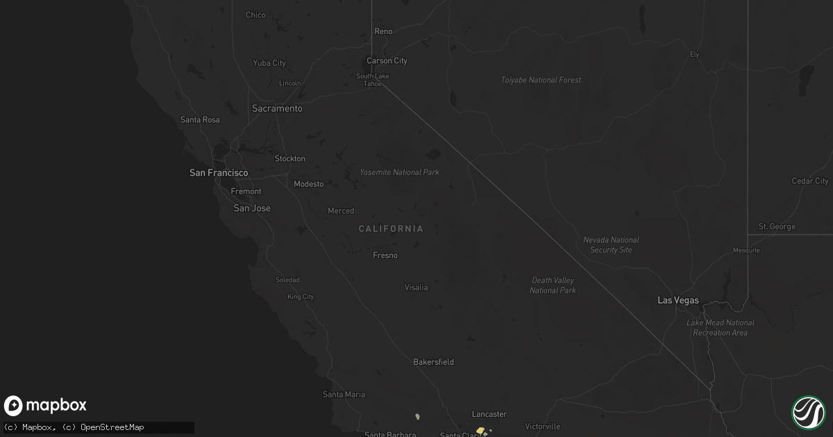
Hail Map in California on July 30, 2015
Get this storm
July 30 map
$229
one time, instant access
Download today. No call, no setup
Keep the $229
Bought the map and want the full workflow? Apply the entire $229 to a subscription within 7 days. None of it is wasted.
Every map, not just this one
This buys you this map. Subscription and you get every map we run, in the markets you choose from a few cities to whole states to nationwide. Plus real-time alerts the moment a storm fires.
Contact data
Name, contact info, occupancy, even credit band for addresses in the footprint. You go from where it hit to who to call.
Become the source they trust
Unlimited branding weather history reports on demand. You already have the documented answer ready for the property owner, and you are the one who showed up with it.
Property data and RoofTrace estimates
Pull up any address you have got, its value and the exact code rules for that jurisdiction, straight from One Click Code. Then RoofTrace estimates the squares, pitch, and roof value, priced the way you price.
Storm reports in California
California
| Date | Description |
|---|---|
| 07/29/201510:15 PM CDT | Followup info on the thunderstorm wind damage event last evening in palm desert: photos shared by local media outlet indicate a downburst/microburst was likely the caus |
| 07/29/20157:45 PM CDT | Tree was blocking the road at san timoteo canyon rd. And redlands blvd. |
| 07/29/20157:38 PM CDT | Power lines are down and trees are blocking the roadway. San timoteo canyon road. |
| 07/29/20157:05 PM CDT | Power lines downed and individuals were trapped in their car. Oak glen and cherry valley road. |
All States Impacted by Hail Map on July 30, 2015
Cities Impacted by Hail Map on July 30, 2015
- Las Cruces, NM
- Yuma, CO
- Otis, CO
- Acton, CA
- Santa Clarita, CA
- West Point, NE
- Leesville, LA
- New Llano, LA
- New Iberia, LA
- Akron, CO
- San Augustine, TX
- Lufkin, TX
- Boise City, OK
- Cuthbert, GA
- Blakely, GA
- Boles, AR
- Kirbyville, TX
- Call, TX
- Fisher, LA
- Florien, LA
- Many, LA
- Saint Francisville, LA
- Redlands, CA
- Calimesa, CA
- Beaumont, CA
- Hoyt Lakes, MN
- Lemoyne, NE
- Arthur, NE
- Owasso, OK
- Port Allen, LA
- Oscar, LA
- Anton, CO
- Omaha, NE
- Bellevue, NE
- Offutt Afb, NE
- Papillion, NE
- Coffeeville, AL
- Thomasville, AL
- Glynn, LA
- Kirk, CO
- Joes, CO
- Aurora, MN
- Livingston, LA
- Kaplan, LA
- Abbeville, LA
- Amite, LA
- Kentwood, LA
- Woodville, MS
- Cameron, LA
- Okemah, OK
- Coweta, OK
- Wagoner, OK
- Bradley, AR
- Taylor, AR
- Lewisville, AR
- Ellisville, MS
- Moselle, MS
- Seminary, MS
- Erwinville, LA
- Mendenhall, MS
- Stratton, CO
- Oakland, NE
- Columbia, MS
- Shubuta, MS
- Bogue Chitto, MS
- Howe, OK
- Kress, TX
- Brimson, MN
- Livingston, TX
- Irvington, AL
- Pattison, MS
- Jackson, LA
- Pine Apple, AL
- Camden, AL
- La Vista, NE
- Grayson, LA
- Milton, FL
- Welsh, LA
- Springhill, LA
- Palmdale, CA
- Ringold, OK
- Lacassine, LA
- Troy, AL
- Eufaula, OK
- Minden, LA
- Fairburn, GA
- Atlanta, GA
- Jay, FL
- Lacombe, LA
- Waynesboro, MS
- Poteau, OK
- Wilburton, OK
- Jayess, MS
- Mena, AR
- Oden, AR
- Denham Springs, LA
- Norman, AR
- Maricopa, CA
- Poplarville, MS
- Keota, OK
- Sallisaw, OK
- Venango, NE
- Emerson, NE
- Liberty, MS
- Idyllwild, CA
- Mountain Center, CA
- Gloster, MS
- Centreville, MS
- Umpire, AR
- Shellman, GA
- Broken Arrow, OK
- Moreno Valley, CA
- Cotton Valley, LA
- Robertsdale, AL
- Cope, CO
- Pinola, MS
- Hattiesburg, MS
- Marksville, LA
- Earth, TX
- Eglin Afb, FL
- Buena Vista, GA
- Mauk, GA
- Saratoga, TX
- Happy, TX
- Sylmar, CA
- Bassfield, MS
- Gilbertown, AL
- Zachary, LA
- Bell City, LA
- Erath, LA
- Lottie, LA
- Claremore, OK
- Pender, NE
- Fort Hancock, TX
- Lake Arthur, LA
- Blair, NE
- Scribner, NE
- Repton, AL
- Frisco City, AL
- Bogalusa, LA
- Baton Rouge, LA
- Petal, MS
- Batavia, IA
- Libertyville, IA
- Fairfield, IA
- Brule, NE
- Bancroft, NE
- Colton, CA
- De Queen, AR
- Bastrop, LA
- Sterlington, LA
- Monroe, LA
- Isabella, MN


