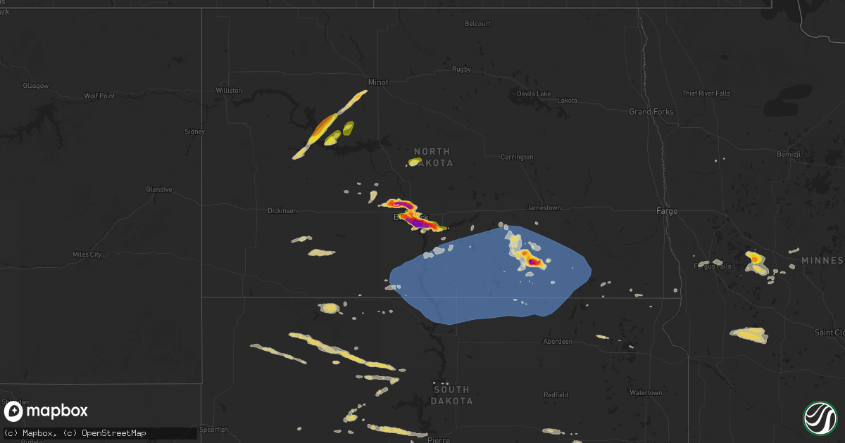
Hail Map on July 29, 2024
Get this storm
July 29 map
$229
one time, instant access
Download today. No call, no setup
Keep the $229
Bought the map and want the full workflow? Apply the entire $229 to a subscription within 7 days. None of it is wasted.
Every map, not just this one
This buys you this map. Subscription and you get every map we run, in the markets you choose from a few cities to whole states to nationwide. Plus real-time alerts the moment a storm fires.
Contact data
Name, contact info, occupancy, even credit band for addresses in the footprint. You go from where it hit to who to call.
Become the source they trust
Unlimited branding weather history reports on demand. You already have the documented answer ready for the property owner, and you are the one who showed up with it.
Property data and RoofTrace estimates
Pull up any address you have got, its value and the exact code rules for that jurisdiction, straight from One Click Code. Then RoofTrace estimates the squares, pitch, and roof value, priced the way you price.
States Impacted by Hail Map on July 29, 2024
Storm reports
Wisconsin
| Date | Description |
|---|---|
| 07/29/20245:44 PM CDT | Reported 3 trees blown down on county hwy v. There was also a report of a power line blown down too... But it was unclear whether the trees took down the power line or |
North Dakota
| Date | Description |
|---|---|
| 07/29/20246:56 PM CDT | Radar estimated time. |
| 07/29/20246:48 PM CDT | Hail was ongoing when call came in at 653 pm. |
| 07/29/20246:38 PM CDT | Relayed via social media. |
| 07/29/20246:35 PM CDT | Multiple baseball-sized hailstones shown in a photo relayed via social media... Fell around 6:35. |
| 07/29/20246:35 PM CDT | Relayed via social media. |
| 07/29/20246:30 PM CDT | Relayed via social media. |
| 07/29/20246:30 PM CDT | A local report indicates 1.75 inch wind near 3 S Bismarck |
| 07/29/20246:27 PM CDT | A local report indicates 1.25 inch wind near 3 S Bismarck |
| 07/29/20246:25 PM CDT | Public photo relayed through broadcast media. There is a ruler in the picture. |
| 07/29/20246:19 PM CDT | Hail caused numerous dents in vehicle. |
| 07/29/20246:18 PM CDT | Lasted almost 15 minutes. A lot of gold ball size hail. |
| 07/29/20246:15 PM CDT | Fell between 6:15 to 6:25 pm cdt. Retired nws employee. |
| 07/29/20246:15 PM CDT | Most hail smaller than 1.25 inch diameter. Hail still falling with a few stones as large as 1.25 inch diameter at the time this report is being sent. |
| 07/29/20246:12 PM CDT | Report from mping: quarter |
| 07/29/20246:12 PM CDT | Mixed with nickel sized hail... Hail continuing at the time of the report. |
| 07/29/20246:06 PM CDT | Time estimated from radar. Photo shared on social media shows numerous large hailstones with the largest estimated to be 2 inches in diameter. |
| 07/29/20246:00 PM CDT | Mesonet station tt584 12 e mott. |
| 07/29/20245:59 PM CDT | Mainly penny sized hail with a few quarters mixed in. |
| 07/29/20245:49 PM CDT | Lasted until 558 pm. |
| 07/29/20245:46 PM CDT | Retired nws employee report. |
| 07/29/20245:45 PM CDT | Relayed via social media. |
| 07/29/20245:45 PM CDT | Hail fell for around 5 minutes overall... Along with 0.36 inches of rainfall. Relayed via social media. |
| 07/29/20245:45 PM CDT | A local report indicates 2.50 inch wind near 7 NNE Mandan |
| 07/29/20245:45 PM CDT | Fell for roughly 15 minutes. |
| 07/29/20245:45 PM CDT | Near solheim school. Lasted about 10 minutes. Then it ended and smaller hail started again. Still occasional hail stones falling until 618 pm. |
| 07/29/20245:43 PM CDT | A local report indicates 1.75 inch wind near 7 S Baldwin |
| 07/29/20245:40 PM CDT | Relayed via social media. |
| 07/29/20245:10 PM CDT | Report relayed by broadcast media. Time estimated from radar. |
| 07/29/20245:10 PM CDT | Pea to golf ball size hail at harmon lake. Report relayed by broadcast media. Time estimated from radar. |
| 07/29/20245:05 PM CDT | Called in report from a ham radio operator. |
| 07/29/20245:00 PM CDT | Mostly dime sized hail with a few quarters mixed in... Lots of rain. |
| 07/29/20244:55 PM CDT | Also had 60 mph wind and lots of rain. Reported damage to corn plants. |
| 07/29/202412:41 AM CDT | Corrects previous to change event type to thunderstorm wind gust. Report from 4 nnw fargo. Asos station kfar fargo ap nd. |
| 07/29/202412:34 AM CDT | Measured gust at fargo airport asos. |
| 07/28/202410:55 PM CDT | Awos station k2d5 oakes nd awos. |
| 07/28/20249:55 PM CDT | Measured 10 meter wind gust at ndawn station wirch 7 northwest. |
| 07/28/20249:11 PM CDT | A local report indicates 1.00 inch wind near 6 ESE Mercer |
| 07/28/20249:06 PM CDT | Four campers were rolled over at mckenna lake. Estimated wind speeds of 75 mph. |
| 07/28/20248:58 PM CDT | Personal weather station measured wind gust. |
| 07/28/20248:49 PM CDT | Personal weather station measured wind gust. |
| 07/28/20248:16 PM CDT | Lots of pea to quarter sized hail with a few golf balls. Crops damaged in the area. Radar estimated time. |
| 07/28/20248:09 PM CDT | 1.3 inches of total rain. Radar estimated time for hail. |
| 07/28/20247:55 PM CDT | Highest wind lasted just a minute or two. No hail. |
| 07/28/20247:30 PM CDT | Photos from social media show large hailstones next to a baseball. |
| 07/28/20247:07 PM CDT | Social media images of baseball size hail near menoken. |
Alabama
| Date | Description |
|---|---|
| 07/29/20245:52 PM CDT | A few trees blown down in the cedar bluff area. |
| 07/29/20245:47 PM CDT | 600 customers in dekalb county were reported without power in the sylvania and geraldine communities due to downed trees and powerlines. |
| 07/29/20245:29 PM CDT | Few trees down in the broomtown area. |
| 07/29/20245:02 PM CDT | 800 customers were reported without power across jackson county due to downed trees and powerlines. |
| 07/29/20244:54 PM CDT | A tree fell on a car on highway 75 just north of highway 40 near henagar. Thankfully... No injuries were reported. |
| 07/29/20244:50 PM CDT | One inch tree limbs broken off of trees and shingles blown off of a roof were reported at this location. M-ping report. |
| 07/29/20244:47 PM CDT | 200 customers were reported without power from flat rock to the south southwest of that location near the dekalb/jackson county line due to down trees and powerlines in |
| 07/29/20244:43 PM CDT | A tree was reported down at the intersection of windsor road and hood avenue. |
| 07/29/20244:43 PM CDT | A tree was reported down at the intersection of moody ridge road and snodgrass road. |
| 07/29/20244:35 PM CDT | One inch tree limbs were reported broken off of trees at this locations and some shingles were blown off of a roof. M-ping report. |
| 07/29/20244:33 PM CDT | A tree was reported down at the intersection of cr 237 and church street. |
Nebraska
| Date | Description |
|---|---|
| 07/29/20243:00 AM CDT | Accompanied by a heat burst with a temperature of 94f and 14 percent humidty. |
| 07/29/20242:06 AM CDT | Accompanied by a heat burst with a temperature of 93f and a dew point of 29f. |
| 07/29/202412:44 AM CDT | Reported at ktqe. |
| 07/28/202411:36 PM CDT | Several large tree branches downed around south sioux city... With some laying on vehicles or residential structures. |
| 07/28/202411:16 PM CDT | Emergency manager reported power line down in carroll... Ne. |
| 07/28/202411:14 PM CDT | 10 to 12 inch diameter tree branches broken out of trees... Some maybe bigger. Estimates 70 mph or higher wind gusts. |
| 07/28/202411:10 PM CDT | A layer of shingles was peeled off the roof of a single family home. Time estimated from radar. |
| 07/28/202411:05 PM CDT | Numerous tree limbs blown down. Time estimated from radar. |
| 07/28/202411:00 PM CDT | Report via social media of large tree down across back deck. |
| 07/28/202410:55 PM CDT | Tree limbs blown down. Time estimated from radar. |
| 07/28/202410:55 PM CDT | 3 inch branches down in the town of wynot... Ne. |
| 07/28/202410:40 PM CDT | A local report indicates 63 MPH wind near 1 E Fordyce |
| 07/28/202410:38 PM CDT | A local report indicates 71 MPH wind near 1 SW Hartington |
| 07/28/202410:08 PM CDT | A local report indicates 1.00 inch wind near 3 W Burton |
| 07/28/20249:40 PM CDT | Numerous 4 to 6 inch diameter limbs down at this location. Winds estimated at 60 mph. |
| 07/28/20248:27 PM CDT | Hail reported as larger than golf ball size and submitted pictures. |
| 07/28/20248:20 PM CDT | Report of nickel to quarter size hail. |
| 07/28/20248:13 PM CDT | Ground white with hail up to golf ball size. |
| 07/28/20247:56 PM CDT | Golf ball size hail currently falling at this location. |
| 07/28/20247:22 PM CDT | Spotter reports some quarter size hail though mostly dime to nickel size. |
Indiana
| Date | Description |
|---|---|
| 07/29/20241:05 AM CDT | Trees down on mosquito creek rd near rt 111. |
| 07/28/202411:40 PM CDT | Several trees downed south of bedford. Time estimated from radar. |
| 07/28/202411:36 PM CDT | Trees downed near the intersection of cr 158 and cr 458. |
| 07/28/202410:45 PM CDT | Tree downed near cr 735r and cr 715n. |
| 07/28/20249:55 PM CDT | Several trees downed on pleasant run. |
| 07/28/20249:48 PM CDT | Several trees down. |
| 07/28/20249:33 PM CDT | Limbs down and scattered over 100ft. A 4.5 ton ac unit lifted off of base and found lying on its side... Ac unit components found 35 feet away. |
| 07/28/20249:33 PM CDT | Mping report of minor wind damage. |
| 07/28/20249:33 PM CDT | Mping report of minor wind damage. |
| 07/28/20248:59 PM CDT | Several trees knocked down. |
| 07/28/20248:48 PM CDT | Several trees knocked down. Damage to property. Possible tornado. |
| 07/28/20248:47 PM CDT | Possible tornado damage to frankton-lapel school administration building and adjacent school buses east of perkinsville along cr 300 n. |
| 07/28/20248:41 PM CDT | Nws survey determined an ef2 tornado with peak winds of 130 mph and a path length of 3.04 miles began at this location. |
| 07/28/20248:40 PM CDT | Possible tornado damage to wood framed building with metal siding along strawtown avenue near perkinsville. Damage continued into madison county. |
| 07/28/20248:14 PM CDT | Minor trees/power lines reported down in the area. Time estimated from radar. |
| 07/28/20248:10 PM CDT | Minor trees/power lines reported down in the area. Time estimated from radar. |
| 07/28/20247:26 PM CDT | Several reports of downed trees in the new castle area. |
Minnesota
| Date | Description |
|---|---|
| 07/29/20245:49 AM CDT | Half dollar to ping pong size hail. |
| 07/29/20241:10 AM CDT | Public report and picture of flattened corn as a result of thunderstorm wind gusts early morning july 30 2024 near french mn west of fergus falls mn. Time estimated fro |
Florida
| Date | Description |
|---|---|
| 07/29/202412:30 PM CDT | Public reported minor tree damage and fence damage near pembroke road associated with a strong thunderstorm. |
Maryland
| Date | Description |
|---|---|
| 07/29/20246:58 PM CDT | Multiple mping reports around i-95 at white marsh for one inch diamter hail. |
| 07/29/20246:28 PM CDT | Power lines down due to thunderstorm winds at the intersection of solley road and mountain road. |
| 07/29/20246:24 PM CDT | Power lines down due to thunderstorm winds along the 4300 block of baltimore-annapolis boulevard. |
| 07/29/20244:15 PM CDT | Several trees and large tree limbs blew down blocking several roads near seneca just north of the potomac river. |
South Dakota
| Date | Description |
|---|---|
| 07/29/20246:40 PM CDT | A local report indicates 63 MPH wind near 7 SSE Meadow |
| 07/29/20246:35 PM CDT | A local report indicates 1.00 inch wind near 7 E Lakeview |
| 07/29/20246:30 PM CDT | Quarter to golf ball sized hail - time estimated by radar. |
| 07/29/20246:25 PM CDT | A local report indicates 1.00 inch wind near 11 NNE White River |
| 07/29/20246:24 PM CDT | Gulf ball size hail. |
| 07/29/20246:22 PM CDT | A local report indicates 68 MPH wind near 10 NNE White River |
| 07/29/20246:19 PM CDT | Reports of broken windows due to hail. |
| 07/29/20246:15 PM CDT | A local report indicates 1.50 inch wind near 9 N White River |
| 07/29/20246:15 PM CDT | Hail sized 3/8 to 1/2 inch completely covering road for close to a mile. |
| 07/29/20246:11 PM CDT | Tree branches broken |
| 07/29/20245:53 PM CDT | Broke a window on the house. |
| 07/29/20245:50 PM CDT | Part of a metal fence with wooden posts blown over. Vegetation was laid down from wind. |
| 07/29/20245:45 PM CDT | Shredded leaves... Car dents... Damaged shingles... Broken car windows. |
| 07/29/20245:45 PM CDT | A local report indicates 62 MPH wind near 9 ENE Belvidere |
| 07/29/20245:44 PM CDT | Campers and motorcycles blown over on i-90. |
| 07/29/20245:35 PM CDT | A local report indicates 63 MPH wind near 9 ENE Belvidere |
| 07/29/20245:30 PM CDT | A local report indicates 1.00 inch wind near 4 S Midland |
| 07/29/20245:25 PM CDT | A local report indicates 60 MPH wind near 1 NE Midland |
| 07/29/20245:05 PM CDT | A local report indicates 1.25 inch wind near 9 W Midland |
| 07/29/20246:11 AM CDT | A local report indicates 1.00 inch wind near 2 W Reliance |
| 07/29/20244:52 AM CDT | 3 to 6 inches branches down. |
| 07/29/20244:46 AM CDT | 8-12 inch diameter branch snapped off. Time estimated based on radar. |
| 07/29/20243:12 AM CDT | Reports of ping pong ball to golf ball size hail in salem. Time estimated from radar. |
| 07/28/202411:34 PM CDT | Personal weather station. |
| 07/28/202411:24 PM CDT | Personal weather station. |
| 07/28/202411:22 PM CDT | Large tree branch downed in richland. Time estimated from radar. |
| 07/28/202411:03 PM CDT | Tree downed in vermillion. Time estimated from radar. |
| 07/28/202411:03 PM CDT | Multiple trees and large branches down across southeast vermillion. Time estimated from radar. |
| 07/28/202410:36 PM CDT | Awos station kykn yankton municipal airport. |
| 07/28/202410:07 PM CDT | Report of considerable tree damage in springfield. Winds estimated at 60 mph. Report from social media. |
| 07/28/20249:37 PM CDT | Personal weather station. |
| 07/28/20249:30 PM CDT | Mesonet station psts2 parkston |
| 07/28/20249:25 PM CDT | Mesonet station psts2 parkston |
| 07/28/20249:21 PM CDT | Mesonet station 26 sd rwis tripp. |
| 07/28/20249:07 PM CDT | Mesonet station 244 sd rwis ft. Randall dam. |
| 07/28/20249:05 PM CDT | Mesonet station dvi09260 armour. |
| 07/28/20249:01 PM CDT | Personal weather station. |
| 07/28/20249:01 PM CDT | Mesonet station 50 herreid |
| 07/28/20249:01 PM CDT | Uprooted cottonwood tree. |
| 07/28/20249:01 PM CDT | Mesonet station 304 sd rwis corsica. |
| 07/28/20248:56 PM CDT | Mesonet station 304 sd rwis corsica. |
| 07/28/20248:51 PM CDT | Mesonet station 50 herreid |
| 07/28/20248:50 PM CDT | Numerous trees down on the north side of aurora. |
| 07/28/20248:50 PM CDT | Numerous trees down on the north side of armour. |
| 07/28/20248:47 PM CDT | Personal weather station. |
| 07/28/20248:40 PM CDT | Roof decking removed on the southwest corner of a shouse and tossed one quarter mile to the southeast. Time estimated from radar. |
| 07/28/20248:29 PM CDT | Large cottonwood tree fell on pickup and numerous large branches down around the yard. Time estimated based on radar. |
| 07/28/20247:55 PM CDT | A local report indicates 61 MPH wind near 4 NNE Colome |
| 07/28/20247:40 PM CDT | Drive-in theatre screen destroyed at the winner drive in. Time estimated. |
| 07/28/20247:40 PM CDT | Numerous reports of wind damage in and around winner. Around a dozen power poles down. |
| 07/28/20247:27 PM CDT | A local report indicates 84 MPH wind near 4 SSE Witten |
| 07/28/20247:17 PM CDT | A local report indicates 79 MPH wind near 4 SSE Witten |
Ohio
| Date | Description |
|---|---|
| 07/29/202412:56 AM CDT | Tree down across roadway. |
| 07/29/202412:55 AM CDT | Tree down in roadway. |
| 07/29/202412:55 AM CDT | Several trees down. |
| 07/29/202412:55 AM CDT | Numerous large limbs down. |
| 07/29/202412:55 AM CDT | Tree down along with powerlines. |
| 07/29/202412:54 AM CDT | Two trees were downed at a residence on sr 350. Time estimated from radar. |
| 07/29/202412:53 AM CDT | Tree down across road and one electric pole snapped. Road impassable. |
| 07/29/202412:50 AM CDT | Tree down across roadway. |
| 07/29/202412:49 AM CDT | Tree in roadway. |
| 07/29/202412:47 AM CDT | Many trees down on edwardsville road. |
| 07/29/202412:46 AM CDT | Trees down and damage to roof of residence. Trees also down on surrounding properties. Possible tornado. |
| 07/29/202412:46 AM CDT | Middleboro road closed near starkey clevenger road due to downed trees and power lines. Time estimated from radar. |
| 07/29/202412:45 AM CDT | Extensive damage to a barn. Possible tornado. |
| 07/29/202412:40 AM CDT | Ef1 tornado confirmed via nws storm survey. Large tree and structure damage. Estimated maximum wind speed up to 95 mph. Estimated track length 8.1 miles. |
| 07/29/202412:35 AM CDT | Tree down on residence. |
| 07/28/202410:00 PM CDT | 12-inch branch down from healthy tree. Time estimated from radar. |
| 07/28/20249:40 PM CDT | Corrects previous flash flood report from 2 wsw camden. Trees down on dillman road. Time estimated from radar. |
Missouri
| Date | Description |
|---|---|
| 07/29/20244:54 AM CDT | Delayed report and time estimated from radar. Many tree limbs down. |
| 07/29/20244:05 AM CDT | Snapped a 3-4 inch tree... And relocated small yrd items. |
Arizona
| Date | Description |
|---|---|
| 07/28/20249:20 PM CDT | Photo on social media showing blown down 12 by 20 foot metal gazebo. Timing estimated by radar. |
| 07/28/20249:16 PM CDT | Severe weather damaged equipment leaving roughly 50 people without power. |
| 07/28/20247:36 PM CDT | Downed power lines causing power outage to roughly 20 people. |
| 07/28/20247:14 PM CDT | Equipment damage due to weather caused power outage. |
Virginia
| Date | Description |
|---|---|
| 07/29/20245:16 PM CDT | One tree down due to thunderstorm winds along the 4300 block of columbia pike. |
| 07/29/20245:16 PM CDT | One tree down due to thunderstorm winds along the 5000 block of 11th street. |
| 07/29/20245:00 PM CDT | One tree down due to thunderstorm winds at the intersection of old columbia pike and whispering lane. |
| 07/29/20245:59 AM CDT | Report from mping: 1-inch tree limbs broken; shingles blown off. |
Georgia
| Date | Description |
|---|---|
| 07/29/20246:58 PM CDT | 5 trees down on roadways in villa rica city limits. |
| 07/29/20246:56 PM CDT | A tree was downed onto power lines on ray cole rd near the ray cole rd extension. |
| 07/29/20246:56 PM CDT | A power line fell into the roadway on mckeown rd at millertown rd. |
| 07/29/20246:52 PM CDT | Several trees were reported down in the area of harmony rd at millertown rd... Some of which temporarily blocked roadways. |
| 07/29/20246:50 PM CDT | A tree was downed onto power lines in the 7000 block of mountain ridge se. |
| 07/29/20246:49 PM CDT | Three trees reported down on roadways in temple city limits. |
| 07/29/20246:47 PM CDT | Tree down at tyson road and hwy 92. |
| 07/29/20246:40 PM CDT | A tree was downed onto power lines on mission rd sw at road 2 sw. |
| 07/29/20246:40 PM CDT | A tree fell onto power lines on hickory hollow sw. |
| 07/29/20246:35 PM CDT | A tree fell onto power lines on kingston hwy nw at hamilton crossing rd nw. |
| 07/29/20246:20 PM CDT | A power line was downed along richard pullen rd. |
| 07/29/20246:15 PM CDT | A tree was downed onto power lines on 2 run crossing nw. |
| 07/29/20246:15 PM CDT | Tree down on lake creek road between drummond road and cantrell loop. |
| 07/29/20246:12 PM CDT | Tree down at highway 80 east and bentley road. |
| 07/29/20246:11 PM CDT | Power poles broken at davis rd w and ga 53 w. |
| 07/29/20246:10 PM CDT | A tree was downed in the 1000 block of flint hill road. |
| 07/29/20246:10 PM CDT | A tree was downed in the 1300 block of yarbrough road. |
| 07/29/20246:06 PM CDT | Multiple trees down in the trion area. |
| 07/29/20246:06 PM CDT | Tree down at burnett circle sw and burnett ferry road sw. |
| 07/29/20245:40 PM CDT | Tree down at highland avenue and hawkins drive. |
| 07/29/20245:33 PM CDT | Multiple trees down across menlo. |
| 07/29/20245:29 PM CDT | Tree and powerlines down at n thornton ave and w tyler street. |
| 07/29/20245:25 PM CDT | Trees down on power lines along duvall road. |
| 07/29/20245:25 PM CDT | Trees down on powerlines along bettis road. |
| 07/29/20245:19 PM CDT | Powerlines down on ellijay street between highway 225s and clarence ridley pkwy. |
| 07/29/20245:19 PM CDT | Multiple trees and powerlines down in varnell. |
| 07/29/20245:15 PM CDT | Powerlines down at mount pleasant road and cohutta beaverdale road. |
| 07/29/20244:15 PM CDT | Tree uprooted at west greene street and wilkinson street. |
| 07/28/20248:42 PM CDT | Large tree down at rowe road and hutchinson road. |
| 07/28/20248:15 PM CDT | Utility lines were reported down along terrace street. |
| 07/28/20248:15 PM CDT | A tree fell onto the 1300 block of df fuller drive. |
| 07/28/20248:10 PM CDT | A tree was downed in the roadway in the 400 block of n. Pine hill road. |
| 07/28/20248:00 PM CDT | A tree fell across the 1200 block of vaughn road. |
| 07/28/20247:58 PM CDT | Wires down at tara blvd and winding way lane. |
| 07/28/20247:44 PM CDT | Tree down on highway 42 s between marshall mill road and bryant road. |
| 07/28/20247:44 PM CDT | Tree down on home near the intersection of caribou trail and salem place. |
| 07/28/20247:35 PM CDT | Tree down on i-85 sb at jonesboro road. |
| 07/28/20247:35 PM CDT | Powerlines down at hemphill st and john calvin ave. |
| 07/28/20247:30 PM CDT | Tree down at south fulton parkway and mason rd. |
| 07/28/20247:25 PM CDT | Tree down on roscoe road near phillips street. |
| 07/28/20247:24 PM CDT | One tree reported down along donnie harper road as reported by 911 call center. |
| 07/28/20247:21 PM CDT | Tree down on girl scout road near welcome-to-arnco road. |
| 07/28/20247:21 PM CDT | Tree down at reynolds rd and boat rock rd. |
| 07/28/20247:16 PM CDT | Tree down at reynolds road and campbellton road. |
| 07/28/20247:12 PM CDT | Large tree down blocking road near intersection of bomar road and whisper court. |
| 07/28/20247:10 PM CDT | Powerlines down along mason creek road just south of cowan mill road. |
| 07/28/20247:08 PM CDT | Several trees down blocking miller way. Also... Powerlines down. |
| 07/28/20247:03 PM CDT | Two trees on road near the intersection of hwy 16 and harper lane. |
| 07/28/20247:03 PM CDT | Tree down at intersection of woodstock road and leita thompson road. |
| 07/28/20247:03 PM CDT | Tree down at west hwy 166 and sunrise circle. |
| 07/28/20247:03 PM CDT | Tree down on road at intersection of beulah church road and old breman road. |
| 07/28/20247:03 PM CDT | Corrects previous tstm wnd dmg report from 2 nw mount zion. Tree down on road near the intersection of hwy 16 and harper lane. |
| 07/28/20247:03 PM CDT | Corrects previous tstm wnd dmg report from carrollton. 7 trees down on roadways in carollton city limits. |
Illinois
| Date | Description |
|---|---|
| 07/29/20246:34 AM CDT | Estimated 50-60 mph winds around marietta. |
| 07/29/20246:19 AM CDT | A local report indicates 65 MPH wind near 4 E Fandon |
| 07/29/20241:35 AM CDT | Late report. Trees and power lines down. Portable car port lifted up and wrapped around a garage. One house had some soffit damage. |
| 07/29/202412:10 AM CDT | Trees down along with some power lines in benton. Time estimated from radar. |
| 07/28/202411:25 PM CDT | Tree limbs down along highway 141 near new haven. Reported by saline county ema director. Time estimated from radar. |
| 07/28/202411:11 PM CDT | A large tree was blown down in ashley. |
| 07/28/202410:51 PM CDT | A couple of large trees blown down north of hoyleton. |
| 07/28/20249:50 PM CDT | Trees down in the roadway and reports of power lines down near dix. |
| 07/28/20249:33 PM CDT | Along highway 50 near the marion county line. |
| 07/28/20249:20 PM CDT | Strong winds all over town. Power lines and traffic lights blown over. Trees downed onto houses. |
| 07/28/20249:19 PM CDT | Business lost its roof on west side of town at intersection of us 50 and selmaville road. |
| 07/28/20249:17 PM CDT | Multiple reports on trees on houses and power lines down. |
| 07/28/20249:15 PM CDT | Small tree limbs snapped. Time estimated from radar. |
| 07/28/20249:00 PM CDT | Minor tree limb damage reported. |
| 07/28/20248:45 PM CDT | Storm chasers reported a rope tornado west of alhambra. |
Kentucky
| Date | Description |
|---|---|
| 07/29/20242:40 AM CDT | Trees down on new haven rd near nat rogers rd. |
| 07/29/20242:34 AM CDT | A local report indicates 61 MPH wind near 1 ESE Lewisburg |
| 07/29/20241:30 AM CDT | Trees down all along olin rd. |
| 07/29/20241:25 AM CDT | Power lines down near weldon rd and old mill rd. |
| 07/29/20241:21 AM CDT | Reports of power poles down around lee villa ct and off hwy 44 w in shepherdsville along with power outages. |
| 07/29/20241:20 AM CDT | Several trees down on hickory ridge between ditto road and kings highway in waddy. |
| 07/29/202412:49 AM CDT | Report of trees down on a car and possible cabin around abes country village. |
Tennessee
| Date | Description |
|---|---|
| 07/29/20244:15 PM CDT | Reports of trees and powerlines down on hamby rd and also mowbray pike rd. Water also covering roadway on thatcher rd. |
| 07/29/20244:07 PM CDT | Several trees and powerlines down across the entire county. |
| 07/29/20243:52 PM CDT | A large portion of a tree was uprooted at this location. |
| 07/29/20243:45 PM CDT | A tree was reported down on camper creek road near old huntsville road. |
| 07/29/20243:18 PM CDT | A tree limb was reported down on the road at this location near the intersection of hurricane creek road and cobb hollow road. |
| 07/29/20243:15 PM CDT | Tspotter report of tree down across hwy 269 just north of ralph broadrick rd. |
| 07/29/20243:15 PM CDT | Tspotter report of tree down across hwy 269 just north of ralph broadrick rd. |
| 07/29/20243:14 PM CDT | A tree was reported across the road at this location on old shelbyville highway. |
| 07/29/20242:30 PM CDT | Trees snapped on academy st. |
| 07/29/20242:29 PM CDT | Trees down on haley road. |
| 07/29/20242:28 PM CDT | Tree down on maney st at burton st. |
| 07/29/20242:28 PM CDT | Tspotter report of several trees and traffic lights blown down on old fort parkway. |
| 07/29/20242:27 PM CDT | Tspotter photo showed truck overturned and trees down at mtsu stadium. |
| 07/29/20242:27 PM CDT | Social media reports of numerous trees down across the mtsu campus. |
| 07/29/20242:25 PM CDT | Tspotter report of trees down around the oaklands mansion. |
| 07/29/20242:17 PM CDT | Tspotter photo of part of siding blown off house near i-24 and i-840 in blackman area. |
| 07/29/20242:15 PM CDT | Trees reported down near i-24 in smyrna. |
| 07/29/20246:30 AM CDT | Several trees down. |
| 07/29/20246:15 AM CDT | Trees down. |
District of Columbia
| Date | Description |
|---|---|
| 07/29/20245:25 PM CDT | One tree down due to thunderstorm winds along the 2400 block of 20th street northwest. |
North Carolina
| Date | Description |
|---|---|
| 07/29/20243:30 PM CDT | Power lines down with a fire on scene. |
Vermont
| Date | Description |
|---|---|
| 07/29/20244:50 PM CDT | A local report indicates 1.25 inch wind near North Clarendon |
Iowa
| Date | Description |
|---|---|
| 07/29/20245:47 AM CDT | Asos. |
| 07/29/20245:39 AM CDT | Delayed report via social media and time estimated from radar. Tree limbs down. |
| 07/29/20245:23 AM CDT | Power lines down at the farm. |
| 07/29/20245:10 AM CDT | Tree limbs down in keosauqua and trees down at lacey state park southwest of keosauqua. Delayed report. |
| 07/29/20245:07 AM CDT | Tree down east of vine ave blocking road... Delayed report. Time estimated from radar. |
| 07/29/20244:38 AM CDT | Delayed report via social media. Several tree limbs down. Largest was 18 inches. |
| 07/29/20244:30 AM CDT | Corrects previous tstm wnd gst report from 4 se kirkville. Kotm asos. |
| 07/29/20244:28 AM CDT | Kotm asos. |
| 07/29/20244:02 AM CDT | Numerous 4+ inch tree limbs down in town. Delayed report... Time estimated. |
| 07/29/20243:59 AM CDT | Personal weather station. |
| 07/29/20243:45 AM CDT | Relayed report of extensive tree damage in harvey. Time estimated from radar. |
| 07/29/20243:35 AM CDT | A local report indicates 66 MPH wind near 3 W Chariton |
| 07/29/20242:50 AM CDT | Report of trees down and a few broken windows at residence. |
| 07/29/20242:47 AM CDT | Personal weather station. |
| 07/29/20242:47 AM CDT | A local report indicates 59 MPH wind near Des Moines Int Airport |
| 07/29/20241:50 AM CDT | Estimated gusts of 55 to 60 mph with heavy rain. |
| 07/29/20241:27 AM CDT | Personal weather station. |
| 07/29/20241:14 AM CDT | Delayed report. Multiple branches up to 6 inches down across town. One larger 12 inch branch down. Flattened corn outside of town. Time estimated from radar. |
| 07/29/20241:12 AM CDT | Public weather station. |
| 07/29/202412:45 AM CDT | Multiple large tree branches downed in aurelia. Time estimated from radar. |
| 07/29/202412:37 AM CDT | Large tree branches downed in cherokee. Time estimated from radar. |
| 07/29/202412:22 AM CDT | Large evergreen tree downed in marcus. Time estimated from radar. |
| 07/29/202412:21 AM CDT | Tree branches downed in quimby. Time estimated from radar. |
| 07/29/202412:08 AM CDT | Several snapped trees at c60 and tamarack avenue. Time estimated from radar. |
| 07/29/202412:08 AM CDT | Large tree branch downed in smithland. Time estimated from radar. |
| 07/29/202412:06 AM CDT | Large tree branch downed in pierson. Time estimated from radar. |
| 07/29/202412:05 AM CDT | A local report indicates 61 MPH wind near 5 NW Whiting |
| 07/29/202412:02 AM CDT | Personal weather station. |
| 07/29/202412:00 AM CDT | Trees and some power lines downed in kingsley. Time estimated from radar. |
| 07/28/202411:55 PM CDT | Lots of tree damage in town. Northwest side of le mars without power. Time estimated via radar. |
| 07/28/202411:55 PM CDT | Awos station klrj le mars airport. |
| 07/28/202411:55 PM CDT | Picture via social media of a large tree down across the intersection of 24th and jones street. Time estimated via radar. |
| 07/28/202411:52 PM CDT | Corrects previous tstm wnd gst report from 2 sw sergeant bluff. Asos station ksux sioux gateway airport. |
| 07/28/202411:52 PM CDT | Semi truck trailer overturned in parking lot. Time estimated from radar. |
| 07/28/202411:46 PM CDT | Personal weather station. |
| 07/28/202411:46 PM CDT | Asos station ksux sioux gateway airport. |
| 07/28/202411:46 PM CDT | Large tree branches down in merrill. Time estimated from radar. |
| 07/28/202411:44 PM CDT | Mesonet station ap032 sioux city. |
| 07/28/202411:40 PM CDT | Picture via social media of a large tree split near 18th and myrtle street. Aside from this... Have seen numerous pictures of trees and branches down across sioux city. |
| 07/28/202411:39 PM CDT | Personal weather station. |
| 07/28/202411:39 PM CDT | Personal weather station. |
Cities Impacted by Hail Map on July 29, 2024
- McDonald, KS
- Levant, KS
- Colby, KS
- Atwood, KS
- Gem, KS
- Rexford, KS
- Selden, KS
- Hoxie, KS
- Park, KS
- Ellis, KS
- Hays, KS
- Victoria, KS
- Pfeifer, KS
- Walker, KS
- Bison, KS
- Gorham, KS
- Russell, KS
- Otis, KS
- Hoisington, KS
- Olmitz, KS
- Bunker Hill, KS
- Dorrance, KS
- Wilson, KS
- Bloomfield, NE
- Crofton, NE
- Wagner, SD
- Lake Andes, SD
- Dante, SD
- Hartington, NE
- Wausa, NE
- Randolph, NE
- Coleridge, NE
- Niobrara, NE
- Center, NE
- Rosalie, NE
- Lyons, NE
- Decatur, NE
- Mclean, NE
- Kennebec, SD
- Reliance, SD
- Gregory, SD
- Platte, SD
- Butte, NE
- Spencer, NE
- Bristow, NE
- Sac City, IA
- Barnard, KS
- Lincoln, KS
- Grafton, IL
- Brussels, IL
- Hunter, KS
- Sylvan Grove, KS
- Portage Des Sioux, MO
- Gypsum, KS
- Hope, KS
- Osborne, KS
- Downs, KS
- Durham, KS
- Tampa, KS
- Pinckneyville, IL
- Natoma, KS
- Tipton, KS
- Waldo, KS
- Estill Springs, TN
- Winchester, TN
- Belvidere, TN
- Tullahoma, TN
- Lynchburg, TN
- Decherd, TN
- Cowan, TN
- Huntland, TN
- Elora, TN
- Estillfork, AL
- Philip, SD
- Midland, SD
- Dunn Center, ND
- Halliday, ND
- Killdeer, ND
- Roseglen, ND
- Beulah, ND
- Garrison, ND
- Zap, ND
- Golden Valley, ND
- Stanton, ND
- Hazen, ND
- Ryder, ND
- Parshall, ND
- Mandan, ND
- Belvidere, SD
- Fort Pierre, SD
- Bismarck, ND
- Plaza, ND
- Okaton, SD
- Baldwin, ND
- Murdo, SD
- Draper, SD
- Saint Francis, SD
- White River, SD
- Wood, SD
- Menoken, ND
- Kadoka, SD
- Presho, SD
- Mission, SD
- Valentine, NE
- Sterling, ND
- Ideal, SD
- Winner, SD
- Witten, SD
- Moffit, ND
- Kulm, ND
- Edgeley, ND
- Sparks, NE
- Springview, NE
- Colome, SD
- Dallas, SD
- Wood Lake, NE
- Anderson, IN
- Frankton, IN
- Mercer, ND
- Mcclusky, ND
- Selfridge, ND
- Strasburg, ND
- Fort Yates, ND
- Solen, ND
- Linton, ND
- McLaughlin, SD
- Wakpala, SD
- Glenham, SD
- Mound City, SD
- Herreid, SD
- Pollock, SD
- Eureka, SD
- Java, SD
- Hague, ND
- Zeeland, ND
- Long Lake, SD
- Cannon Ball, ND
- Ashley, ND
- Leola, SD
- Wishek, ND
- Hazelton, ND
- Braddock, ND
- Napoleon, ND
- Kintyre, ND
- Lehr, ND
- Fredonia, ND
- Tappen, ND
- Gackle, ND
- Cleveland, ND
- Jud, ND
- Streeter, ND
- White Lake, SD
- Stickney, SD
- Harrison, SD
- Plankinton, SD
- Corsica, SD
- New Holland, SD
- Armour, SD
- Mount Vernon, SD
- Parkston, SD
- Dimock, SD
- Delmont, SD
- Tripp, SD
- Olivet, SD
- Tyndall, SD
- Avon, SD
- Scotland, SD
- Kaylor, SD
- Forbes, ND
- Montpelier, ND
- Jamestown, ND
- Mills, NE
- Ellendale, ND
- Westport, SD
- Frederick, SD
- Fullerton, ND
- Berlin, ND
- Lesterville, SD
- Freeman, SD
- Menno, SD
- Emery, SD
- Utica, SD
- Hurley, SD
- Parker, SD
- Marion, SD
- Irene, SD
- Viborg, SD
- Centerville, SD
- Davis, SD
- Mission Hill, SD
- Volin, SD
- Yankton, SD
- Fordyce, NE
- Laurel, NE
- Dixon, NE
- Allen, NE
- Wynot, NE
- Newcastle, NE
- Maskell, NE
- Ponca, NE
- Jackson, NE
- Waterbury, NE
- Emerson, NE
- Hubbard, NE
- South Sioux City, NE
- Jefferson, SD
- Dakota City, NE
- Salix, IA
- Elk Point, SD
- Homer, NE
- Sergeant Bluff, IA
- Sioux City, IA
- North Sioux City, SD
- Oakes, ND
- Lamoure, ND
- Gwinner, ND
- Verona, ND
- Dickey, ND
- Marion, ND
- Hornick, IA
- Lawton, IA
- Bronson, IA
- Sloan, IA
- Burbank, SD
- Merrill, IA
- Westfield, IA
- Hinton, IA
- Akron, IA
- Le Mars, IA
- Moville, IA
- Kingsley, IA
- Blanchester, OH
- Climbing Hill, IA
- Anthon, IA
- Remsen, IA
- Pender, NE
- Thurston, NE
- Walthill, NE
- Winnebago, NE
- Macy, NE
- Bancroft, NE
- Onawa, IA
- Whiting, IA
- Oakland, NE
- Tekamah, NE
- Little Sioux, IA
- Craig, NE
- Blencoe, IA
- Correctionville, IA
- Washta, IA
- Oto, IA
- Pierson, IA
- Smithland, IA
- Mondamin, IA
- Rodney, IA
- Battle Creek, IA
- Castana, IA
- Mapleton, IA
- Soldier, IA
- Moorhead, IA
- Pisgah, IA
- Cushing, IA
- Danbury, IA
- Ute, IA
- Holstein, IA
- Ida Grove, IA
- Charter Oak, IA
- Arthur, IA
- Dunlap, IA
- Deloit, IA
- Wall Lake, IA
- Odebolt, IA
- Dow City, IA
- Ricketts, IA
- Kiron, IA
- Woodbine, IA
- Schleswig, IA
- Denison, IA
- Breda, IA
- Carroll, IA
- Auburn, IA
- Arcadia, IA
- Arion, IA
- Westside, IA
- Lake View, IA
- Vail, IA
- Lake City, IA
- Rockwell City, IA
- Glidden, IA
- Lohrville, IA
- Logan, IA
- Lanesboro, IA
- Templeton, IA
- Farnhamville, IA
- Westphalia, IA
- Lidderdale, IA
- Earling, IA
- Modale, IA
- Magnolia, IA
- Halbur, IA
- Harlan, IA
- Missouri Valley, IA
- Churdan, IA
- Defiance, IA
- Persia, IA
- Portsmouth, IA
- Aspinwall, IA
- Kirkman, IA
- Shelby, IA
- Panama, IA
- Neola, IA
- Irwin, IA
- Manilla, IA
- Manning, IA
- Adair, IA
- Gray, IA
- Ralston, IA
- Brayton, IA
- Atlantic, IA
- Audubon, IA
- Marne, IA
- Dedham, IA
- Exira, IA
- Kimballton, IA
- Coon Rapids, IA
- Bayard, IA
- Avoca, IA
- Walnut, IA
- Guthrie Center, IA
- Scranton, IA
- Hamlin, IA
- Elk Horn, IA
- Bagley, IA
- Jefferson, IA
- Panora, IA
- Yale, IA
- Jamaica, IA
- Rippey, IA
- Dana, IA
- Paton, IA
- Gowrie, IA
- Grand Junction, IA
- Dawson, IA
- Anita, IA
- Casey, IA
- Menlo, IA
- Redfield, IA
- Stuart, IA
- Adel, IA
- Waukee, IA
- Perry, IA
- Minburn, IA
- Dallas Center, IA
- Linden, IA
- West Des Moines, IA
- Madrid, IA
- Bouton, IA
- Granger, IA
- Urbandale, IA
- Ogden, IA
- Boone, IA
- Grimes, IA
- Woodward, IA
- Clive, IA
- Pilot Mound, IA
- Beaver, IA
- Stratford, IA
- Dayton, IA
- Harcourt, IA
- Boxholm, IA
- Des Moines, IA
- Huxley, IA
- Kelley, IA
- Elkhart, IA
- Ames, IA
- Johnston, IA
- Slater, IA
- Alleman, IA
- Sheldahl, IA
- Cambridge, IA
- Polk City, IA
- Luther, IA
- Ankeny, IA
- Mitchellville, IA
- Carlisle, IA
- Mingo, IA
- Runnells, IA
- Pleasant Hill, IA
- Norwalk, IA
- Altoona, IA
- Windsor Heights, IA
- Colfax, IA
- Cumming, IA
- Van Meter, IA
- Indianola, IA
- Prole, IA
- Bondurant, IA
- Maxwell, IA
- Berwick, IA
- Prairie City, IA
- Swan, IA
- Knoxville, IA
- Pleasantville, IA
- Otley, IA
- Monroe, IA
- Hartford, IA
- Milo, IA
- Ackworth, IA
- Pella, IA
- Chariton, IA
- Harvey, IA
- Tracy, IA
- Melcher Dallas, IA
- Hamilton, IA
- Lovilia, IA
- Columbia, IA
- Bussey, IA
- Lacona, IA
- Reasnor, IA
- Oskaloosa, IA
- Leighton, IA
- Beacon, IA
- Eddyville, IA
- Collins, IA
- Newton, IA
- Nevada, IA
- Russell, IA
- Albia, IA
- Melrose, IA
- Williamson, IA
- Liberty Center, IA
- Lucas, IA
- Plano, IA
- Promise City, IA
- Moravia, IA
- New Sharon, IA
- University Park, IA
- Sully, IA
- Mystic, IA
- Centerville, IA
- Exline, IA
- Udell, IA
- Moulton, IA
- Ottumwa, IA
- Blakesburg, IA
- Cedar, IA
- Unionville, IA
- Chillicothe, IA
- Fremont, IA
- Bloomfield, IA
- Kirkville, IA
- Drakesville, IA
- Hedrick, IA
- Agency, IA
- Fairfield, IA
- Batavia, IA
- Eldon, IA
- Packwood, IA
- Memphis, MO
- Selma, IA
- Floris, IA
- Libertyville, IA
- Downing, MO
- Pulaski, IA
- North Clarendon, VT
- Rutland, VT
- Flemingsburg, KY
- Mayslick, KY
- Ewing, KY
- Tollesboro, KY
- Maysville, KY
- Wallingford, KY
- Cuttingsville, VT
- Milton, IA
- Cantril, IA
- Douds, IA
- Lancaster, MO
- Arbela, MO
- Stockport, IA
- Brighton, IA
- Mount Pleasant, IA
- Keosauqua, IA
- Lockridge, IA
- Birmingham, IA
- Mount Sterling, IA
- Martinsburg, IA
- Vandalia, IL
- Ramsey, IL
- Shobonier, IL
- Sandoval, IL
- Vernon, IL
- Alma, IL
- Iuka, IL
- Mount Vernon, IL
- Texico, IL
- Mulberry Grove, IL
- Fillmore, IL
- Kell, IL
- Dix, IL
- Salem, IL
- Bluford, IL
- Patoka, IL
- Odin, IL
- Hillsboro, IA
- Salem, IA
- Donnellson, IA
- Farmington, IA
- Gorin, MO
- West Point, IA
- Wayland, MO
- Wyaconda, MO
- Kahoka, MO
- Revere, MO
- Saint Paul, IA
- Bonaparte, IA
- Luray, MO
- Argyle, IA
- Gladstone, IL
- Middletown, IA
- West Burlington, IA
- New London, IA
- Burlington, IA
- Danville, IA
- Keokuk, IA
- Montrose, IA
- Hamilton, IL
- Fort Madison, IA
- Alexandria, MO
- Denmark, IA
- Saint Patrick, MO
- Carman, IL
- Wever, IA
- Dallas City, IL
- Niota, IL
- Nauvoo, IL
- Sciota, IL
- Carthage, IL
- Roseville, IL
- Raritan, IL
- Lomax, IL
- La Harpe, IL
- Good Hope, IL
- Media, IL
- Blandinsville, IL
- Stronghurst, IL
- Macomb, IL
- Basco, IL
- Warsaw, IL
- Elvaston, IL
- Tennessee, IL
- Colchester, IL
- Plymouth, IL
- Industry, IL
- Bushnell, IL
- Deer Creek, MN
- Henning, MN
- Ottertail, MN
- Littleton, IL
- Rushville, IL
- Frederick, IL
- Beardstown, IL
- Camden, IL
- Augusta, IL
- Lewistown, IL
- Bardolph, IL
- Table Grove, IL
- Smithfield, IL
- Adair, IL
- Ipava, IL
- Marietta, IL
- Smithshire, IL
- Cuba, IL
- Vermont, IL
- Astoria, IL
- Browning, IL
- Bath, IL
- Kimball, SD
- Wessington Springs, SD
- Chandlerville, IL
- Virginia, IL
- Havana, IL
- Liverpool, IL
- Ethan, SD
- Granville, IA
- Marcus, IA
- Mott, ND
- Regent, ND
- Dawson, ND
- Steele, ND
- Rock Valley, IA
- Hawarden, IA
- Meriden, IA
- New Salem, ND
- Center, ND
- Preston, GA
- Marissa, IL
- Lenzburg, IL
- Mascoutah, IL
- Solomon, KS
- Bennington, KS
- Abilene, KS
- Minneapolis, KS
- Naper, NE
- Brazil, IN
- Centerpoint, IN
- New Douglas, IL
- Pocahontas, IL
- Highland, IL
- Alhambra, IL
- Burlington, ND
- Minot, ND
- Makoti, ND
- Des Lacs, ND
- Salem, SD
- Montrose, SD
- Lafayette, AL
- Bunker Hill, IL
- Worden, IL
- Dorsey, IL
- Fergus Falls, MN
- Parkers Prairie, MN
- New Market, AL
- Hazel Green, AL
- Huntsville, AL
- Collinsville, IL
- Troy, IL
- Hancock, MN
- Starbuck, MN
- Cyrus, MN
- Glenwood, MN
- Brooten, MN
- Smithboro, IL
- Sorento, IL
- Greenville, IL
- Donnellson, IL
- Kinmundy, IL
- Raywick, KY
- West Rutland, VT
- Ireton, IA
- Maurice, IA
- Eagle Butte, SD
- Staples, MN
- Lantry, SD
- Huron, SD
- Eagle Bend, MN
- Miltona, MN
- Prattville, AL
- Talbotton, GA
- Junction City, GA
- Hayes, SD
- Fitzgerald, GA
- Abbeville, GA
- Rhine, GA
- Coal City, IN
- Clay City, IN
- Timber Lake, SD
- Benton, IL
- Bowling Green, IN
- Freedom, IN
- Rothsay, MN
- Lewisburg, TN
- Sioux Center, IA
- Forman, ND
- Shelbyville, TN
- Essex, MD
- Rosedale, MD
- Middle River, MD
- Nottingham, MD
- Baltimore, MD
- Dupree, SD
- Hamill, SD
- Brookville, IN
- Cedar Grove, IN
- Billingsley, AL
- Ainsworth, NE
- Ambrose, GA
- Columbiana, AL
- Wilsonville, AL
- Marine, IL
- Edwardsville, IL
- Bethalto, IL
- Alton, IL
- Cogswell, ND
- Enning, SD
- Canistota, SD
- Beresford, SD
- Spencer, SD
- Alexandria, SD
- Bison, SD
- Meadow, SD
- Hoyleton, IL
- Lynch, NE
- Taylorville, IL
- Blakely, GA
- Alton, IA
- Hull, IA
- Milesville, SD
- Central, IN
- Mauckport, IN
- Corydon, IN
- Battletown, KY
- Lenox, GA
- Hillsboro, IL
- Irving, IL
- Witt, IL
- Bingham, IL
- Wolsey, SD
- Pukwana, SD
- Fort Thompson, SD
- Gann Valley, SD
- Boston, KY
- Lebanon Junction, KY
- Lower Brule, SD
- Chamberlain, SD
- Baileyton, AL
- Butler, IL
- Litchfield, IL
- Laurel, IN
- Rushville, IN
- New Leipzig, ND
- Washburn, ND
- Winfred, SD
- Howard, SD
- Canova, SD
- Bertha, MN
- Paoli, IN
- English, IN
- French Lick, IN
- Hamilton, GA
- Fayetteville, TN
- Kelso, TN
- Bristow, IN
- Ferdinand, IN
- Birdseye, IN
- Wray, GA
- Andover, SD
- Pierpont, SD
- Worthington, IN
- Dawson, GA
- Leopold, IN
- Cannelton, IN
- Branchville, IN
- Leavenworth, IN
- Elizabethtown, KY
- Lemmon, SD
- Crookston, NE
- Glen Carbon, IL
- Maryville, IL
- Okeana, OH
- Hamilton, OH
- Oxford, OH
- Staunton, IN
- Lewis, IN
- Jasonville, IN
- Delphos, KS
- Glasco, KS
- Keldron, SD
- Coffeen, IL
- Nokomis, IL
- Brownstown, IL
- Walshville, IL
- Plantersville, AL
- Cherry Creek, SD
- Sigourney, IA
- Metamora, IN
- Coulterville, IL
- Tilden, IL
- Freeburg, IL
- Milan, GA
- Scheller, IL
- Brooklyn, MD
- Halethorpe, MD
- Bloomington, IN
- Springville, IN
- Lennox, SD
- Humboldt, SD
- Hartford, SD
- Centerville, IN
- Cambridge City, IN
- Milton, IN
- Cusseta, GA
- Hamel, IL
- Caseyville, IL
- Fairview Heights, IL
- O'Fallon, IL
- Muldraugh, KY
- Shepherdsville, KY
- Bardstown, KY
- Coxs Creek, KY
- Louisville, KY
- Clermont, KY
- Brandenburg, KY
- Elizabeth, IN
- West Point, KY
- Laconia, IN
- Browerville, MN
- Norris City, IL
- Carmi, IL
- Marengo, IN
- Hardinsburg, IN
- Spencer, IN
- Kingston, GA
- Cartersville, GA
- Carthage, SD
- Culloden, GA
- Musella, GA
- Donalsonville, GA
- Campbellsville, KY
- Bridgewater, SD
- Lidgerwood, ND
- New York Mills, MN
- Alpena, SD
- Cavour, SD
- Iroquois, SD
- Heltonville, IN
- Bedford, IN
- Bisbee, AZ
- Omaha, IL
- Wessington, SD
- Richland, IA
- Opelika, AL
- Auburn, AL
- Tuskegee, AL
- Orange City, IA
- Vining, MN
- Avoca, IN
- Norman, IN
- Oolitic, IN
- Bartelso, IL
- Centralia, IL
- Carlyle, IL
- Staunton, IL
- Ashley, IL
- Moro, IL
- Germantown, IL
- Richview, IL
- Breese, IL
- Okawville, IL
- Hoffman, IL
- Livingston, IL
- Nashville, IL
- Beckemeyer, IL
- Brighton, IL
- Aviston, IL
- Prairie City, SD
- Enfield, IL
- Perry, GA
- Sparks, GA
- Lebanon, KY
- Loretto, KY
- Taft, TN
- New Castle, IN
- Isabel, SD
- Reva, SD
- Nashville, IN
- Mulberry, TN
- Long Pine, NE
- Castleberry, AL
- Evergreen, AL
- Straughn, IN
- Waltonville, IL
- Sesser, IL
- Fort Valley, GA
- Saint Anthony, IN
- Daviston, AL
- Canton, SD
- Waverly Hall, GA
- Shiloh, GA
- Dallas, GA
- Pickens, SC
- Sunset, SC
- Parkville, MD
- Westville, FL
- Worthing, SD
- Clarissa, MN
- Shelburn, IN
- Sullivan, IN
- Bloomfield, IN
- Hanover, MD
- Fort George G Meade, MD
- Jessup, MD
- Severn, MD
- Brewton, AL
- Waubay, SD
- Harvel, IL
- Raymond, IL
- Morristown, SD
- Buena Vista, GA
- Harrisburg, SD
- Claire City, SD
- Rosamond, IL
- Pana, IL
- Tamaroa, IL
- Mulkeytown, IL
- Mableton, GA
- Austell, GA
- Fort Benning, GA
- Gettysburg, SD
- Sabetha, KS
- Inwood, IA
- Motley, MN
- Scott Air Force Base, IL
- Belleville, IL
- Arcadia, IN
- Atlanta, IN
- Sylacauga, AL
- Oconee, IL
- Owaneco, IL
- Palmer, IL
- Morrisonville, IL
- Lithia Springs, GA
- Douglasville, GA
- Larchwood, IA
- Hartford, IL
- Granite City, IL
- South Roxana, IL
- East Alton, IL
- Roxana, IL
- Wood River, IL
- Normandy, TN
- Wartrace, TN
- Parrott, GA
- Liberty, IN
- Richmond, IN
- Yatesville, GA
- Morrow, OH
- Midland, OH
- Pleasant Plain, OH
- Clarksville, OH
- Hazlehurst, GA
- Fairmount, ND
- Du Bois, IL
- Richland, GA
- Gambrills, MD
- Annapolis Junction, MD
- Odenton, MD
- Shelby, AL
- Wadena, MN
- Huntingburg, IN
- Holland, IN
- Dalhart, TX
- Flintville, TN
- Bullhead, SD
- Cherokee, IA
- Marbury, AL
- Deatsville, AL
- Mauk, GA
- Artesian, SD
- New England, ND
- Murfreesboro, TN
- Evansville, IN
- Chandler, IN
- Newburgh, IN